

Hiking trail at Peddocks Island, Boston Harbor Islands National Recreation Area
There are two different hikes available at Peddocks Island. Visitors can take a 1.25-mile tour of Fort Andrews, or they can hike from the ferry dock to the west end of the island (West Head), passing a community of eclectic summer cottages along the way. Since there is a little bit of overlap between the two, a combined hike is not a bad idea. Together they cover roughly 4 miles of trail.
The Fort Andrews hike is described in detail on the Touring Fort Andrews web page here on National Park Planner.
HIKE TO WEST HEAD

Hike to West Head (click to enlarge)
Length: 3 miles, round trip
Time: 1.5 hours
Difficulty: Mainly easy with a few small hills
Most of the hike to West Head on Peddocks Island is out in the open, so wear a hat and apply sunscreen if avoiding the sun is important to you. You may also want to consider wearing long pants. While I didn’t run into any bugs worth mentioning during my August visit, there are ticks on the island, though they are generally not a problem. There is also an abundance of poison ivy and some briers on the trail.
I began my hike to West Head from the Peddocks Island Visitor Center along an old, paved road that was left over from the days of Fort Andrews. Follow this past the Chapel, the only wooden building remaining on the island from the World War II era.
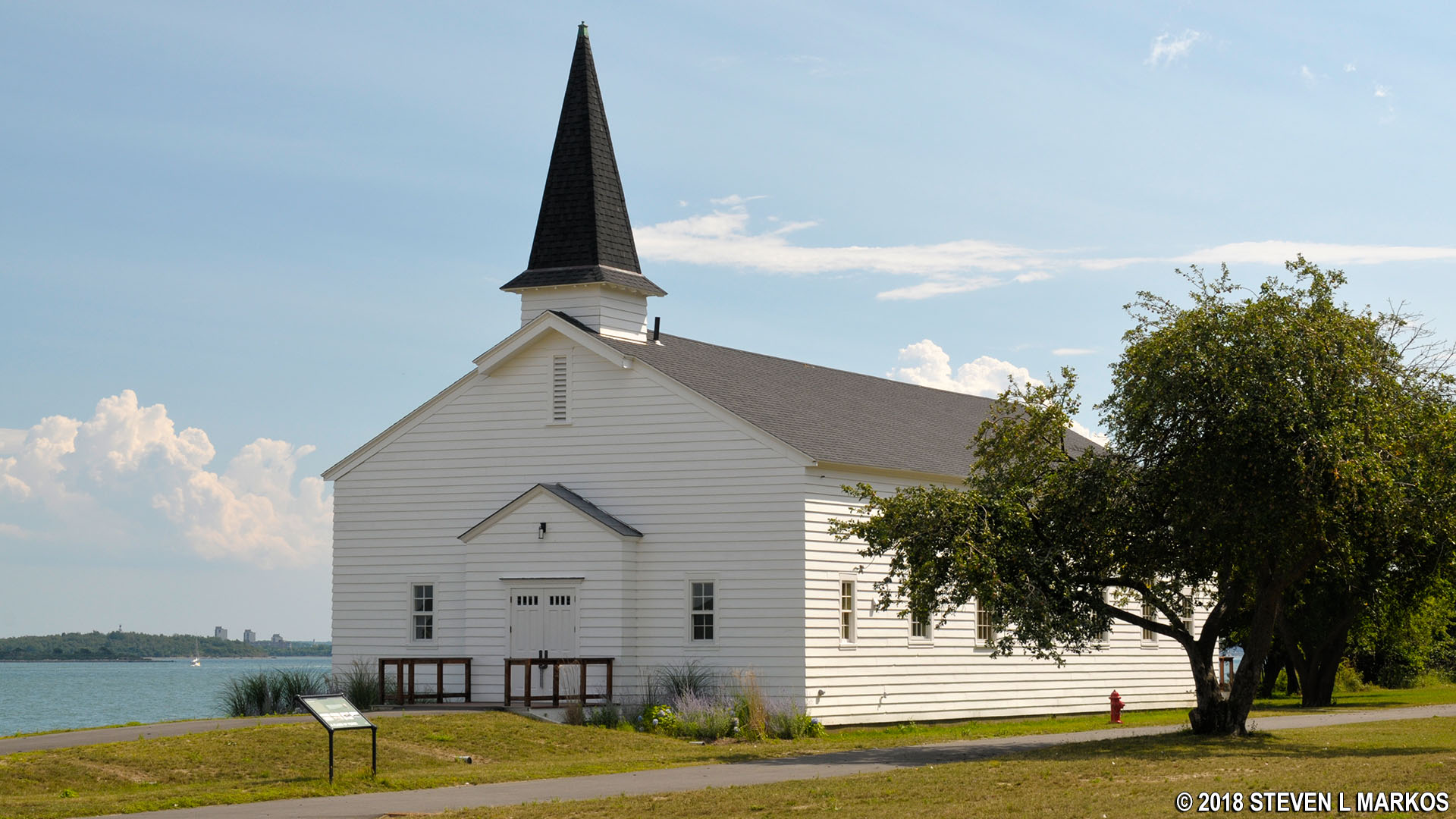
Chapel at Fort Andrews on Peddocks Island, Boston Harbor Islands National Recreation Area
The road remains paved for .3 mile, then turns into a dirt road that runs close to the shore before curving north and cutting across to the other side of the island. While that might sound like a long way to go, at this point the island is only 70 yards wide.
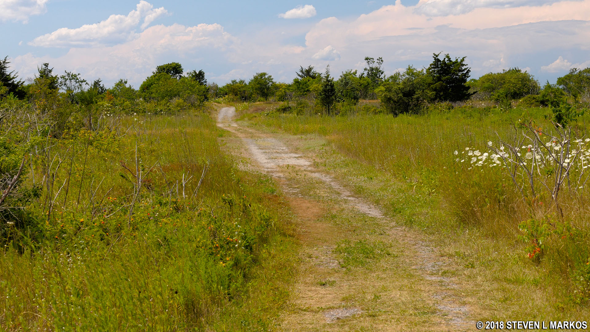
Old dirt road leads to the west end of Peddocks Island, Boston Harbor Islands National Recreation Area
When you come to the wooded area of Middle Head and first see some cottages, the dirt road ends and the trail gets a little overgrown. A Ranger warned me that eventually it won’t even look like there’s a trail, but to keep on going.

First Middle Head cottage seen on the hike to West Head on Peddocks Island, Boston Harbor Islands National Recreation Area

Trail to the west end of Peddocks Island gets a little faint and overgrown in the Middle Head section of the island, Boston Harbor Islands National Recreation Area
Once you get into the woods the trail becomes more apparent. The surface is grass, and the trees provide some temporary shade.

Grassy path through the forest at Middle Head on Peddocks Island, Boston Harbor Islands National Recreation Area
A little over three-quarters of a mile into the hike, you will emerge from the forest and stumble upon the main group of cottages. The Middle Head community originated as a home for Portuguese fishing families who were evicted from Long Island (in Boston Harbor, not New York) in 1887 so that the city of Boston could build a chronic disease hospital and housing for the poor. The owner of Peddocks Island allowed everyone to live on the property as tenants-at-will, meaning that because they paid rent and didn’t own the land—they owned their house only—they could be evicted at any time. The same arrangement continues today. The residents own the building, but not to the land, so while you may feel like you are trespassing by walking right in front of their houses, the land is part of Boston Harbor Islands National Recreation Area.

Cottages at Middle Head on Peddocks Island, Boston Harbor Islands National Recreation Area

Walking past the front door of a Middle Head cottage on Peddocks Island, Boston Harbor Islands National Recreation Area
After leaving the cottages behind, the trail remains out in the open for a while and passes through a salt marsh. A small pond is on the left.

Salt Marsh between Middle Head and West Head on Peddocks Island, Boston Harbor Islands National Recreation Area
The reappearance of the forest signals your arrival at West Head. This part of Peddocks Island is made up of a large hill, but the trail skirts the base of it by curving south through the forest, so you won’t have to do much uphill hiking. The trail does fork, so stay to the left. A right leads over to the northern shore.

Tunnel of trees in the forest at West Head on Peddocks Island, Boston Harbor Islands National Recreation Area
The trail emerges from the forest onto an open, grassy field, and in a tenth of a mile you will be at the shore. This is the end of the trail.

Shoreline at the end of the hike to West Head on Peddocks Island, Boston Harbor Islands National Recreation Area
I returned the same way I came because I was in a hurry to catch the next ferry, but it is possible to walk back along the shore in the clockwise direction (head to the right). The reason you don’t want to walk in the counterclockwise direction is because of the salt marsh seen a little earlier in the hike. There is a small creek that connects it to the bay, so if you head this way you would have to cross the creek and perhaps even part of the marsh. While that doesn’t sound too bad if you don’t mind getting wet, sometimes a marsh has a soft bottom, and you could find yourself knee-deep in mud.

Peddocks Island Salt Marsh
If you hike clockwise along the shore all the way back to the dock, the distance is 2.25 miles. However, if you recall the 70-yard wide section of the island, you can jump back on the trail at this point and cut the distance down to 1.75 mile. That is, by the way, still a quarter mile longer than walking back the same way you came.
With a few exceptions, use of any photograph on the National Park Planner website requires a paid Royalty Free Editorial Use License or Commercial Use License. See the Photo Usage page for details.
Last updated on January 17, 2024


