

Map of the South End hike at Cathleen Stone Island (click to enlarge)
Cathleen Stone Island Main Page
Length: 3 miles
Time: 1.5 hours
Difficulty: Easy
At the south end of Cathleen Stone Island (formerly Thompson Island) are two salt marshes, what little remains of a freshwater pond, a cemetery, and Challenge Field, an area of jungle-gym type obstacles used by the students of Outward Bound. A loop hike can be made around the area, plus there is an out-and-back trail that follows the shore and ends at the inlet that connects the West Salt Marsh to Boston Harbor.
Because there is no visitor center on Cathleen Stone Island, there is no chance to pick up a printed trail map. If you have a digital camera, I suggest taking a photo of the map on the wayside exhibit located near the ferry dock and then refer to it when needed. Keep in mind that there are trails within the park that are not shown, so it is easy to get confused as to which way to go at a few of the intersections. The island is only a little over a mile long and less than a half mile at its widest point, so you can’t stay lost forever.

Map of Thompson Island (click to enlarge)
Begin the hike by taking a left on the first dirt road you come to when reaching the end of the ferry dock. On the way, you will pass one of the Outward Bound buildings and a marshy area that was once a freshwater pond; it is now largely filled in with vegetation. To your right is a nice view of the Boston skyline.

View of Boston from Cathleen Stone Island, Boston Harbor Islands National Recreation Area
About a tenth of a mile down the trail is a three-way split. A right just leads to the beach, while a left cuts over to the other side of the island. Thus, take the middle trail—a dirt road—to continue the hike south along the shoreline.
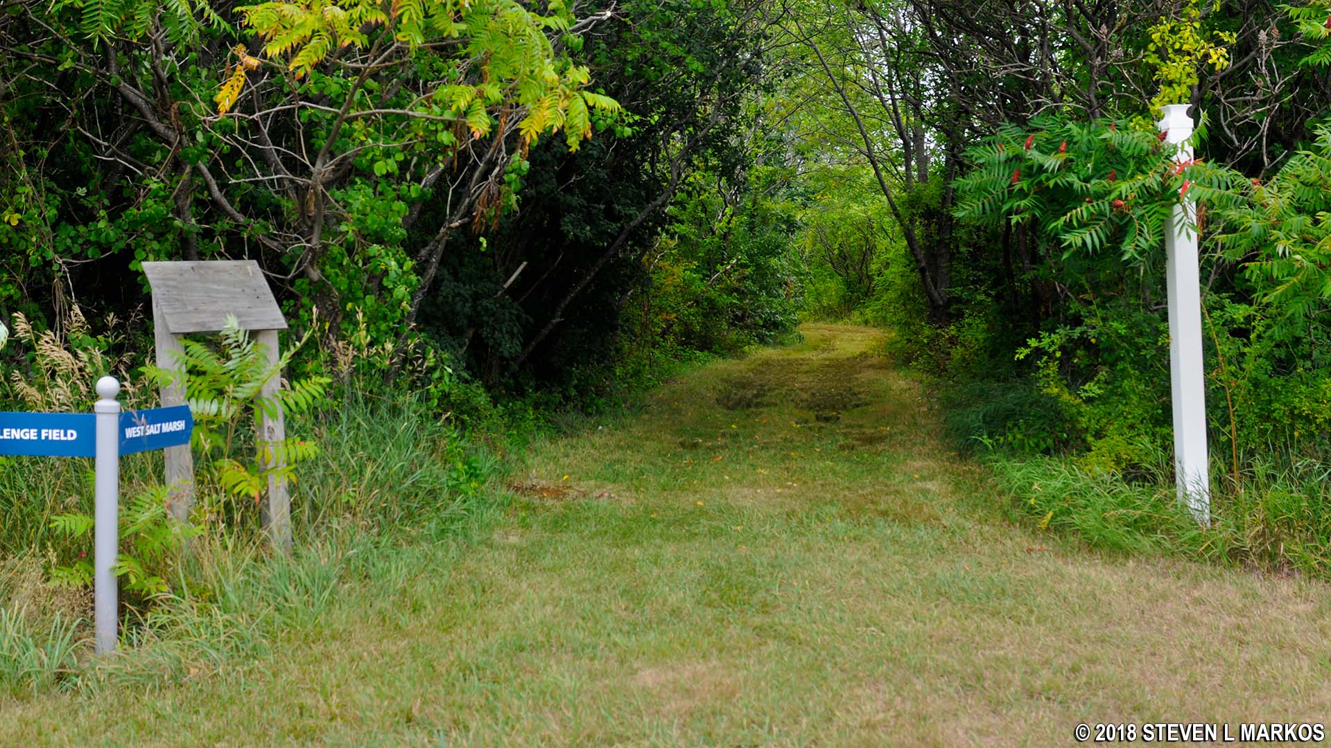
The next intersection is marked with a gazebo. The hiking trail to Challenge Field makes a left at this point, but the dirt road continues straight. I decided to see what was ahead, which resulted in a 1-mile out-and-back hike to the West Salt Marsh inlet. I highly recommend this detour.
Gazebo on the trail to the southern end of Cathleen Stone Island, Boston Harbor Islands National Recreation Area
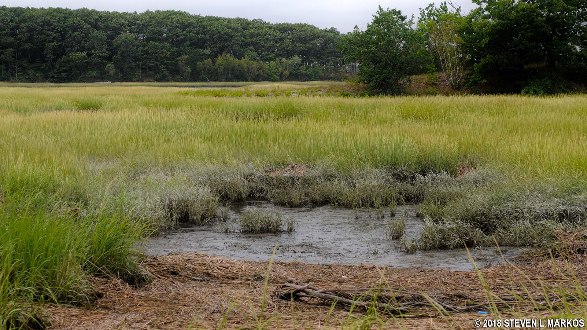
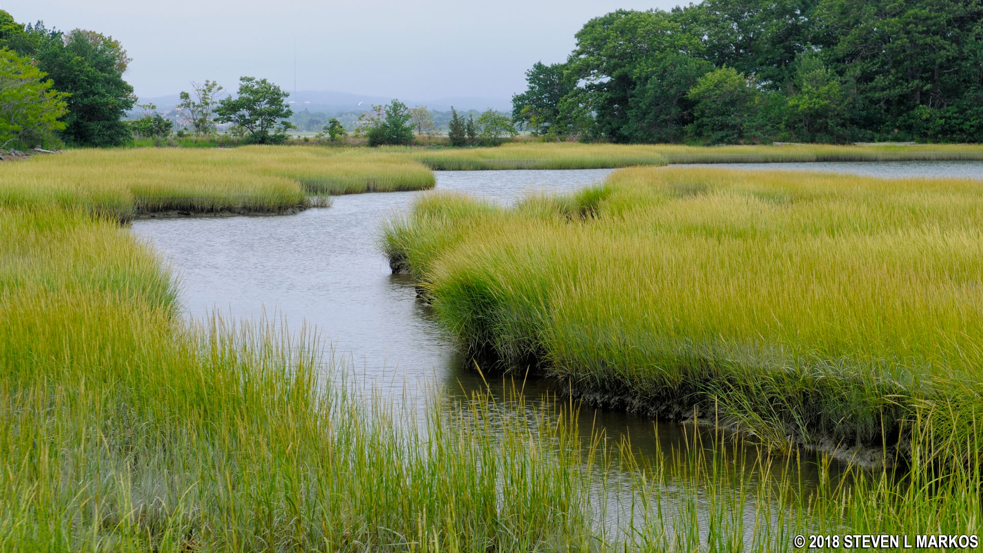
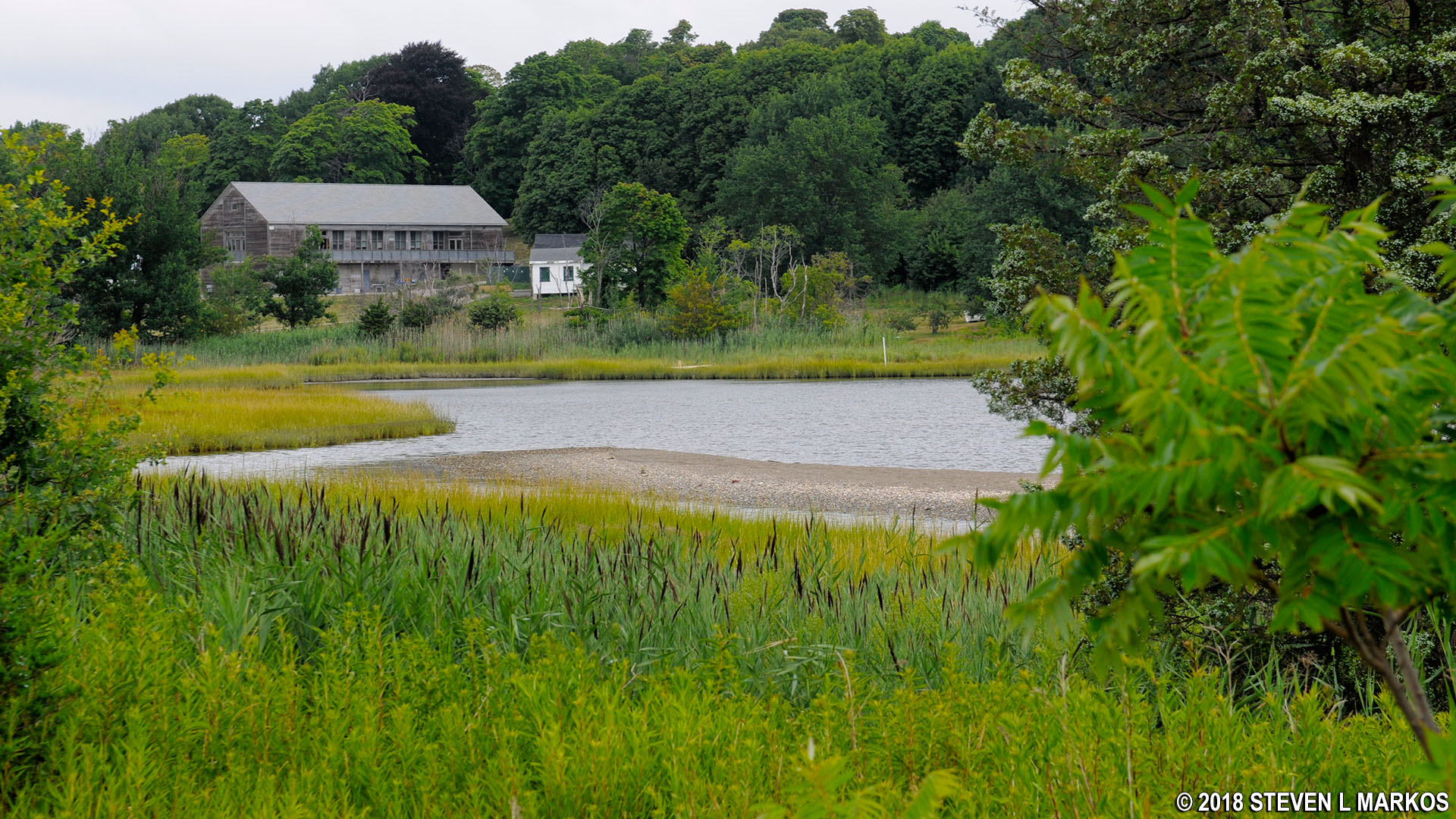
After a short stretch of trail where trees block the view of the bay, the vegetation clears and you will find yourself walking right along the water. To your left is the West Salt Marsh, the largest salt marsh within Boston Harbor Islands National Recreation Area.

Trail along the southwest shore of Cathleen Stone Island, Boston Harbor Islands National Recreation Area
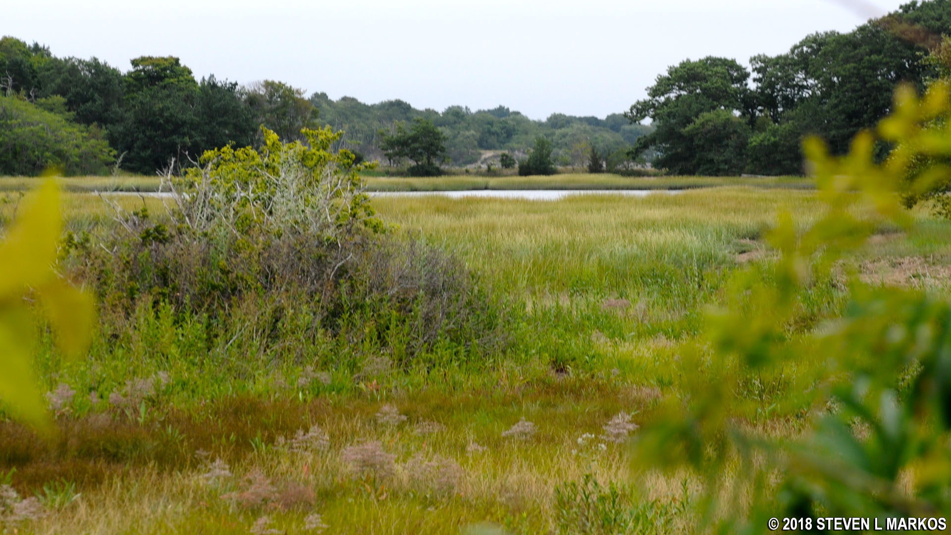
West Salt Marsh on Cathleen Stone Island, Boston Harbor Islands National Recreation Area
The trail forks again when it reaches another forested area, with a left being the way to continue the hike. Straight ahead is a dump used for cardboard boxes; you can see the boxes from the intersection.
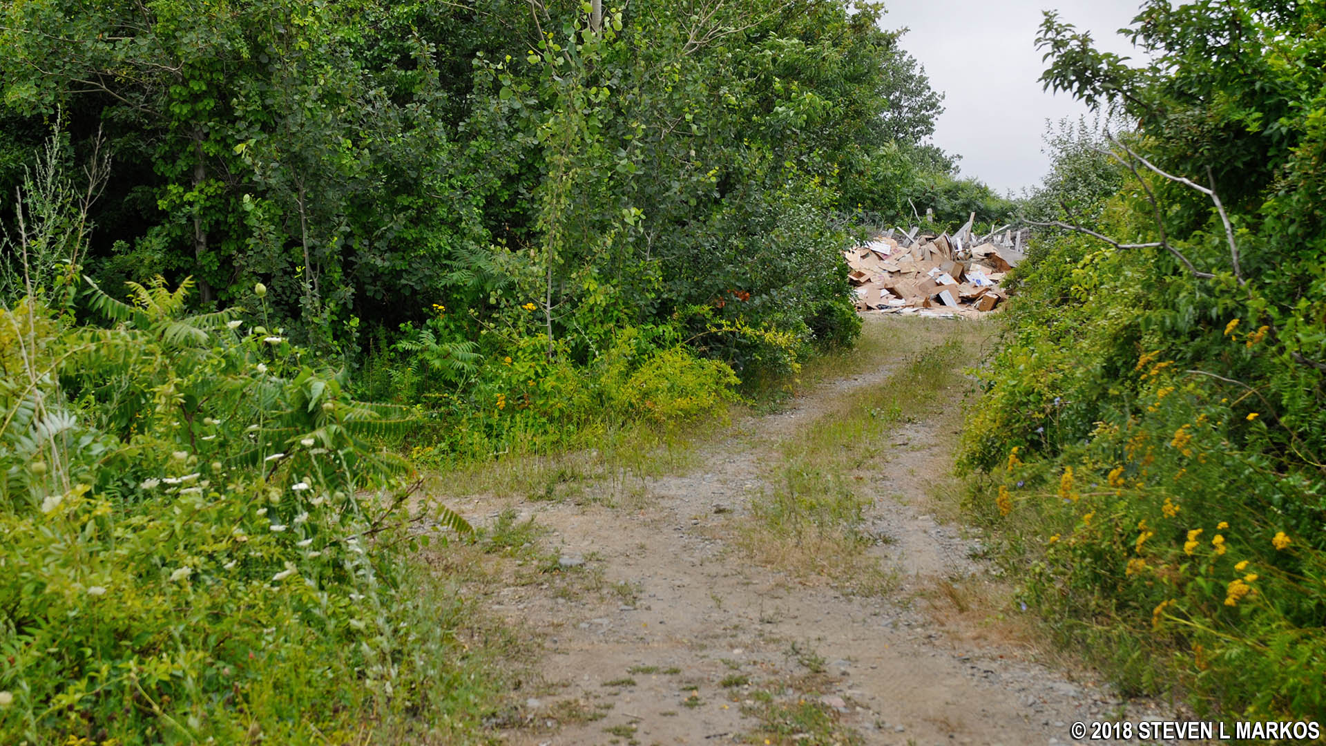
Cardboard dump at the southwest end of Cathleen Stone Island, Boston Harbor Islands National Recreation Area
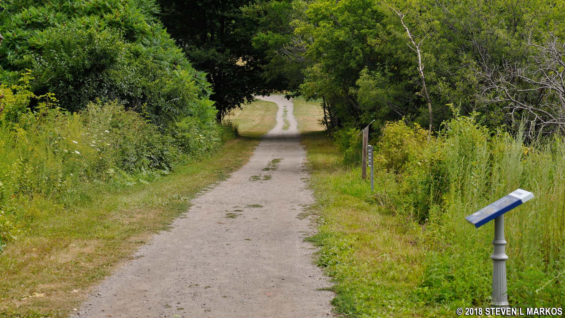
The trail continues through a stand of trees and forks twice within the forest. I wanted to keep along the shoreline, so I always took the right fork.

Trail through the forest next to the West Salt Marsh at the south end of Cathleen Stone Island, Boston Harbor Islands National Recreation Area
The trail eventually ends at the beach. The shoreline curves around to the left and disappears, begging to be explored. Keep walking to reach the West Salt Marsh inlet, one of the most scenic spots on the island.
Beach at the south end of Cathleen Stone Island, Boston Harbor Islands National Recreation Area
The small creek that connects the West Salt Marsh with the bay is why it is not possible to walk the entire Cathleen Stone Island shoreline without getting wet, though at low tide the creek is very shallow. There used to be some sort of bridge across the inlet, but posts are now down on either side. The inlet is .75 mile from the ferry dock.

West Salt Marsh inlet at the southern end of Cathleen Stone Island, Boston Harbor Islands National Recreation Area

West Salt Marsh inlet at the southern end of Cathleen Stone Island, Boston Harbor Islands National Recreation Area
When done exploring the area, head back to the gazebo. I decided to take some of the other routes inside the stand of trees and came upon a small shed with a circular bench outside. Since the trail is bounded by the bay on one side and the marsh on the other, no matter which fork you take, you’ll always end up back on the main trail that leads to the gazebo. Depending on your route, you may run into another shed and bench.
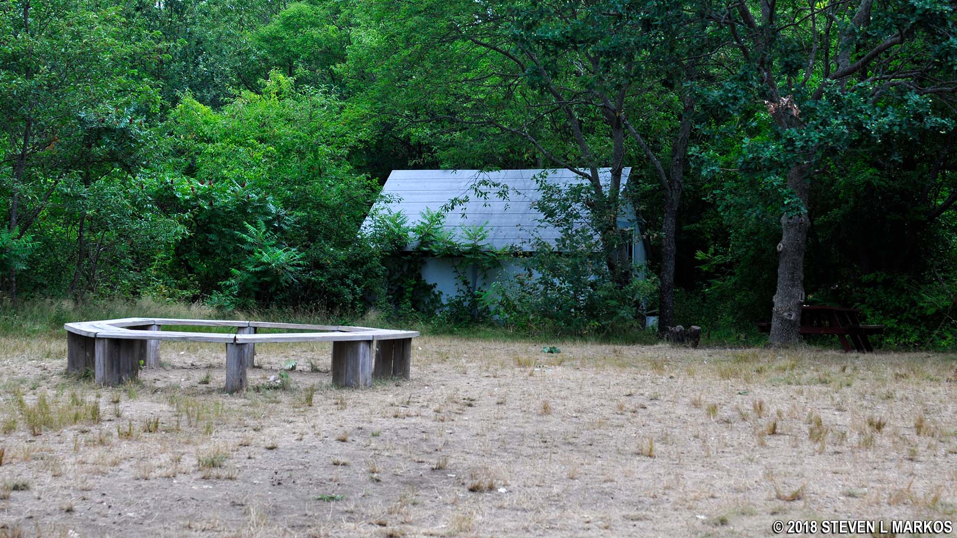
Shed and bench in the forested area near the West Salt Marsh on Cathleen Stone Island, Boston Harbor Islands National Recreation Area
Once back at the gazebo, take a right. The trail begins in the forest, but quickly emerges back onto an open field until it eventually dead ends at another forested area. Just before the dead end is a short spur trail on the right that leads to another viewing area of the marsh.
View of the West Salt Marsh on Cathleen Stone Island, Boston Harbor Islands National Recreation Area
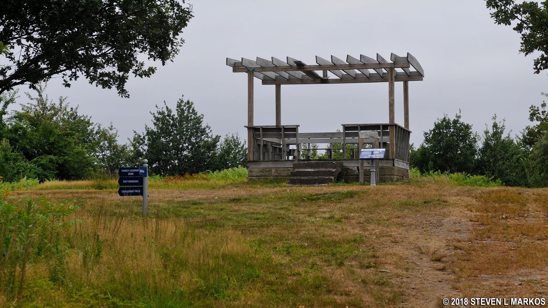
When you reach the dead end at the forest, take a right to continue towards Challenge Field. Back in the early 1800s, Thompson Island was home to a Farming School for kids. This was a school similar to Outward Bound, but for farming instead of outdoor adventure and education. This intersection is where the original Farmhouse used by the school was located. It is now the site of the Family Learning Zone.
Outward Bound Family Learning Zone on Cathleen Stone Island, Boston Harbor Islands National Recreation Area
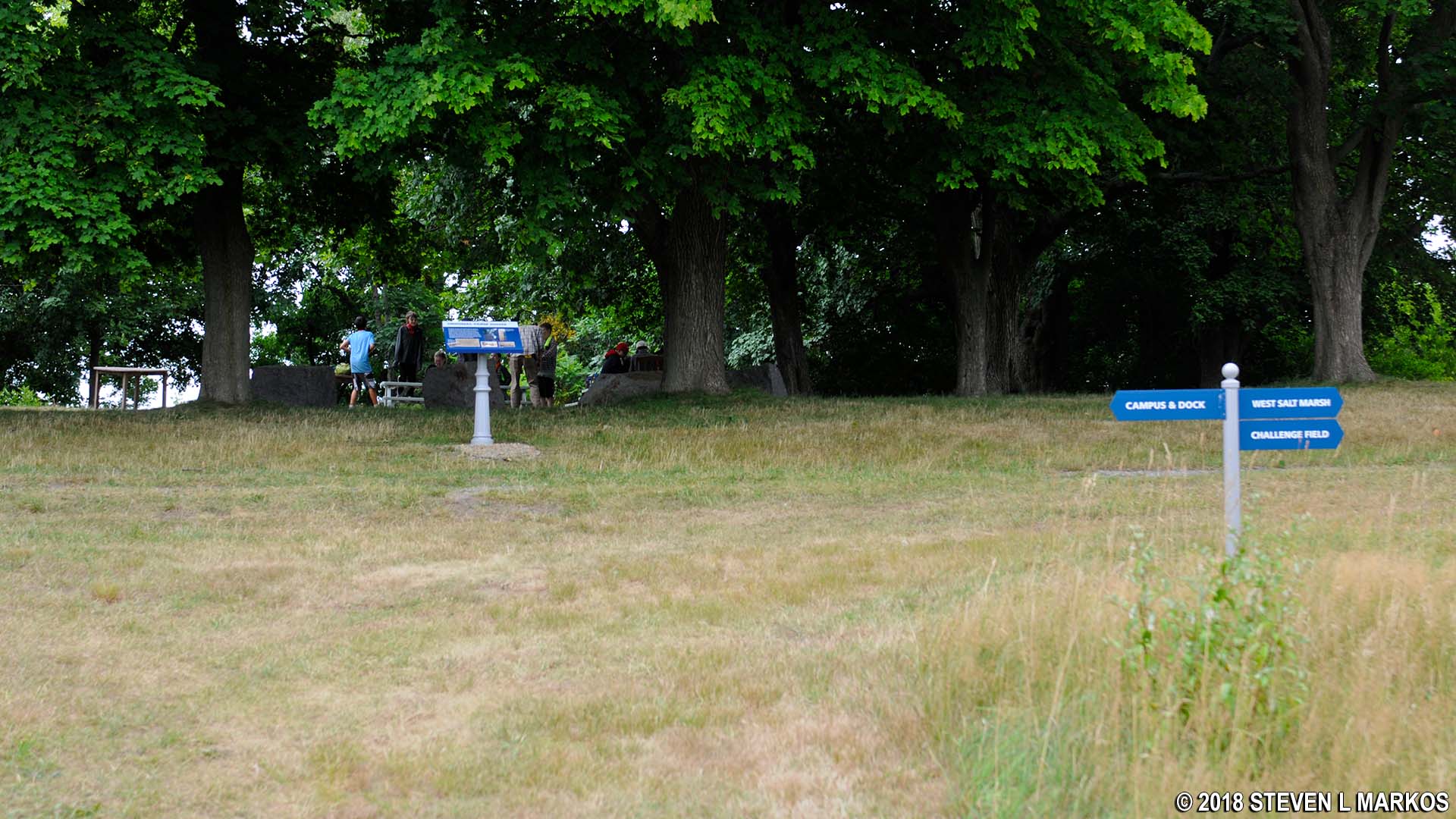
Just a short ways down the trail is another intersection. You ultimately want to stay left to reach Challenge Field, but take the short detour to the right for some excellent views of West Salt Marsh. Wayside exhibits tell about the ecology of the area.
Side trail near the Outward Bound Family Learning Zone to the West Salt Marsh on Cathleen Stone Island, Boston Harbor Islands National Recreation Area
West Salt Marsh on Cathleen Stone Island, Boston Harbor Islands National Recreation Area
There are some Outward Bound obstacles that allow students to cross over one of the creeks, but these are off limits to the public.
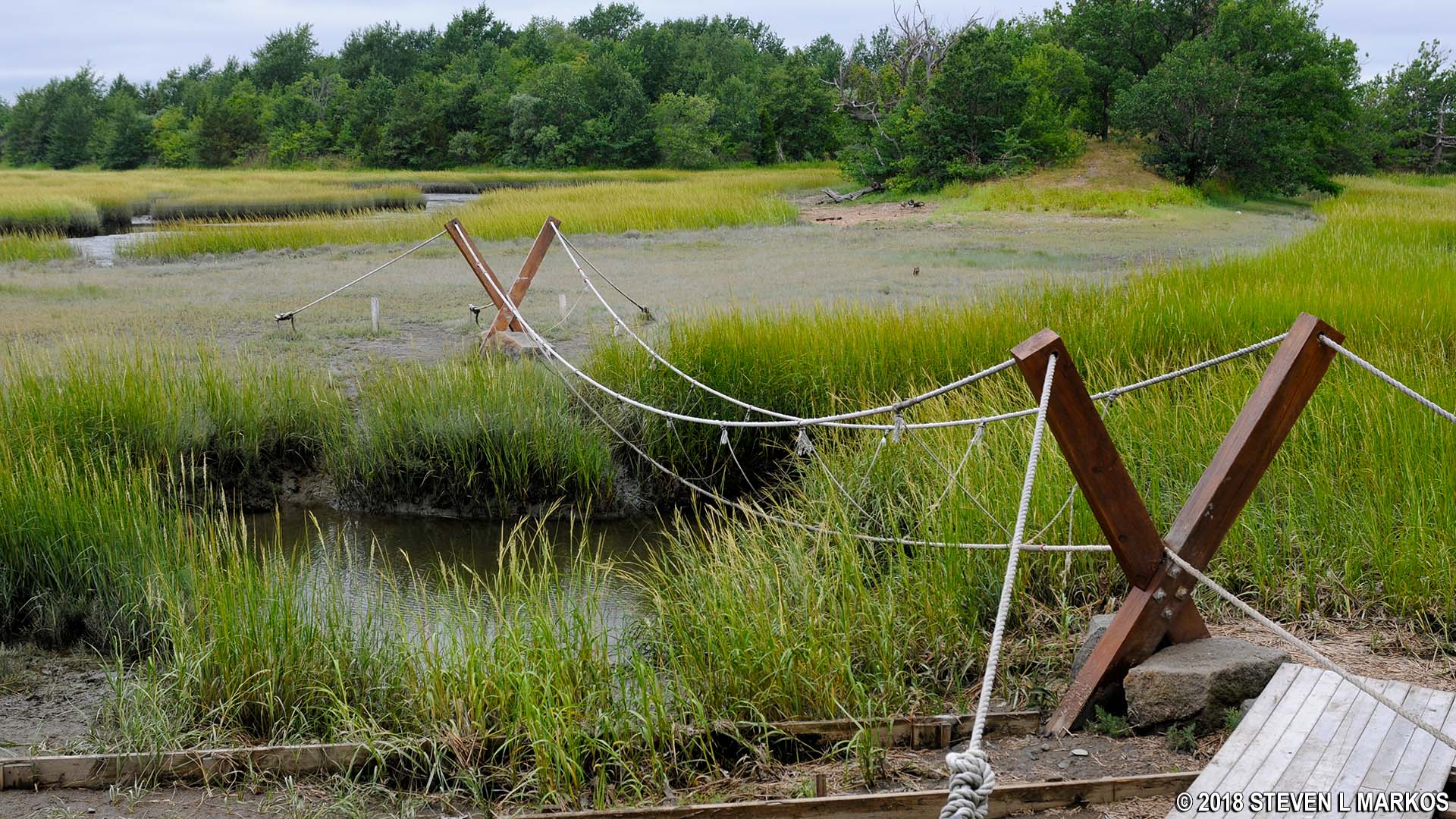
Rope bridge for Outward Bound students spans a creek on Cathleen Stone Island, Boston Harbor Islands National Recreation Area
Once back on the main trail it’s only 100 yards to the next intersection, the dirt road that leads to Challenge Field—take a right. If you weren’t hiking for pleasure, this is the road that you would take from the Outward Bound campus buildings to get to Challenge Field. At this point you will have hiked 1.7 miles.
Intersection with the main road on Cathleen Stone Island, Boston Harbor Islands National Recreation Area
Just to the left of the intersection are three concrete structures, but unfortunately there is no sign that identifies them. I know that the marsh was drained back in the Farming School days, so if I had to guess, I’d say these have something to do with the dike system.

Unidentified structure on the southern end of Cathleen Stone Island, Boston Harbor Islands National Recreation Area
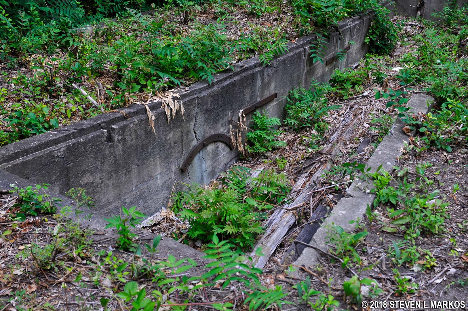
Unidentified structure on the southern end of Cathleen Stone Island, Boston Harbor Islands National Recreation Area
Challenge Field, a large field with climbing obstacles on it (off limits to the public), is just 200 yards ahead. There is also a bench that overlooks West Salt Marsh and the Boston area across the harbor.
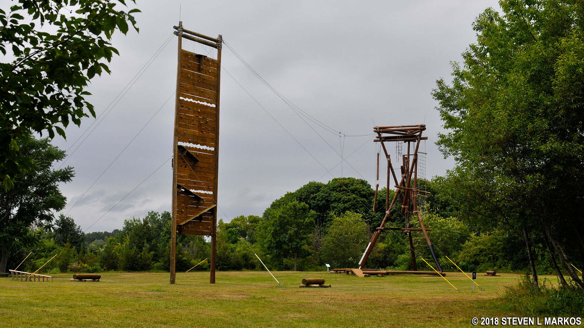
Obstacles at Outward Bound’s Challenge Field on Cathleen Stone Island, Boston Harbor Islands National Recreation Area
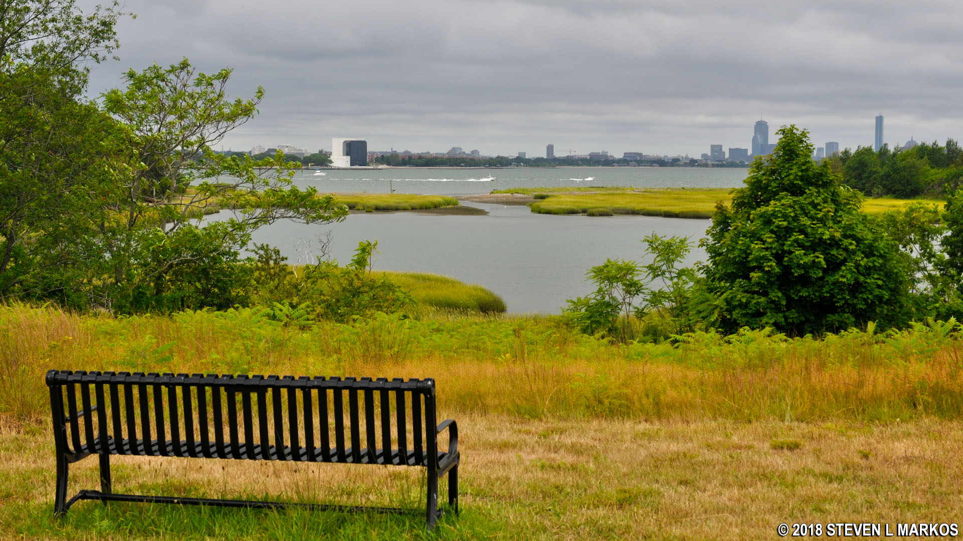
View of the West Salt Marsh and the Boston area from the southern end of Cathleen Stone Island, Boston Harbor Islands National Recreation Area
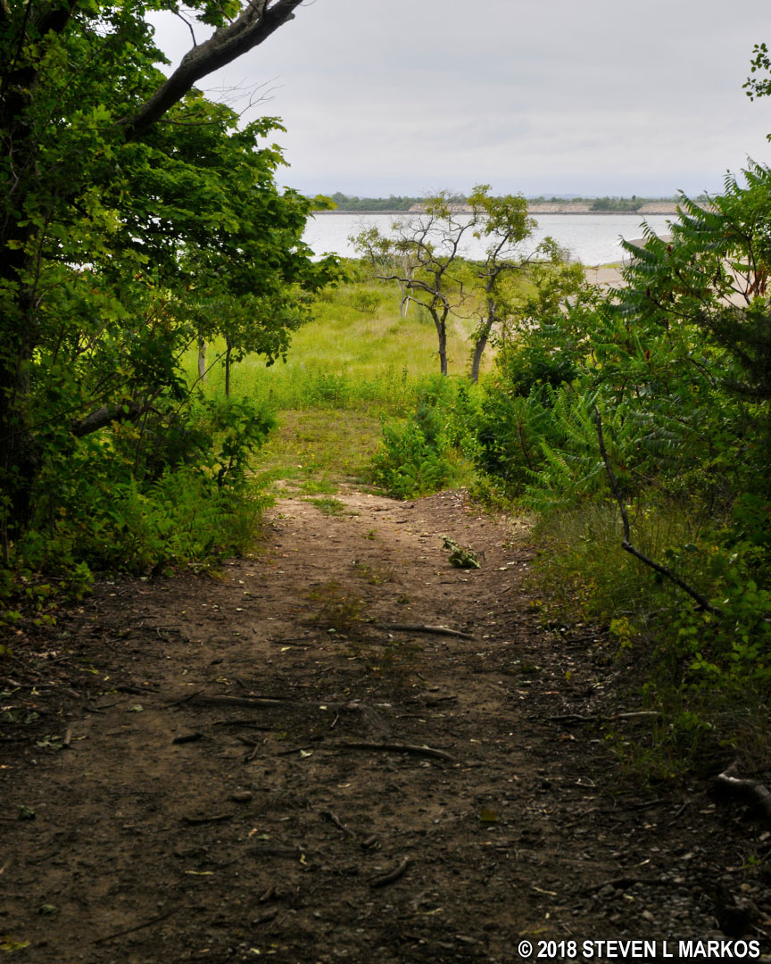
The general idea of the loop hike is to circle around Challenge Field and start back towards the dock, but there is an old cemetery on this end of the island, so just keep walking on the road past the field until you come to another fork. Take a left to reach the cemetery, which is just around the corner. A right leads over to the other side of the West Salt Marsh inlet (the side you couldn’t get to earlier in the hike).
Trail to the cemetery on the south end of Cathleen Stone Island, Boston Harbor Islands National Recreation Area
Only a few tombstones remain in the cemetery, though many people are buried here. Of these, only one has an inscription: a stone for Charles Lind who died in 1902. Twenty-three of the people buried here are Farm School students who died in a boating accident in 1842 (imagine the lawsuits today). Ironically, they were on a fishing trip as a reward for good behavior. Sixty years later—1902—seven more students died in a boating accident. I’m guessing that Charles Lind was one of them. The cemetery also contains graves of island residents.
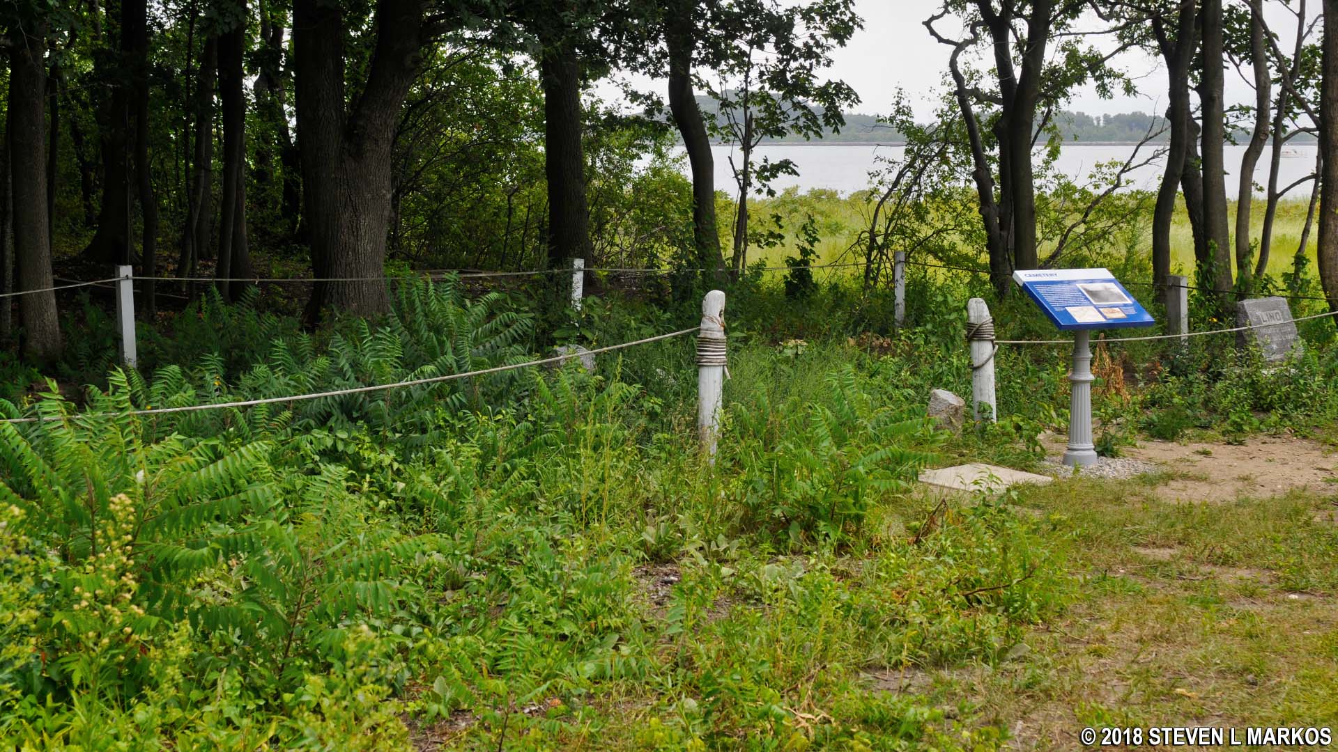
Thompson Island Cemetery, Boston Harbor Islands National Recreation Area

Grave of Charles Lind in the Thompson Island Cemetery, Boston Harbor Islands National Recreation Area
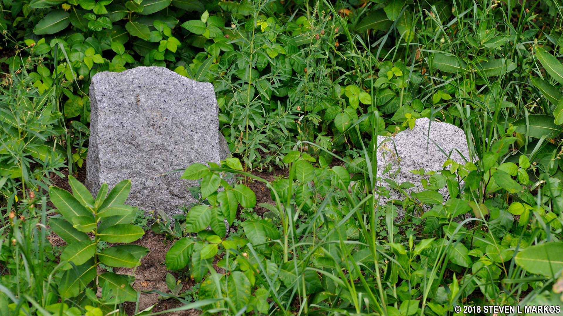
Tombstones in the Thompson Island Cemetery, Boston Harbor Islands National Recreation Area
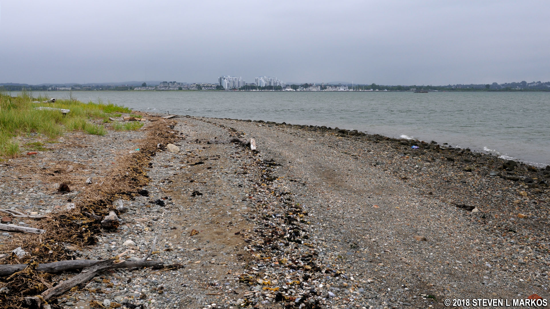
I took a short stroll down the beach until I came to a spit that extended towards the mainland—the Squantum neighborhood of Quincy. During low tide you can actually walk all the way across to Squantum, though some low-water wading may be required, depending on the tide. The distance is .3 mile.

Cathleen Stone Island Spit
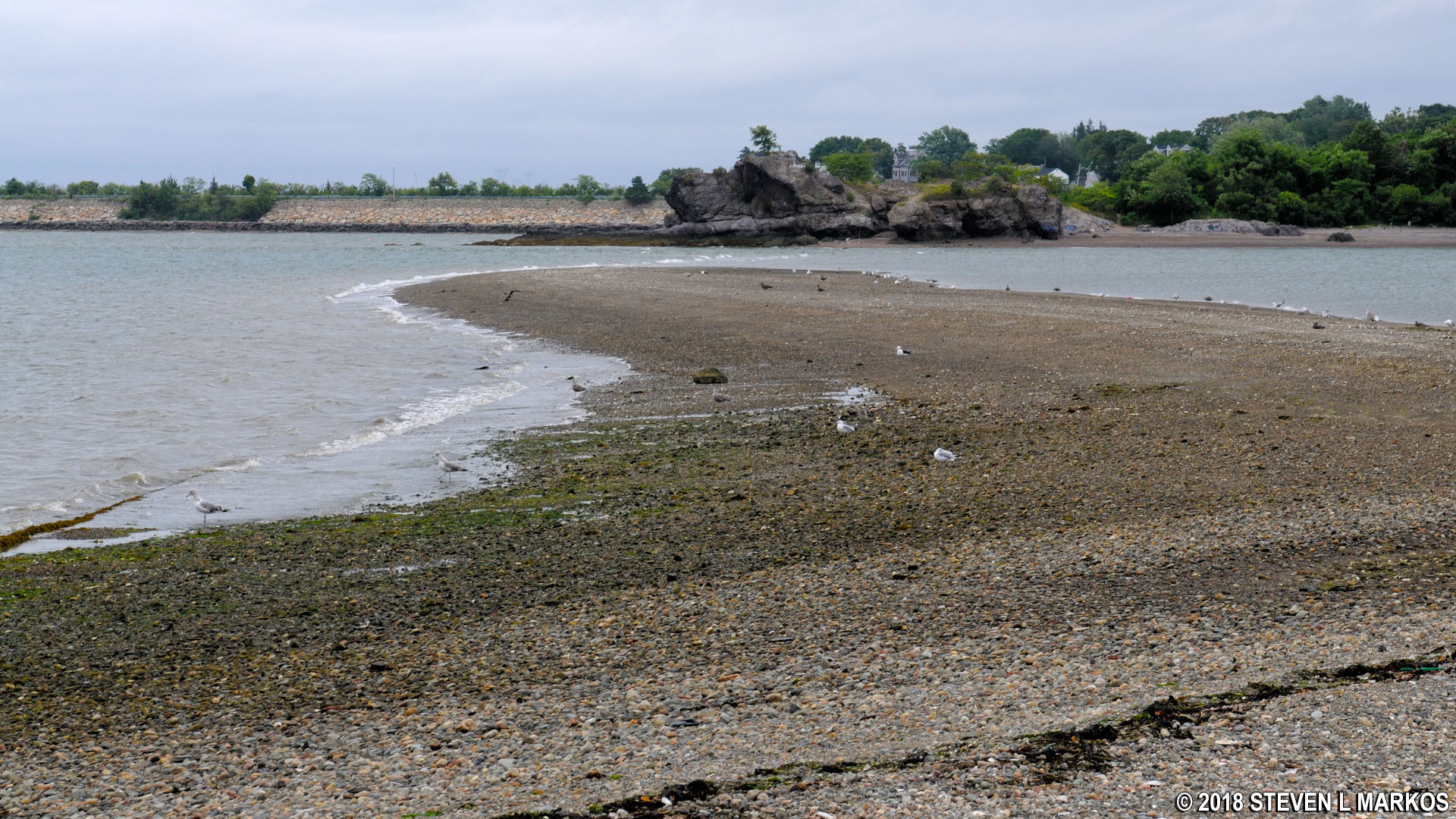
Cathleen Stone Island Spit connects to Quincy, Massachusetts
You could probably continue around the island along the beach, but you must eventually return to the inland trail due to the fact that you will run into the inlet at the East Salt Marsh. The problem is that there are steep dunes and brush that you must climb up and over in order to get from the beach back onto the trail. Therefore, I opted to return to the cemetery. There is supposedly a trail that loops past the cemetery and connects to Challenge Field, but I couldn’t find it so I just walked back the way I came, then crossed Challenge Field to the other side. There is no actual trail on the field, so just walk north along the edge. You are eventually funneled towards a trail at the north end of the field that leads through the forest—take this.
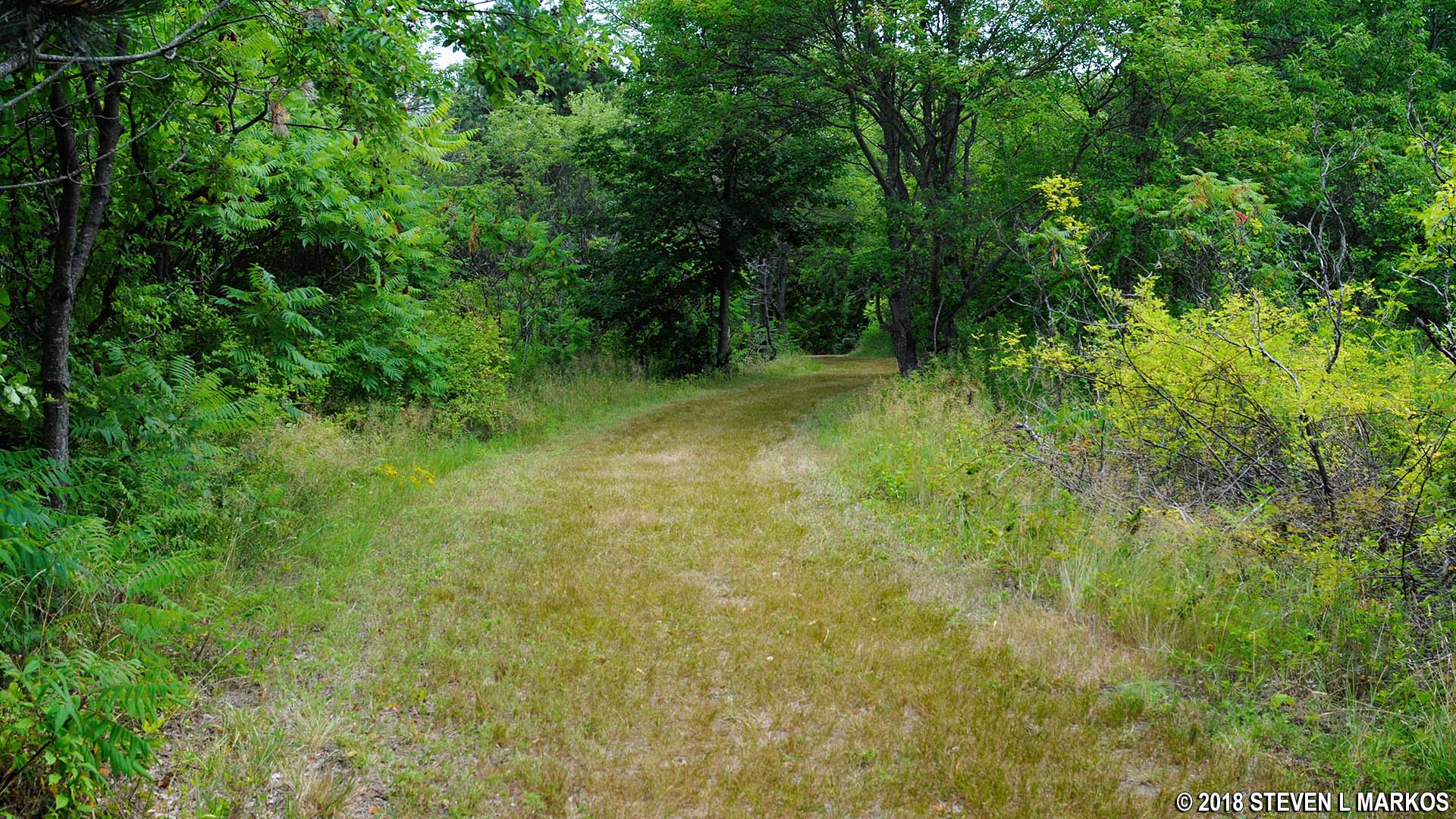
Trail through the forest at the north end of Challenge Field on Cathleen Stone Island, Boston Harbor Islands National Recreation Area
The hike through the forest is quick, and you will soon come to another field. There are three mowed paths through the grass, with the left and center leading over to the main road. Stick to the path on the right that runs parallel to the water for the best scenery.
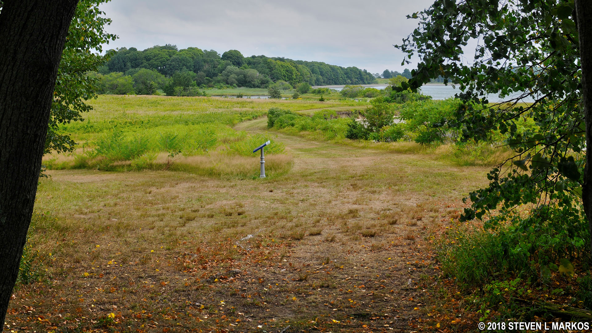
Field north of Challenge Field on Cathleen Stone Island, Boston Harbor Islands National Recreation Area

Grass trail runs parallel to the southeastern shore of Cathleen Stone Island near the East Salt Marsh, Boston Harbor Islands National Recreation Area
The trail soon curves away from the water and runs along the East Salt Marsh. Trees and brush block the view of the marsh for much of the hike, but there are a few clearings where you can get a good look.
East Salt Marsh on Cathleen Stone Island, Boston Harbor Islands National Recreation Area
The grass path eventually merges with the main road; take this back to the campus. You’ll get a few more looks at the marsh along the way.
Main road back to the Outward Bound campus and the ferry dock on Cathleen Stone Island, Boston Harbor Islands National Recreation Area

East Salt Marsh on Cathleen Stone Island, Boston Harbor Islands National Recreation Area
If you came to Cathleen Stone Island and aren’t an Outward Bound student, you came to hike, so exploring the south end of the island is mandatory. It is an enjoyable hike, and you get to see a variety of ecosystems. I was able to hike both this and the northern trail to Coolidge Meadow in 2.5 hours and still catch the mid-day ferry back to Boston.

Back at the Cathleen Stone Island ferry dock, Boston Harbor Islands National Recreation Area
With a few exceptions, use of any photograph on the National Park Planner website requires a paid Royalty Free Editorial Use License or Commercial Use License. See the Photo Usage page for details.
Last updated on May 7, 2025


