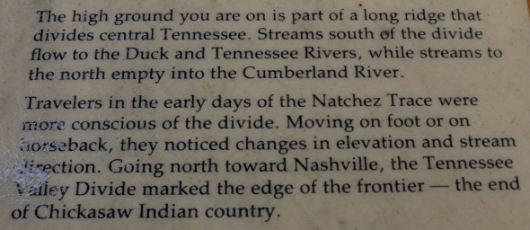
An information panel about the Tennessee Valley Divide is all there is to see at this stop on the Natchez Trace Parkway. Unfortunately, the information panel cannot be read from your car because it is one of the nearly flat, table-like panels found only at the very northern end of the Parkway. Being such a nice guy, I have posted the photo below of the sign’s text. This allows you to get the information while maintaining maximum laziness.
The Tennessee Valley Divide stop is also a parking area for the Highland Rim segment of the Natchez Trace National Scenic Trail. A sign points out distances to various destinations. Head into the forest to the left of the sign to hike north to Garrison Creek. Follow the moved path to the right of the sign to hike to the southern end of the trail on Highway 7.
Back to the Top | Next Stop North | Next Stop South
With a few exceptions, use of any photograph on the National Park Planner website requires a paid Royalty Free Editorial Use License or Commercial Use License. See the Photo Usage page for details.
Last updated on November 24, 2021


