

Carriage road at Marsh-Billings-Rockefeller National Historical Park
Marsh-Billings-Rockefeller National Historical Park is comprised of 550 acres, and aside from a few buildings such as the Billings Mansion and the Carriage Barn Visitor Center, nearly everything is undeveloped and covered with forest. Roughly twenty miles of hiking trails and ten miles of carriage roads crisscross the property, all of which are open to the public at no cost. The park includes Mount Tom and the surrounding area, so expect hilly terrain.
In the spring, summer, and fall, the trails and carriage roads are available to both hikers and horseback riders (with the exception of no horses on the Precipice or North Peak trails). During the winter, the carriage roads and some of the wider hiking trails can be used for cross-country skiing and snowshoeing. No bikes are allowed on any of the trails or carriage roads.
It is the Woodstock Inn and Resort Nordic Center that actually maintains the trails for winter sports, not the National Park Service. The organization oversees an entire network of trails throughout Woodstock, including 12 miles within Marsh-Billings-Rockefeller National Historical Park. Therefore, you must purchase a daily or seasonal pass from the Nordic Center, even if you only plan to use the trails within the park. Equipment rentals and cross country skiing lessons are also available. See the Woodstock Nordic Center web page for more information.
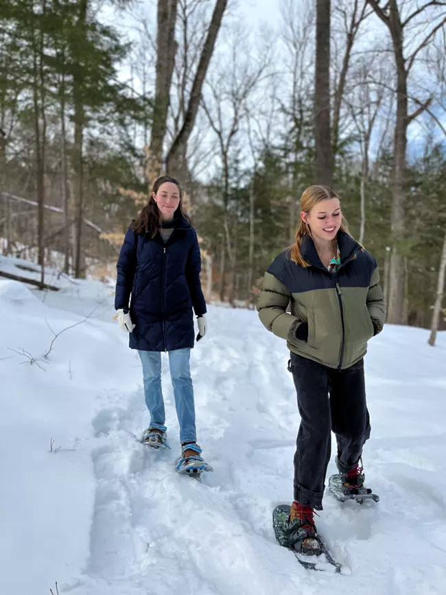
Snowshoeing at Marsh-Billings-Rockefeller National Historical Park (photo by National Park Service)
Hiking trails have surfaces that can be covered in rocks and roots, are often narrow enough to require single-file hiking, and have difficulties ranging from easy to moderately strenuous.
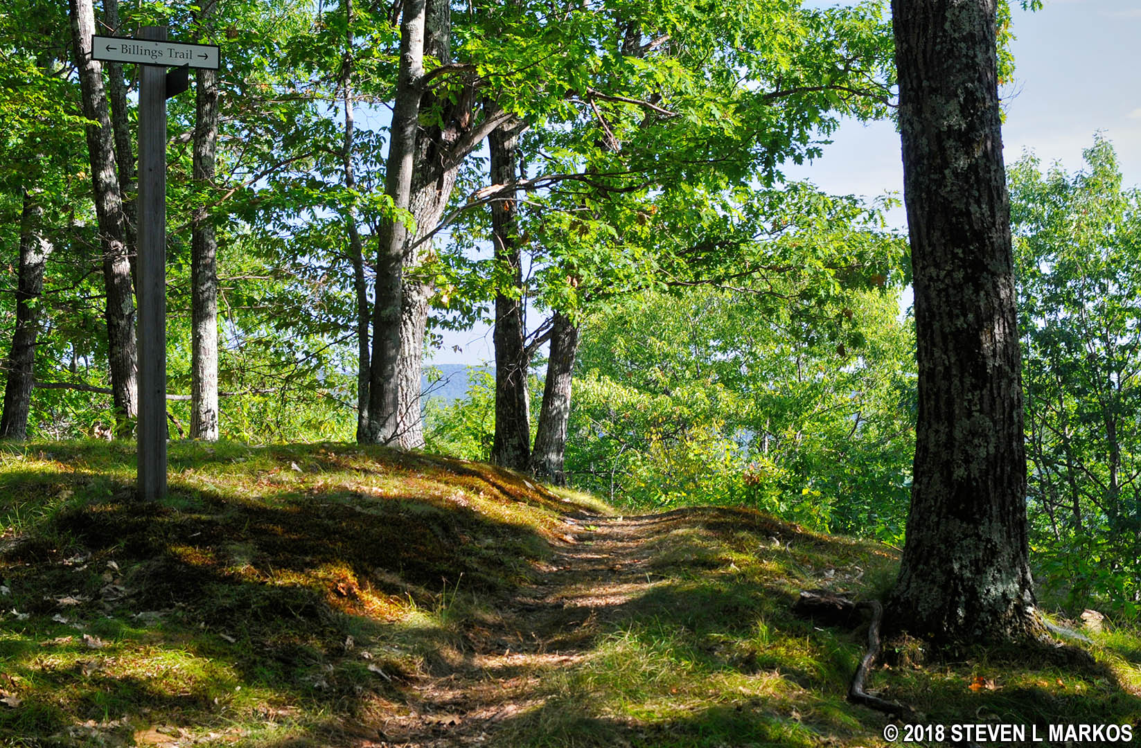
North Peak Trail leads to the top of Mount Tom in Billings Park, Woodstock, Vermont
Carriage roads, on the other hand, are perfect for leisurely walks with friends and family because they are wide and smooth. You can even push a baby carriage or travel along them in a wheelchair, especially if you have off-road wheels. However, they are not flat, so those in wheelchairs may need help getting up and down the hills. Carriage roads range from flat and easy to hilly and moderate in difficulty.
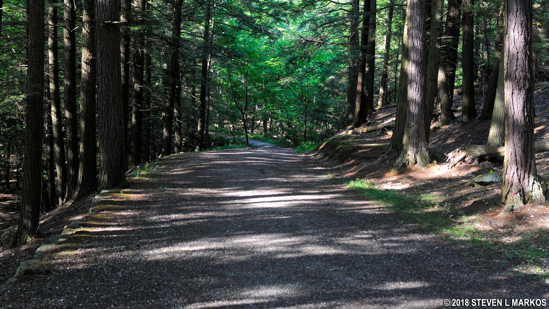
Mount Tom Road in Billings Park, Woodstock, Vermont
There are parking lots on both the east and west sides of Marsh-Billings-Rockefeller National Historical Park. On the east side, parking is at the overflow parking lot for the Billings Farm and Museum. At the far end of the parking lot (towards the farm buildings) is a sidewalk that leads to Route 12. The entrance to the National Historical Park is located directly across the street. The driveway forks almost immediately. Take a left to reach the Carriage Barn Visitor Center or a right to access the trails.

Entrance to Marsh-Billings-Rockefeller National Historical Park
On the west end is a parking lot on Prosper Road. The trails are directly accessible from there.
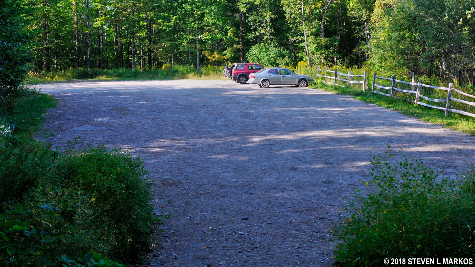
Parking lot on Prosper Road, Marsh-Billings-Rockefeller National Historical Park
A small trail map is included on the standard park brochure, but for more detail be sure to pick up the Walk Woodstock Trail Map at the Carriage Barn Visitor Center. This also includes trails in Billings Park, Faulkner Park, and King Farm, all of which are adjacent to Marsh-Billings-Rockefeller National Historical Park. Some trails run through multiple parks, but there is no barrier to entry, and you won’t even know when you are leaving one park and entering another.
The trail map makes it look like you must cross a continent to get from one end of the park to the other, but in reality it is only about two miles across. The hike from the Carriage Barn Visitor Center to The Pogue (a pond) is about a mile. Furthermore, the trails are not isolated from each other, so you can piece together a loop hike suitable to your liking by using all or parts of multiple trails. You can download the Trail Distances flyer to get an accurate idea of the length of a particular route. The flyer is also available at the Visitor Center.
The Walk Woodstock trail map differentiates between foot path and ski trail. Every trail and carriage road in the park is open to hikers, and most are open to horseback riders. However, skiers must stick to carriage roads and trails delegated as ski trails. Carriage roads are the widest and most well-groomed trails in the park, amounting to what are basically gravel roads. Foot paths are narrow, earthen trails. Ski trails can be gravel or earthen. They are wider than foot paths, but not as well-groomed as carriage roads.

McKenzie Farm Trail, a designated ski trail in Marsh-Billings-Rockefeller National Historical Park
While I was not able to hike every inch of every trail in the park, I did put a dent in them. I made a 4.3-mile hike on the east side of the park—using The Pogue as the dividing point between east and west—and a 3.75-mile hike on the west side. In all, I covered parts of fifteen trails and carriage roads and have written reviews of my hikes. If you don’t care for my route, you will at least know what to expect—terrain, difficulty—of some of the trails.
• Mountain Road (partial)
• Precipice Trail (entire)
• Mount Tom Road (partial)
• Billings Trail (partial)
• North Peak Trail (partial)
• One Less Traveled Trail (partial)
• Summer Pasture Road (partial)
• Spring Lot Trail (partial)
• Pogue Brook Trail (entire)
• Prosper Trail (partial)
• Middle Pass Trail (entire)
• North Ridge Loop (partial)
• Pogue Loop (entire)
• McKenzie Road (entire)
• McKenzie Farm Trail (entire)
With a few exceptions, use of any photograph on the National Park Planner website requires a paid Royalty Free Editorial Use License or Commercial Use License. See the Photo Usage page for details.
Last updated on June 21, 2025


