

West Side Hike Map (click to enlarge)
For a map of the trails at Marsh-Billings-Rockefeller National Historical Park and the surrounding parks, download the Walk Woodstock Trail Map (PDF) or pick up a copy at the Carriage Barn Visitor Center.
Length: 3.75-mile loop
Time: 2 hours
Difficulty: ★★☆☆☆
I divided my hiking at Marsh-Billings-Rockefeller National Historical Park into two hikes, one covering the east side of the park and one the west side, using The Pogue (a small pond) as the dividing point. My West Side Hike is a loop that covers all or parts of six hiking trails and carriage roads, with The Pogue as its main destination.
PROSPER TRAIL
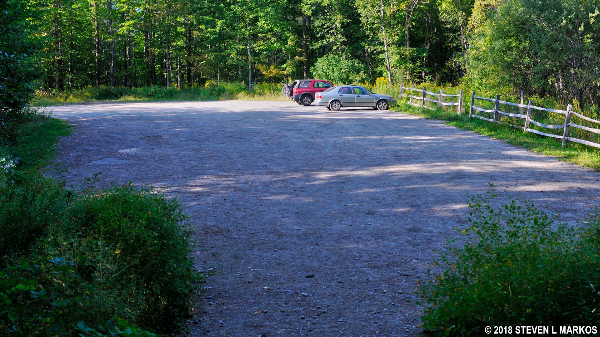
If starting a hike on the west side of the park, use the parking lot on Prosper Road. From there you can pick up two trails, the Prosper Trail from the center of the lot and the McKenzie Farm Trail from the south end. My hike starts on the Prosper Trail and finishes on the McKenzie Farm Trail.
The difficulty of trails within Marsh-Billings-Rockefeller National Historical Park and the other adjacent parks is denoted on the trail signs by using the same system for ranking ski trail difficulty. This is fittings since Mount Tom, the small mountain located within the park, used to be a ski slope for beginners that operated from the early 1950s until around 1980 (it was part of the Suicide Six Resort). A green circle means easy, a blue square is moderate, and a black diamond is difficult. The Prosper Trail is a blue-square trail.
There are a couple of short-but-steep segments on the Prosper Trail—the equivalent of perhaps walking up two flights of stairs–but for the most part it is a steady uphill climb from the start. The trail is shown as a ski trail on the Walk Woodstock Trail Map, which means that it is not quite as wide and smooth as a carriage road, but not as narrow and rough as a hiking trail.

Typical terrain on the Prosper Trail in Marsh-Billings-Rockefeller National Historical Park
MIDDLE PASS TRAIL
As you hike east on the Prosper Trail, be on the lookout for the Middle Pass Trail, the second intersection on the left. The first comes at .4 mile into the hike (North Slope Trail), and the Middle Pass Trail is just another tenth of a mile farther. Take this until it dead ends into the North Ridge Loop in .4 mile. When I did the hike, the trail started off through some fairly overgrown terrain, so I was glad I had on my long pants to protect against possible ticks and poison ivy (I did not encounter either).
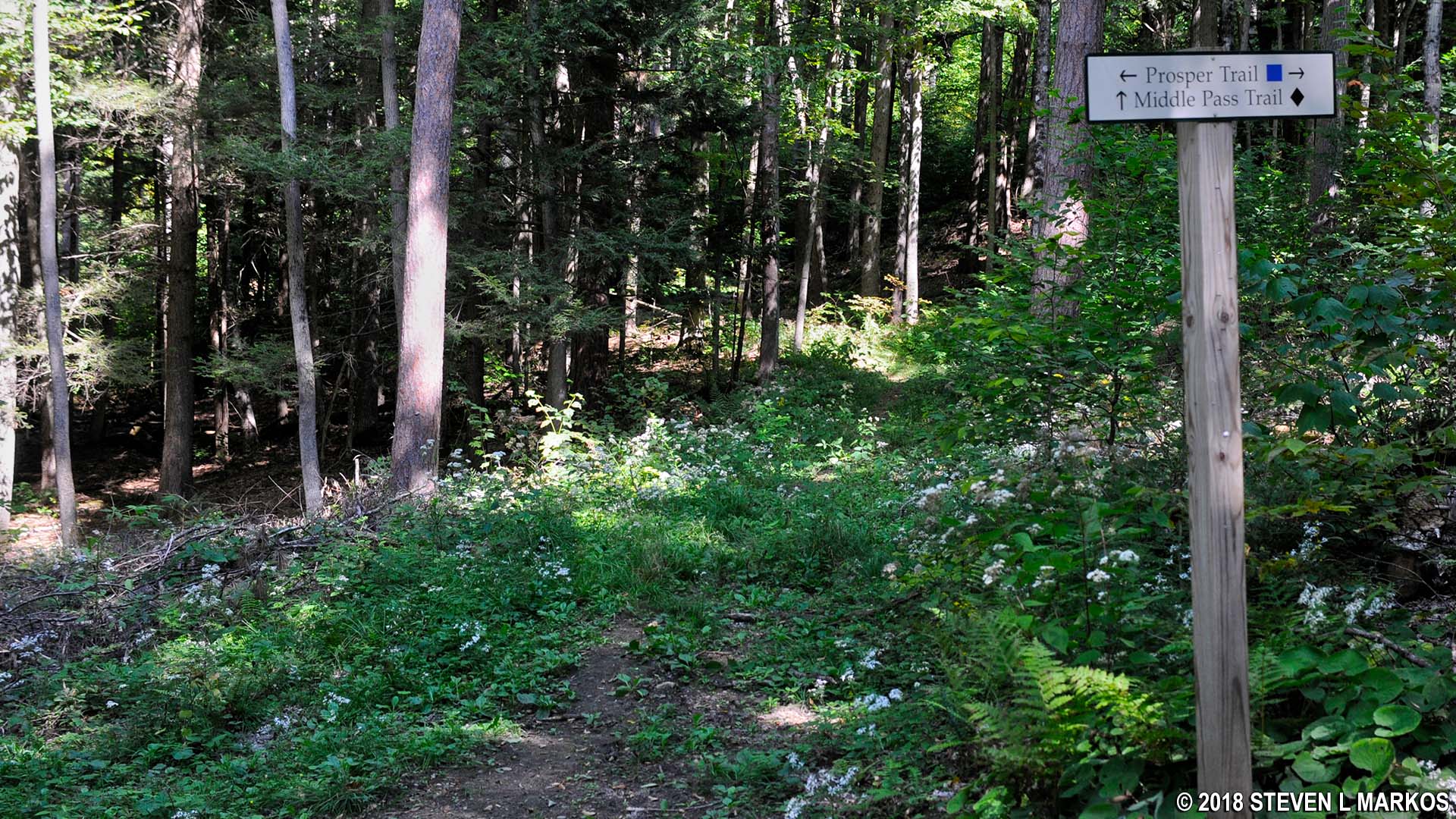
Intersection of the Prosper and Middle Pass trails in Marsh-Billings-Rockefeller National Historical Park
The Middle Pass Trail runs along level ground for about a tenth of a mile, but after that the hike is uphill. The trail has been given a black diamond designation, but I didn’t find it any more difficult than the Prosper Trail.

Typical terrain on the Middle Pass Trail in Marsh-Billings-Rockefeller National Historical Park
NORTH RIDGE LOOP
By the time you reach the intersection with the North Ridge Loop carriage road you will be at the top of the hill. Take a left and hike around the loop in the clockwise direction. After a short and level segment, the road begins a long, gradual descent for most of the way to The Pogue. The North Ridge Loop is a green-circle trail, indicating that it is easy to hike.

North Ridge Loop in Marsh-Billings-Rockefeller National Historical Park
There are a number of intersections along the way, with the first coming just a tenth of a mile from the start. Stay to the left when the road forks to remain on the North Ridge Loop. The second intersection, which comes a half mile later, is with the Spring Lot Trail.

Intersection of the North Ridge Loop and Spring Lot trails in Marsh-Billings-Rockefeller National Historical Park
According to the trail map, there is supposed to be a scenic overlook between the first two intersections, but I never saw one. Most likely it is now overgrown with forest. In fact, the road itself has a few sections that are covered with grass, which is quite unlike the other carriage roads in Marsh-Billings-Rockefeller National Historical Park. The west side trails do not get as much action as the more popular east side trails, allowing for them to become overgrown much quicker.

Grassy segment of the North Ridge Loop in Marsh-Billings-Rockefeller National Historical Park
Two tenths of a mile past the Spring Lot intersection are two right turns, one after the other. These are part of a triangular intersection, so take either one—the first preferably—to stay on the North Ridge Loop. A left leads over to Summer Pasture Road, another carriage road.
POGUE LOOP TRAIL
The next intersection is the one where the hike departs from the North Ridge Loop. It is a short connector trail to the Pogue Loop, the trail that encircles the pond.

Connector from the North Ridge Loop to the Pogue Loop Trail, Marsh-Billings-Rockefeller National Historical Park
You can hike around The Pogue in either direction. I opted to take a right, but it makes no real difference which way you go. At this point you will have hiked 1.9 miles.

The Pogue, a small pond in Marsh-Billings-Rockefeller National Historical Park
There are some nice views of the pond when you first start the loop, but there won’t be many again until you reach the southeastern shore. On the north shore, trees and other vegetation often stand between the trail and the pond. On the west side the trail actually rises up above the pond on a ridge, and on the southwest side it veers away from the pond.
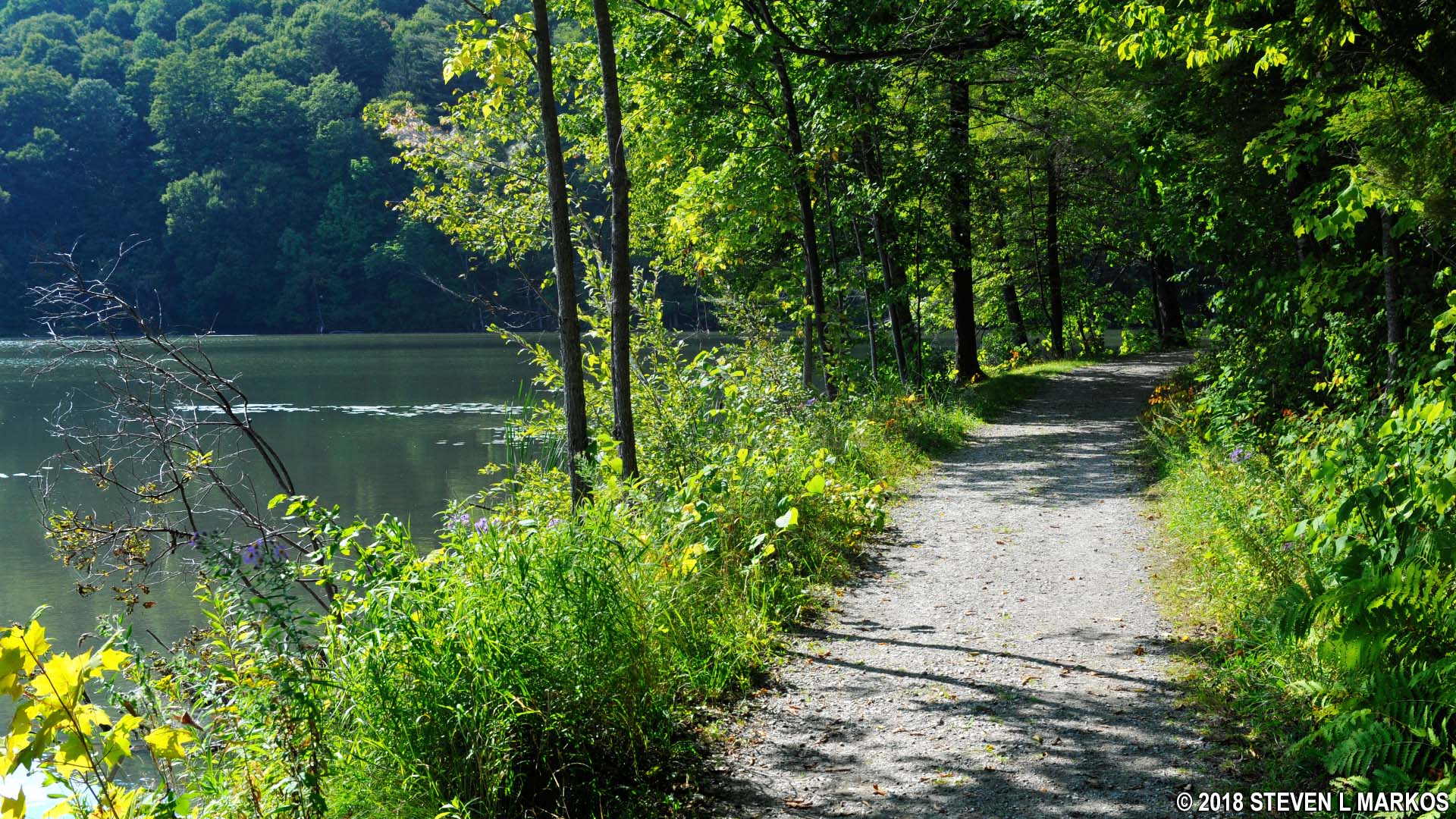
View of The Pogue along the Pogue Loop Trail in Marsh-Billings-Rockefeller National Historical Park

Ridge above The Pogue on the west side of the Pogue Trail in Marsh-Billings-Rockefeller National Historical Park
On the southeast side is the dam that creates the pond. The terrain really opens up here, and you can get an unencumbered view.
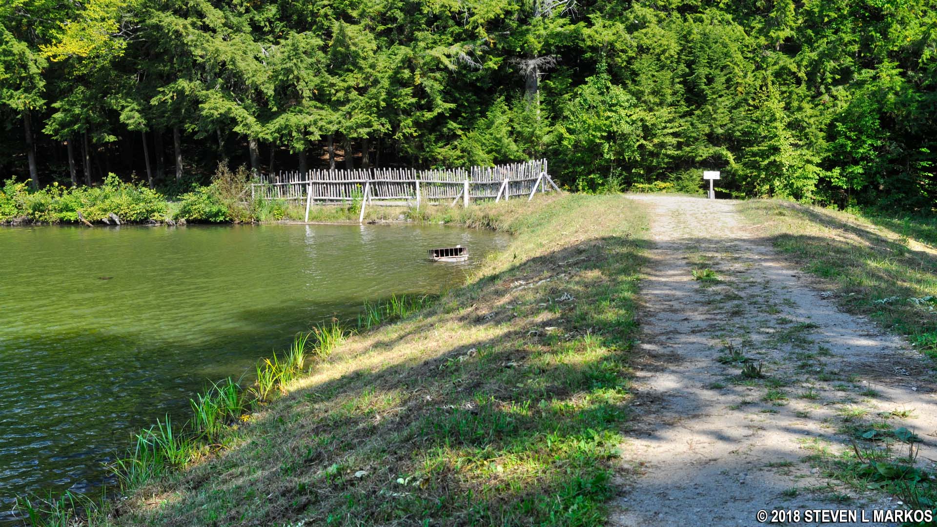
Earthen dam that creates The Pogue, a small pond in Marsh-Billings-Rockefeller National Historical Park
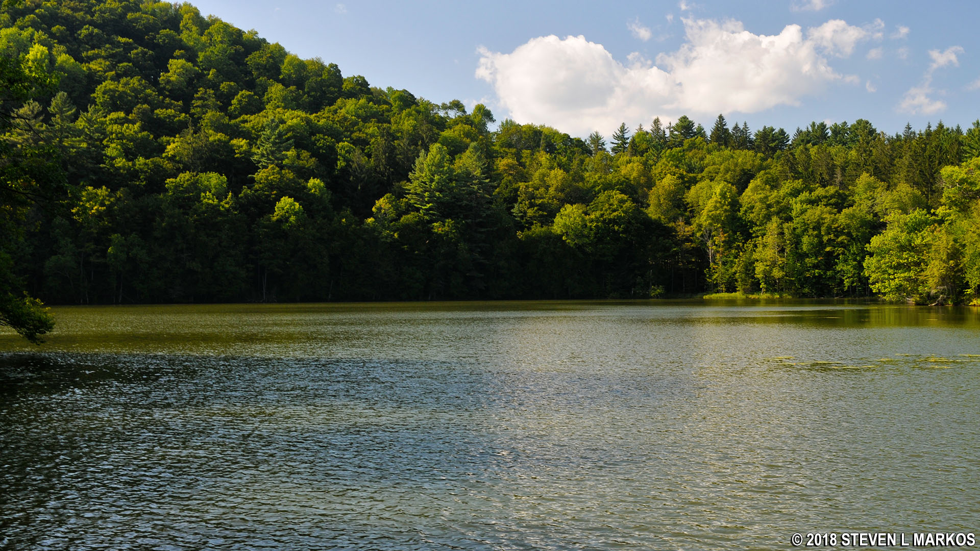
The Pogue, a small pond in Marsh-Billings-Rockefeller National Historical Park
The trail forks at the southeastern corner of the pond near the wooden fence. If you want to head back to the Carriage Barn Visitor Center or the Billings Mansion, take a right onto Mountain Road, a carriage road that leads to the east side of Marsh-Billings-Rockefeller National Historical Park. To get back to the Prosper Road parking lot continue around The Pogue by staying to the left.

Last segment of the Pogue Loop Trail
NORTH RIDGE LOOP
In a tenth of a mile you will be back to where you started the hike around the pond. Take a right to return to the North Ridge Loop. Once there, take a left and continue west for about .2 mile until reaching the intersection with McKenzie Road.

Southwestern end of the North Ridge Loop in Marsh-Billings-Rockefeller National Historical Park
MCKENZIE ROAD
Take a left on McKenzie, another carriage road (a sign marks the intersection). The road starts off on level terrain but soon slopes downhill. In fact, you’ll have a long, gradual descent all the way back to the parking lot.

McKenzie Road, one of the carriage roads in Marsh-Billings-Rockefeller National Historical Park
Stay on McKenzie Road for .6 mile until reaching the intersection with the McKenzie Farm Trail. You will pass three intersections along the way: the Prosper Trail, the North Slope Trail, and the West Ridge Trail. The McKenzie Farm Trail intersection is the last one before McKenzie Road dead ends into the paved Prosper Road, and thus there is only one way to turn—right.

Intersection of McKenzie Road and the McKenzie Farm Trail, Marsh-Billings-Rockefeller National Historical Park
MCKENZIE FARM TRAIL
The McKenzie Farm Trail is just a quarter mile long and proceeds downhill at a good pace. I had put away my hiking poles, but sort of wished I still had them. The trail, however, wasn’t steep enough or long enough for me to take the time to pull them out of my backpack.

Typical terrain along the McKenzie Farm Trail in Marsh-Billings-Rockefeller National Historical Park
The McKenzie Farm Trail comes out at the south side of the Prosper Road parking lot, thus ending the hike at 3.75 miles. Since most of the journey is along carriage roads, it’s not all that difficult, and the trip around The Pogue is a nice change from nearly continuous forested terrain at Marsh-Billings-Rockefeller National Historical Park.
McKenzie Farm Trail trailhead at the Prosper Road parking lot, Marsh-Billings-Rockefeller National Historical Park
With a few exceptions, use of any photograph on the National Park Planner website requires a paid Royalty Free Editorial Use License or Commercial Use License. See the Photo Usage page for details.
Last updated on December 17, 2025


