

View of the Blue Ridge Parkway’s Linville Falls from the bottom of Linville Gorge
Length: 1.5 miles, round trip
Time: 2 hour (includes hiking and stopping to see the falls)
Difficulty: Very strenuous with extremely rough terrain
Both the Linville Gorge Trail and the Plunge Basin Trail take hikers to unique views of Linville Falls. The difference is that Plunge Basin Trail ends at a viewing area that is level with the upper section of the falls, whereas the Linville Gorge Trail takes you to the base of the falls. There are also views from the Erwins View Trail, so you have three different options to see the falls—hiking to all three views is not a bad idea. Linville Falls flows year around and is the best waterfall on the Blue Ridge Parkway.

Click to enlarge
The hike to both Plunge Basin and Linville Gorge begins on the same trail. I highly suggest hiking to both, assuming you are physically able. The hike to Plunge Basin is easy to moderate, but the hike to the Gorge is probably the toughest on the Blue Ridge Parkway, and tougher than most eastern United States trails.
The hike to Linville Gorge (and Plunge Basin) begins at the stairs on the left side of the Linville Falls Visitor Center. A one-minute walk along a short connector trail leads to the intersection with the main trail. Make a right to get to either Plunge Basin or the Gorge (a left turn takes you on a short, easy hike to Dugger’s Creek Falls). The trail begins with a moderate uphill climb, but after only a tenth of a mile it flattens out and remains that way until the Plunge Basin / Gorge split, another two tenths of a mile farther ahead. The trail surface is fairly smooth for a trail in the Blue Ridge Mountains, but this is not to say that it is rock and root free.
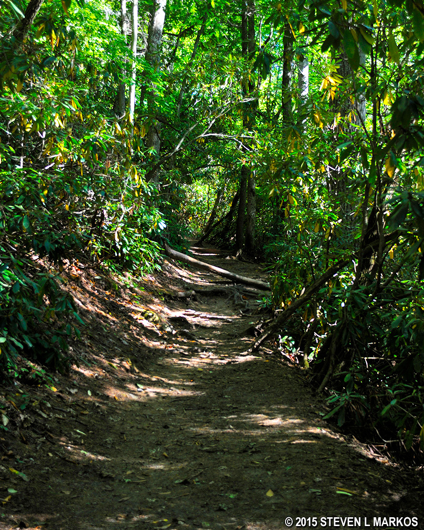
Typical terrain of the first .3 mile of the Plunge Basin Trail, Blue Ridge Parkway
Before arriving at the split with the Plunge Basin Trail, be aware that there is an unmarked intersection with a trail that branches off to the left. I have no idea where this leads, but to get to the Gorge stay straight. Once you reach the split with the Plunge Basin Trail, take a left. Signs point the way.

Intersection of the Plunge Basin and Linville Gorge trails, Blue Ridge Parkway
Once on the trail to the Gorge, the easy hiking is over. Not only is the trail steep, dropping a good distance to the bottom of the gorge in less than a half mile, but the terrain is as rough as you will find on the Blue Ridge Parkway, or on the East Coast for that matter. The ground is littered with python-sized roots and rocks ranging from head- to body-size. You are constantly taking one- to -two foot high steps up or down rocks, which is hell on the knees. On more than one occasion you must climb the rocks. And did I mention the stairs?
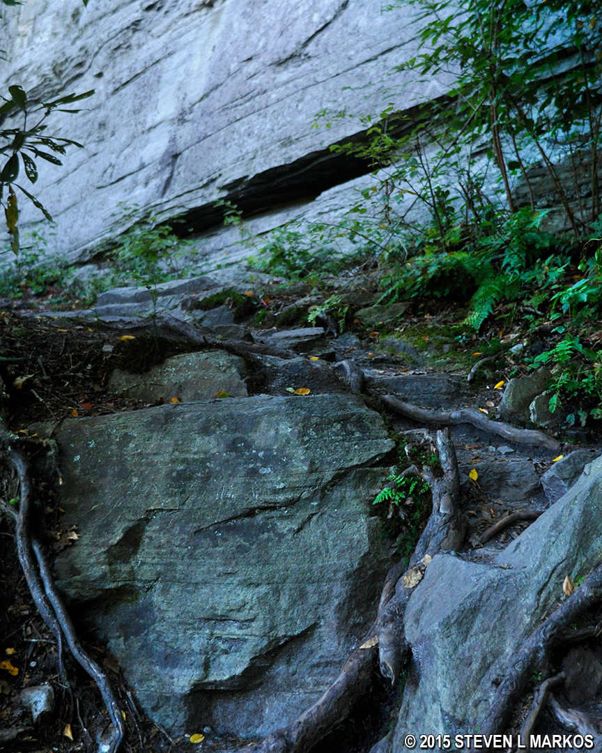
One of the larger rocks blocking progress on the Blue Ridge Parkway’s Linville Gorge Trail
The roots are just as bad. In some cases it’s like being Indiana Jones in the snake pit. You spend most of your time trying not to break an ankle. Needless to say, progress slows considerably. It took me a half hour to hike .4 mile.
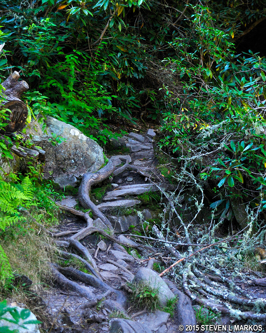
Typical terrain of the Blue Ridge Parkway’s Linville Gorge Trail
Unless you know where to turn, you are going to end up at the Linville River too far downstream to even see the waterfall—this is where I ended up. Other than walking upstream through the water, I had no idea how to get to the falls. I was about to head back pretty disgruntled when I saw another photographer not only upstream, but on the other side of the river. There had to be a way…and there is. Just before you get to the river, be on the lookout for giant slabs of granite on the right side of the trail. Behind them is a barely recognizable trail that takes you upriver. It starts off a little overgrown with rhododendrons, and the terrain is just as rocky, if not worse, than the hike down, but it will get you to the waterfall.
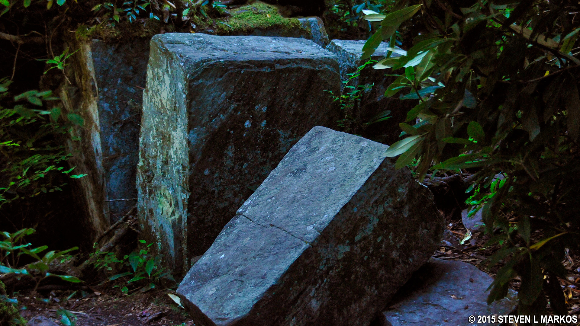
Granite slabs mark the turn on the Blue Ridge Parkway’s Linville Gorge Trail that leads upriver to the falls
As you follow the riverbank upstream, you must eventually make your way towards the center of the river if you want to get a good photo. You can do this by stepping on stones and large rocks, but there’s only so far you can go without wading into the water. If it weren’t for one spot where the stepping stones were just a little too far apart, you could walk all the way across without getting wet. This would be nice because the best seat in the house is on the opposite side where the aforementioned photographer was (he waded across in the calf deep water). From this vantage point you are looking directly at the waterfall, whereas staying on the same side of the river where the trail comes out puts you at a slight angle to the falls, though it is still a great view for the minimal effort. Since it was too late in the day to get a decent photo no matter where I was, I stayed put. (For the best photos, do not visit in the late afternoon because the waterfall will be in the shadows and the sun will be shining directly in your face. )
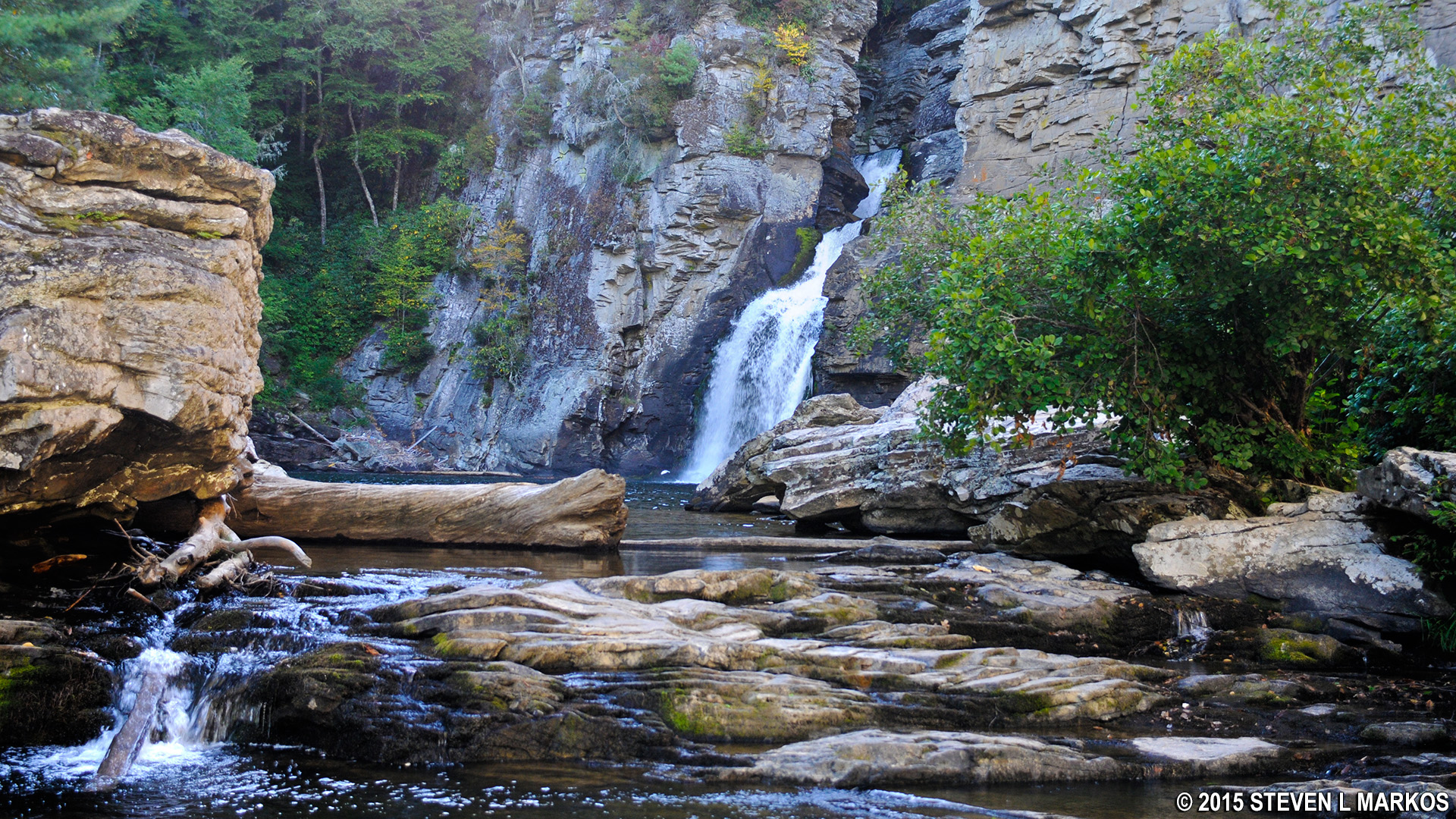
The approach to Linville Falls, the best waterfall on the Blue Ridge Parkway
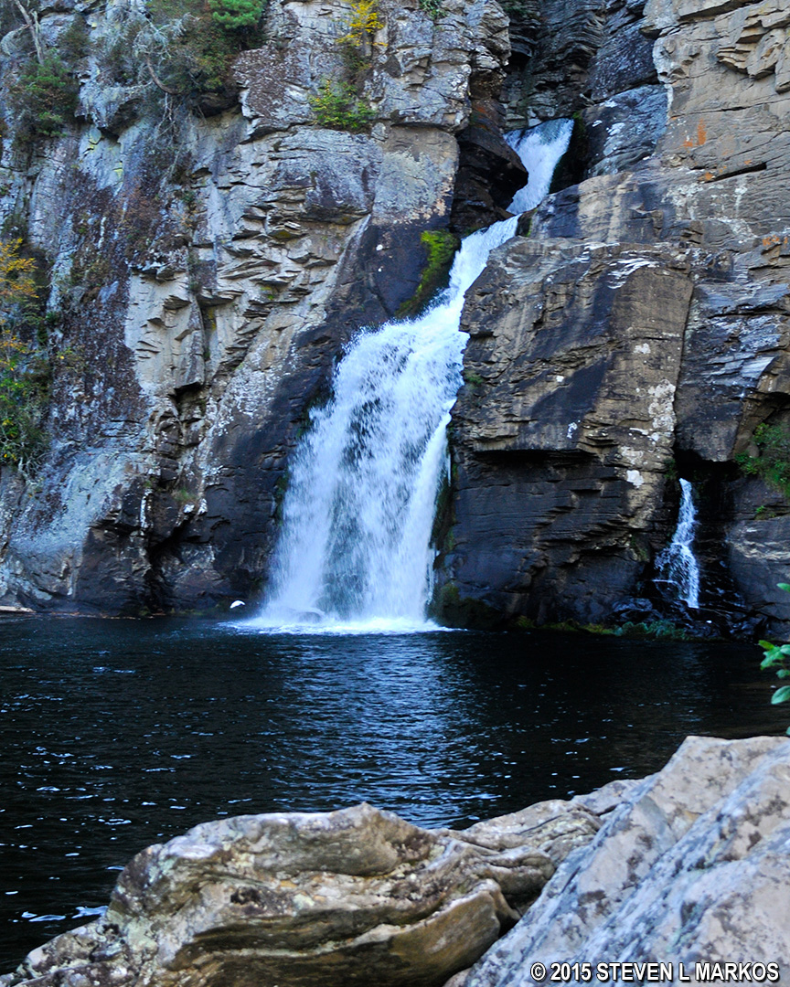
Linville Falls, the best waterfall on the Blue Ridge Parkway
Plan to spend two hours on the journey, which includes time to enjoy the falls. Round trip is about 1.5 miles. If you aren’t worn out, I suggest hiking the much easier Plunge Basin Trail when returning. A combination of the two hikes takes about 2.5 hours and covers just over 2 miles.
Back to the Top | Linville Falls Hiking Trails | Waterfalls
With a few exceptions, use of any photograph on the National Park Planner website requires a paid Royalty Free Editorial Use License or Commercial Use License. See the Photo Usage page for details.
Last updated on November 25, 2023


