
Water Route Overlook on the Natchez Trace Parkway
The Water Route Overlook is located at the east end of the John Coffee Memorial Bridge, which spans the Tennessee River in the northwest corner of Alabama. A side road leads from the Natchez Trace Parkway to a sizable lot of land where you will find a picnic area and information about the Trail of Tears. This is also a great stop for viewing and photographing the bridge.
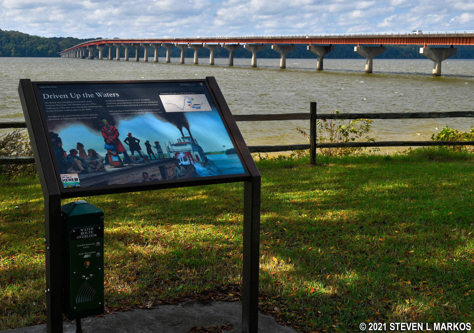
The purpose of the Water Route Overlook stop on the Natchez Trace Parkway is to mark the location where Cherokee Indians boarded barges that were pulled up the Tennessee River during their journey to Oklahoma as required by the Indian Removal Act of 1830. Other Indian tribes in the area had voluntarily moved prior to 1830, but many of the Cherokee refused to go and were eventually rounded up and forced to leave, an odyssey that is now called the Trail of Tears. An information panel with audio commentary about the water journey is near the parking lot overlooking the river. Push a button on the exhibit panel to hear the commentary.
In the large field bordering the parking lot is a picnic area with four tables but no grills. The road ends in a loop, so those with large RVs and trailers will have no problem getting back onto the Natchez Trace Parkway. If you are looking for a larger picnic area, complete with restrooms, Colbert Ferry Park is the first stop you come to when crossing over the bridge.

Picnic area at the Water Route Overlook on the Natchez Trace Parkway
The John Coffee Bridge was named after a general who fought under Andrew Jackson in the Creek Indian Wars. He was appointed to negotiate treaties with the southeastern Indian tribes for removal to the west per the Indian Removal Act of 1830. I have no idea why a bridge would be named for him, especially since he is from Tennessee and the bridge is in Alabama (though he did settle down in Alabama later in life, dying in nearby Florence). Bridges are often named for politicians, not obscure 1800s military personalities, especially ones involved in the forced removal of the Indians—but I guess back in 1964 when the bridge opened, that wasn’t an issue.

John Coffee Memorial Bridge over the Tennessee River
Back to the Top | Next Stop North | Next Stop South
With a few exceptions, use of any photograph on the National Park Planner website requires a paid Royalty Free Editorial Use License or Commercial Use License. See the Photo Usage page for details.
Last updated on November 30, 2021


