
Stage Road Trail at Appomattox Court House National Historical Park
See the Hiking Trails web page for a trail map.
Length: .9 mile
Time: 30 minutes (one way)
Difficulty: Easy
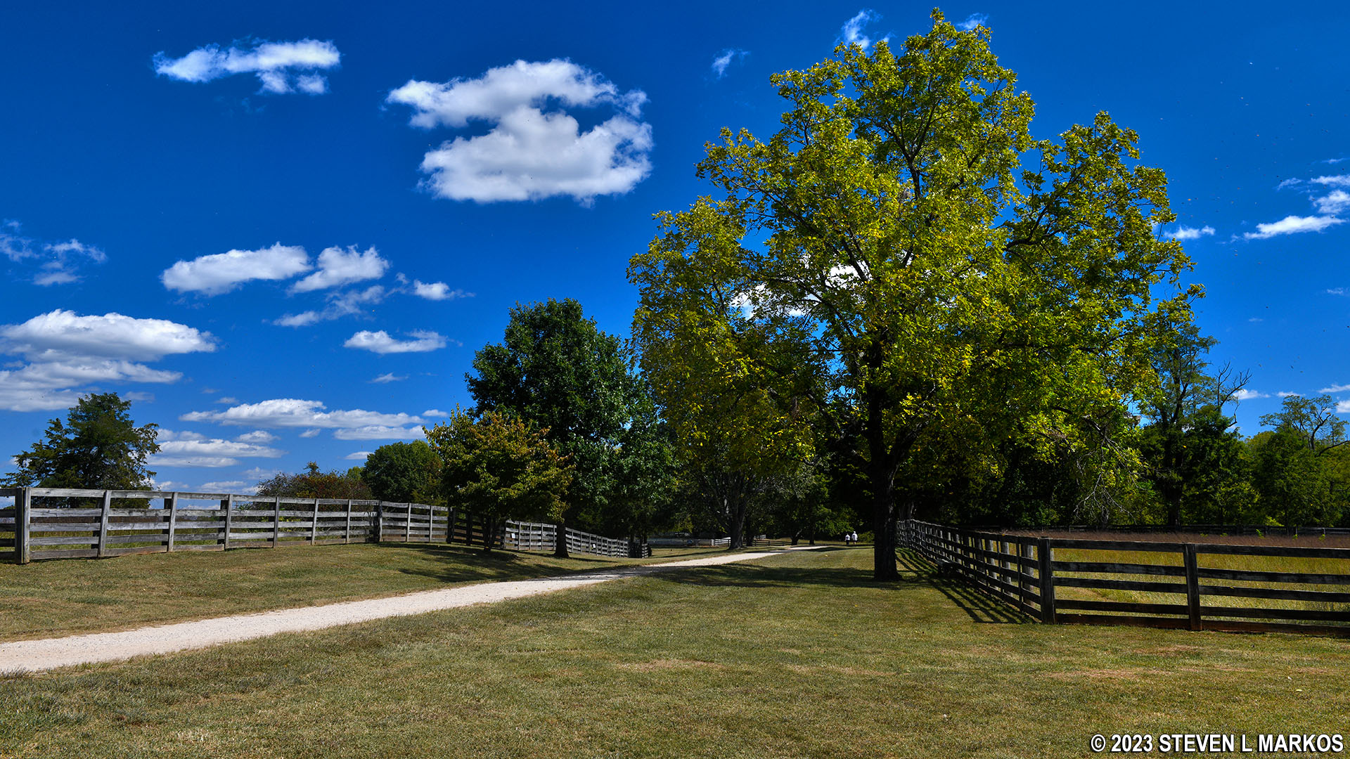
The Stage Road Trail at Appomattox Court House National Historical Park follows a section of the historic Richmond-Lynchburg Stage Road that runs through the heart of the park. The trail’s eastern trailhead is at the Confederate Cemetery, and its western trailhead is at the intersection with the Tibbs Trail at Highway 24. If you are exploring the historical village of Appomattox Court House, the main attraction at the park, you can start a hike in the middle of the trail.
If you have time, don’t simply walk to one end of the Stage Road Trail and back. Do what I did and make a loop out of your hike by adding the Tibbs Trail. Together they are 2.2 miles long, and the hike is one of the best in the park. I started on the Tibbs Trail at the Confederate Cemetery and traveled around in the clockwise direction. Thus, I began the Stage Road Trail at its eastern end at Highway 24. There is no parking here, so starting at the eastern end isn’t really an option unless you arrive there on the Tibbs Trail.
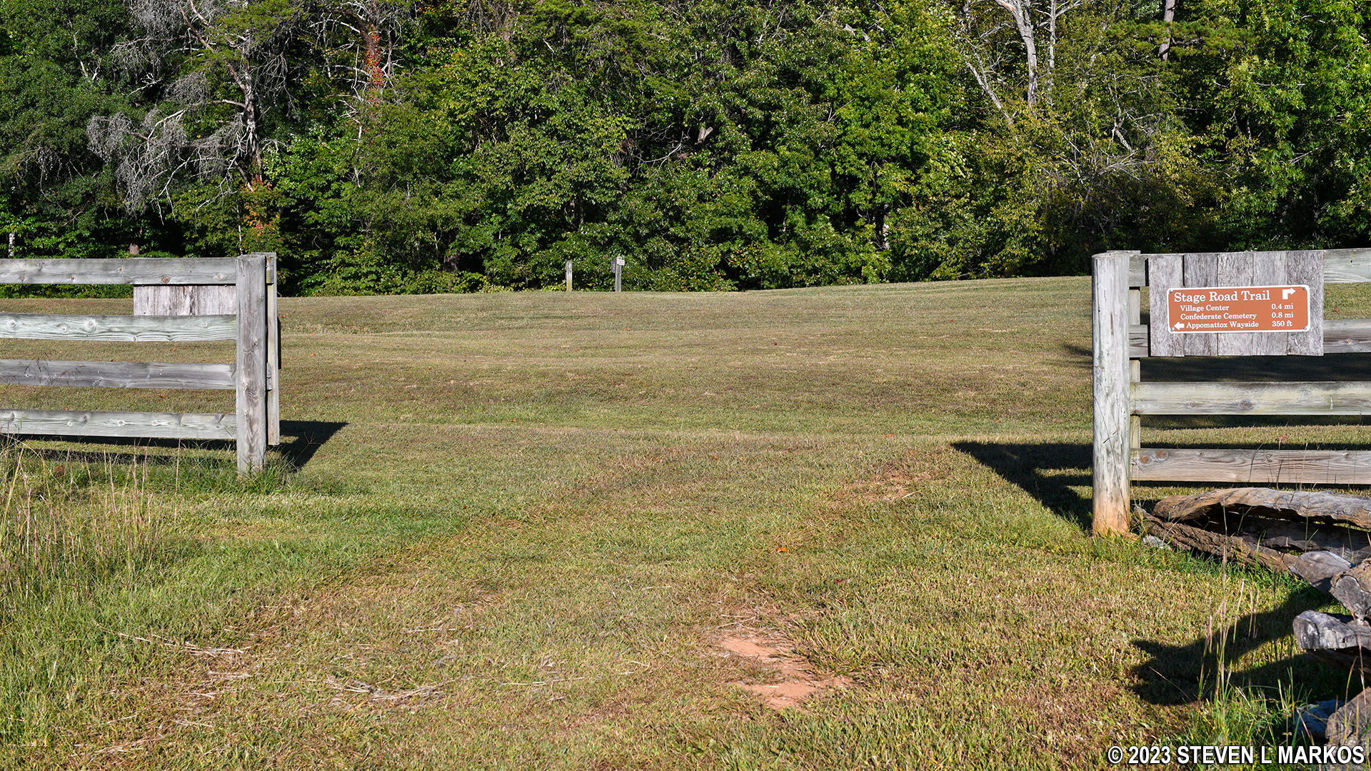
The Tibbs Trail ends at a gap in a fence that runs along Highway 24. To begin the hike on the Stage Road Trail, pass through the fence and turn to the right. Do not turn prior to the fence. The trail signage is not clear about this, and if you turn prior to the fence and follow the mowed path, you’ll eventually have to climb over the fence to get on the official trail.
Eastern trailheads for the Tibbs and Stage Road trails at Appomattox Court House National Historical Park

Eastern end of the Stage Road Trail at Appomattox Court House National Historical Park

Mowed path that runs along the Stage Road Trail on the opposite side of the fence—Do Not Take It—Appomattox Court House National Historical Park
The hike starts at the bottom of a valley, so the first section heads up a mild incline. A tenth of a mile from the start is the site where generals Robert E. Lee and Ulysses S. Grant met on April 10, 1865, the day after Lee surrendered his Army of Northern Virginia. Lee’s army was only one of many Confederate armies, and his surrendered did not mean that the Civil War was over. During this meeting, Grant tried to convince Lee to contact the other generals and ask them to surrender as well. Lee refused, though his surrender heavily influenced the other Confederate generals, and the war was over for the most part within a couple of months.

Stop along the Stage Road Trail where Lee and Grant met on April 10, 1865, Appomattox Court House National Historical Park
When the Confederates surrendered on April 9th, each soldier had to turn over his firearms. This was done on the 10th. The Confederates were stationed east of Appomattox Court House, so they marched from east to west on the Richmond-Lynchburg Stage Road, the same direction as those starting a hike on the Stage Road Trail at its eastern end. Union soldiers lining the road saluted the Confederates as they walked by on their way towards the town.
Up to this point, the Stage Road Trail heads slightly uphill and is a grass path. Just past the Lee-Grant meeting spot, the terrain levels out and the trail, for a very short length, is paved. However, almost immediately it becomes a dirt road just as it was in 1865. It also forks, so stay left. To the right is a park road that leads to the Clover Hill Tavern Kitchen, which now serves as the souvenir and book store for Appomattox Court House National Historical Park.

Stage Road Trail (left) and the road to the Clover Hill Tavern Kitchen at Appomattox Court House National Historical Park
If you haven’t already walked this far east on the Stage Road when exploring the village, you will see for the first time the Peers House and the Appomattox County Jail before eventually coming to a traffic circle that goes around the Appomattox County Courthouse building, which is now the park’s Visitor Center.

Peers House at Appomattox Court House National Historical Park

Appomattox County Jail at Appomattox Court House National Historical Park

Richmond-Lynchburg Stage Road leading into the center of Appomattox Court House
Continue walking west when you get to the other side of the courthouse. As you walk out of town you’ll pass the Meeks General Store and the McLean House where the surrender meeting took place on April 9th.

Stage Road Trail west of the courthouse passes the Meeks General Store, Appomattox Court House National Historical Park
As you leave the town behind, be on the lookout for a stone that marks where the very last skirmish of the Battle of Appomattox Court House took place. This is about a five minute walk past the intersection with Tibbs Lane (not to be confused with the Tibbs Trail).
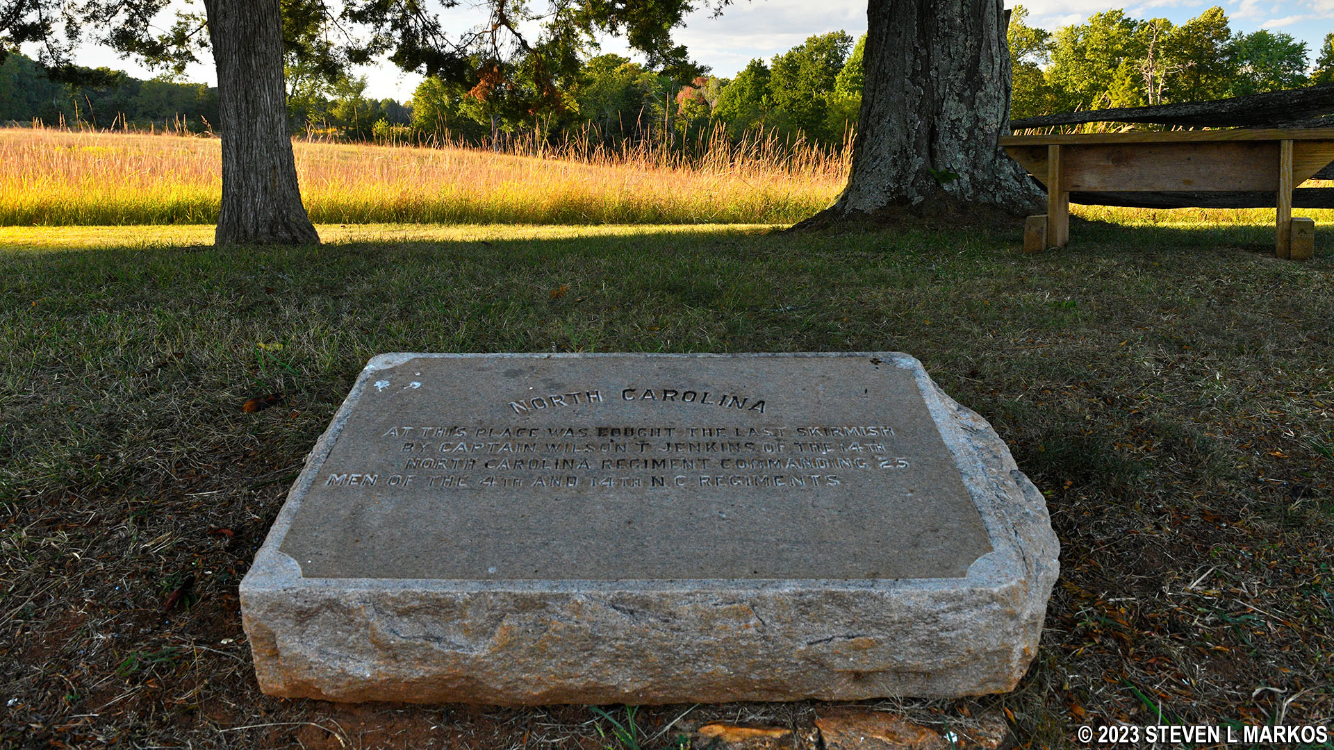
Stone marks the spot of the last skirmish during the Battle of Appomattox Court House, Appomattox Court House National Historical Park
The Stage Road continues for .4 mile past the courthouse, ending at the Confederate Cemetery where 18 Confederate soldiers and one Union soldier are buried.

Richmond-Lynchburg Stage Road west of Appomattox Court House, Appomattox Court House National Historical Park

Confederate Cemetery at Appomattox Court House National Historical Park
With a few exceptions, use of any photograph on the National Park Planner website requires a paid Royalty Free Editorial Use License or Commercial Use License. See the Photo Usage page for details.
Last updated on June 27, 2023


