

Trail Map (click to enlarge)
Length: 1.5 mile loop (Old Trace + Natchez Trace National Scenic Trail)
Time: 1 hour
Difficulty: Easy
A .75-mile section of the original Natchez Trace runs through the Rocky Springs area. It is an out-and-back trail unless you form a loop with the Natchez Trace National Scenic Trail (which I did). If you have the Scenic Trail brochure, the original Trace segment is marked with a blue dotted line and highlighted in yellow, while the Scenic Trail is marked with a red dotted line.
You can begin the hike at either end of the trail. One trailhead is located just before the point where the main road through Rocky Springs splits to form a loop and begins one-way travel. A second starting point is at the Rocky Springs Campground where a short connector trail leads to the Trace. I started the hike from the park road. The trailhead, which has its own parking area, is marked with a large brown sign and a stone monument.
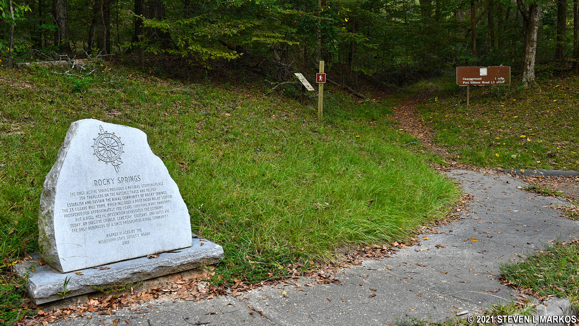
Original Natchez Trace trailhead on the Rocky Springs town site road
This section of the Natchez Trace provides a wonderful example of the “sunken” road feature that is characteristic of the trail’s southern end. The soil here is very sandy, and the enormous gully that now makes up much of the trail at Rocky Springs is a result of thousands upon thousands of people, horses, and wagons traveling along it and wearing a ditch into the earth. During the nearly 200 years since the trail fell into disuse, trees and other vegetation reclaimed the land, and today most of the original Trace is unrecognizable. Thus, any sections you can walk on have been cleared by the National Park Service.

Sunken Natchez Trace at Rocky Springs on the Natchez Trace Parkway
At about the .7-mile mark you will come to a turnoff for the Port Gibson Road. The trail is fairly overgrown—in fact, there’s not even a trail that I could see—so it doesn’t look like many people hike to Port Gibson Road.

Sign marks the intersection of the Old Trace and trail to Port Gibson Road
Very shortly after passing the Port Gibson Road sign, the Natchez Trace dead-ends at Little Sand Creek, but you will not find any directional signs suggesting further travel options (unmarked intersections and poor navigational aids are typical of the Natchez Trace National Scenic Trail). If your goal was simply to hike the original Trace, turn around and head back the way you came. If you want to get to the campground, take a right and follow the trail along the creek. However, if you want to make a loop out of the hike and return along the Natchez Trace National Scenic Trail, things get a little confusing.
As soon as you get to the Port Gibson Road sign, look to your right and you will see a trail that cuts back so sharply that it essentially forms a U-turn in relation to the original Natchez Trace that you are on. This is the section of the Natchez Trace National Scenic Trail that takes you back to your car. A post designates this trail as one for horses only, but this is some sort of mistake for there are no trails in the park strictly for horses, at least not today. If you are hiking the loop, ignore the sign and take this trail to get back to your car. It will come out a little south of where you parked, so the last leg of the journey is a short walk back along the road.

Rocky Springs segment of the Natchez Trace National Scenic Trail
On the way back you will pass through a field. The woods along the edge appear to be used as a park dumping ground for old picnic tables and grills. There’s even an empty barrel of a now-banned herbicide. Dinitro (a brand name for denoseb) was banned in 1986, so this barrel has been here for a while. However, by the time you read this the area may have been cleaned up.

Junkyard of old picnic area equipment

Old barrel of now-banned dinitro herbicide
The trail reenters the forest at the far end of the field, though this time around it is nothing but an old gravel road. This will take you all the way back to the park road where you will then turn right to get back to your car.

Typical flat, gravel terrain of the Natchez Trace National Scenic Trail
If you were to hike this loop from the Rocky Springs Campground, follow the signs to the trail. You will start off by walking along the creek. Make a left turn at the first intersection you come to. This will take you to the start of the loop, with the above mentioned “Horses Only” trail forking to the left and the original Natchez Trace forking to the right. Since you are going to hike in a loop, you can go either way.

Trail from the campground along Little Sand Creek (photo was taken when heading to the campground)
The hike is very easy. Most of the trail is wide, flat, and smooth. Other than the confusion near the creek, there are no other unmarked intersections or other tricky areas to navigate.
With a few exceptions, use of any photograph on the National Park Planner website requires a paid Royalty Free Editorial Use License or Commercial Use License. See the Photo Usage page for details.
Last updated on December 10, 2021


