
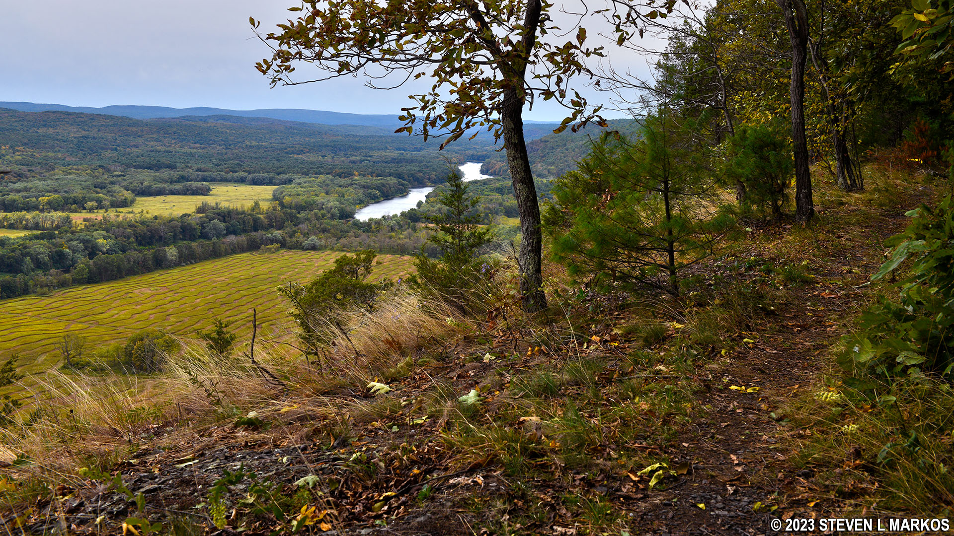
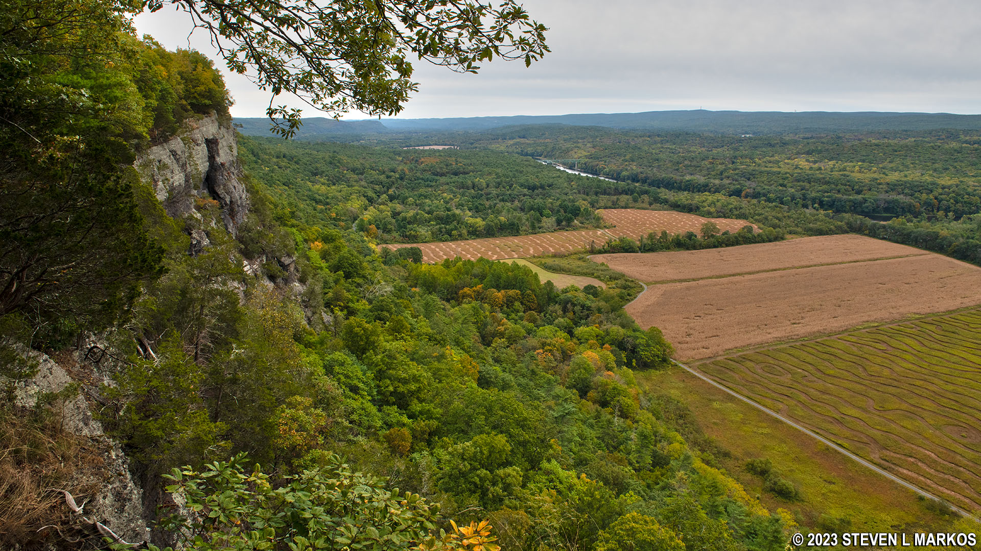
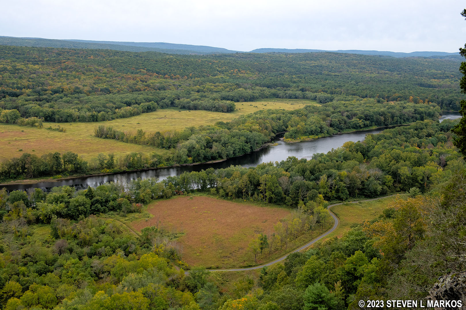
View from the Cliff Trail in Delaware Water Gap National Recreation Area
Length: 2.8 miles, one way
Time: 1.5 hours, one way
Difficulty: Moderate
The Cliff Trail is one of many trails in the Cliff Park section of Delaware Water Gap National Recreation Area. Located at the northern end of the park near Milford, Pennsylvania, this section takes its name from the Cliff Park Golf Course, the first golf course in America designed by a woman, Annie R. Buchanan. It became part of the park when the land was donated by the Buchanan Family in 2003. The Buchanans owned the property since 1803, and the golf course has been around since 1913.
The trail runs the entire length of the Cliff Park area, from near Milford Knob at its northeast end to the Hackers Trailhead on Raymondskill Road at its southwest end. Direct access is from the Hackers Trailhead parking lot. If starting from the northeast end, you must first hike 1.25 mile on the Milford Knob Trail. This is where I started my Cliff Trail hike, as I combined it with most of the trails at Cliff Park to form a 12-mile loop. This trail report covers only the Cliff Trail and is written from the perspective of hiking southwest from Milford Knob.

Corrected trail map for the Cliff Park Area trails at Delaware Water Gap National Recreation Area (click to enlarge)
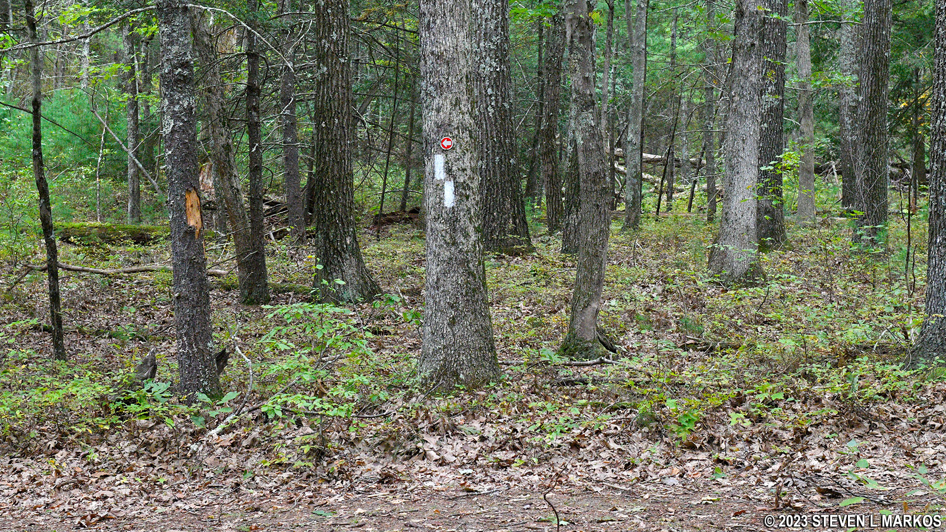
I picked up the Cliff Trail after taking in the view of Milford, Pennsylvania, and the Delaware River from the Milford Knob Overlook. On this end of the park, the Cliff Trail is wide with a fairly smooth surface, though there are short stretches that are cluttered with small rocks. It is marked with white blazes, which are paint splotches on trees or rocks that mark the route like Hansel and Gretel breadcrumbs.

White blazes mark the Cliff Trail in Delaware Water Gap National Recreation Area
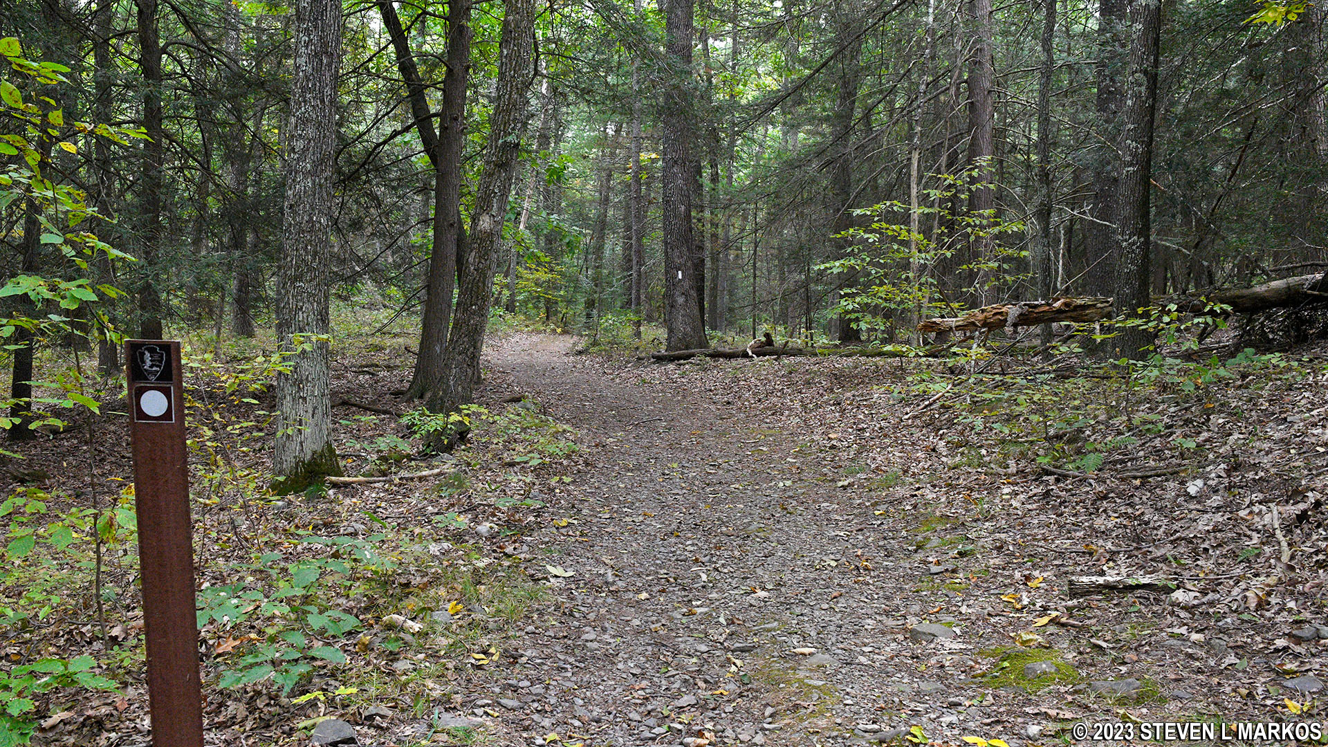
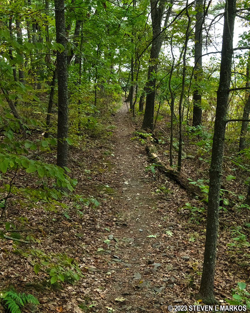
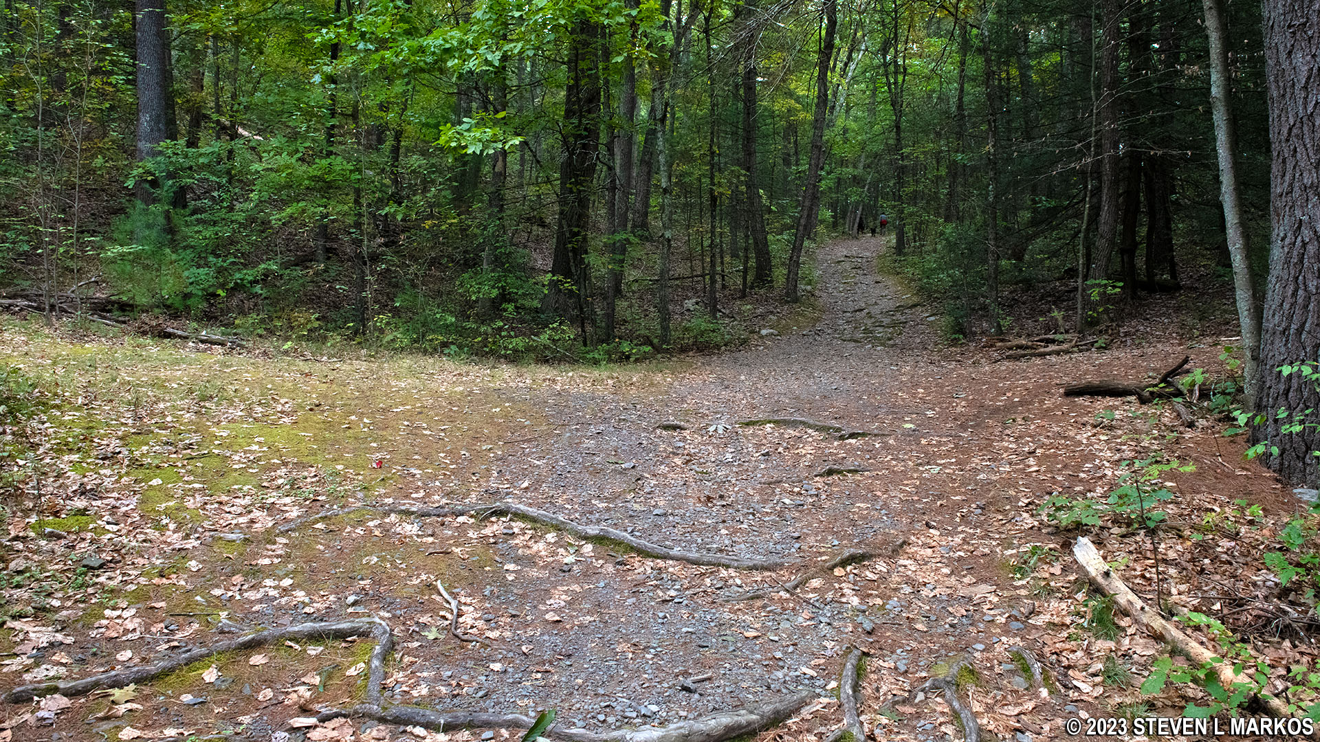
Other than one short-but-steep hill (200 feet long), the Cliff Trail is fairly easy to hike for the first .6 mile to the intersection with the Quarry Path Trail. It runs through the forest, but the canopy is high and the ground is not cluttered with too much vegetation, providing an open feeling instead of one of being in a dark forest where you are liable to encounter lions and tigers and bears. Oh my.
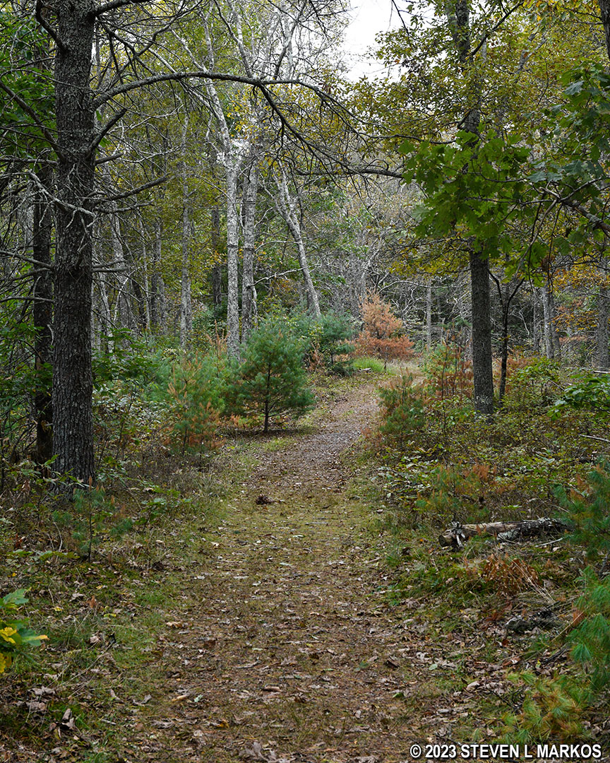
Typical terrain at the northeast end of the Cliff Trail in Delaware Water Gap National Recreation Area
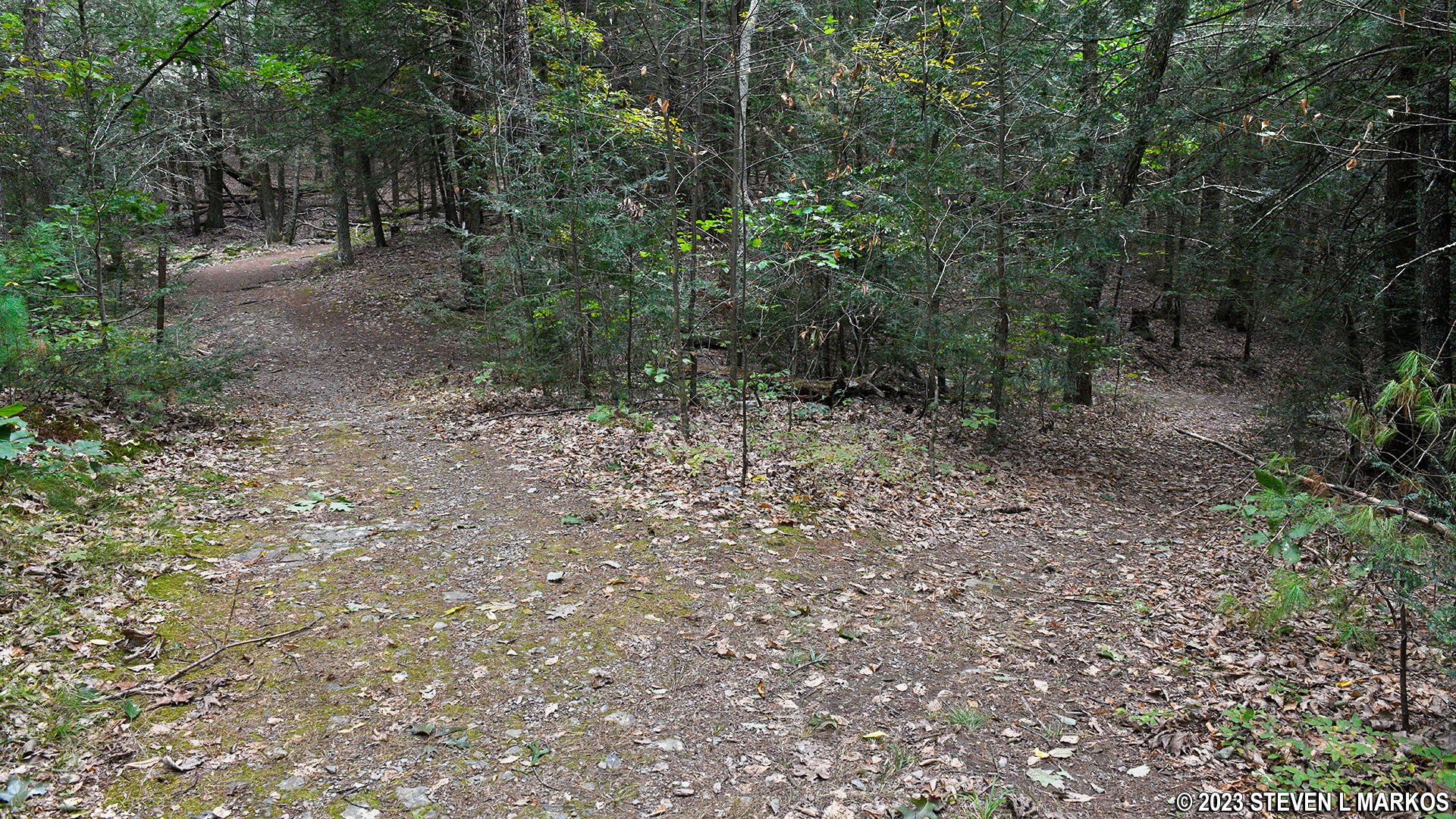
Confusion sets in at the Quarry Path Trail intersection. Looking at the trail map provided by the National Park Service in the Guide to the Gap, a free tabloid-size publication that has maps for all trails within Delaware Water Gap National Recreation Area, there appears to be a turn to the left (Quarry Path) and the option to continue straight on the Cliff Trail. In reality, the Cliff Trail dead ends at a T-intersection. A left-pointing red arrow and two white blazes that stairstep to the left on a tree at the intersection indicate that left is the way to go. Where the trail to the right leads, I do not know. What I do know is that this is not the intersection with the Quarry Path Trail. In fact, it is the first of three intersections all within a stone’s throw of each other, none of which are on the government trail map.
Unmarked intersection near the Cliff Trail / Quarry Path intersection, Delaware Water Gap National Recreation Area
There is another intersection as soon as you make the turn, this one being with the Quarry Path. Two white blazes stairstep to the right indicating the turn for the Cliff Trail. There is also a sign post with a white dot and an arrow to the right (Cliff Trail) and a green dot with white in the center and an arrow to the left. This is for the Quarry Path, which is marked with green and white blazes (per the Guide to the Gap).
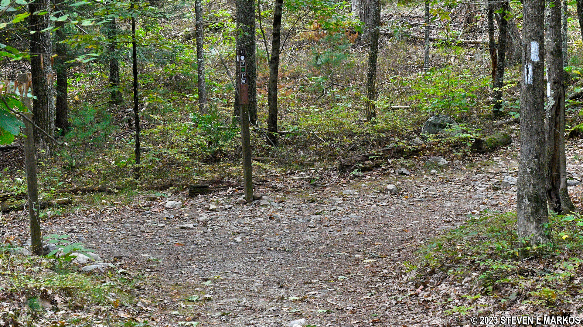
Intersection of the Cliff Trail and Quarry Path in the Cliff Park section of Delaware Water Gap National Recreation Area
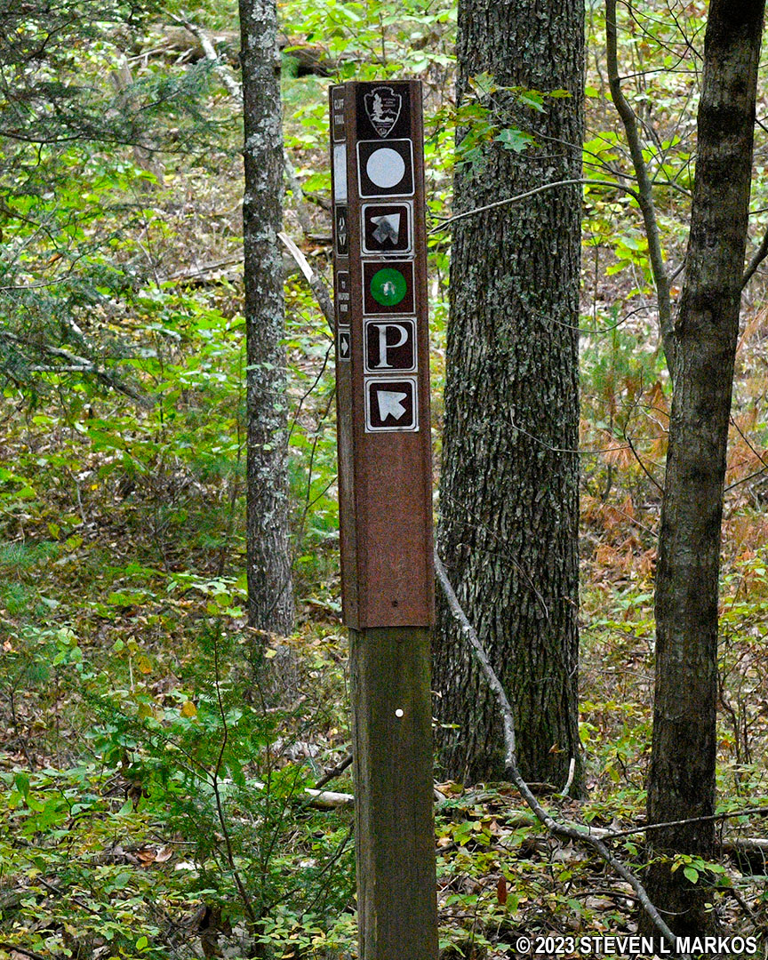
Trail sign at the intersection of the Cliff Trail and Quarry Path, Delaware Water Gap National Recreation Area
Then, to make matters even more confusing, the Cliff Trail immediately splits, only this time there are no sign posts and only a tree with three white blazes in a triangular shape, a configuration that indicates the start of a trail. Start of what trail? The Cliff Trail started near Milford Knob. What happens here is that the Cliff Trail splits into two trails that run parallel to each other because the lower trail is often closed for Peregrine falcon nesting, whereas the upper trail is always open. Which one is the official Cliff Trail, I don’t know, but they both lead to the Hackers Trailhead parking lot. The lower trail is a narrow path that follows right along a cliff—the type where if you fall off, you are dead. The upper trail is a wider, gravel path, possibly a former road. To distinguish between the two in my review, I will refer to them as Upper Cliff Trail and Lower Cliff Trail.
Since I would be returning to the Milford Knob Trailhead parking lot via the Cliff Trail, I figured I’d hike one trail on the way out and the other on the way back. The map in Guide to the Gap shows a RIVERVIEW OVERLOOK up ahead, so I figured this had to be on the lower of the two trails, and I thus took a left at the fork. (Note: I made the corrections on the trail map shown here on National Park Planner. Corrections are in RED.)
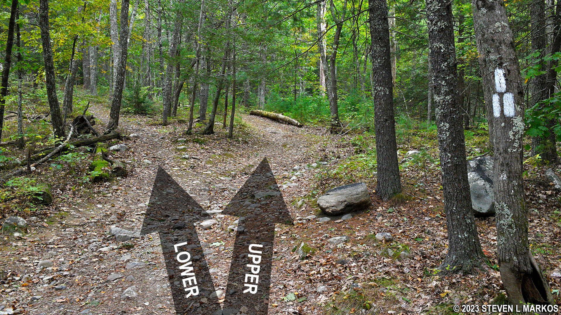
Upper and Lower Cliff Trails in the Cliff Park section of Delaware Water Gap National Recreation Area
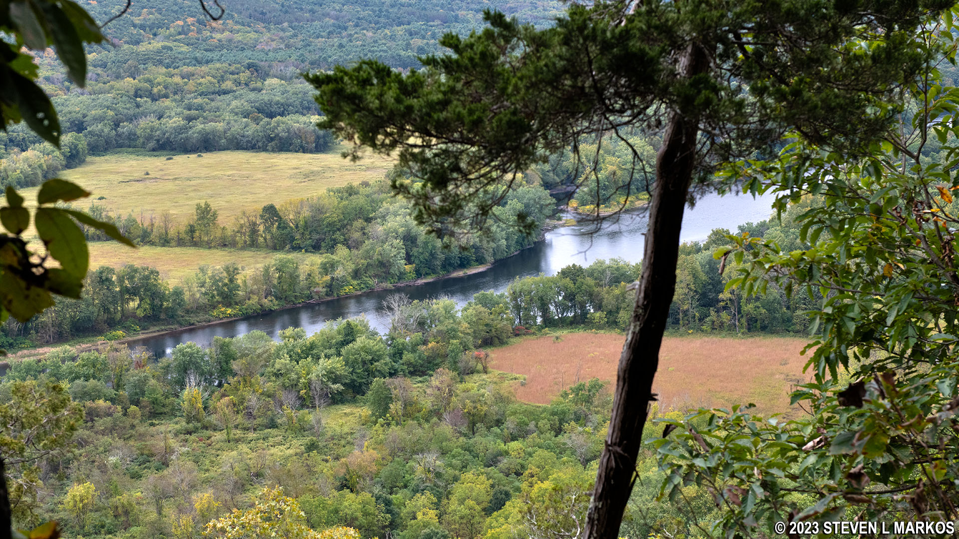
The Riverview Overlook is .3 mile from the Quarry Path intersection. There are some views along the trail of the valley below, but most of the time trees and other vegetation are in the way. All is clear at the overlook, plus there is a bench to sit on if you want to enjoy the view for an extended period of time. There is also a trail that connects back to the upper trail.
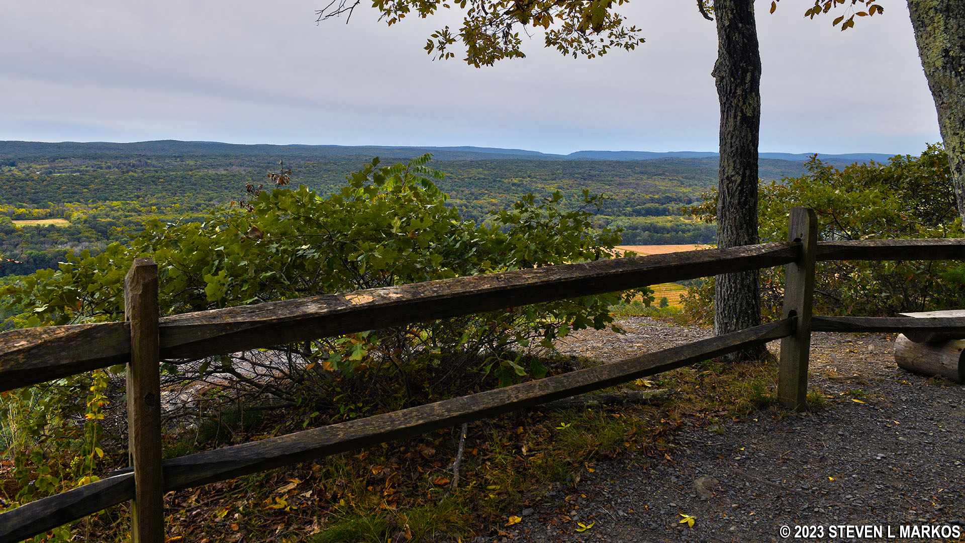
Riverview Overlook on the Cliff Trail in Delaware Water Gap National Recreation Area
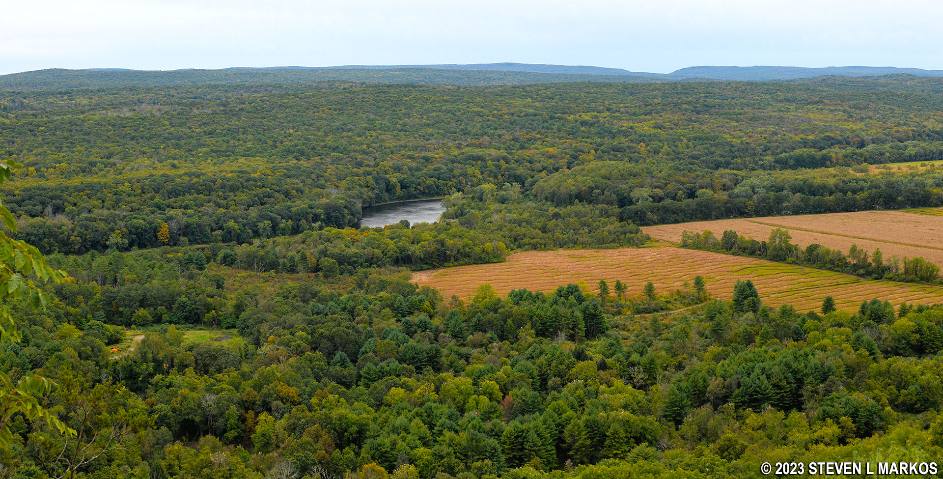
View of the Delaware River and agricultural fields from the Riverview Overlook on the Cliff Trail in Delaware Water Gap National Recreation Area
The Lower Cliff Trail continues past the overlook, hugging the cliff as before. The upper trail is actually on a ridge high above the lower trail. If there are people hiking along it, you can see them through the trees.
A half mile past the Riverview Overlook (1.4 mile from the start near Milford Knob), the Lower Cliff Trail comes to a closed area and makes a curve to the right in order to connect back to the upper trail high up on the ridge. The trail utilizes a switchback, so there are two moderate hills separated by a level area instead of one very steep climb to the top. Total distance to the Upper Cliff Trail is about a tenth of a mile.
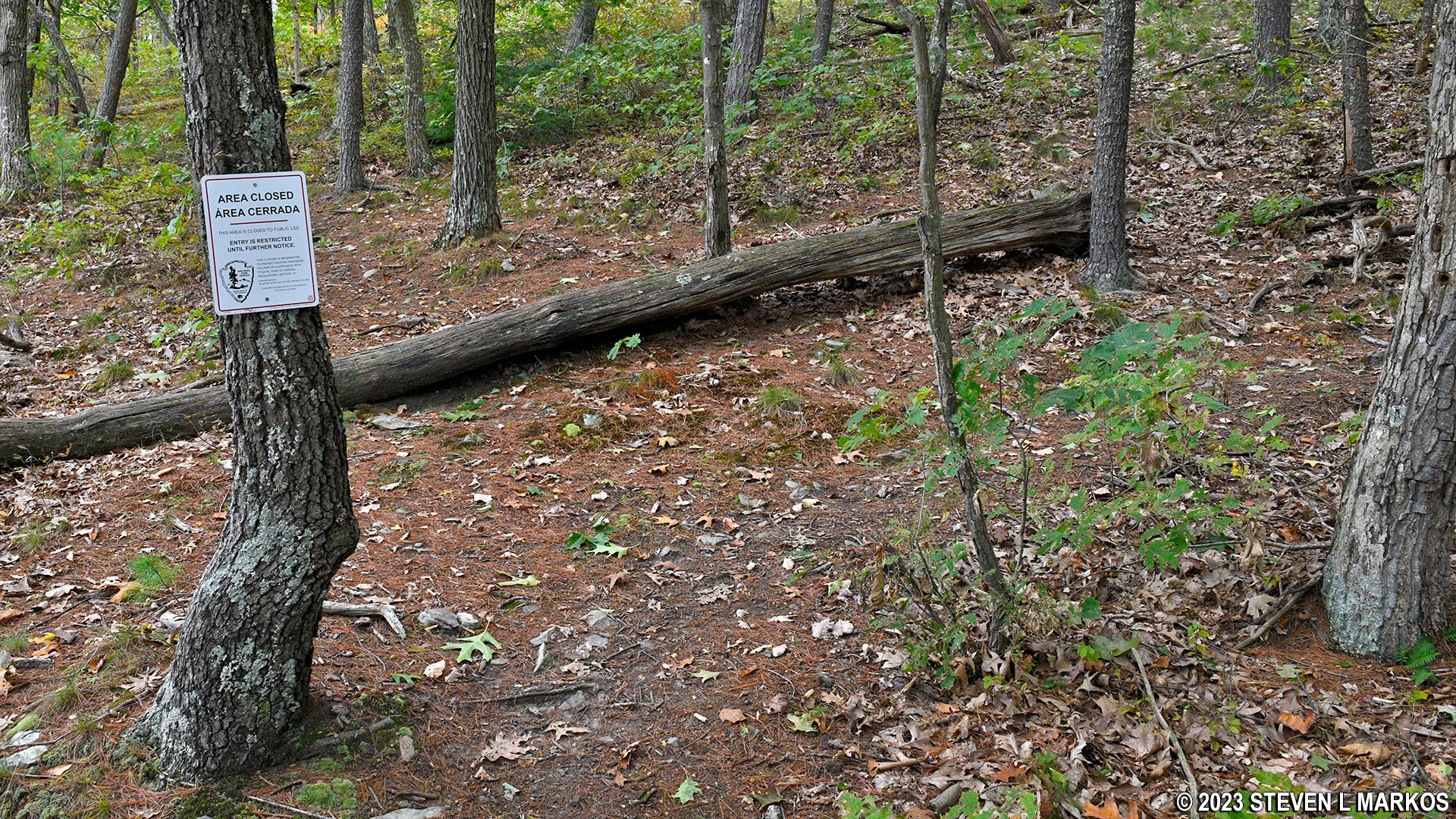
The Lower Cliff Trail in Delaware Water Gap National Recreation Area avoids a section of the park closed for Peregrine falcon nesting
Once at the top where the two trails merge, I noticed an AREA CLOSED sign pertaining to the section of the Lower Cliff Trail that I had just hiked. And up ahead, the trail splits again into an upper and lower section, with the lower section, a short, C-shaped segment that reconnects to the upper trail a quarter mile later, heading down a steep hill to the left. An AREA CLOSED sign was at the start of that section of trail as well. I began to put two and two together and realized that the lower section is most likely permanently closed. It’s just that the AREA CLOSED sign at the fork near the Quarry Path Trail was missing. I believe this to be a permanent closure because the CLOSED signs are nailed to trees, whereas signs for areas temporarily closed for bird nesting season are typically on posts that can easily be removed when nesting season is over. Oh well. My suggestion is that unless there is an AREA CLOSED sign at the Quarry Path, or any other connector to the lower trail, take the Lower Cliff Trail because that’s where all the good views are found.
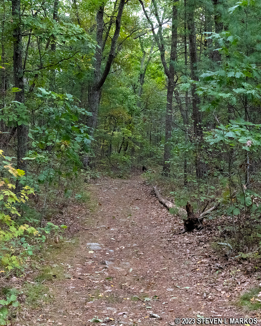
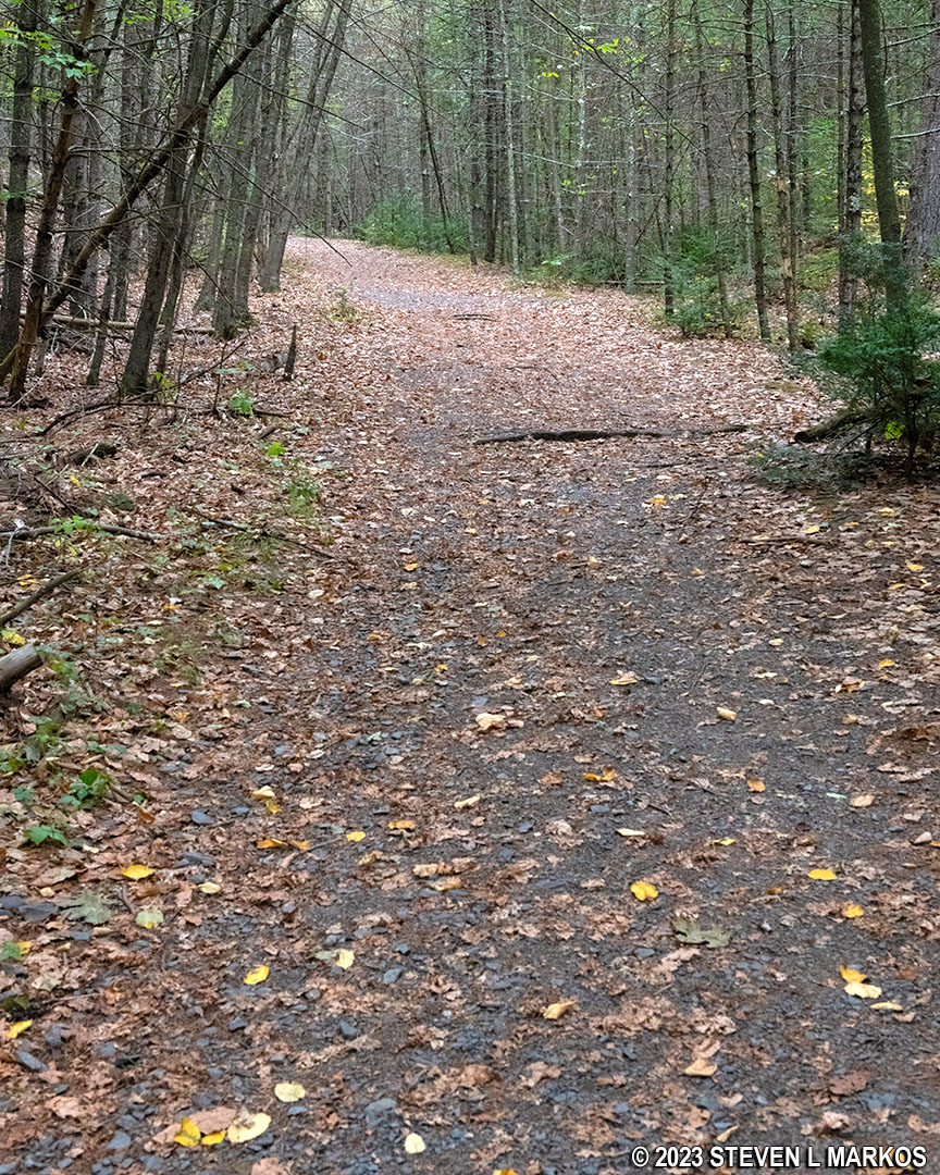
Continue down the Upper Cliff Trail, which, as mentioned earlier, is a wide dirt path, not a narrow hiking trail as is the lower section.
Typical terrain on Upper Cliff Trail in Delaware Water Gap National Recreation Area
The Cliff Trail heads slightly downhill, and a tenth of a mile past the lower trail turnoff is the intersection with a rocky, tenth-of-a-mile connector to the Pond Loop Trail. There is an unmarked fork to the right prior to the official intersection a stone’s throw ahead. This is just a shortcut that shaves off a few feet by forming a triangle. When I visited, the connector was also closed due to Peregrine falcon nesting, and in truth, if you want to hike only the Pond Loop Trail, or the Buchanan Trail that connects to it, start at the Cliff Park Trailhead near the Cliff Park Golf Course. It is a long hike from the Milford Knob or Hackers trailheads to these trails.
Shortcut (right fork) just before the official intersection of the Cliff Trail and the connector to the Pond Loop Trail, Delaware Water Gap National Recreation Area
Just past the Pond Loop Trail connector, the Upper Cliff Trail gets slightly narrower and a little more rockier, but it’s still wider than the Lower Cliff Trail.
Terrain on the Upper Cliff Trail south of the Pond Loop Trail connector, Delaware Water Gap National Recreation Area
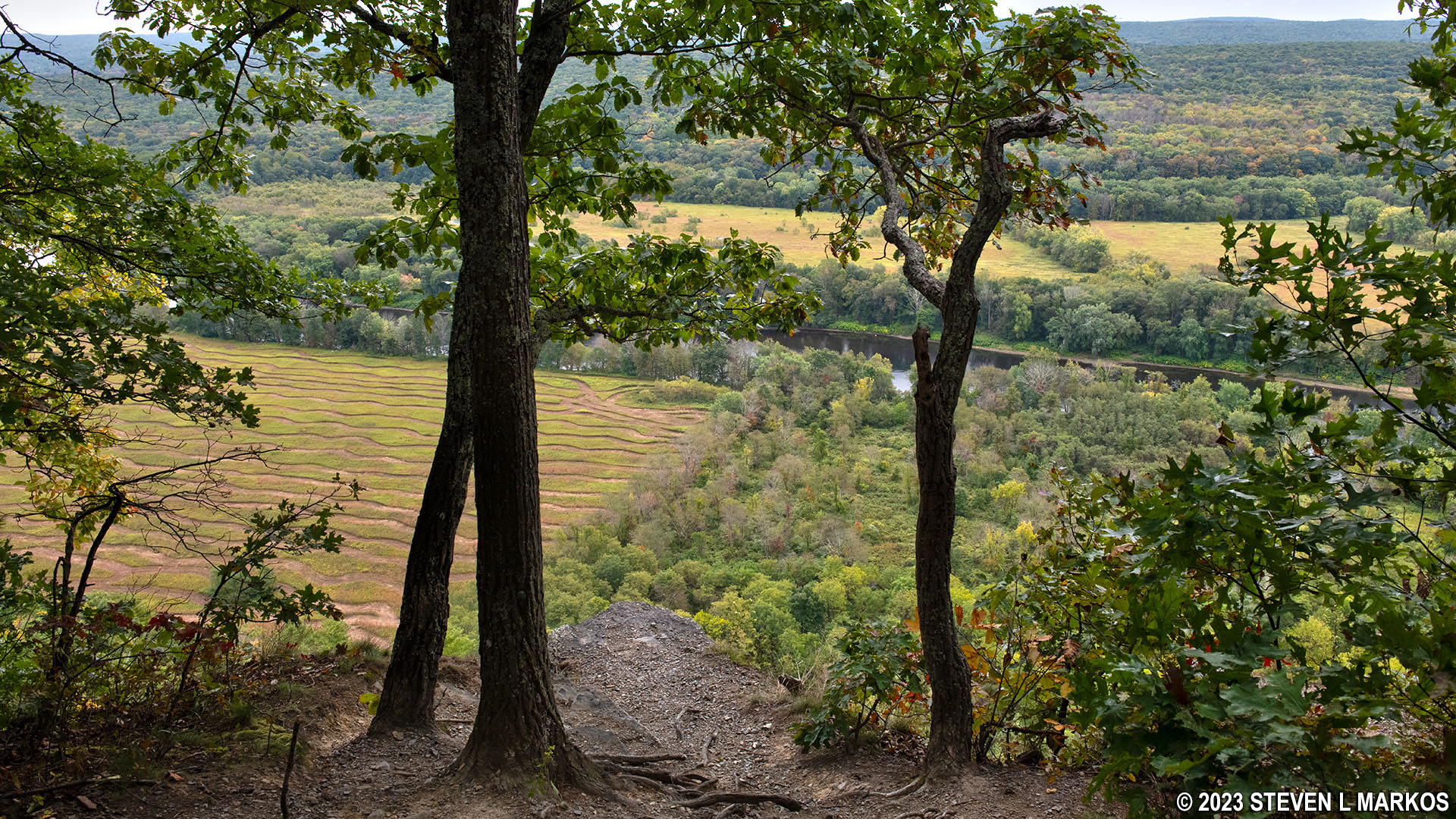
A third of a mile past the connector is the second overlook on the Cliff Trail, the Minisink Overlook. Here you get excellent views of the cliffs where the falcons nest. In fact, I could hear them and see them flying around the area.
View from the Minisink Overlook on the Cliff Trail in Delaware Water Gap National Recreation Area
The Cliff Trail splits again at the Minisink Overlook, but the lower trail was closed, so I remained on the upper trail. However, in less than a tenth of a mile ahead is a four-way intersection with connectors to the Buchanan Trail (right) and Lower Cliff Trail (left). Since there was no CLOSED sign, and because the best views are on the lower trail, I took the connector to the left.
The lower trail heads down a moderate hill for a tenth of a mile before leveling out. There are some views of the Delaware River and the valley below, but most of the time trees and other vegetation are in the way. I will say that the views are nowhere as good as on the first section of the lower trail, so if you want an easier hike, stick to the wide, Upper Cliff Trail in this area.
Typical terrain on the southern half of the Lower Cliff Trail in Delaware Water Gap National Recreation Area
View from the southern end of the Lower Cliff Trail in Delaware Water Gap National Recreation Area
A half mile after detouring onto the Lower Cliff Trail is the third and final overlook, the Tristate Overlook. At first it appears that the view is obscured by three trees, but there is a pointed piece of land that juts out beyond the trees that you can stand on—and hope it doesn’t collapse—for a clear view of the area. In truth, it’s just more of the same: agricultural fields, valley, and the Delaware River.
Tristate Overlook on the Cliff Trail in Delaware Water Gap National Recreation Area
View from the Tristate Overlook on the Cliff Trail in Delaware Water Gap National Recreation Area
The Lower Cliff Trail was closed beyond the Tristate Overlook, so I had to take the short connector back to the upper section. I didn’t walk much more than a tenth of a mile before coming to another four-way intersection that is not on the National Park Service map. In fact, there is no intersection of any kind on the map. The Upper Cliff Trail continues straight ahead. To the right is a U-shaped trail that cuts over to the Hackers Trail. A left leads back to the Lower Cliff Trail.
Intersection of the Upper Cliff Trail and a connector to the Hackers Trail (left) and Lower Cliff Trail (right), Delaware Water Gap National Recreation Area
From here to the end of the Cliff Trail, a .4-mile hike, the trail takes a dive down a very steep hill that never seems to end. The average grade is right at 15%, a grade that is considered the start of strenuous hiking.
Steep terrain on the last .4 mile of the Cliff Trail before Raymondskill Road, Delaware Water Gap National Recreation Area
The only thing to be aware of is that just before crossing over a bridge towards the end of the hike is another unmarked and unmapped trail that veers off to the left. I didn’t draw it in on my map because I’m not sure where it goes, but I believe it cuts over to Raymondskill Road. Regardless, just cross the bridge to stay on the Upper Cliff Trail. A few minutes later the Cliff Trail dead ends into the Hackers Trail within eyesight of Raymondskill Road. The Hackers Trailhead parking lot is on the other side of the road.
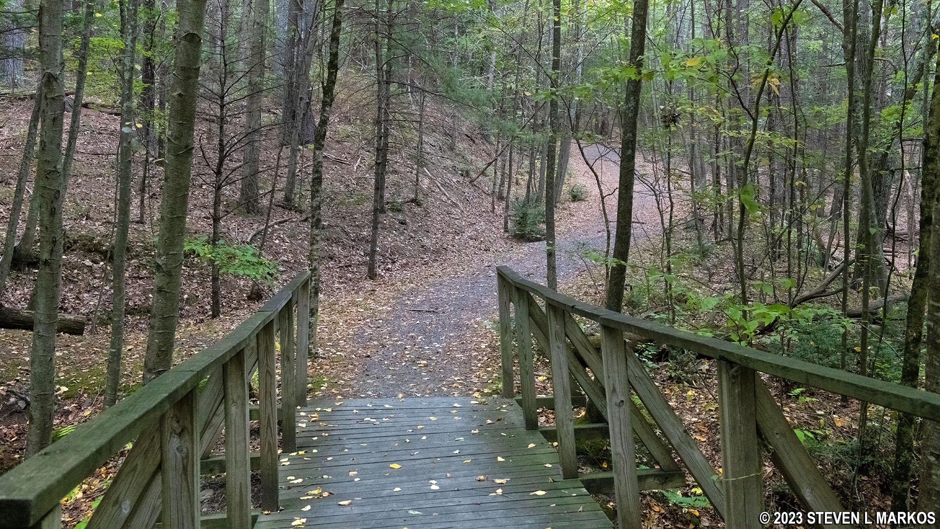
Footbridge over a small creek at the southern end of the Cliff Trail in Delaware Water Gap National Recreation Area
If you don’t have a ride at the end, you have a few options. On weekends from Memorial Day to Labor Day, there is a free shuttle bus that runs from Raymondskill Falls back to the Milford Knob Trailhead parking lot. See the National Park Service’s Shuttles web page for more information. The other options are to hike back on the Cliff Trail or make a loop utilizing the Hackers Trail and Buchanan Trail, though you’ll still be hiking partway back on the Cliff Trail. Regardless of choice, if you want to see a nice waterfall, hike the short Raymondskill Falls Trail that starts in the Hackers Trailhead parking lot.
With a few exceptions, use of any photograph on the National Park Planner website requires a paid Royalty Free Editorial Use License or Commercial Use License. See the Photo Usage page for details.
Last updated on January 15, 2024


