

Raymondskill Falls at Delaware Water Gap National Recreation Area
Length: .5-mile loop
Time: 30 minutes
Difficulty: Strenuous
The Raymondskill Falls Trail (aka Raymondskill Creek Trail) is one of many trails in the Cliff Park section of Delaware Water Gap National Recreation Area. Located at the northern end of the park near Milford, Pennsylvania, this section takes its name from the Cliff Park Golf Course, the first golf course in America designed by a woman, Annie R. Buchanan. The National Park Service acquired the Cliff Park area when the land was donated by the Buchanan Family in 2003. The Buchanans owned the property since 1803, and the golf course has been around since 1913.
The Raymondskill Falls Trail is accessed directly from either the Hackers Trailhead parking lot or the Raymondskill Falls parking lot, both of which are on Raymondskill Road. The Raymondskill Falls parking lot is not on the National Park Service map, but it is just a stone’s throw up the road from the Hackers parking lot.
The map shows a loop trail that passes a three-tier waterfall and a separate trail that branches off the loop and leads to Raymondskill Creek. This report covers the loop trail only. The creek trail was closed when I did the hike. According to the National Park Service, the creek trail is a quarter mile long (one way) and is only open in “fall to spring,” whatever that means. I was there in early October and it was closed. October means fall to me.

Corrected trail map for the Cliff Park Area trails at Delaware Water Gap National Recreation Area (click to enlarge)
Waterfall trails are the most popular in Delaware Water Gap National Recreation Area, and on weekends and nice summer days the parking lots are going to be packed. If you can’t find a spot and are visiting on weekends or holidays from Memorial Day through Labor Day, a free shuttle bus runs between the Milford Knob Trailhead to Raymonskill Falls every twenty minutes from 10 AM to 4 PM. If you are hiking other trails in the Cliff Park area, the shuttle is also ideal for hiking from one end to the other without having to walk all the way back to where you started. For more information, visit the National Park Service’s Shuttles web page.
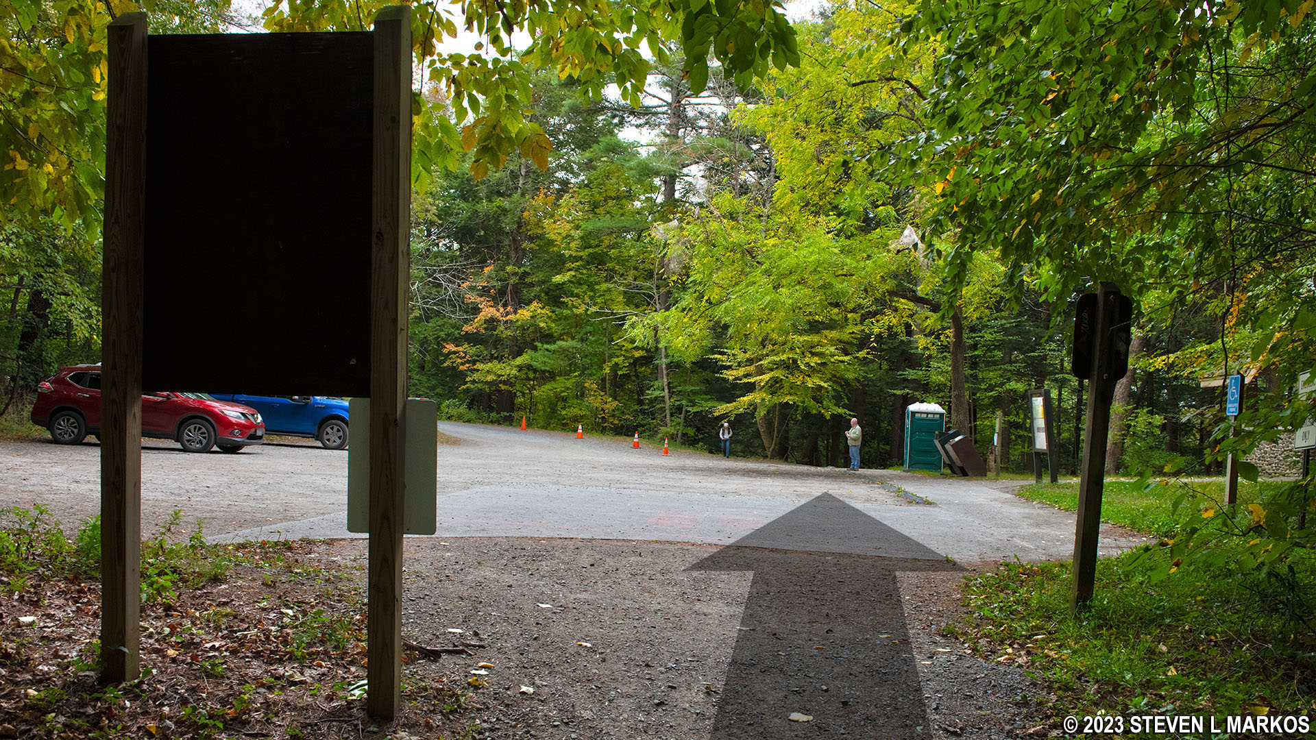
I started from the Hackers Trailhead parking lot, the one closest to the intersection of Raymondskill Road and US 209 / Federal Road, because I had just finished hiking the Hackers Trail located directly across the street. From the parking lot, you must first walk a short distance down the trail to the intersection where the loop begins. There is an inconspicuous trail that branches off to the right while the trail you have been walking on, a wide and inviting gravel path, continues straight ahead. That inconspicuous trail is the turn you would make if you wanted to hike around the Raymondskill Falls Trail in the counterclockwise direction. It leads over to the other parking lot and then continues on to the waterfalls, first coming to the upper falls, then the middle and lower falls. By staying straight, which is the most obvious way to go, you are hiking around the loop in the clockwise direction, arriving at the falls in reverse order. This is the way I proceeded, and this report is written from that perspective. However, in retrospect, I’d rather go the other way around and see the waterfalls from top to bottom. To do so, either take the inconspicuous trail or start the hike from the Raymondskill Falls parking lot to begin with.
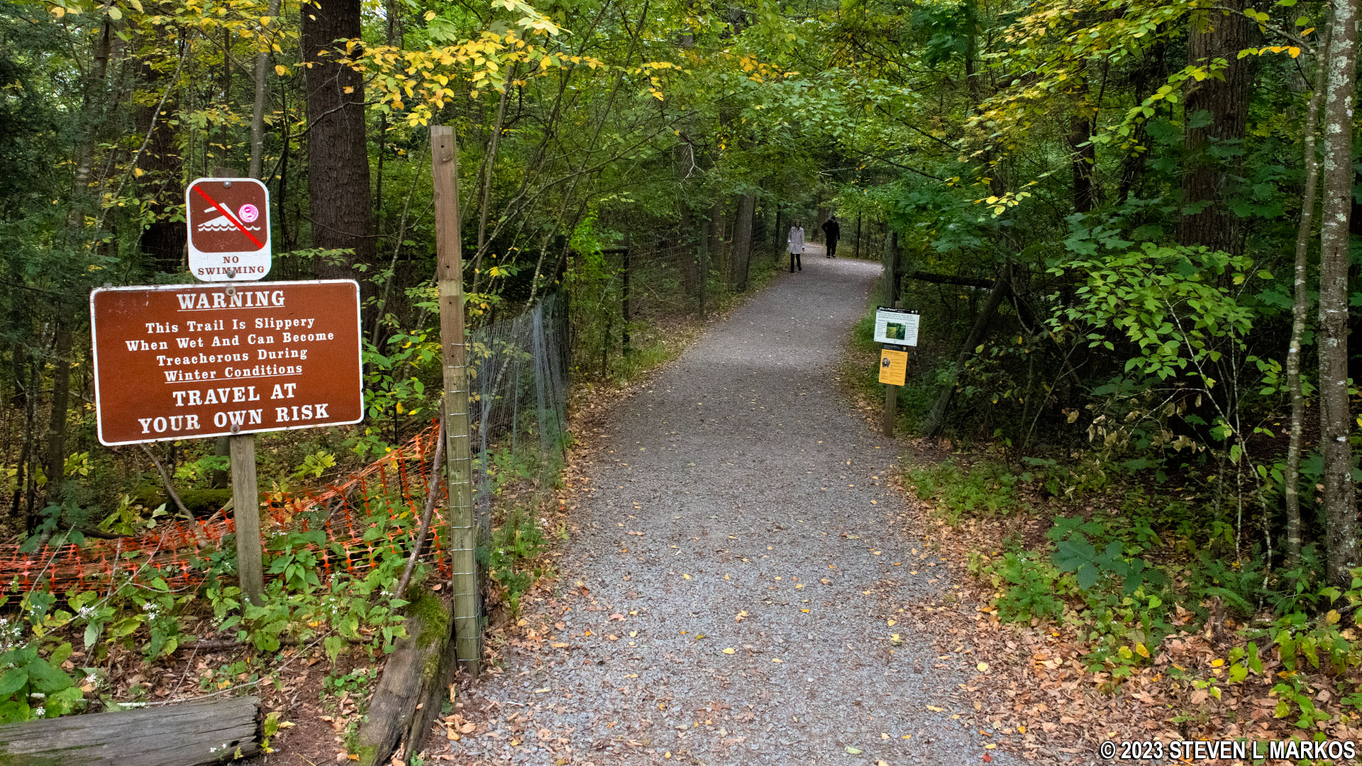
Start of the Raymondskill Falls Trail at the Hackers Trailhead parking lot in Delaware Water Gap National Recreation Area
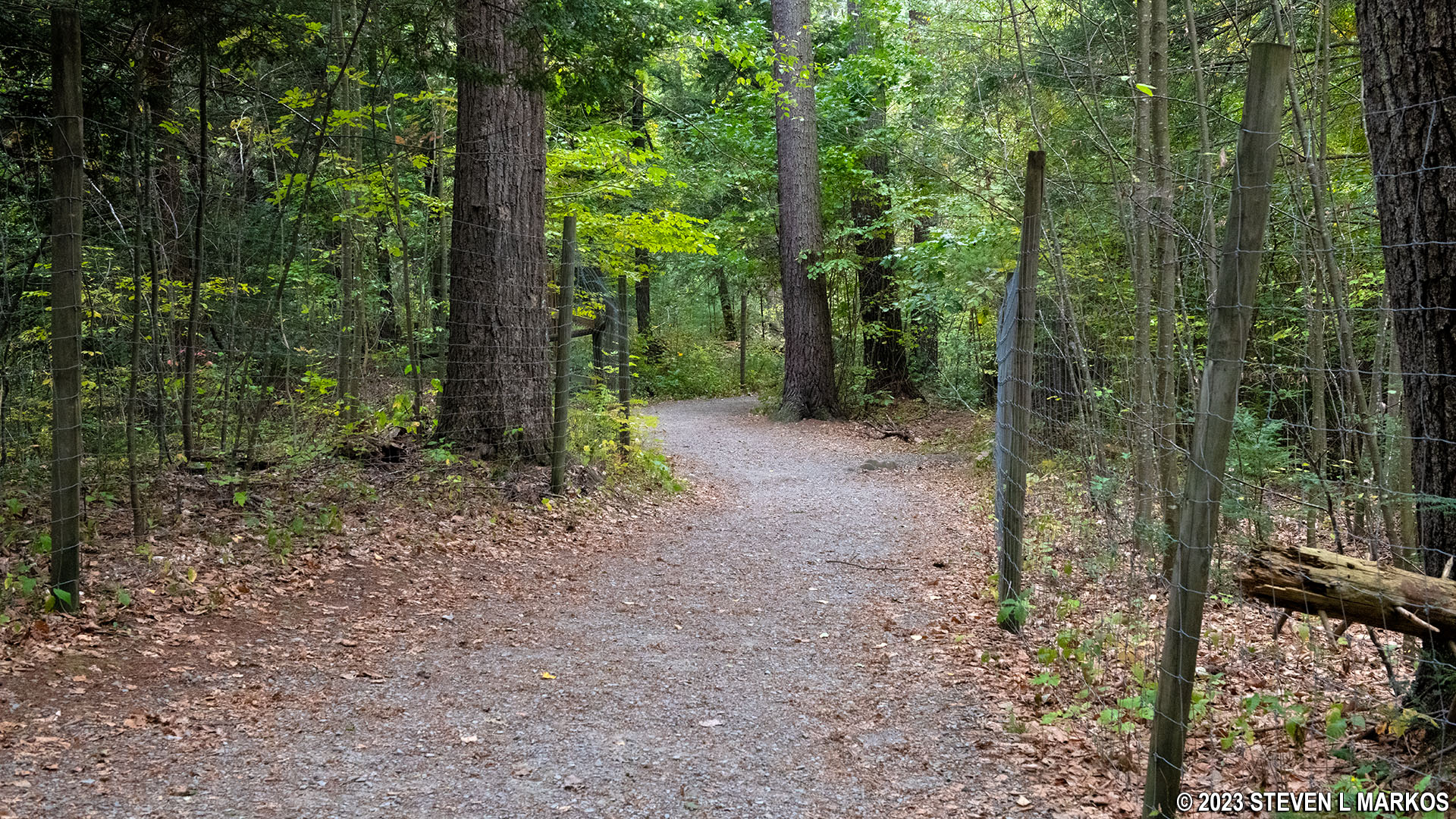
Typical terrain on the Raymondskill Falls Trail near the Hackers Trailhead parking lot, Delaware Water Gap National Recreation Area
With the exception of the narrow “inconspicuous” trail that connects the two parking lots, the entire Raymondskill Falls Trail is a wide, gravel path with a smooth surface largely free of rocks and roots. It heads steeply downhill to the waterfalls and then steeply back up to the parking lot. From the start of the loop, it is 750 feet to the bottom, with the last 500 feet having an average grade of -18%. There are even steps to help visitors down the hill. (Strenuous hiking begins at 15%. A minus sign in front of the grade percentage refers to a downhill grade.)
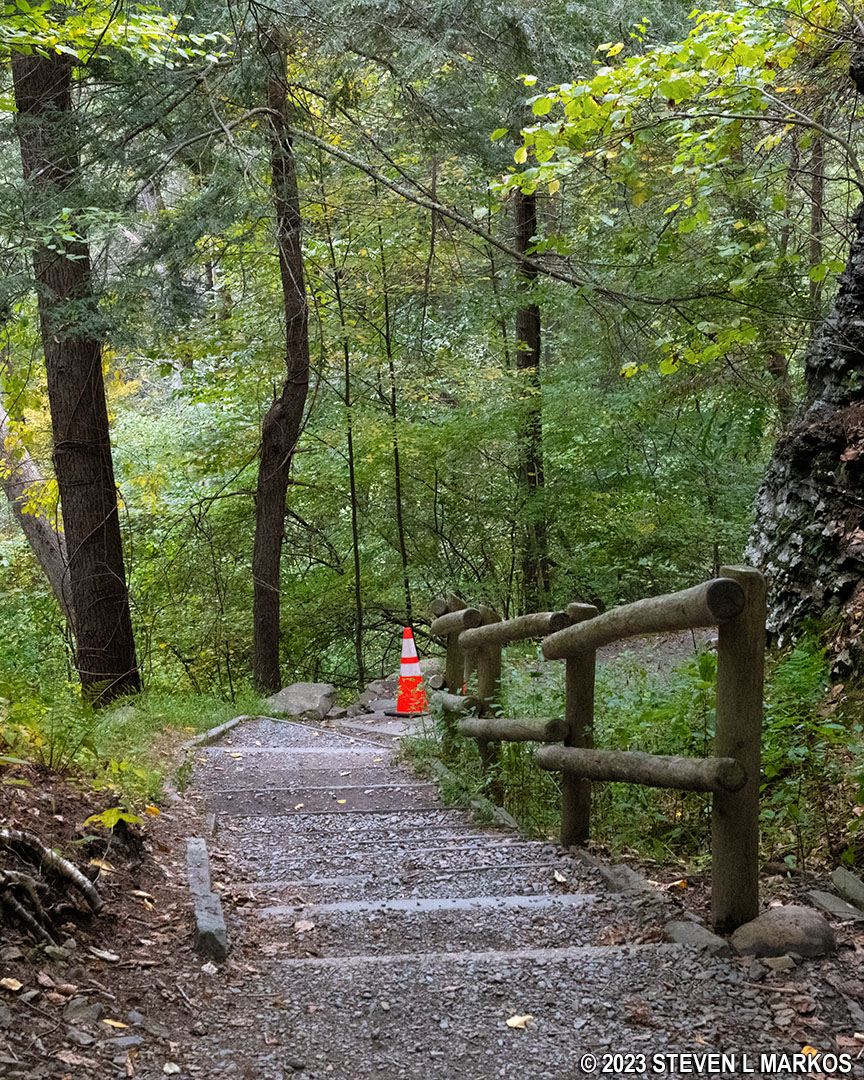
Stairs lead down to the waterfalls on the Raymondskill Falls Trail in Delaware Water Gap National Recreation Area
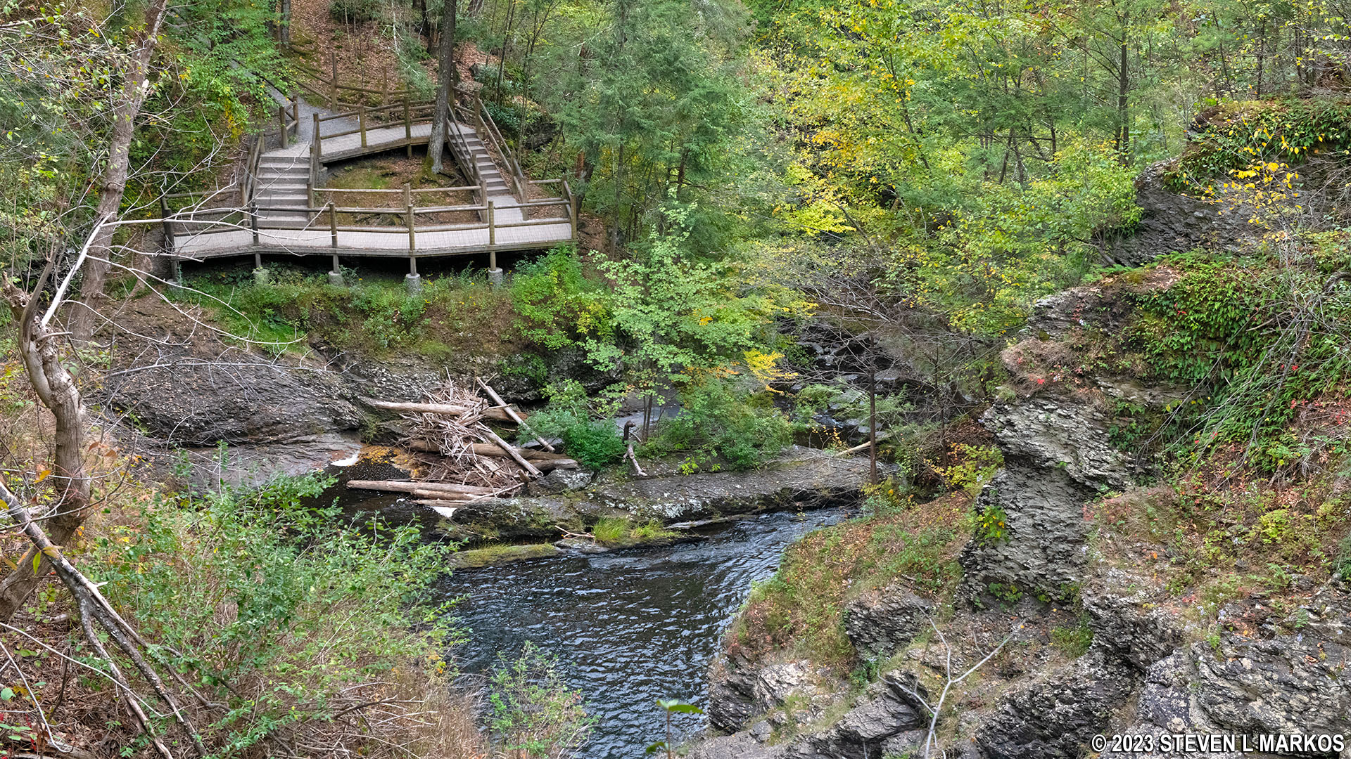
At the bottom of the hill is an observation deck at the base of the middle waterfall and the top of the lower waterfall (the upper falls are farther down on the trail). The view of the middle falls is excellent, but the view of the lower falls isn’t that good since you are looking sideways at it.
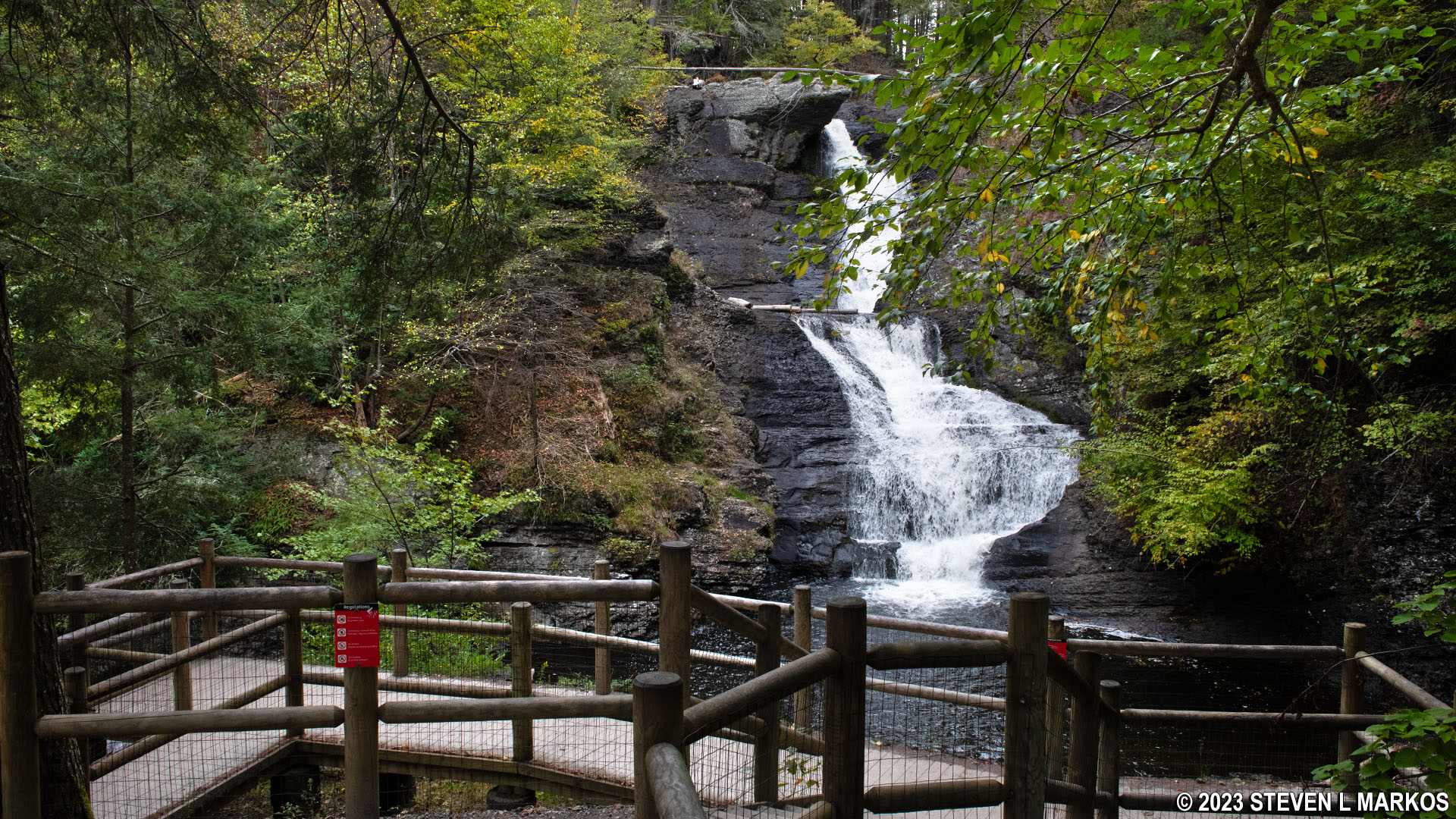
Observation deck at the middle and lower Raymondskill waterfalls in Delaware Water Gap National Recreation Area

Middle Raymondskill Falls in Delaware Water Gap National Recreation Area
If you thought the hike down was steep, wait until you see the hike up. Stairs cover the entire hill, and the average grade to the upper waterfalls, a 350-foot hike in length, is 31% with short stretches reaching 50%. That’s a steep climb.

Steep terrain on the Raymondskill Falls Trail in Delaware Water Gap National Recreation Area
At the top of the hill is a view of the upper waterfalls, which are really just a series of cascades. The distance between the two viewing areas is about a tenth of a mile.

Upper Raymondskill waterfalls at Delaware Water Gap National Recreation Area
View of the middle waterfall observation deck on the Raymondskill Falls Trail in Delaware Water Gap National Recreation Area
The hike continues uphill from the upper falls viewing area. The first 75 feet are extremely steep, but after that the climb is moderate at worse with an average grade of only 11%.

Uphill hike on the western side of the Raymondskill Falls Trail in Delaware Water Gap National Recreation Area
At the top of the hill the trail comes out at the Raymondskill Falls parking lot. To get back to the Hackers Trailhead, walk across the parking lot, passing the restroom building, and you’ll see the trail—the inconspicuous trail—continue into the woods. When this dead ends into the gravel trail on which you started the hike, take a left to get back to the Hackers Trailhead parking lot.
Cross the Raymondskill Falls parking lot to continue on the Raymondskill Falls Trail to the Hackers Trailhead parking lot, Delaware Water Gap National Recreation Area
With a few exceptions, use of any photograph on the National Park Planner website requires a paid Royalty Free Editorial Use License or Commercial Use License. See the Photo Usage page for details.
Last updated on January 16, 2024


