
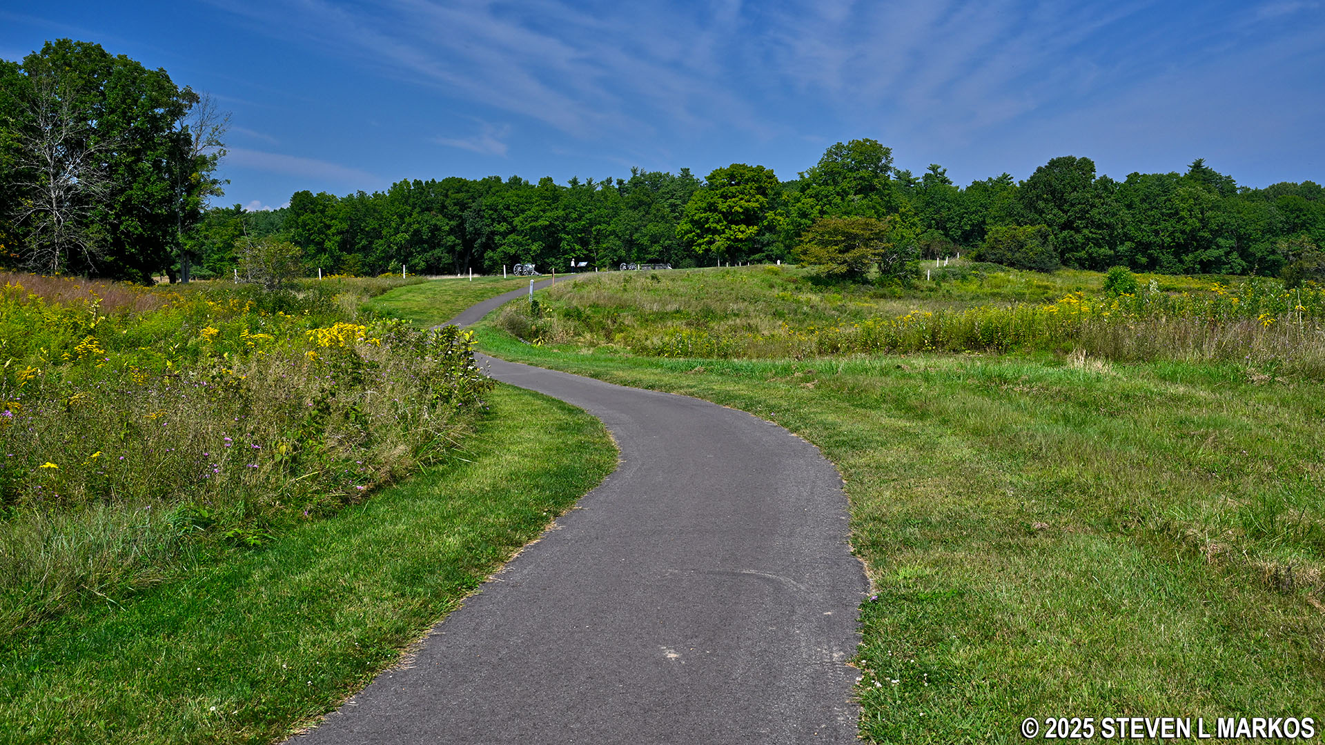
Paved path circles the Freeman Farm area on the Saratoga Battlefield Tour, Saratoga National Historical Park
SARATOGA BATTLEFIELD TOUR
STOP 6: FREEMAN’S FARM
Allow 30 minutes for a visit
The sixth stop on the Saratoga Battlefield Tour, Freeman’s Farm, is the most involving of all stops on the tour. This is where the first battle at Saratoga took place on September 19, 1777, the Battle of Freeman’s Farm. Much of the second battle—the Battle of Bemus Heights—was also fought in the general vicinity of the farm less than a month later on October 7th.
A half-mile paved path circles the farm. Along the route are wayside exhibits that explain the events that took place here and plenty of artillery exhibits that mark the locations of British cannon during the second battle.
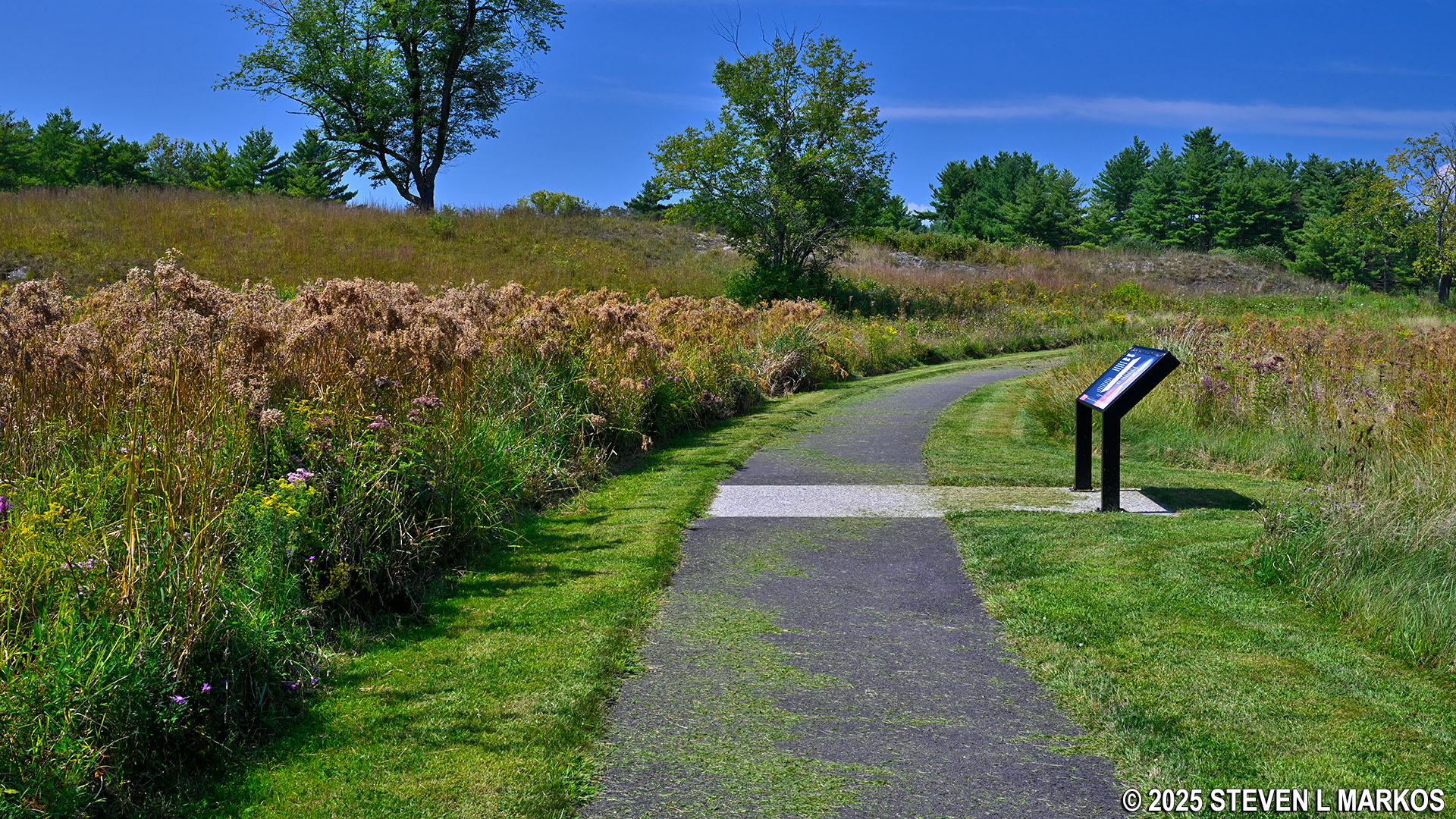
Wayside exhibit at the Freeman’s Farm stop on the Saratoga Battlefield Tour, Saratoga National Historical Park
The most logical route to Albany, New York, the target of British General John Burgoyne, was along the Hudson River. However, the Americans had built a substantial line of fortifications a mile south of Freeman’s Farm, stretching from the Neilson Farm in the west to Bemus Heights at the Hudson River in the east, effectively blocking the way. Realizing this, Burgoyne decided to move the bulk of his army west, away from the river, in an attempt to march around the fortifications at the Nielson Farm. In doing so, the British ran into American troops at John Freeman’s farm, and a battle ensued. While the British were technically victorious, they suffered losses of around 600 men, including a large number of officers. The Americans only lost half that many men, and those who survived retreated back to the American line. The route to Albany was still blocked.
Burgoyne had been promised reinforcements from New York City by General Henry Clinton, so after the battle at Freeman’s Farm he decided to make camp and wait for these new troops to arrive. While doing so, his men built their own fortifications, which were comprised of trenches and two log-and earth redoubts at their western flank. A redoubt is typically an enclosed fort built in an outlying area that serves as an outpost for soldiers sent to defend a strategic point, though how substantial it is built depends on the urgency of the situation. The Light Infantry Redoubt (aka Balcarres Redoubt, named after commander Major Alexander Lindsey, Earl of Balcarres) was set up here at Freeman’s Farm. In the photo below, the posts (hard to see) in the distance mark its location at the northern end of the paved loop path.
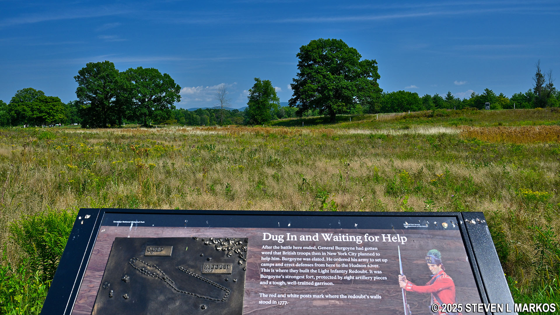
Posts in the distance mark the former location of Balcarres Redoubt at Freeman’s Farm, Saratoga National Historical Park
The second, the Breymann Redoubt, was located about a half mile northwest of Freeman’s Farm. This fort protected the far right flank of the British line. Overall, the defenses stretched from the general area of the farm all the way to the Hudson River. The cannon on display represent British positions. The red-topped posts mark the actual location of the fortifications as determined by archeologists.

Position of a British cannon at Freeman’s Farm, Saratoga National Historical Park
After waiting for more than two weeks with no help arriving and supplies running out, Burgoyne decided to lead a scouting force of 1,700 men to check out the American defenses at the Neilson Farm. However, they were spotted by American scouts a little southwest of here at Simeon Barber’s Farm. When American commander General Horatio Gates was informed of the British movement, he ordered an attack. Fighting broke out around 2:30 PM.
Unknown to Burgoyne, American reinforcements had been arriving since the first battle, and now his army was outnumbered two to one. The British eventually retreated from Barber’s farm, falling back to Freeman’s Farm and the two redoubts. While the Balcarres Redoubt held off the assault, the massive American force overran the Breymann Redoubt. Fighting continued until dark. Realizing he had no chance of victory, Burgoyne ordered his men to retreat back to the fortifications near the Hudson River. The next evening, the British withdrew to the village of Saratoga (now Schuylerville) where they hoped to hold out until Clinton’s reinforcements arrive. This never happened, and they were eventually surrounded and forced to surrender on October 17th.
While the second battle at Saratoga is called the Battle of Bemus Heights, no fighting took place anywhere near Bemus Heights, which is a couple miles to the southeast. The name was most likely given to differentiate it from the first battle, which was already called the Battle of Freeman’s Farm. Both are also known as the First Battle of Saratoga and the Second Battle of Saratoga.
There are three trails that pass through the Freeman’s Farm area. The Wilkinson Trail, the only named trail at Saratoga National Historical Park, cuts right through the middle, east to west. This is a 4-mile loop that starts at the Visitor Center. The portion that runs through the farm is the southern side of the trail.
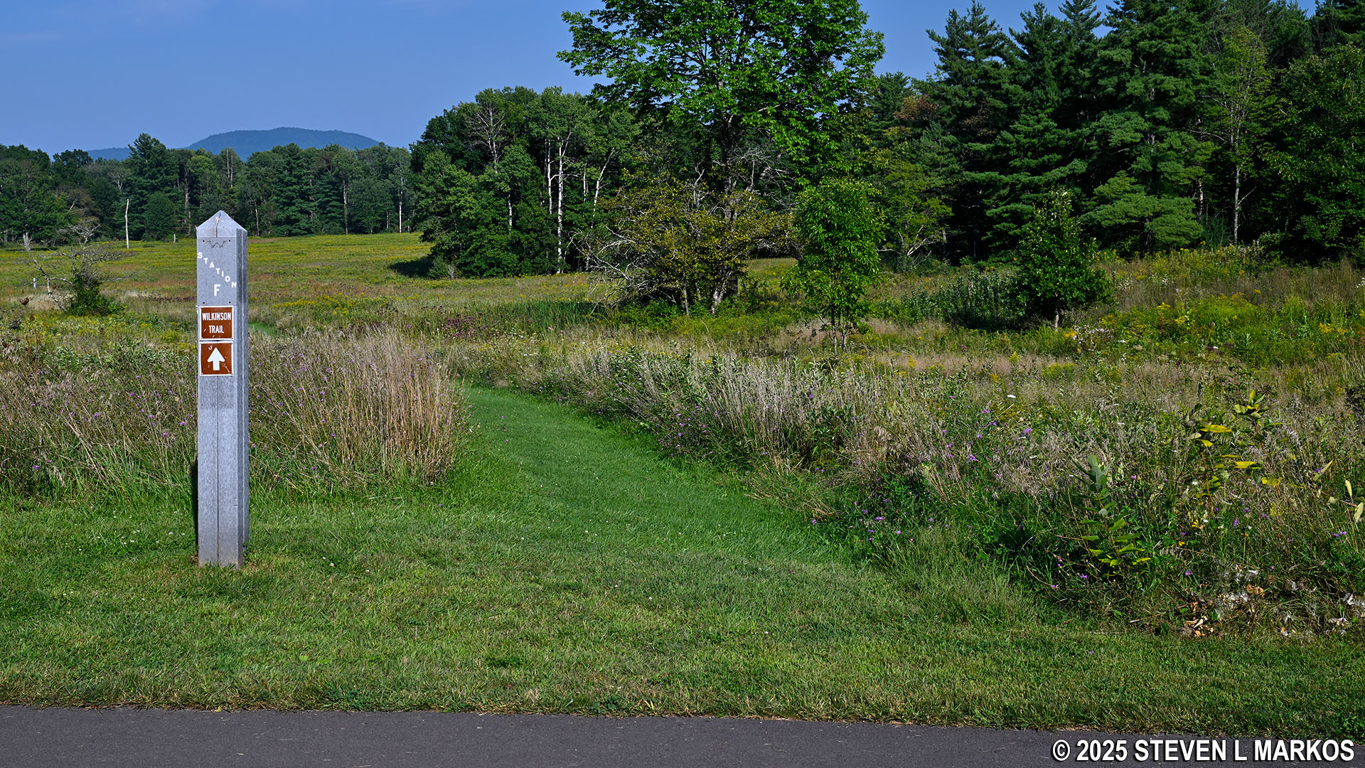
Wilkinson Trail passes through the Freeman’s Farm stop on the Saratoga Battlefield Tour, Saratoga National Historical Park
At the northeastern corner of the paved loop is the Liaison Trail, a quarter-mile connector to the northern side of the Wilkinson Trail. Take this shortcut if you want to chop off a little over two miles from the Wilkinson Trail hike.
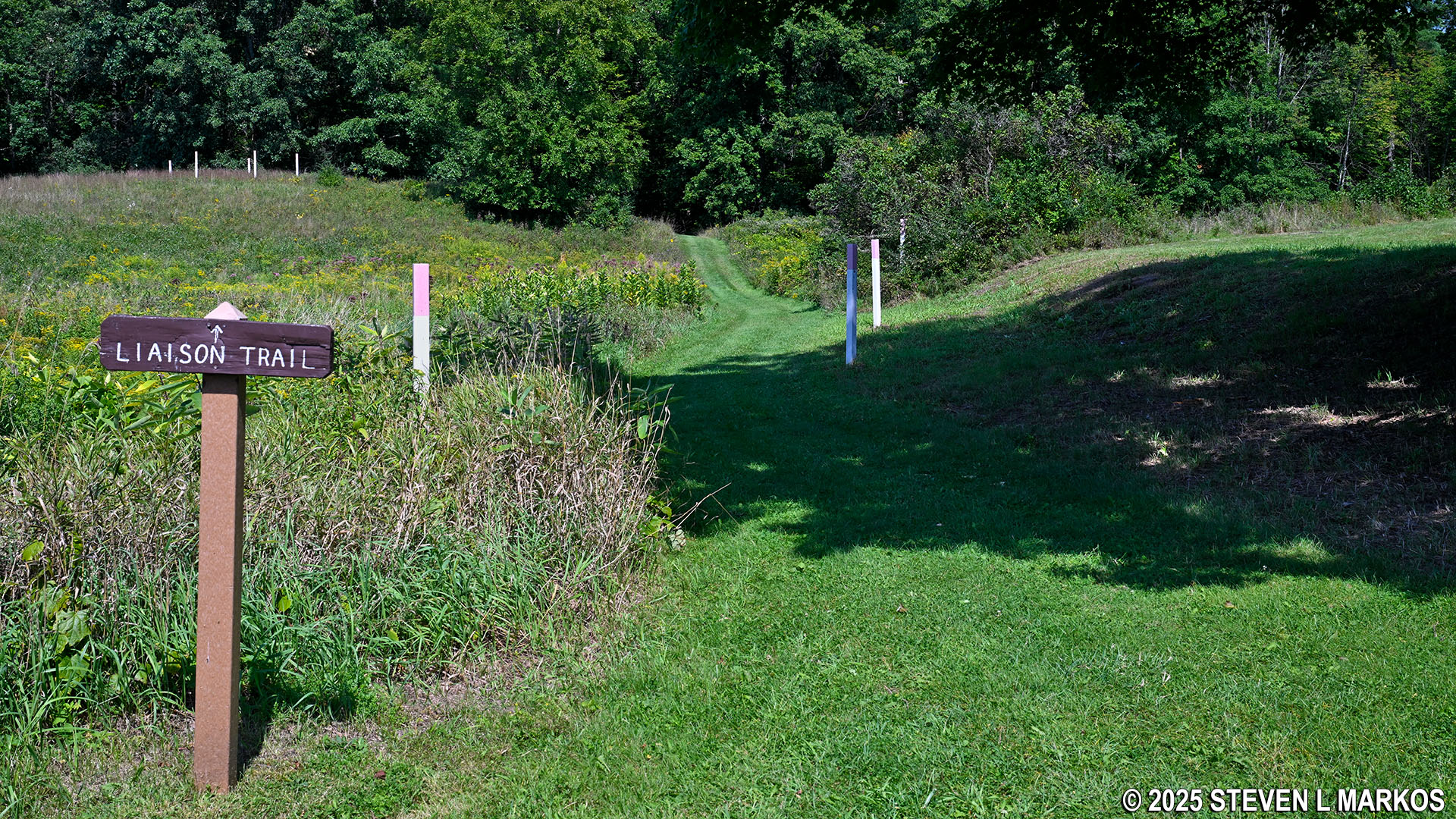
Southern trailhead for the Liaison Trail at the Freeman’s Farm stop on the Saratoga Battlefield Tour, Saratoga National Historical Park
At the southern end of the paved path is a trail that connects to Stop 4 (The Path to War) on the battlefield tour. While the trail has some hills, it is quite easy, and the grass path is a pleasure to walk on. Of course you can drive to Stop 4, so unless you are looking for exercise and have some extra time on your hands, just stick to your car. The hike is described in detail on the Path to War web page here on National Park Planner.

Trail from Freeman’s Farm (Stop 6) to Stop 4 on the Saratoga Battlefield Tour, Saratoga National Historical Park
Next Stop | Previous Stop | Battlefield Tour Home Page
With a few exceptions, use of any photograph on the National Park Planner website requires a paid Royalty Free Editorial Use License or Commercial Use License. See the Photo Usage page for details.
Last updated on October 17, 2025


