

Jockey Hollow Trail Map (click to enlarge)
Be sure to pick up a trail map at either the Jockey Hollow Visitor Center or the Washington’s Headquarters Museum. There is a small fee for the map. You can also download a PDF version on the Park Map web page here on National Park Planner.
Length: 2.5-mile loop
Time: 1.5 hours
Difficulty: ★★☆☆☆
There are a number of places where you can pick up the Grand Parade Trail (aka Yellow Trail due to the color coding on the trail map), but the official start is at the Wick House, which is where I began the hike. The Wick House can be reached either via a short walk from the Jockey Hollow Visitor Center or by driving the tour road to the Wick House parking lot.
To find the trailhead from the Wick House, head towards the large, red barn and keep walking past it. You’ll end up on a grass-covered path that eventually turns to gravel before merging with the main road. Where the grass meets the gravel is the Yellow Trail trailhead for hiking in the counterclockwise direction. There is another trailhead a little farther down the gravel road, and if you start at it, you’ll be hiking around in the clockwise direction. The hike starts at one trailhead and comes out at the other. It makes no difference which way you go—one direction isn’t any easier than the other. I started from the first trailhead, and this report is written from that perspective.
Trailhead for hiking the Grand Parade Trail in the counterclockwise direction from the Wick House, Morristown National Historical Park
At the trailhead is a sign and a tree on which three yellow blazes (paint splotches) are painted. Blazes serve as Hansel and Gretel breadcrumbs for hikers to follow, and three blazes indicate the official starting point of a trail.
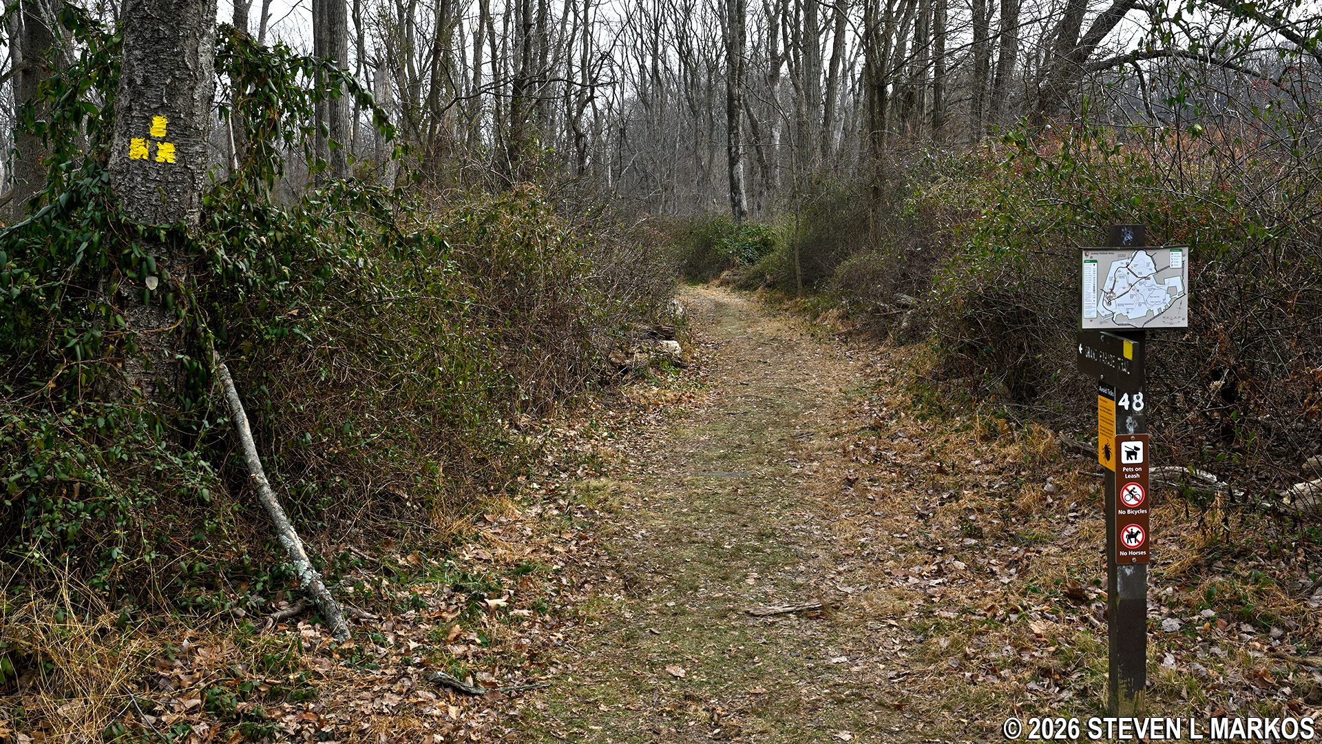
Start of theYellow Trail near the Wick House at Morristown National Historical Park
Not too far from the start of the hike is the intersection with the Orange Trail. Also known as the Soldier Hut Trail, it bisects the Grand Parade Trail loop and ends at the Pennsylvania Line Encampment Site where there is a soldier hut exhibit. The Grand Parade Trail also passes through the encampment site. It just takes a little longer to get there.
Intersection of the Grand Parade and Orange trails in the Jockey Hollow unit of Morristown National Historical Park
While the trail map uses colors for the trail names, signs in the park always use the actual trail names, so be sure you know them. I mention this because at .3 mile into the hike is a T-intersection with a sign indicating that the Grand Parade Trail, not the Yellow Trail, continues to the left. A right leads over to Jockey Hollow Road.

Intersection of the Grand Parade Trail and a connector to Jockey Hollow Road, Morristown National Historical Park
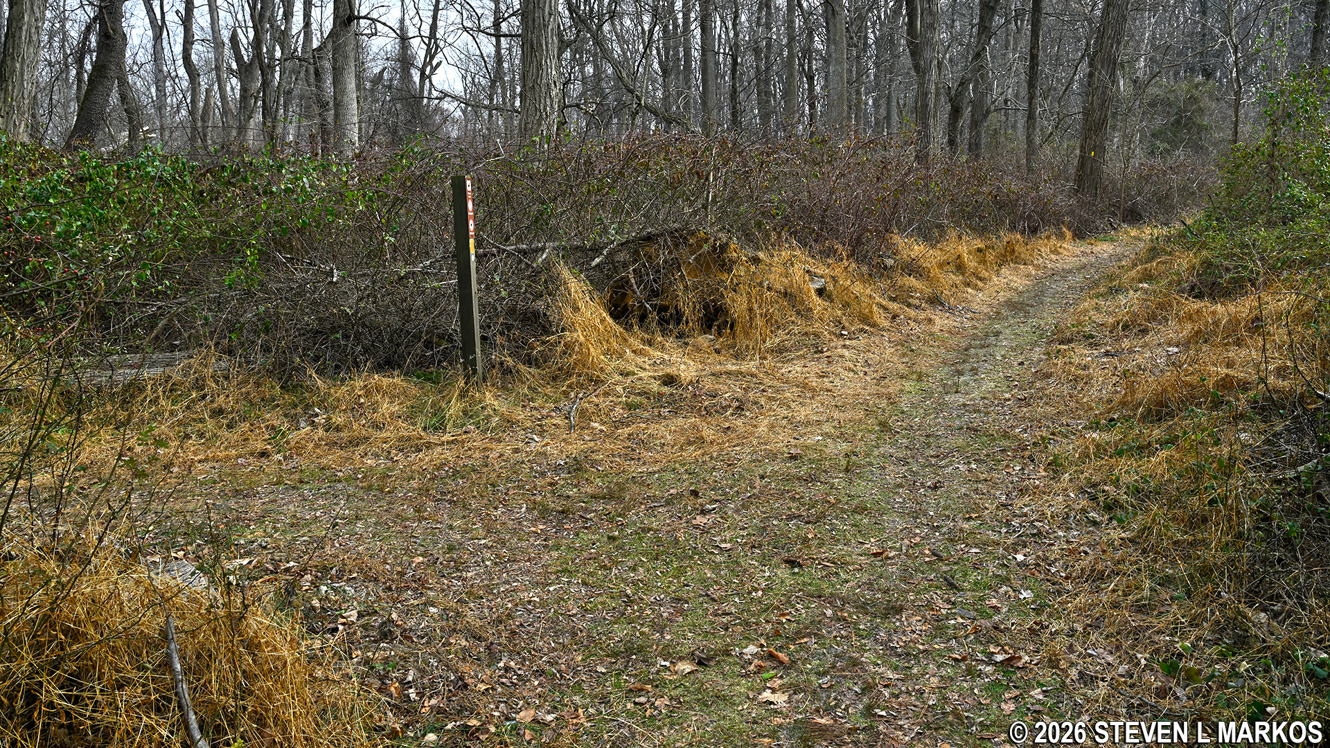
Once you make the turn, the trail begins following Jockey Hollow Road as it heads downhill at a very gradual pace through grassy terrain. Ticks love to hang out in low-lying vegetation, so I suggest wearing long pants no matter what the temperature (there are also briers on the trail, another reason to wear long pants). Ticks live close to the ground so they can attach to anything that walks by, even small animals like squirrels and rabbits, so keep an eye out for them on the fronts of your lower legs. Once attached, they instinctively start crawling upwards. If they can get to your crotch, that’s their game plan, otherwise they’ll continue up to your armpits or hair. If they lived high off the ground in the trees, as some people believe, they wouldn’t be able to attach to anything other than Bigfoots and basketball players.

Typical terrain on the section of the Grand Parade Trail that follows alongside Jockey Hollow Road, Morristown National Historical Park
At .7 mile into the hike is Jockey Hollow Road and a mass of trail intersections that are all located near a parking lot called Trail Center. At this point, take a sharp left towards a footbridge—do not cross the road. To continue on the Grand Parade Trail you must actually hike to the Trail Center parking lot, which you do by crossing the bridge. Trail signs and yellow blazes show the way.

Footbridge on the Grand Parade Trail that leads to the Trail Center parking lot in the Jockey Hollow unit of Morristown National Historical Park
When you reach the parking lot keep straight and walk to the other side. Once there, look to your 11 o’clock position for the continuation of the Grand Parade Trail.

Trail Center parking lot in the Jockey Hollow unit of Morristown National Historical Park
Continuation of the Yellow Trail on the northern end of the Trail Center parking lot in the Jockey Hollow unit of Morristown National Historical Park
Trail Center is at the bottom of a shallow valley, which is why the Grand Parade Trail was heading downhill as it approached the parking lot. Upon departing, the trail now leads uphill out of the valley. As with the hike down, the incline is very gradual and won’t warrant much notice from anyone in decent shape.

Slight uphill hike on the Grand Parade Trail near the Trail Center parking lot in the Jockey Hollow unit of Morristown National Historical Park
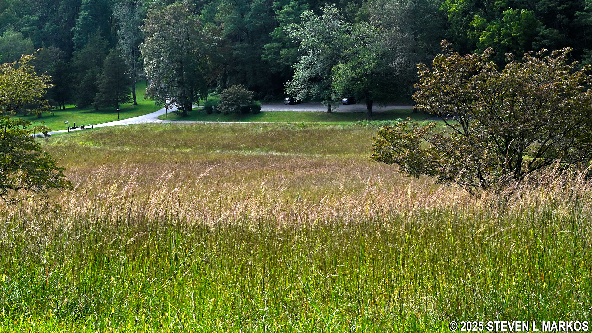
At exactly the 1-mile mark, the Grand Parade Trail comes out at the Grand Parade, the 6th stop on a tour of Morristown National Historical Park. The Grand Parade was the area where troops of the Continental Army drilled and had inspections during their winter encampment at Jockey Hollow.

Wayside exhibits at the Grand Parade stop on the tour of Morristown National Historical Park
The trail continues on the other side of Grand Parade Road, but you must first walk up the road (take a left) a short distance to reach the trailhead. From here the trail climbs another moderately strenuous hill for the next third of a mile.

Continuation of the Grand Parade Trail on the northern side of Grand Parade Road, Morristown National Historical Park
A quarter mile past the Grand Parade is an intersection with a trail that connects to the White Trail, which lies about a quarter mile to the northeast. A sign clearly identifies each path. Stay left to continue on the Grand Parade Trail.

Intersection of the Grand Parade Trail and a connector to the Grand Loop Trail (White Trail) in the Jockey Hollow Unit of Morristown National Historical Park
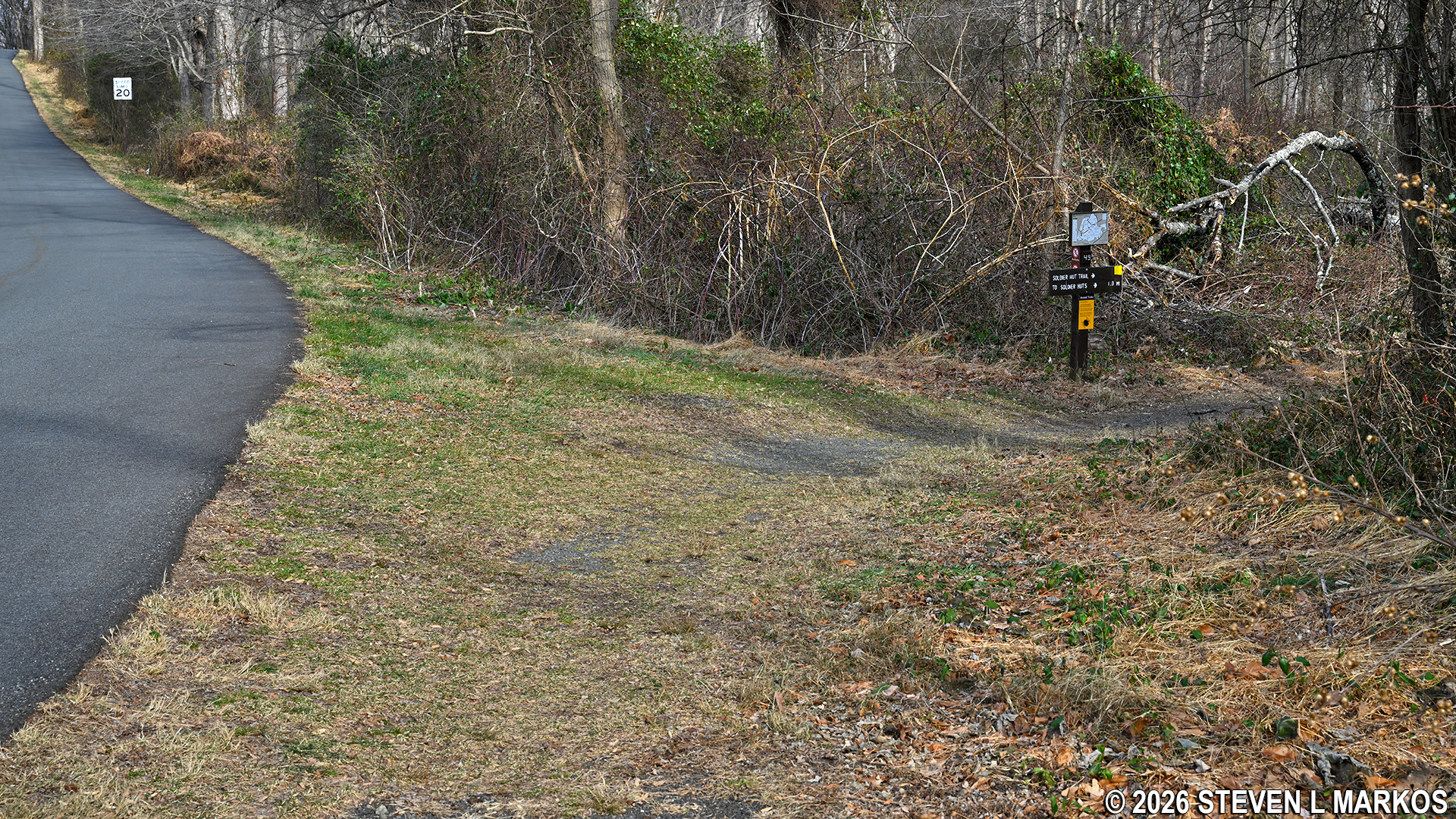
There is one other intersection before coming to the next point of interest on the hike, the Soldier Huts at the Pennsylvania Line Encampment Site. This intersection is with a connector trail that leads northwest to Sugarloaf Road. It is not on the trail map. To stay on track, follow the sign that points to SOLDIER HUTS.
At the 1.5-mile mark on the hike is the Pennsylvania Line Encampment Site. Soldiers arrived at Jockey Hollow in the winter of 1779-80 with nothing but a tent to live in until they built their own log huts, which took about two weeks. Today, nothing remains of the camp, but the National Park Service has built what are believed to be historically accurate reproductions of the huts.
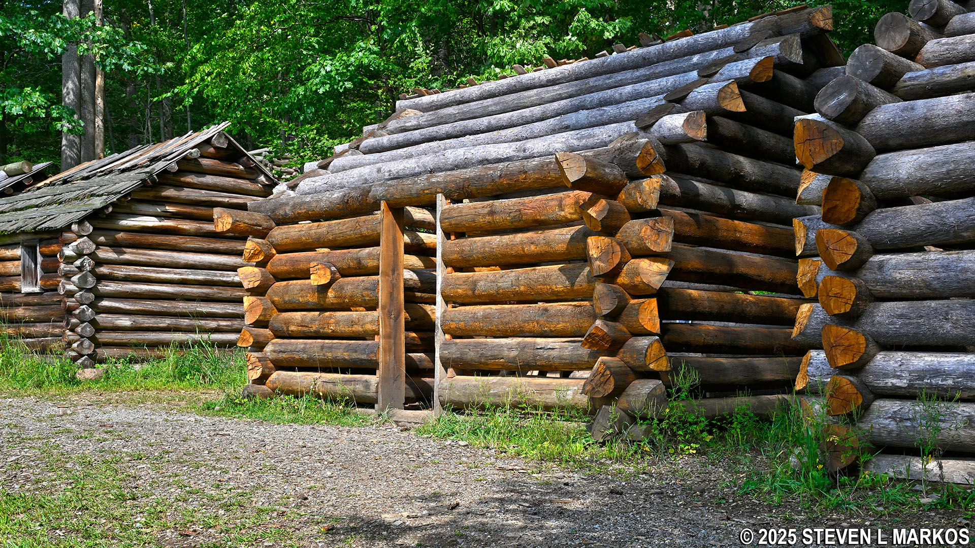
Reproductions of soldier huts at the Pennsylvania Line Encampment Site in the Jockey Hollow unit of Morristown National Historical Park
When done visiting the huts, walk down the hill on the gravel path towards the parking lot for the Pennsylvania Line Encampment Site until it ends at Grand Parade Road near the intersection with Cemetery Road. The Grand Parade Trail continues across the street. Look for a large boulder and a yellow blaze on a tree. The trailhead is just beyond the tree. The boulder is a memorial that marks the general location of what was once thought to be the gravesite of approximately one hundred men who died at Jockey Hollow. The memorial was erected in 1932, but modern archeological techniques and technologies have turned up no evidence of any graves in the field. In fact, nobody knows where the 100 or so men are buried, but the dead were traditionally buried within the parade ground.
View of the Pennsylvania Line Encampment Site parking lot from the Soldier Hut exhibit, Morristown National Historical Park
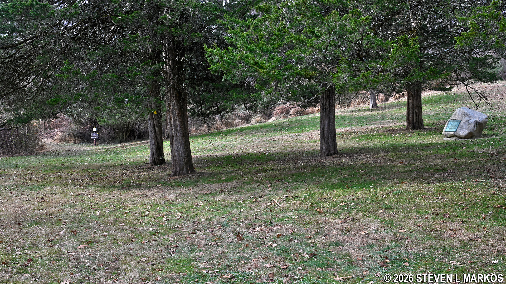
Grand Parade Trail continues past the Jockey Hollow Cemetery Memorial, Morristown National Historical Park
The trail now follows Cemetery Road all the way back to the Wick Farm, sometimes within sight of the pavement. The terrain is flat and once again very brushy, which means ticks and briers.

Typical terrain of the Grand Parade Trail on the final stretch along Cemetery Road, Morristown National Historical Park
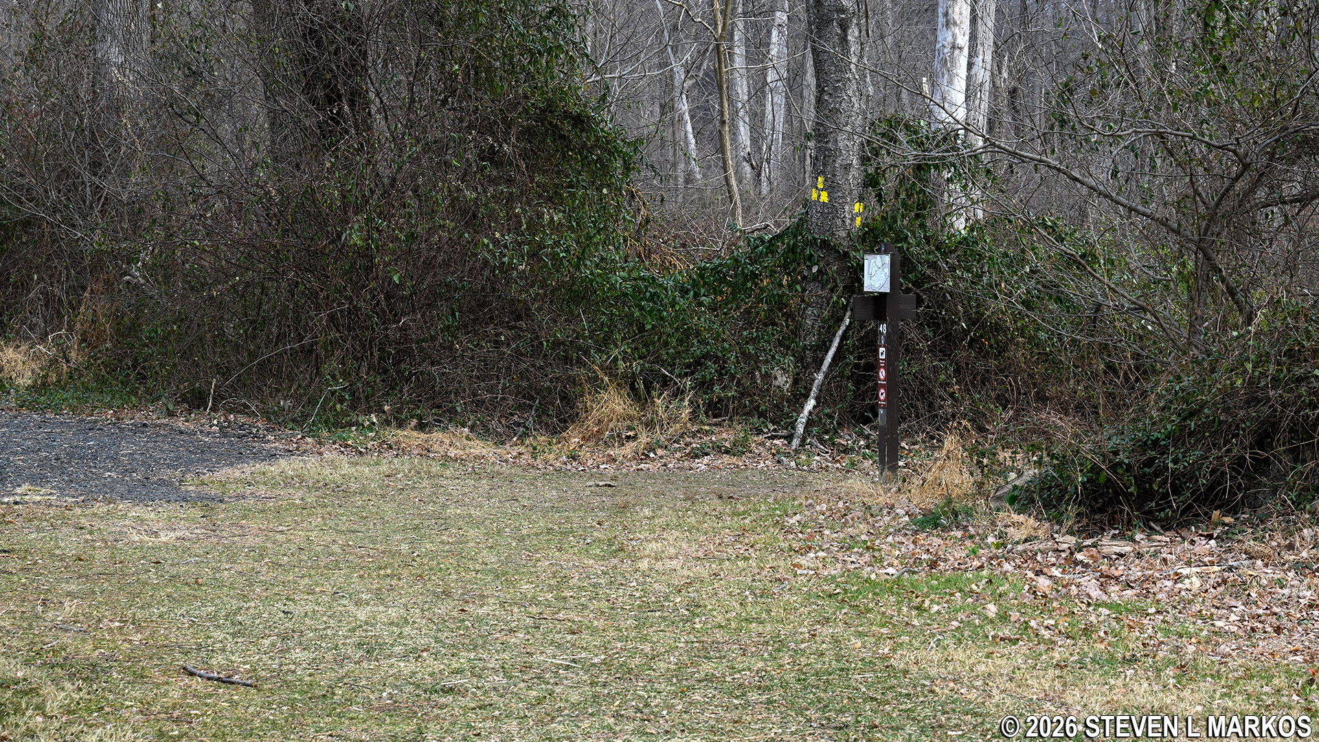
As mentioned, the Grand Parade Trail comes out where the gravel path and Cemetery Road meet. The Wick barn is within view, so just head in that direction to get back to the parking lot.
Trailhead for hiking the Grand Parade Trail in the clockwise direction from the Wick House, Morristown National Historical Park
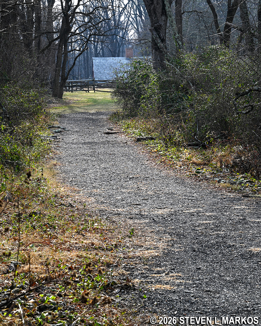
View from the clockwise trailhead for the Grand Parade Trail towards the Wick Farm barn, Morristown National Historical Park
If you want to see all of the Morristown National Historical Park tour stops in Jockey Hollow but don’t want to drive, then hiking the Grand Parade Trail is the solution. Just be sure to park at the Jockey Hollow Visitor Center, which is the first designated stop. You can then take the short walk to the Wick Farm, perhaps join a tour of the farmhouse, and then hike to the only other tour stops in Jockey Hollow, the Grand Parade and the Pennsylvania Line Encampment Site.
With a few exceptions, use of any photograph on the National Park Planner website requires a paid Royalty Free Editorial Use License or Commercial Use License. See the Photo Usage page for details.
Last updated on July 15, 2026


