

Jockey Hollow Trail Map (click to enlarge)
Be sure to pick up a trail map at either the Jockey Hollow Visitor Center or the Washington’s Headquarters Museum. There is a small fee for the map. You can also download a PDF version on the Park Map web page here on National Park Planner.
Length: 1.4-mile loop
Time: 1 hour
Difficulty: ★★☆☆☆
The Primrose Brook Trail (aka Red Trail due to the color coding on the trail map) is accessed at the Trail Center parking lot located on Jockey Hollow Road. This is the second parking lot on the right after entering the Jockey Hollow Encampment Area. It is not on the main park map, but it is shown on the park’s trail map. From this parking lot you can pick up any trail in the park except for the White Trail.
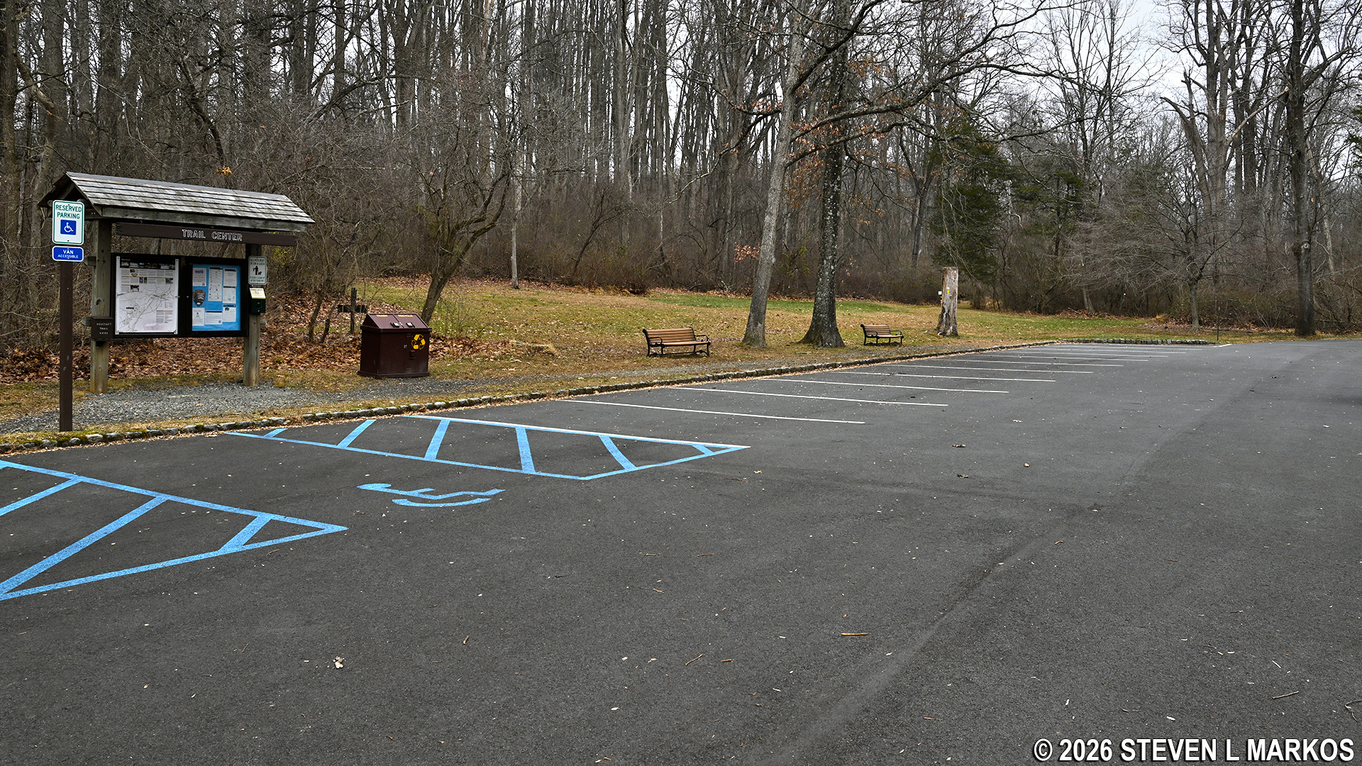
Trail Center Parking Lot in the Jockey Hollow unit of Morristown National Historical Park
There are two trailheads for the Primrose Brook Trail, one located directly across the road from the parking lot—which sets hikers off on the east side of the loop in a clockwise direction—and a second a little farther down the road towards the Visitor Center. I started the hike at the trailhead across from the parking lot, which is the most sensible place to start, and this report is written from that perspective.
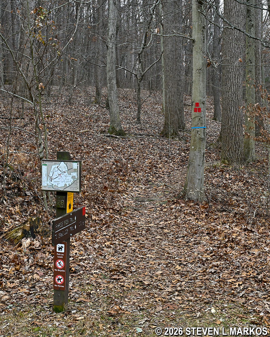
Trailhead for the Primrose Brook Trail across the road from the Trail Center parking lot in the Jockey Hollow unit of Morristown National Historical Park
After a quarter mile of hiking, you will find yourself in an area of lush ferns and other greenery as the trail begins following the small creek that gives it its name, Primrose Brook.

Primrose Brook in the Jockey Hollow unit of Morristown National Historical Park
The trail crosses the creek a number of times, usually on stepping stones.

Primrose Brook Trail crosses Primrose Brook via stepping stones, Morristown National Historical Park
Primrose Brook is very picturesque. The trail often runs so close to it that if you tripped, you could fall right in, which is quite possible since the trail surface is very rocky. Watch your step.

The eastern side of the Primrose Brook Trail hugs Primrose Brook for much of the way, Morristown National Historical Park
About .3 mile from the start is a connector trail to the other side of the loop so that you can cut the hike short and quickly return to the parking lot. However, the trail is only 1.4 miles long to begin with, so if that’s too long for you, you probably shouldn’t be hiking in the first place.

Shortcut connects from one side of the Primrose Brook Trail loop to the other, Morristown National Historical Park
At .45 mile into the hike is a four-way intersection with the Grand Loop Trail Trail (aka White Trail). A sign points to different destinations that are accessible from the intersection. Stay straight to remain on the Primrose Brook Trail.

Eastside intersection of the Primrose Brook and Grand Loop trails in the Jockey Hollow unit of Morristown National Historical Park
The Primrose Brook Trail crosses the Grand Loop Trail a second time just a quarter mile farther ahead. This marks the far end of the loop, the point where it starts heading back to the parking lot. It also marks the point where the trail veers from the water, which effectively ends the pleasant scenery until the very last quarter mile when it once again hugs the brook.
Creeks and rivers tend to run through the lowest point on the landscape, so as expected, the Primrose Brook Trail heads uphill on a moderate incline as it departs Primrose Brook. In addition, it is a little overgrown, so be sure to check yourself for ticks.

Typical terrain at the southern end of the Primrose Brook Trail just past the Grand Loop Trail intersection, Morristown National Historical Park
Once out of the ravine, the terrain on the west side of the Primrose Brook Trail is similar to that of the east side. And as mentioned, it once again runs very close to Primrose Brook for its last quarter mile.
The trail ends at Jockey Hollow Road. Once there, take a right. It’s a tenth of a mile back to the Trail Center parking lot along the road.

End of the Primrose Brook Trail hike at Jockey Hollow Road, Morristown National Historical Park
When I am hiking a trail in a history-themed park such as Morristown National Historical Park, I want to hike a trail that takes me past historical sites so that I can get a feel for the events that took place. While the Primrose Brook Trail does have some pretty scenery, it passes no historical sites, markers, or monuments. It is simply a hike for exercise, and if exercise is what you are after, hiking one of the shortest trails in the park isn’t going to help you accomplish your goal. I suggest skipping this and hiking the Grand Parade Trail or the New Jersey Brigade Trail if you are interested in history, or the Grand Loop Trail if you want exercise. It is the longest trail in the park.
With a few exceptions, use of any photograph on the National Park Planner website requires a paid Royalty Free Editorial Use License or Commercial Use License. See the Photo Usage page for details.
Last updated on July 15, 2026


