
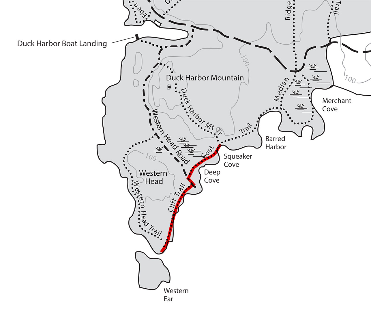
Cliff and Goat Trail map (click to enlarge)
I hiked the Cliff and Goat trails as part of a 4.6-mile loop around the southern end of Isle au Haut that also uses the Western Head and Duck Harbor Mountain trails. See the Hiking on Isle au Haut web page here on National Park Planner for more information about his hike.
Length: 1.1 mile, one way
Time: 45 minutes
Difficulty: Moderate
I started my hike on the Cliff Trail at its intersection with the Western Head Trail on the southern end of Acadia National Park’s Isle au Haut. Had I not seen the sign for the Cliff Trail, I wouldn’t even have known I changed trails, at least not for the first quarter mile. Like the Western Head Trail, the start of the Cliff Trail covers fairly level terrain, but the trail surface is full of rocks and roots. It proceeds into the forest, then suddenly appears at a coastal beach or overlook, the same pattern used by the Western Head Trail.
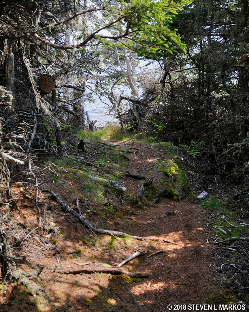
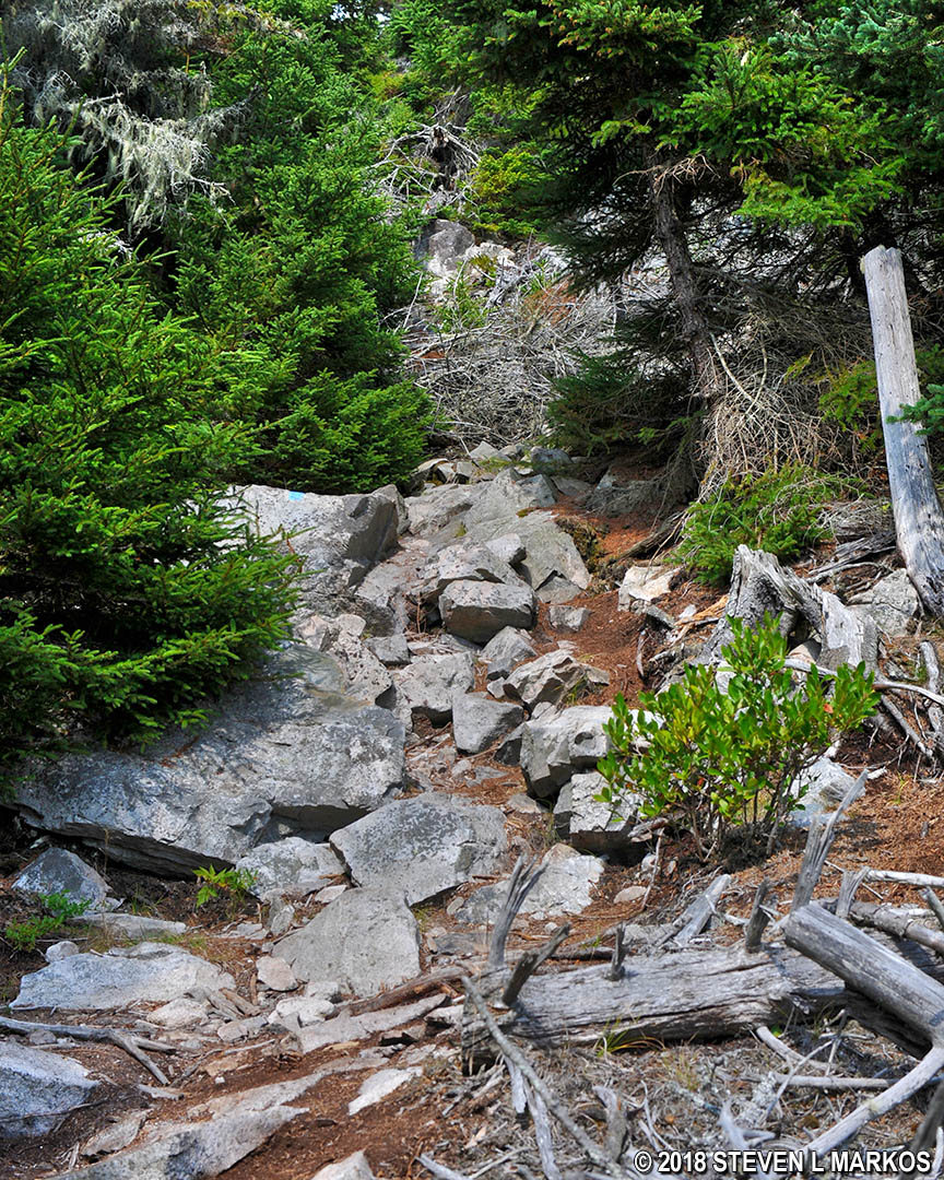
Typical terrain at the southern end of the Cliff Trail on Acadia National Park’s Isle au Haut
The first beach the trail visits is very narrow and flanked by rocks that stretch out into the water on either side. If you could run a road to this spot, the beach would make a perfect boat ramp.
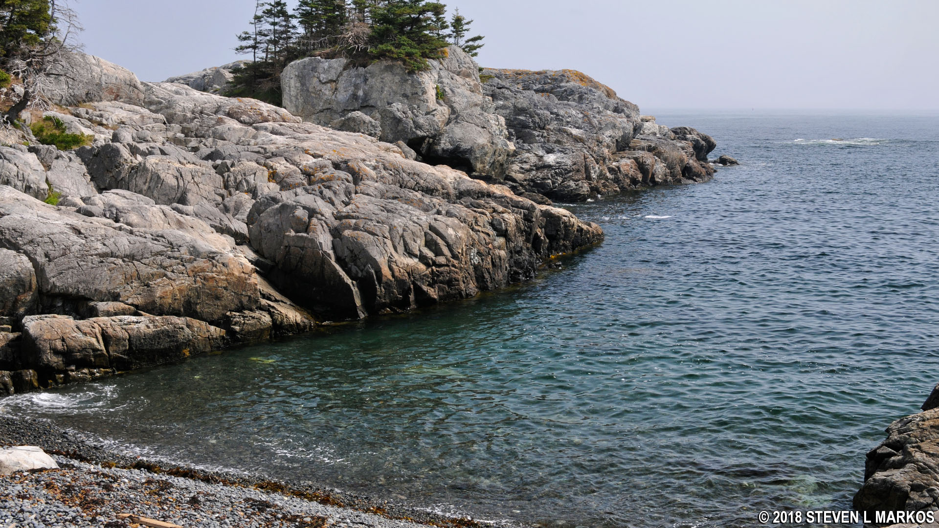
Gravel and cobblestone beach at the southern end of the Cliff Trail on Acadia National Park’s Isle au Haut
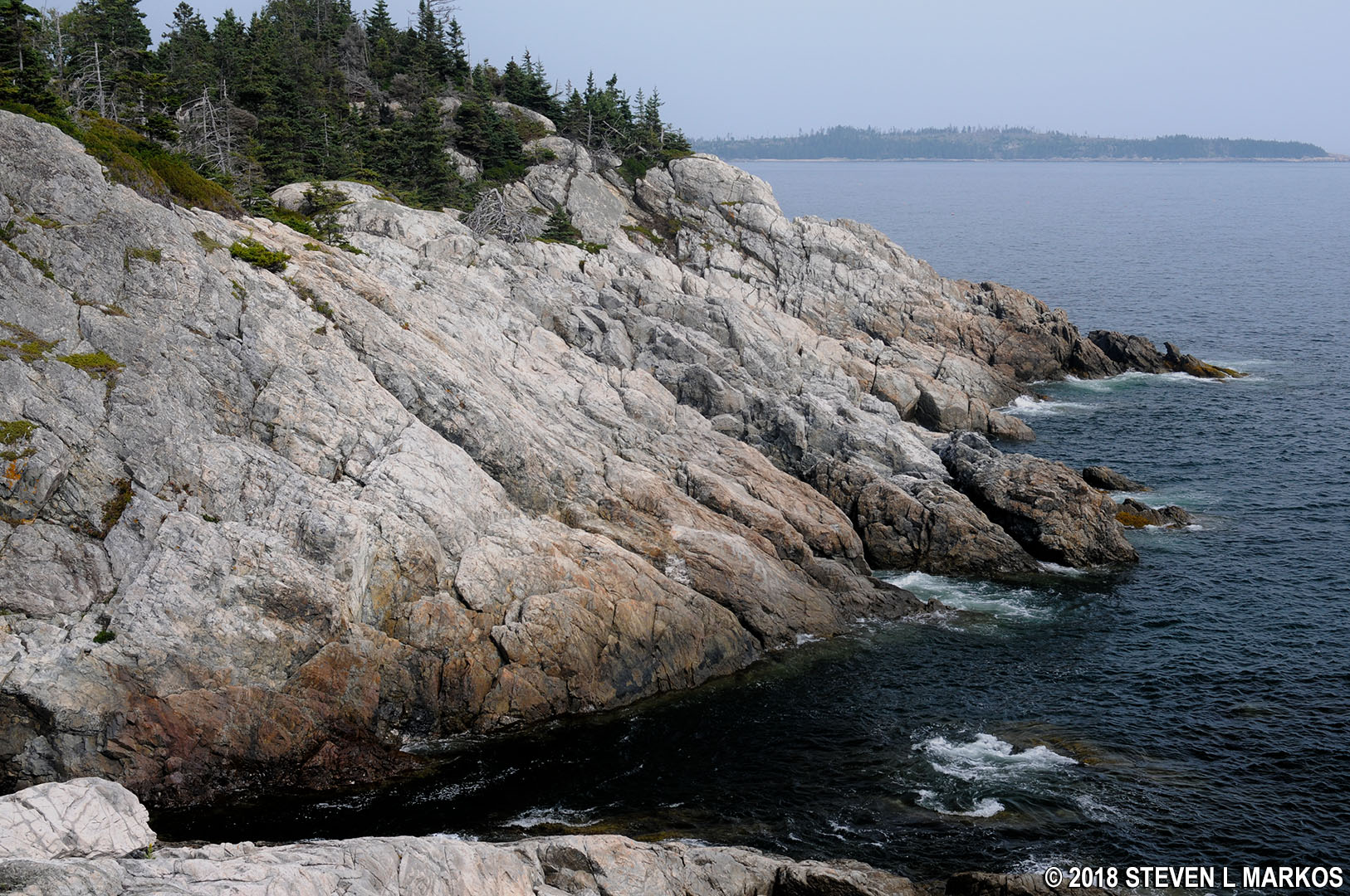
After a third of a mile, the Cliff Trail emerges from the forest at an area where the cliffs themselves are seen for the first time.

View of the cliffs on the southeast shore of Acadia National Park’s Isle au Haut
At this point the trail becomes a lot more rugged and hilly. To start, there is a large boulder field that must be climbed, though it is short. Once back into the woods, the trail surface remains full of rocks and roots, but this time around the rocks are much larger. All of this contributes to a reduction in your typical hiking pace.
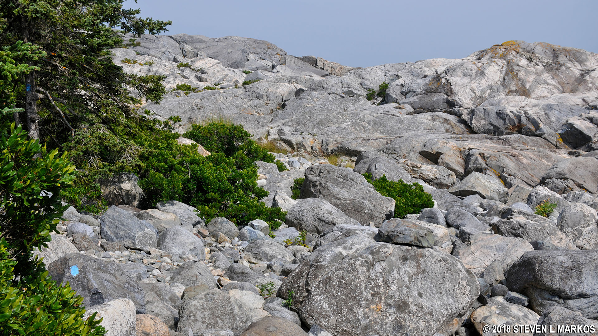
Boulder field on the Cliff Trail at the southern end of Acadia National Park’s Isle au Haut
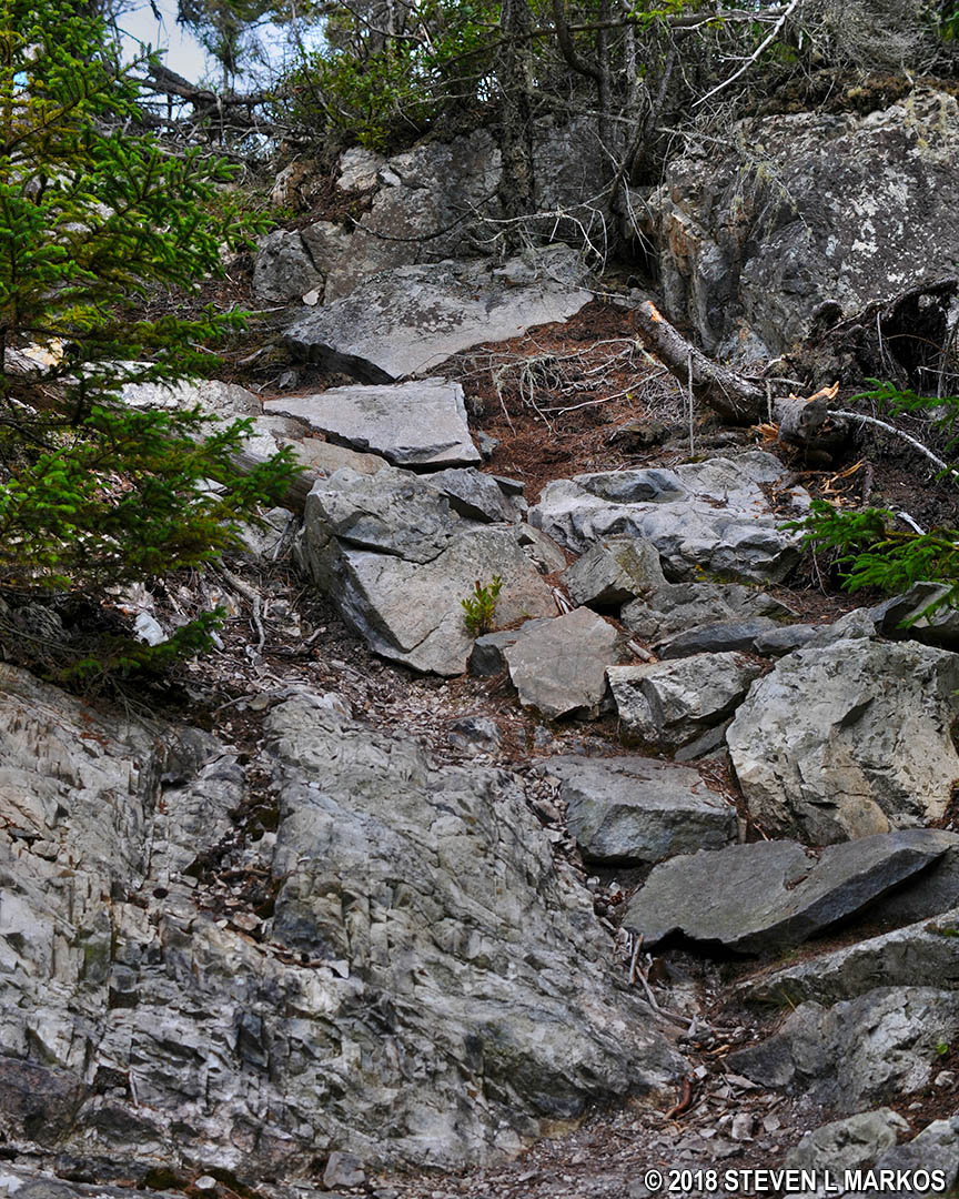
Typical terrain on the uphill climb on the Cliff Trail at the southern end of Acadia National Park’s Isle au Haut
Over the next quarter mile the trail works its way up high enough to where it starts earning its name, Cliff Trail. At one overlook I happened to see some hikers walking across the top of an even taller cliff, so I knew I was heading in that direction.
View of the cliffs along the southeast shore of Isle au Haut in Acadia National Park

Hikers high above the shore on the Cliff Trail at Acadia National Park’s Isle au Haut
To reach the taller cliffs, the trail climbs two extremely steep and rocky embankments, but once you get to the top you’ll have a grand view of the shoreline. This is the highest point on the Cliff Trail.
One of two steep embankments at the northern end of the Cliff Trail on Acadia National Park’s Isle au Haut

Bird’s eye view of the cliffs along the southeast shore of Isle au Haut, Acadia National Park
Just past the cliff overlook is the intersection with Western Head Road (not the trail). The Cliff Trail actually ends at the road, making it .75 mile long. To continue the hike, take a short jog to the left on the road until coming to the Goat Trail.

Southern trailhead for the Goat Trail on Acadia National Park’s Isle au Haut
The Goat Trail is 2.1 miles long, but my loop hike only follows it for .3 mile from Western Head Road to Squeaker Cove where the Duck Mountain Trail begins. This is the easiest section of the hike, with flat terrain and a trail surface that is only slightly marred by roots. Keep in mind that I have no idea what the rest of the Goat Trail has in store, so I can’t claim that the entire trail is easy. It follows the coastline for nearly two more miles, and the National Park Service rates it as moderate in difficulty. I’m guessing that it is similar to the Cliff Trail.
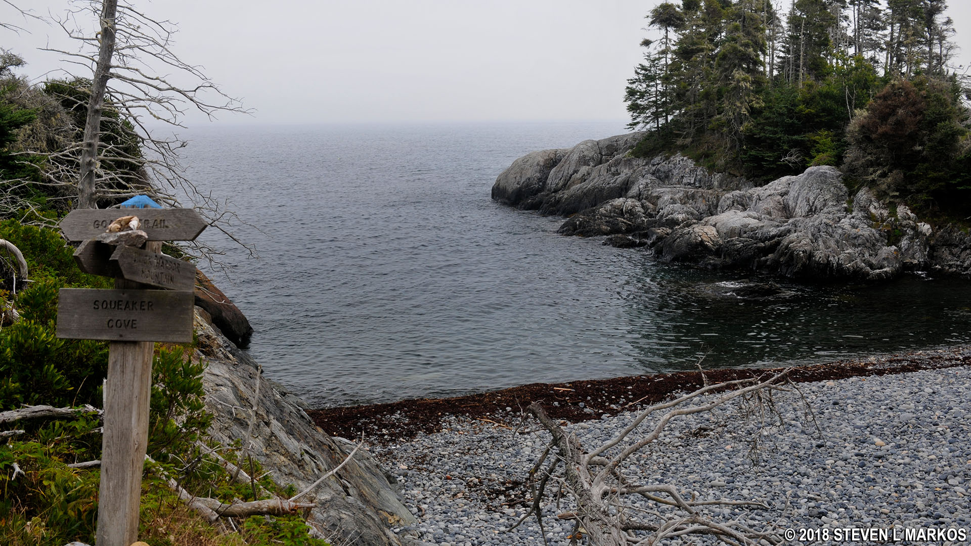
Squeaker Cove at Acadia National Park’s Isle au Haut
Thus ends the hike on the Cliff and Goat trails. While this segment is only 1.1 mile long, the distance to Squeaker Cove from the start of the loop hike at the Duck Harbor boat dock is 3.3 miles. It took me 3 hours to reach this point, which included stopping for a bite to eat and taking dozens of photos.
See the Duck Harbor Mountain Trail web page here on National Park Planner for details on the final leg of the loop hike around the southern end of Isle au Haut.
With a few exceptions, use of any photograph on the National Park Planner website requires a paid Royalty Free Editorial Use License or Commercial Use License. See the Photo Usage page for details.
Last updated on August 15, 2023


