
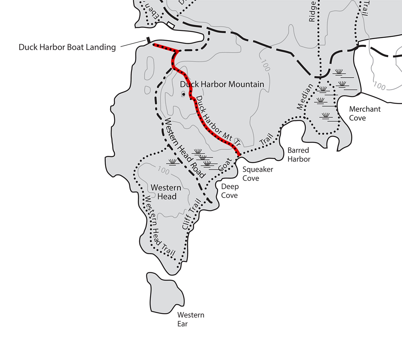
Duck Harbor Mountain Trail map (click to enlarge)
NOTE: The following trail review discusses the slope of the trail, which is called a grade. This is not the angle of the slope, but the calculation of rise (climb in elevation) divided by run (length of horizontal progress) expressed as a percentage ((rise/run) x 100). For example, using feet as the unit of measurement, a 10% grade means that a trail climbs 10 feet for every 100 feet in length. Positive grades are inclines and negative grades are declines; National Park Planner uses positive numbers in all cases, but gives a written indication of whether a slope is uphill or downhill. The grade given for an entire trail is an average, so mountainous trails may have sections with extremely steep grades as well as level areas. For reference:
- A wheelchair accessible trail has a grade of no more than +/-5%
- Most recreational trails are designed to be no more than +/-10%, with a steeper segment every now and then
- Most people agree that a +/-15% grade is where things begin to get really steep
- Stairs in a typical house and the steepest ski slopes have a grade of 60%
- A 45º angle is equal to a grade of 100%
- A stepladder has a grade of 260%
- A wall perpendicular to the ground (straight up) has a grade of infinity
To put Acadia National Park mountain trails into perspective, the average grade from the first Nepal base camp to the summit of Mount Everest is 17%, while the average grade from South Col (final camp) to the summit is 60%. Average grades of many trails in Acadia exceed Everest’s 17%, and short stretches go way beyond 60%. The difference, aside from ice and snow, is that the 60% grade of the South Col to Everest summit hike covers 3,100 vertical feet and lasts for a mile, whereas a 60% grade at Acadia may last a few hundred feet. The tallest mountain in Acadia is only 1,530 feet, so even if the grade was 60% from bottom to top, the hike would still only be half as long as the Everest summit hike.
I hiked the Duck Harbor Mountain Trail as part of a 4.6-mile loop around the southern end of Isle au Haut that also uses the Western Head, Cliff, and Goat trails. See the Hiking on Isle au Haut web page here on National Park Planner for more information about his hike.
DUCK HARBOR MOUNTAIN TRAIL
Length: 1.3 mile, including the hike back to the ferry dock
Time: 1.5 hours
Difficulty: Strenuous
By the time I reached the trailhead for the Duck Harbor Mountain Trail on the east coast of Isle au Haut, I had been hiking for three hours. It was 2:30 PM, and the ferry back to the mainland was scheduled to depart at 4 PM. The trail is strenuous, and keeping up your normal hiking pace is not going to happen, so if you are trying to make up time in order to catch the ferry, this isn’t the place to do it. I made it back with fifteen minutes to spare, which means it can be done if you reach the trailhead by 2:30 PM. However, making it back and enjoying the hike are not the same things. I literally had to run down the mountain—I was so sweaty that my pants were soaked—so I would not have made it had I hiked at my usual pace. Thus, I recommend that if you are a slow hiker like I am that you be at the trailhead by 2 PM, otherwise take the gravel Western Head Road back to the dock. The road is located at the end of the Cliff Trail.
With that said, the eastern trailhead for the Duck Harbor Mountain Trail begins at Squeaker Cove, a small cobblestone beach that is clearly marked with a directional sign.
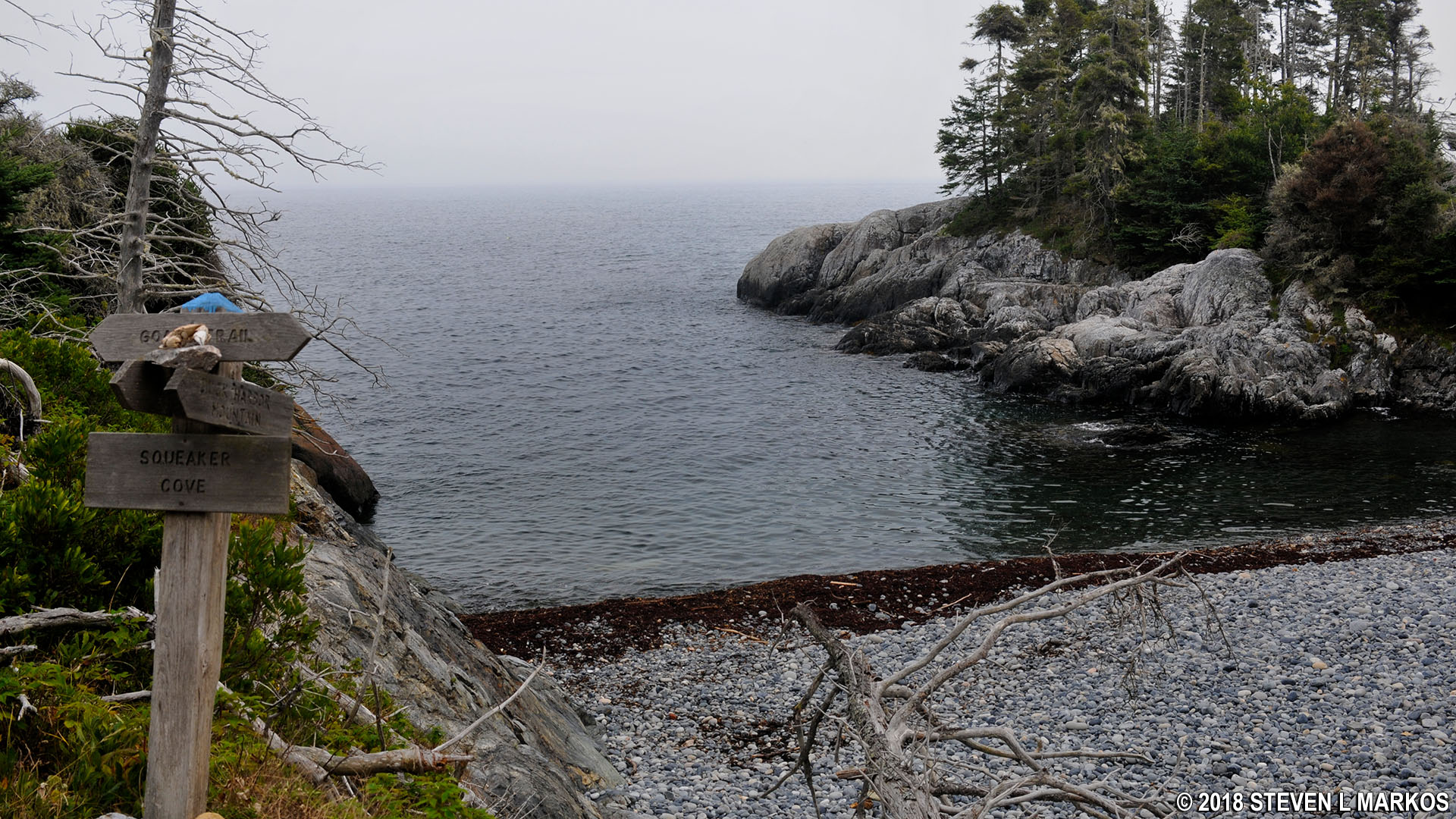
Squeaker Cove on Acadia National Park’s Isle au Haut
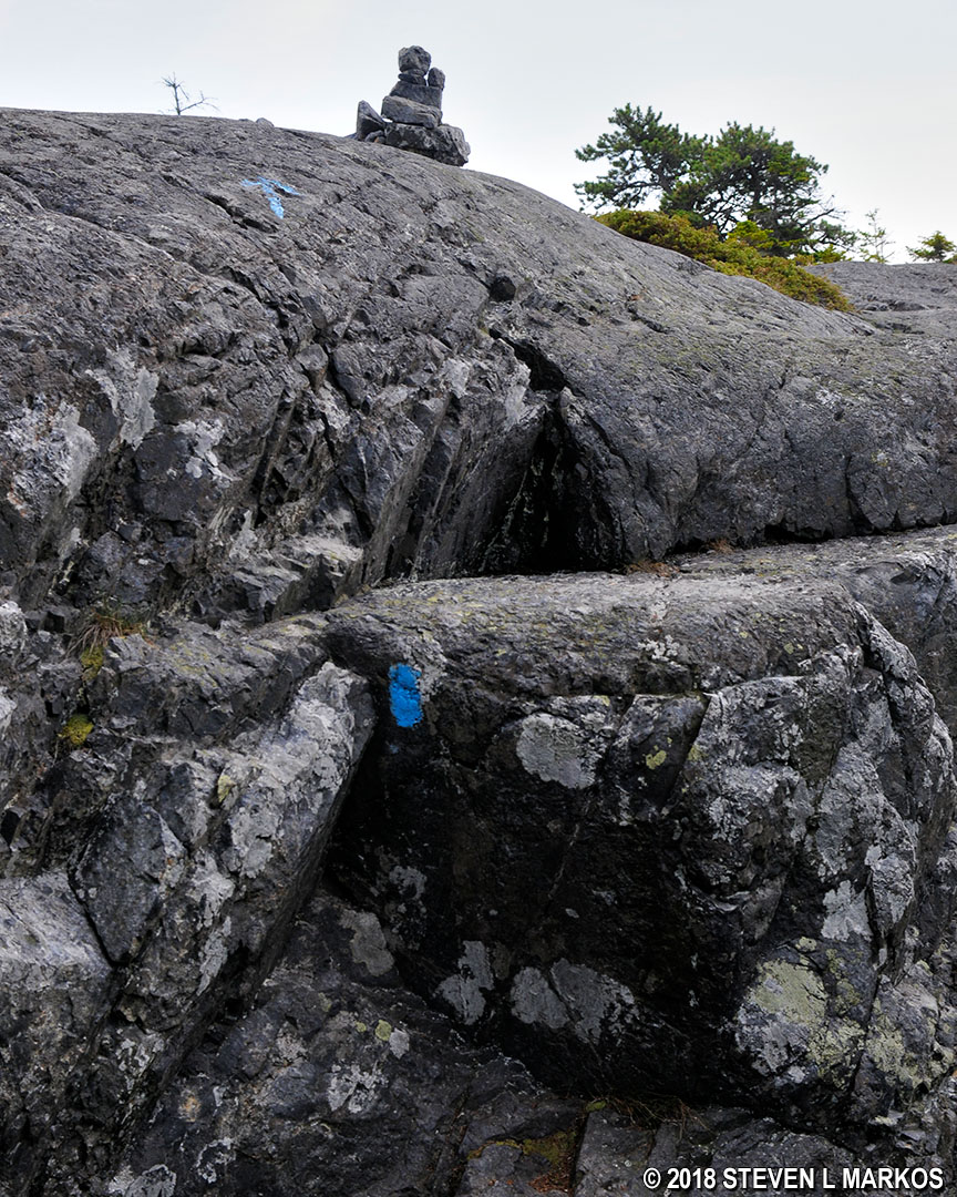
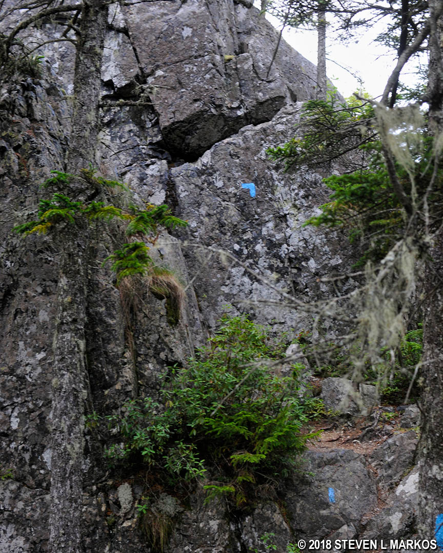
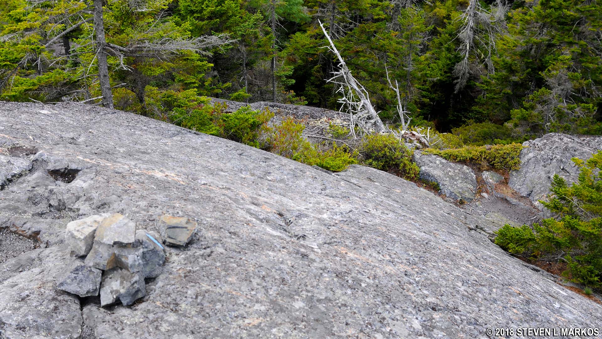
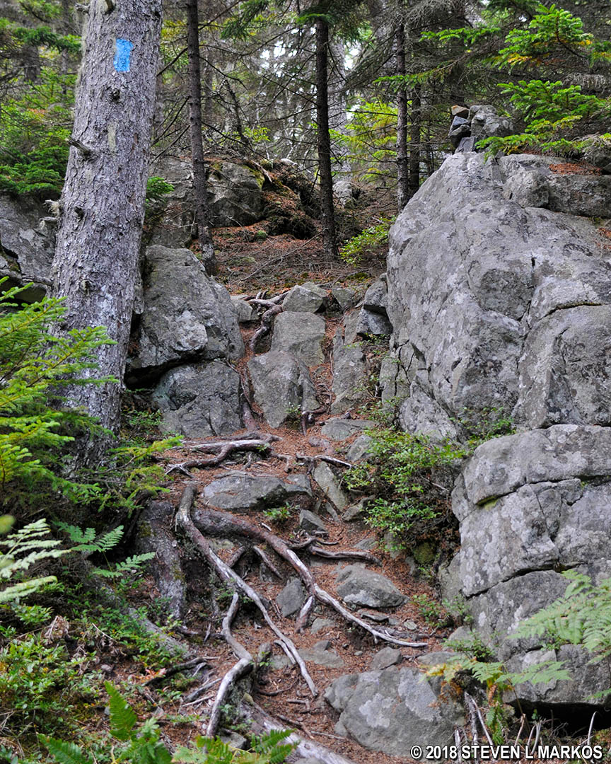
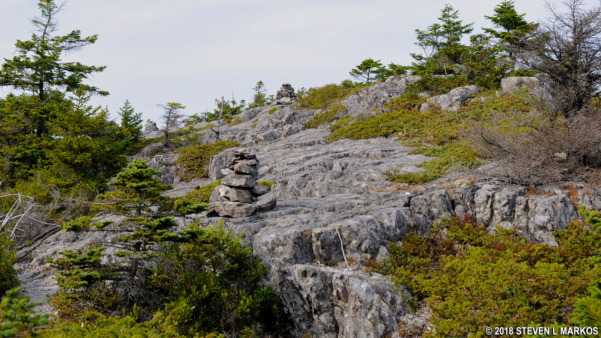
The hike traverses flat terrain for a few hundred feet before starting a steep ascent along granite slabs. To follow the correct route, it is important that you understand how the trail is marked. Blue paint splotches called blazes are either painted on the rocks or on the trees. These function as Hansel and Gretel breadcrumbs, so when in doubt as to which way to go, look for the blazes. In areas where there are no trees, cairns are also used to mark the trail. These are distinct piles of rocks placed on barren surfaces. You typically can see from one blaze or cairn to the next, and if not, you should see one within a few minutes of hiking if you are going in the right direction.
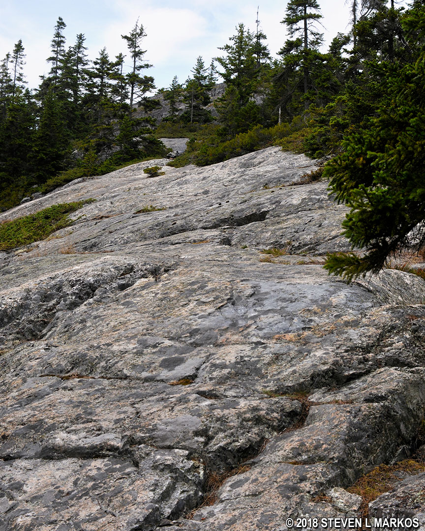
Rocky terrain along the Duck Harbor Mountain Trail on Acadia National Park’s Isle au Haut
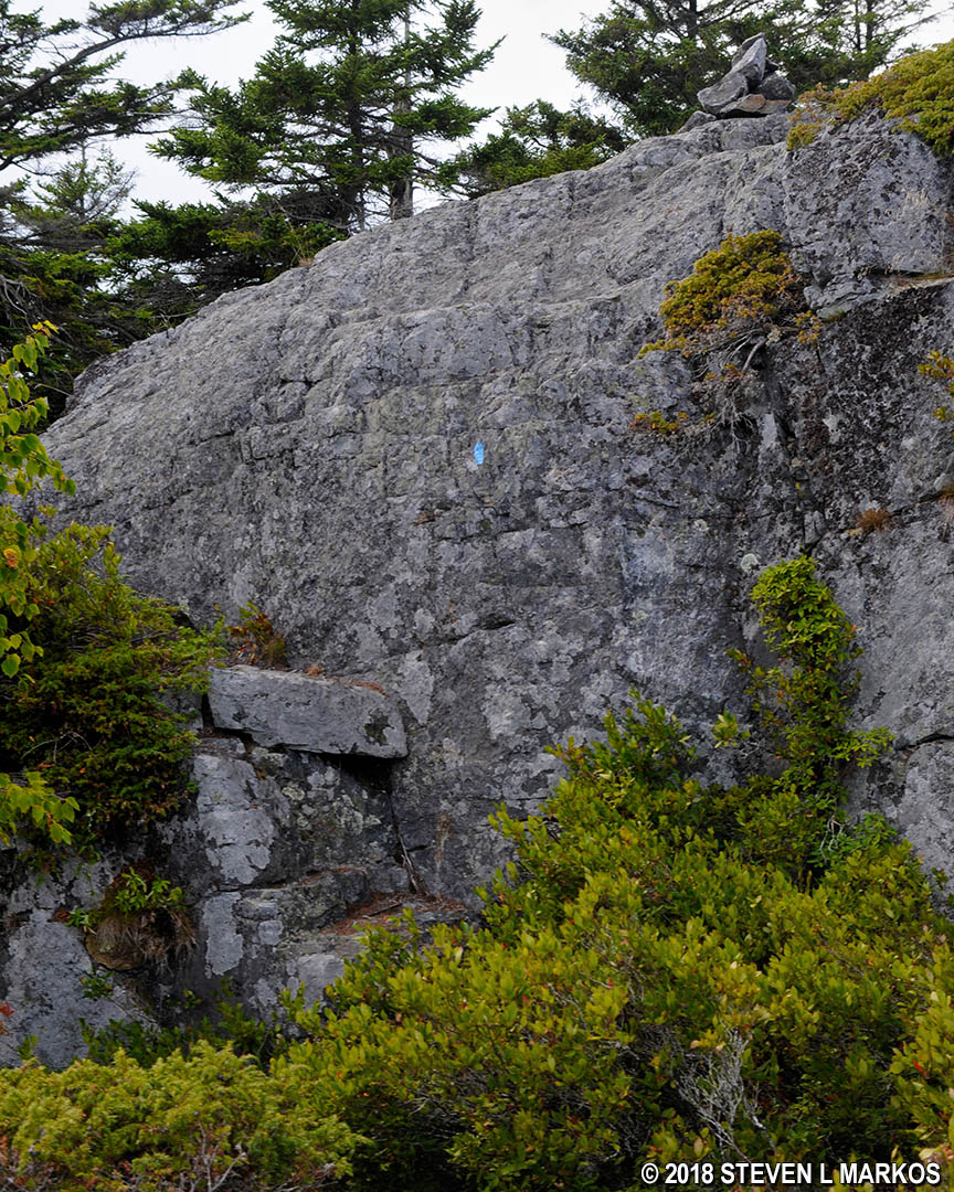
The trail climbs 130 vertical feet in its first .15 mile, an average grade of 16%. This includes two short rock walls that are the steepest climbs without the use of pre-attached rungs or ladders that I came across within Acadia National Park, and I hiked 45 miles of trails in the park, including hikes to 14 mountain peaks. After reaching the top of the second wall I figured that I must be at the summit of Duck Mountain, but I could still see an even taller peak in the distance.
First rock wall on the east side of the Duck Harbor Mountain Trail on Acadia National Park’s Isle au Haut
Second rock wall on the east side of the Duck Harbor Mountain Trail on Acadia National Park’s Isle au Haut
Once at the top of the second wall it is an almost immediate climb back down…or should I say slide back down. There’s no way to walk down the initial drop of at least twenty feet. This is a good reason to wear long pants—which I had on. In shorts, your legs are bound to get sand-papered while sliding down the rough granite.
Steep downward slide on the Duck Harbor Mountain Trail on Acadia National Park’s Isle au Haut
At the bottom is a short .1-mile reprieve across flat terrain before the trail begins the actual ascent to the summit of Duck Harbor Mountain. There are four hills to the climb, and when at the summit you will have covered 150 vertical feet in a quarter mile, an average grade of 12%. The ascent of each hill, however, is much steeper, usually 20-30% (the average includes flat areas at the top of each hill). Of course, when I did the hike I had no idea how many hills there were, so I was expecting each to be the summit. After two of them I began to wonder if this would ever end.
Typical terrain on the way up Duck Harbor Mountain on Acadia National Park’s Isle au Haut
Rock wall that must be climbed to reach the summit of Duck Harbor Mountain on Acadia National Park’s Isle au Haut
The summit is not marked with a sign like those on the Mount Desert Island mountains. It is instead marked by a U. S. Geodetic survey disc embedded into one of the rocks. The amazing thing about the hike is that despite how tough it is, the summit is only 315 feet above sea level. That’s less than half the height of most mountains on Mount Desert Island.
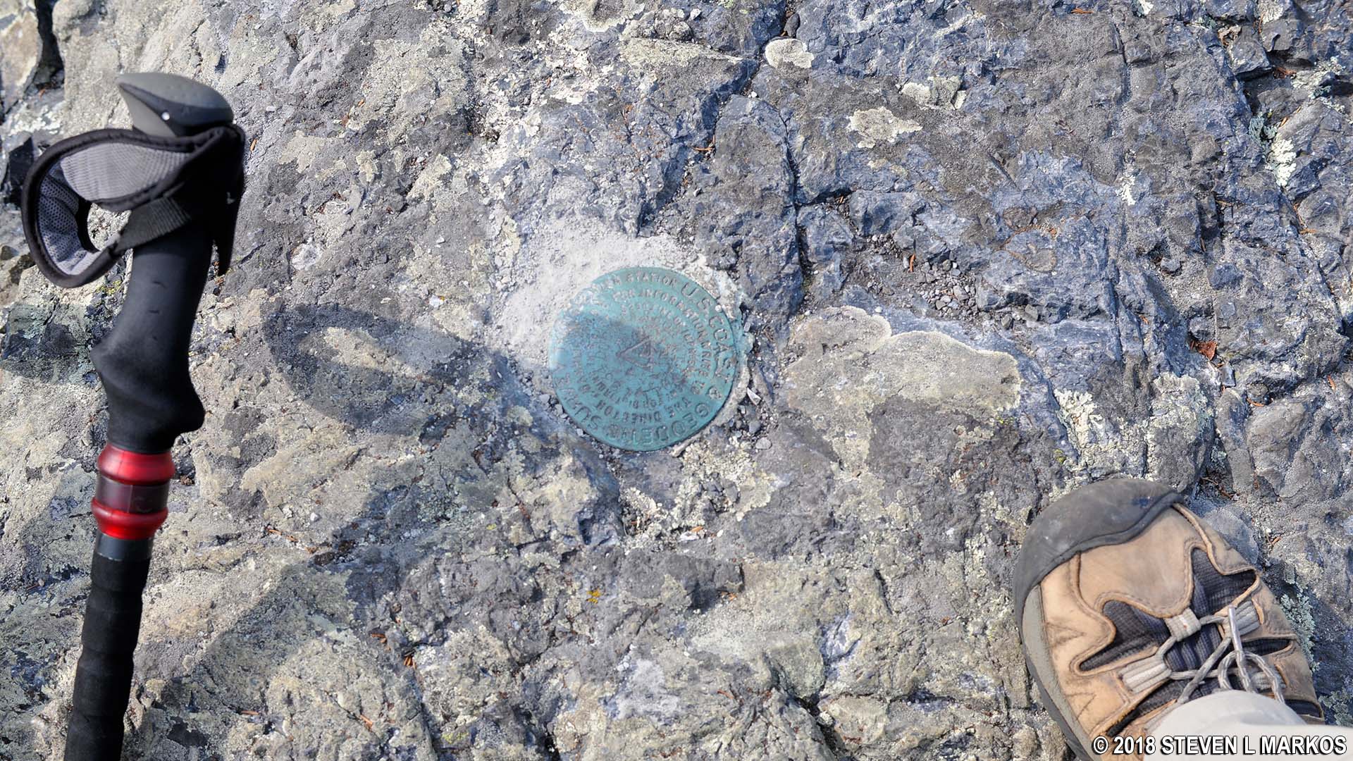
Summit marker for Duck Harbor Mountain on Acadia National Park’s Isle au Haut
The view from the summit is obscured by a few tall pine trees, and I ultimately felt that it wasn’t really worth the effort. Being a hazy day didn’t make things any better, and the biting flies were terrible. Why there were so many at the summit, I don’t know. There were so many buzzing around my head that I must have looked like Pig Pen in the Peanuts cartoon.
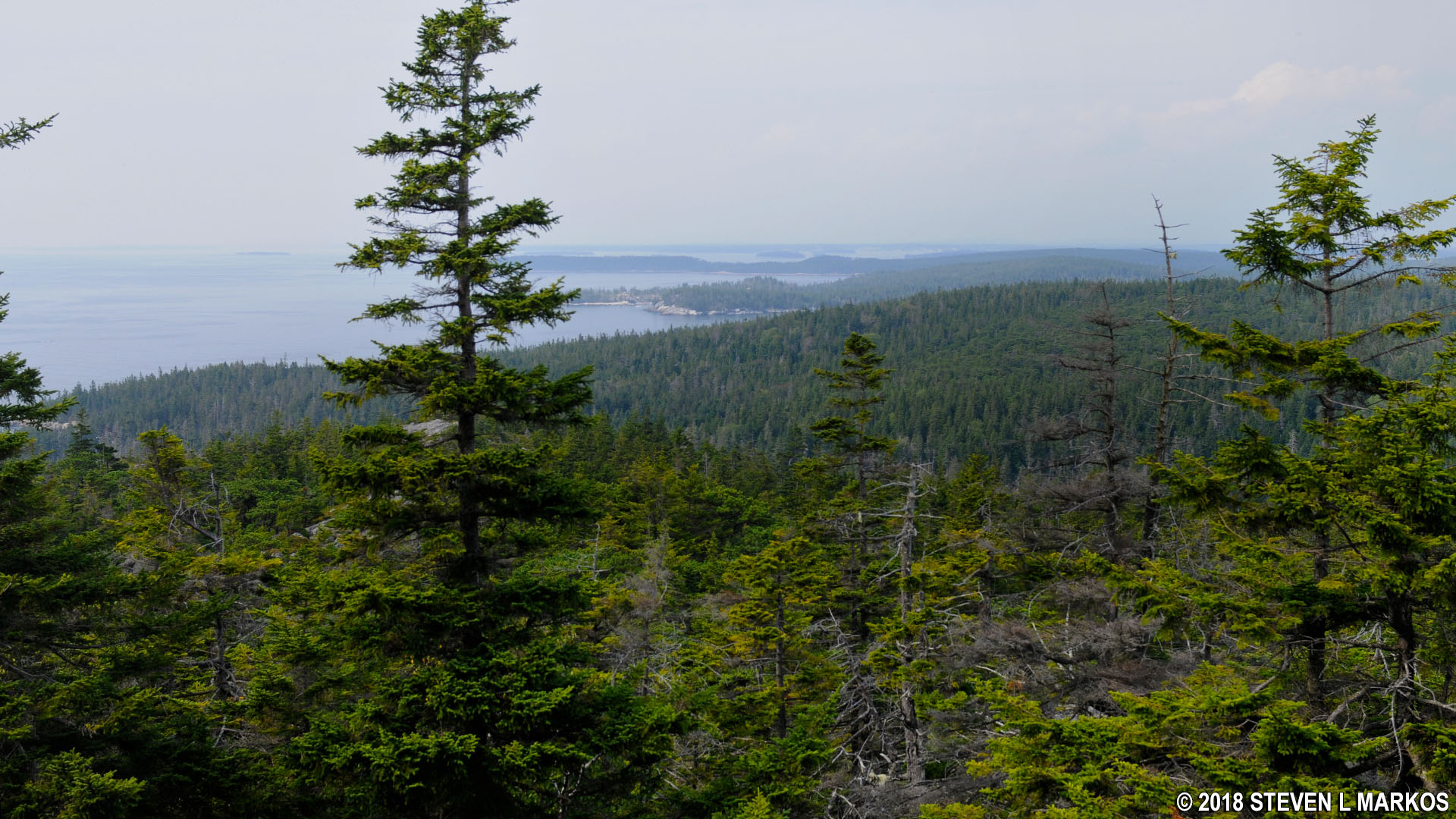
View northeast from the summit of Duck Harbor Mountain on Acadia National Park’s Isle au Haut
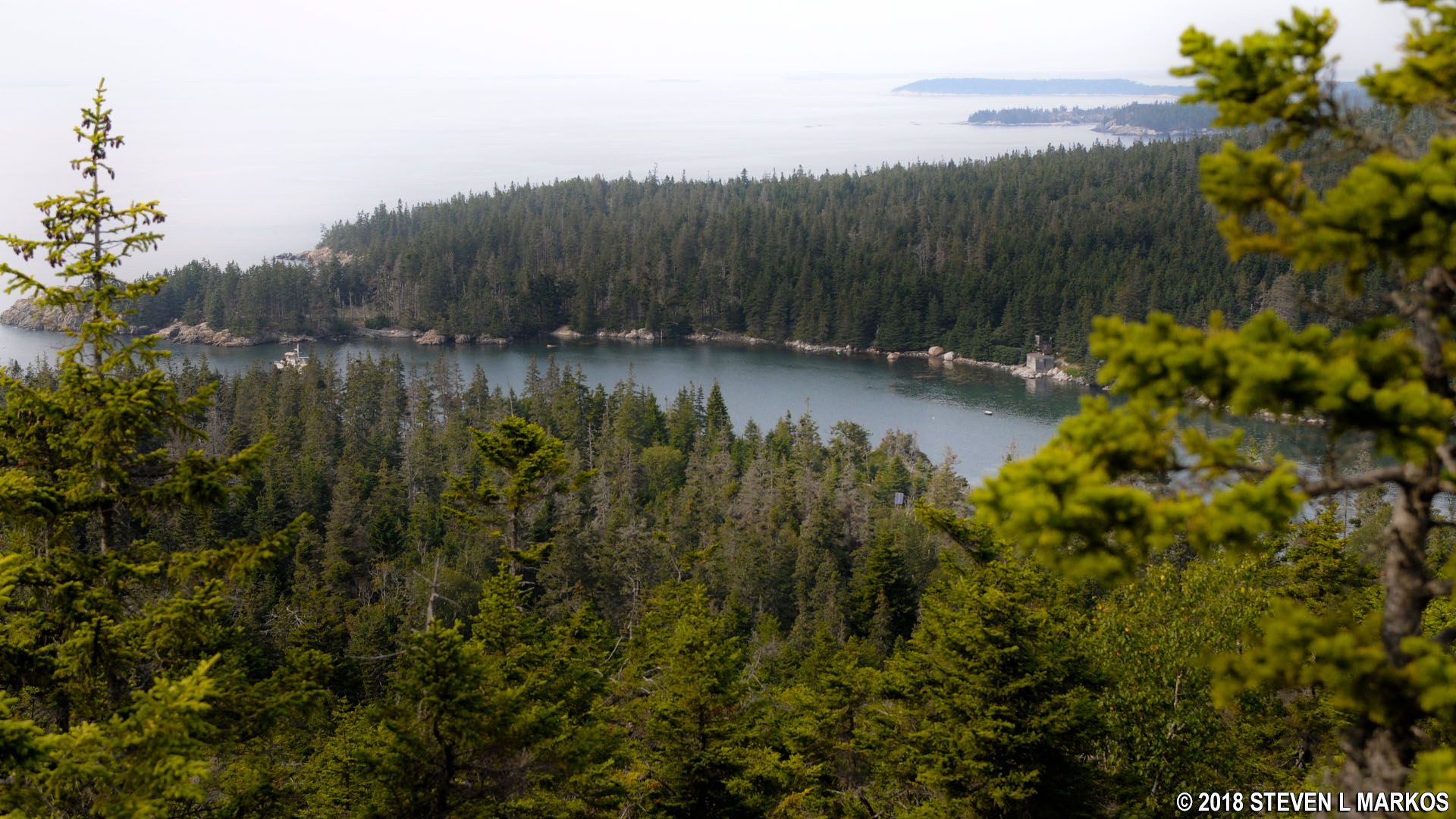
Continue the hike by walking across the mountain top in the same direction (the trail is difficult to follow at this point, so look for the blazes and cairns). After sliding down another steep granite hill you will come to a second, smaller peak where the view, in my opinion, is actually a little better than from the summit. The bay to the northwest is Moores Harbor where the Isle au Haut town ferry dock is located. You can’t see Duck Harbor (where the Acadia National Park ferry lands) because it is blocked by another peak just up ahead.
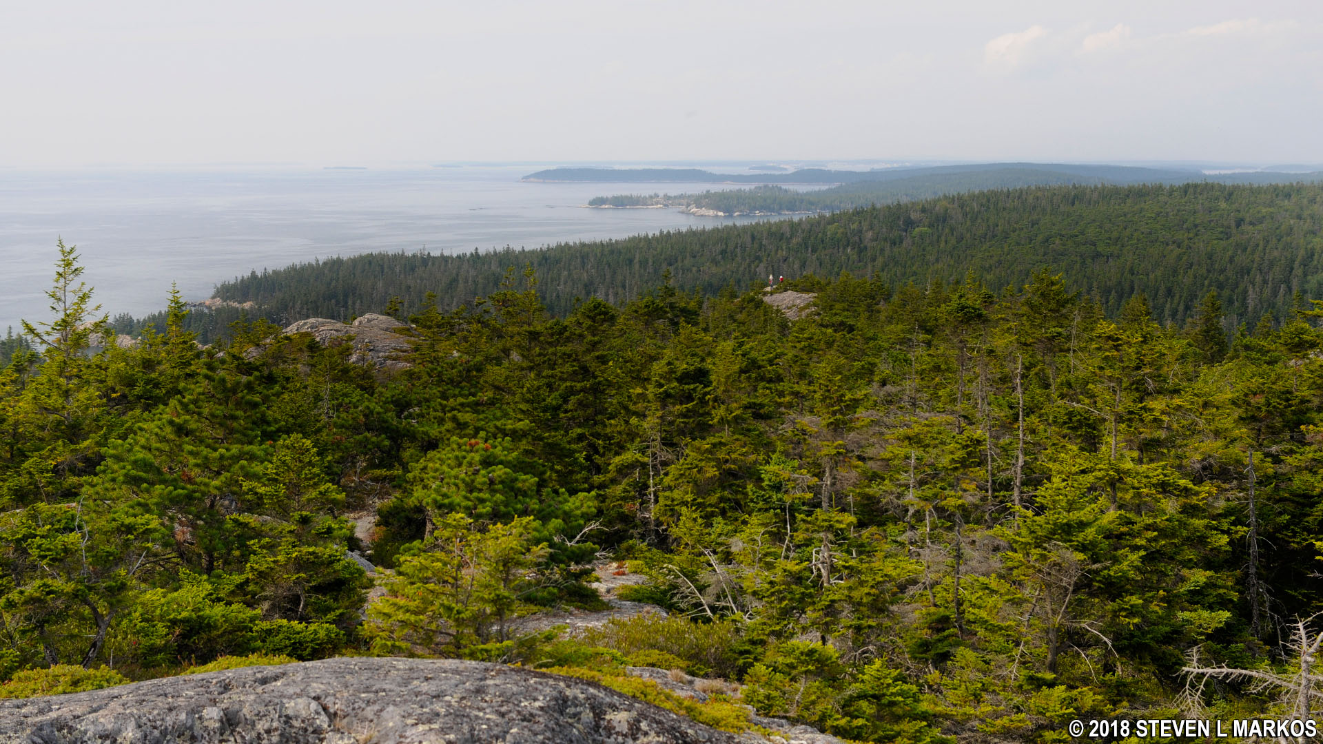
Clear view from Duck Harbor Mountain northwest to Moores Harbor on Isle au Haut, Acadia National Park
It took me 45 minutes to reach the top of Duck Harbor Mountain, a distance of .7 mile (4 miles from the start of the loop hike at the Duck Harbor ferry dock). It was now 3:15 PM, which gave me 45 minutes to get back down, a distance of a half mile. Thinking that the far-off Moores Harbor was Duck Harbor, and not knowing what the terrain was like, I went into panic mode and began running down the mountain.
The small peak that was blocking the view of Duck Harbor is just a tenth of a mile away across a shallow valley and not very difficult to reach. From here you can see Duck Harbor, but not the dock.
Terrain of the Duck Harbor Mountain Trail to the peak overlooking Duck Harbor on Acadia National Park’s Isle au Haut
Duck Harbor at Acadia National Park’s Isle au Haut
The final descent from the top of the hill to Western Head Road covers 150 vertical feet in a tenth of a mile, an average grade of 30%. However, there aren’t any rock walls to jump or slide down, and I was able to make it to the road in five minutes; it took me another three to get to the dock. I arrived with 15 minutes to spare. Needless to say, I don’t have any photos of the trip down.
I had been hiking for twelve days previously at the Mount Desert Island and the Schoodic Peninsula units of Acadia National Park, so while I enjoyed my hike around Isle au Haut, it was nothing new for me. Being rushed for time was not all the fun, plus the view from Duck Harbor Mountain was less than spectacular. I recommend this hike for those who want a challenge, but if you came to Isle au Haut to relax, take my loop hike, but skip the mountain climb and return on Western Head Road instead. This way you can have a picnic on one of the cobblestone beaches, see the coastline scenery, and you can take your time doing so.
With a few exceptions, use of any photograph on the National Park Planner website requires a paid Royalty Free Editorial Use License or Commercial Use License. See the Photo Usage page for details.
Last updated on August 18, 2023


