
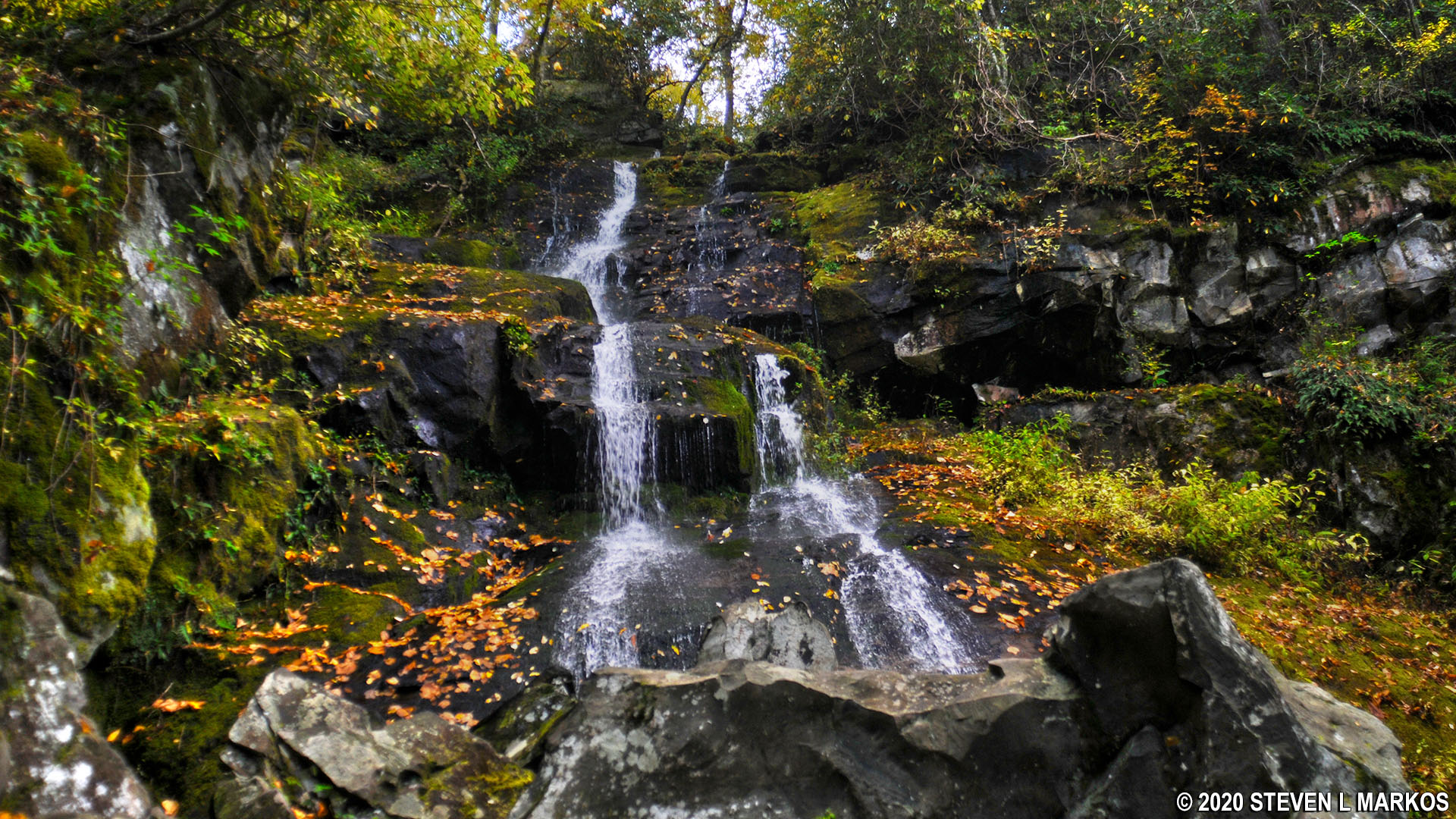
Hen Wallow Falls in Great Smoky Mountains National Park
See the Cosby Region web page for an interactive location map
Length: 2.2 miles one way to Hen Wallow Falls (4.4 miles round trip)
Time: 3 hours
Difficulty: Moderate with a short-but-extremely-strenuous section at the very end
The Gabes Mountain Trail in Great Smoky Mountains National Park runs from the Cosby Campground for 6.6 miles to the intersection with the Maddron Bald Trail. However, most people hiking it are only interested in seeing Hen Wallow Falls, which is just 2.2 miles from the campground. If you are camping, there is a connector trail to the Gabes Mountain Trail within the campground between campsites A21 and A64. If you are not camping, the official Gabes Mountain Trail trailhead is located just before the parking lot for the Cosby Picnic Area. This is on the same road as the campground, but prior to the campground entrance. There is a parking lot specifically for hikers, but it is the farthest one from the trailhead. I doubt anyone cares where you park, so use the closer picnic area parking lot if possible.
I was camping at Cosby, so I started at the campground connector trail, which dead ends into the Gabes Mountain Trail after .3 mile. If you start at the picnic area, it is .3 mile to this same intersection, so distance-wise, it doesn’t matter where you begin the hike.
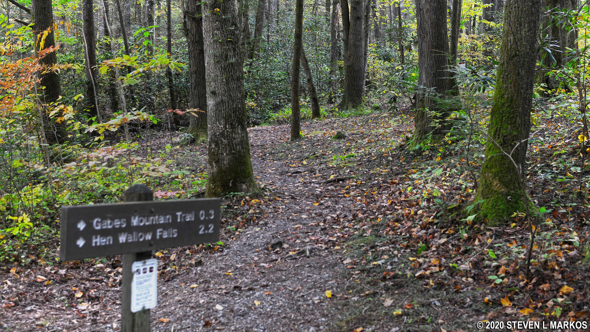
Connector trail to the Gabes Mountain Trail at Cosby Campground in Great Smoky Mountains National Park
On the way to the intersection, the connector trail crosses two wet areas where small streams trickle through. When I did the hike in October 2020 there were many downed trees, and at times it was hard to even discern the trail at all. However, these may well have been removed by the time you do the hike, and the trail might be easier to follow.
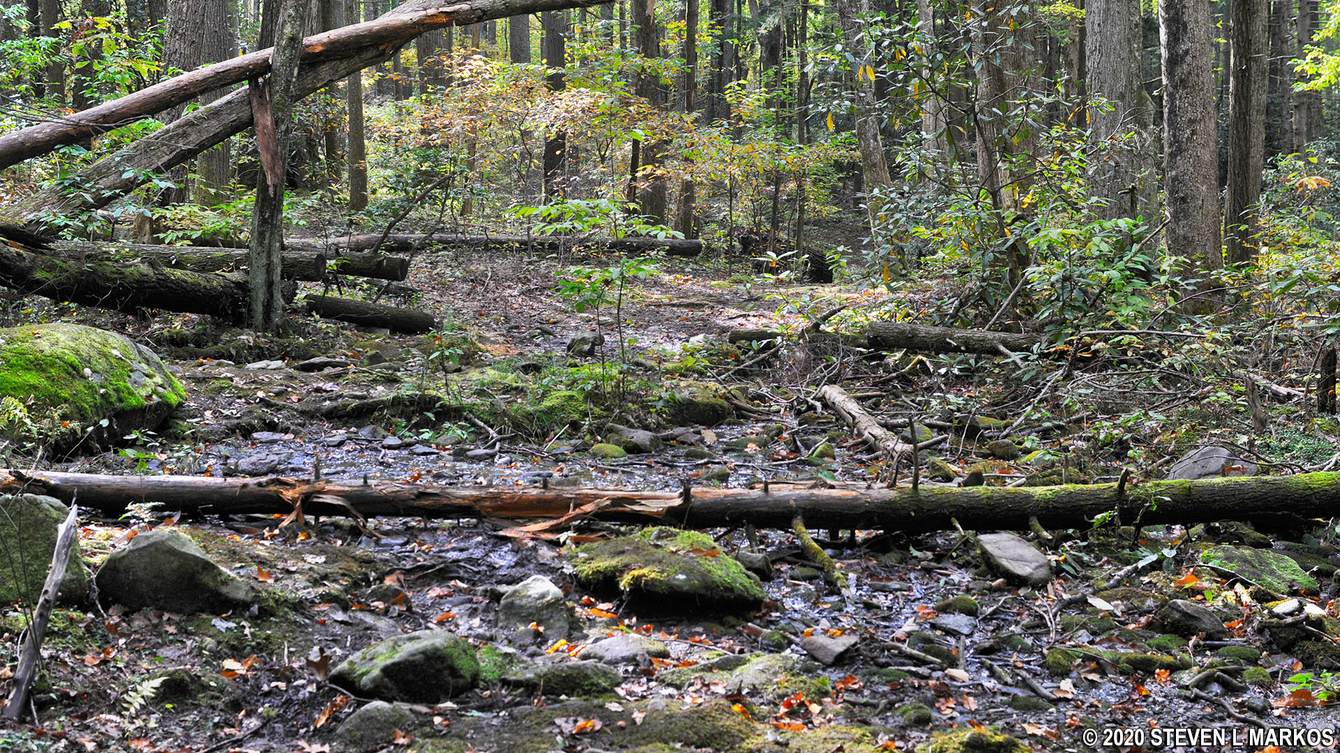
Downed trees along the connector trail between the Cosby Campground and the Gabes Mountain Trail, Great Smoky Mountains National Park
At the intersection, take a left on the Gabes Mountain Trail to continue the hike to Hen Wallow Falls. The trail passes through a deep and dark forest, the type where you’d expect to see Lions and Tigers and Bears. Not far after making the turn, the trail crosses a stream on what I call an Indiana Jones Bridge. These are single logs with a wood railing attached to them. If you were in an Indiana Jones movie and bad guys were chasing you as you tried to cross a chasm, they’d be rocking the log back and forth in an attempt to make you fall to your death.
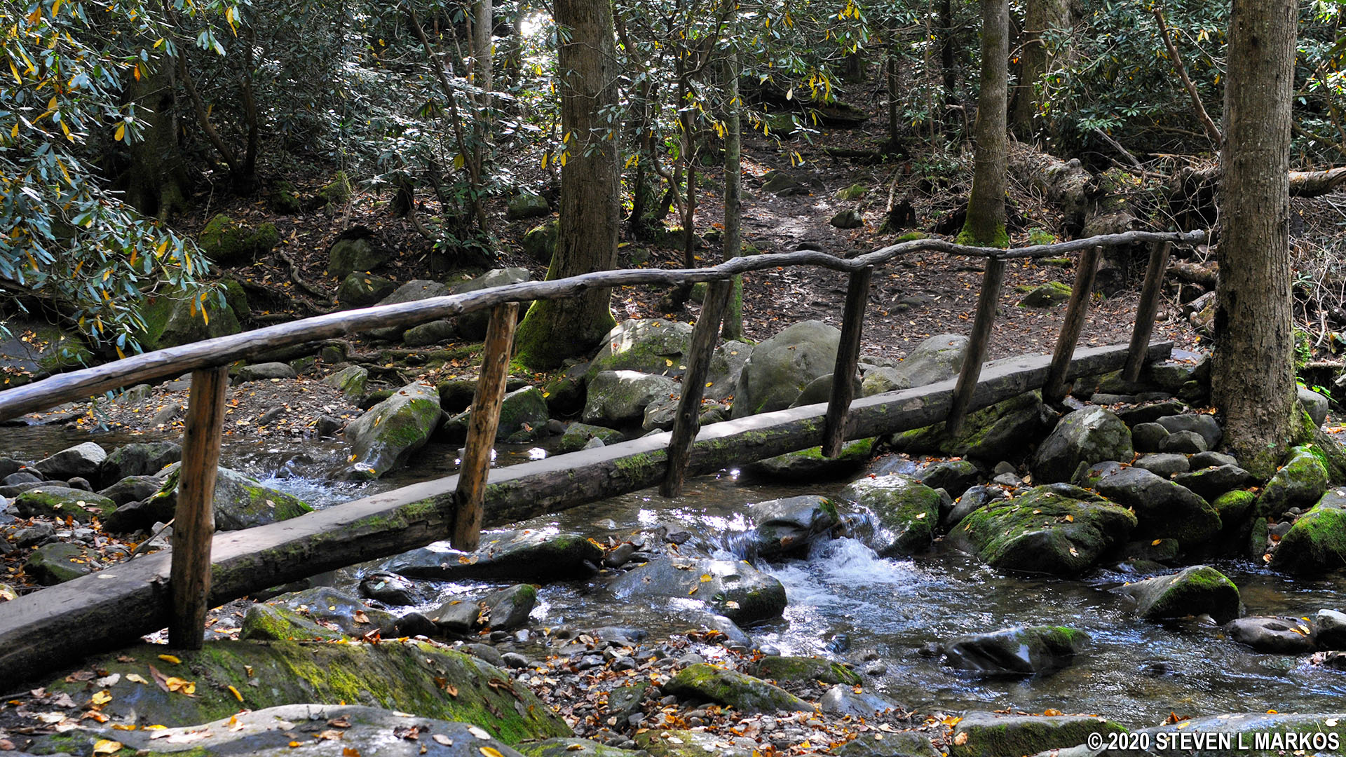
Indiana Jones bridge across a stream on the Gabes Mountain Trail in Great Smoky Mountains National Park
Once over the bridge the trail becomes very rocky and full of roots. The surface is comprised of a hard clay, and when it is wet, it is very slippery. Hiking boots will not keep you from slipping since they can’t dig into the earth. If you have hiking poles, be sure to bring them with you.
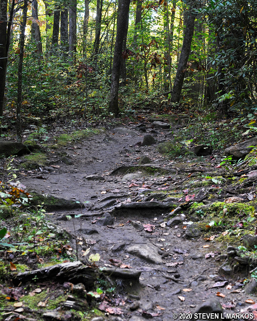
Rocky terrain and hard clay surface of the Gabes Mountain Trail in Great Smoky Mountains National Park
The first .3 mile of the Gabes Mountain Trail is full of ups and downs like a roller coaster. However, about a half mile from the start the trail begins a series of four climbs that are interrupted by short downhill segments. The climbs are not long—the longest is just .3 mile—but the hills are quite steep. I wouldn’t call them strenuous, but the first two are right at that threshold. There are three more creek crossings via Indiana Jones bridges along the way.
The third hill, which begins just after the fourth creek crossing, it not very steep, and you can pretty much walk at your regular pace. There are still plenty of rocks and roots on the trail.
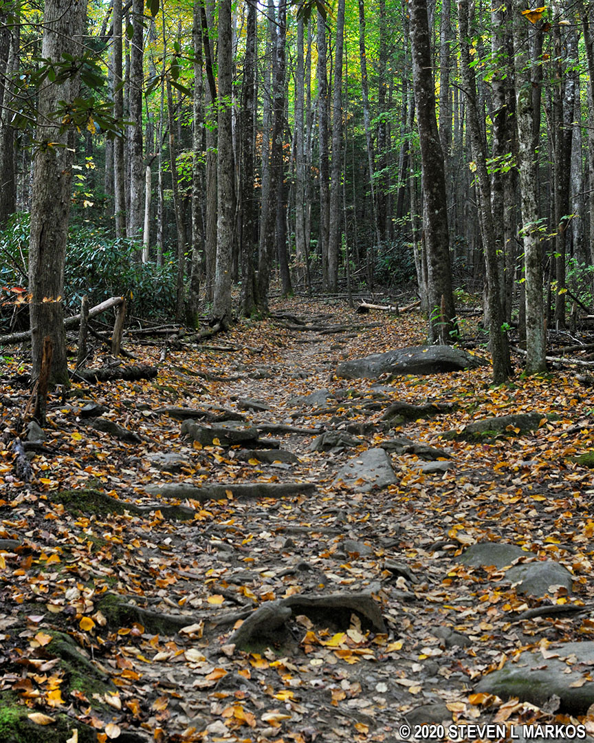
Typical terrain on the Gabes Mountain Trail in Great Smoky Mountains National Park
At 1.8 miles from the campground you will be on a ridge and on your way to the top of the last hill. The trail narrows substantially at this point, and you now come in contact with vegetation. Be sure to check yourself for ticks every few minutes.
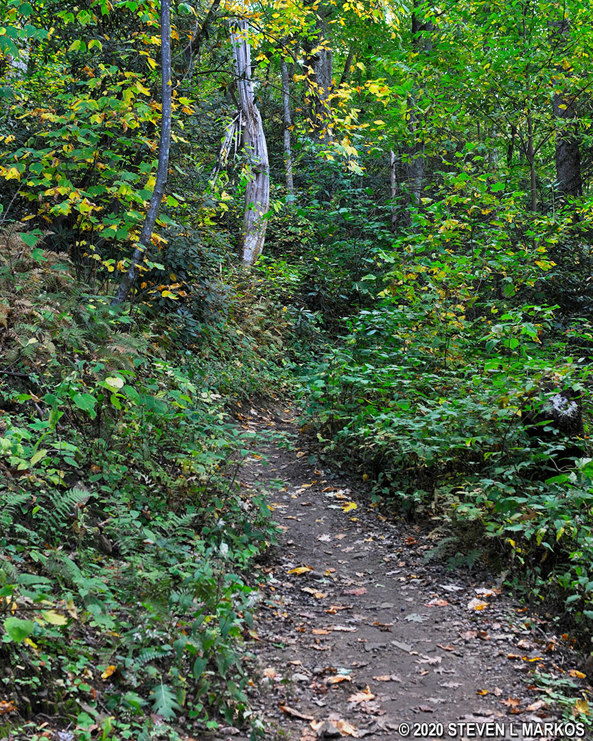
Gabes Mountain Trail narrows just before Hen Wallow Falls, Great Smoky Mountains National Park
The final leg of the hike to Hen Wallow Falls comes at the 2.1-mile mark. Here the trail splits, and it is an extremely steep descent to the waterfall on a side trail. The grade averages 21%, and most people agree that a grade of 15% is where strenuous hiking begins. This is by far the hardest part of the hike, but luckily it lasts for just a tenth of a mile. (Note: The grade is not the angle of the slope, but the calculation of rise—climb in elevation—divided by run—length of horizontal progress—expressed as a percentage ((rise/run) x 100). For example, using feet as the unit of measurement, a 10% grade means that a trail climbs 10 feet for every 100 feet in length.)
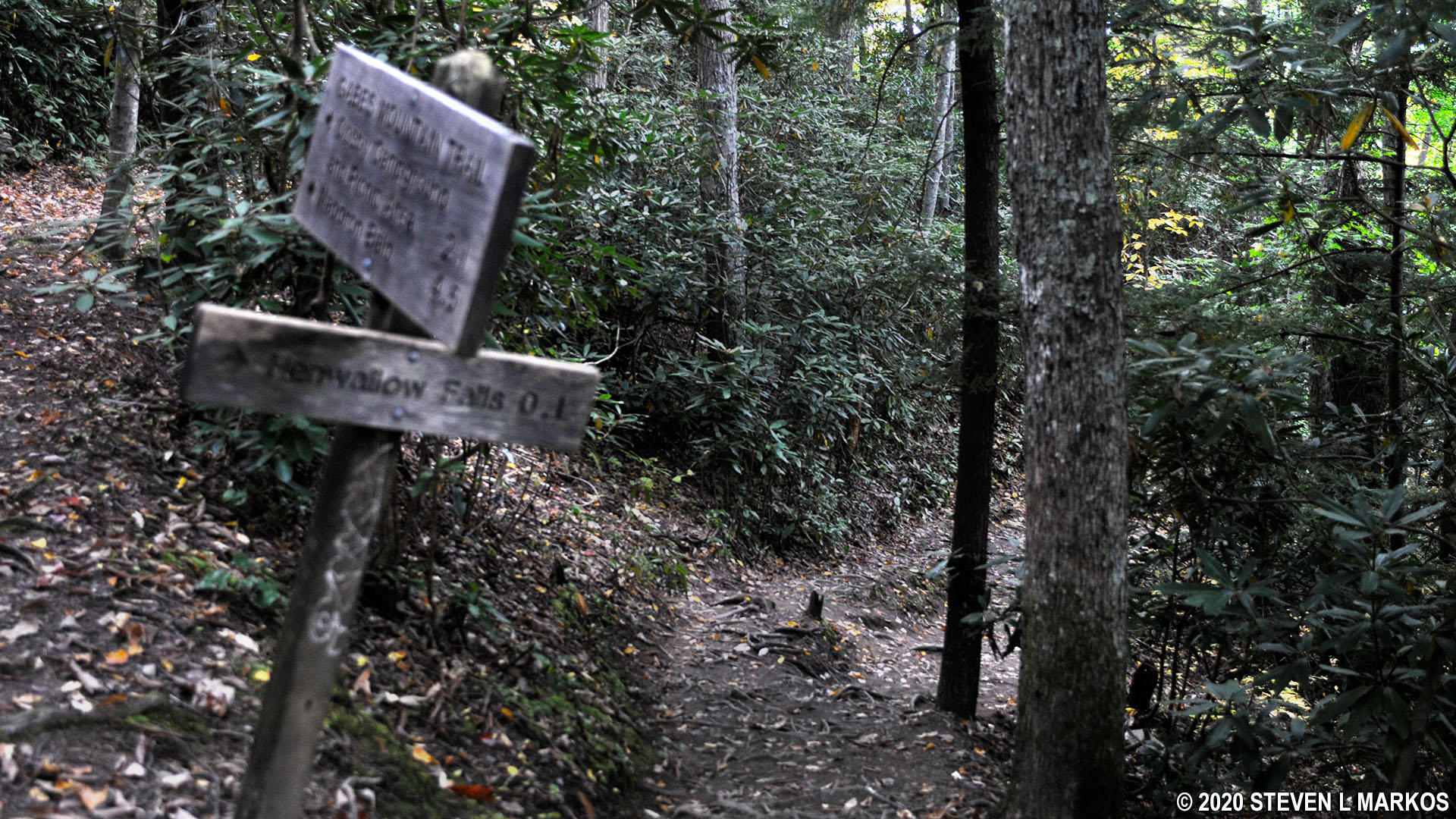
Side trail from the Gabes Mountain Trail to Hen Wallow Falls is very steep, Great Smoky Mountains National Park
After all that, I didn’t find Hen Wallow Falls to be all that interesting. It’s more of a steam that flows down a sloping sheet of rock than an actual waterfall. Since I was at Cosby Campground with time on my hands, the trip was worth the effort, but I don’t recommend going out of your way just to see the waterfall.

Hen Wallow Falls in Great Smoky Mountains National Park
With a few exceptions, use of any photograph on the National Park Planner website requires a paid Royalty Free Editorial Use License or Commercial Use License. See the Photo Usage page for details.
Last updated on February 13, 2025


