
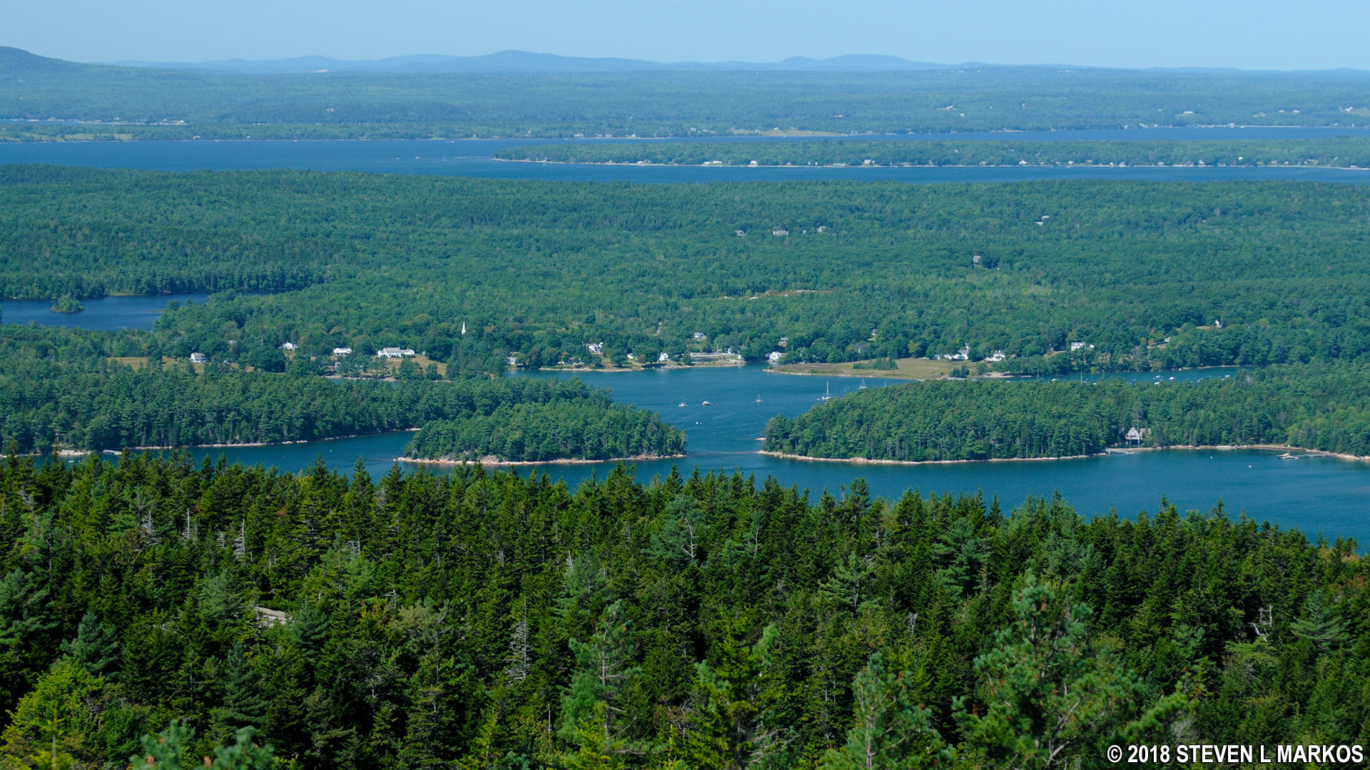
View from Acadia National Park’s Gilmore Peak of the northern end of Somes Sound
NOTE: The following trail review discusses the slope of the trail, which is called a grade. This is not the angle of the slope, but the calculation of rise (climb in elevation) divided by run (length of horizontal progress) expressed as a percentage ((rise/run) x 100). For example, using feet as the unit of measurement, a 10% grade means that a trail climbs 10 feet for every 100 feet in length. Positive grades are inclines and negative grades are declines; National Park Planner uses positive numbers in all cases, but gives a written indication of whether a slope is uphill or downhill. The grade given for an entire trail is an average, so mountainous trails may have sections with extremely steep grades as well as level areas. For reference:
- A wheelchair accessible trail has a grade of no more than +/-5%
- Most recreational trails are designed to be no more than +/-10%, with a steeper segment every now and then
- Most people agree that a +/-15% grade is where things begin to get really steep
- Stairs in a typical house and the steepest ski slopes have a grade of 60%
- A 45º angle is equal to a grade of 100%
- A stepladder has a grade of 260%
- A wall perpendicular to the ground (straight up) has a grade of infinity
To put Acadia National Park mountain trails into perspective, the average grade from the first Nepal base camp to the summit of Mount Everest is 17%, while the average grade from South Col (final camp) to the summit is 60%. Average grades of many trails in Acadia exceed Everest’s 17%, and short stretches go way beyond 60%. The difference, aside from ice and snow, is that the 60% grade of the South Col to Everest summit hike covers 3,100 vertical feet and lasts for a mile, whereas a 60% grade at Acadia may last a few hundred feet. The tallest mountain in Acadia is only 1,530 feet, so even if the grade was 60% from bottom to top, the hike would still only be half as long as the Everest summit hike.
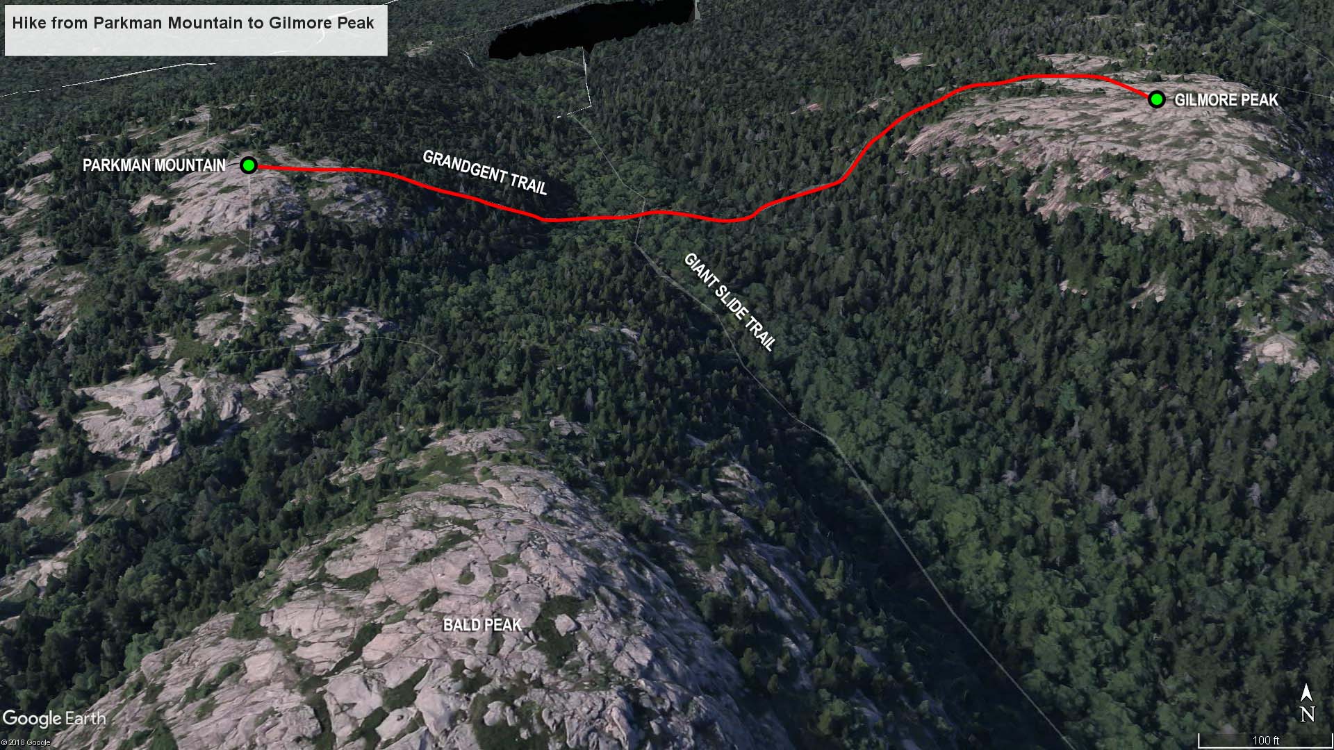
Parkman Mountain to Gilmore Peak trail map (click to enlarge)
I hiked to the top of Gilmore Peak as part of my hike to the summit of six mountains just west of Acadia National Park’s Jordan Pond on Mount Desert Island. This is the third leg of the journey, and it starts from the top of Parkman Mountain. See the Six Mountain Summit Hike web page to read about the first two segments of the hike.
Length: .5 mile
Time: 45 minutes
Difficulty: Very strenuous
From the parking lot on Highway 3 just north of Upper Hadlock Pond, a hike on the Bald Peak and Parkman Mountain trails leads to the summit of Parkman Mountain in 1.3 miles. The next destination on my Six Mountain Summit Hike is Gilmore Peak, and it is reached via the Grandgent Trail, which begins at the Parkman Mountain summit and runs all the way to Sargent Mountain, stopping at Gilmore Peak along the way.
To find the trailhead for the Grandgent Trail, when reading the summit sign on Parkman Mountain, look over your right shoulder and you will see a cairn and two mountains—that’s where you are heading. The closer, bald-top mountain is Gilmore Peak. The taller, tree-covered mountain is Sargent Mountain, the fourth stop on the hike.

View of Sargent Mountain with bald-topped Gilmore Peak on the right, Acadia National Park
Picture Parkman Mountain as a football (American football) that has been cut in half lengthwise and placed on the ground. You are standing at the very top in the very middle, the summit of the ball so to speak. The Grandgent Trail does not run towards the tip of the football along a gradual slope, but down the side of the ball, which is quite steep. In fact, the Grandgent Trail descends 196 feet to the valley between the two mountains in .2 mile, an average grade of 20%, which is as steep as any trail in Acadia National Park. Keep in mind that this is the average and that some segments reach grades of 70%, and 30+% grades are common (the steepest section is towards the bottom). By comparison, the hike up the south end of Parkman Mountain from Bald Peak averaged just 13%.
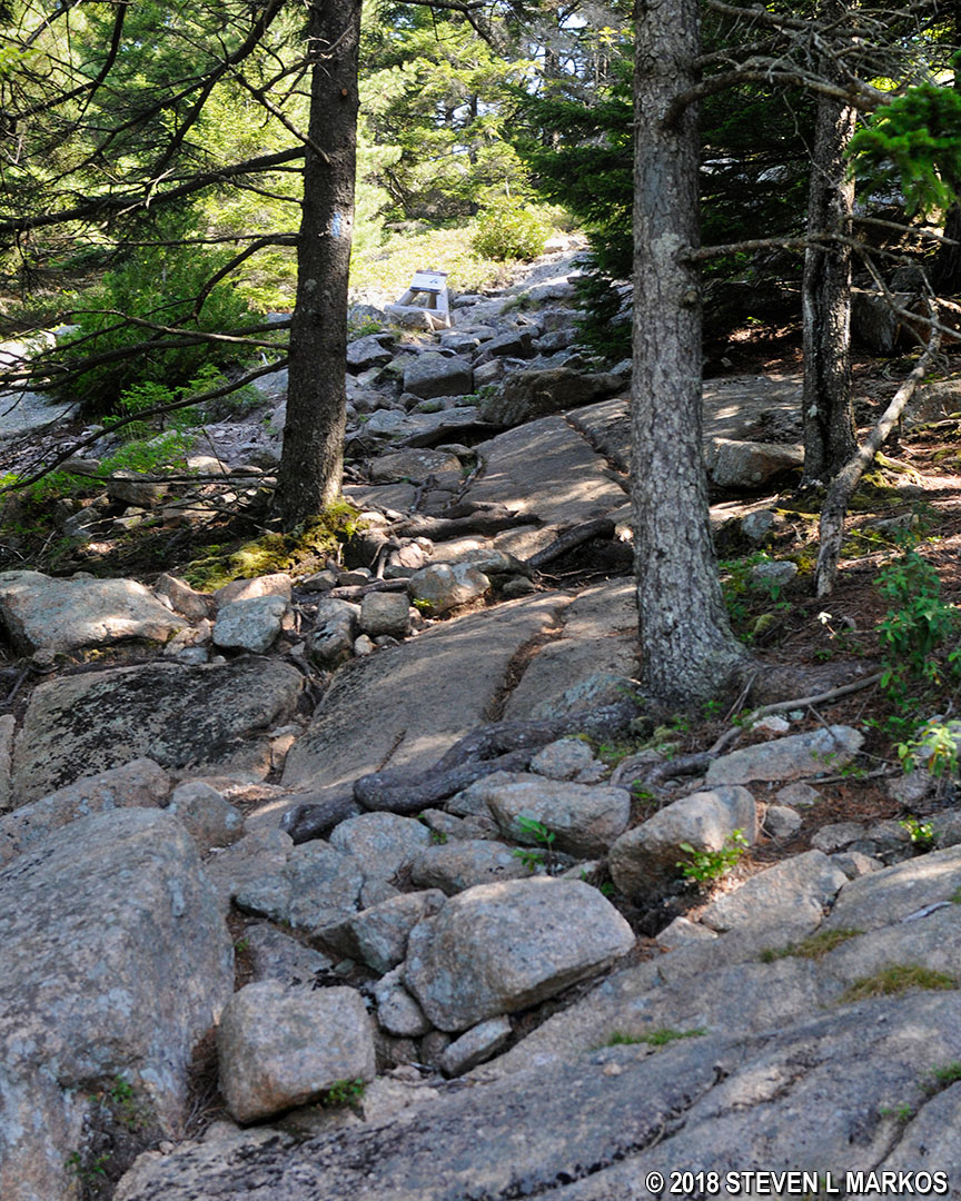
The terrain at the upper elevations on the west side of Parkman Mountain is forested, and the trail surface is nothing but rocks and roots—it’s like walking down a rockslide. This is in stark contrast to the south side of the mountain where the upper elevations are exposed slabs of granite. Your normal hiking pace will be cut in half when traversing this type of terrain because you must watch your every step so that you don’t break an ankle. (My photos are all looking back up from where I came due to the danger of the downhill journey).
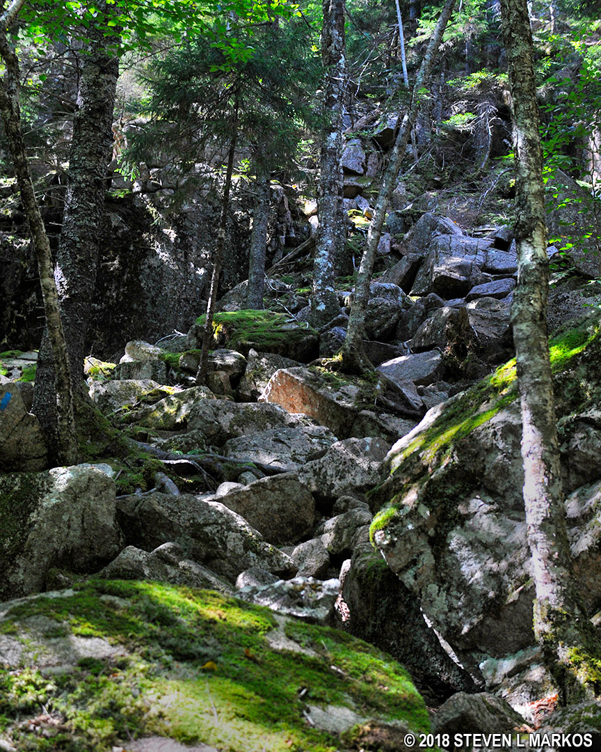
Terrain on the descent from the Parkman Mountain summit on the Grandgent Trail at Acadia National Park
The trail often becomes indistinguishable from the rest of the forest, so it is important to understand how the route is marked. Blue paint splotches called blazes are either painted on the rocks or on the trees. These function as Hansel and Gretel breadcrumbs, so when in doubt as to which way to go, look for the blazes. In areas where there are no trees at all, cairns are used to mark the trail. These are distinct piles of rocks placed on barren surfaces. You typically can see from one blaze or cairn to the next, and if not, you should see one within a few minutes of hiking if you are going in the right direction.
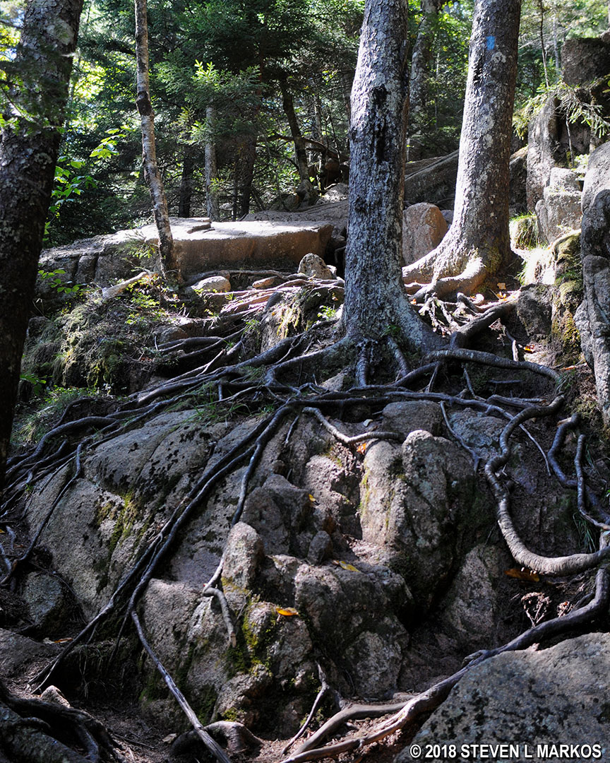
Blue blaze marks the route of the Grandgent Trail in Acadia National Park
The only good thing to say about the hike down to the valley is that it is short, only taking fifteen minutes or so. At the bottom is the intersection with the Giant Slide Trail. A sign points to the different destinations; continue on the Grandgent Trail towards Sargent Mountain.
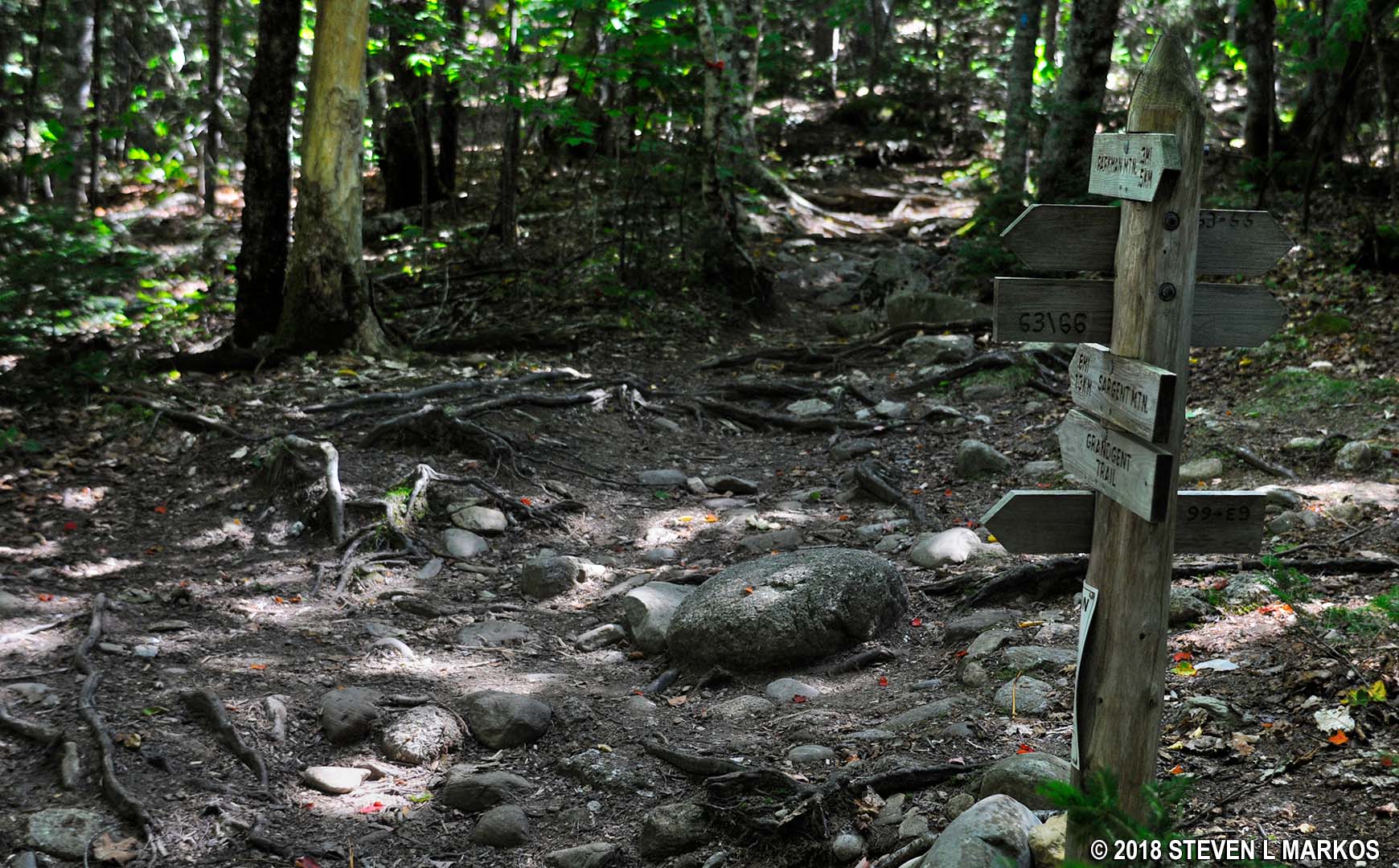
Intersection of the Giant Slide and Grandgent trails, Acadia National Park
The level reprieve of the valley doesn’t last long, and you will soon be hiking to the top of Gilmore Peak. The climb is just as difficult as the descent, covering 280 vertical feet in a little less than .3 mile, an average grade of 19.5%. The toughest part is the middle third, which has an average grade of 32%.
The start of the hike continues through the forest along rocks and roots, but the trail eventually emerges into the sunshine and runs across granite slabs like on the south side of Parkman Mountain. Cairns and blue blazes painted on the rocks mark the route.
Start of the ascent up Gilmore Peak on the Grandgent Trail in Acadia National Park
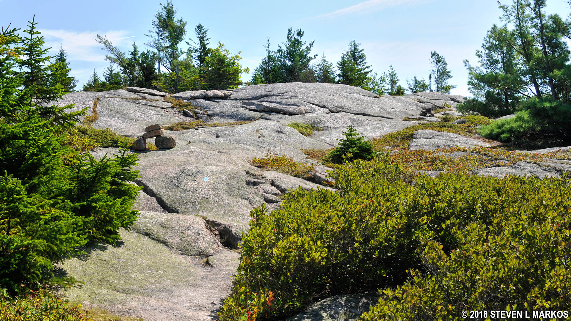
Terrain on the upper section of the Grandgent Trail in Acadia National Park
The summit of Gilmore Peak is marked with a sign that states the mountain’s elevation, 1,036 feet.
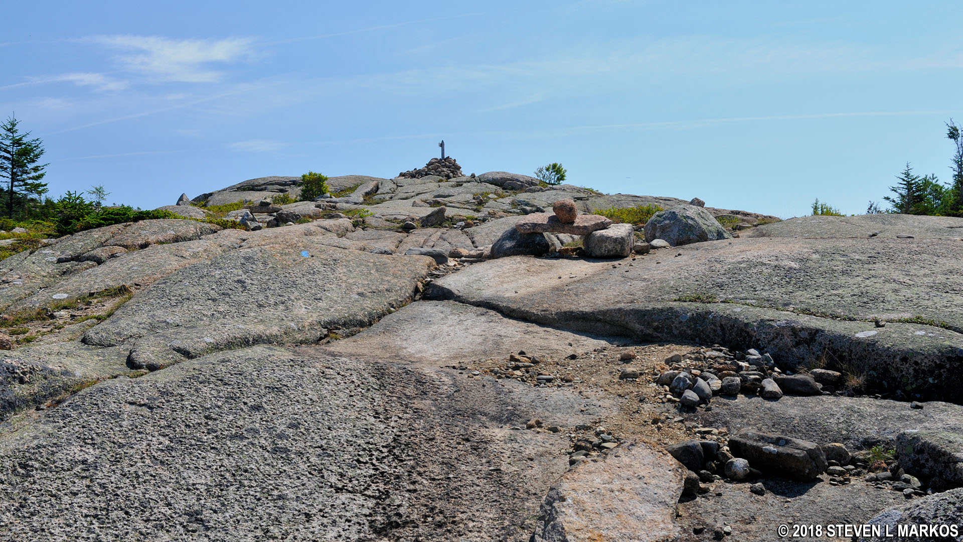
Summit of Acadia National Park’s Gilmore Peak

Sign marks the summit of Acadia National Park’s Gilmore Peak
Gilmore Peak is a little farther east than Parkman Mountain and Bald Peak, so you don’t get quite as good a view from the summit. Sargent Mountain to the east is much taller, thus blocking any views in that direction. You can see the north end of Somes Sound and the waters west of Mount Desert Island, and if you look to the south you can see Northeast Harbor. And of course you have a clear view of the Parkman Mountain summit.

View of Parkman Mountain from Gilmore Peak in Acadia National Park
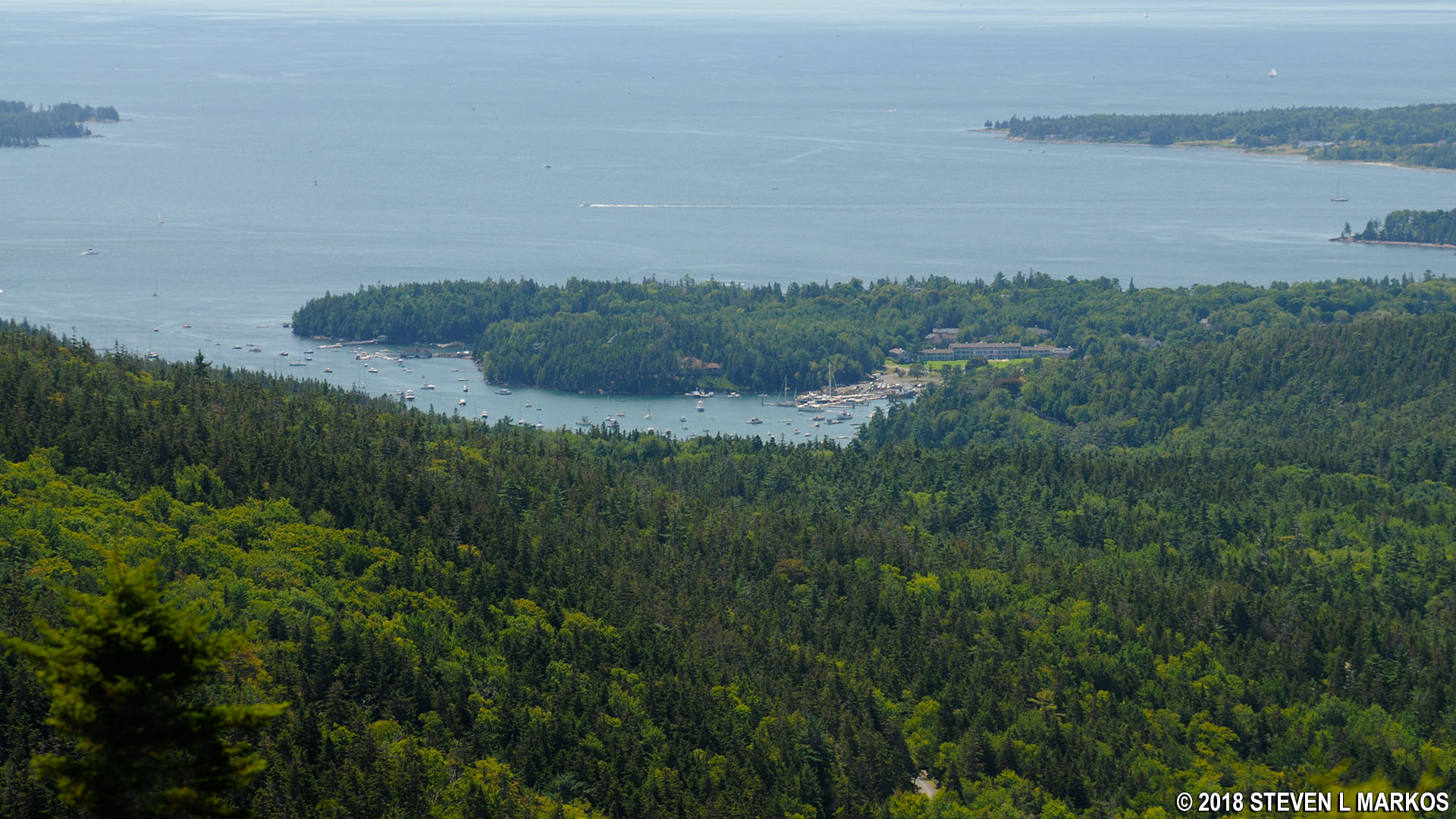
View to the south from Gilmore Peak of Northeast Harbor, Acadia National Park
The next destination is Sargent Mountain, .7 mile to the east. See the Gilmore Peak to Sargent Mountain Hike web page for details on this segment of the Six Mountain Summit Hike.
With a few exceptions, use of any photograph on the National Park Planner website requires a paid Royalty Free Editorial Use License or Commercial Use License. See the Photo Usage page for details.
Last updated on August 24, 2023


