

Hikers take a rest at the top of Acadia National Park’s Sargent Mountain
NOTE: The following trail review discusses the slope of the trail, which is called a grade. This is not the angle of the slope, but the calculation of rise (climb in elevation) divided by run (length of horizontal progress) expressed as a percentage ((rise/run) x 100). For example, using feet as the unit of measurement, a 10% grade means that a trail climbs 10 feet for every 100 feet in length. Positive grades are inclines and negative grades are declines; National Park Planner uses positive numbers in all cases, but gives a written indication of whether a slope is uphill or downhill. The grade given for an entire trail is an average, so mountainous trails may have sections with extremely steep grades as well as level areas. For reference:
- A wheelchair accessible trail has a grade of no more than +/-5%
- Most recreational trails are designed to be no more than +/-10%, with a steeper segment every now and then
- Most people agree that a +/-15% grade is where things begin to get really steep
- Stairs in a typical house and the steepest ski slopes have a grade of 60%
- A 45º angle is equal to a grade of 100%
- A stepladder has a grade of 260%
- A wall perpendicular to the ground (straight up) has a grade of infinity
To put Acadia National Park mountain trails into perspective, the average grade from the first Nepal base camp to the summit of Mount Everest is 17%, while the average grade from South Col (final camp) to the summit is 60%. Average grades of many trails in Acadia exceed Everest’s 17%, and short stretches go way beyond 60%. The difference, aside from ice and snow, is that the 60% grade of the South Col to Everest summit hike covers 3,100 vertical feet and lasts for a mile, whereas a 60% grade at Acadia may last a few hundred feet. The tallest mountain in Acadia is only 1,530 feet, so even if the grade was 60% from bottom to top, the hike would still only be half as long as the Everest summit hike.
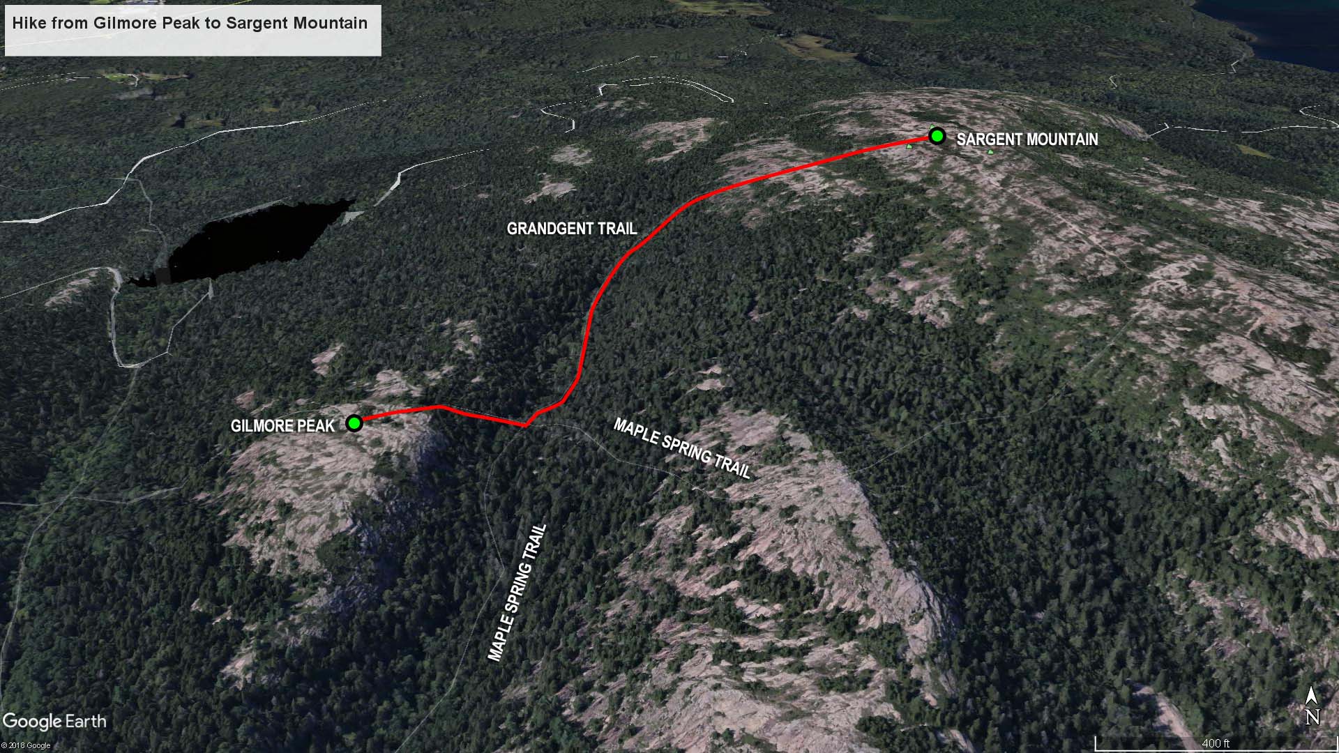
Gilmore Peak to Sargent Mountain trail map (click to enlarge)
I hiked to the top of Sargent Mountain as part of my hike to the summit of six mountains just west of Acadia National Park’s Jordan Pond on Mount Desert Island. This is the fourth leg of the journey, and it starts from the top of Gilmore Peak. See the Six Mountain Summit Hike web page to read about the first three segments of the hike.
Length: .7 mile
Time: 1 hour
Difficulty: Strenous
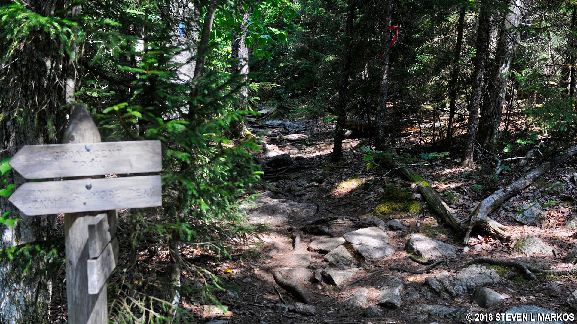
From the parking lot on Highway 3 just north of Upper Hadlock Pond, a hike to the summit of Gilmore Peak is 1.8 miles. The journey now continues on the Grandgent Trail to Sargent Mountain, the large, tree-covered mountain .7 mile to the east.
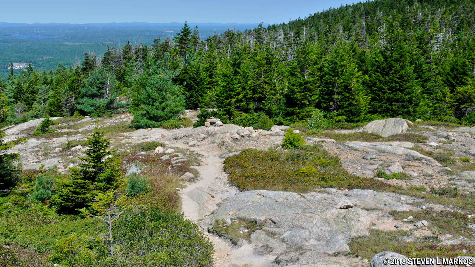
Start of the hike to Sargent Mountain from Gilmore Peak in Acadia National Park
Luckily, the valley between Gilmore Peak and Sargent Mountain is less than 100 feet below. The .2-mile hike down is fairly easy, as the slope averages only a 10% grade. However, the terrain is covered with rocks, so it is slow going. You must watch your every step to avoid twisting an ankle.
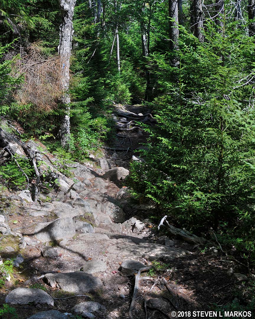
Rocky terrain on the hike down Gilmore Peak on the Grandgent Trail in Acadia National Park
Once in the valley, the trail crosses a small creek on an Indiana Jones Bridge just before the intersection with the Maple Spring Trail. I call the bridge an Indiana Jones Bridge because its single-log construction looks like a bridge that bad guys will attempt to dislodge while you make your escape across a deep chasm. Turn left at the intersection to remain on the Grandgent Trail.
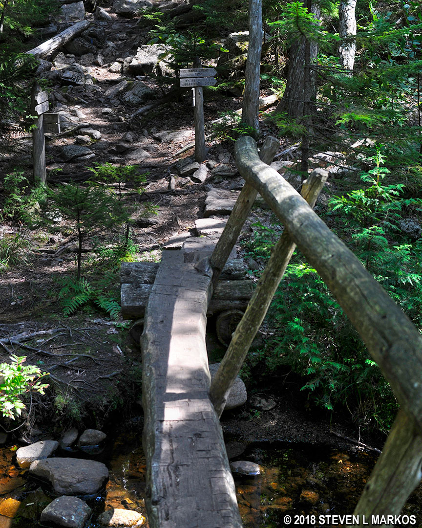
Intersection of the Grandgent and Maple Spring trails, Acadia National Park
The hike through the valley covers relatively level terrain for a tenth of a mile, but the surface is once again comprised of rocks and roots. I had my first fall on the hike when I stepped on a root and my foot slid across it like I stepped on a banana peel.
Typical terrain on the Grandgent Trail in the valley between Gilmore Peak and Sargent Mountain, Acadia National Park
While the average grade up the east side of Sargent Mountain is a very steep 20%, I barely noticed the uphill climb because the first tenth of a mile is like hiking through a rockslide, and my main concern was not twisting an ankle on the rough terrain. There is often no discernible trail, so be on the lookout for blue blazes painted on the trees. These mark the route like Hansel and Gretel breadcrumbs.
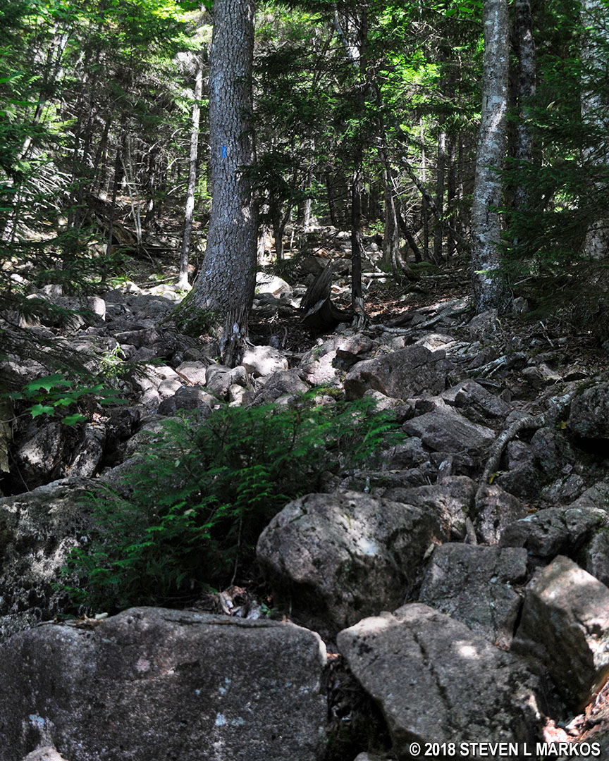
Beginning of the hike up Acadia National Park’s Sargent Mountain on the Grandgent Trail
After a tenth of a mile, the trail emerges from the forest and spills out into the open, and as usual, onto slabs of granite. Despite the grade, the trail never seems very steep. This may be because the climb is constant and lacks the short-but-really-steep stretches that are common to the mountain trails in Acadia National Park.
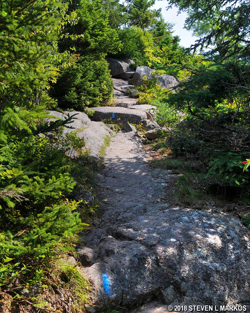
Typical climb up granite slabs on the Grandgent Trail in Acadia National Park
The last tenth of a mile to the summit has to be the easiest mountain section of the entire Six Mountain Summit Hike. You’ll know you reached this point when you start to get nice views of the surrounding area, including a large swath of the northern section of Somes Sound.

Panoramic view of Somes Sound from the slope of Sargent Mountain in Acadia National Park
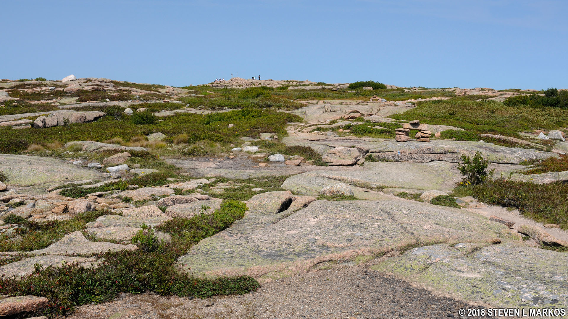
The top of Sargent Mountain is an enormous field of exposed granite. The views are not very good at the official summit, which is marked by a sign that states the elevation, so you must walk along the top to different locations. It’s a mini hike just to get from one end to the other. For example, from the summit to the south edge of the mountain top is a quarter-mile round trip, but you do get a nice view of the mouth of Somes Sound and the Atlantic Ocean beyond.

Sign marks the summit of Acadia National Park’s Sargent Mountain
View from the southern end of the top of Sargent Mountain, Acadia National Park

View towards the mouth of Somes Sound and the Atlantic Ocean from the top of Acadia National Park’s Sargent Mountain
While the views to the west are similar to the ones from Bald Peak, Parkman Mountain, and Gilmore Peak, up until reaching the top of Sargent Mountain there were no views to the east. Now you can see Eagle Lake, a body of water that will be part of the terrain for the next few miles of the hike.

View of Eagle Lake from the top of Acadia National Park’s Sargent Mountain
The next destination is Penoboscot Mountain. See the Sargent Mountain to Penobscot Mountain Hike web page for details on this segment of the Six Mountain Summit Hike.
With a few exceptions, use of any photograph on the National Park Planner website requires a paid Royalty Free Editorial Use License or Commercial Use License. See the Photo Usage page for details.
Last updated on August 17, 2023


