

Second Manassas Trail map (click to enlarge)
Note: The trails at Manassas National Battlefield Park are poorly marked, so be sure to bring a trail map with you for navigation purposes. The best is the Trail Guide, a tri-fold map that is free at the Henry Hill Visitor Center. For planning purposes, you can download it here, but be sure to pick up a full-color version before you begin your hike.
Manassas Trail Map (PDF)
Length: 6.25-mile loop
Time: 4 hours
Difficulty: Mostly easy with a few moderate hills
The Second Manassas Trail covers the grounds of Manassas National Battlefield Park west of Sudley Road to Groveton Road. Unfortunately, it adds very little to the understanding of the battle and is much better suited as an exercise trail. It doesn’t go anywhere near Brawner Farm where the fighting started or the Sudley Church Area. It covers none of the Unfinished Railroad Loop Trail and overlaps only with the least interesting section of the Deep Cut Loop Trail. The only trail that it extensively overlaps with is the Chinn Ridge Loop Trail, and that is the only trail in the park that is void of historical interest. If history is what you are after, you are much better off hiking the individual loop trails at the various Second Manassas Battlefield Tour stops (Unfinished Railroad Loop Trail, Deep Cut Loop Trail, Brawner Farm Loop Trail, Sudley Loop Trail, and Chinn Ridge Loop Trail).
When hiking the First Manassas Trail it is possible to cover points of interest in chronological order by hiking counterclockwise from the Henry Hill Visitor Center. There’s no such luck here on the Second Manassas Trail, though the closest thing you are going to get to a chronological hike in time is by starting at the Matthews Hill parking lot and hiking counterclockwise. This would cover the fighting on the second and third day of the battle in about as close to chronological order as you can get.
About two-thirds of the Second Manassas Trail is out in the open, so if avoiding the sun is important to you, be sure to wear a hat and apply sunscreen. Also, much of the trail follows a mowed grass path, a favorite habitat for ticks. I picked up two right off the bat. I suggest wearing long pants treated with Permethrin when hiking anywhere in Manassas National Battlefield Park.
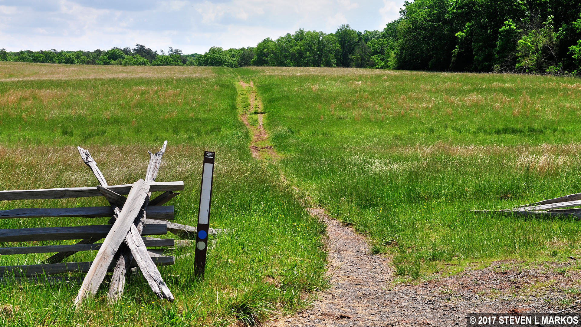
To start the hike in the counterclockwise direction from the Matthews Hill parking lot (Stop #4 on the battlefield tour) you must walk back to the entrance and cross Sudley Road. While not visible from the parking lot, there is a dirt path hidden a little ways down the embankment on the other side of the road. Once at the trail, take a right to start hiking north. This segment of the trail is also part of the bridle (horse) trail, so watch your step.
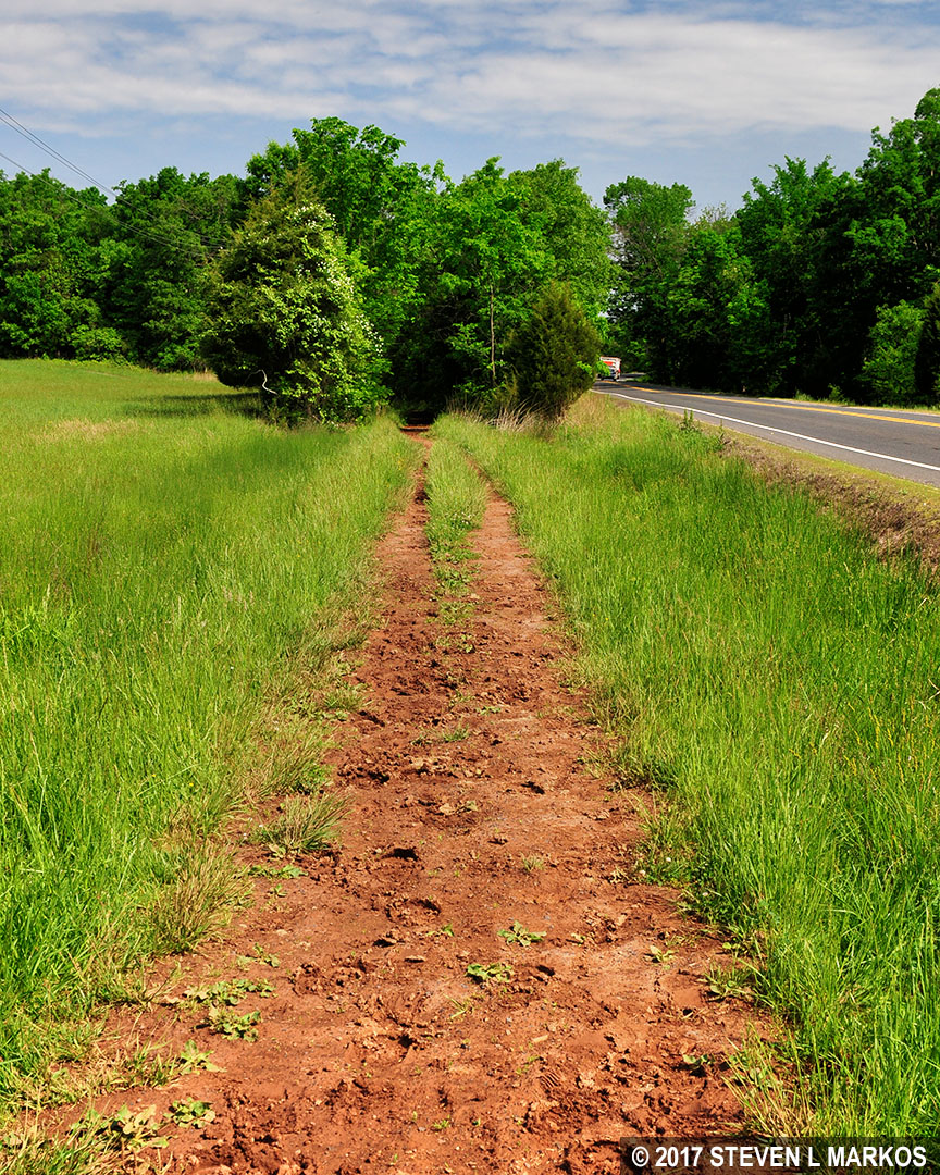
Start of the Second Manassas Trail from the Matthews Hill parking lot, Manassas National Battlefield Park
The hike’s first destination is the parking lot for Stop #6 on the battlefield tour, the Unfinished Railroad. There is absolutely nothing of interest along the way as far as history goes, other than the fact that Matthews Hill is from where attacks were launched on August 29th and again on the 30th against Confederate troops positioned along the Unfinished Railroad. Matthews Hill was far enough from the actual fighting to be used as a staging point for Union forces.
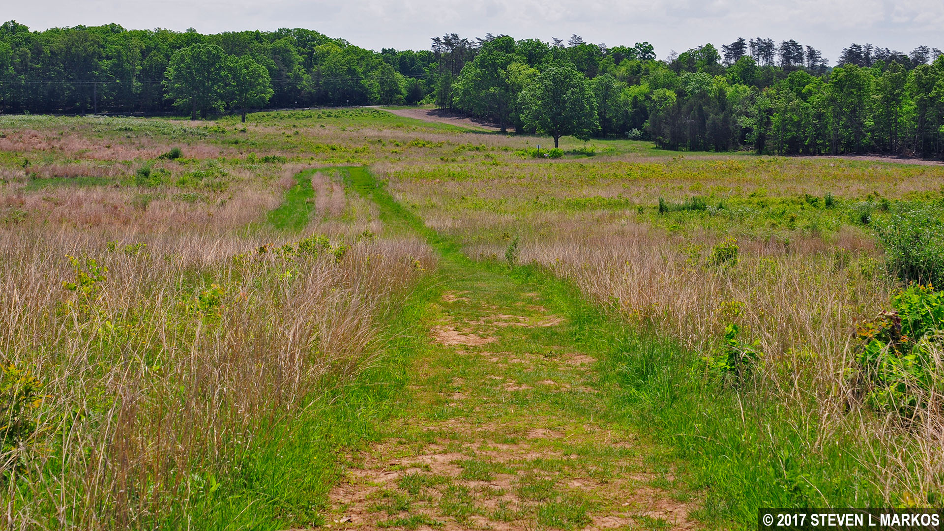
For the next .75 mile the trail follows right along the tree line or slightly in the forest with an open field on the left. It is here that I picked up two ticks. The trail is often very narrow, and you are bound to brush up against the grass where the ticks like to hide.
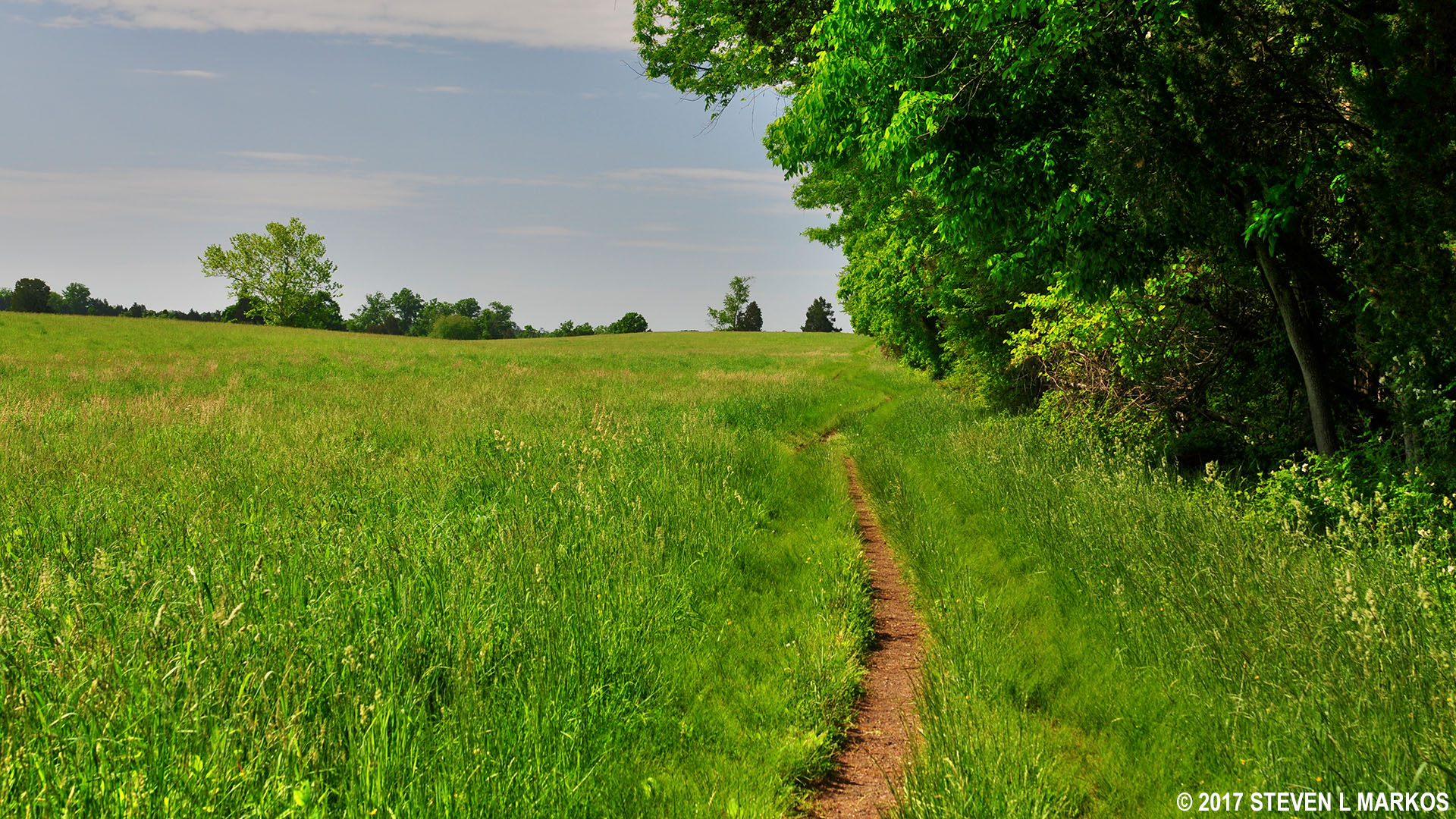
Like most trails in Manassas National Battlefield Park, the Second Manassas Trail often runs though tick infested grass
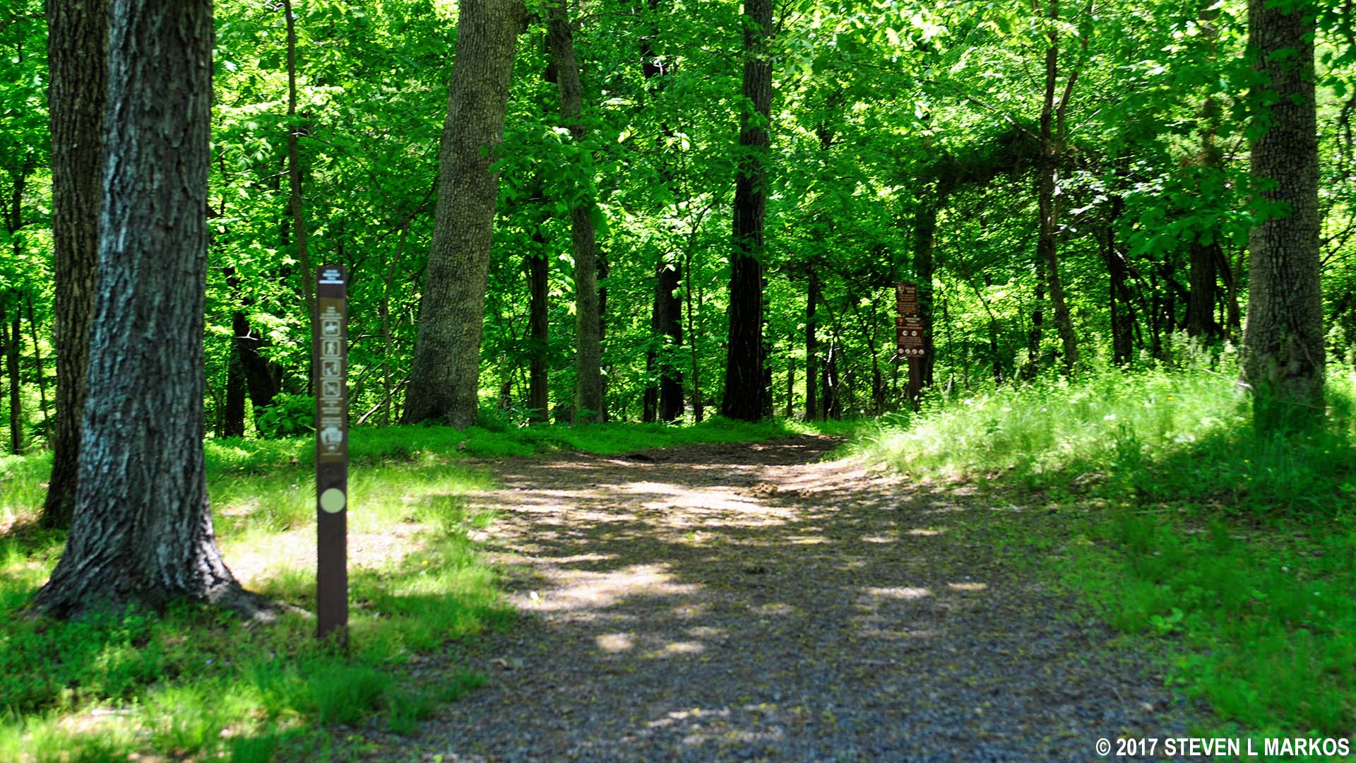
The trail enters the thick of the forest a mile into the hike. Up until this point the hiking and bridle trails have been merged, but they now separate. Stay right to remain on the Second Manassas Trail.
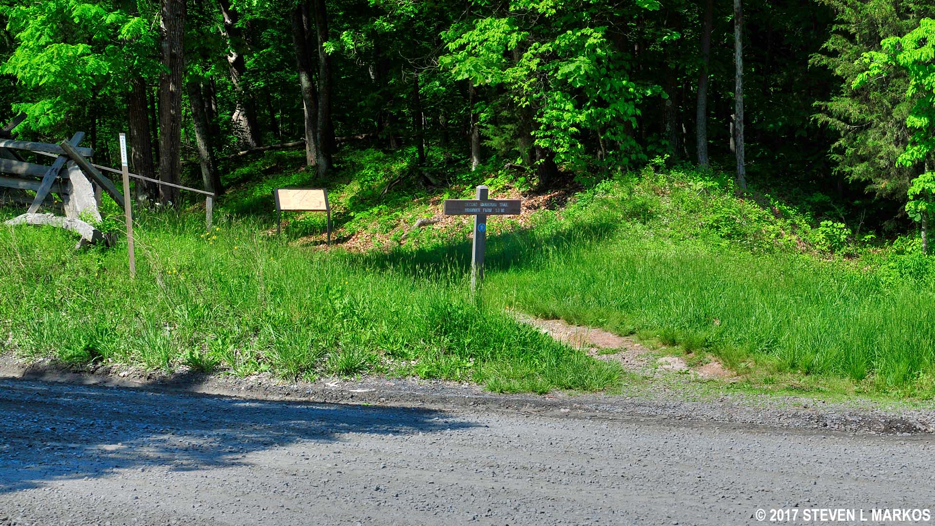
In a quarter mile after entering the forest is the parking lot for the Unfinished Railroad. The Unfinished Railroad Loop Trail is to the right of the parking lot (you entered from the backside). If you have enough energy, I highly suggest hiking this easy, 1.25-mile trail.

Trailhead for the Unfinished Railroad Loop Trail in Manassas National Battlefield Park
The section of the Unfinished Railroad that was used in the Second Battle of Manassas stretches from Bull Run near Sudley Church to the Brawner Farm. To keep the tracks out of the water in case of flooding, the railroad was built on an elevated platform created by digging ditches on either side of the route and piling the dirt in the middle. This artificial hill provided the Confederate army with an excellent place to hide behind. Soldiers could spend days digging a trench and building a similar wall—here was one already completed. It would not only slow down attacking Union soldiers, but they would also have to scale the hill before charging down the other side, which left them exposed to musket and cannon fire. If you hike the Unfinished Railroad Loop Trail, you can actually see this rail bed, which remained unfinished—no tracks—because the Manassas Gap Railroad ran out of money before completing the project, an Alexandria to Gainesville rail line.
Walking along the top of the elevated railroad bed on the Unfinished Railroad Loop Trail in Manassas National Battlefield Park
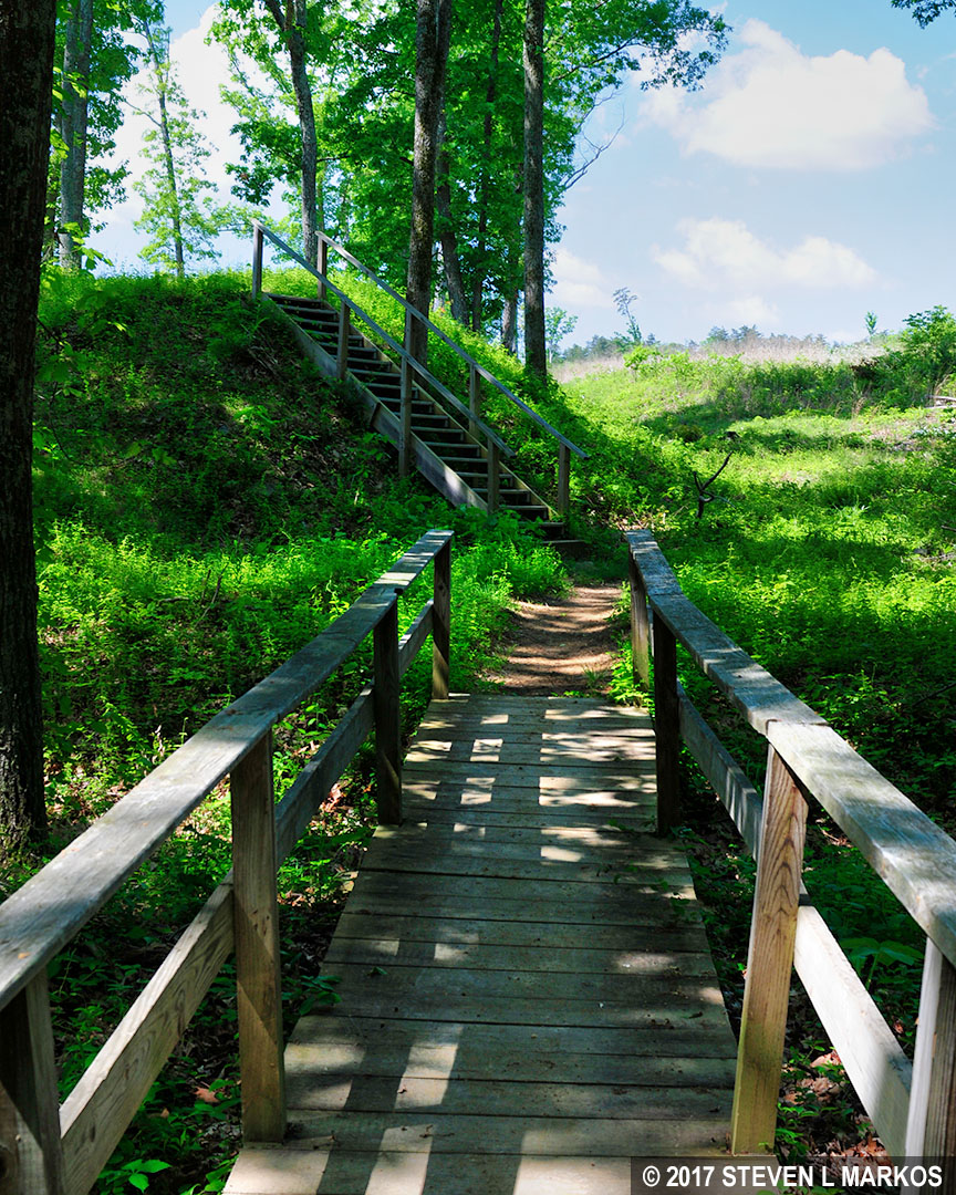
To continue the Second Manassas Trail, walk out of the parking lot to the main road, the gravel Featherbed Lane. The trail continues on the other side, slightly to the left, around the 10 o’clock position. There is a wayside exhibit and a set of stairs. Take the stairs to continue the hike.
The Second Manassas Trail continues across the street from the Unfinished Railroad parking lot, Manassas National Battlefield Park
As you walk towards the parking lot for the Deep Cut, Stop #7 on the battlefield tour, you will begin to see two common features of the trails at Manassas National Battlefield Park. One is what I call “quote panels.” These are wayside exhibits that contain eyewitness accounts of the battle by Confederate and Union soldiers. Union quotes are found along Union battle lines and Confederate quotes along Confederate battle lines. The two types are also distinguished by color: Union panels have a blue stripe and Confederate panels have a red stripe.
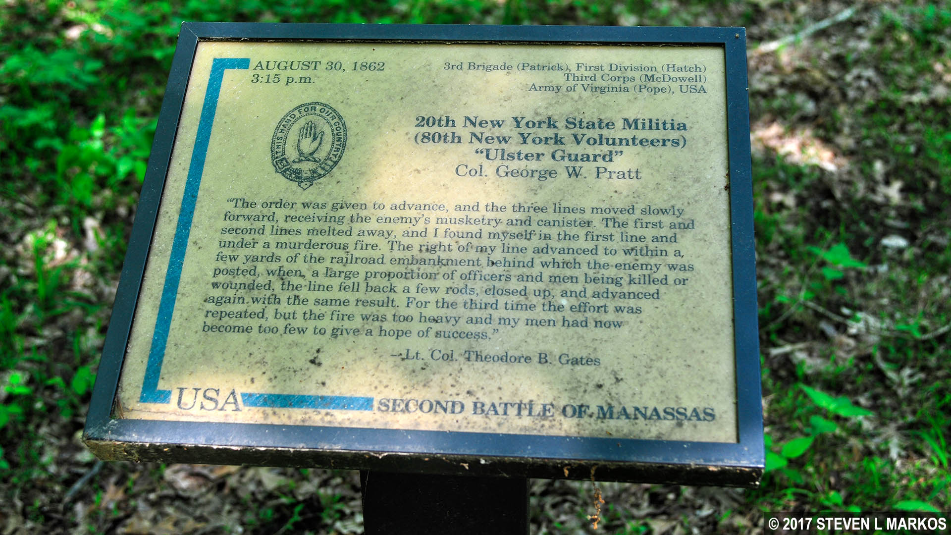
Union quote panel along a trail in Manassas National Battlefield Park
There is also a Witness Tree along the trail. When the Civil War took place, nearly all of this land was farm land and free of trees. Witness trees are those known to have actually been standing in 1862. Most of the other trees have grown up since the National Park Service took over the property between the late 1930s and the 1950s.
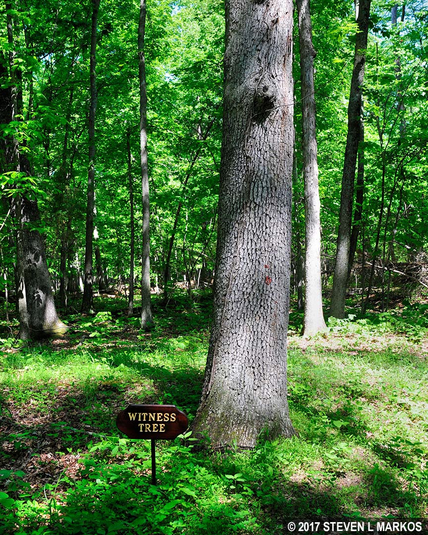
Witness Tree along the Second Manassas Trail in Manassas National Battlefield Park
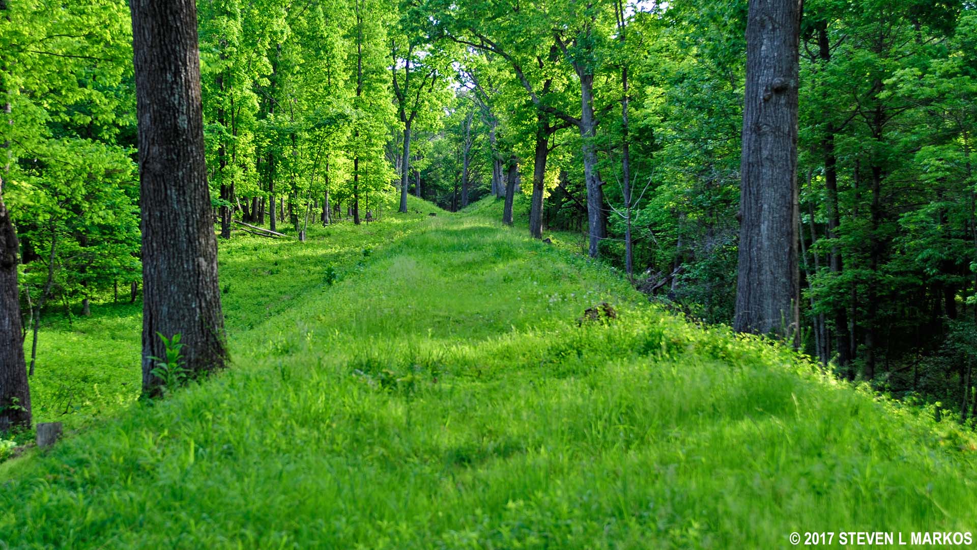
Just before the Second Manassas Trail exits the forest is a set of stairs that leads up to a section of the elevated railroad bed, so if you didn’t hike the Unfinished Railroad Loop Trail, you can now get a visual idea of what exactly is an unfinished railroad.
Stairs on the Second Manassas Trail lead up to the elevated bed of the Unfinished Railroad, Manassas National Battlefield Park
Elevated railroad bed of the Unfinished Railroad in Manassas National Battlefield Park
The next point of interest on the Second Manassas Trail is at the northeast corner of the Deep Cut Loop Trail, the Second Manassas Monument (aka Second Bull Run Monument, aka Groveton Monument). This monument is very similar to the First Manassas Monument at the Henry House near the Henry Hill Visitor Center. The monument was dedicated on June 10, 1865, three days before the monument at Henry Hill, making it one of the earliest Civil War memorials in existence. It is interesting to note that the inscription reads, “In Memory of the Patriots who fell at Groveton.” Not Manassas. Groveton.

Second Manassas Monument, Manassas National Battlefield Park
From the monument, the next destination on the Second Manassas Trail is the Dogan House at the corner of Groveton Road and Highway 29. To get there, head down the fairly steep hill that lies in front of the monument.
Mowed path south of the Second Manassas Monument, Manassas National Battlefield Park
At the bottom of the hill are two intersections, one marked by a wooden post with a sign on it and one marked by a footbridge over a small stream. The sign is where sharpshooters from the Wisconsin Company 1st Regiment of Berdans were pinned down by Confederate fire. The sharpshooters arrived on the scene long before the rest of the army and shot it out with Confederate skirmishers—light infantry or cavalry soldiers positioned out in front of the main battle line—before becoming trapped. After the war, one of the sharpshooters came back to the battlefield and marked this position. The sign standing today is not the original, but it is in the same spot.

Wisconsin Company Sharpshooter sign on the Second Manassas battlefield, Manassas National Battlefield Park
To continue on the Second Manassas Trail, ignore both intersections and stay straight on the gravel path until you come to Featherbed Lane, which is paved at this point. On the other side of the road is a dirt path that follows a rail fence south (right turn) for a half mile to Highway 29.
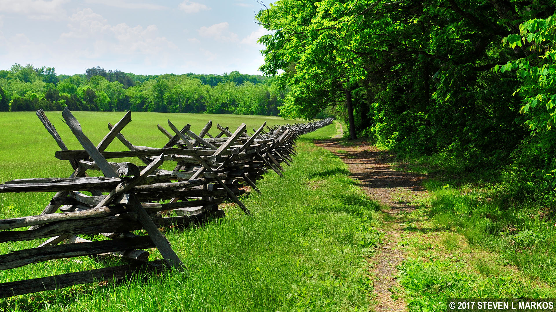
The Second Manassas Trail follows a dirt path between Featherbed Lane and Highway 29, Manassas National Battlefield Park
The Lucinda Dogan House is one of three original structures from the Civil War era within Manassas National Battlefield Park, and the only one left standing in Groveton. The house is not open, but you can look in the window. (The other original structures are the Thornberry House near Sudley Church and the Stone House.)
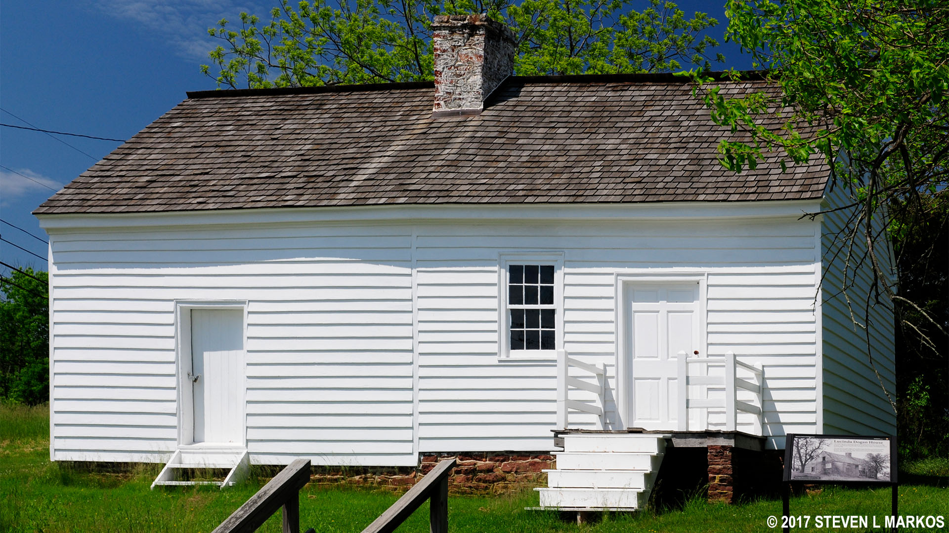
The Dogan House is one of the few Civil War-era structures still standing in Manassas National Battlefield Park
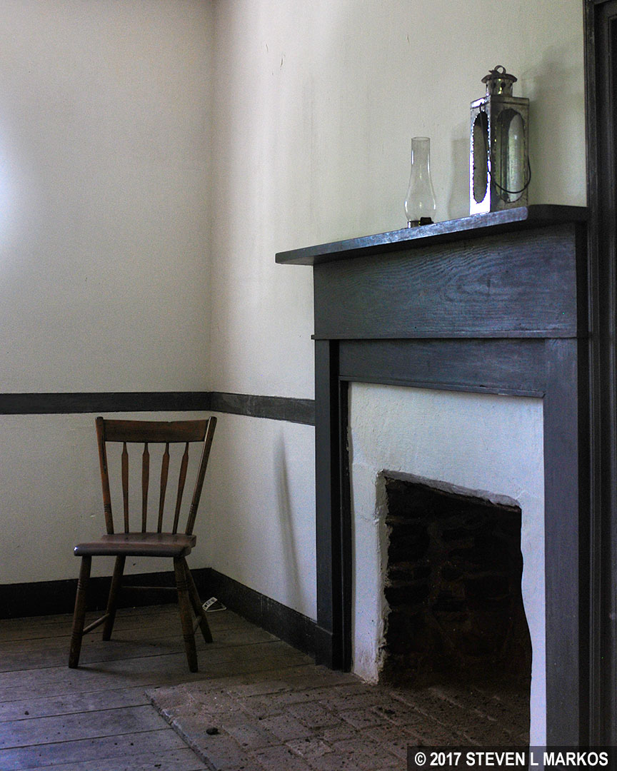
A peak inside the Dogan House, one of the few Civil War-era structures still standing in Manassas National Battlefield Park
The next point of interest is the New York Monuments, Stop #9 on the battlefield tour. To get there, cross Highway 29 and continue down Groveton Road (the road changes names on the other side of Hwy 29) for 50 yards until you come to a gap in the rail fence and a mowed path through the grass. This leads to two of the three monuments at the tour stop.
Section of the Second Manassas Trail from the Dogan House to the New York Monuments tour stop, Manassas National Battlefield Park
The driveway from Highway 29 through the New York Monuments tour stop is quite long. The Second Manassas Trail meets it at the end where monuments to the 5th Regiment New York Volunteers (the famed Zouaves) and the 10th Regiment New York Volunteers are located. Both regiments took heavy losses when 30,000 Confederate troops steamrolled through the area on their way to Henry Hill during the last day of fighting.
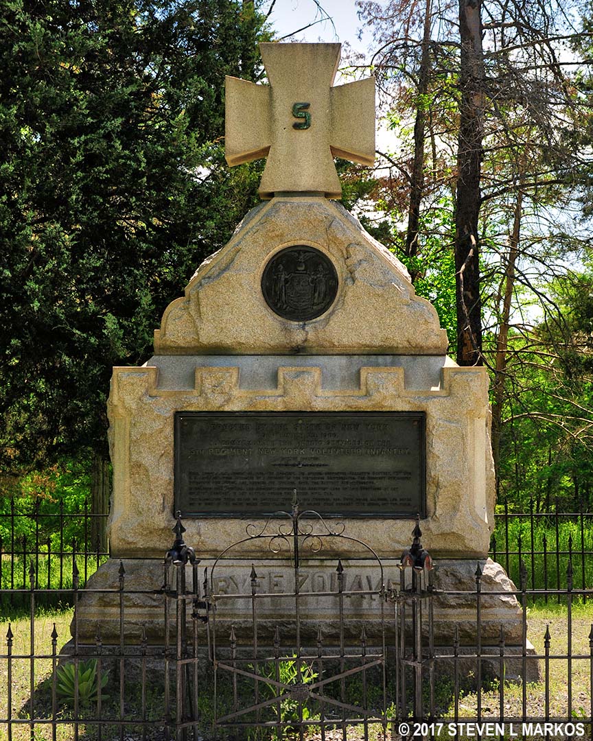
5th Regiment New York Volunteers Monument at Manassas National Battlefield Park
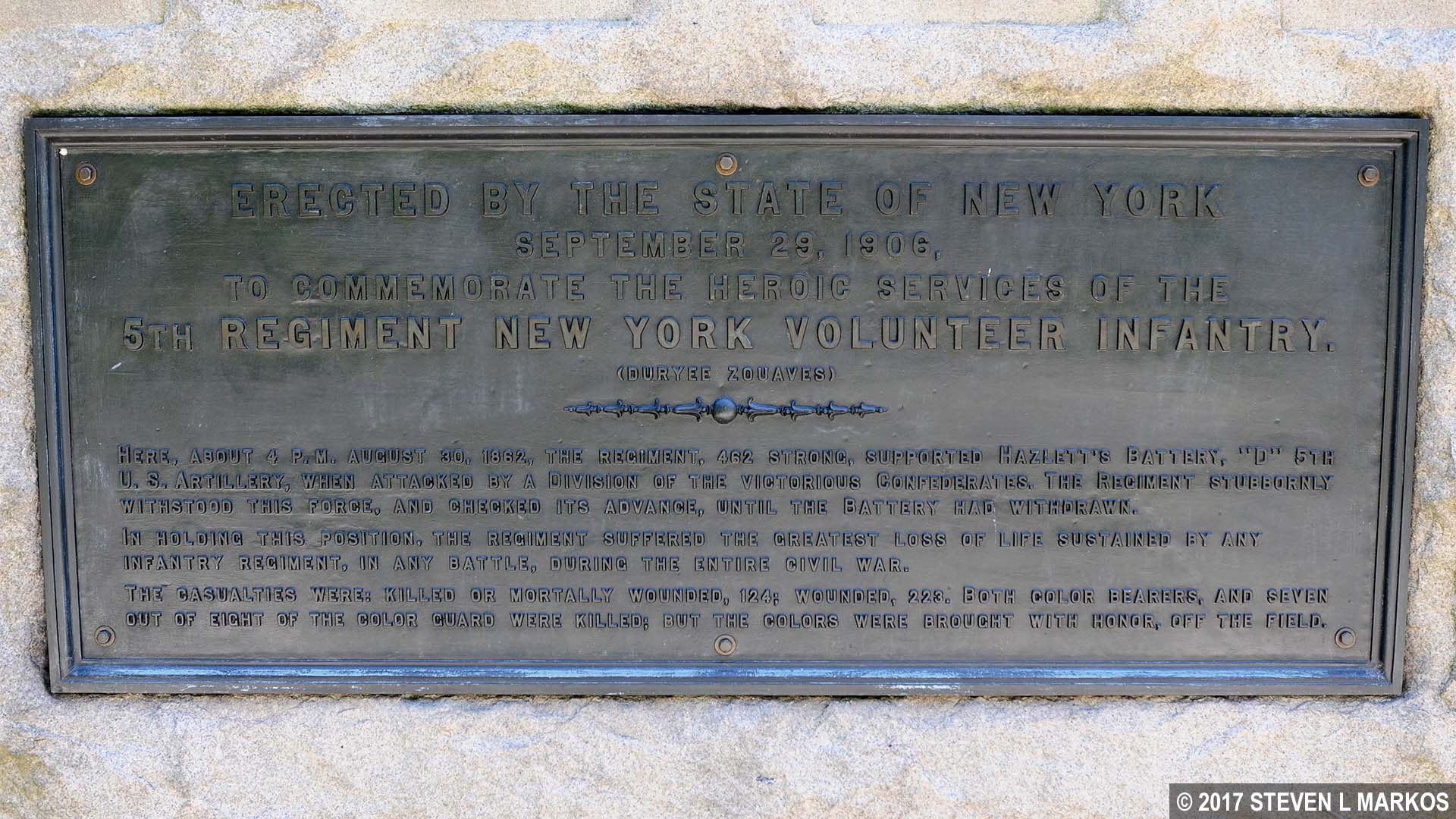
Memorial plaque on the 5th Regiment New York Volunteers Monument at Manassas National Battlefield Park
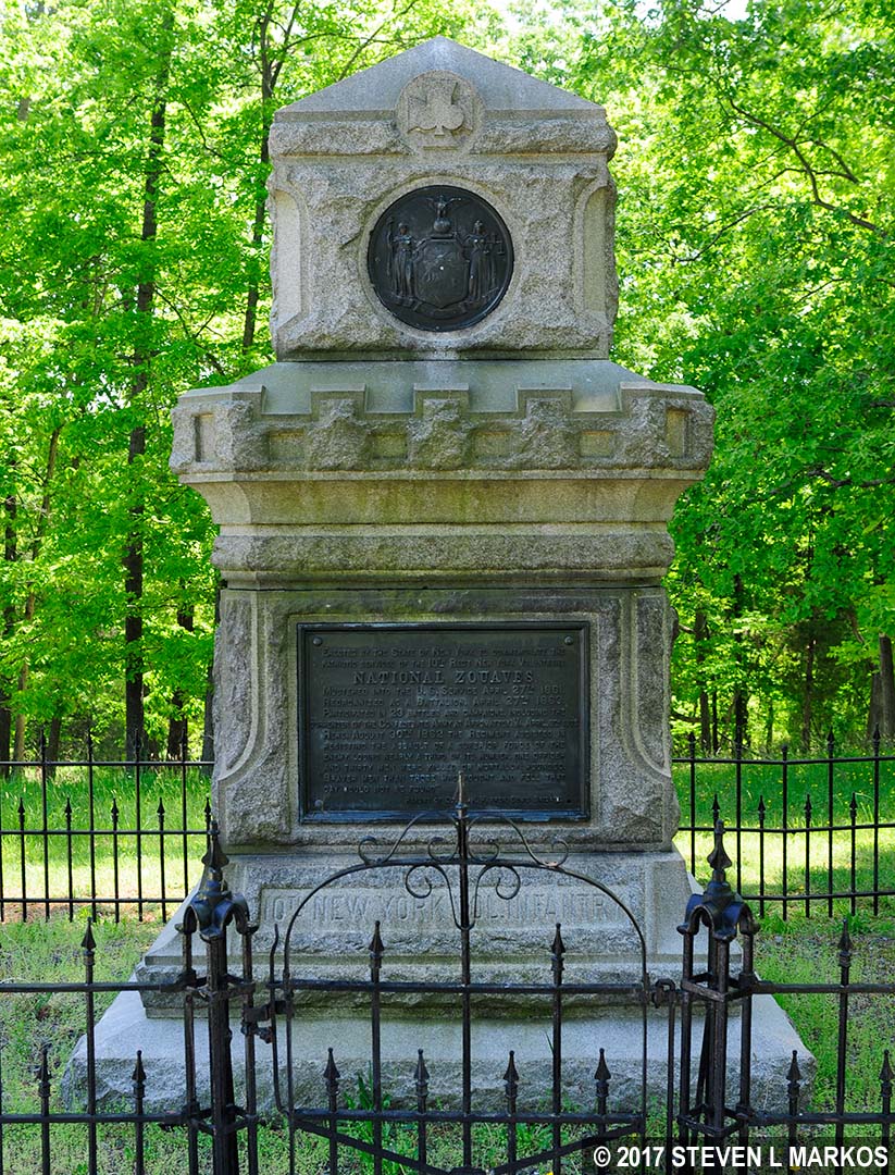
10th Regiment New York Volunteers Monument at Manassas National Battlefield Park
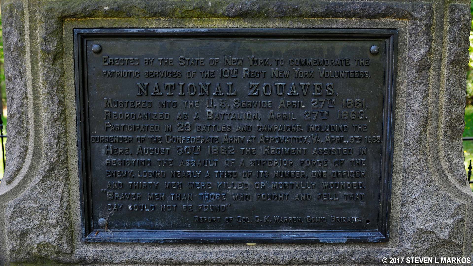
Memorial plague on the 10th Regiment New York Volunteers Monument at Manassas National Battlefield Park
The other monument is located a quarter mile up the road near Highway 29. You can see it later by car. The half-mile round-trip walk isn’t worth the effort while hiking the Second Manassas Trail.
The next destination is Chinn Ridge, one of the last places where fighting took place on August 30, 1862. It is across this ridge that General James Longstreet’s 30,000-man army marched on its way to Henry Hill, destroying everything in its path, including the aforementioned 5th and 10th New York Regiments. If you ventured off the trail to see the monuments, return to the end of the tour road and follow the signs into the woods towards Chinn Ridge. At this point the hiking and bridle trails are merged once again.
Second Manassas Trail is open to both hikers and horseback riders from the New York Monuments to Chinn Ridge, Manassas National Battlefield Tour
It is about a quarter mile to the intersection with the Chinn Ridge Loop Trail. Cross a footbridge over Youngs Branch and take a right. It is here that the two trails merge, and you are now hiking around the Chinn Ridge Loop Trail in the counterclockwise direction. If you continued straight once crossing the bridge, you would also be on the Chinn Ridge Loop Trail but hiking in the clockwise direction.

Youngs Branch near Chinn Ridge, Manassas National Battlefield Park
Youngs Branch is located at the bottom of the valley, and from here the trail begins its ascent to Chinn Ridge. However, the incline is only moderate for a few minutes before it becomes gradual and barely noticeable.
Since crossing Youngs Branch, the bridle trail has been merged with the hiking trail, so watch your step. The bridle trail does break away on its own at an intersection at the southwest corner of the trail. Take a left to get to the Chinn Ridge parking lot, following the sign to CHINN RIDGE / VISITOR CENTER. The horse trail keeps straight. As you hike towards the parking lot you are following in the footsteps of Confederate soldiers who would ultimately engage and overrun Union troops on the ridge.

The Second Manassas Trail follows the Chinn Ridge Loop Trail back to the parking lot, Manassas National Battlefield Park
There are wayside exhibits about Chinn Ridge at the parking lot, and you can take a short walk to the foundation of Hazel Plain, a house owned by Benjamin Chinn at the time of the Civil War. Chinn purchased the property and house in 1853 from a descendant of the Hooe Family. The property came into the Hooe Family by way of marriage: Howson Hooe married Ann Francis Harris in 1724, and her father had purchased the property in 1717. Whether the couple inherited or was given the property is not clear, but they eventually deeded it to Barnard Hooe, and he built a house in 1809. When his daughter inherited the property she named the house Hazel Plain. The house stood until being torn down in 1950.

Foundation of Hazel Plain at Chinn Ridge, Manassas National Battlefield Park
The Hooe Family Cemetery is also a short walk from the parking area. There is one tombstone for Bernard Hooe and a few fieldstones that mark forgotten graves.

Path to the Hooe Cemetery at Chinn Ridge, Manassas National Battlefield Park

Grave of Bernard Hooe, a veteran of the American Revolution, in the Hooe Cemetery at Chinn Ridge, Manassas National Battlefield Park
To continue the Second Manassas Trail, look for the paved path on the opposite side of the parking lot from where you arrived. This path runs along the actual Chinn Ridge.
The Second Manassas Trail follows the paved path along Chinn Ridge, Manassas National Battlefield Park
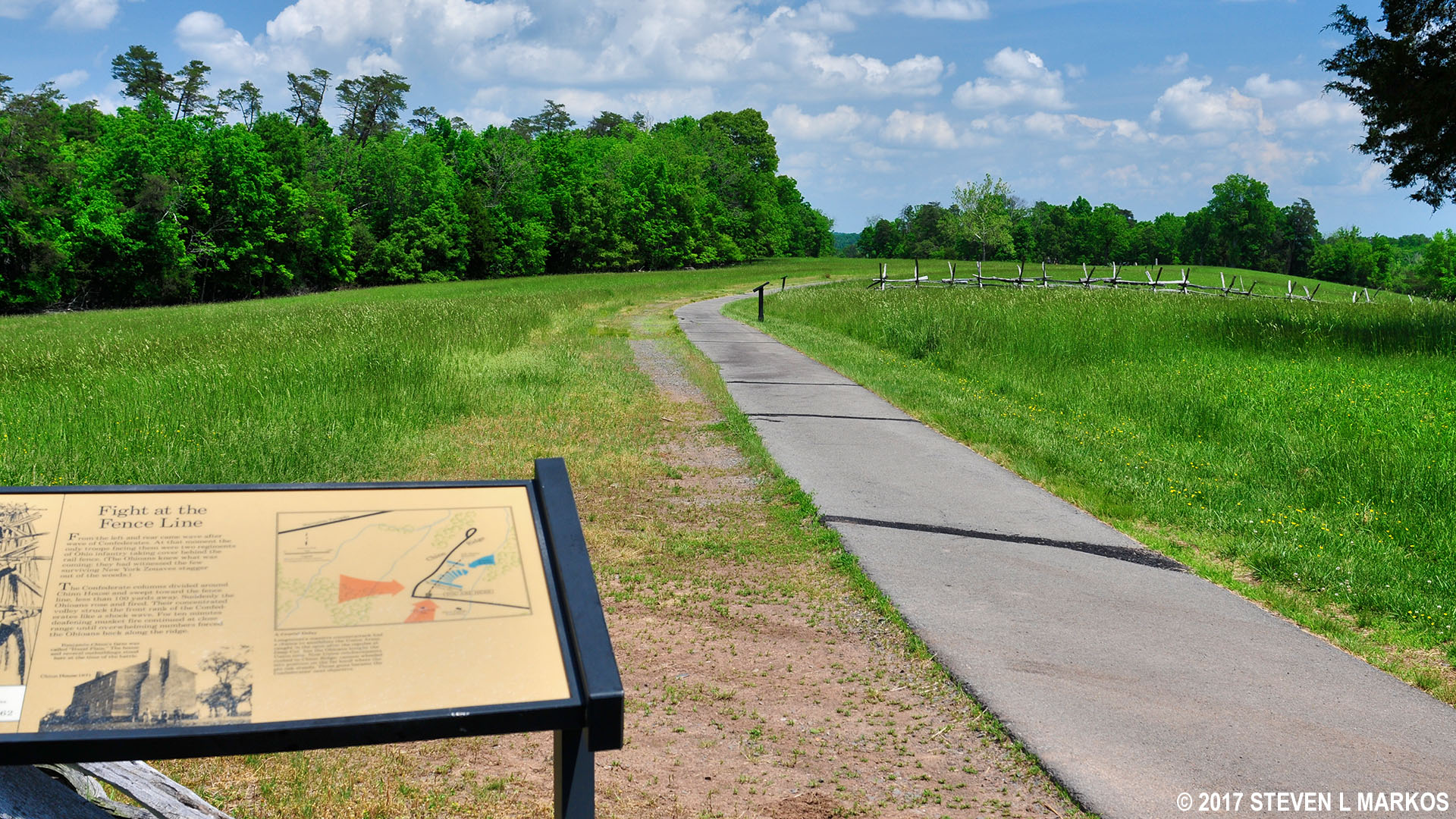
There are plenty of quote panels and even an artillery exhibit that marks the spot where the 5th Maine Battery set up four cannons to hold off the oncoming Confederate army. By this point the battle was lost, and the new Union objective was to slow the Confederate assault until darkness could bring an end to the fighting for the day. If Union troops could hold Henry Hill, they could retreat back to Washington in the dark. Because of valiant stands by the men of the 5th Maine and other units on or near Chinn Ridge, by nightfall Henry Hill was still in Union possession.

Civil War-era cannon mark the position of the 5th Main Battery on Chinn Ridge, Manassas National Battlefield Park

Chinn Ridge battle map
About halfway down the path are two monuments. One is a memorial to Fletcher Webster, the son of Daniel Webster, a famed Senator from Massachusetts and two time Secretary of State under presidents William Harrison / John Tyler (Harrison died a month into his term) and Millard Filmore. Fletcher was a colonel in the Union army. He died during the fighting on Chinn Ridge.
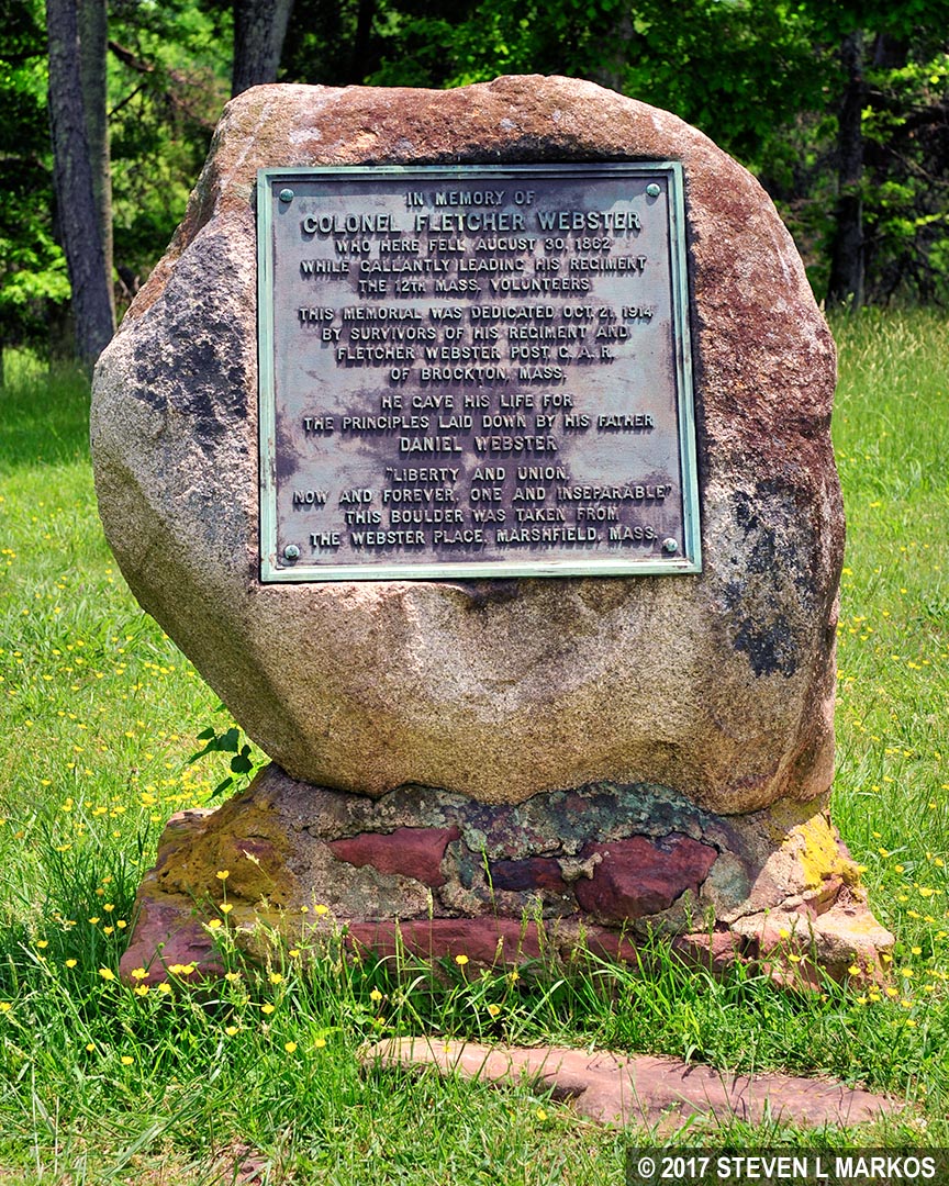
Fletcher Webster Memorial at Chinn Ridge, Manassas National Battlefield Park
The second monument is a memorial to the troops from Texas who fought in the Second Battle of Manassas. You will see this same Texas monument at various national battlefields, and all were erected in modern times, this one in 2012. Specifically mentioned on the monument is the Texas Brigade, a Confederate brigade under the command of John Bell Hood.

Texas Memorial at Chinn Ridge dedicated in 2012, Manassas National Battlefield Park
The Second Manassas Trail continues behind the Webster monument, though the paved path along Chinn Ridge continues for another quarter mile. However, all there is to see at the end is a wayside exhibit about the Union retreat, so the half-mile round trip does not warrant the effort.

End of the paved trail along Chinn Ridge, Manassas National Battlefield Park
To continue the hike on the Second Manassas Trail, turn at the Webster Memorial and hike downhill until the trail dead ends into a road that runs between the Visitor Center and the Chinn Ridge parking lot. It is a half mile back to the Visitor Center along this road, and this is one of the steeper parts of the hike.

Final leg of the Second Manassas Trail is along a paved road to the Henry Hill Visitor Center in Manassas National Battlefield Park
My review of the Second Manassas Trail ends here, though hikers still have a lengthy walk back to the Matthews Hill parking lot. Walk to the front of the Visitor Center and simply hike north. You will pass the Henry House, hike down Henry Hill to the Stone House at Highway 29, and then up Matthews Hill. It is a straight shot, approximately 1.3 miles. Everything along the way pertains to the First Battle of Manassas, so if you want to read about what you will see on the hike back, check out the review of the First Manassas Trail here on National Park Planner.
Note: The new trail map (see below as compared to the map at the top of this page) has hikers continue all the way to the end of the paved path on Chinn Ridge, take a dirt trail that leads to Sudley Road (Highway 234), and then take a right and walk back to the Visitor Center along Sudley Road. However, this is not a wise idea because there is a lot more traffic on Sudley Road than the side road accessed by taking the trail behind the Webster memorial. I recommend sticking to the old route.

Manassas National Battlefield Park trail map (click to enlarge)
With a few exceptions, use of any photograph on the National Park Planner website requires a paid Royalty Free Editorial Use License or Commercial Use License. See the Photo Usage page for details.
Last updated on June 17, 2025


