
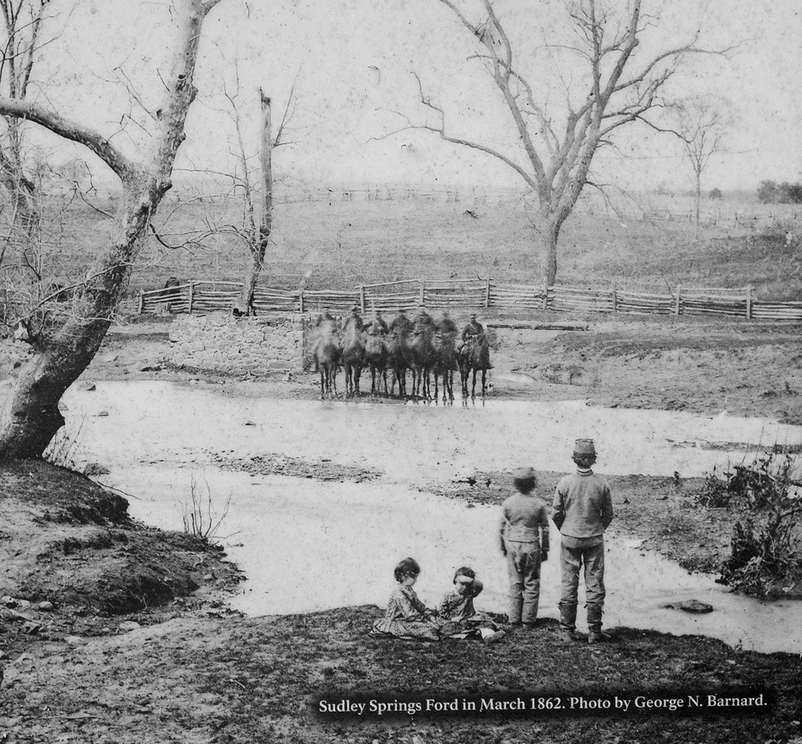
Sudley Springs Ford as it appeared in 1862
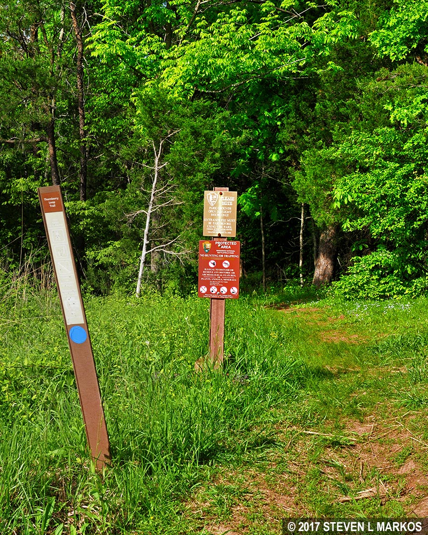
Note: The trails at Manassas National Battlefield Park are poorly marked, so be sure to bring a trail map with you for navigational purposes. The best is the Trail Guide, a tri-fold map that is free at the Henry Hill Visitor Center. For planning purposes, you can download it here, but be sure to pick up a full-color version before you begin your hike.
Manassas Trail Map (PDF)
Length: .7-mile loop
Time: 45 minutes
Difficulty: Mostly easy, but there are two moderate hills
The area surrounding the Sudley Methodist Church figured prominently in both the First and Second Battles of Manassas, though the Sudley Loop Trail focuses mainly on the first battle. It is near the church that the Union army crossed Bull Run and Catharpin Creek on July 21, 1861, in an attempt to circle around Confederate forces stationed near the Stone Bridge so they could attack from the rear. In the second battle, the Confederate line extended to Bull Run, and it is here that Union forces launched an unsuccessful attack on its left flank.
The parking area for the Sudley Loop Trail is at Stop #5 on the Second Manassas Battlefield Tour. This is a small parking lot located prior to the church and cemetery if you are coming from Highway 29. The trailhead for the Sudley Loop Trail is directly across the street.
Trailhead for the Sudley Loop Trail in Manassas National Battlefield Park
The hike starts out on a short connector trail that reaches the loop in less than a tenth of a mile. A sign suggests hiking the loop in the counterclockwise direction, putting you on a direct path to Bull Run. This is what I did, and this report is written from that perspective.

Start of the loop portion of the Sudley Springs Trail in Manassas National Battlefield Park
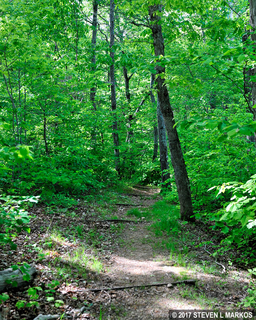
The hike towards the creek starts out on the elevated portion of what has become known as the Unfinished Railroad. To create a railroad bed that would keep the tracks out of the water in case of flooding, ditches were dug on either side of the proposed route and the dirt was piled in the middle to create an elevated platform. In this case, no tracks were ever laid, thus the name Unfinished Railroad. In the Second Battle of Manassas, Confederate General Thomas “Stonewall” Jackson used the elevated rail bed as a defense. His men were positioned in the gully closest to Sudley Road, and the Union approached from the other side. To attack, Union soldiers had to climb the slope and expose themselves to gunfire before charging into the Confederate line. On top of that, the barrier made it next to impossible to bring cannon and other heavy equipment with them.

Typical terrain along a segment of the Sudley Loop Trail that follows an unfinished railroad bed, Manassas National Battlefield Park
Before coming to Bull Run, there is a pile of rubble that was once the home of Amos and Margaret Benson. There is a wayside exhibit at the site, but it makes no mention as to the house’s demise—war or nature.
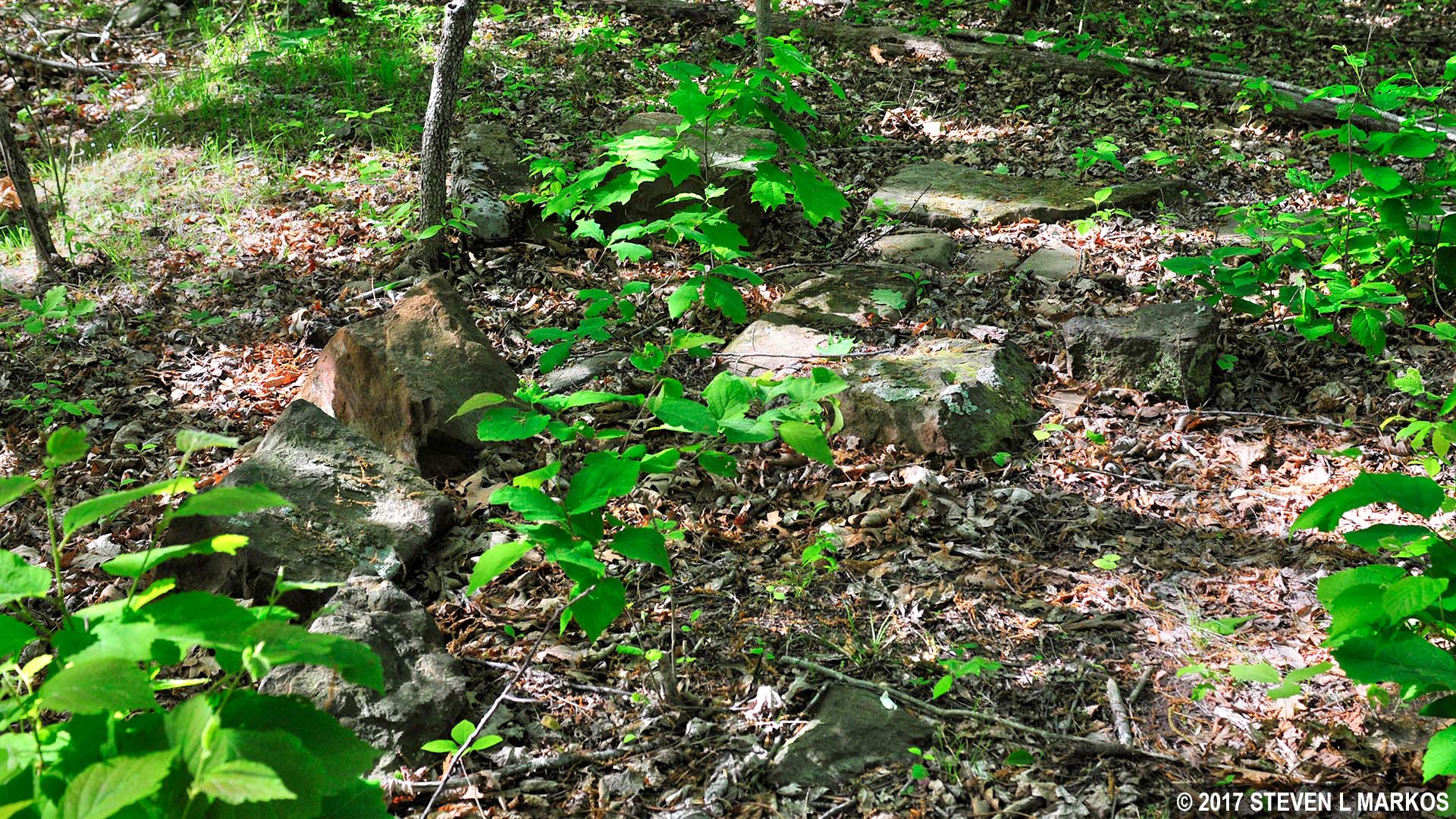
Pieces of the Benson House foundation along the Sudley Loop Trail in Manassas National Battlefield Park
As mentioned, Bull Run is just up ahead, but it is a steep downhill hike to get to it. The National Park Service has installed what look to be steps, but these are actually used for erosion control.
Steep hill on the Sudley Loop Trail leads down to Bull Run, Manassas National Battlefield Park
When you reach Bull Run you will see that it isn’t particularly deep or wide, so why couldn’t the Union army simply cross at any point? Well, the banks of the creek are very steep, thus crossing with wagons and artillery could only be done at bridges such as the Stone Bridge, or at fords, which are places where crossings can reasonably be accomplished. The Union army crossed Bull Run much farther upstream at Sudley Ford just outside the park border. They then had to cross a small tributary, Catharpin Creek, at Sudley Springs Ford, which is within the park and lies up ahead on the Sudley Loop Trail.

Bull Run in the Sudley Church area of Manassas National Battlefield Park
For the next quarter mile the trail follows Bull Run. Before reaching Sudley Springs Ford at the far end of the loop, the trail passes the Thornberry House. The trail at this point is a narrow oval, and the return portion is just on the other side of the property. If you want to see the house, you can leave the trail now or see it on the way back to the parking lot. The National Park Service cuts the grass on the other side, versus the knee-high grass on the Bull Run side. A wayside exhibit about the house is on the other side as well, so it is best to continue down the trail and visit the house later.
Thornberry House as seen from Bull Run in the Sudley Church area of Manassas National Battlefield Park
A directional sign posted at the spot where you first see the Thornberry House is quite confusing. It points to the SUDLEY POST OFFICE farther down the trail and SUDLEY SPRINGS back the way you just came. The house was once used as the post office, but other than that, the sign makes no sense unless Sudley Springs is different from Sudley Springs Ford, which is up ahead. Just ignore the sign and continue hiking along Bull Run.

Directional sign along the Sudley Loop Trail in the Sudley Church area of Manassas National Battlefield Park
Sudley Springs Ford is located on Catharpin Creek just before it flows into Bull Run. A wayside exhibit is at the spot where the Union army crossed on July 21, 1861, at 9:30 AM. Today the place is a forest and there would be no chance of any wagons crossing at this point, but back in 1861 the land was cleared (see the photo at the top of this page).

Sudley Springs Ford in Manassas National Battlefield Park
After leaving Sudley Springs Ford, the trail curves back towards the parking lot and once again passes the Thornberry House. Now is the time to see it, though the interior is closed to the public.

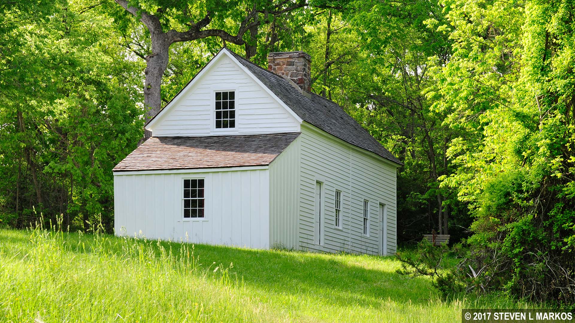
Thornberry House in Manassas National Battlefield Park as seen from the Sudley Road side
The Thornberry House is one of three original Civil War-era structures in the park, the others being the Stone House and the Dogan House. It was built in 1840 by John Thornberry for his family—a wife and five children. The family left the area for both battles only to find the house looted and dead and wounded soldiers on the property when they returned. After the second battle there were 150 dead bodies for them to deal with.
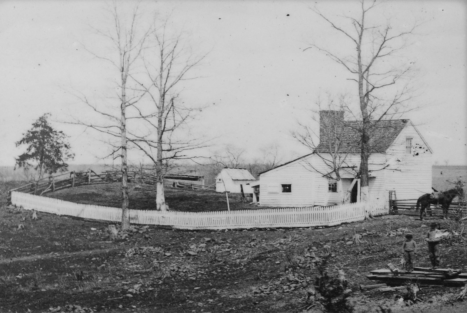
Photo of the Thornberry House from 1862
In addition to the house is an outhouse, complete with a modern toilet seat. Looks like somebody has turned it into an unofficial restroom, though you’d have to be really desperate to use it.
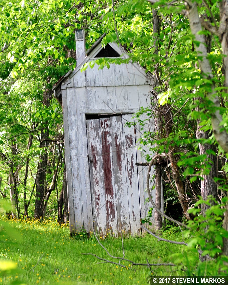
Thornberry House outhouse, Manassas National Battlefield Park
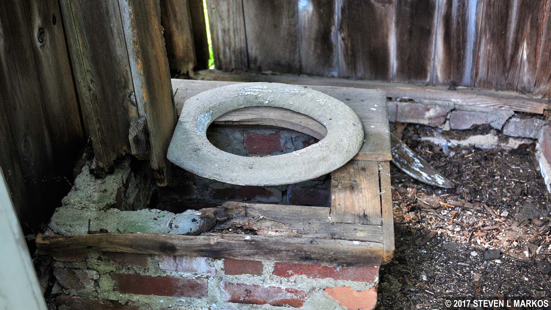
Inside the Thornberry House outhouse, Manassas National Battlefield Park
This area of the Sudley Loop Trail gets rather muddy if it has been raining. There is a boardwalk over most of the mud, but not all.
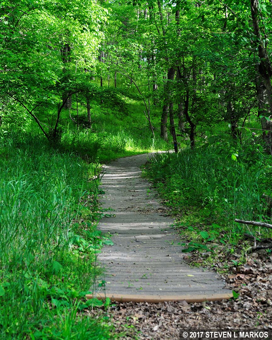
Boardwalk through the muddy section of the Sudley Loop Trail in Manassas National Battlefield Park
Just as there was a downhill hike at the beginning of the trail, the path now leads uphill. Creeks tend to run through the lowest part of terrain, and trails often head downhill to the water and uphill when leaving it. Such is the case with the Sudley Loop Trail. Other than the hills at the start and end of the trail, the hike is easy.
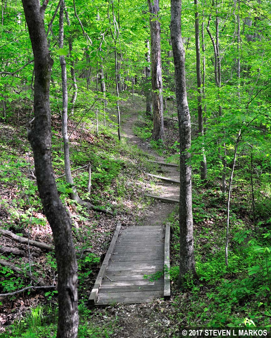
Hilly portion of the Sudley Loop Trail in Manassas National Battlefield Park
Like most trails at Manassas National Battlefield Park, the Sudley Loop Trail passes quite a bit of history, and a hike around it certainly enhances the battlefield experience. It doesn’t take long, so it is well worth your time if you are interested in learning about the battles at Manassas while getting a little exercise.
With a few exceptions, use of any photograph on the National Park Planner website requires a paid Royalty Free Editorial Use License or Commercial Use License. See the Photo Usage page for details.
Last updated on June 18, 2025


