

First Manassas Trail map (click to enlarge)
Note: The trails at Manassas National Battlefield Park are poorly marked, so be sure to bring a trail map with you for navigation purposes. The best is the Trail Guide, a tri-fold map that is free at the Henry Hill Visitor Center. For planning purposes, you can download it here, but be sure to pick up a full-color version before you begin your hike.
Manassas Trail Map (PDF)
Length: 5.5-mile loop
Time: 3 hours
Difficulty: Mainly easy with a few moderate hills
The First Manassas Trail is a loop trail that covers the eastern half of Manassas National Battlefield Park, from Sudley Road to Bull Run (creek). While trailheads are located at various places in the park, and you can hike the loop in either direction, it is best to start at the Henry Hill Visitor Center and hike in a counterclockwise manner so that you pass the sites where events took place in chronological order. The first destination is the Stone Bridge, the location where the First Battle of Manassas began.
Much of the First Manassas Trail is out in the open, so if avoiding the sun is important to you, be sure to wear a hat and apply sunscreen. Also, much of the trail follows a mowed grass path, a favorite habitat for ticks. While I didn’t pick up any on this hike, I did on some of the other trails. I suggest wearing long pants treated with Permethrin when hiking anywhere in Manassas National Battlefield Park.
To start the hike, find the counterclockwise trailhead located to the right of the Visitor Center parking lot (when looking at the building). The trail begins as a path through the tall grass as it heads towards the forest.
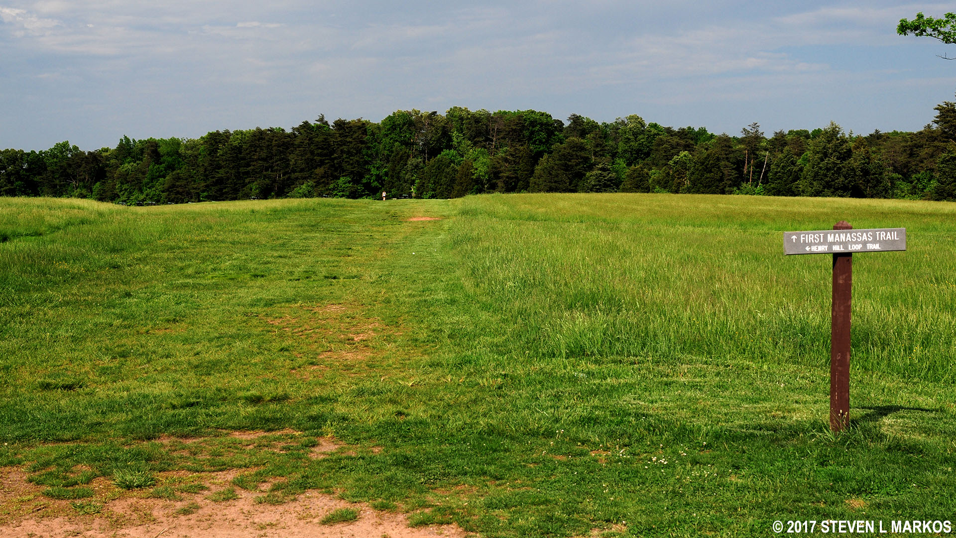
Start of a counterclockwise hike on the First Manassas Trail in Manassas National Battlefield Park
The First Manassas Trail crosses the Henry Hill Loop Trail near an exhibit of Civil War-era cannon. This is the position of the Confederate battle line at the very end of the fighting, so pay no attention to it at this point. These cannon and the rest of the Henry Hill area are best seen by hiking the Henry Hill Loop Trail. While there is some overlap between the two trails, there is enough virgin ground covered on the Henry Hill Loop Trail to warrant hiking it in addition to the First Manassas Trail.

Civil War-era cannon near the intersection of the First Manassas Trail and the Henry Hill Loop Trail in Manassas National Battlefield Park
The trail splits as soon as it enters the forest (this is not shown on any of the maps). To the left is what appears to be a service road, while the hiking trail continues to the right. The intersection is clearly marked with a sign.
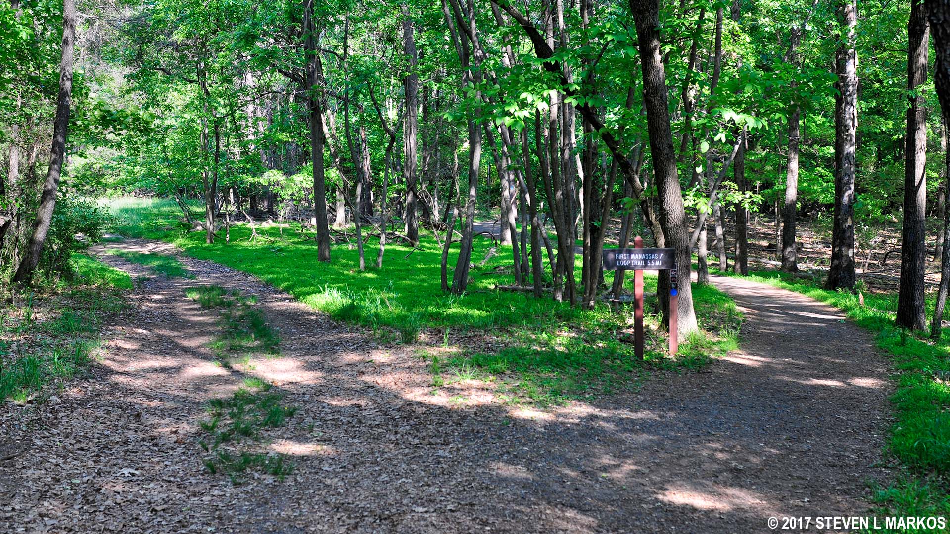
First Manassas Trail forks to the right at a split with a service road on the southern side of the trail, Manassas National Battlefield Park
You are now walking in the area through which Confederate troops passed as they marched from Bull Run to the fields of Henry Hill to take a stand against the Union army. This is one of two long segments of the trail that passes through the forest.
At .6 mile into the hike the trail dead ends into a dirt road. A sign points left towards the Stone Bridge, which is the direction you want to take. This will start you hiking north towards Highway 29. During the Civil War, Highway 29 was called the Warrenton Turnpike, and it was the main road to Centreville.
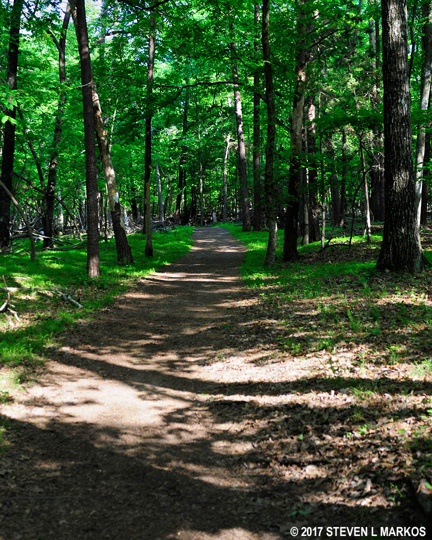
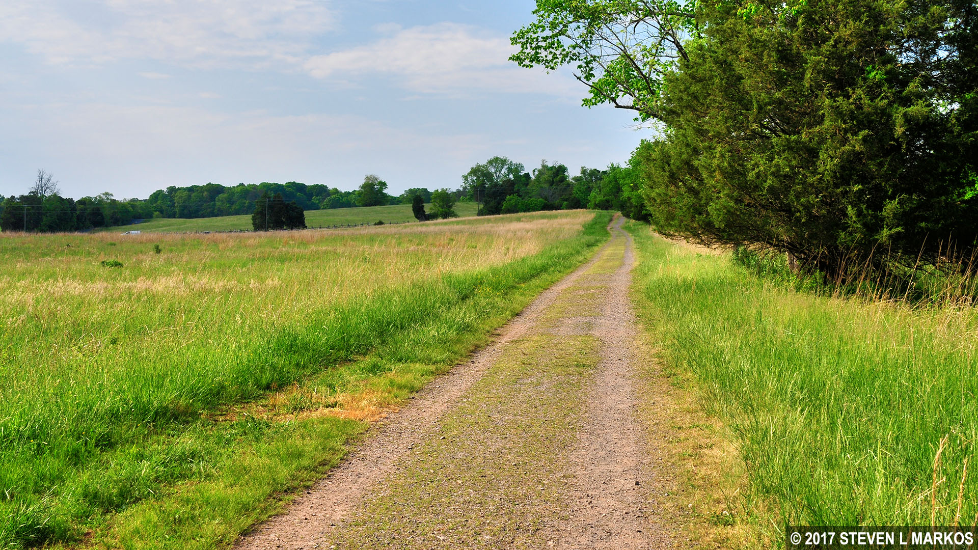
Typical terrain of the southern half of the First Manassas Trail in Manassas National Battlefield Park
If you look to your right, you will see another trail paralleling the gravel road. This is one of the bridle (horse) trails in Manassas National Battlefield Park. Things get a little confusing just up ahead because there is a crossing over Youngs Branch (creek), and horses cannot use the pedestrian footbridge. Just before the creek the two trails merge, then promptly split, with the hiking trail departing from the gravel road and forking to the left. This will bring you to the footbridge, but not before the trail forks a second time. Stay to the right to get to the bridge. Horses remain on the gravel road and must wade across the creek.
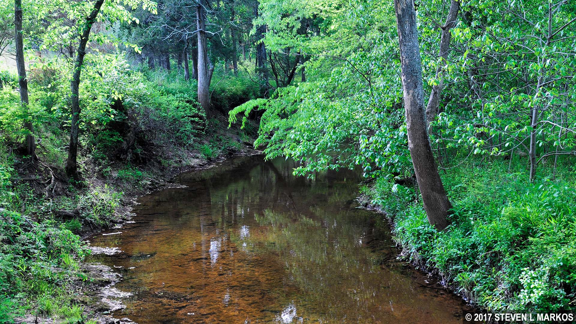
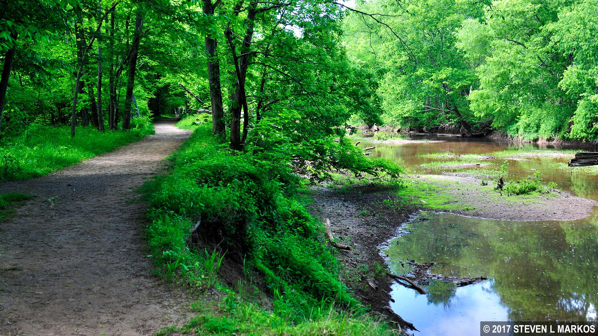
The First Manassas Trail crosses Youngs Branch on its southeastern side, Manassas National Battlefield Park
The First Manassas Trail rejoins the gravel road at an open field on the other side of the bridge; the bridle trail forks off to the right.
Gravel road section of the First Manassas Trail that leads north towards Highway 29, Manassas National Battlefield Park
From Youngs Branch it is a .3-mile hike to Highway 29 and another .2 mile from the road to the next point of interest, the site of the Van Pelt House. Just before coming to the highway the gravel road veers to the right while a dirt hiking trail continues straight. The gravel road leads over to small parking lot a couple hundred yards away. Stay straight and cross the highway to reach the Van Pelt House site.
Just before reaching the house site, the trail curves sharply to the right. A wayside exhibit marks the spot where the Van Pelt House stood before burning down in the 1930s, so there is nothing to see today. The field you have been walking along was the Van Pelt Farm. The Confederates were positioned here during the First Battle of Manassas to guard the Stone Bridge. During the Second Battle of Manassas, Union soldiers used the house as a hospital.
The Van Pelt sign also marks where the First Manassas Trail and the Stone Bridge Loop Trail merge into one. Take a right to continue to the next point of interest, the Stone Bridge.
As you walk south and get closer to Highway 29, you are walking along the ridge where the Confederates were positioned to guard the Stone Bridge. You can’t see anything today due to the trees, but during the Civil War all of this was farmland, and the Confederates had a clear view of Bull Run. At 5:30 AM on July 21, 1861, Union artillery opened fire on them from a mile back on the other side of the creek. After two hours of shelling and no formidable attack by the Union, Confederate Colonel Nathan Evans got suspicious that perhaps this was a diversion, so he sent most of his men up to Matthews Hill. If anyone was going to sneak up behind him, they would be coming from that direction. Sure enough, at around 10 AM the two sides met, spoiling the Union’s surprise attack. A wayside exhibit on the ridge tells the story.
Just past the wayside exhibit, the trail curves north and begins down a hill as it comes off the ridge and heads towards Bull Run. It passes through a narrow stretch of forest before coming out at a boardwalk that spans a wet area. At this point the terrain levels out.

Boardwalk section of the First Manassas Trail west of the Stone Bridge, Manassas National Battlefield Park
The boardwalk stretches nearly a quarter mile before ending just short of the Stone Bridge. The bridge itself is not on the trail, so be sure to make the short detour to check it out. If you walk all the way to the parking lot, you can read about the bridge on a couple of wayside exhibits.

The Stone Bridge, Manassas National Battlefield Park
In March 1862, the Confederates left the Manassas area and blew up the Stone Bridge to prevent Union troops from having an easy time crossing the creek. A few months before the Second Battle of Manassas (August 1862), Union engineers built a wooden bridge at this spot, using the abutments of the original Stone Bridge. This area did not see any fighting during the battle, but it was over the wooden bridge that the Union army retreated after suffering a second defeat at Manassas. They blew up the bridge once everyone was across. The bridge that stands today was built in 1884 and supposedly looks just like it did when originally built in 1825.

Photo of the destroyed Stone Bridge, Manassas National Battlefield Park
As you continue down the trail, you will be walking along Bull Run. This section is easy and rather scenic, so expect crowds on a nice day.

Hikers on the section of the First Manassas Trail that runs along Bull Run, Manassas National Battlefield Park
Hikers on the section of the First Manassas Trail that runs along Bull Run, Manassas National Battlefield Park
In a half-mile is an intersection marked by a footbridge spanning a small creek that feeds into Bull Run. The First Manassas Trail continues straight over the bridge, but it hits an extremely steep hill just up ahead. For those who have trouble walking, you can turn left before the bridge and take a shortcut across easier terrain to the other side of the hill. This shortcut runs through the forest and comes out at a field. If you do this, be sure to take a right when reaching the field and also continue straight past the next intersection to get back on the First Manassas Trail. I assume that if you set out to hike nearly six miles in the first place that a steep hill isn’t going to faze you, so cross the bridge to remain on the First Manassas Trail.

Footbridge on the First Manassas Trail over a small creek that feeds into Bull Run, Manassas National Battlefield Park

Steep hill on the northeast side of the First Manassas Trail near Bull Run, Manassas National Battlefield Park
In a quarter mile from the bridge the trail exits the forest and spills out onto an open field. It is at this field where the First Manassas and Stone Bridge Loop trails separate. There is no trail sign indicating which way to go, but take a right to remain on the First Manassas Trail. Taking a left leads down to the Van Pelt House intersection on the Stone Bridge Loop Trail, the only section of the trail not covered by the First Manassas Trail. There is nothing to see along the way, so if you hike the First Manassas Trail, there is no reason to hike the Stone Bridge Loop Trail on its own.

First Manassas and Stone Bridge trails diverge at a field, Manassas National Battlefield Park
You are now hiking through territory that is not covered by any other trails in the park. You will be walking along a dirt road with the forest on your right and the field on your left for about .4 mile before heading back into the forest. As you approach the Matthews Hill area, the terrain becomes rather hilly, though nothing beyond moderate in difficulty.
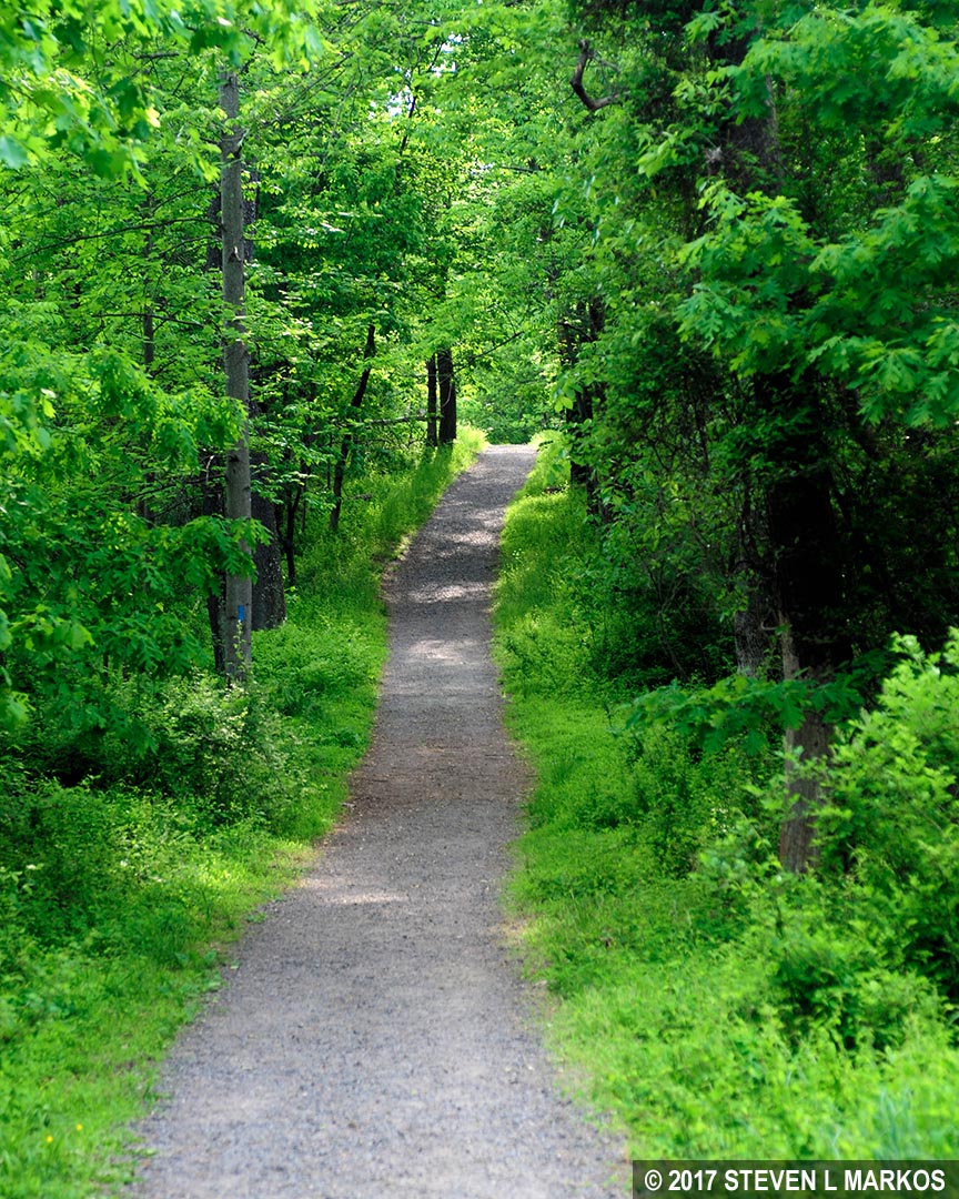
Typical terrain of the First Manassas Trail near Matthews Hill, Manassas National Battlefield Park
The next point of interest comes about 3.5 miles into the hike: Pittsylvania, the estate of Landon Carter, Jr., and the Carter Family Cemetery. Nothing remains of the house today except for a few stones of the house foundation. By the time the First Battle of Manassas rolled around, the Carters had already lost most of their plantation, and the house was abandoned. It served as a hospital after the battle was over. The house ended up burning down in the fall of 1862 (no connection to the war). One of the Carters’ daughters was Judith Henry, the elderly lady who died in her house on Henry Hill after Union artillery opened fire on it in an attempt to hit Confederate soldiers who were using it for cover. The Henry House is visited later on the hike.

Illustration of the Pittsylvania plantation house based on historical evidence
The Carter Family Cemetery is located a tenth of a mile down a side path. There are around seventy people buried there, with the last burial taking place in 1903. However, all of the headstones have been removed, so you aren’t missing much if you skip this short detour. The wall around the cemetery was built from the stones of Pittsylvania after it burned down.

Carter Family Cemetery, Manassas National Battlefield Park
From the Pittsylvania site, the First Manassas Trail continues through the forest and the terrain flattens out a bit. The next point of interest is the intersection with the northeastern corner of the Matthews Hill Loop Trail. This is marked by a memorial to George Stovall, who according to the inscription was killed at this spot on July 21, 1861. However, this is not the original location of the monument. It was moved here from a wheat field by farmers so that it would be at the location where Stovall’s unit, the Rome Light Guards of the 8th Georgia Volunteers, did most of its fighting. Stovall was not an officer or anyone important, so this monument was erected by his family and not by the state or federal government or a veterans organization.

Memorial to George Stovall, Manassas National Battlefield Park
Keep straight past the monument and follow the directional signs for the Matthews Hill Loop Trail, for it and the First Manassas Trail merge at this point. In fact, if you hike the First Manassas Trail, there is no reason to go back and hike the Matthews Hill Loop Trail because all interesting spots are covered.

Intersection at the Stovall memorial where the Matthews Hill and First Manassas Trails merge, Manassas National Battlefield Park
The trail intersects once again with a bridle trail and eventually comes out onto an open field. There is a mowed path to the left and right that runs along the tree line, but do not take it. Stay straight and head across the field towards Sudley Road.
You are now walking along the Union line during the battle on Henry Hill. The Union planned to march to Henry Hill unopposed, but this plan was thwarted when Confederate Colonel Nathan Evans sent men up to Matthews Hill to intercept them. As you cross the field you will pass above an artillery exhibit marking the position of the Rhode Island Artillery Battery, which consisted of six 13-pounder James Rifled Guns (pounder refers to the weight of the ball or shell that could be fired).

The First Manassas Trail follows the Union line just above the Rhode Island Artillery Battery, Manassas National Battlefield Park
When the trail dead ends into another mowed swathe of grass, take a left and head south towards the Stone House and Highway 29. A little farther down is a path that leads over to the cannon exhibit so that you can take a closer look. As soon as the Confederates were spotted, the 2nd Rhode Island Regiment charged down the hill to hold them off while the cannon were maneuvered into place. Those on display are authentic Civil War-era guns, but not necessarily ones used at Manassas.

Cannon exhibit on Matthews Hill marks the placement of the Rhode Island Artillery Battery, Manassas National Battlefield Park

Union cannon on Matthews Hill aims towards the Confederate line, Manassas National Battlefield Park

Civil War-era cannon on Matthews Hill in Manassas National Battlefield Park
From the artillery exhibit, continue down the hill, passing through an opening in a rail fence, until you come to the next intersection, which is again unidentified—this is the Confederate line. From this position you can see just how close the two armies were from each other. The Confederates, who had 900 men at the start of the battle, faced an overwhelming 15,000-man Union force, yet they held out for one and a half hours before retreating back towards Henry Hill. How, you may ask, did the 15,000 not immediately overwhelm them? Because not all 15,000 arrived at once. The line of Union troops stretched for six miles all the way back to the Stone Bridge. Thus, the Confederates originally faced a reasonable number, but with each passing minute more Union soldiers arrived. Even with reinforcements joining them on the battlefield, they could not contend with the endless supply of Union soldiers coming over the hill.

Typical terrain of the First Manassas Trail in the Matthews Hill area, Manassas National Battlefield Park
If you were to take a left, you would be hiking along the Confederate line, which runs through the forest and comes out at the Stovall memorial. While this is not the route of the First Manassas Trail (it is the route of the Matthews Hill Lop Trail), you may want to venture a short ways down so you can look up towards the Rhode Island Artillery Battery and see the battlefield from the Confederate perspective.

View from the Confederate position on Matthews Hill towards the Union position, Manassas National Battlefield Park
The First Manassas Trail splits from the Matthews Hill Loop Trail at this point and now heads downhill towards the Stone House, one of the iconic fixtures of the battlefield. The house was built in the mid-1800s and served as a tavern and inn. It figured into both battles at Manassas as a Union hospital. You are free to tour the house from April through November at various times (for a current schedule, check the National Park Service’s official Operating Hours and Seasons web page for Manassas National Battlefield Park). When closed, all you can do is take a photo and read a few paragraphs about the house on two wayside exhibits.

The Stone House, Manassas National Battlefield Park
The First Manassas Trail continues across Highway 29 and heads up to Henry Hill, one of the steepest climbs in the park. Be sure to cross the road at the intersection, for this is a very busy road and cars travel at high speeds. Once across you will see a footbridge that spans Youngs Branch.
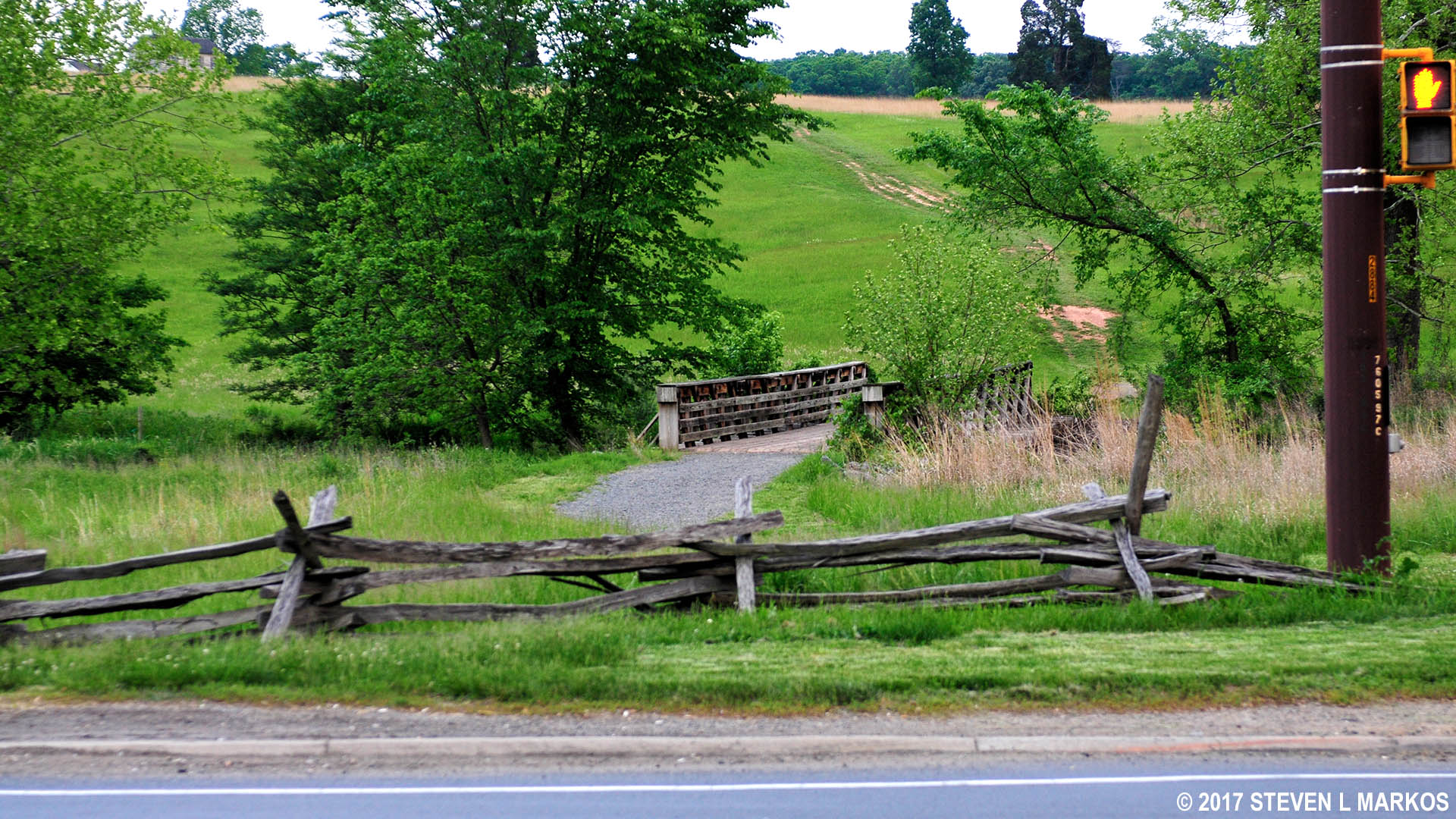
Intersection on the west side of the First Manassas Trail with Highway 29, Manassas National Battlefield Park
The first stop of importance on the south side of Highway 29 is at a lone tree and a wayside exhibit about the fighting on Matthews Hill, which you can see in the distance. This exhibit is at the northwestern corner of the Henry Hill Loop Trail. As the Confederates on Matthews Hill were retreating towards Henry Hill, Captain John Imboden set up four cannon at this location to fire on the advancing Union soldiers in hopes of slowing them down so the Confederates had time to organize a defense to the east of this position.
Location of Confederate Captain John Imboden’s artillery battery on Henry Hill, Manassas National Battlefield Park

View towards Matthews Hill from Confederate Captain John Imboden’s artillery battery on Henry Hill, Manassas National Battlefield Park
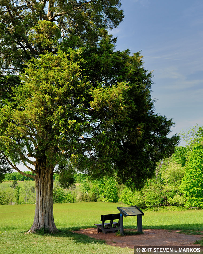
From here back to the Visitor Center, the First Manassas Trail and the Henry Hill Loop Trail merge as one. As mentioned earlier, there is a lot of ground that is not covered by the First Manassas Trail, and I highly suggest hiking the Henry Hill Loop Trail separately. For now, stay straight and head towards the Henry House, a tenth of a mile away.
This is not the house that stood during the First Battle of Manassas. That house sustained extensive damage and was abandoned by the Henrys, and later that winter it was stripped clean for firewood by Confederate soldiers camping nearby. In 1870, two of the Henry children, Ellen and Hugh, decided to rebuild the house using part of the original foundation. Ellen and some of her cousins lived here, while Hugh moved in at a later time. In 1883 the house was enlarged to its current size.

Post-Civil War Henry House at Manassas National Battlefield Park
The Henry House is not open to the public. In lieu of stepping inside, information about the Civil War-era house has been placed in the windows for all to read. I found this to be a highly inventive solution to disseminate information without opening the house.
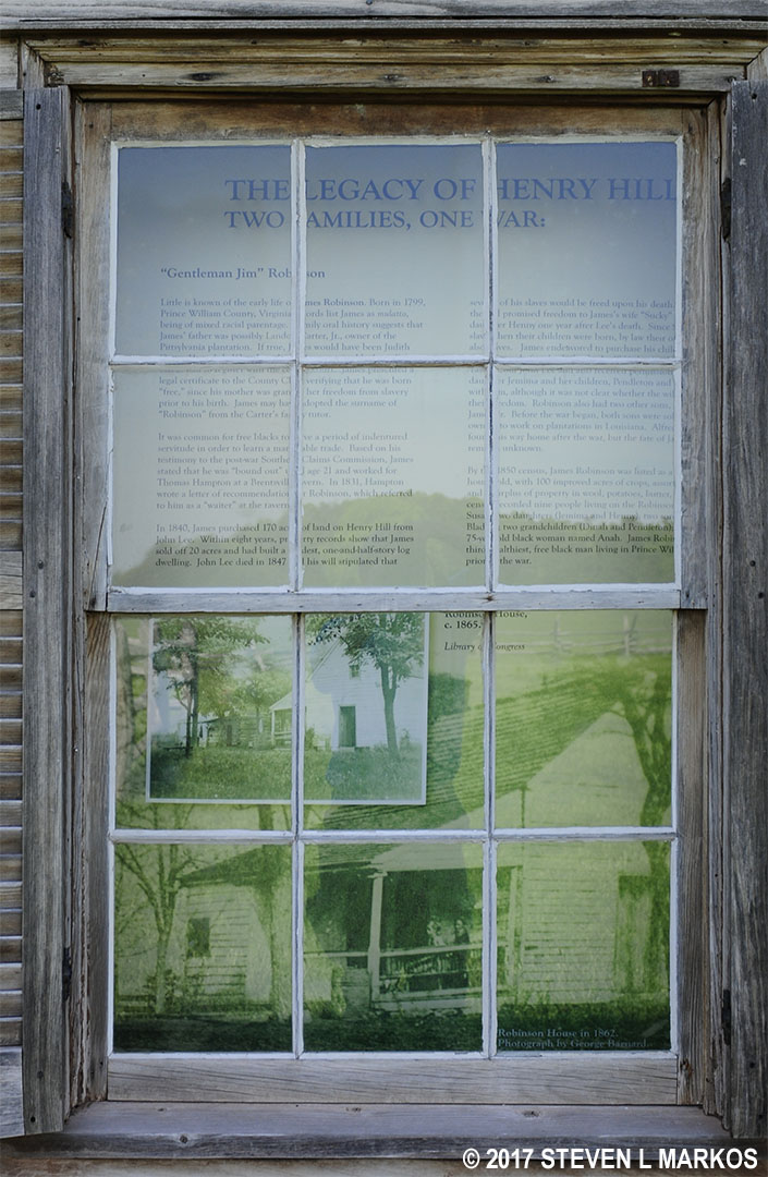
Information in a window at the Henry House, Manassas National Battlefield Park
Three people are buried in a cemetery located in the yard. The one who has become the most famous over the years is Judith Henry, a bed-ridden 84-year-old lady who refused to leave during the battle and was subsequently killed. Her daughter Ellen, her son John, and her slave Lucy Griffith were also in the house at the time. Confederate soldiers were using it for cover, and not realizing civilians were inside, Union artillery commander Captain James Ricketts decided to open fire on it. Everyone was injured to some extent, but only Judith was killed. She was the only civilian to die during the battle. Ellen and Hugh, who died much later of natural causes, are also buried here.
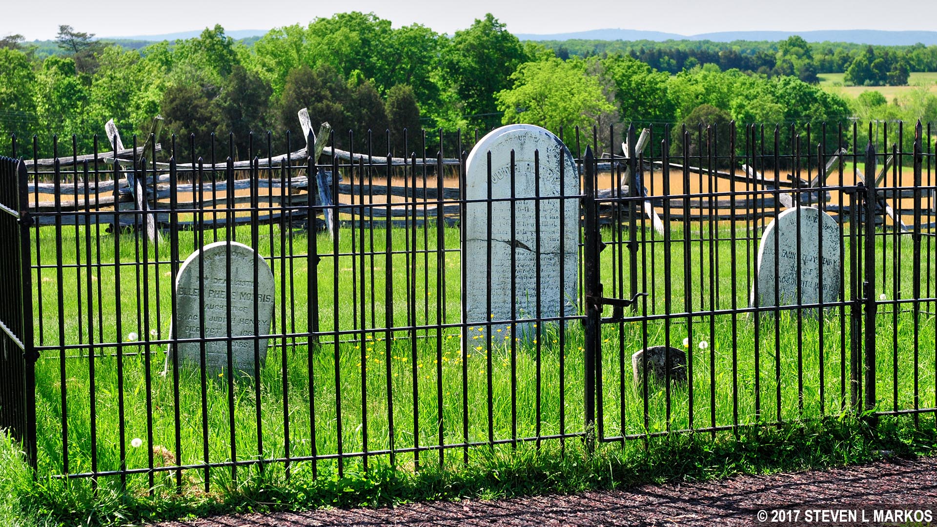
Henry Family cemetery, Manassas National Battlefield Park
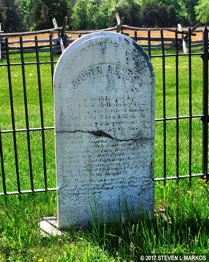
Grave of Judith Henry in the Henry Family cemetery, Manassas National Battlefield Park
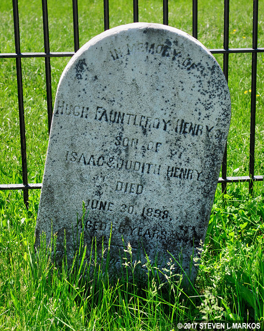
Grave of Hugh Henry in the Henry Family cemetery, Manassas National Battlefield Park

Grave of Ellen Henry (Morris by marriage) in the Henry Family cemetery, Manassas National Battlefield Park
Behind the house is the Henry Hill Monument, a memorial to the Union soldiers who died in the battle. Dedicated on June 13, 1865, it is one of the earlier Civil War memorials. The structure is made of sandstone blocks and has four 200-pounder shells placed around the base and one at the top.
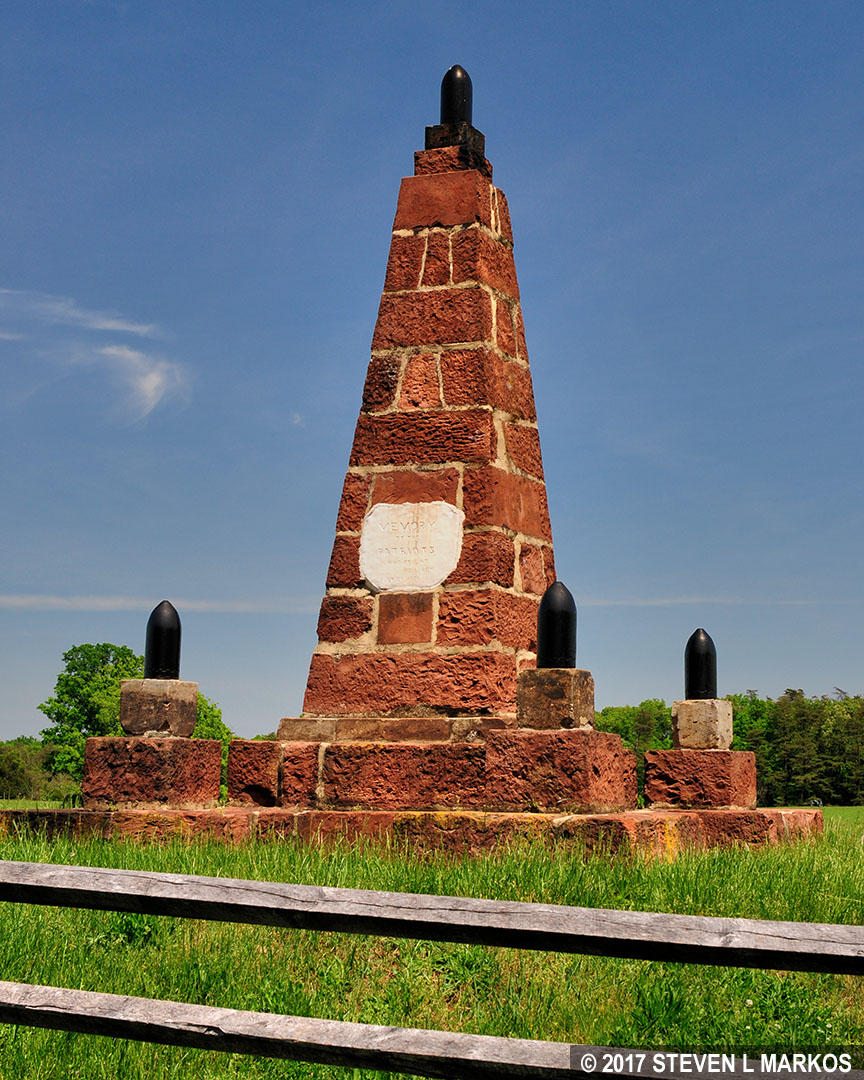
Henry Hill Memorial at Manassas National Battlefield Park
There isn’t much of a worn path from the Henry House back to the Visitor Center, so just walk in the direction of the cannon and artillery supply wagons. You are now walking along the Union line during the fighting on Henry Hill. After driving the Confederates off of Matthews Hill, General Irvin McDowell decided to wait an hour for more troops to arrive, for they had started marching from near the Stone Bridge, and the line was nearly six miles long. During this time he sent artillery commanders Captains James Ricketts and Charles Griffin to the top of Henry Hill to set up an artillery battery. This was a very risky move since they would be far ahead of the rest of the army. The cannon exhibits you pass on the way to the Visitor Center mark this location. They are aimed towards the forest, which is where the Confederates were positioned. If you hike the Henry Hill Loop Trail you will visit the Confederate Line, but the First Manassas Trail does not cover that area.
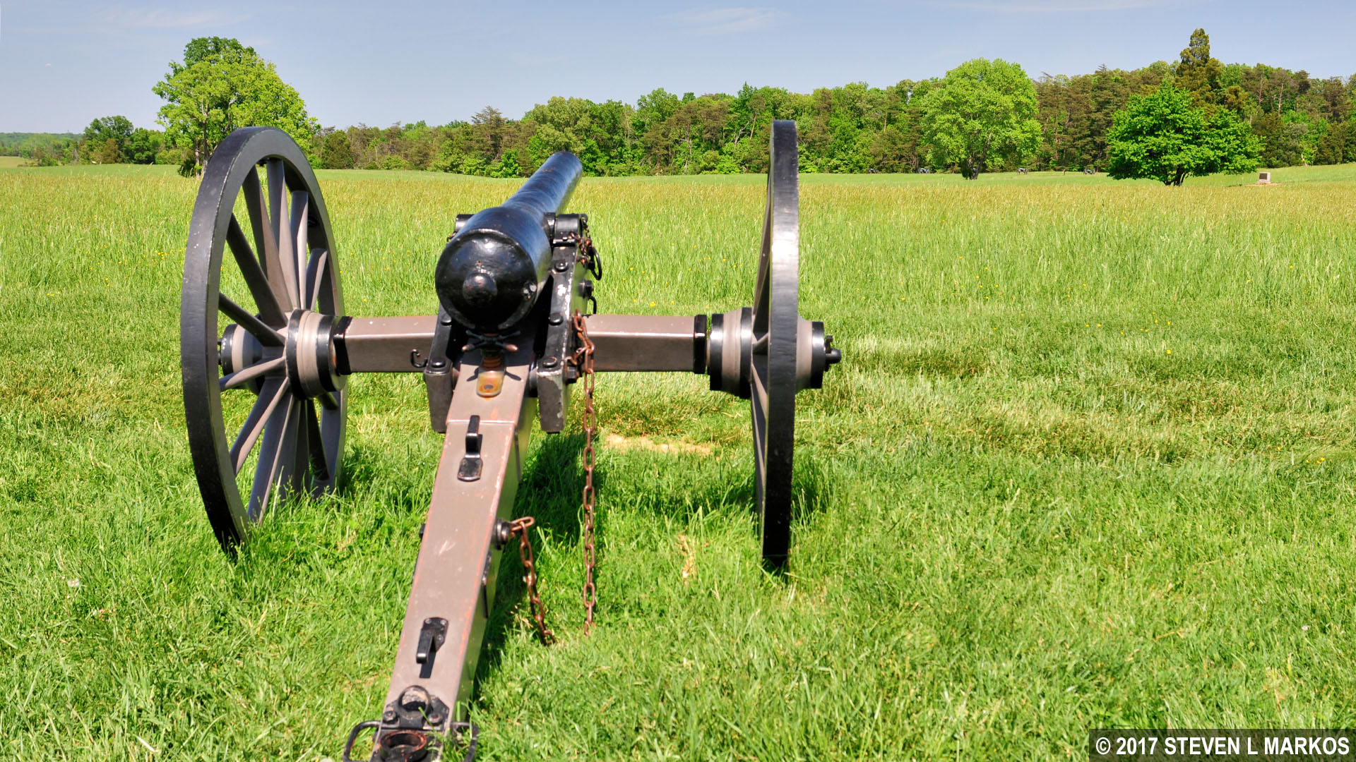
Union cannon on Henry Hill aims towards the Confederate line, Manassas National Battlefield Park
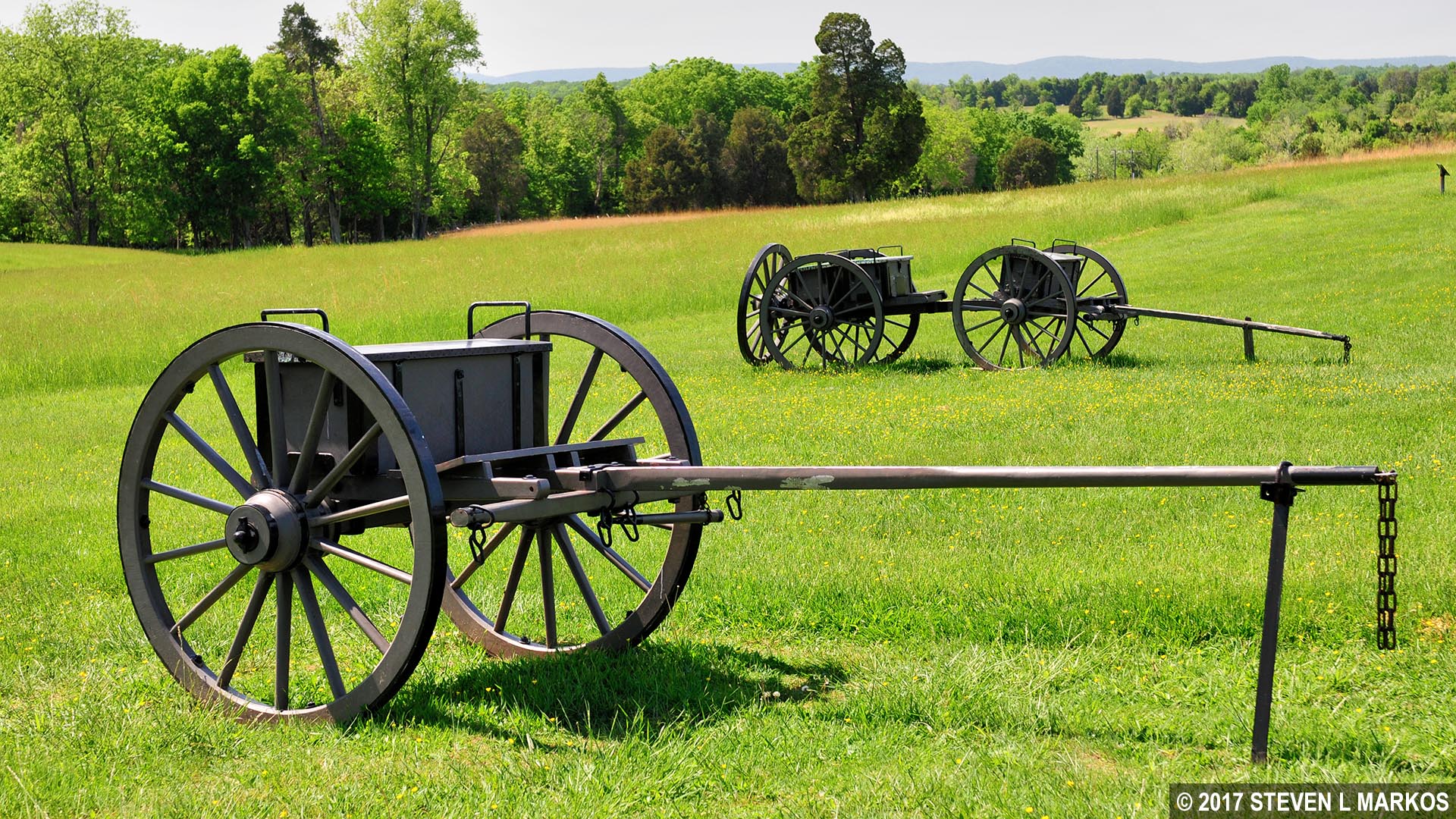
Union supply wagon for artillery on Henry Hill, Manassas National Battlefield Park
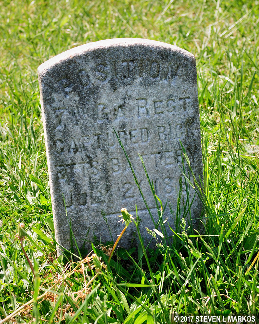
As you pass the cannon and supply wagons you may notice a stone marker that looks like a tombstone—it is not. In 1903 a group of men who fought in the war placed markers just like this one at various locations on the battlefield to indicate unit positions during the First Battle of Manassas. This one marks the spot where the 7th Georgia Regiment captured James Ricketts’ battery of cannon towards the end of the battle.
Marker on Henry Hill at the spot where Union cannon were captured by the Confederates, Manassas National Battlefield Park
There is one last point of interest on the hike. When you get back to the parking area, look for two lone cannon directly behind it. Ricketts had opened fire from his position on the other side of the Visitor Center, and once the Confederates’ attention was drawn to him, Charles Griffin maneuvered two cannon to this location, only a hundred or so yards from the Confederate left flank. Artillery placed at such angle could fire directly into the Confederate line, a trajectory known as enfilading fire. When firing head on, shells may fall short or overshoot the target, but when firing from the side you can’t miss, plus it is possible to take out multiple men with one shot. A soldier who fought in the Second Battle of Manassas was eyewitness to a shell that came in at such an angle that it took off one man’s head, hit the next in the neck, the next in the chest, and a fourth in the gut, disemboweling him.

Enfilading Fire Diagram
Instead of just sitting there and waiting to get peppered at close range, Confederate Colonel A. C. Cummings ordered his 33rd Virginia Infantry to charge the guns. Four hundred men burst from the battle line, firing along the way. The cannon crews were wiped out and the Confederates captured the pieces. Union soldiers soon took them back, but were driven off once again by Confederate reinforcements.
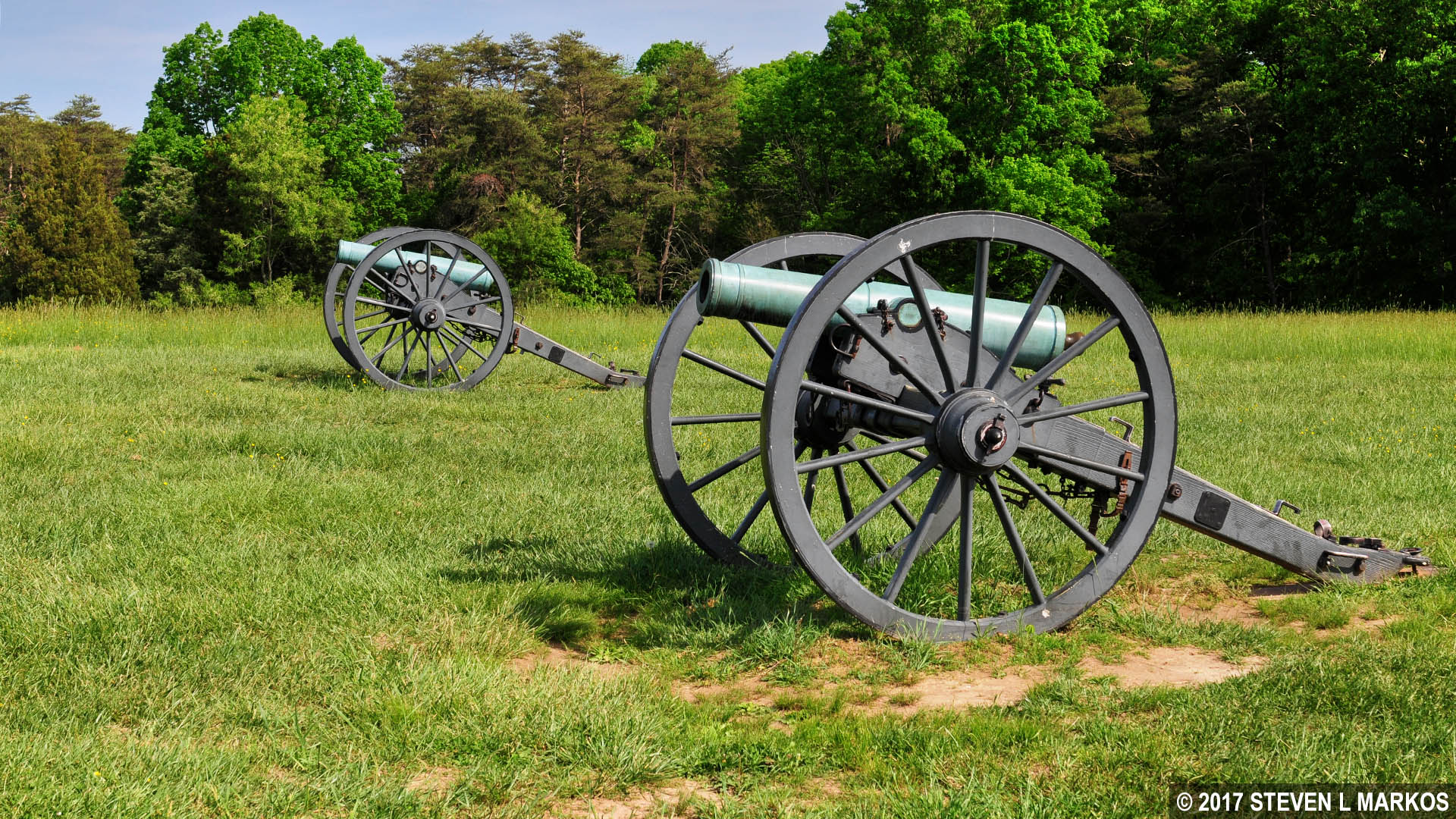
Two cannon mark the spot where Confederates captured Charles Griffin’s small artillery battery, Manassas National Battlefield Park
Behind the two cannon is one last wayside exhibit that gives a quick synopsis of how the battle ended. The charge by the 33rd Virginia Infantry inspired other Confederates to do the same, and by the late afternoon the Union had been driven off of Henry Hill and pushed west all the way to Chinn Ridge, turning what looked to be a defeat into a possible victory. The battle ended on Chinn Ridge after fresh brigades of Confederate soldiers joined the fighting. Union troops retreated north along Sudley-Manassas Road, ending the first major battle of the Civil War.
The decision to hike the First Manassas Trail all depends on whether you have hiked or plan to hike the loop trails at the Stone Bridge, Matthews Hill, and Henry Hill. The First Manassas Trail links these together, and other than the Pittsylvania house site and Carter Cemetery—of which there really is nothing to see—most points of interest are covered on the loop trails. My recommendation is to hike the First Manassas Trail only if you are out for exercise as much as for history. If all you want to do is see the important locations on the battlefield, stick with the individual trails.
With a few exceptions, use of any photograph on the National Park Planner website requires a paid Royalty Free Editorial Use License or Commercial Use License. See the Photo Usage page for details.
Last updated on May 17, 2025


