

North River Trail and Potowmack Canal Trail map
I hiked the North River and Potowmack Canal trails as part of a 6-mile loop hike around Great Falls Park. See the Hiking Trails web page for details. These trails make up the second segment of the hike. Links to the previous and next segments are located at the bottom of this trail review.
Length: 1.1 mile, one-way
Time: 30 minutes, not including stops at the three Great Falls overlooks
Difficulty: Easy
The first segment of my 6-mile loop hike around Great Falls Park ends across the street from the upper parking lot. To continue the hike on the North River Trail, enter the parking lot and take a left. The trailhead is located at the far northern end of the parking lot. You will see a gravel path that crosses a small field before entering into the forest. This is the North River Trail.

Start of the North River Trail at the upper parking lot of Great Falls Park in Virginia
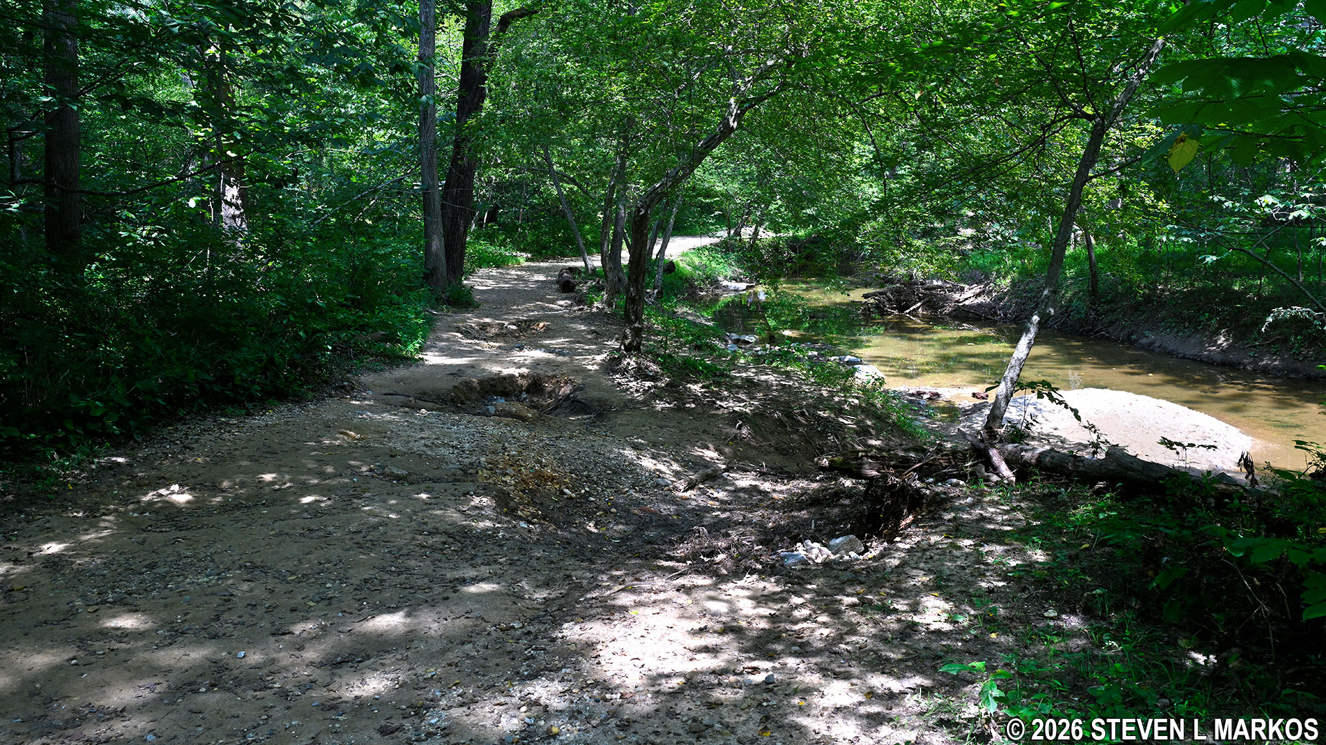
Once the North River Trail enters the forest it becomes a wide gravel path, possibly a former road of some type. Stay on the trail until it intersects with the Potowmack Canal Trail, at which point you will take a sharp right and start hiking south back towards the Great Falls Visitor Center. The North River Trail continues farther north, leaving Great Falls Park and continuing on to Riverbend Park, but this is the end of the line as far as my hike is concerned. The distance you travel on the trail is quite short, only .2 mile.

Typical terrain of the North River Trail at Great Falls Park in Virginia
The intersection with the Potowmack Canal Trail is more like a merger than an intersection, for they come together in a V-shape. In fact, you will see the Potowmack Canal Trail to your right, getting closer and closer as you walk on the North River Trail. You’ll know that you have reached the point where you should make the sharp right turn when you see a DANGER sign about swimming and wading in the river.

DANGER sign near the intersection of the North River and Potowmack Canal trails at Great Falls Park in Virginia
The Potowmack Canal Trail runs along the Potomac River for the first quarter mile. If you are a fisherman, there are many good fishing spots here (and many more if you head north instead). This is a scenic stretch of trail, and you may pass artists painting river scenes. Also, because it is level and easy to hike, expect to find large crowds on a nice day.

Artist painting a scene of the Potomac River as viewed from the Potowmack Canal Trail at Great Falls Park in Virginia
The trail leaves the river after a quarter mile, yet it still continues to follow a small channel of water. This is where boats would exit the Potomac River to enter into the Potowmack Canal.
Northern end of the Potowmack Canal within Great Falls Park
The Potowamack Canal was designed to be a bypass around the Great Falls. To do so, a channel was dug parallel to the river, with entry and exit points above and below the falls. Because the Potomac drops 80 feet in less than a mile at Great Falls, in addition to digging the actual channel, five locks had to be built, some by blasting through solid rock. Later on in this hike you will pass the remains of Lock 1 and 2.
Locks allow boats to be lifted and lowered to different levels of the canal similar to the way a toy boat in a bathtub can be raised or lowered by controlling the water level in the tub. It is hard to describe in words just how this process works, but you can watch the following video that was produced by the Chesapeake and Ohio Canal National Historical Park, which is the canal on the other side of the Potomac River in Maryland. If you visit the Great Falls Tavern section of the park, you can ride a canal boat and even go through a working lock. There are locks like this in operation on small rivers all over the world, still using the same technology as developed over two-hundred years ago.
While the initial section of the canal looks like a natural channel, you can’t miss the man-made portions that are lined with stone retaining walls. These start about halfway down the central parking lot at Great Falls Park, which you can clearly see off to your right.

Section of the Potowmack Canal within Great Falls Park
As you continue south, you will pass all three of the scenic overlooks for Great Falls. Each gives a different view, so be sure to stop by all them. There is a picnic area at each overlook as well.

Panorama of the Great Falls from Overlook 1 (click to enlarge) at Great Falls Park in Virginia

View of Great Falls from Overlook 2 at Great Falls Park in Virginia

Panorama of Great Falls from Overlook 3 (click to enlarge) at Great Falls Park in Virginia
If you are daring, or just dumb, you can scurry away from the established overlooks by climbing on the rocks. I saw one guy way beyond where he should be, obviously trying to raise the yearly death toll average at the park.

Viewing the Potomac River from a hard-fought position atop Mather Gorge in Great Falls Park
The next segment of the hike is the River Trail, and there are two ways to access it depending on whether you stop at the third overlook. If you do stop, there is a dirt path to the right of the observation platform. I’m not sure if it has a name, but take it and you will eventually end up on the River Trail. If you pass the overlook and stay on the Potowmack Canal Trail, take a left at the fork that you will come to in about a tenth of a mile.
Next Trail Segment: River Trail | Previous Trail Segment: Mine Run Trail
With a few exceptions, use of any photograph on the National Park Planner website requires a paid Royalty Free Editorial Use License or Commercial Use License. See the Photo Usage page for details.
Last updated on April 9, 2026


