
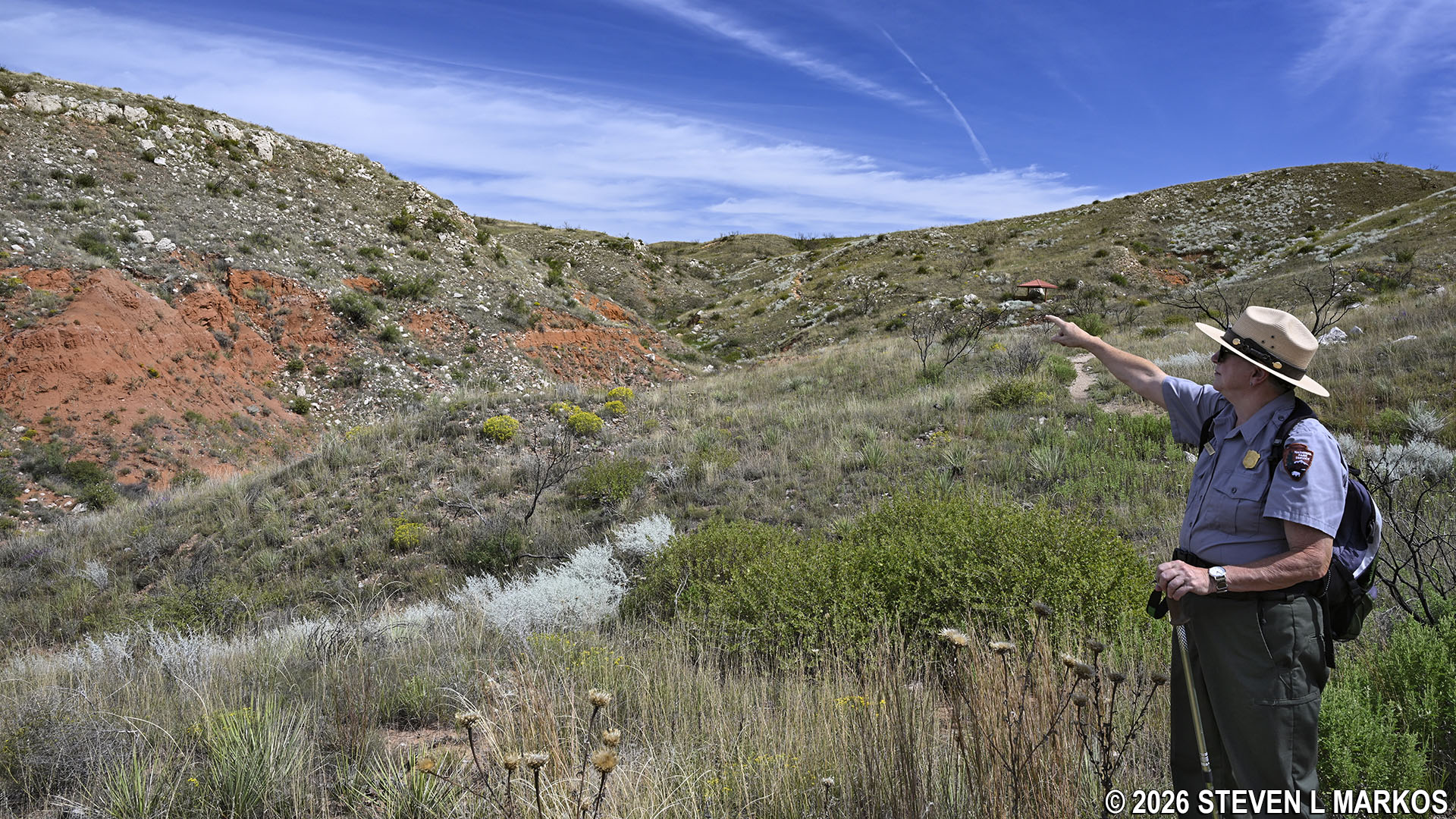
Ranger conducts a tour of the Alibates Flint Quarries at Alibates Flint Quarries National Monument
Visiting the Alibates Quarries at Alibates Flint Quarries National Monument is only allowed on a two-hour Ranger-guided tour. Attending requires hiking a .6-mile out-and-back trail (1.2 miles, round trip) that leads to the top of the mesas where Alibates flint was quarried. The tour is typically held at 10 AM each day, and there may be a second tour depending on staffing and the weather. Registration is required, and while you can show up before tour time and get a spot, you really need to call in advance just to make sure that a tour will be held on the day of your visit. For the latest reservation information, visit the park’s Alibates Quarries Tours web page.
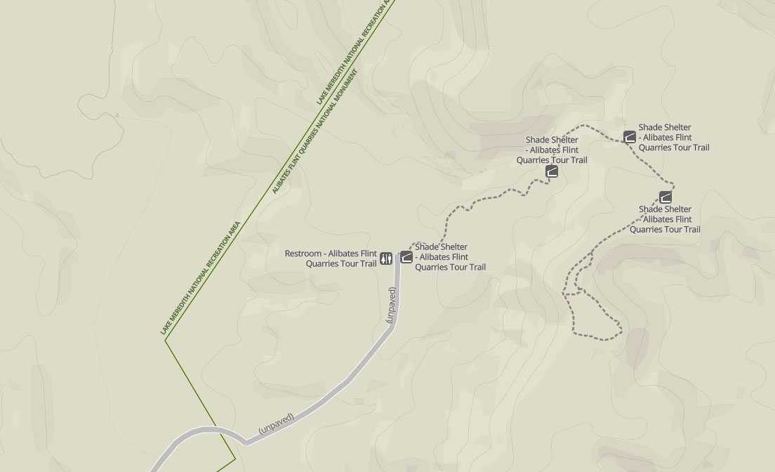
Quarry Tour Trail Map at Alibates Flint Quarries National Monument
The tour begins in front of the Visitor Center with a brief Ranger talk. Participants then follow the Ranger in their personal vehicles to the trailhead located 2.5 miles down Alibates Tour Road. The road is gated, and the trailhead is inaccessible unless you are on the tour.

Alibates Quarries Tour begins in front of the Visitor Center at Alibates Flint Quarries National Monument
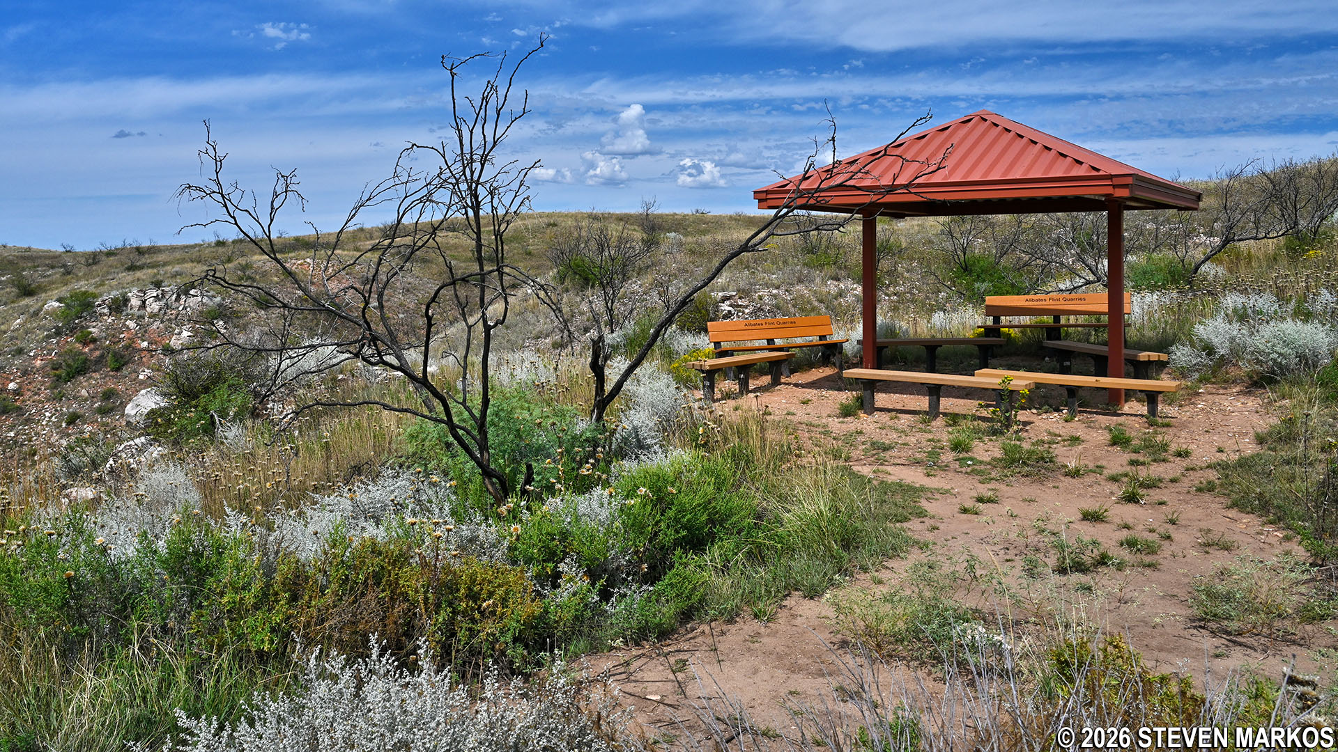
At the start of the trail, everybody reconvenes under one of four shade shelters located along the path. From here, it appears that it’s going to be a pretty steep climb to the top of the mesa, and it is. However, there are plenty of stops along the way where the Ranger gives an educational chat, so there is no rush to the top. The shelters, by the way, offer the only opportunities for visitors to get out of the sun while on the tour, so be sure to wear a hat and apply sunscreen if avoiding the sun is important to you. Don’t forget to bring some water and wear comfortable, sturdy, closed-toe shoes or boots.

Ranger and tour group at the first shade shelter on the Alibates Quarries Tour at Alibates Flint Quarries National Monument
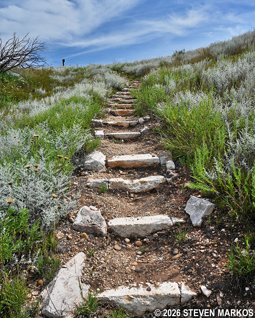
The hike begins with a gradual ascent along an unpaved path comprised mostly of dirt and loose rocks. There are also a variety of steps and stairs at some sections of the trail.
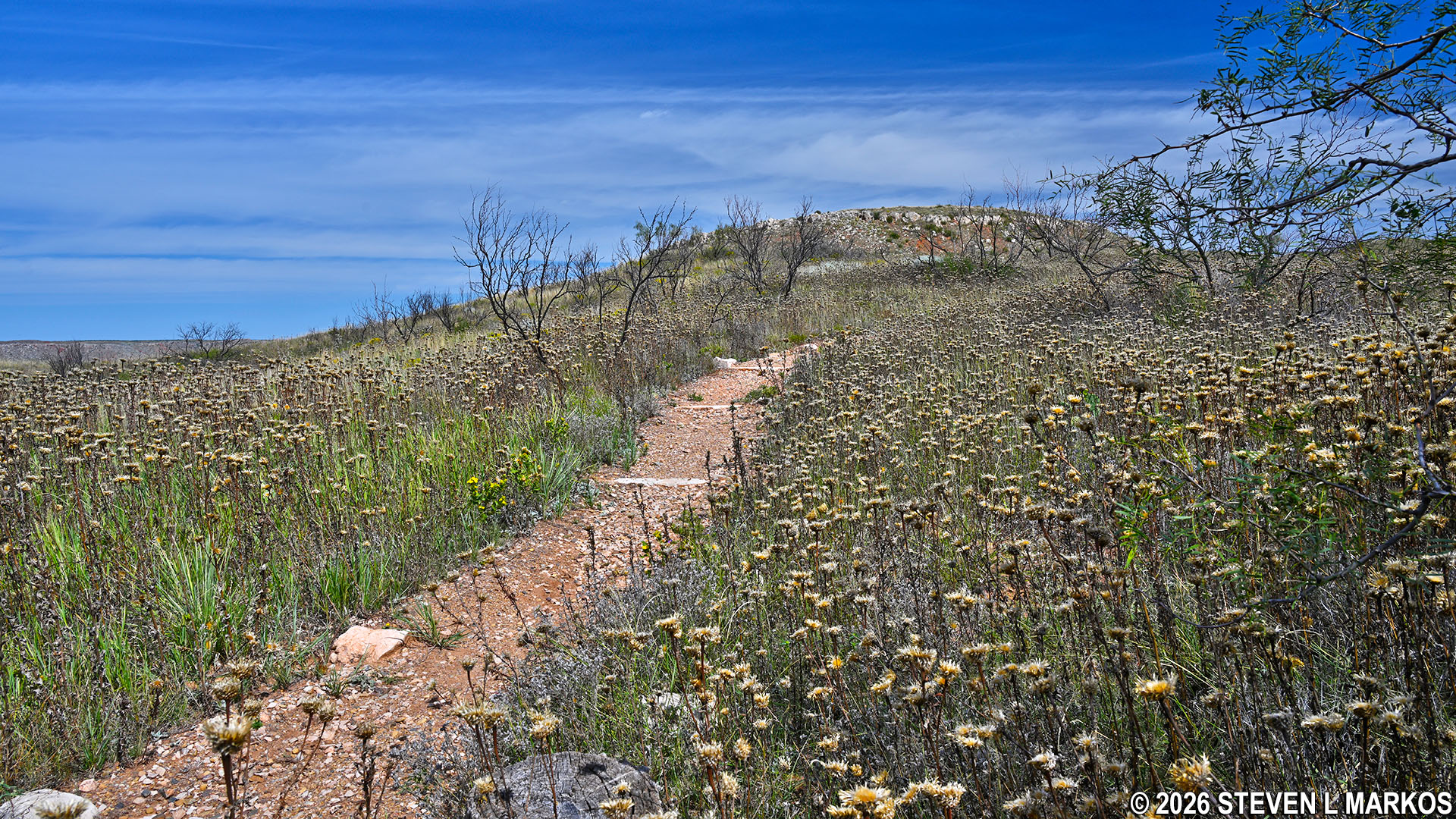
Typical terrain at the start of the hike to the Alibates Flint Quarries, Alibates Flint Quarries National Monument
To the north of the trail is a large hill with a red section towards the bottom. Known as Permian red beds, this 200-million-year old mesa is part of the oldest exposed rock formations in the Texas Panhandle. It gets its distinctive red color from metallic minerals that have oxidized over time. The gray-colored caprocks near the top of the mesa are dolomite, which formed from organic materials such as plankton, shelled animals, algae, and coral when the region was submerged beneath the ocean.

Large mesa with visible Permian red beds and dolomite caprock, Alibates Flint Quarries National Monument
A large boulder at the corner of the second shade shelter is half Alibates flint and half dolomite. Also called agatized dolomite, Alibates flint is formed over time when microscopic quartz crystals from silica-rich water replace the calcium and magnesium carbonate that make up dolomite. On the other side of the trail, just past the shelter, sits another large boulder comprised only of dolomite.

Dolomite boulder containing Alibates flint at the second shade shelter along the trail to the Alibates Flint Quarries, Alibates Flint Quarries National Monument

Large dolomite boulder near the second shade shelter along the trail to the Alibates Flint Quarries, Alibates Flint Quarries National Monument
Shortly past the second shelter are dolomite boulders with striated layers (multiple long, thin parallel streaks) of algae that formed when the area was covered by an ocean. The dolomite sat atop softer materials—sandstone, siltstone, mudstone, gypsum—that make up the red beds seen today, creating what is known as a caprock. Over millions of years, a mesa formed, and when the softer rock underneath the caprock wore away, slabs of the dolomite broke off and rolled down the hill. This is why the once-horizontal layers of algae are now at all sorts of odd angles.

Rock formations with striated layers of algae seen on the Quarry Tour at Alibates Flint Quarries National Monument
At the quarter-mile mark is a steep set of steps with an average grade of 14.5% (strenuous hiking is considered to start at 15%). This is the steepest section of the entire trail. Along the path, silver and sand sage grow in abundance. If you pull off a small piece, which the Ranger allows, you can smell the distinct scent of the sage.
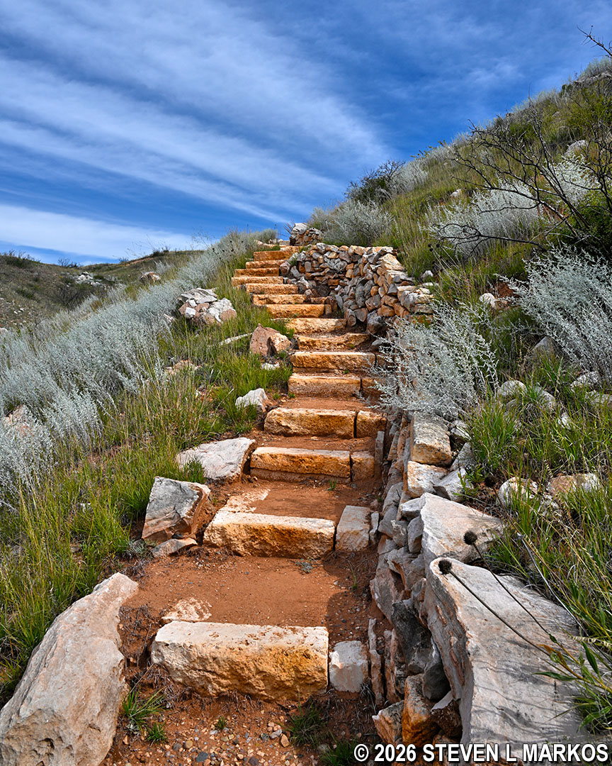
Steep set of steps surrounded by sage after the second shade shelter along the trail to the Alibates Flint Quarries, Alibates Flint Quarries National Monument
The third shade shelter is located a third of a mile into the hike. This was the longest stop on the tour I took—roughly 15 minutes. The Ranger provided valuable information on the area’s geology, natural history, and the people who quarried flint as far back as 10,000 years ago.
Third shade shelter along the trail to the Alibates Flint Quarries, Alibates Flint Quarries National Monument
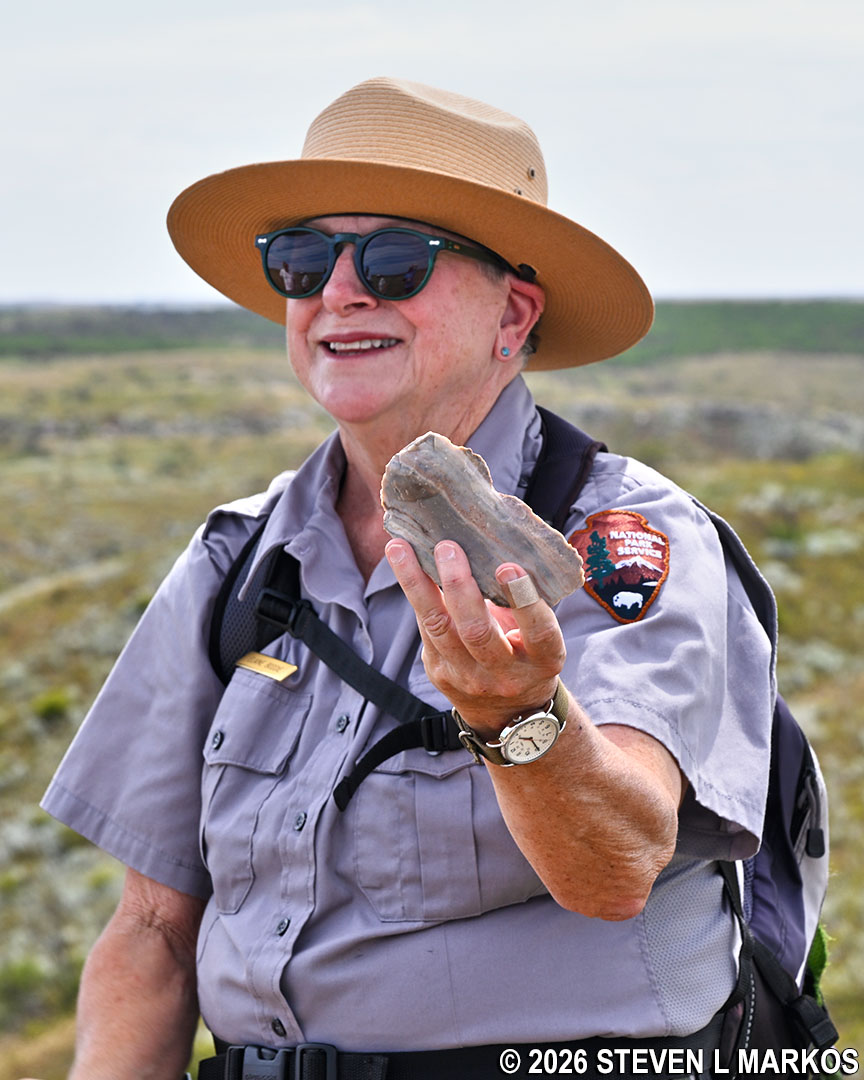
Ranger conducting a tour of the Alibates Flint Quarries holds a piece of Alibates flint, Alibates Flint Quarries National Monument
Just past the third shelter, another set of steps leads to the top of the mesa. Though not as steep as the earlier set, it is close, with an average grade of 13.5%.
Steep set of steps after the third shade shelter on the trail to the Alibates Flint Quarries, Alibates Flint Quarries National Monument
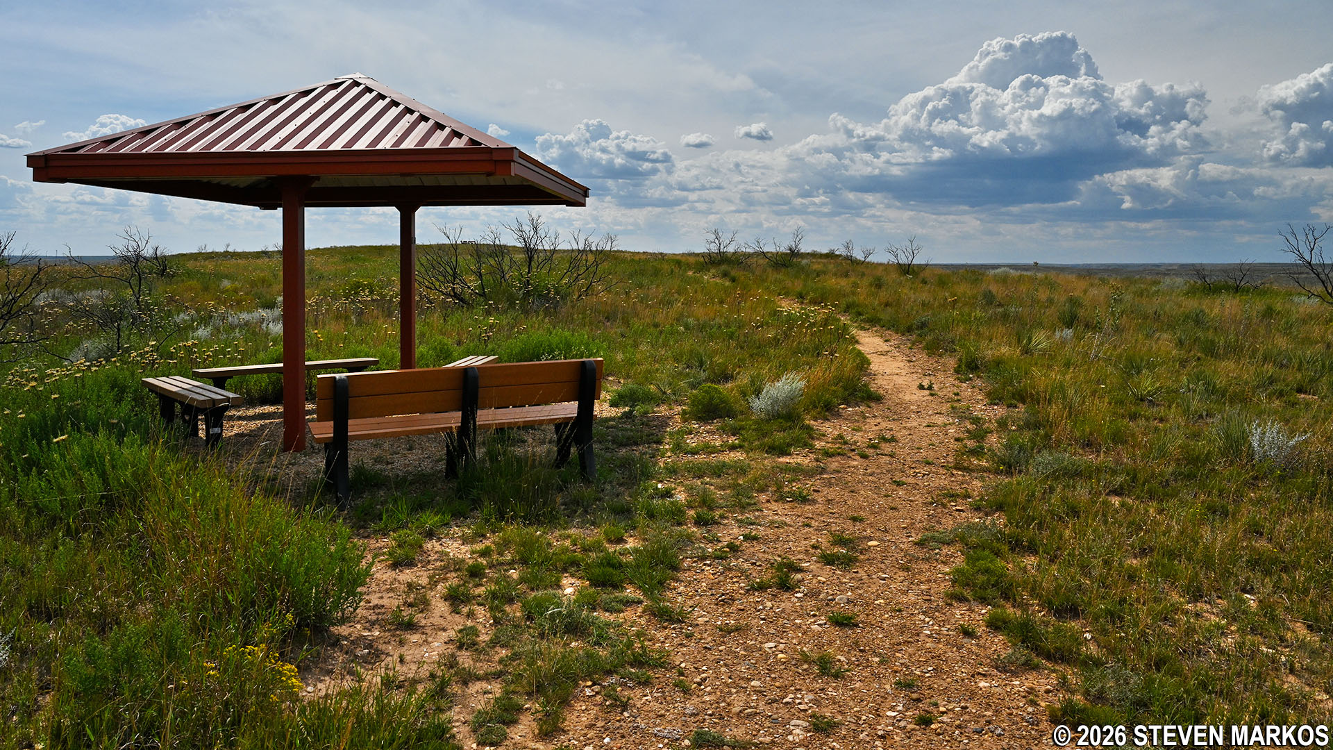
At the top of the mesa is one last shade shelter. From here, the .2-mile path to the quarry pits becomes fairly level.
Shade shelter at the top of the mesa at the Alibates Flint Quarries, Alibates Flint Quarries National Monument

Typical terrain of the trail at the top of the mesa at the Alibates Flint Quarries, Alibates Flint Quarries National Monument
Evidence of flint quarrying is everywhere. There are multiple piles of lithic scatter (debris from worked rock). Considered trash of ancient civilizations, the piles are comprised of shards and fragments (debitage) of flint that flaked off during knapping (the shaping of flint with a hammer stone). The process of knapping reduces a raw stone into a finished tool.
A piece of flint next to a hammer stone at the Alibates Flint Quarries, Alibates Flint Quarries National Monument
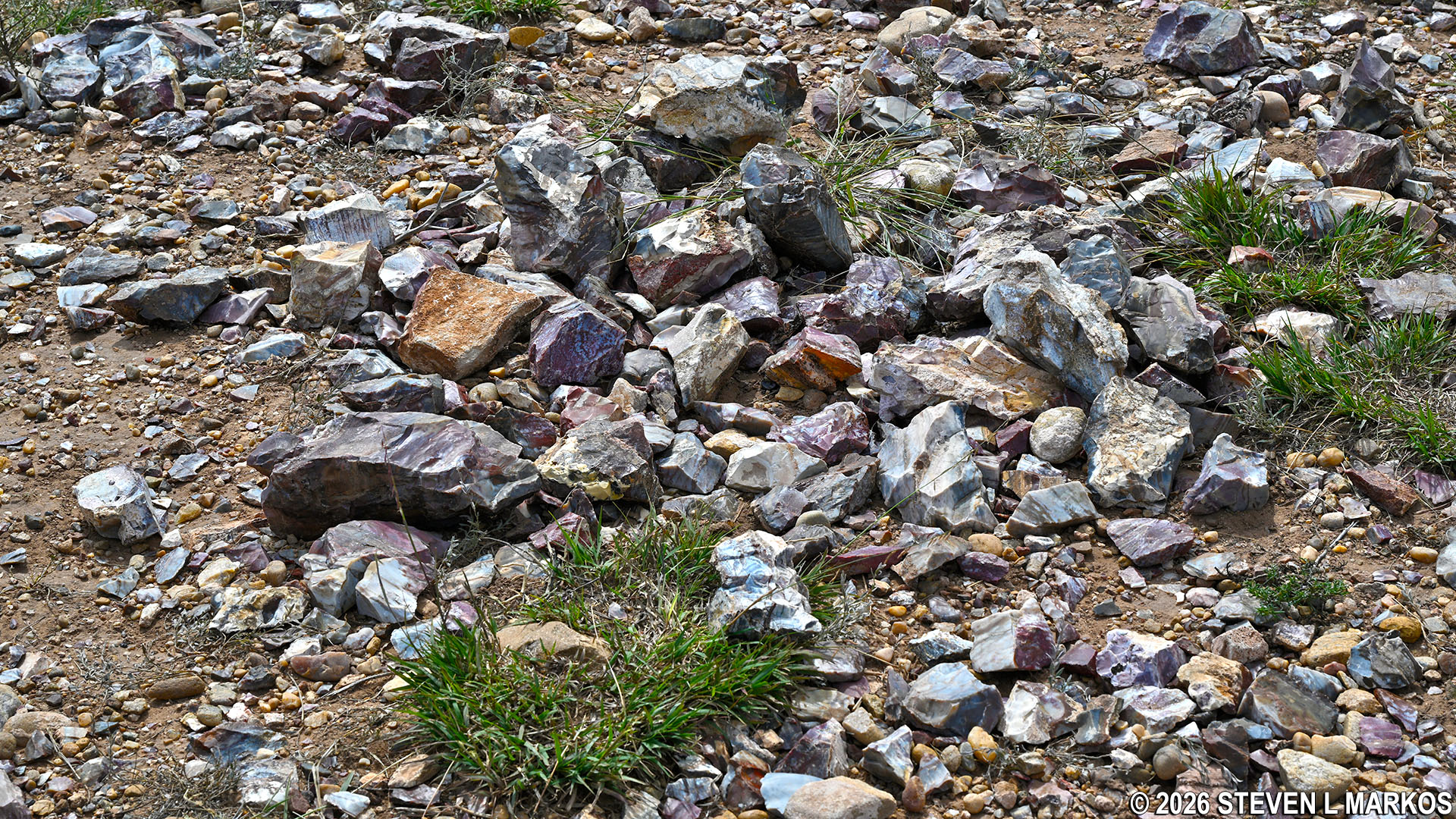
Lithic scatter pile at the Alibates Flint Quarries, Alibates Flint Quarries National Monument
Lithic scatter pile at the Alibates Flint Quarries, Alibates Flint Quarries National Monument
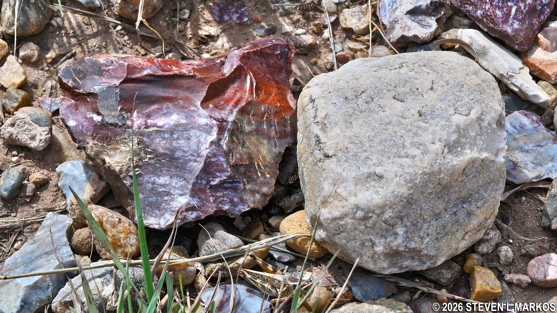
Many of the rocks found around the quarries today have visible crystals that formed a botryoidal habit—grape-like appearance—due to the silica-rich waters that streamed through cracks and voids in the dolomite and eventually bubbled up. This process allowed the quartz crystals to grow larger, resulting in poor-quality flint. Visitors to the quarries will come across numerous pieces of discarded flint while on the tour.
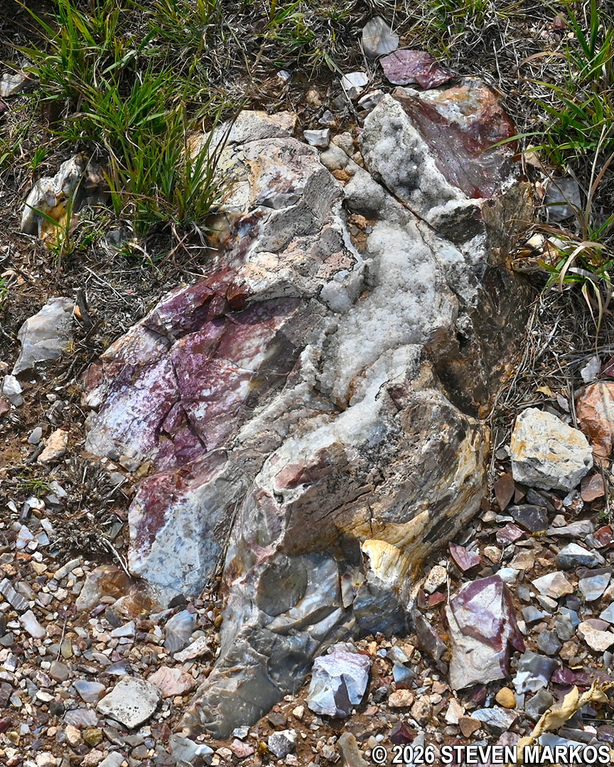
Dolomite boulder with botryoidal crystals and flint at the Alibates Flint Quarries, Alibates Flint Quarries National Monument
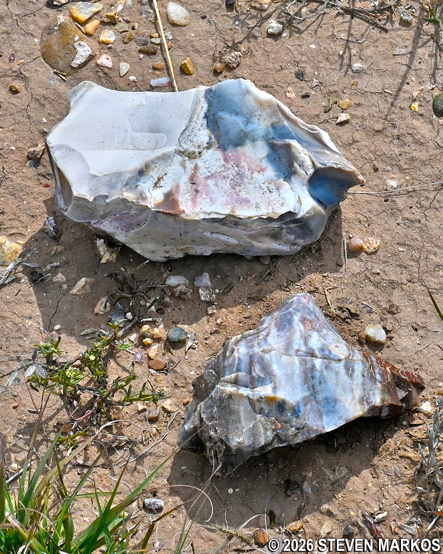
Broken pieces of flint at the Alibates Flint Quarries, Alibates Flint Quarries National Monument
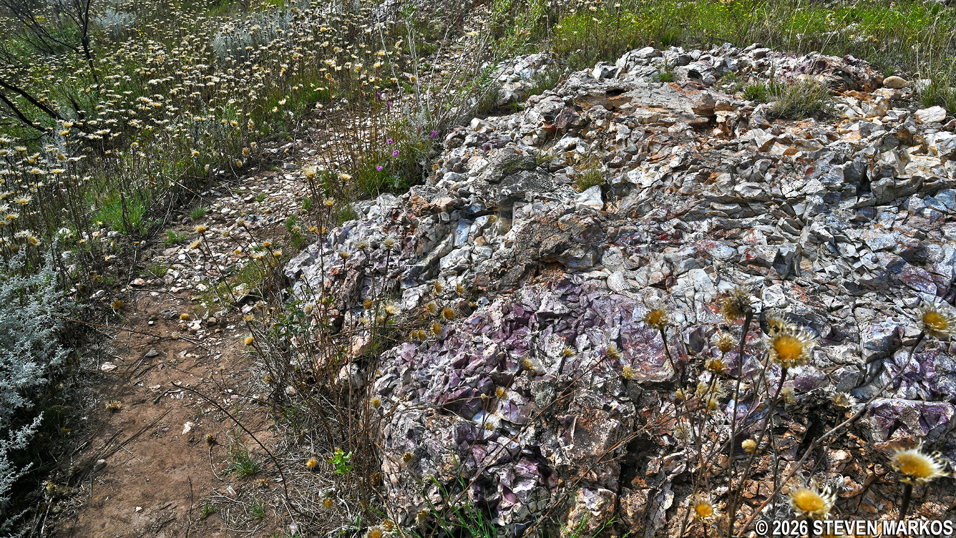
Knowing that the exposed portions of the dolomite boulders often produced low-quality flint, the Antelope Creek people who quarried here from 1150 to 1450 decided to dig small, shallow pits in order to reach the higher-quality flint at the bottom of the boulders, the part still buried in the earth. The pits were three to five feet deep and between five and twenty feet wide. Over time, they filled in with soil and vegetation, so all that remains today are mild depressions that would most likely go unnoticed unless pointed out. If you are expecting to see actual quarry pits, you will be disappointed.

Filled in quarry pit at the Alibates Flint Quarries, Alibates Flint Quarries National Monument
The final part of the tour takes visitors a couple of hundred feet past the quarry pits to a group of westward-facing benches overlooking the Canadian River Valley. Barely a stream today, the river first started flowing from melting glaciers. When Sanford Dam was built in 1965 to create Lake Meredith, the river rose above 100 feet. A 10-year drought in the late 1990s reduced the water level to just 26 feet, and most wildlife and vegetation died. The river is now primarily fed by rainfall runoff.
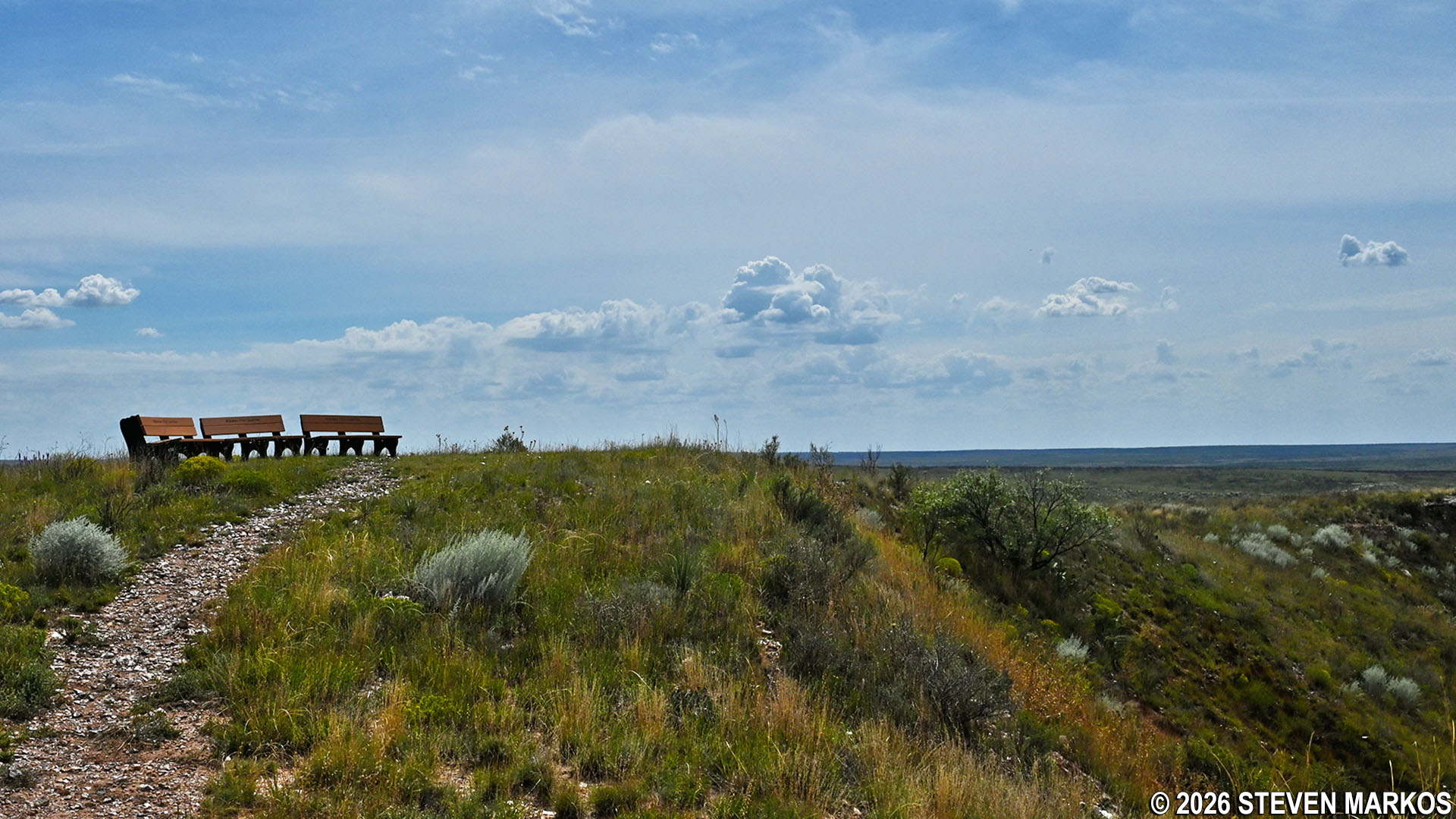
Benches at the top of the mesa at the Alibates Flint Quarries, Alibates Flint Quarries National Monument
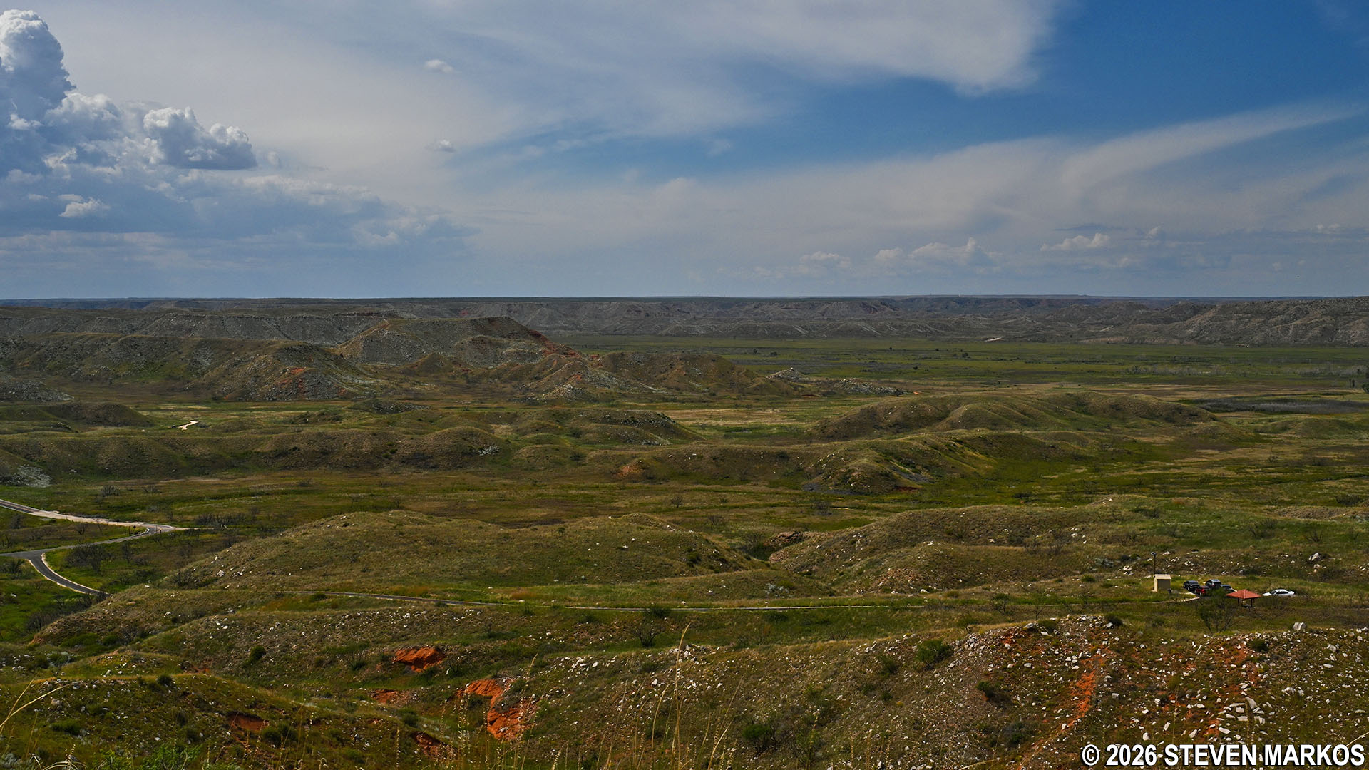
View of the Canadian River Valley from the top of the mesa at the Alibates Flint Quarries, Alibates Flint Quarries National Monument
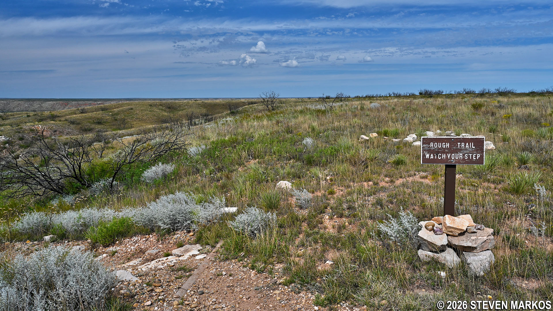
After taking in the views of the Canadian River Valley, the tour group heads back down the mesa. A caution sign just before the steps—which might have gone unnoticed on the way up—advises visitors about the steep and rough trail ahead. Thankfully, what lies ahead is already known.
Caution sign for a steep downhill section of the trail near the Alibates Flint Quarries, Alibates Flint Quarries National Monument

Participants on the Alibates Quarries Tour head back down the mesa, Alibates Flint Quarries National Monument
While the Alibates Flint Quarries themselves are a bit anticlimactic, the quarry tour is still well worth any visitor’s time. First off, the park is called Alibates Flint Quarries National Monument, so if you don’t see the actual quarries, there isn’t much point in stopping by. Second, you will learn something about geology and anthropology, which may come in handy at your next trivia contest. However, the real draw is the beauty of the area. You can see from the photos on this page that the hike to the top of the mesa is quite spectacular. If you are physically able to do it, be sure to call ahead to reserve your spot on the tour. You don’t want to come all the way out here just to find that tours for the day have been cancelled.
With a few exceptions, use of any photograph on the National Park Planner website requires a paid Royalty Free Editorial Use License or Commercial Use License. See the Photo Usage page for details.
Last updated on February 8, 2026


