

Outer Blue Mountain Lake Trail in Delaware Water Gap National Recreation Area
Blue Mountain Lake Area Trails Home Page
Length: 4.6-mile loop
Time: 2 hours
Difficulty: Between easy and moderate
The Blue Mountain Lake Trail in Delaware Water Gap National Recreation Area is located in New Jersey between Millbrook Village and Walpack Center. If using Google Maps for directions, search “Blue Mountain Lakes Walpack.” The trail has its own parking lot on Blue Mountain Lakes Road.
National Park Service literature refers to the trails in this area in the singular: the Blue Mountain Lake Trail. However, there are really two trails, an inner loop that goes around the shore of Blue Mountain Lake and an outer loop that goes nowhere near the lake and extends all the way to Hemlock Pond. There are connectors between the two, but the layout essentially makes them two separate hiking trails. For lack of a more original name, I will call the outer loop trail the Outer Blue Mountain Lake Trail (or Outer Trail) and the inner loop trail the Inner Blue Mountain Lake Trail (or Inner Trail). This report covers the Outer Trail. See the Inner Blue Mountain Lake Trail report for more information on that hike.
At the north end of the Outer Blue Mountain Lake Trail is the Hemlock Pond Trail. If you have any interest in hiking it, be sure to add it to your Outer Trail hike because there is no direct access to it. You must either hike to it from here or from the Crater Lake Trail. In truth, its not worth hiking unless you just want some additional exercise. The only view of the pond is from the dam at the northwest end. The dam is only a couple minutes walk from where the Hemlock Pond Trail intersects with the Upper Blue Mountain Lake Trail, so there is no reason to hike the entire trail if all you want to do is see the pond.
There are many trails in this area that are not on the map provided by the National Park Service, neither on the official Delaware Water Gap National Recreation Area website nor on the printed map provided in the Guide to the Gap, a tabloid-size brochure that is available for free at any visitor center. I have made corrections that I know of to the government-issued map (below). Corrections are shown as red dotted lines..

Corrected trail map for the Blue Mountain Lake area of Delaware Water Gap National Recreation Area (click to enlarge)
Due to the numerous intersections in this area that are not on the trail map and that have no directional signage, it is important to know that the route of the Outer Blue Mountain Lake Trail is marked with blue blazes and the Inner Blue Mountain Lake Trail with red blazes. For those unfamiliar with blazes, these are paint splotches on trees or rocks that serve as Hansel and Gretel breadcrumbs (or course you need to know who Hansel and Gretel are).

Blue blazes mark the route of the Outer Blue Mountain Lake Trail in Delaware Water Gap National Recreation Area
Regardless of which trail you plan to take, the hike starts at the far end of the parking lot (look for two signs). The gated dirt road is the start of the Outer Blue Mountain Lake Trail heading in the clockwise direction. The narrower path to the right leads to the start of the Inner Blue Mountain Lake Trail loop and the Outer Blue Mountain Lake Trail in the counterclockwise direction. I took the narrow trail to the right, and this report is written from that perspective.

Trailhead for hiking the Outer Blue Mountain Lake Trail in the counterclockwise direction, Delaware Water Gap National Recreation Area

Trailhead for hiking the Outer Blue Mountain Lake Trail in the clockwise direction, Delaware Water Gap National Recreation Area
While the trail starts off as a narrow path, it widens into an obvious former dirt road just around the corner. A hundred yards later is an intersection that is on the National Park Service map but has no directional signage. This is the start of the Inner Blue Mountain Lake Trail loop. The narrow trail that forks off from the road to the left is the clockwise trailhead for the Inner Trail. Continuing straight on the dirt road, which actually still has some patches of asphalt on it, sets you off hiking the Inner Trail in the counterclockwise direction. It also leads to the counterclockwise trailhead for the Outer Blue Mountain Lake Trail, which is where I was headed.

The start of the Inner Blue Mountain Lake Trail loop is a hundred yards from the parking lot, Delaware Water Gap National Recreation Area
Patches of old asphalt appear periodically on the Outer Blue Mountain Lake Trail, Delaware Water Gap National Recreation Area
In another tenth of a mile is an intersection with a trail that branches off the road to the right. This is the Outer Blue Mountain Lake Trail, so turn here to continue the hike. There is a post at the intersection with a blue blaze on it, as well as a blue blaze on a tree at the start of the trail. If you want to hike the Inner Blue Mountain Lake Trail, stay straight on the road.

Split between the Inner and Outer Blue Mountain Lake trails when hiking in the counterclockwise direction, Delaware Water Gap National Recreation Area
The Outer Blue Mountain Lake Trail is an oval that runs northeast—southwest. So that I can reference points of interest along the trail in my review, I need to define geological / navigational terms. I will call the end of the trail near Blue Mountain Lake the southern end, and the end near Hemlock Pond the northern end. Where I am standing now, at the start of the Outer Trail heading in the counterclockwise direction, I will call the southeastern position since if Blue Mountain Lake ran north to south, this spot would be east of the lake. The other side of the loop at this end of the lake is the southwestern position. Likewise, this side of the loop near Hemlock Pond is the northeastern position and the opposite side of the loop, the northwestern position.
The entire Outer Blue Mountain Lake Trail is hilly, though most hills are mild with average grades between 8% and 10% (15% is where strenuous starts). There are a few short-but-steep sections (150 feet, 15% to 20% average grades), but these are few and far between. Furthermore, other than one short section where the trail temporarily narrows, the Outer Trail is an old road, though most of it is now covered in grass. The surface is relatively free of rocks and roots, and overall it is a fairly easy trail to hike. I’d rate the difficulty a 2 on a scale of 1 to 5 (with 5 being the most strenuous).

Typical terrain on the southeastern end of the Outer Blue Mountain Lake Trail, Delaware Water Gap National Recreation Area
From the start, the Outer Blue Mountain Lake Trail climbs a short hill (one of those steep ones), and at the top is an intersection with an old dirt road (on the left) that is not on the National Park Service map. Based on my dedicated hiking GPS unit, this road runs between and parallel to the Inner and Outer trails (see the corrected trail map). Stay straight to remain on the Outer Trail.

Steep hill on the southeastern end of the Outer Blue Mountain Lake Trail, Delaware Water Gap National Recreation Area
Once past the intersection, the Outer Trail immediately heads downhill for another 150 yards before curving sharply to the left on a northeast trajectory towards Hemlock Pond. This begins a .6-mile stretch of trail that heads up and over a large hill, with a half mile of that distance being a long, gradual ascent. The average grade of the climb is 8%, which is mild but noticeable.
At the bottom of the hill is the intersection with a connector to the Inner Blue Mountain Lake Trail. Again, stay straight to continue on the Outer Trail.

Intersection of the Outer Blue Mountain Lake Trail and a connector to the Inner Trail, Delaware Water Gap National Recreation Area
By this time the Outer Blue Mountain Lake Trail is beyond the northern end of the lake. Until it intersects with the Hemlock Pond Trail another mile ahead, it is as straight as an arrow. It heads up and over another large hill, but again, the ascent and descent is mild (9% average grade maximum). You can’t come out here in a wheelchair, but only those completely out of shape will put much thought into the climb.

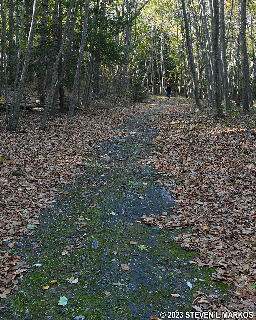
Typical terrain on the east-central section of the Outer Blue Mountain Lake Trail, Delaware Water Gap National Recreation Area
Both my hiking GPS and a phone-based hiking app that I use show two or three intersections with trails that branch off to the left, but I only saw one, a wide grass road at the top of the hill, 1.8 mile into the hike. This connects to the end of the middle trail mentioned earlier (see corrected map). Regardless of how many intersections there actually are, ignore all of them and just keep hiking straight until you get to the Hemlock Pond Trail.
At the two-mile point is a pond that is shown on my hiking app but not on my GPS or the National Park Service map. If you do the hike in the morning, you can get a nice photograph. Later in the day the sun will be shining right in your face.

Small pond along the Outer Blue Mountain Lake Trail southwest of Hemlock Pond, Delaware Water Gap National Recreation Area

Outer Blue Mountain Lake Trail passes a small pond southwest of Hemlock Pond, Delaware Water Gap National Recreation Area
Just past the pond, the Outer Blue Mountain Lake Trail descends a hill that is a little steeper than the previous ones, perhaps moderate in difficulty. It lasts for less than 100 yards, and at the bottom, the trail makes a big curve to the left. A tenth of a mile later is the intersection with the Hemlock Pond Trail. At this point you will have hiked 2.25 miles.
If you plan on hiking around Hemlock Pond, take a right. This will allow you to make a big loop out of both trails. If all you want to do is hike the Outer Blue Mountain Lake Trail, take a left to head northwest over to the other side of the loop. This section is shared by both the Outer Trail and the Hemlock Pond Trail, which explains why you will see blue and green blazes on the trees (green is for the Hemlock Pond Trail).
No sooner do you turn left than you come to one of the steeper hills on the hike. It is only 100 feet long, but the grade averages 15%.

Hilly terrain at the northern end of the Outer Blue Mountain Lake Trail as it runs parallel to the shore of Hemlock Pond, Delaware Water Gap National Recreation Area
The shared section of trail is a quarter mile long, uphill halfway and downhill the other. When you get to the other side of the loop, the trail comes to a T-intersection. A right sets you off hiking the Hemlock Pond Trail in the clockwise direction, while a left leads back towards Blue Mountain Lake. If you want to see Hemlock Pond, it’s only a couple minutes walk to the dam from the intersection.

Hemlock Pond at Delaware Water Gap National Recreation Area
The hike back southwest towards Blue Mountain Lake, while not a mirror image of the hike out, is very similar. The trail is an old road, and the terrain is hilly with a few moderate climbs. Lots of ups and downs.

Typical terrain on the northwest end of the Outer Blue Mountain Lake Trail, Delaware Water Gap National Recreation Area
I’m not sure if it will be there when you do the hike, but there was an old lawn mower sitting on a large rock. I was surprised to see such a contraption in the middle of the trail, and even more surprised that nobody had carted it off.

Old lawn mower on the northwest end of the Outer Blue Mountain Lake Trail, Delaware Water Gap National Recreation Area
At the 3.5-mile point on the hike, the Outer Blue Mountain Lake Trail intersects with another connector over to the Inner Trail. There is a tree with a double blue blaze that stairsteps to the right at the intersection. A double blaze indicates a turn, and the direction of the stairstep indicates which way to turn. Thus, stay to the right to remain on the Outer Trail.

West-central intersection of the Outer Blue Mountain Lake Trail and a connector to the Inner Blue Mountain Lake Trail, Delaware Water Gap National Recreation Area
Just past the intersection is the steepest hill on the entire hike. I knew it when I hiked it, even though I couldn’t confirm it with statistics until I got home and analyzed the data. It is a couple hundred feet long and has a grade of 16%.

Steep hill on the west-central section of the Outer Blue Mountain Lake Trail, Delaware Water Gap National Recreation Area
As you approach the southwestern end of the trail, you’ll be back to the area with numerous intersections that are not on the National Park Service map. At some point you must cut over to the left to a trail that runs between the Outer and Inner trails—not on the map—similar to the situation on the other side of the lake (see corrected trail map). I made the turn at a 4-way intersection that comes 4.35 miles into the hike. There was a tree down across the trail straight ahead—could be there on purpose to block the route—and a giant boulder blocking the trail to the right, leaving a left as the most logical way to go. There are no blue blazes anywhere, but you can’t miss the boulder.

Boulder at the 4-way intersection at the southwest end of the Outer Blue Mountain Lake Trail, Delaware Water Gap National Recreation Area
A hundred yards from the 4-way intersection, the trail curves to the right, crossing some terrain that looked rough enough to make me doubt I was on the right path. However, I did see a blue blaze, so this is at least one way to go. My buddy who was hiking with me continued straight at the 4-way (hiking around the downed tree) and made it back to the parking lot as well.

Rough terrain at the southwest end of the Outer Blue Mountain Lake Trail, Delaware Water Gap National Recreation Area
Beyond the rocky area, the Outer Blue Mountain Lake Trail reverts to being an old road. It’s just another quarter mile to the parking lot, downhill all the way.

Typical terrain on the southwest side of the Outer Blue Mountain Lake Trail a quarter mile from the Blue Mountain Lake Parking Lot, Delaware Water Gap National Recreation Area
Aside from exercise, there’s not much reason to hike the Outer Blue Mountain Lake Trail since it goes nowhere near Blue Mountain Lake. I suggest spending your time on the Inner Trail, particularly if you are looking for some nice scenery. A quarter mile of that trail runs so close to the lake that you can jump right in.

End of the Outer Blue Mountain Lake Trail at the parking lot, Delaware Water Gap National Recreation Area
With a few exceptions, use of any photograph on the National Park Planner website requires a paid Royalty Free Editorial Use License or Commercial Use License. See the Photo Usage page for details.
Last updated on January 31, 2026


