

Highland Lighthouse and Lightkeeper’s Quarters at Cape Cod National Seashore
See the Lighthouses web page for an interactive location map.
PARKING
Parking for the Highland Lighthouse is done at the Highland House, a city of Truro museum. The lighthouse is a .2-mile walk from there. This is also the parking lot for the Highland Links Golf Course, a 9-hole course that is open to the public (it is owned by the National Park Service but run by a concessionaire). I arrived around 9 AM and there were plenty of parking spaces, but by noon the lot was quickly filling up.

Highland House Museum at Cape Cod National Seashore
LIGHTHOUSE TOURS
For those 48″ and taller, the Highland Lighthouse is typically open for climbing from mid-April through Columbus Day. There is a fee to climb the tower. Tickets are sold at the Lightkeeper’s Quarters, the house next to the actual lighthouse. If you pay to visit the Highland House Museum down the street—which is not operated by the National Park Service—you get a buck off the lighthouse admission price. See the Highland Light website for the current fees and schedule.
The Lightkeeper’s Quarters now serves as the visitor center and has a gift shop and small museum about the lighthouse.

Gift store inside the Lightkeeper’s Quarters at the Highland Lighthouse in Cape Cod National Seashore
The Highland Lighthouse is only 66 feet tall, so the climb is not as strenuous as other lighthouse climbs on the east coast. Being located on top of a 120-foot cliff overlooking the Atlantic Ocean, it did not have to be very tall.
Groups of twelve people are allowed to climb the lighthouse at one time, and groups are allowed up every fifteen minutes. A guide gives a brief introduction at the base of the lighthouse, and then you walk up on your own. Another guide is located at the top and can answer any questions you might have.

View from the top of the spiral staircase inside the Highland Lighthouse at Cape Cod National Seashore
If you are looking to take photos, the top level is enclosed in glass, so you’ll have to deal with glare and dirt. However, there is an open window one level below, and while you only get one view from there, it’s probably the best direction as far as views go. You can see the Highland House, the Highland Links golf course, and some of the houses in the area.

View of the Highland House and the Highland Links golf course from the Highland Lighthouse at Cape Cod National Seashore
Once at the top, information cards describe what you are seeing in all directions. The original lighthouse location and the Federal Aviation Administration (FAA) radar tower located within the Highlands Center complex are all part of the view.

View of the site where Cape Cod National Seashore’s Highland Lighthouse was originally located

FAA radar tower at Highlands Center on Cape Cod
I don’t know if there is a time limit for the stay at the top, but since all there is to do is take a look at the surrounding scenery, I can’t imagine spending much more than fifteen minutes.
MUSEUM
A small museum is located inside the Lightkeeper’s Quarters. There are three information panels that cover the Highland Light and the life of the lighthouse keeper. Artifacts include an original Fresnel lens (from another lighthouse), a section of a Fresnel lens used in the Highland Light between 1901 and 1946, and a collection of buttons used on the jackets of the lightkeeper.

Exhibits inside the Highland Lighthouse Museum at Cape Cod National Seashore
There is also a 10-minute video about the history of the Highland Lighthouse that plays continuously on a loop. It shows on a small screen mounted on the wall. There are no seats, so you must stand up to watch it.

Video about the Highland Lighthouse shows on a continuous loop inside the Lightkeeper’s Quarters, Cape Cod National Seashore
SCHEDULING YOUR TIME
It takes about an hour to visit the Highland Lighthouse. This includes time to read through the information in the museum, watch the film about the lighthouse, climb to the top, and walk the grounds and get photos of the lighthouse and lightkeeper’s quarters.
LIGHTHOUSE HISTORY
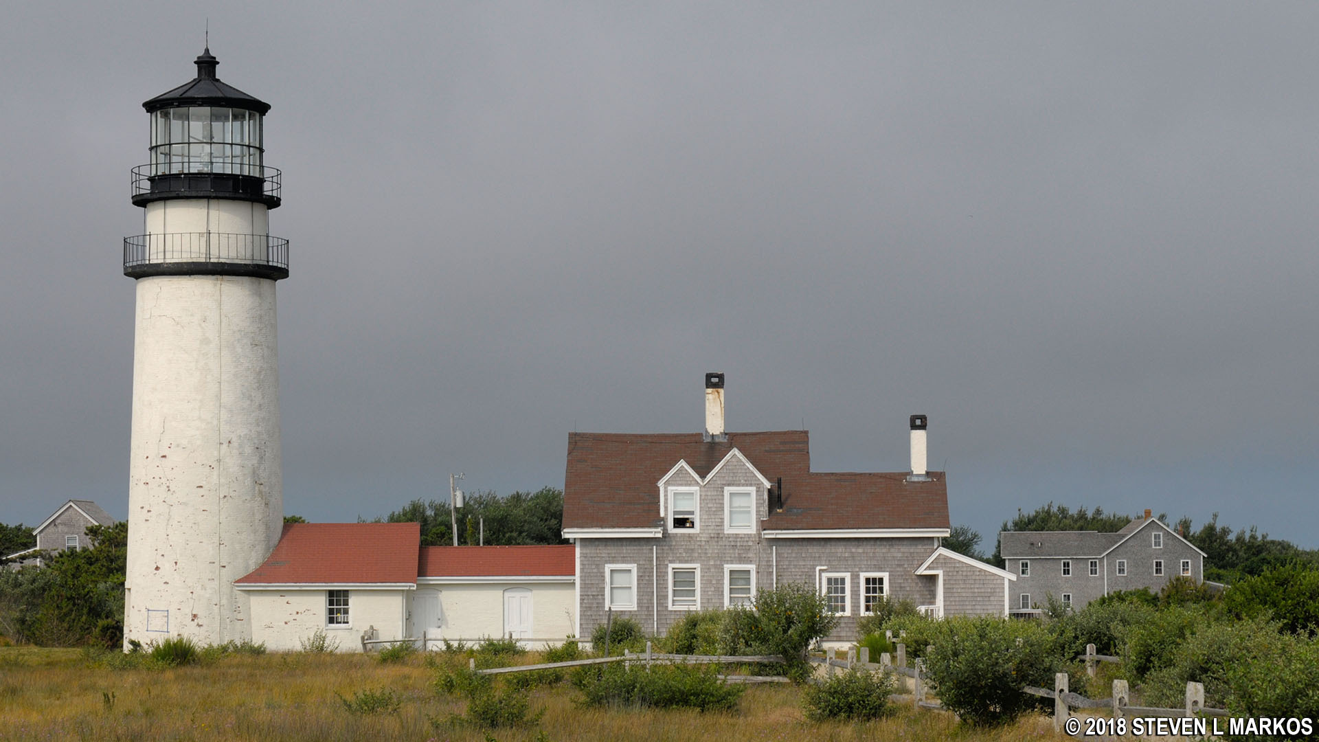
The original Highland Lighthouse (aka Cape Cod Lighthouse) was a 45-foot wooden tower that was authorized by President George Washington and completed in 1797. It was the first lighthouse on Cape Cod and the twentieth overall in the United States. The original structure was replaced by a brick lighthouse in 1831, and it operated until being replaced by the current lighthouse in 1857. At this time a new lightkeeper’s quarters—the house where the lightkeeper and his family lived—was built, as was a duplex for the two assistant lightkeepers (the duplex was torn down in the 1960s). The lighthouse still functions, but with GPS and radar it now serves more as a historical reminder of earlier times than an essential navigational aid.

Lightkeeper’s Quarters and Highland Lighthouse built in 1857, Cape Cod National Seashore
When originally built, the Highland Lighthouse was 500 feet from the edge of the cliff overlooking the Atlantic Ocean. By 1996, storms had eroded away the cliffs to the point where the lighthouse was within 125 feet of the edge. With erosion taking an average of three feet of shoreline each year, the decision was made to save the tower by moving it 453 feet farther inland. At the dedication and relighting ceremony on November 3, 1996, ownership of the lighthouse was transferred from the U. S. Coast Guard to the National Park Service, though the Coast Guard still operates the light.
A stone near the oceanside cliff marks the original location of the Highland Light. This is the best place to get a photo of the lighthouse and lightkeeper’s quarters because you can get far enough away to take in the entire structure, and you are slightly uphill compared to the front side of the buildings. The added elevation puts you more on an even level with the lighthouse.

Marker for the Highland Lighthouse’s original location, Cape Cod National Seashore
Back side of Cape Cod National Seashore’s Highland Lighthouse as seen from its original location
With a few exceptions, use of any photograph on the National Park Planner website requires a paid Royalty Free Editorial Use License or Commercial Use License. See the Photo Usage page for details.
Last updated on February 26, 2024


