
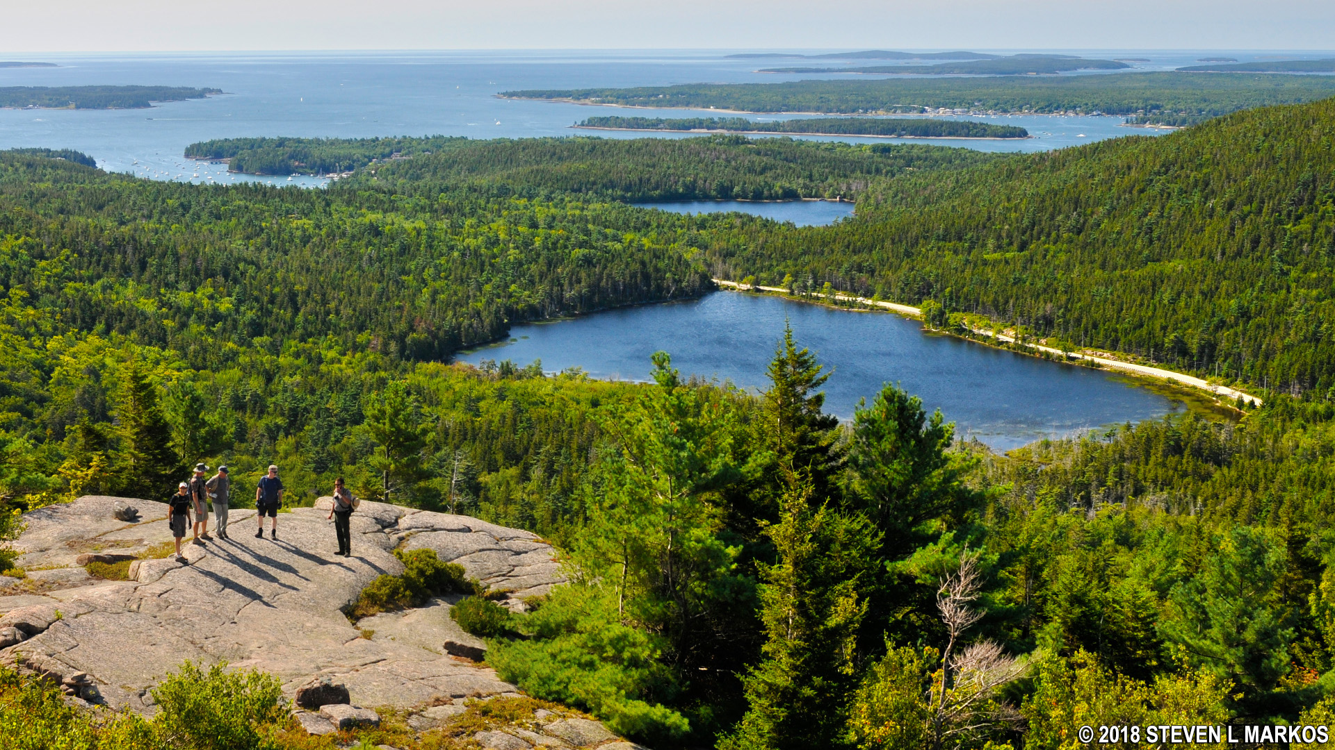
View from the summit of Bald Peak in Acadia National Park
I hiked to the top of Bald Peak as part of my hike to the summit of six mountains just west of Acadia National Park’s Jordan Pond on Mount Desert Island. This is the first leg of the journey. See the Six Mountain Summit Hike web page for more information.
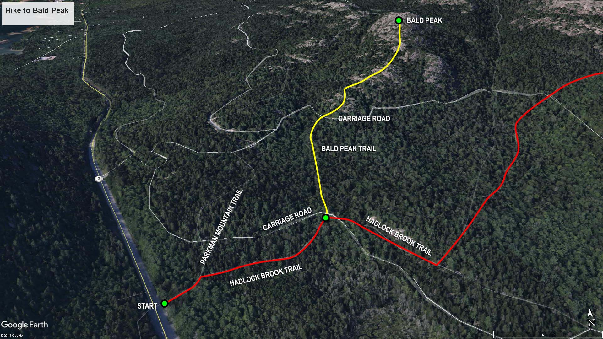
Hike to Bald Peak map (click to enlarge)
Length: 1 mile
Time: 1 hour
Difficulty: Very strenuous
The first stop on my Six Mountain Summit Hike at Acadia National Park is Bald Peak. The hike starts on Hadlock Brook Trail, which is located just north of Upper Hadlock Pond, directly across the road from the parking area on Highway 3.
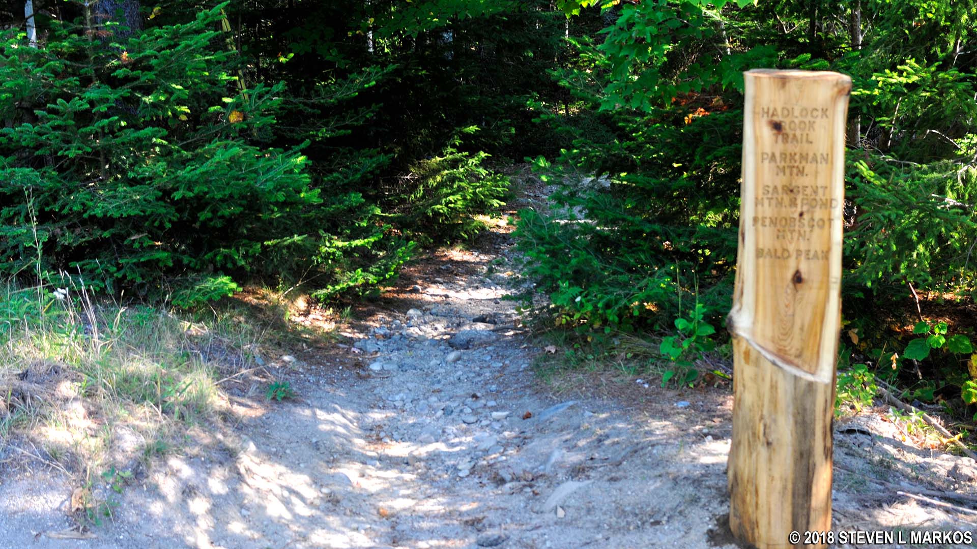
Trailhead for the Hadlock Brook Trail in Acadia National Park
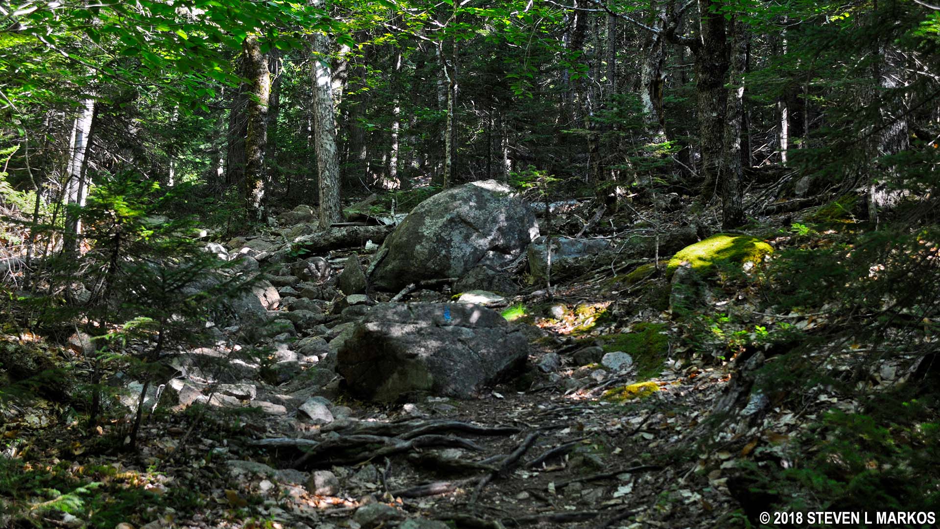
Begin by walking .2 mile down the trail until reaching the intersection with the Bald Peak Trail. You’ll come to the Parkman Mountain Trail intersection almost immediately, but just pass this by. Though a short segment, there are so many roots and football-size rocks that at times it’s nearly impossible to discern where the trail is, so look for the blue blazes on the trees and large boulders. These are paint splotches that function as Hansel and Gretel breadcrumbs. You typically can see from one blaze to the next, and if not, you should see one within a few minutes of hiking if you are going in the right direction.
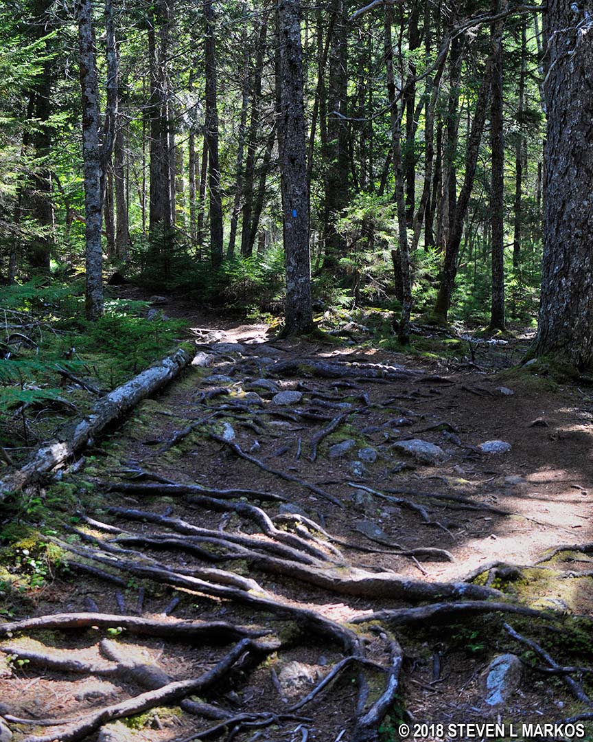
Typical terrain at the start of the Hadlock Brook Trail in Acadia National Park
The Bald Peak Trail branches off from the Hadlock Brook Trail to the left. Shortly afterwards, the trail crosses a carriage road. These look like normal gravel roads but can only be used by hikers, bikers, horseback riders, and those in horse-drawn carriages.

Trailhead for the Bald Peak Trail at the intersection with the Hadlock Brook Trail, Acadia National Park
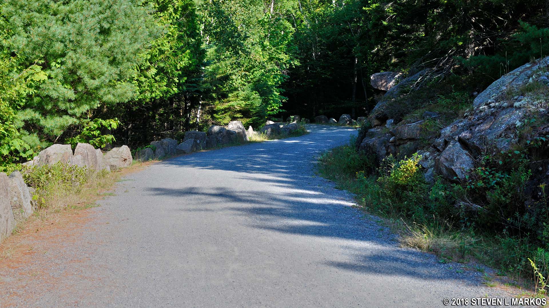
Typical carriage road at Acadia National Park
By this point in my visit to Acadia National Park I had hiked dozens of trails. I can say without reservation that the Bald Peak Trail is one of the hardest to follow. It begins through the forest, and much of it looks like a natural disaster area. Some sections don’t even resemble a trail, and at other spots there are three possible ways to go, so I really had to rely on the blazes.
Blue blazes painted on boulders mark the Bald Peak Trail at Acadia National Park
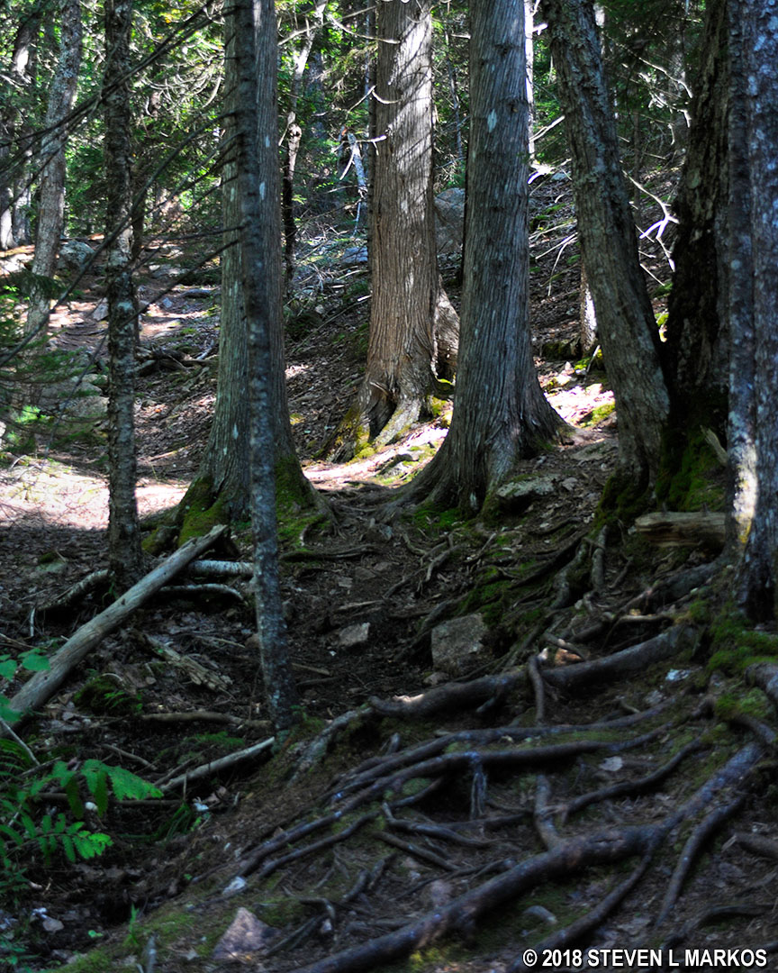
Faded blaze on a tree is the only sign that the Bald Peak Trail exists, Acadia National Park
The Bald Peak Trail crosses another carriage road at the half-mile mark, and from this point on it leaves the forest and begins traversing granite slabs that are often exposed to the sun. In areas where there are no trees, cairns are also used to mark the trail. These are distinct piles of rocks placed on barren surfaces.
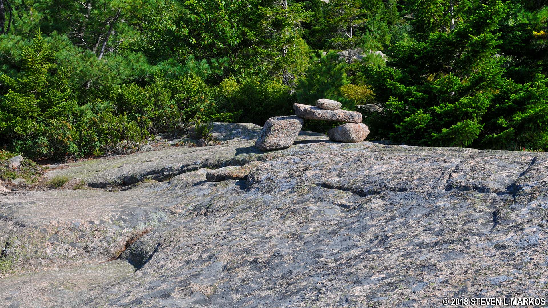
Example of a cairn on a trail at Acadia National Park
While the rocks and roots that populated the wooded section of the trail were hard to negotiate, the granite proves to be an even tougher hike, not because it is rugged, but because it is much steeper. There were a few sections that I had to climb on all four limbs like a dog.
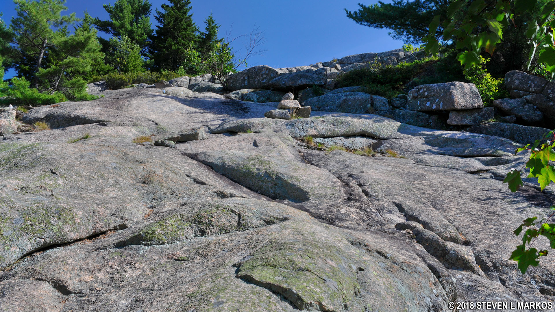
Steep granite slab on the upper section of the Bald Peak Trail at Acadia National Park
Whenever you get to an open area, turn around, because you are now high enough to start getting some nice views of Upper and Lower Hadlock ponds, Somes Sound, and other surrounding areas.
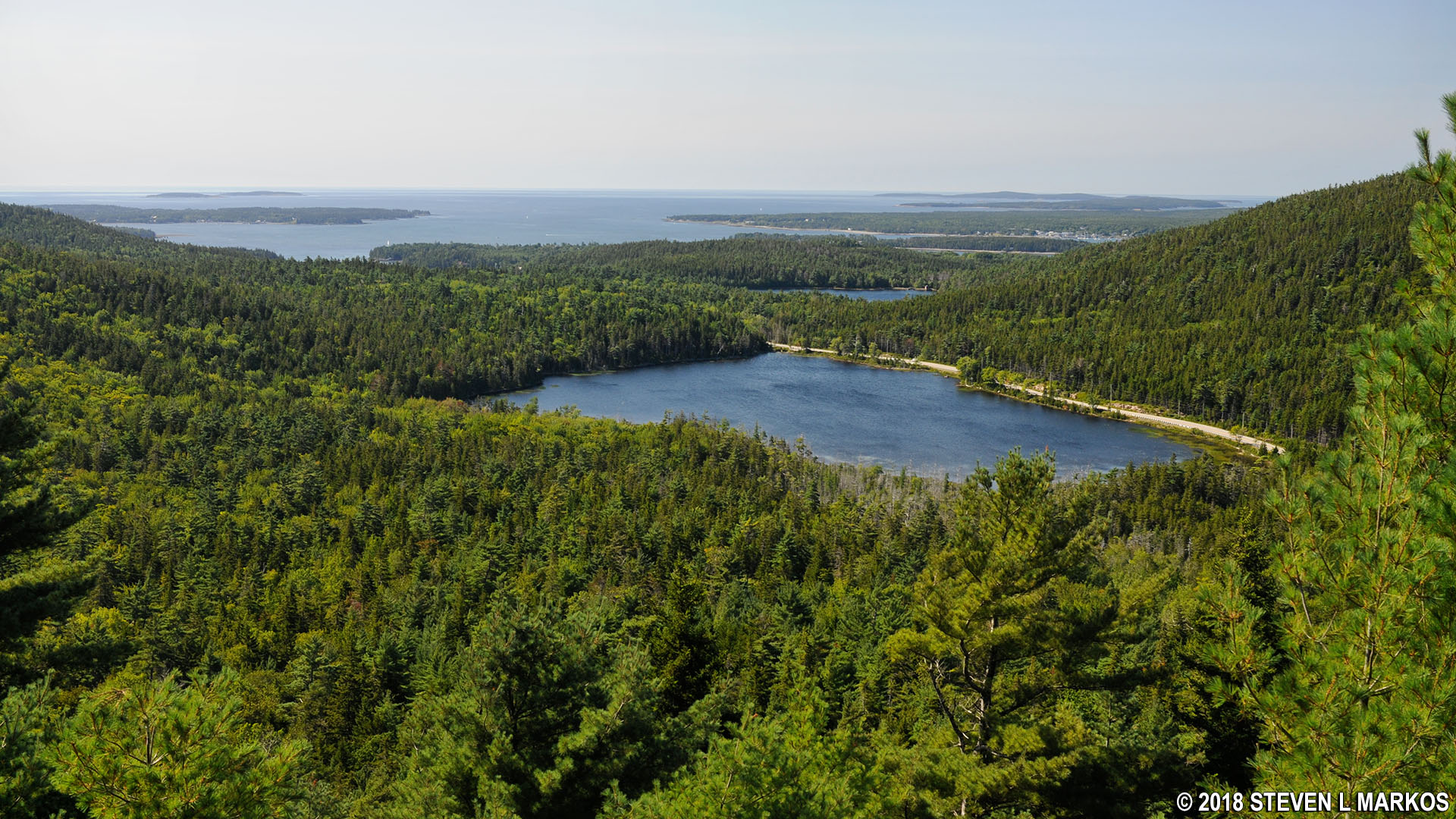
View of Upper and Lower Hadlock ponds and the mouth of Somes Sound from Acadia National Park’s Bald Peak
At .9 mile into the hike you come to a level slab of granite where you can see the top of the mountain, though you can’t see the actual summit from here.

Summit of Bald Peak in Acadia National Park
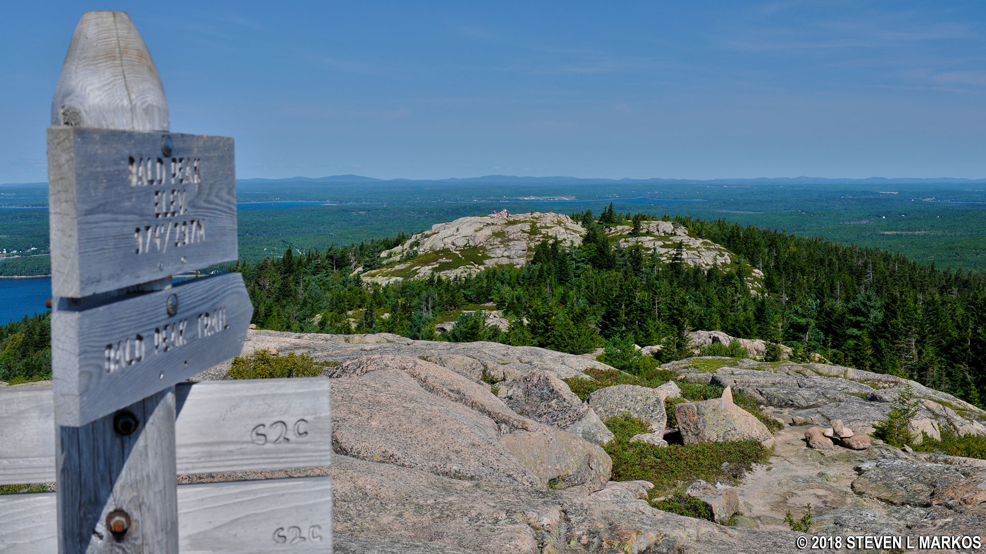
The top of Bald Peak is a fairly level, large granite field. The actual summit is marked with a sign that indicates the elevation.

Summit of Bald Peak in Acadia National Park

Sign marks the summit of Acadia National Park’s Bald Peak
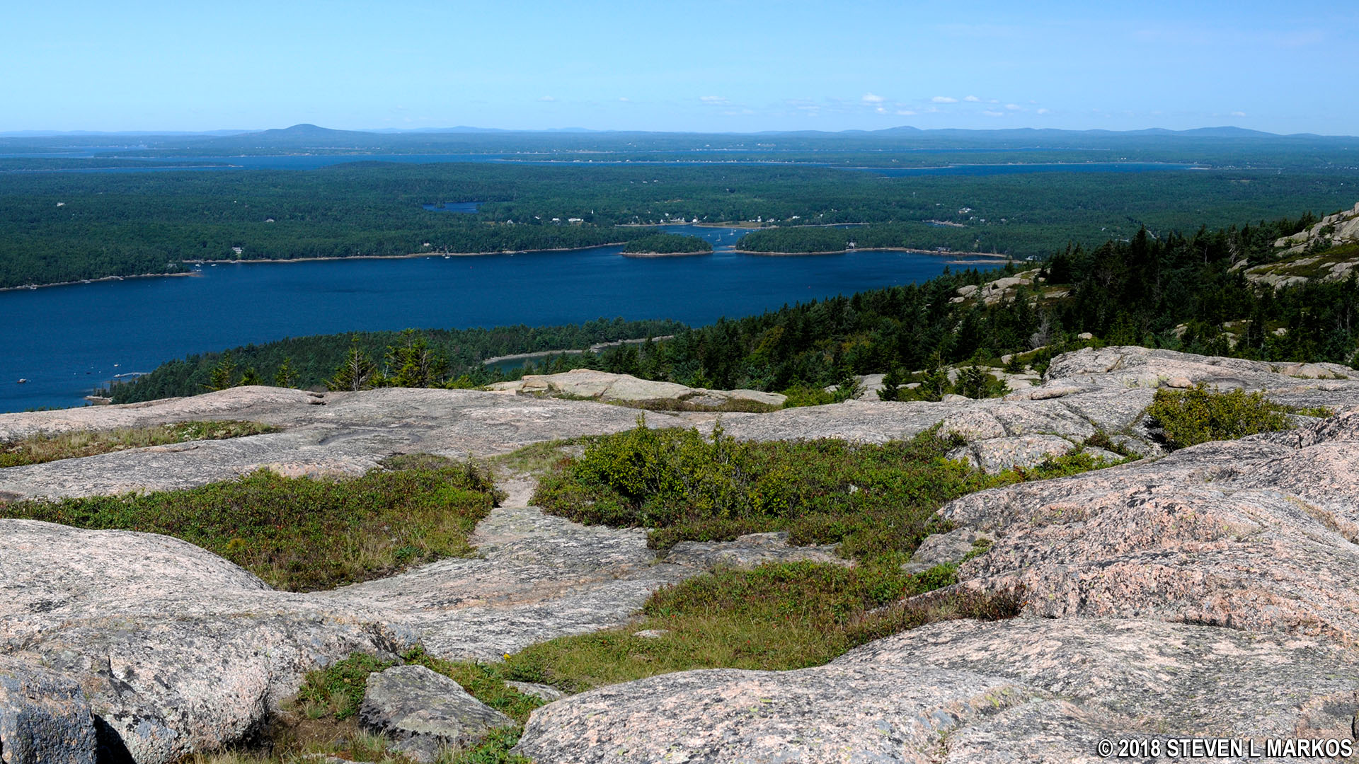
There are excellent views in all directions, though you may have to roam to different ends of the granite top for the best viewing locations.
Northwest view of the northern end of Somes Sound from the summit of Acadia National Park’s Bald Peak
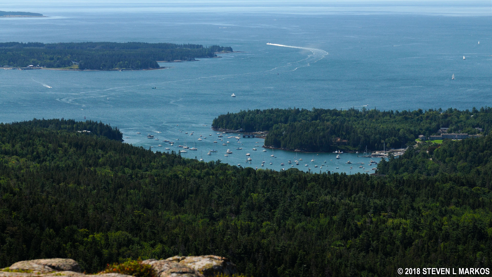
South view of Northeast Harbor from the summit of Acadia National Park’s Bald Peak

Southwest view from Acadia National Park’s Bald Peak of Lower Hadlock Pond, Greening Island in Somes Sound, and Blue Hill Bay
The next destination is Parkman Mountain, just .3 mile away and only 30 feet lower than Bald Peak. See the Bald Peak to Parkman Mountain Hike web page for details on this segment of the Six Mountain Summit Hike.
View of Parkman Mountain from Bald Peak in Acadia National Park
With a few exceptions, use of any photograph on the National Park Planner website requires a paid Royalty Free Editorial Use License or Commercial Use License. See the Photo Usage page for details.
Last updated on August 18, 2023


