
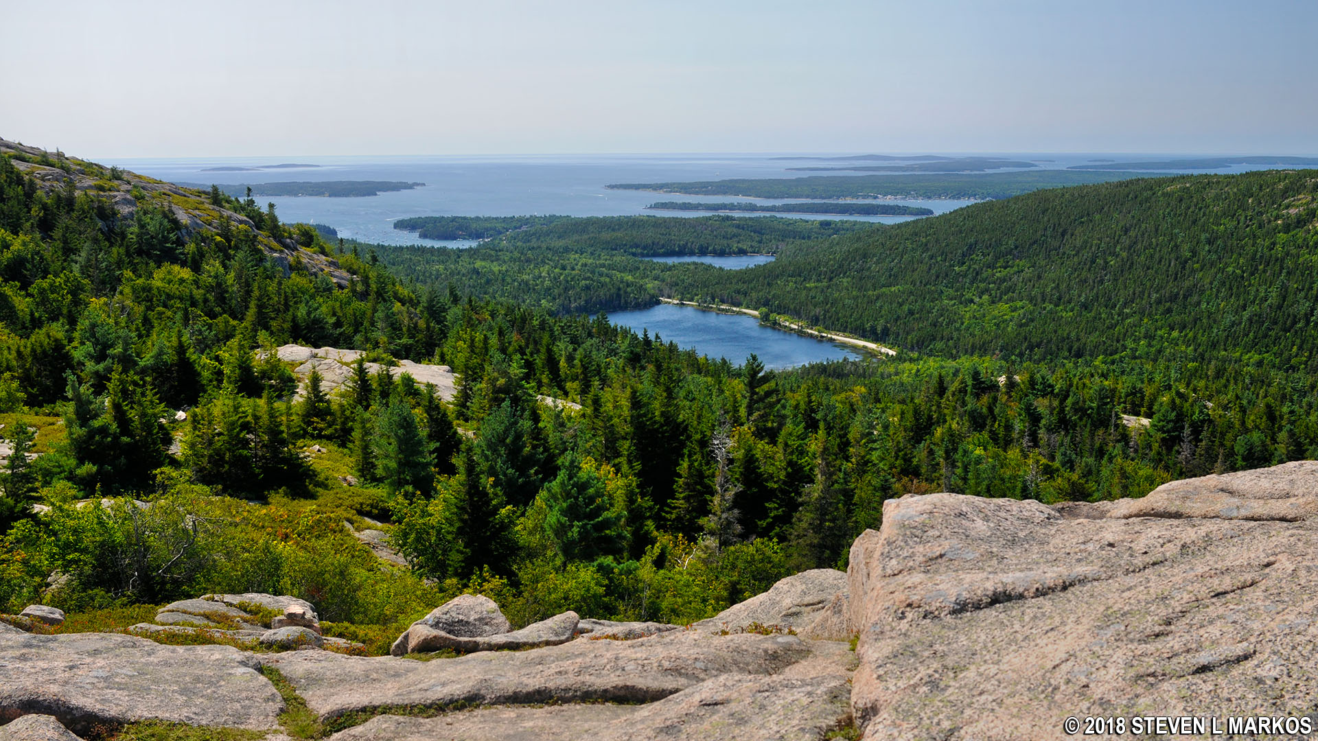
View from the top of Parkman Mountain in Acadia National Park
I hiked to the top of Parkman Mountain as part of my hike to the summit of six mountains just west of Acadia National Park’s Jordan Pond on Mount Desert Island. This is the second leg of the journey, and it starts at the top of Bald Peak. See the Hike to Bald Peak web page for more information about reaching Bald Peak. See the Six Mountain Summit Hike web page for more information on the entire hike.

Bald Peak to Parkman Mountain Hike map (click to enlarge)
Length: .3 mile
Time: 20 minutes
Difficulty: Strenuous
From the top of Bald Peak you can see the next destination, Parkman Mountain, for it is just .3 mile away, and the difference in summit elevations is only 30 feet (the mountains themselves are roughly 950 feet tall). The good thing about the hike is that the valley between them is 850 feet in elevation (versus 300 feet at the parking lot), so you only have to hike down a hundred feet before hiking back up a hundred feet.
Hikers on their way to Bald Peak from Parkman Mountain, Acadia National Park
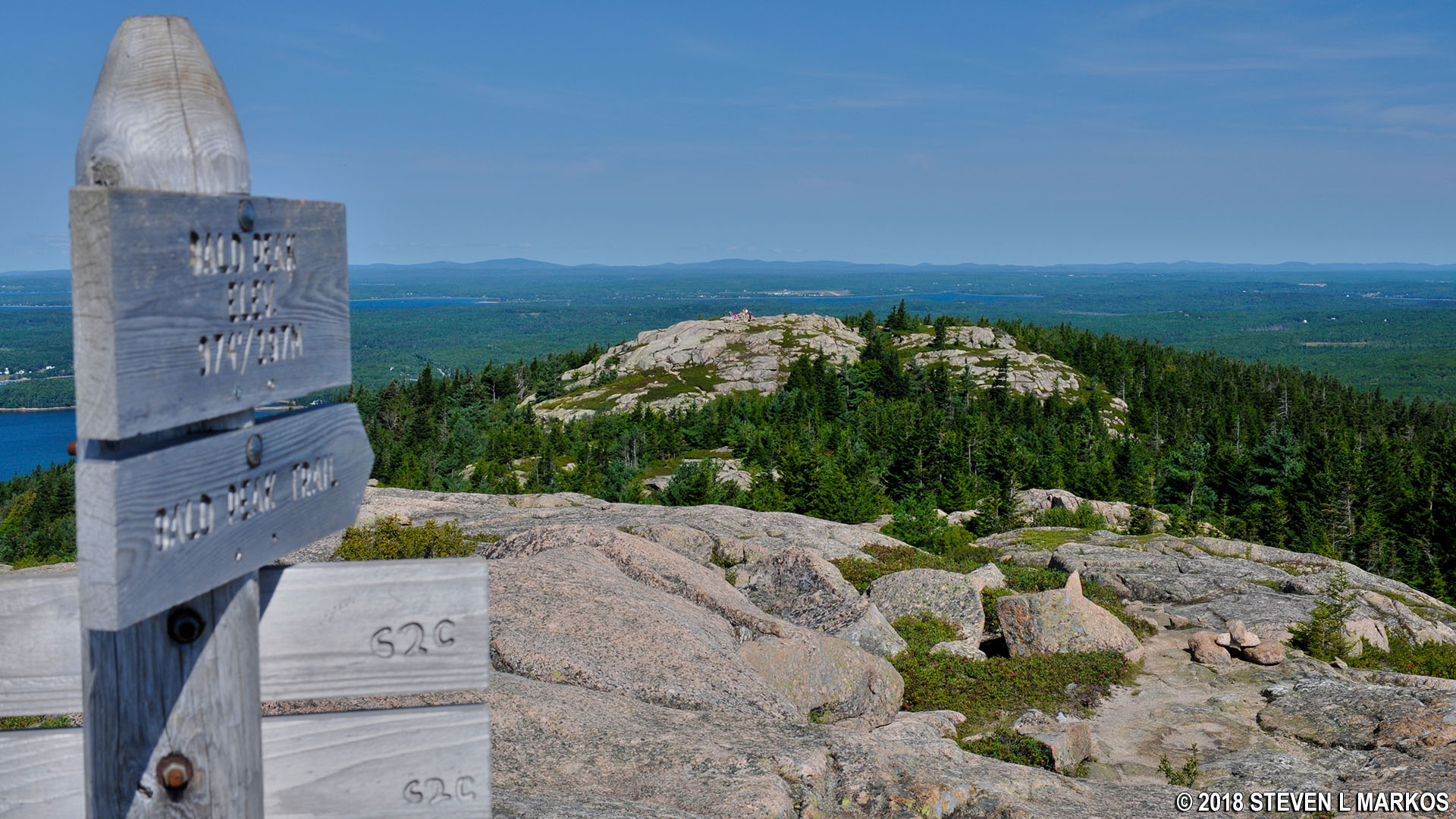
The hike to Bald Peak was along the Bald Peak Trail, but the trail doesn’t end at the summit. Instead, it continues for another .2 mile until dead ending into the Parkman Mountain Trail in the valley between the two mountains. The sign at the top of Bald Peak points the way.
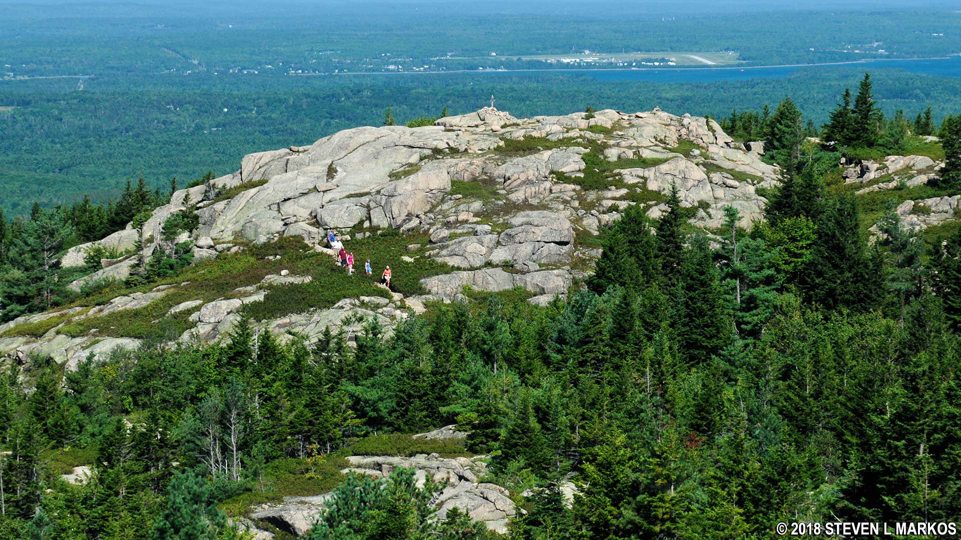
View of Parkman Mountain from Bald Peak, Acadia National Park
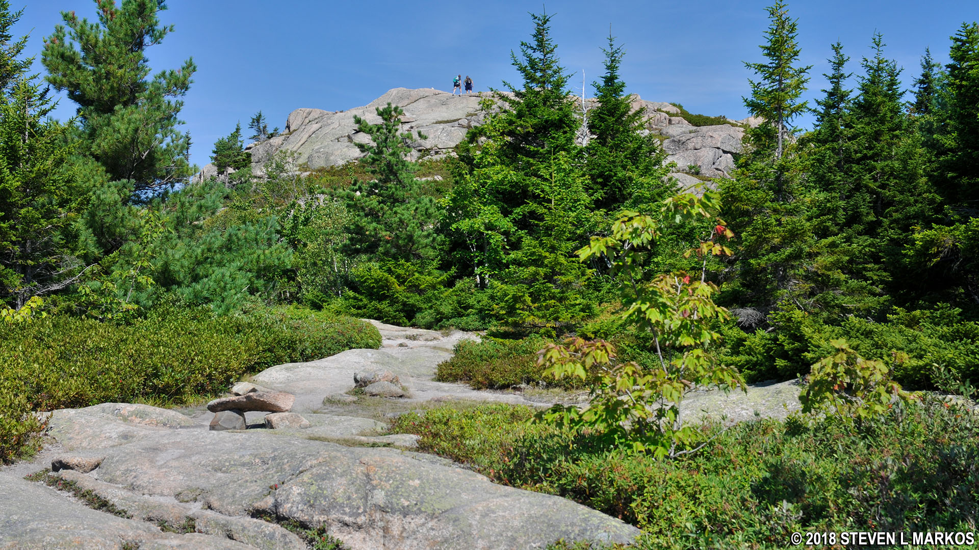
The trail heads downhill at a very fast pace along slabs of granite and boulder cliffs. Fortunately, the distance to the valley floor is just a tenth of a mile, so the descent takes only five minutes.

Steep and rocky terrain on the descent along the Bald Peak Trail from the Bald Peak summit, Acadia National Park
The walk across the valley is on level terrain, and in less than a tenth of a mile you’ll reach the Parkman Mountain Trail. You can see the summit from here, as it is just another tenth of a mile ahead. The hike to the top is identical to the descent—steep cliffs and granite slabs.
Summit of Parkman Mountain in Acadia National Park

Ascent up Parkman Mountain on the Parkman Mountain Trail, Acadia National Park
The summit is marked with a sign, and as with Bald Peak, the top of Parkman Mountain is a large, open field of granite that you can walk around on to reach different viewing areas. Being just .3 mile from where you were earlier, it should come as no surprise that the views are basically the same.
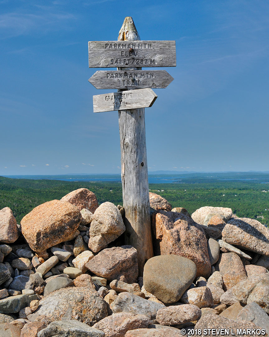
Parkman Mountain summit sign, Acadia National Park
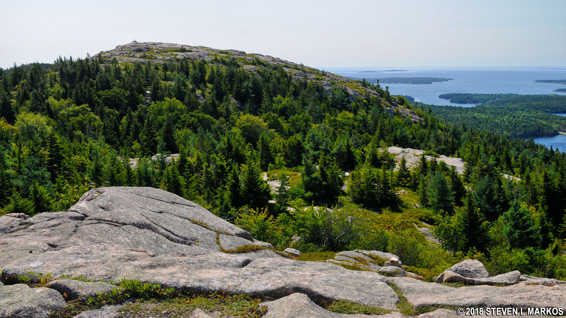
View of Bald Peak from the top of Parkman Mountain, Acadia National Park
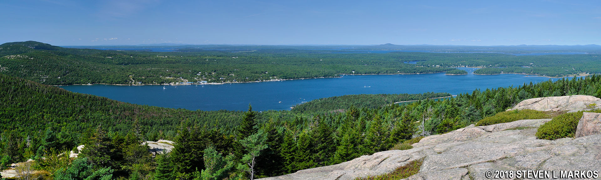
Panoramic view of the northern end of Somes Sound from the top of Parkman Mountain in Acadia National Park
The next destination is Gilmore Peak, a half mile away. See the Parkman Mountain to Gilmore Peak Hike web page for details on this segment of the Six Mountain Summit Hike.
With a few exceptions, use of any photograph on the National Park Planner website requires a paid Royalty Free Editorial Use License or Commercial Use License. See the Photo Usage page for details.
Last updated on August 10, 2023


