
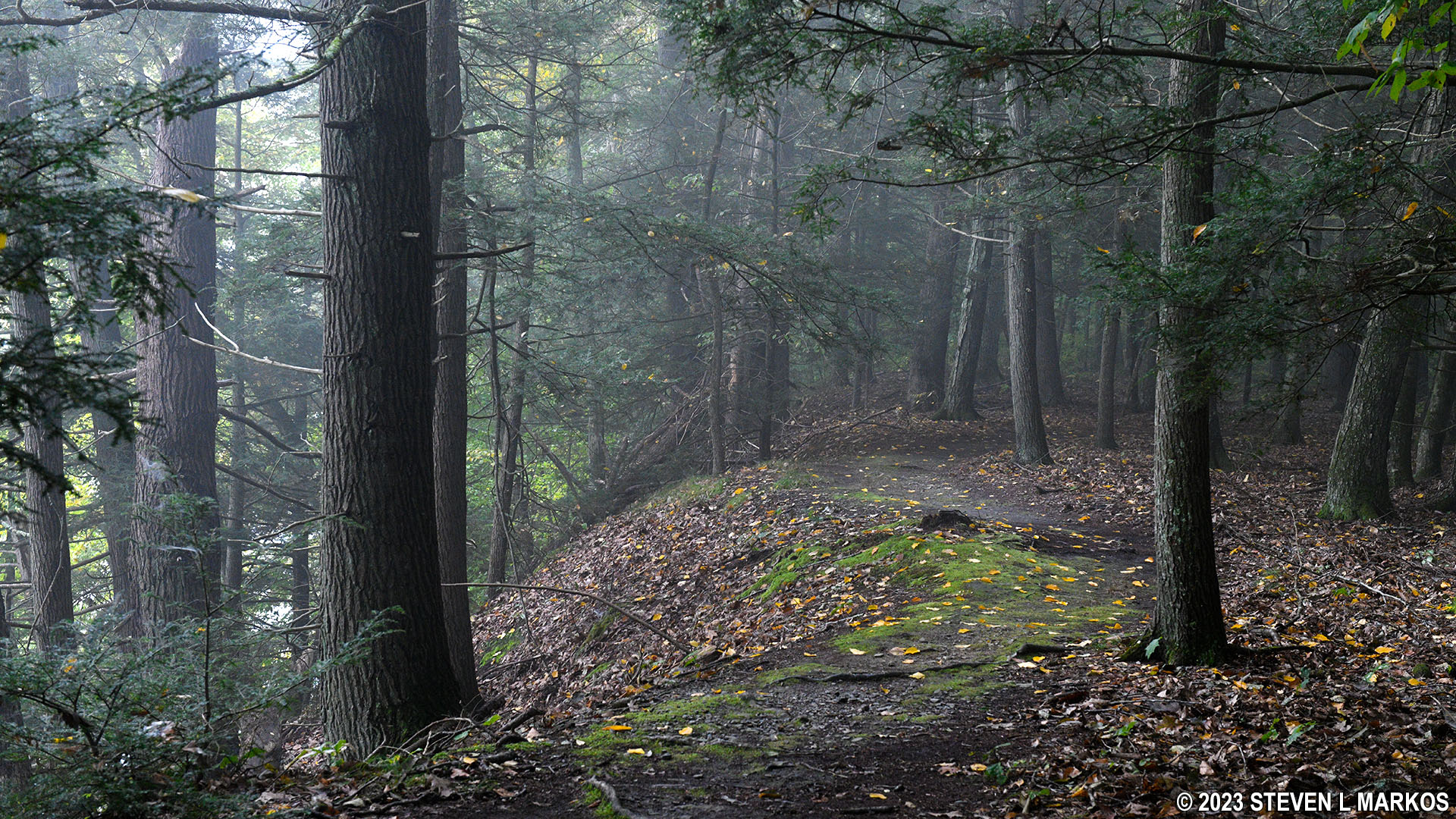
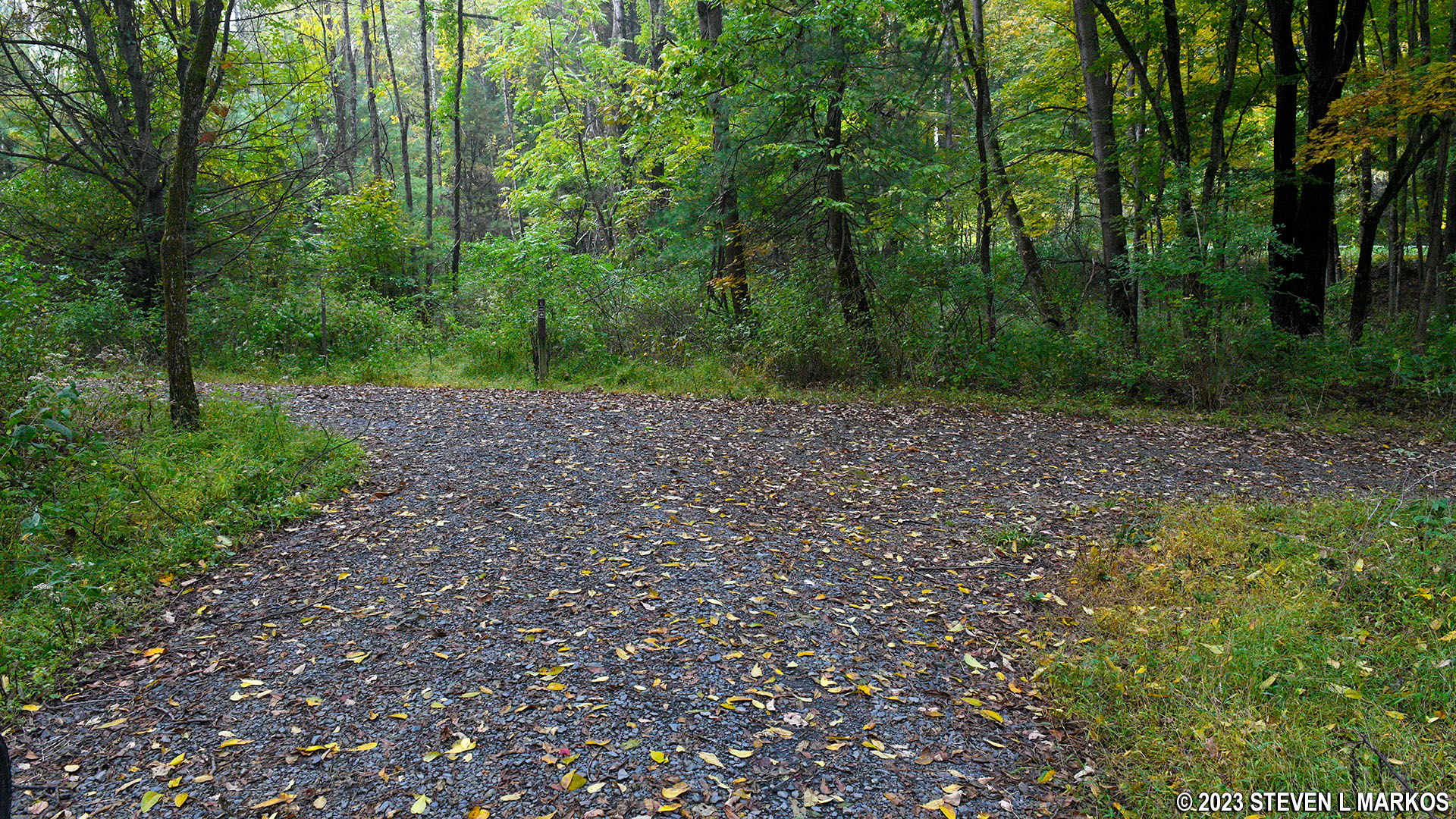
Hikers-only section of the McDade Recreational Trail between the Pittman Orchard and Conashaugh parking lots in Delaware Water Gap National Recreation Area
Note: There are mile marker posts along the McDade Trail just as there are along a highway. Trail miles are counted south to north, with Mile 0 being at the southern trailhead in Hialeah. Since this report is written from the perspective of traveling south from Pittman Orchard to Conashaugh, the accounting of the trail miles covered on the trip is in reverse order.
Trail Miles Covered: 28.6 to 26.2
Length: 2.4 miles
Difficulty: Moderate
River Run Shuttle: Does not stop at either parking lot
Before starting this review, I want to warn bikers that a half mile past the Pittman Orchard parking lot, the trail is open to hikers only all the way to the Conashaugh parking lot. Bikers must divert onto US 209 / Federal Road, a 45 MPH highway with no road shoulder (and speeds are more like 55 MPH). For those who value their lives and want to avoid biking on a highway, all you can do when starting at Pittman Orchard is to bike north to Milford Beach and back, a 4.5-mile round trip. There is also a hikers-only section between Conashaugh and the next parking area, White Pines. Thus, if you want a longer bike trip and are heading south, start at White Pines. You’ll have a 24-mile uninterrupted ride from there.

US 209 / Federal Road within Delaware Water Gap National Recreation Area
I also want to warn hikers that the Pittman Orchard-Conashaugh section of the trail is closed to everyone from December 15th to July 15th for eagle nesting season. If you are looking for something longer than the 4.5-mile out-and-back trip to Milford Beach during this time, start at Conashaugh. Now on to the trail review.
The parking lot at Pittman Orchard is on Federal Road and is connected to the McDade Trail by a short path (the trail parallels the road but is anywhere from within sight distance to a tenth of a mile away in this area). Upon arriving at the McDade Trail, turn right to head south and left to head north.
The McDade Trail starting at Pittman Orchard and heading south remains quite level for a half mile before ascending a mild hill back up to Federal Road where it crosses over Raymondskill Creek via a pedestrian bridge. If you want to see Raymondskill Falls, the Raymondskill Falls Trail is a short distance up Raymondskill Road, which is on the other side of Federal Road from the bridge.
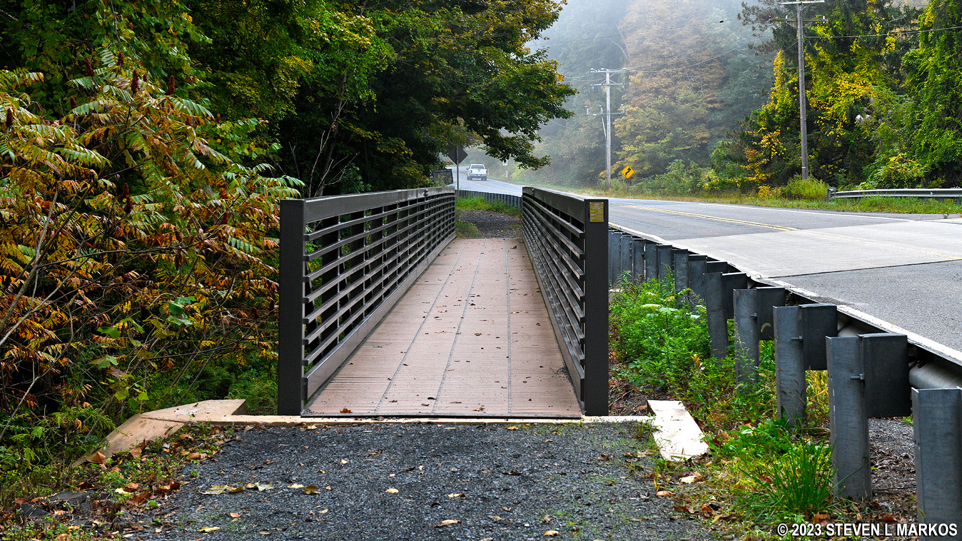
Bridge on the McDade Trail that spans Raymondskill Creek, Delaware Water Gap National Recreation Area
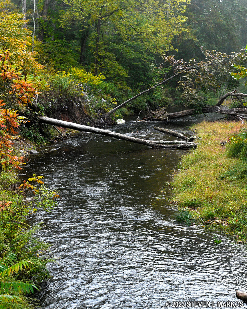
Raymondskill Creek in Delaware Water Gap National Recreation Area
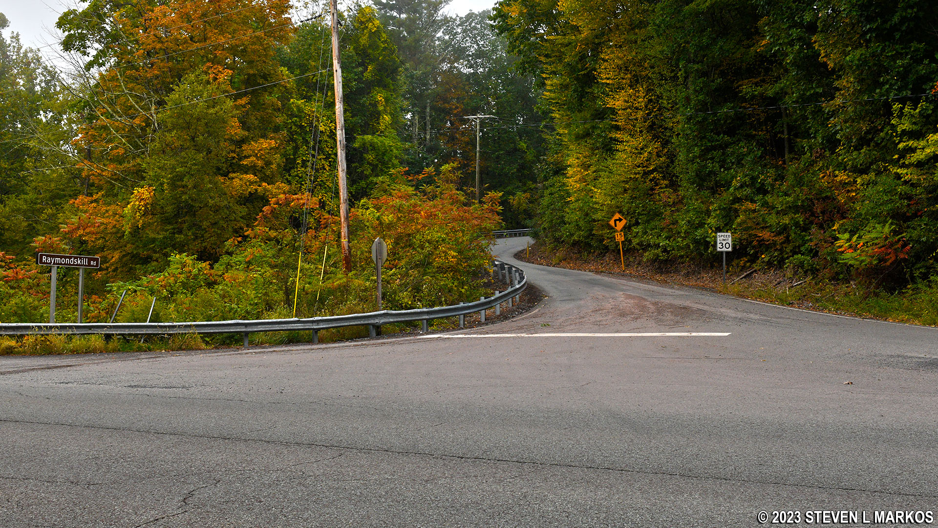
The Raymonskill Falls Trail is just up the road from the intersection of Federal and Raymondskill roads, Delaware Water Gap National Recreation Area
Just past the bridge, the McDade Trail dead ends at a T-intersection. A sign directs bikers to the right, back out to Federal Road, and hikers to the left. This is the end of the line for bikers (or even hikers during eagle nesting season). Bikers who want to continue south must ride on the highway for roughly four miles to the White Pines parking lot.
T-intersection on the McDade Trail just south of the bridge over Raymondskill Creek, Delaware Water Gap National Recreation Area
And bikers, before you think, “I’ll just push my bike on the hiker section,” that is an extremely grueling experience that I wouldn’t wish upon my worst enemy. Yes, I did it because on its website the National Park Service bills the entire trail as a 31-mile biking trail, and I was just some dunce from out of town that didn’t know any better. The hikers-only section runs right along a cliff, and the trail is so narrow in some spots that there is not enough room to walk next to your bike without it hanging off the cliff. There are also steep sections that use stone staircases. I would push my bike up a couple steps and then lock the brakes so I could pull myself up, then repeat the agonizing process over and over all the way to the top. I lost a $40 can of bear spray while doing this and had no desire to go back and find it.
If you are on foot at the T-intersection, take a left to continue hiking south on the McDade Trail. It actually remains a bikeable trail for about .6 mile before narrowing into a traditional hiking trail. At this point there is a NO BIKES sign.
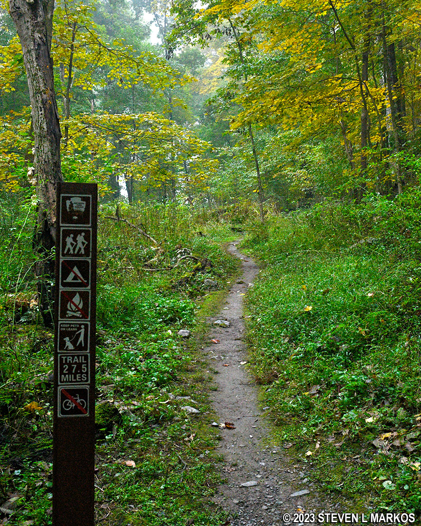
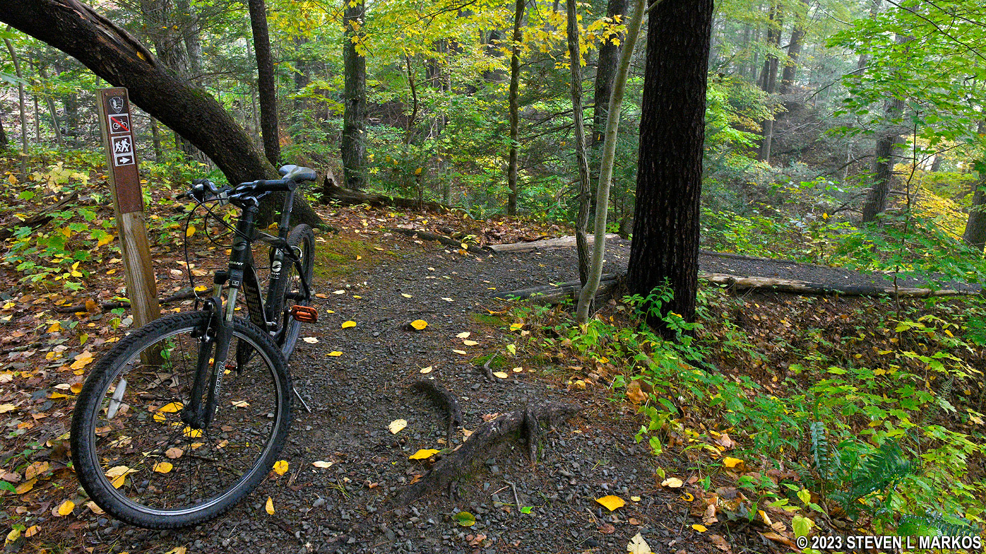
Start of the hikers-only section of the McDade Trail south of the Pittman Orchard parking lot, Delaware Water Gap National Recreation Area
Of course I, on my bike and not knowing any better, continued on, and for a few minutes the McDade Trail was really just a mountain bike trail. Then came one of the reasons why you can’t ride a bike, and one of the reasons why you don’t even want to push it along this section: the first of many stone staircases. This one has an average grade of 20%, so it is a tough climb even for hikers (15% is considered the start of strenuous hiking).
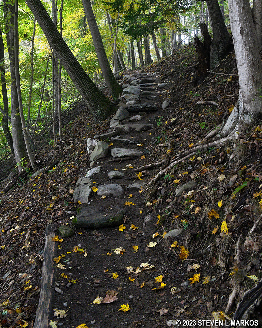
Stone staircase up a steep hill on the hikers-only section of the McDade Trail south of Pittman Orchard, Delaware Water Gap National Recreation Area
The McDade Trail soon makes its way down to a ridge / cliff directly above the Delaware River. There is a steep downhill slope on one side of the trail and a steep uphill slope on the other side. The trail is also extremely narrow—no place to be pushing a bike as I was—and any misstep could send you tumbling down the hill to a potential death, or at least serious injury. And Federal Road, in places, is just 25 feet away, but straight up the steep hill covered with thick vegetation. I was wishing I had taken the road, and there it was with no possibility for me to get to it.
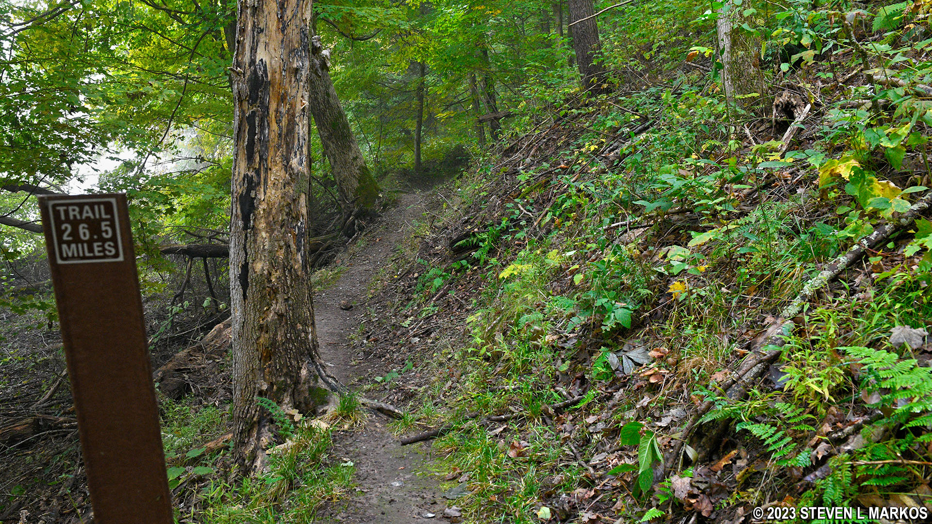
Very narrow segment of the hikers-only section of the McDade Trail south of Pittman Orchard, Delaware Water Gap National Recreation Area
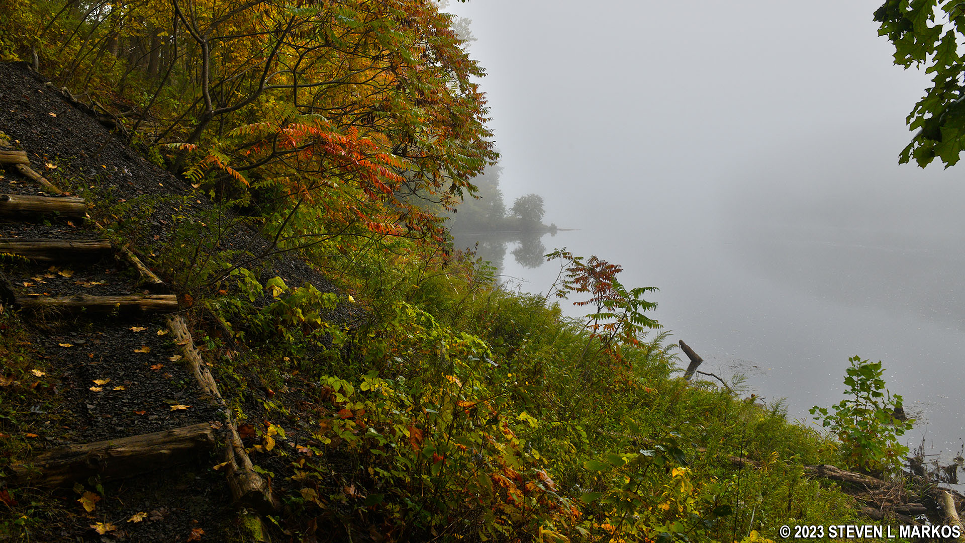
View of the Delaware River from the hikers-only section of the McDade Trail south of Pittman Orchard, Delaware Water Gap National Recreation Area
For hikers, this is a nice trail with great views of the river. Yes, there are some short-but-steep sections—five hills between 150 and 250 feet long with grades ranging from 20% to 28%—but most of it is pretty level.
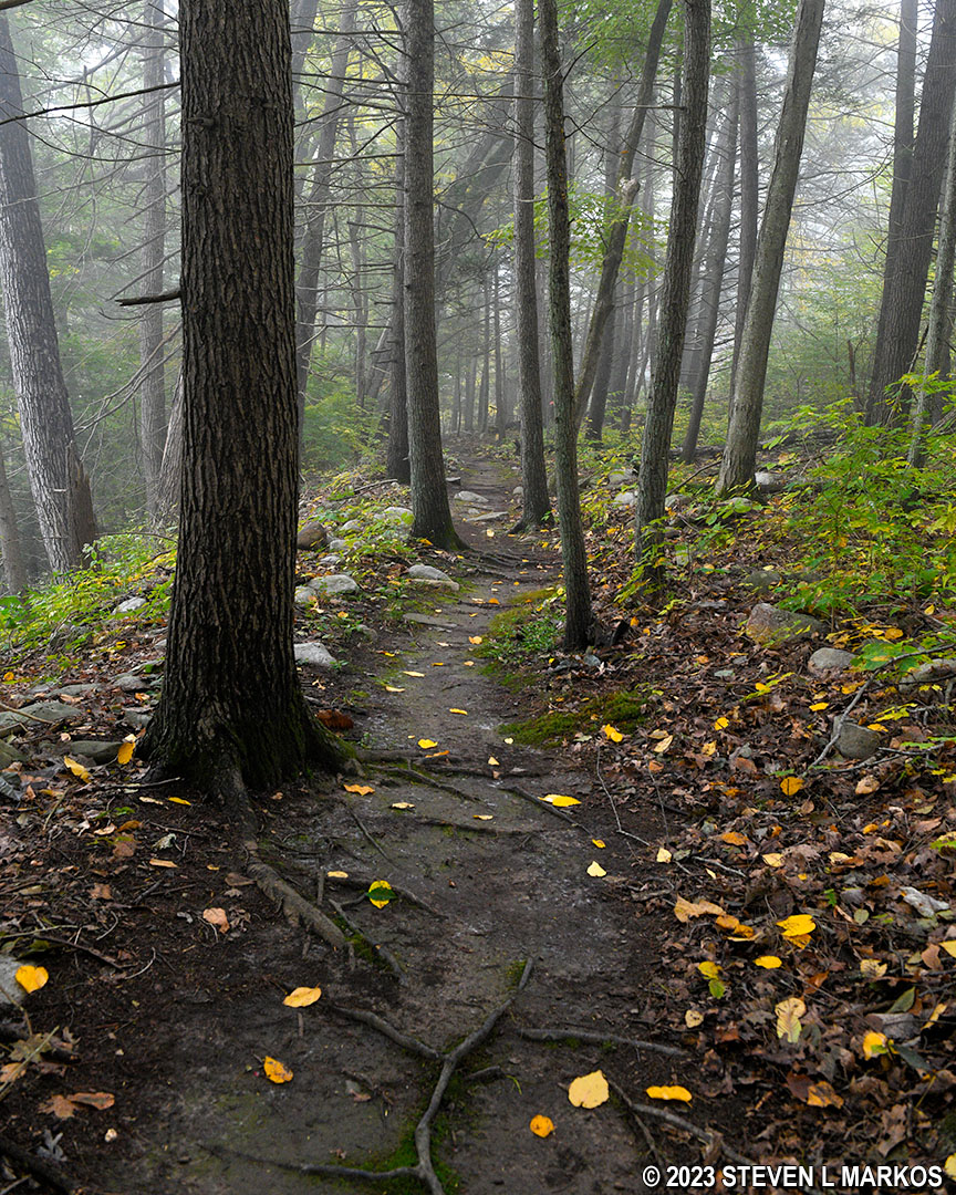
Typical terrain on the level segments of the hikers-only section of the McDade Trail south of Pittman Orchard, Delaware Water Gap National Recreation Area
The McDade Trail finally emerges from the forest at the Conashaugh parking lot on Federal Road. The hikers-only section is 1.4 miles in length and took me 50 minutes while pushing my bike. If you started from Milford Beach, you have now hiked (or biked) 4.6 miles.
End of the hikers-only section of the McDade Trail just north of the Conashaugh parking area on Federal Road in Delaware Water Gap National Recreation Area
Next Section South | Next Section North | McDade Trail Home Page
With a few exceptions, use of any photograph on the National Park Planner website requires a paid Royalty Free Editorial Use License or Commercial Use License. See the Photo Usage page for details.
Last updated on January 19, 2024


