
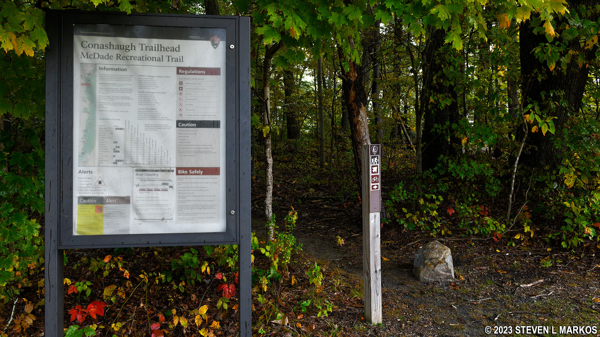
Conashaugh Trailhead on Federal Road for the McDade Trail in Delaware Water Gap National Recreation Area
Note: There are mile marker posts along the McDade Trail just as there are along a highway. Trail miles are counted south to north, with Mile 0 being at the southern trailhead in Hialeah. Since this report is written from the perspective of traveling south from Conashaugh to White Pines, the accounting of the trail miles covered on the trip is in reverse order.
Trail Miles Covered: 26.2 to 24.4
Length: 1.8 miles
Difficulty: Moderate
River Run Shuttle: Does not stop at either parking lot
Before getting to the trail review, I want to warn bikers not to start a trip on the McDade Trail from the Conashaugh trailhead because it is a hikers-only trail to the north until the Pittman Orchard parking lot and a hikers-only trail starting 1.25 mile to the south and continuing to White Pines. To get around these segments of the trail, bikers must divert onto US 209 / Federal Road, a 45 MPH highway with no road shoulder (and speeds are more like 55 MPH). For those who value their lives and want to avoid biking on a highway, you can start at Pittman Orchard and bike north to Milford Beach and back, a 4.5-mile round trip, or start at White Pines where you can bike south for 24 miles.

US 209 / Federal Road within Delaware Water Gap National Recreation Area
Hikers also need to be aware that the Pittman Orchard-Conashaugh section is closed to everyone from December 15th to July 15th for eagle nesting season. During this time, hikers starting at Conashaugh can only hike south. Now on to the trail review.
The Conashaugh parking lot is directly on Federal Road, and the McDade Trail starts directly from the parking lot. To the south, the trail runs very close to the road, though you can’t always see it due to trees and other vegetation. I began from here on my bike because, as I said in the Pittman Orchard to Conashaugh review, I was just a dunce from out of town who didn’t know to start at White Pines if I wanted to bike south on the McDade Trail. I ended up here after being stupid enough to push my bike along the hikers-only section to the north, a grueling experience that I wouldn’t wish upon my worst enemy. Of course I was going to face the same thing 1.25 mile from here.
Start of the McDade Trail at the Conashaugh parking area on Federal Road, Delaware Water Gap National Recreation Area
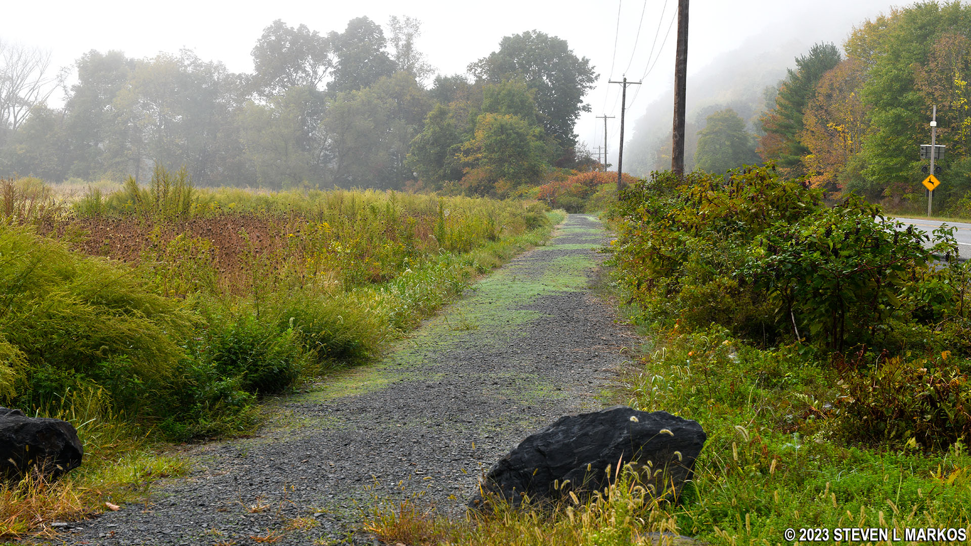
From the Conashaugh parking lot, the McDade Trail starts off to the south through another agricultural area. The first 1.25 mile covers level terrain except for a rollercoaster dip about three quarters of the way that first heads downhill to a creek crossing and then back up a very short-but-steep section with an average grade of 25% (most hikers agree that 15% is where strenuous starts).
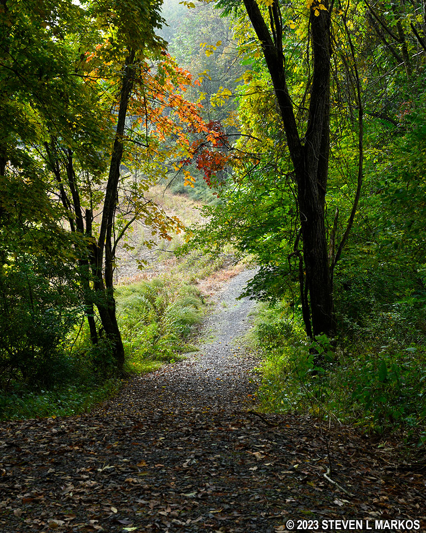
Steep downhill segment of the McDade Trail between Conashaugh and White Pines, Delaware Water Gap National Recreation Area
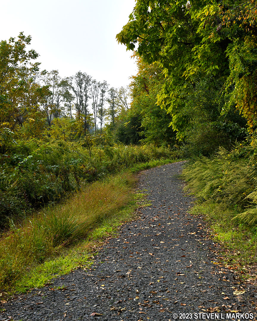
Steep uphill segment of the McDade Trail between Conashaugh and White Pines, Delaware Water Gap National Recreation Area
Just past the top of the hill is an intersection with no directional signage. Coming from the north and heading south as I was, the other trail merges with the McDade Trail. I’d have to make a sharp turn to the right—basically a U-turn—to get on it, and there is no reason for that since it is perfectly clear that the McDade Trail continues straight ahead. But if you are coming from the south and heading north, it is an obvious fork with no directional signage pointing which way to go (the photo below is taken from the perspective of a person traveling north). The right fork is the wider of the two trails, which should tip you off as to which way to go since it matches the McDade Trail you have been traveling on up to this point. I have no idea where the other trail goes, but it appears to cover nice and flat terrain.
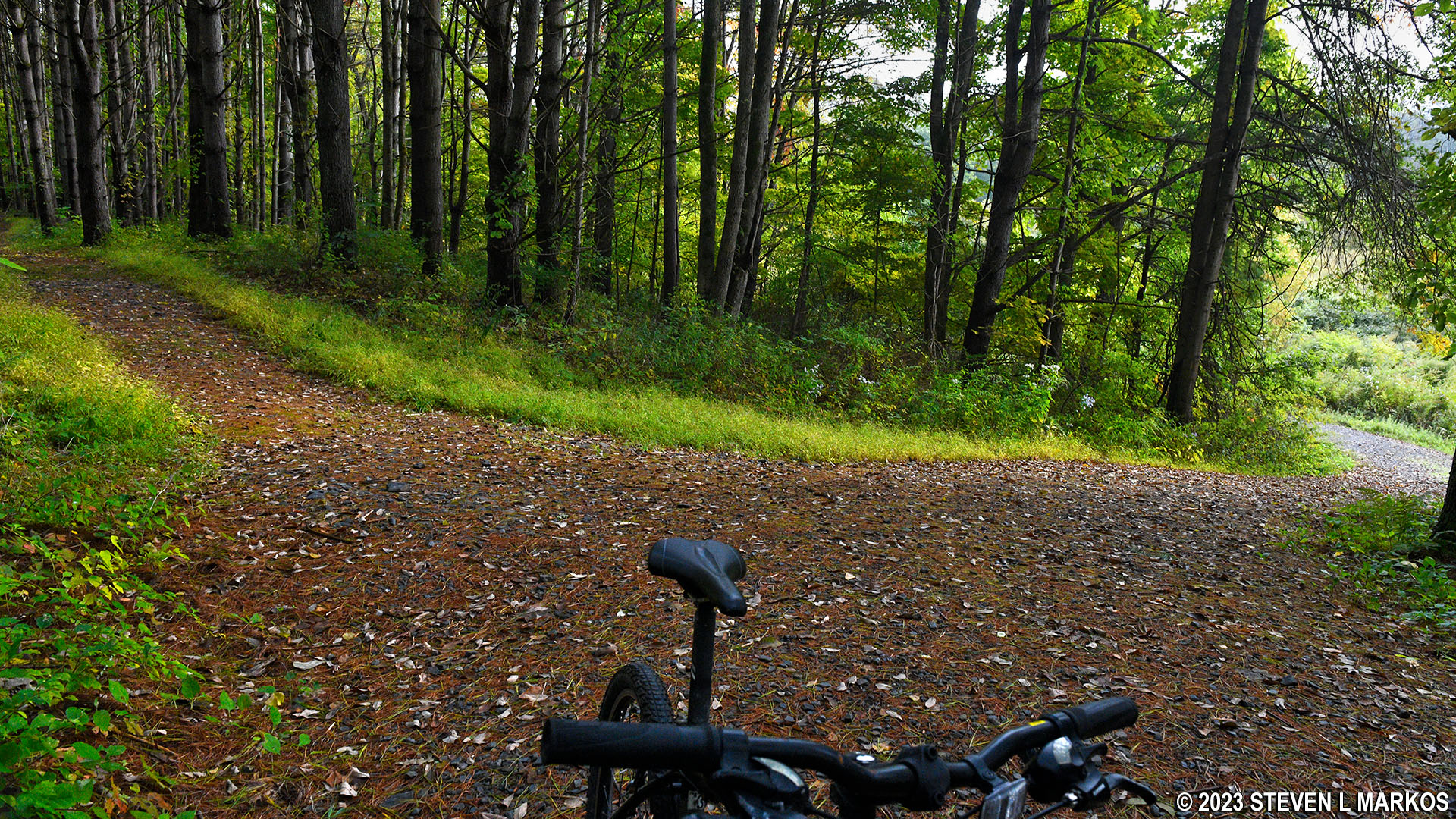
Unmarked intersection on the McDade Trail south of the Conashaugh parking area at Delaware Water Gap National Recreation Area
A quarter mile from the fork, there is a ROUGH TRAIL sign. What in the world does this mean? It means it’s back to no bikes, even though there are no signs specifically banning them as there are on the other hikers-only section. So from here to about a half mile from the White Pines parking lot, bikers must either use the road or push their bikes along a very rough traditional hiking trail. The problem is that there is no way to get to the road other than by biking all the way back to Conashaugh. If you aren’t willing to do that, and you aren’t willing to bike on US 209, you have no choice other than to push your bike for the next half mile up and over a steep hill. And just like the hikers-only section on the Pittman Orchard-Conashaugh segment, pushing a bike over this type of terrain is not fun in the least.
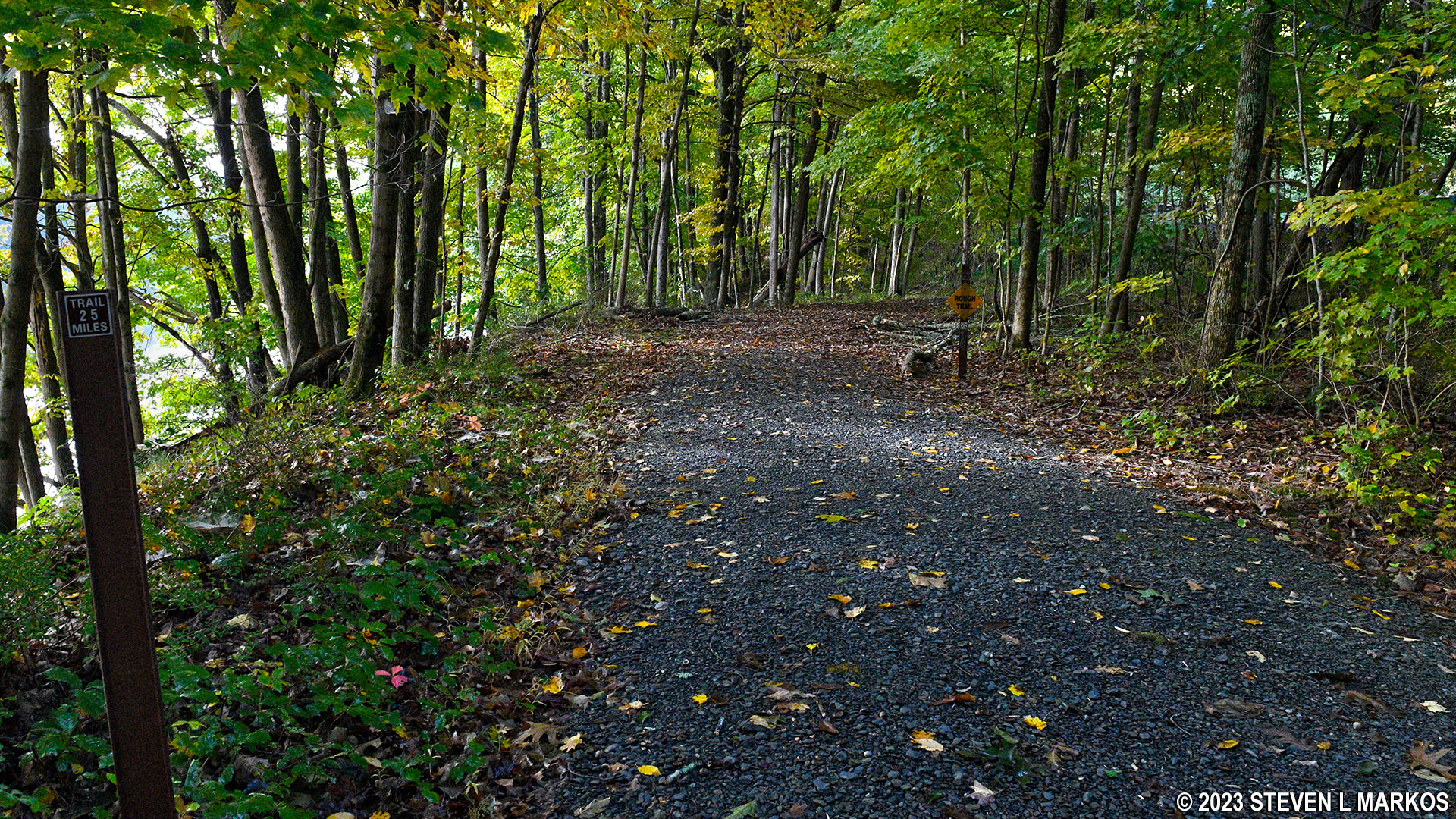
Start of the hikers-only section of the McDade Trail south of the Conashaugh parking lot, Delaware Water Gap National Recreation Area
For hikers, the climb up the hill is tough, but not a big deal. The hike up is a little short of two tenths of a mile and is accomplished via three mini climbs (100 feet or so each) with grades averaging between 15% and 18%. The trail runs right along the Delaware River at times, so you get some nice views.
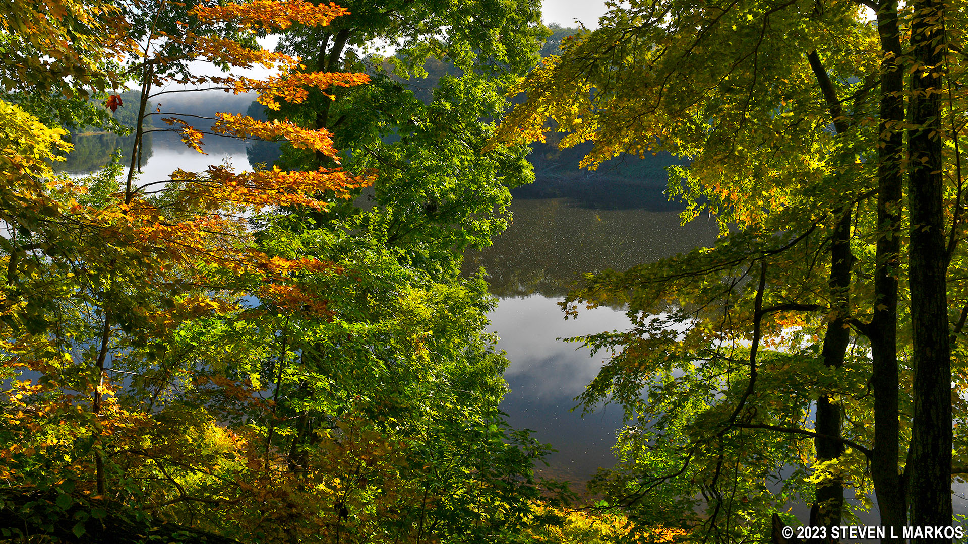
View of the Delaware River from the McDade Trail between Conashaugh and White Pines in Delaware Water Gap National Recreation Area
However, for those with bikes, there are wooden and stone staircases to climb. On the uphill climbs, I’d have to push my bike up the stairs ahead of my body, lock the brakes, pull myself up, and then repeat the agonizing process over and over all the way to the top. This half mile took me 20 minutes. Though there is a lot of pretty scenery, it’s the last thing on your mind. First thing is cursing the National Park Service for calling the McDade Trail a 31-mile biking trail. But as I said, I’m just a dunce from out of town who didn’t know any better. I’m sure the local bikers know to skip this section.
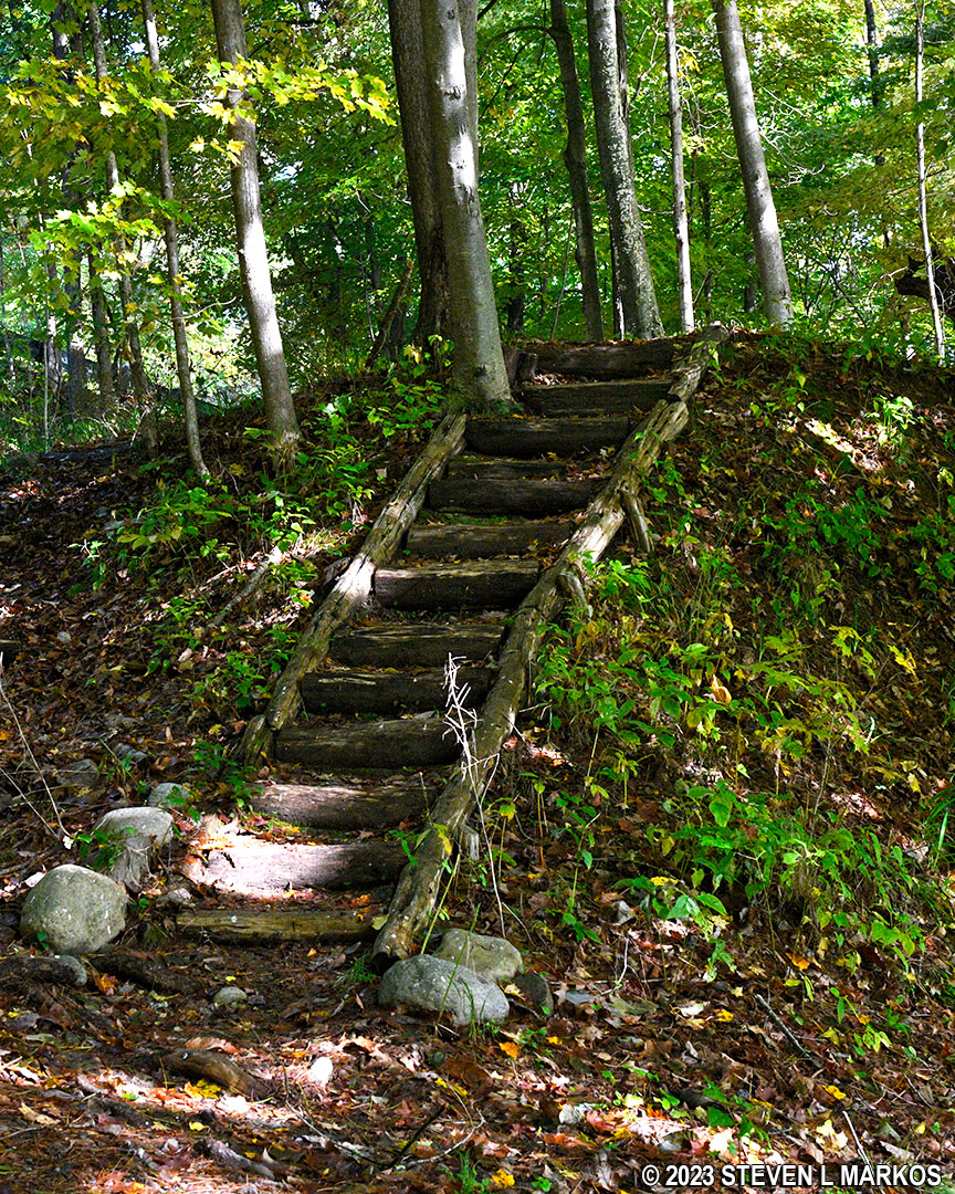
Section of stairs on the hikers-only section of the McDade Trail between Conashaugh and White Pines, Delaware Water Gap National Recreation Area
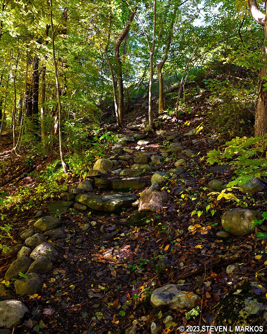
Stone staircase helps hikers scale a steep hill on the hikers-only section of the McDade Trail between Conashaugh and White Pines, Delaware Water Gap National Recreation Area
The McDade Trail eventually comes back out at Federal Road where it reverts to being a wide, gravel path that is open to both hikers and bikers—for what that’s worth to those biking. The trail runs right along the road for a quarter mile before veering away and heading down a hill for another .2 mile. At the bottom is the White Pines parking lot.
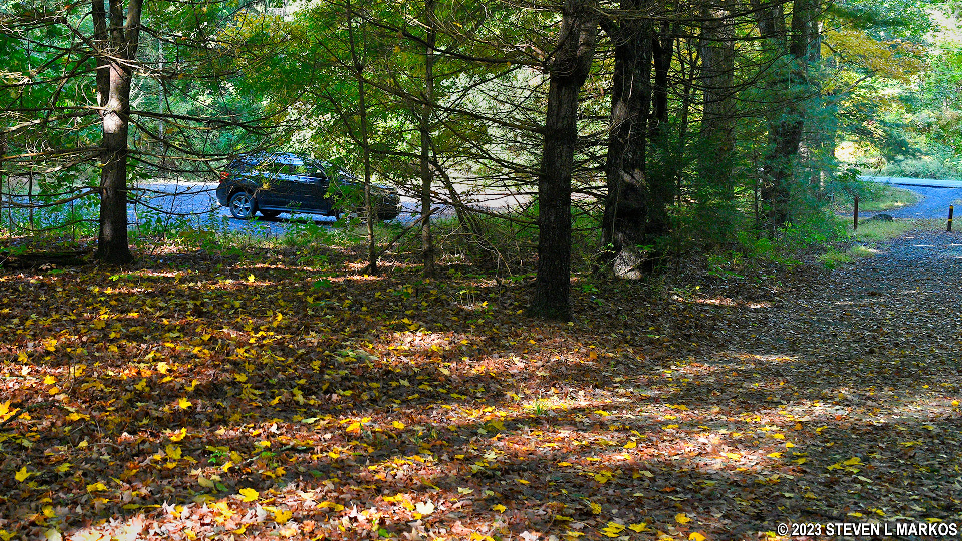
White Pines Trailhead parking on Federal Road for Delaware Water Gap National Recreation Area’s McDade Trail
Next Section South | Next Section North | McDade Trail Home Page
With a few exceptions, use of any photograph on the National Park Planner website requires a paid Royalty Free Editorial Use License or Commercial Use License. See the Photo Usage page for details.
Last updated on January 19, 2024


