
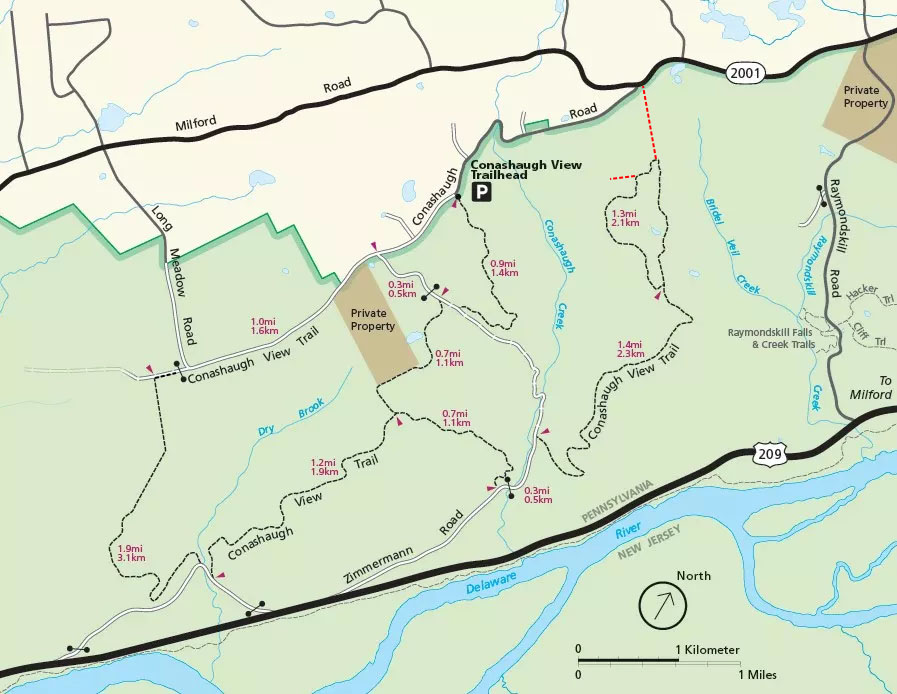
Corrected Conashaugh View Trail Map (click to enlarge)
The Conashaugh View Trail in Delaware Water Gap National Recreation Area is located on the Pennsylvania side of the park between Raymondskill Road and the Marie Zimmerman House. The trail is open to both hikers and horseback riders. For those on horseback, trailer parking is at the Conashaugh View Trailhead on Conashaugh Road.
The National Park Service claims there are nine miles of trails, but that does not account for the fact that one section is an out-and-back trail or that if you don’t have a ride waiting at one end, you have a long walk back to the main parking lot on one of the park roads. I hiked all the trails at one time starting at the Conashaugh View Trailhead and ending at the southern end of Conashaugh Road where I had a friend pick me up, and the distance was 10.6 miles. I started with the loop trail on the north side of Zimmerman Road (an old dirt road no longer in use), then continued on to the trails on the south side of Zimmerman Road.
The National Park Service considers all the trails in this area one trail, but nearly eleven miles is more than most hikers want to cover in one outing, particularly those without rides at one end. There are really two discontiguous trails, each of which can be hiked on its own. For review purposes, I am splitting the hike into two sections, using Zimmerman Road as the dividing point. Even if you don’t have a ride at one end and have to hike back to the starting point, these hikes are shorter than hiking everything at once. (NOTE: The trail names are my own creation.)
Conashaugh View Loop Trail
trail north of Zimmerman Road
6 miles one way / 9 miles round trip
Conashaugh View Trail South
trail south of Zimmerman Road
3.8 miles one way / 7.6 miles round trip
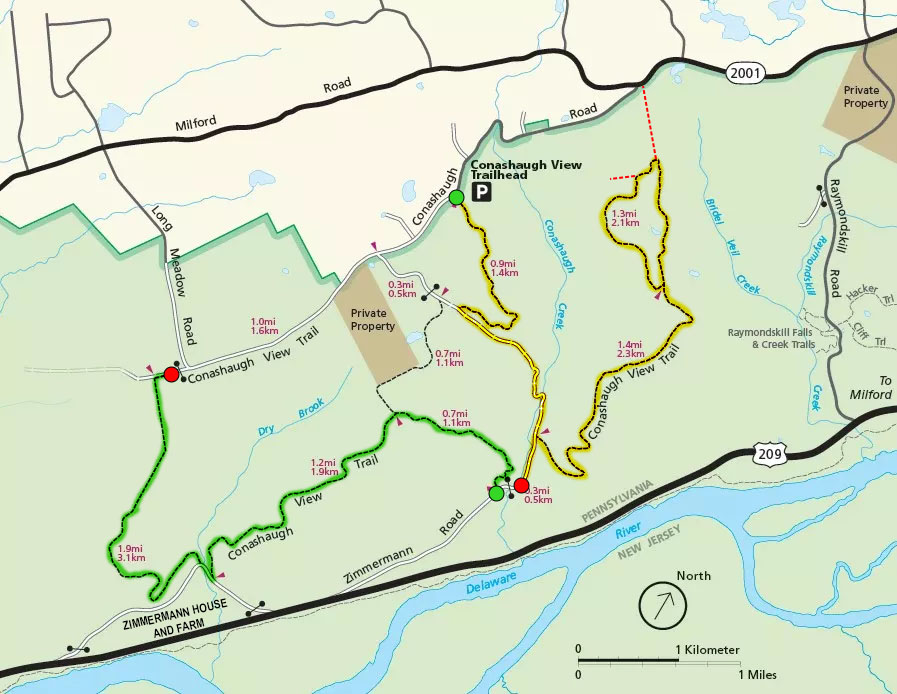
Conashaugh View Trail routes
With a few exceptions, use of any photograph on the National Park Planner website requires a paid Royalty Free Editorial Use License or Commercial Use License. See the Photo Usage page for details.
Last updated on January 16, 2024


