
Conashaugh View Trail in Delaware Water Gap National Recreation Area
Length: 6 miles one way / 9 miles round trip
Time: 3 hours, one way
Difficulty: Moderate with a few steep hills
The Conashaugh View Trail in Delaware Water Gap National Recreation Area is located in Pennsylvania between Raymondskill Road and the Marie Zimmerman House. The trail is open to both hikers and horseback riders. The National Park Service considers all the trails in this area to be one, but at nearly 11 miles, hiking everything at once is more than most people are interested in doing, particularly those without rides at one end. Horseback riders, on the other hand, will welcome the mileage.
Since I am writing for hikers and not horseback riders, I have split the Conashaugh View Trail into two hikes using the old Zimmerman Road as the dividing point. On the north side of the road is what I call the Conashaugh View Loop Trail and on the south side the Conashaugh View Trail South. See the map below for the two routes. The South trail route is highlighted in green and the Loop Trail route in yellow. Green dots indicate the starting points of the hike and red dots the end points. This report only covers the Loop Trail. See the Conashaugh View Trail South report here on National Park Planner for details on that hike. (Note: I reference north and south of Zimmerman Road while the trail appears to lie east and west of the road on the trail map. This is because the map is not oriented in the north-south direction as it should be.)
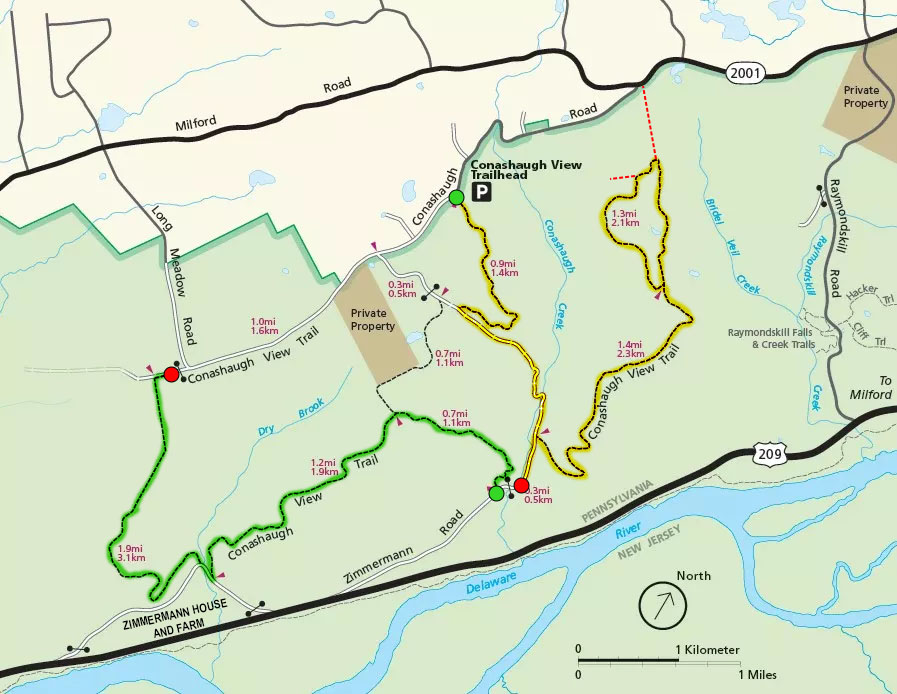
Conashaugh View Trail routes
The hike starts at the Conashaugh View Trailhead parking lot on Conashaugh Road. Look for the trailhead next to the large trail identification sign. From here, hike for about 500 feet until coming to an intersection. There is a directional sign at this point with an orange dot on it, which is the color of the blazes that mark the Conashaugh View Trail route. Blazes are paint splotches on trees or rocks that you follow like Hansel and Gretel breadcrumbs.
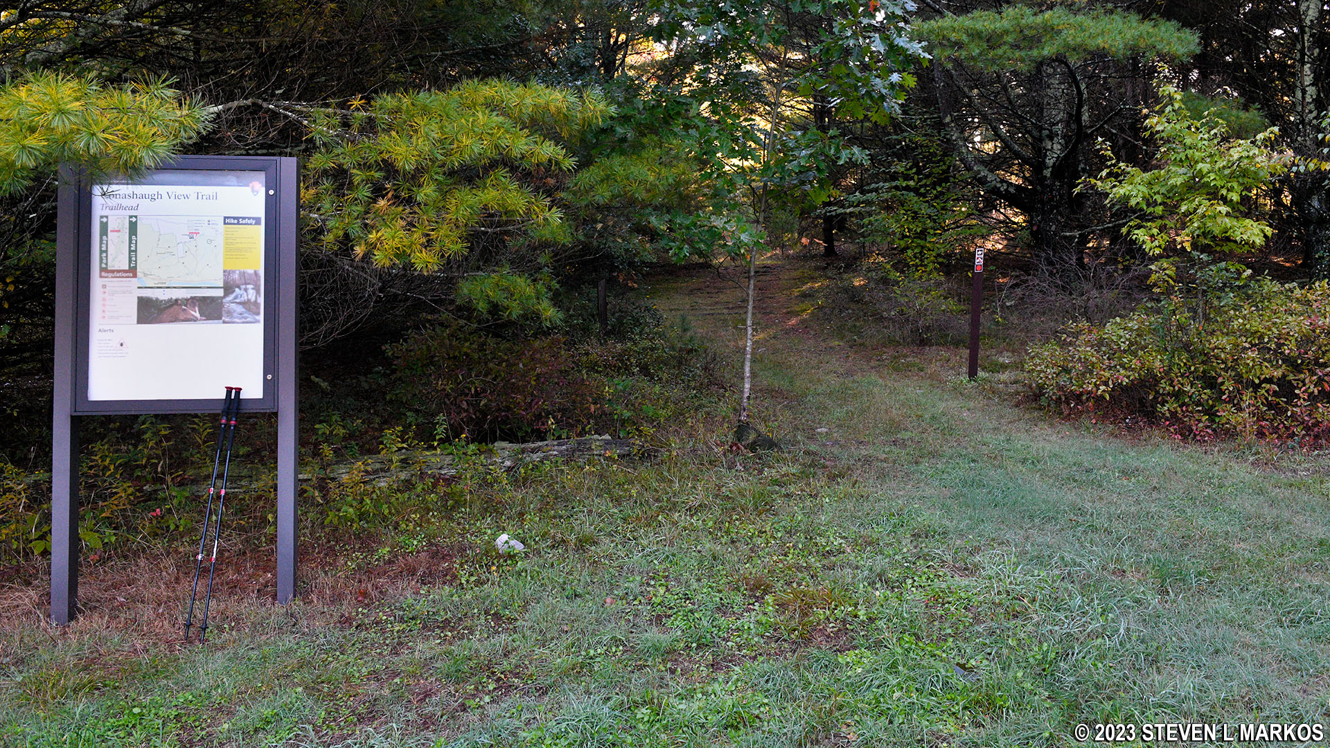
Start of the Conashaugh View Trail at the parking lot on Conashaugh View Road, Delaware Water Gap National Recreation Area
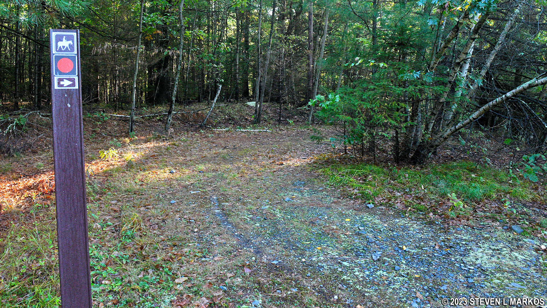
Orange marks the route of the Conashaugh View Trail, Delaware Water Gap National Recreation Area
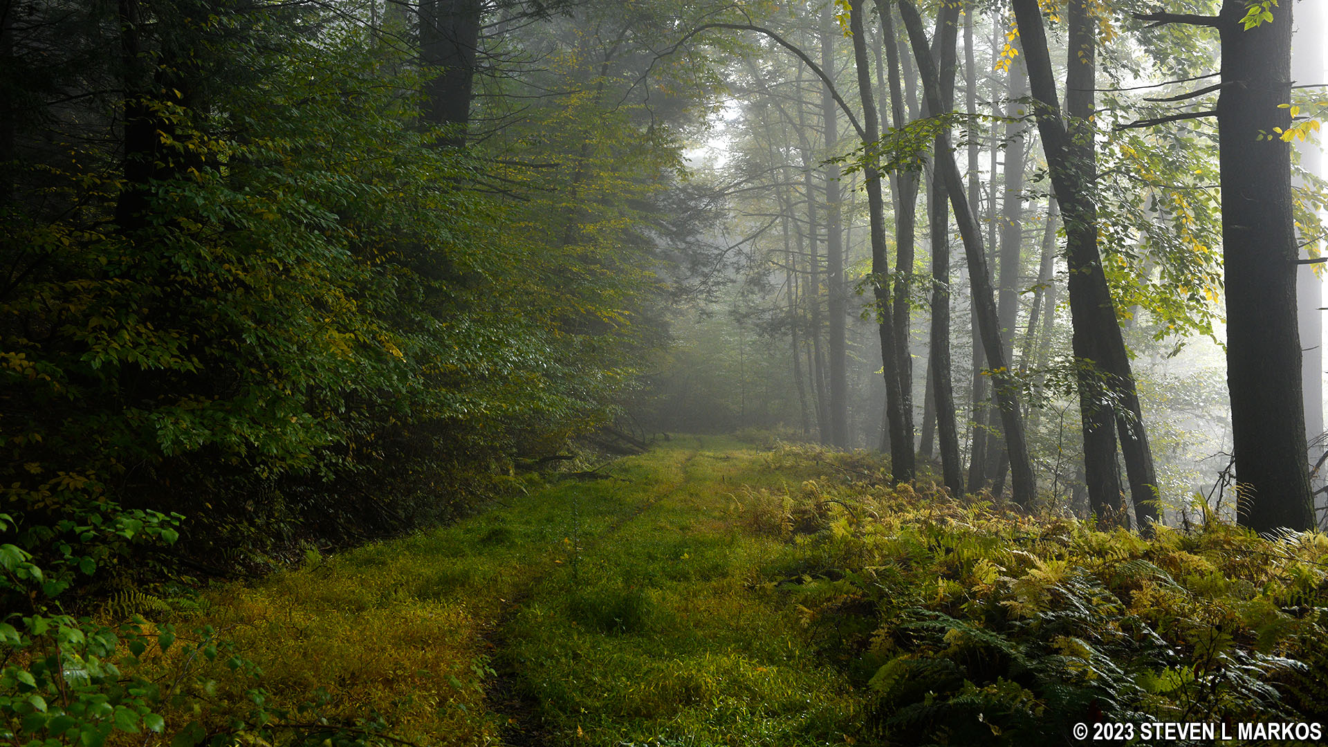
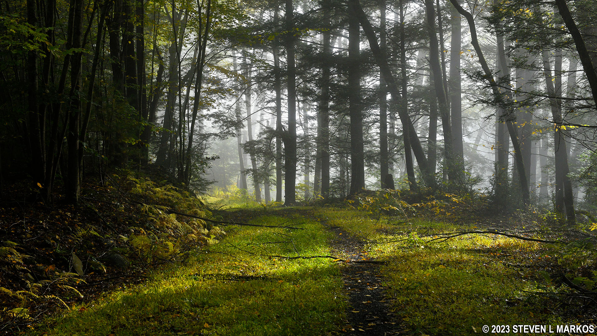
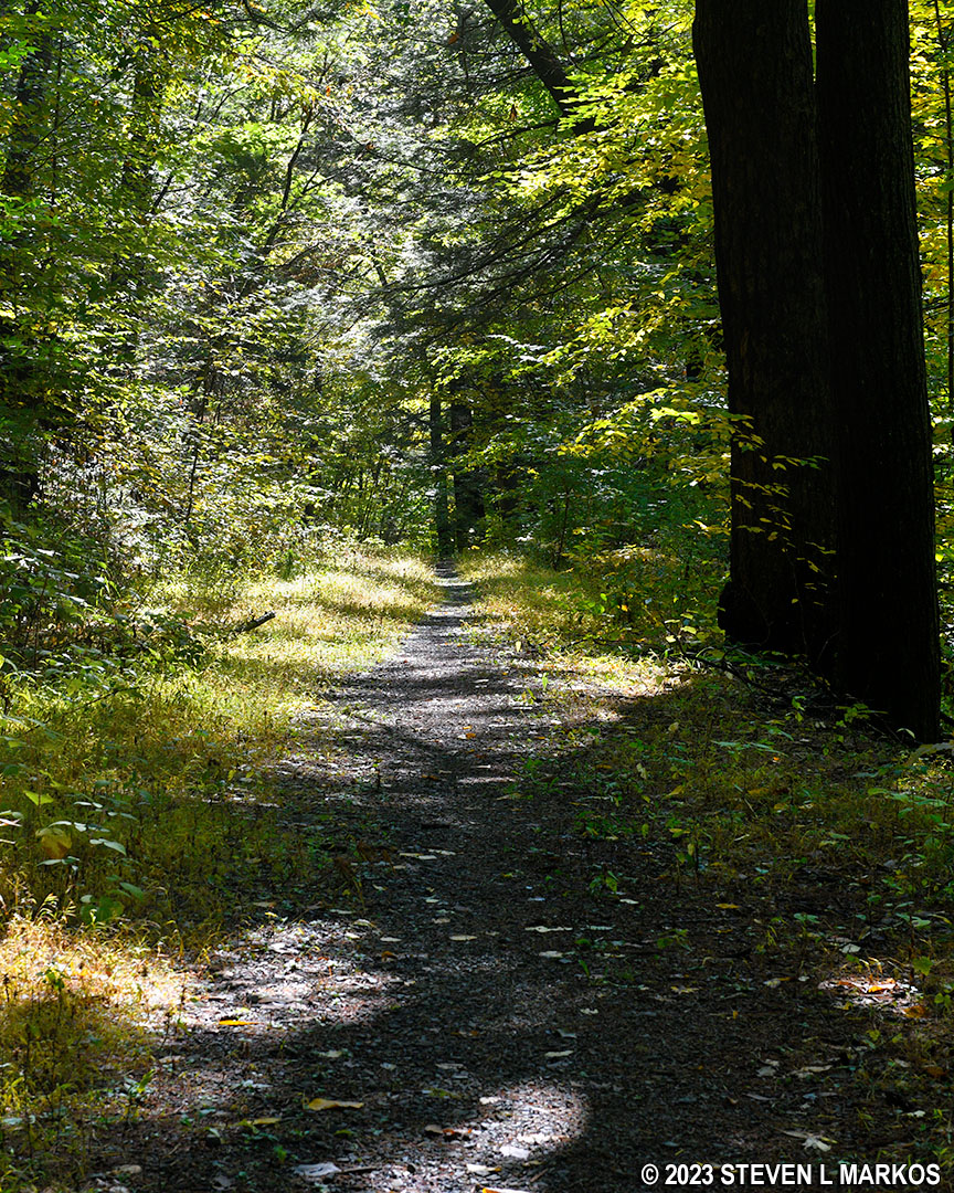
The Conashaugh View Trail starts off as wide as a country road, which it most likely once was. It is a fairly smooth trail, largely free of rocks and roots, that runs through a forest with a tall canopy and very little vegetation on the ground—the type of forest I like. It heads gradually downhill all the way to Zimmerman Road .9 mile away.
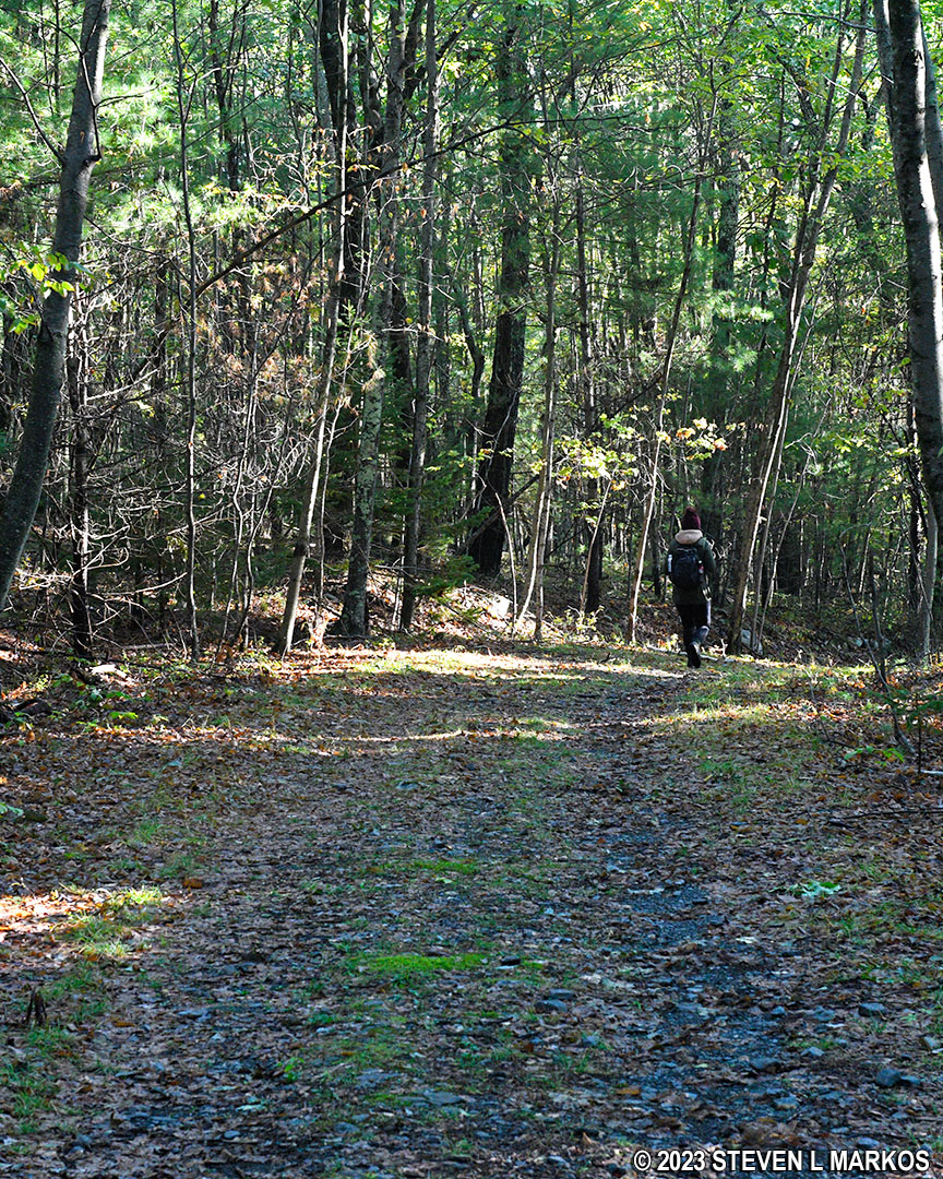
Typical terrain at the start of the Conashaugh View Trail in Delaware Water Gap National Recreation Area
The Conashaugh View Trail in Delaware Water Gap National Recreation Area runs almost entirely through a forest
The trail dead ends into Zimmerman Road, which at this point is an old dirt road that is no longer in use. The intersection is marked with a directional sign and two large rocks. The sign points to the right, but this is not the way to go to get to the loop trail. Right takes you to a trail that connects to the Conashaugh View Trail on the south side of Zimmerman Road. Ignore the sign and turn left.
Intersection with the Zimmerman Road at the northern end of the Conashaugh View Trail, Delaware Water Gap National Recreation Area
While this section of Zimmerman Road may well have been a road at one time, today it is more of a traditional hiking trail until it gets closer to the Zimmerman House and US 209 / Federal Road. In fact, it starts out fairly overgrown. This is prime tick habitat, and there are also some briars, so I recommend long pants for this hike.
The Zimmerman Road portion of the Conashaugh View Trail starts off being fairly overgrown, Delaware Water Gap National Recreation Area
The overgrown area doesn’t last long, and you will soon be on a wide and beautiful section of Zimmerman Road.
Zimmerman Road section of the Conashaugh View Trail at Delaware Water Gap National Recreation Area
After two tenths of a mile, the trail, which has headed gradually downhill since the start, now begins a much steeper descent that lasts all the way until the turn onto the loop portion of the hike. The average grade is -14%, so it is certainly a hill that does not go unnoticed. (Strenuous hiking begins at 15%. A minus sign before the grade percentage indicates a downhill slope.)
Before coming to the turnoff for the loop trail, Zimmerman Road crosses a small stream located in a shallow gully. I had to climb down the bank a few feet to get to the water, and I could see skid marks in the clay where previous hikers slipped. I had my hiking poles with me, so I didn’t suffer that same fate. Just beyond the stream crossing is a small cascade.
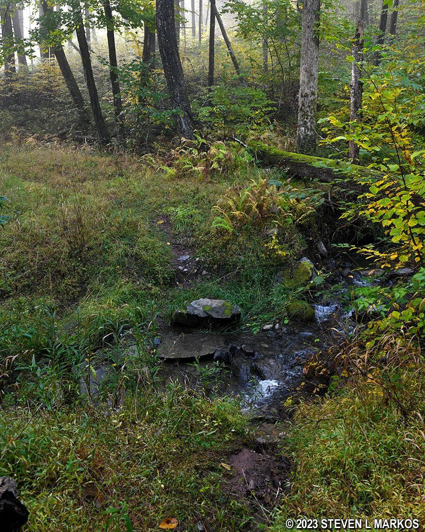
Stream crossing on the Zimmerman Road portion of the Conashaugh View Trail, Delaware Water Gap National Recreation Area
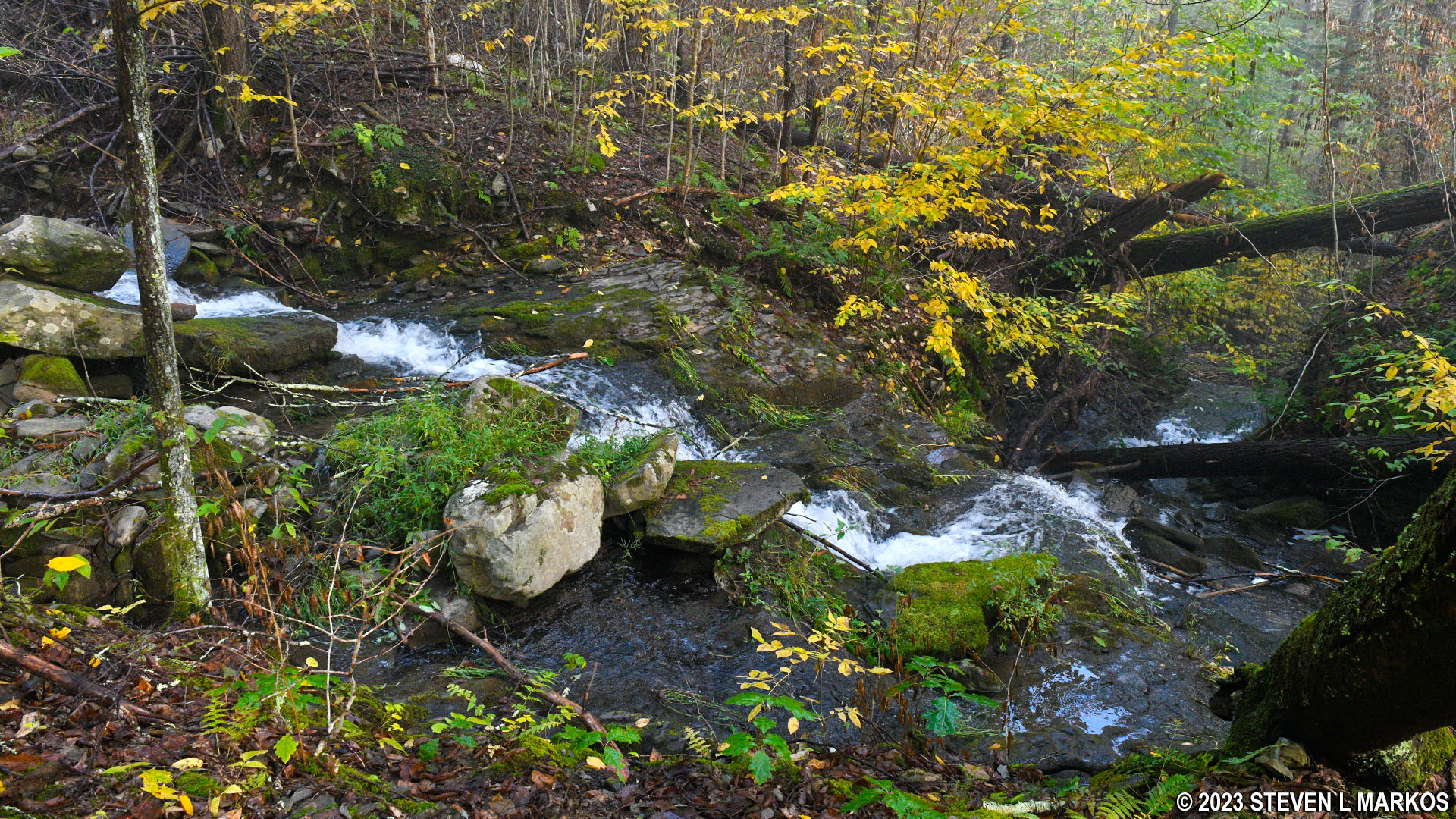
Cascade along the Zimmerman Road portion of the Conashaugh View Trail, Delaware Water Gap National Recreation Area
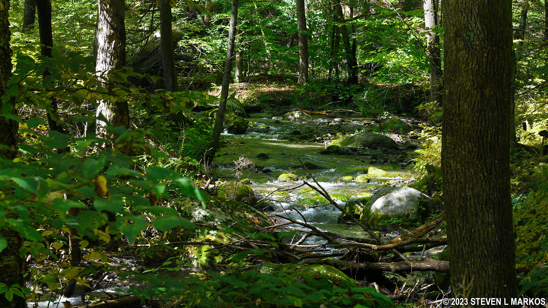
The trail continues downhill, though not as steeply, and arrives at Conashaugh Creek a few minutes later. This is a much wider waterway than the previous stream. You do have to cross it, and if you don’t have high-top hiking boots on, your feet are going to get wet. There are some stepping stones, but they are loose, as if hikers tossed them into the water to create a bridge instead of them having been naturally exposed by the current and thus anchored into the creek bed.
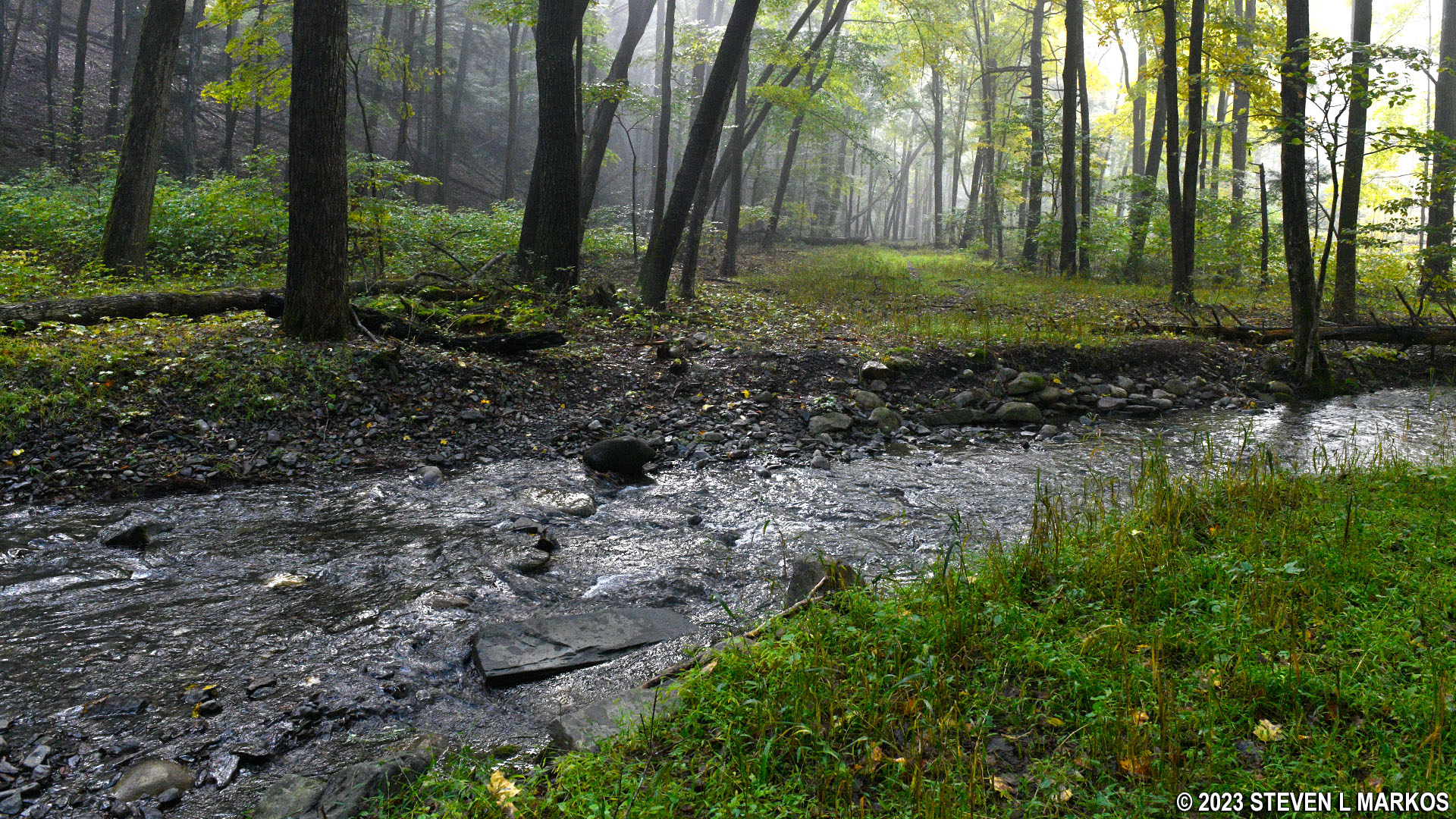
The Zimmerman Road portion of the Conashaugh View Trail crosses Conashaugh Creek, Delaware Water Gap National Recreation Area
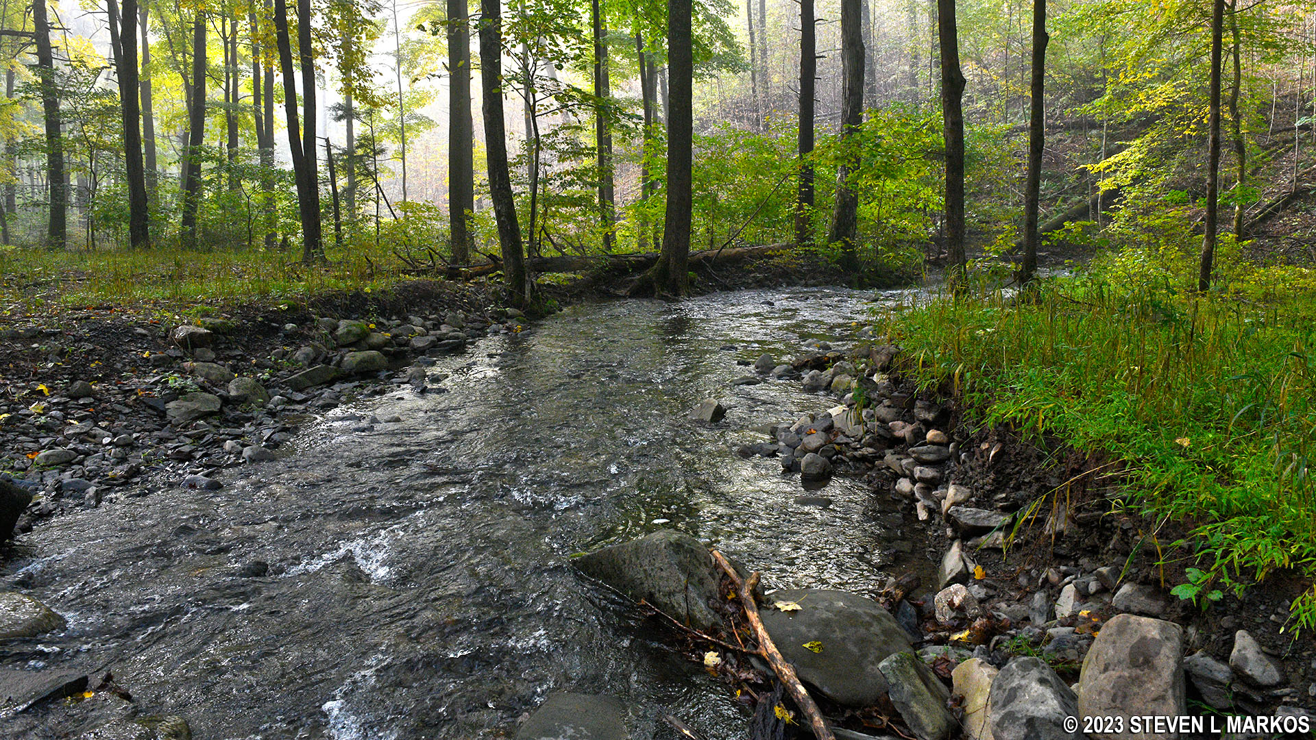
Conashaugh Creek in the Delaware Water Gap National Recreation Area
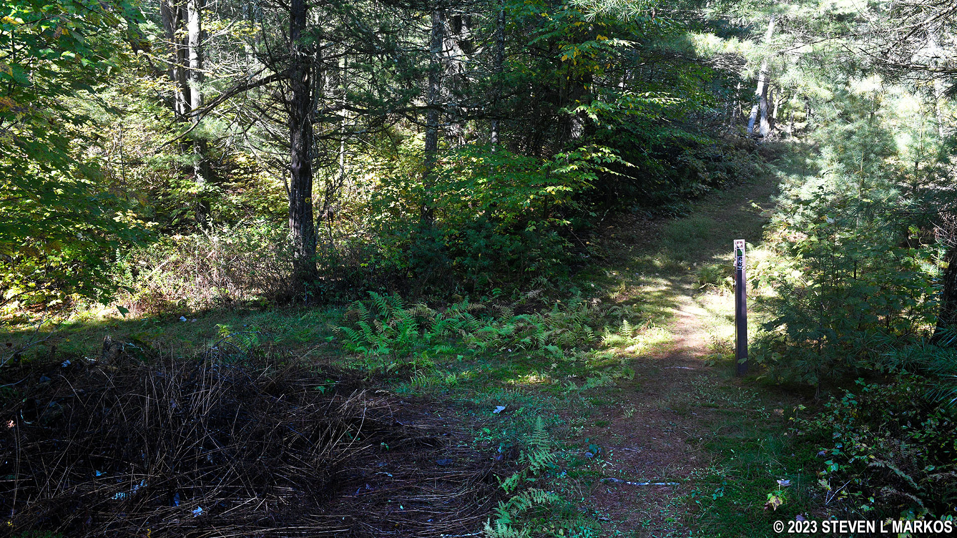
The turnoff for the loop trail comes .2 mile after crossing Conashaugh Creek (1.7 mile from the parking lot). Look for the turn on your left. The intersection is marked with another directional sign.
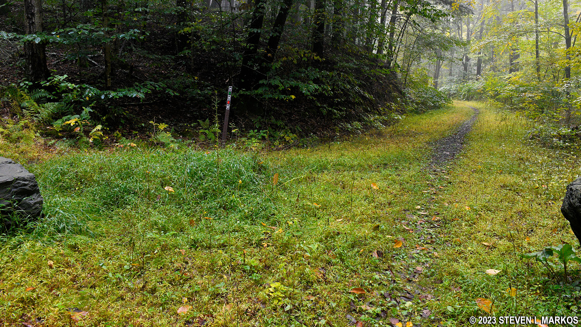
Start of the Conashaugh View Loop Trail on the north side of Zimmerman Road in Delaware Water Gap National Recreation Area
The loop portion of the hike is actually lollypop shaped, meaning you hike out on a stick before coming to the actual loop. From the start, the stick heads straight up to the top of Pow Wow Hill, a climb in elevation of 475 feet in a little less than a mile. The first .2 mile has an average grade of 20%, so it is steep. The trail surface remains relatively smooth, though there are patches of tree roots here and there. Sections of the trail still show old tire tracks, so this used to be an old road as well.
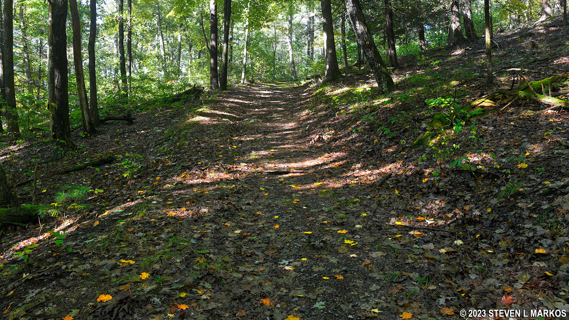
Steep terrain on the stick portion of the Conashaugh View Loop Trail in Delaware Water Gap National Recreation Area
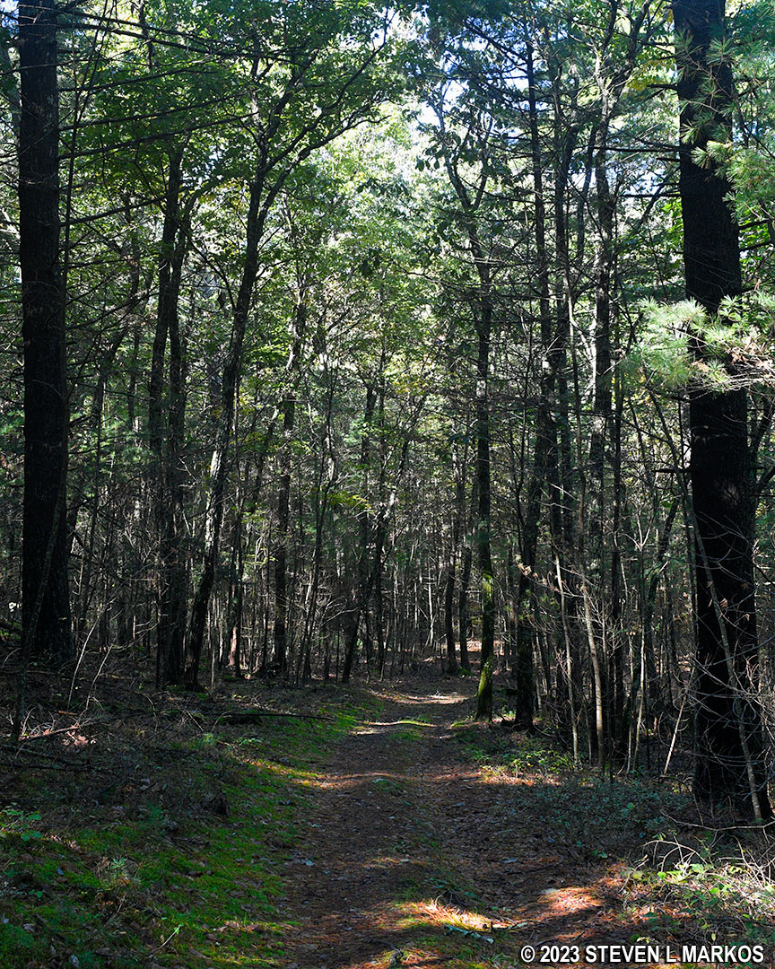
After the first steep .2 mile, the Conashaugh View Loop Trail continues uphill but at a much milder pace. The trail map shows large curves on this section, which are switchbacks that make the hike up a little easier.
At 2.75 miles from the parking lot (a mile from the turn onto the loop trail), the Conashaugh View Loop Trail reaches its highest point near Pow Wow Hill. There are no views from here, as the trail remains deep in the forest. The terrain levels out for about 400 feet before heading downhill for .2 mile. The descent is somewhat mild with an average grade of only -11%.
Level section of the Conashaugh View Loop Trail near the top of Pow Wow Hill, Delaware Water Gap National Recreation Area
The loop portion of the trail begins 1.5 mile from Zimmerman Road. I continued straight and hiked around in the counterclockwise direction.
Start of the loop portion of the Conashaugh View Loop Trail in Delaware Water Gap National Recreation Area
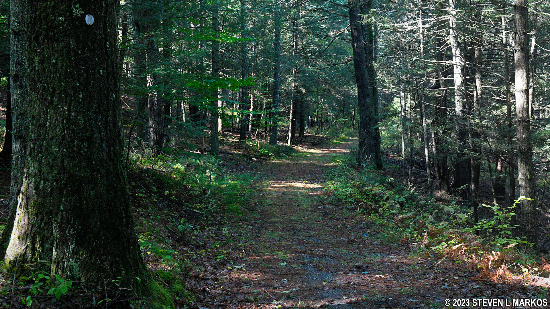
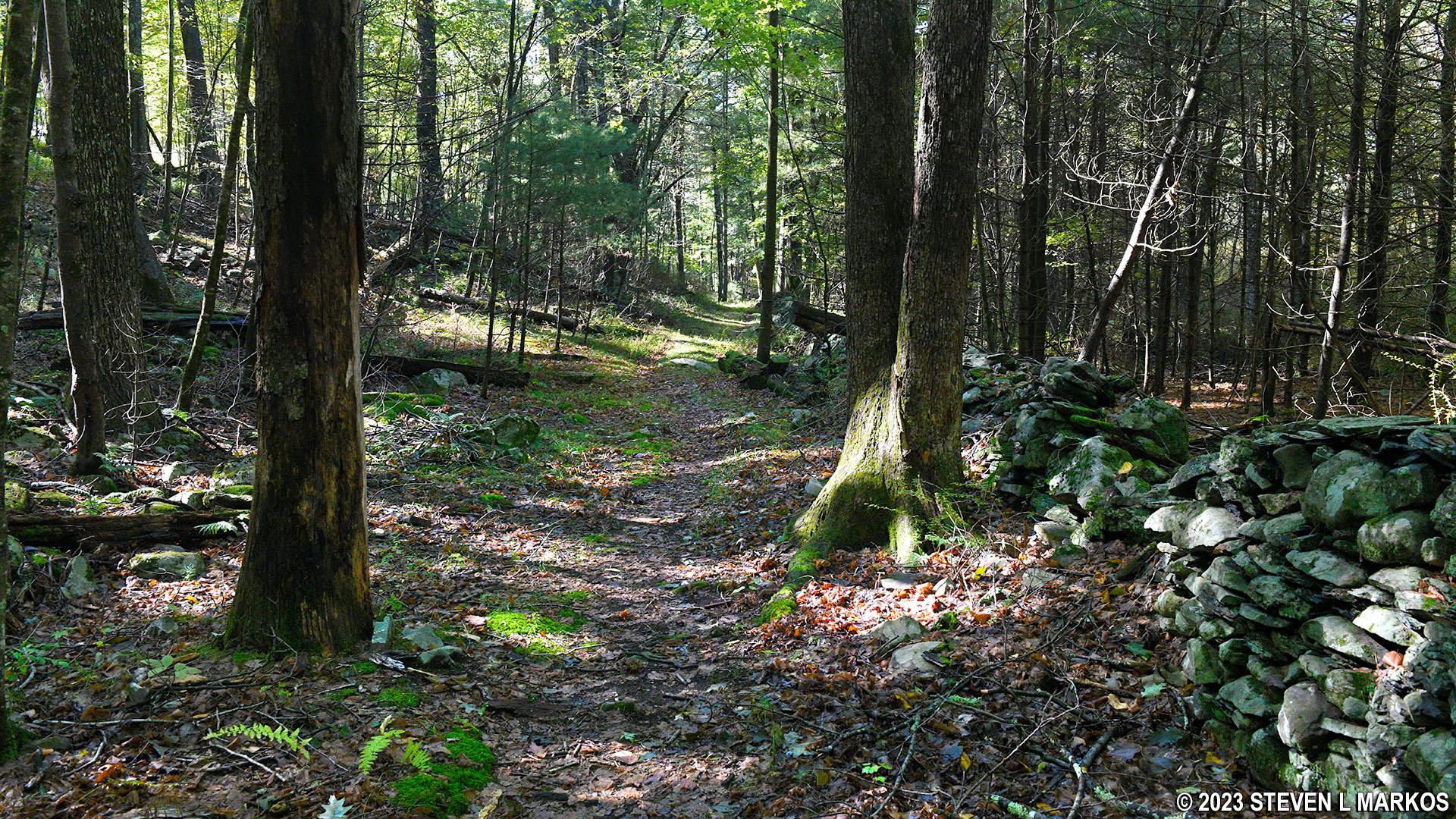
The trail climbs up and over three small hills. The downsides of the first two hills are quite steep with grades between 15% and 20% (of course, that’s downhill when hiking in the counterclockwise direction as I was). The third hill is much easier. The trail remains as wide as an old road except where it narrows at the very start of the loop.
Typical terrain on the loop portion of the Conashaugh View Loop Trail in Delaware Water Gap National Recreation Area
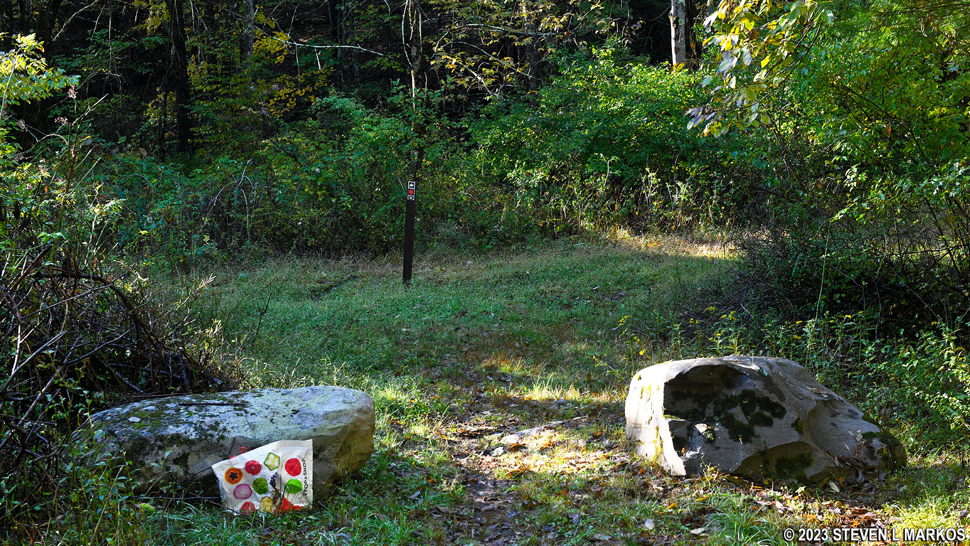
There are two intersections that are not on the government-issued trail map (I have drawn these in with red on the map at the top of this page). The first comes halfway around the loop and leads up to a parking lot on Conashaugh Road. I’m not sure where the second leads, so I just drew in a partial trail. Keep left at both intersections.
Stone fences begin appearing on the south side of the loop, about three quarters of the way around (again, when hiking in the counterclockwise direction). Since there are so many stones in the area, landowners used them instead of wood to build fences.
Stone fences on the southern end of the loop portion of the Conashaugh View Loop Trail in Delaware Water Gap National Recreation Area
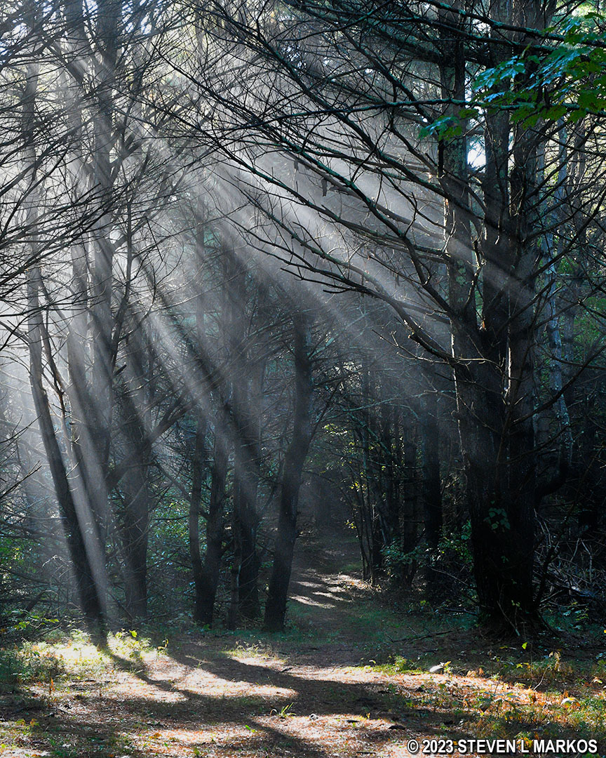
When I did the hike, the sun hit the wet trees and caused them to omit steam as if they were on fire. I hadn’t seen that before, and I thought it was pretty neat. I also saw a large spider, a marbled orb weaver, the type that catches and cocoons hikers that aren’t paying attention.
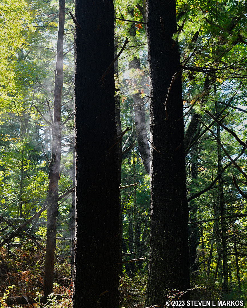
Mist coming off of wet trees warmed by the sun

Marbled orb weaver spider
You’ll be back around to the start of the loop at 4.6 miles into the hike (the loop itself is 1.4 mile long). Take a right and proceed back the way you came to the intersection with Zimmerman Road. At that point, you can take another right and hike approximately three miles back to Conashaugh Road (9-mile round trip hike) or turn left to continue on to the Conashaugh View Trail on the south side of Zimmerman Road, which is what I did. This section of Zimmerman Road, which is now more road-like than before, follows along Conashaugh Creek.
Typical terrain on Zimmerman Road south of the turnoff for the loop portion of the Conashaugh View Trail, Delaware Water Gap National Recreation Area
The Zimmerman Road section of the Conashaugh View Trail south of the turnoff for the loop hike follows Conashaugh Creek, Delaware Water Gap National Recreation Area
In two tenths of a mile the trail comes out at the paved section of Zimmerman Road that is still open to vehicle traffic. Take a right and walk another tenth of a mile to get to the Conashaugh View Trail on the south side of Zimmerman Road. There is actually a parking lot, so if you are with a friend and have access to a second car and aren’t planning on hiking any farther, you can park here and save yourself the hike back to Conashaugh Road.
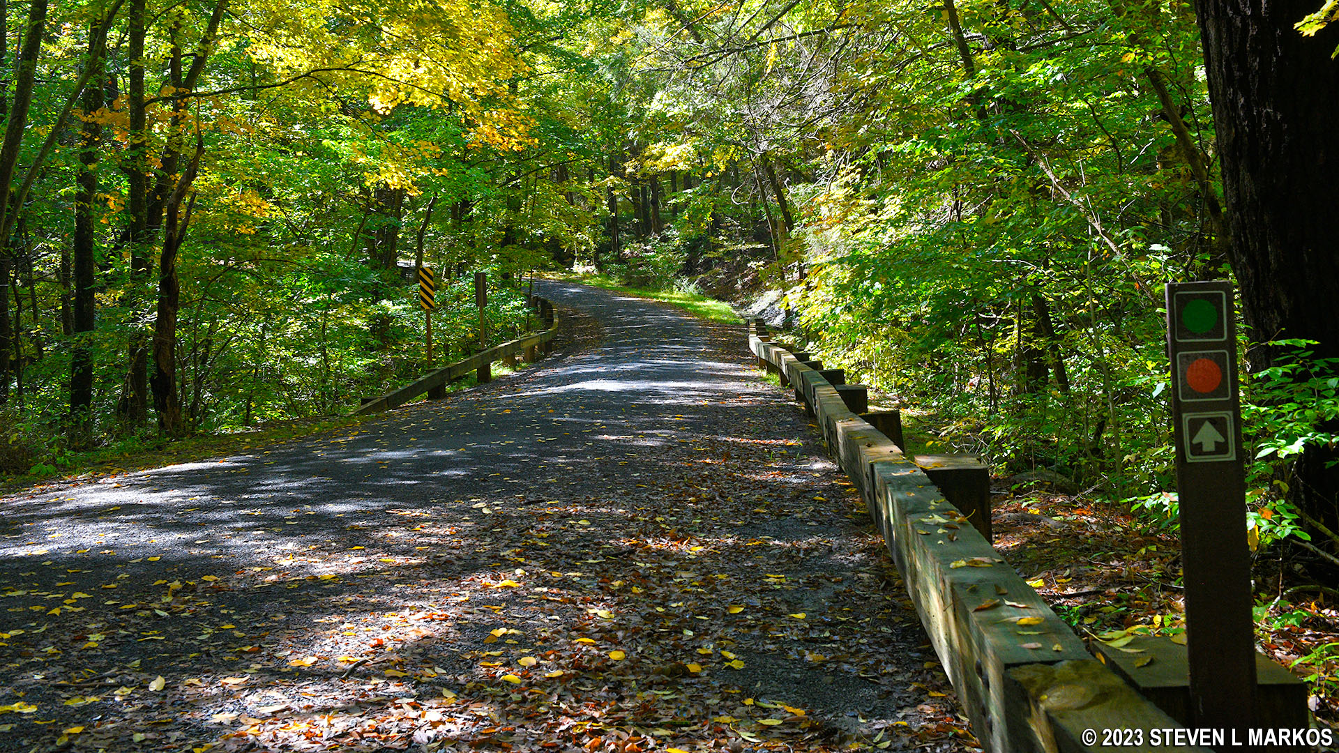
Paved section of Zimmerman Road near the Marie Zimmerman House at Delaware Water Gap National Recreation Area
While I did continue hiking the southern half of the Conashaugh View Trail, I cover it in a separate review. See the Conashaugh View Trail South report here on National Park Planner for details.
With a few exceptions, use of any photograph on the National Park Planner website requires a paid Royalty Free Editorial Use License or Commercial Use License. See the Photo Usage page for details.
Last updated on January 17, 2024


