
Conashaugh View Trail between the Marie Zimmerman Farm and Conashaugh Road, Delaware Water Gap National Recreation Area
Length: 3.8 miles, one way
Time: 2 hours
Difficulty: Moderate with a couple steep hills to climb
The Conashaugh View Trail in Delaware Water Gap National Recreation Area is located in Pennsylvania between Raymondskill Road and the Marie Zimmerman House. The trail is open to both hikers and horseback riders. The National Park Service considers all the trails in this area to be one, but at nearly 11 miles, hiking everything at once is more than most people are interested in doing, particularly those without rides at the end. Horseback riders, on the other hand, will welcome the mileage.
Since I am writing for hikers and not horseback riders, I have split the Conashaugh View Trail into two hikes using the old Zimmerman Road as the dividing point. On the north side of the road is what I call the Conashaugh View Loop Trail and on the south side the Conashaugh View Trail South. See the map below for the two routes. The South Trail route is highlighted in green and the Loop Trail route in yellow. Green dots indicate the starting points of the hike and red dots the end points. This report only covers the South Trail. See the Conashaugh View Loop Trail report here on National Park Planner for details on that hike.
Note 1: I reference north and south of Zimmerman Road while the trail appears to lie east and west of the road on the trail map. This is because the map is not oriented in the north-south direction as it should be.
Note 2: I refer to the intersection of Conashaugh Road and Long Meadow Road as the location of one of the trailheads for the Conashaugh View Trail (the end point of the South Trail highlighted in green on the map). One National Park Service map (printed Guide to the Gap publication) calls the road Conashaugh View Road and another (online map) calls it Conashaugh Road. Google Maps calls the entire road Long Meadow Road, as if there is no intersection at all. The road simply makes a 90 degree turn at what I call the intersection of two different roads. I have no idea of which is correct. Just be aware of my nomenclature.
Conashaugh View Trail routes
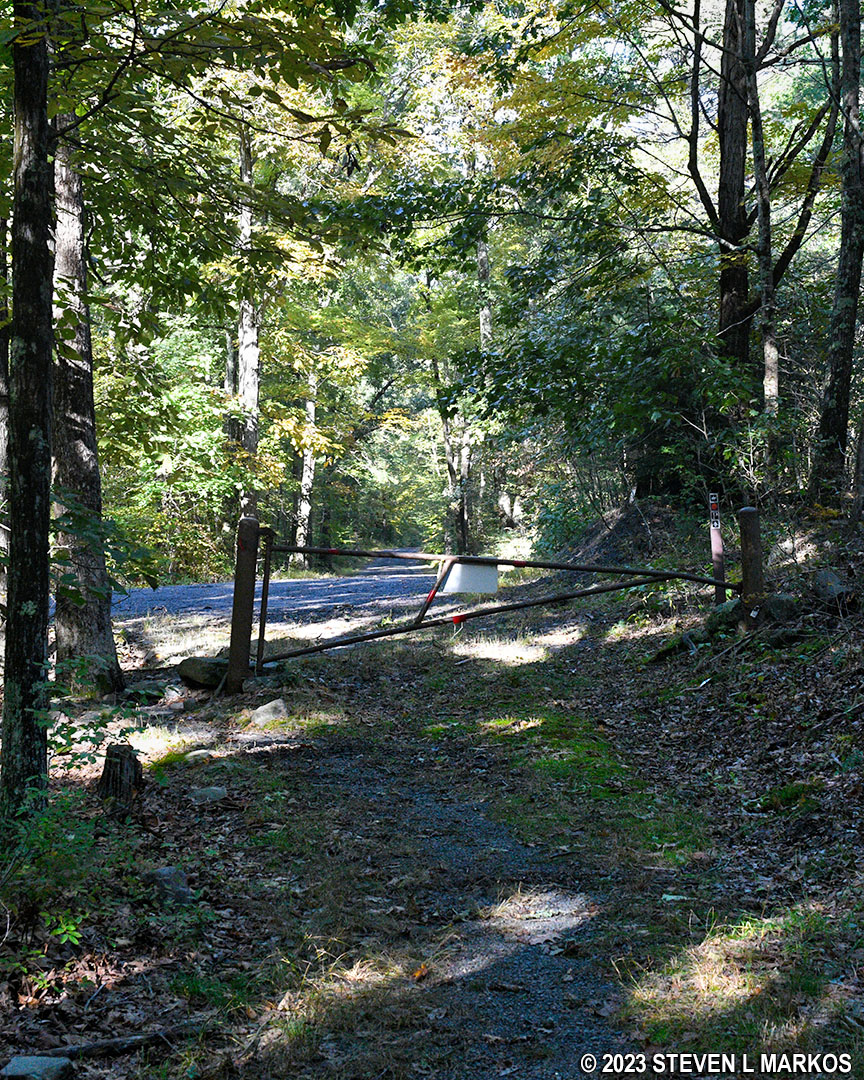
There are two places to access the southern half of the Conashaugh View Trail. One is at the end of Conashaugh Road near the intersection with Long Meadow Road. Conashaugh Road is nothing more than an old dirt road that is gated and closed to vehicle traffic south of the intersection. There is no parking area, so the only way to start a hike from here is to either walk 1.25 mile from the Conashaugh View Trailhead parking lot or to get dropped off.
The second starting point is a trailhead on the paved portion of Zimmerman Road. There is a small parking lot at the end of the road that can fit perhaps three cars. This is where I started the hike, though I didn’t drive here. I arrived via my Conashaugh View Loop Trail, so by the time I started out on the southern half of Conashaugh View Trail, I had already hiked a little over six miles.
To begin the hike from the Zimmerman Road parking lot, walk back down the road about a tenth of a mile to the actual trailhead. From the tire tracks worn into the ground, it is obvious that the Conashaugh View Trail is an old dirt road, and it remains so all the way to the end, though the road-like appearance is not evident at all times.
Trailhead for the Conashaugh View Trail on Zimmermann Road, Delaware Water Gap National Recreation Area
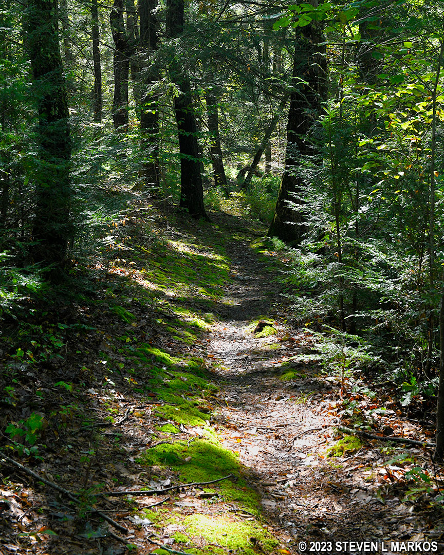
The first 2.1 miles of the Conashaugh View Trail runs between Zimmerman Road on the north end and Zimmerman Farm Road on the south end (the farm road leads to the Marie Zimmerman House, and it is gated and closed unless the house is open). The general trajectory of this section of trail is up and over a large hill—a gain in altitude of roughly 425 feet—with the top of the hill coming about halfway between the two roads. This is not to say there are no level areas. The first .2 mile covers relatively flat terrain, and there is a level stretch at the top of the hill, but overall you’ll be hiking uphill as you head south and then downhill once you get to the halfway point.
There are multiple climbs on the hike to the top of the hill, each separated by short, level reprieves. The first climb is about two tenths of a mile long and has an average grade of 14% (15% is considered the start of strenuous hiking), including one 50-foot section at the beginning that is tippy-toe steep. That’s so steep that you must push off on the balls of your feet just to move forward, and your heels never touch the ground. This is interrupted by a 100-yard level section before the start of a second climb of nearly a half mile, with the first two tenths having an average grade of 20%. Needless to say, it’s a pretty steep hill.
Hilly terrain on the Conashaugh View Trail near the Zimmermann Farm in Delaware Water Gap National Recreation Area
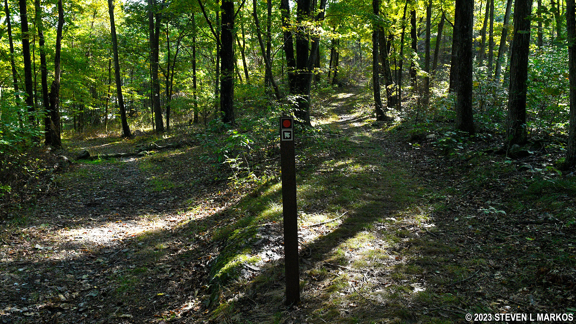
At the .7-mile mark on the hike, the climb gets much easier. A tenth of a mile later is the intersection with a trail that connects to Zimmerman Road near the Conashaugh View Trailhead parking lot (this section of the road is dirt and no longer in use). A directional sign is at the intersection, but there are no trail names on it, only colored circles. In order to make the right decision as to which way to turn, you must know that the route of the Conashaugh View Trail is marked with orange blazes, which are paint splotches on trees and rocks (and sign posts) that serve as Hansel and Gretel breadcrumbs. With that knowledge, you’ll know to follow the arrow that corresponds to the orange circle and take the trail to the left. There is also a green circle on the post, but there are no green-blazed trails in this area that I know of. I can only assume this is the blaze color of the connector trail.

The route of the Conashaugh View Trail in Delaware Water Gap National Recreation Area is marked by orange blazes
The actual crest of the hill comes at one mile into the hike. After that there is a .2 mile downhill section (mild to moderate in difficulty) and then the Conashaugh View Trail levels out for the next .4 mile. There are a few hills, but most are not worth mentioning. It had been raining the day before I did the hike, and water had puddled at many places along the level section of trail. I saw an eastern newt in the wet sticks and leaves on the ground.
Level terrain along the Conashaugh View Trail at the halfway point between Zimmerman Road and Zimmerman Farm Road, Delaware Water Gap National Recreation Area
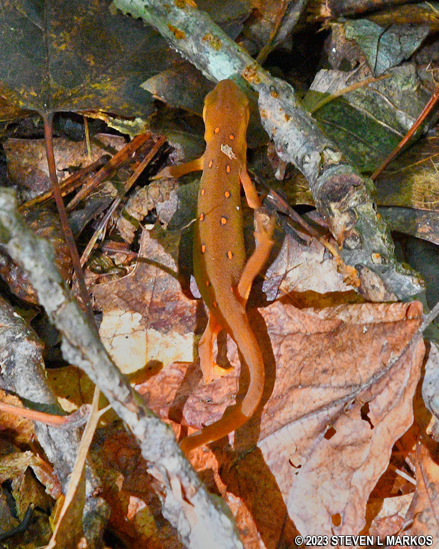
Eastern newt
After 1.7 mile of hiking, the Conashaugh View Trail begins its descent down the hill to Zimmerman Farm Road a half mile away. Just imagine the reverse of the hike up the hill and you’ll know what to expect.
There are a lot of loose rocks on this downhill section. At times it was like walking on the bottom of a creek bed. I twisted my good ankle on one of them and slipped on another when it shot out from under my foot like a cartoon banana peel. Loose rocks are more prominent on hills due to the years of water rushing down the hill after a rainstorm and washing away the top soil.
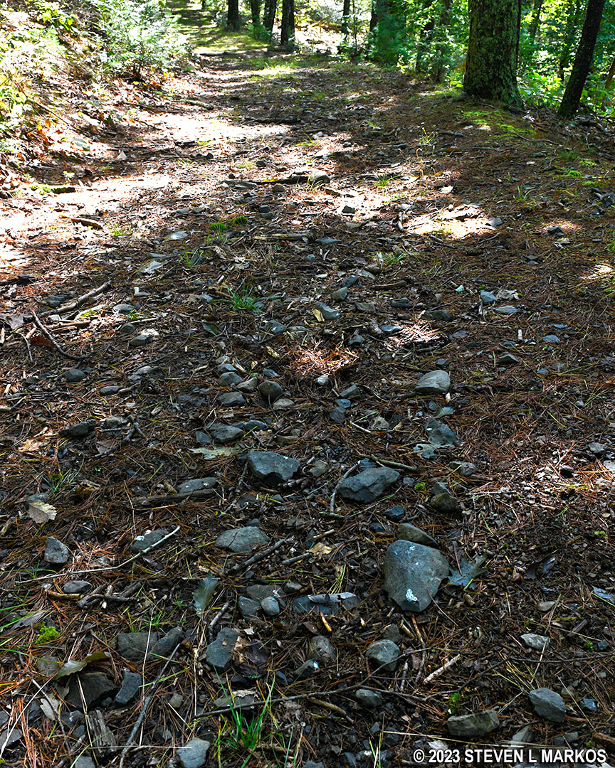
Rocky section of the Conashaugh View Trail near the Zimmermann Farm in Delaware Water Gap National Recreation Area
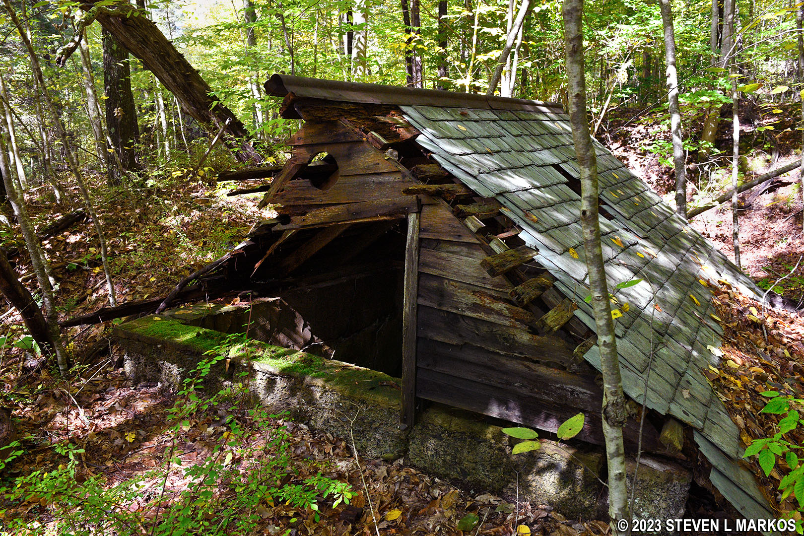
About halfway down the hill is an old building that looks like a shed, but most of it is below ground. I read somewhere about an old mill being in this area. There are no mill wheels or grind stones laying around, but it could be part of a mill. Being in this area, it most likely belonged to Marie Zimmerman. The Conashaugh View Trail actually curves around the structure, but there is a side trail that leads over to it.
Conashaugh View Trail passes the possible remnants of an old mill near the Zimmermann Farm in Delaware Water Gap National Recreation Area
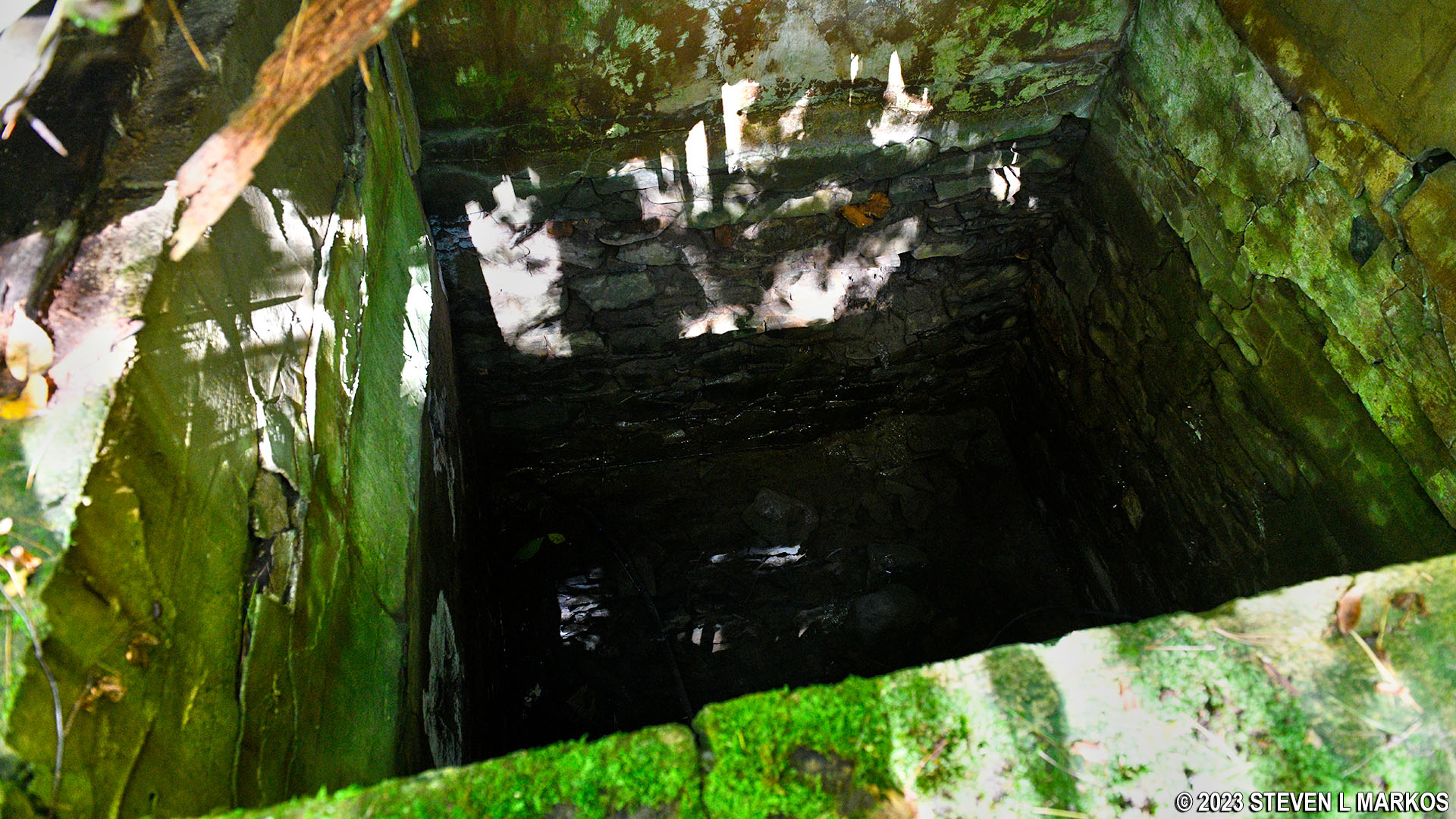
Below ground section of the possible remnants of an old mill near the Zimmermann Farm in Delaware Water Gap National Recreation Area
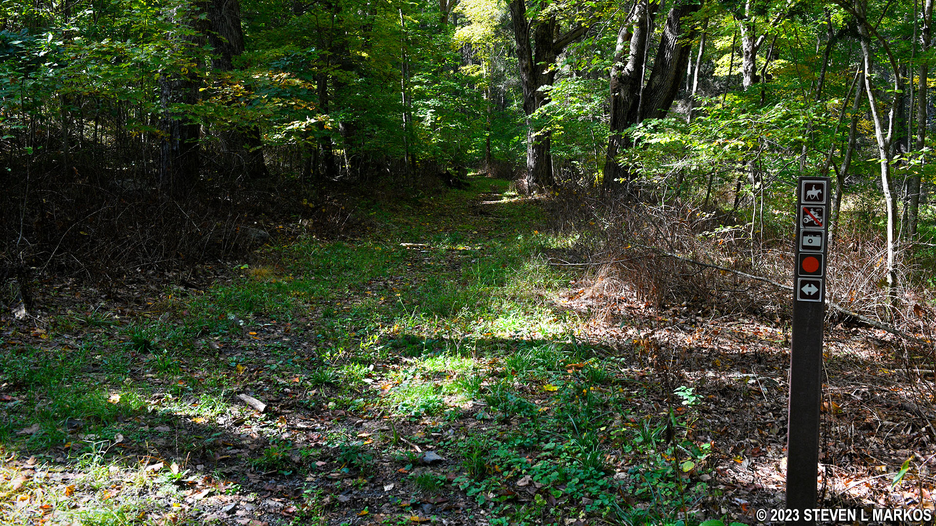
The trail eventually comes out on Zimmerman Farm Road. Take a right on the road, and in a tenth of a mile you will come to the trailhead for the section of the Conashaugh View Trail that runs west to Conashaugh Road. There is a directional sign at the intersection with an orange circle and a left / right arrow. I don’t know what this is referring to since straight ahead is the only trail in sight. Left and right is the Zimmerman Farm Road. Just ignore this and take the obvious trail that heads uphill.
Trailhead for the segment of the Conashaugh View Trail that runs between the Zimmermann Farm and Conashaugh Road, Delaware Water Gap National Recreation Area
If you are interested is seeing some old, dilapidated farm buildings, continue past the trail intersection to the Zimmerman Farm. The house, which has been restored, is much farther away and is a hike on its own, but the farm buildings are within sight of the intersection.
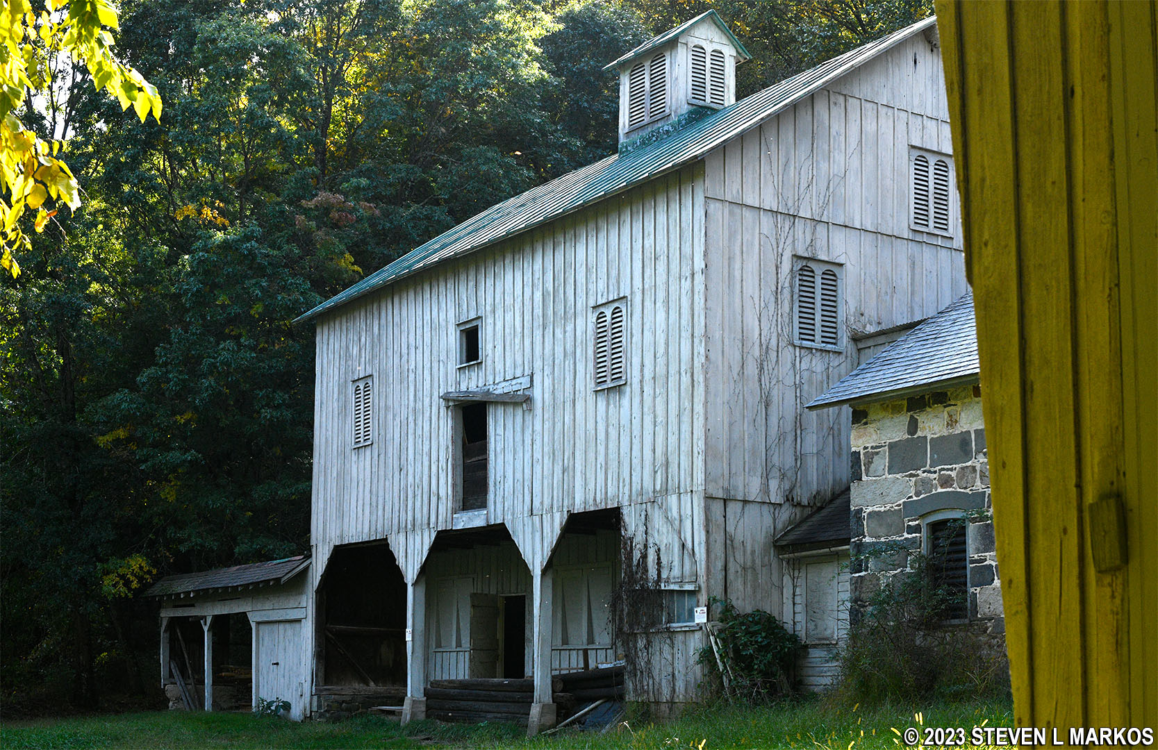
Milk barn at the Zimmermann Farm, Delaware Water Gap National Recreation Area
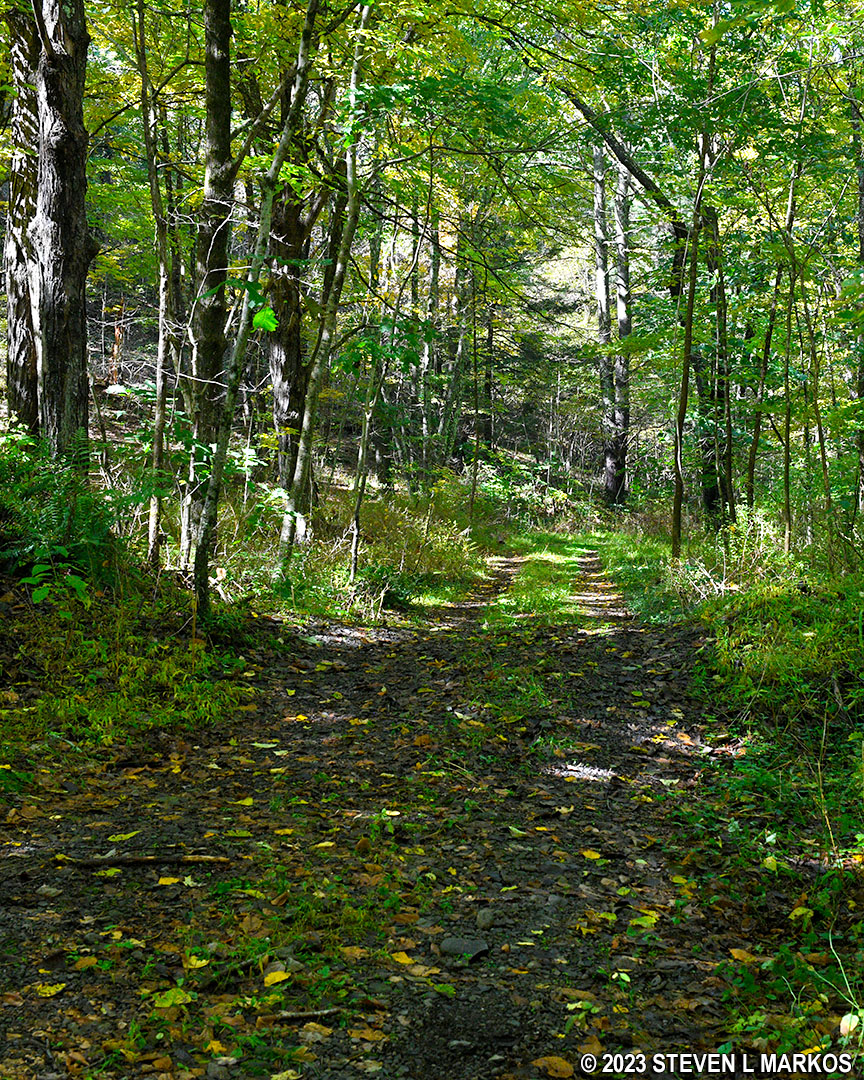
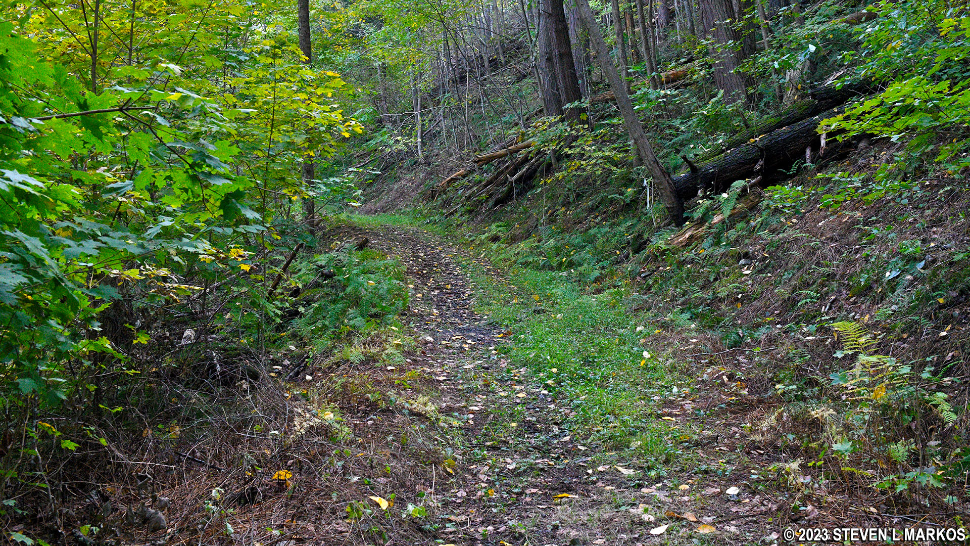
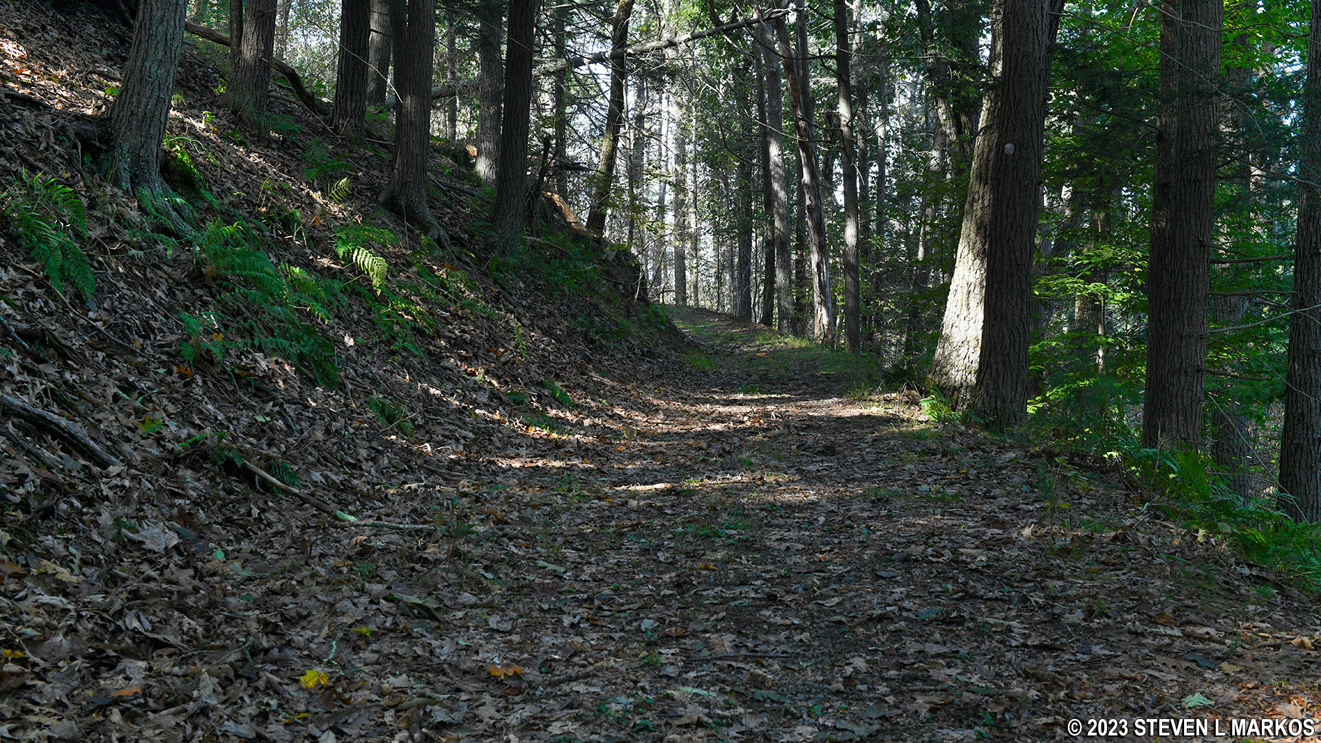
This section of the Conashaugh View Trail runs uphill for about .7 mile before leveling out and following relatively flat terrain all the way to Conashaugh Road. Fortunately, this hill is not nearly as steep as the one between the two Zimmerman roads. Grades average around 10%, which I’d rate as a 2 out of 5 on a difficulty scale.
Hilly terrain of the Conashaugh View Trail between the Zimmermann Farm and Conashaugh Road, Delaware Water Gap National Recreation Area
There is an overlook with a scenic view .3 mile from the Zimmerman Farm Road trailhead.
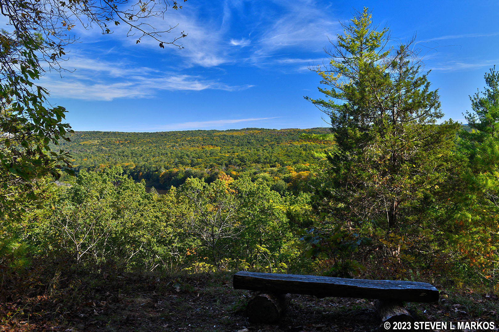
Scenic overlook on the Conashaugh View Trail just west of the Zimmermann Farm in Delaware Water Gap National Recreation Area
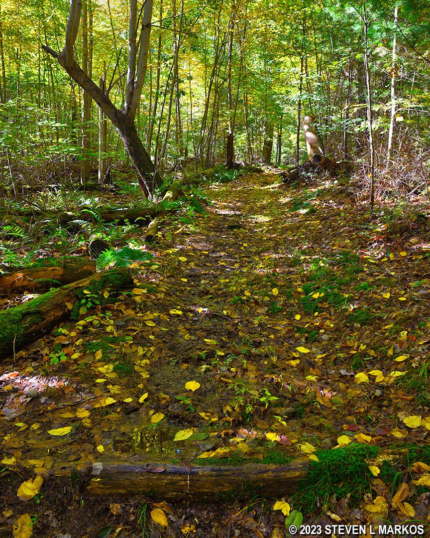
From the overlook, the Conashaugh View Trail continues uphill for another .4 mile until finally reaching the top of the hill.
Hilly terrain of the Conashaugh View Trail between the Zimmermann Farm and Conashaugh Road, Delaware Water Gap National Recreation Area
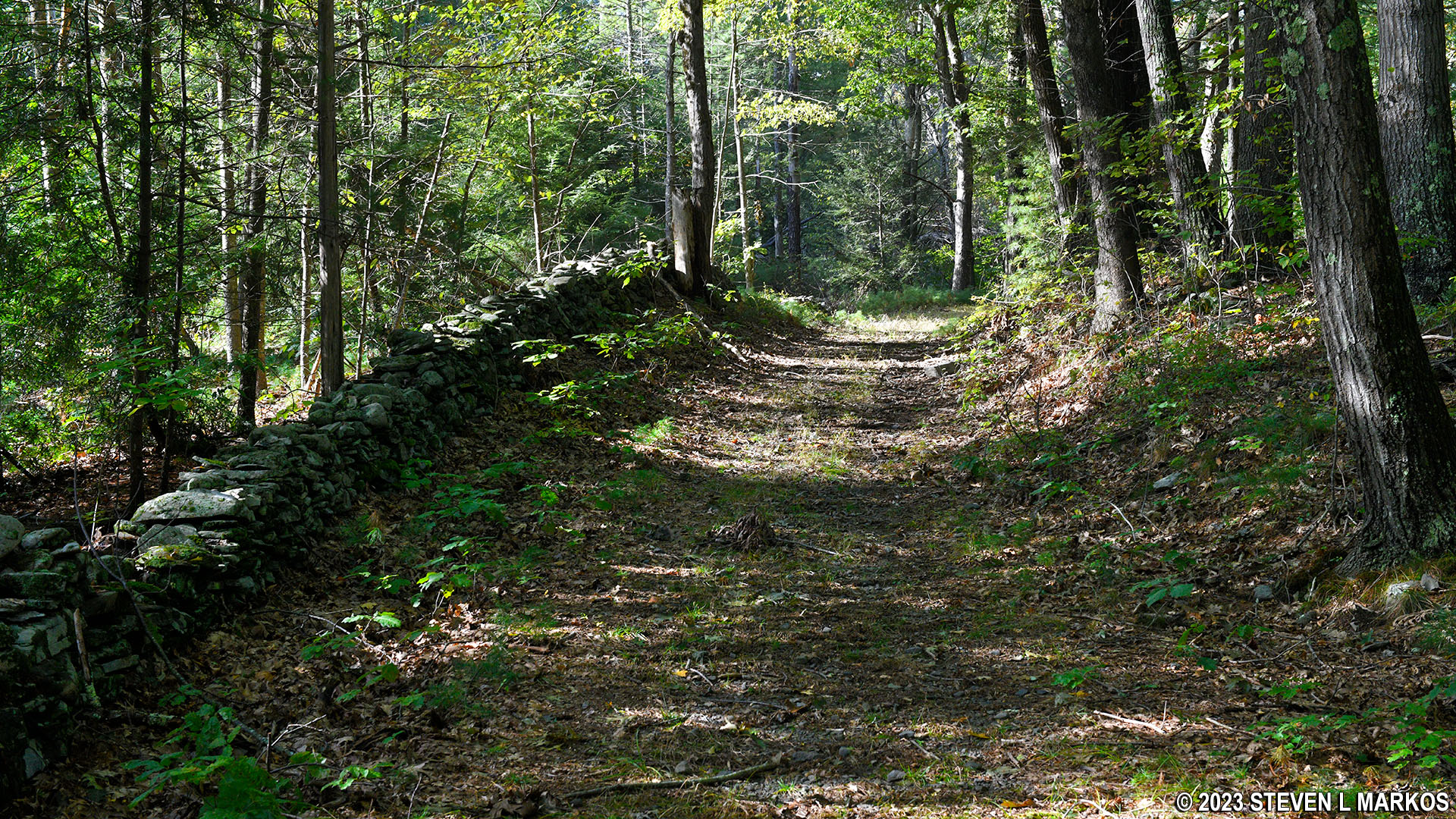
As mentioned earlier, most of the remaining trail is fairly level. There are some hills, but all are negligible and will go unnoticed if you are thinking about something else. There are a couple of stretches that are lined with stone walls. Early homesteaders built fences with rocks instead of using wood.
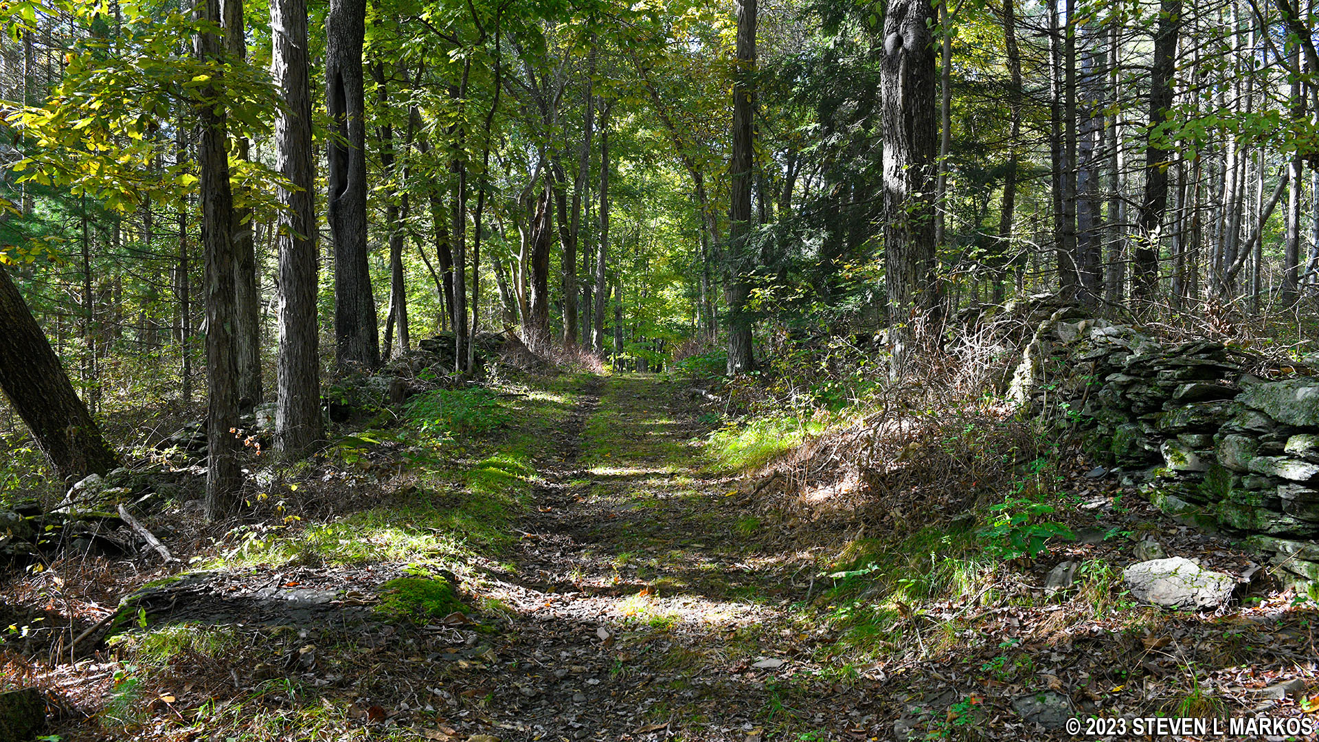
Stone fences line sections of the Conashaugh View Trail between the Zimmermann Farm and Conashaugh Road, Delaware Water Gap National Recreation Area
Though not on any of the maps, there is a small lake 1.4 mile from the trailhead on Zimmerman Farm Road (3.5 miles from the very start of the hike). The lake is not very far from the end of the hike at Conashaugh Road.
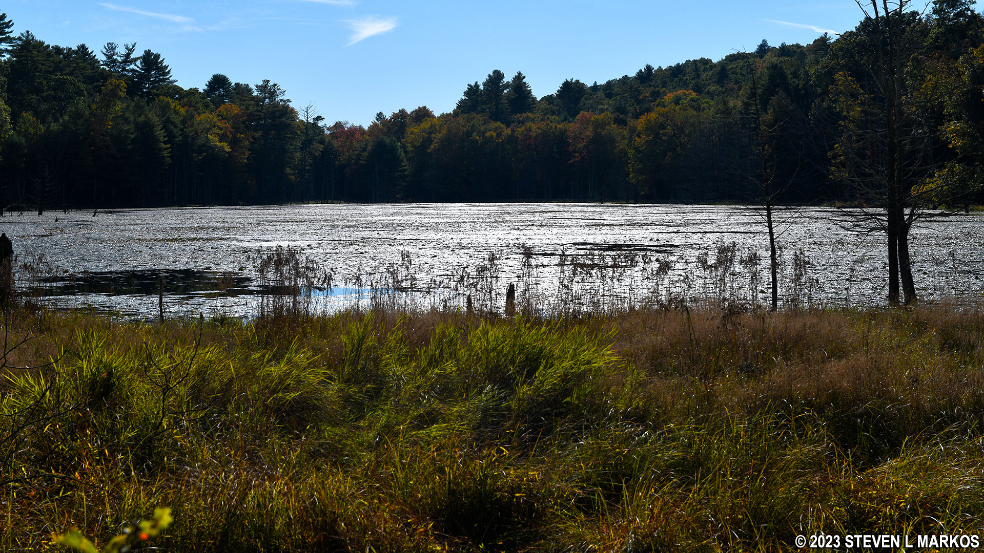
Small lake at the south end of the Conashaugh View Trail near Conashaugh Road, Delaware Water Gap National Recreation Area
Not far past the lake, and just around the corner from the end of the hike at Conashaugh and Long Meadow roads, is a trail intersection that is not on the National Park Service map. Coming from the Zimmerman Farm as I was, it is a sharp V-turn to the left. If you keep walking straight ahead, as you should, and aren’t paying attention, you won’t even notice it. However, if you are coming from Conashaugh Road, it is an obvious fork. I have no idea what this trail is, but it appears to be heading towards the lake.
Fork in the trail when hiking east from Conashaugh Road to the Zimmermann Farm on the Conashaugh View Trail in Delaware Water Gap National Recreation Area
The hike ends at the gate on Conashaugh Road. If you parked at the Conashaugh View Trailhead parking lot as I did, you have another 1.25 mile walk back to your car along the road. That’s why it’s nice to have a young and fast-walking assistant who can hike to the car and then drive back to pick you up.
Southern end of the Conashaugh View Trail near the intersection of Conashaugh and Long Meadow roads, Delaware Water Gap National Recreation Area
With a few exceptions, use of any photograph on the National Park Planner website requires a paid Royalty Free Editorial Use License or Commercial Use License. See the Photo Usage page for details.
Last updated on January 17, 2024


