
Fishermen’s Trail in the Sandy Hook unit of Gateway National Recreation Area leads to Sandy Hook Bay at the northern tip of the peninsula
Sandy Hook Unit Home Page | Hiking at Sandy Hook
Length: .6 mile one way to the bay and another .4 mile to the northern point of Sandy Hook
Time: 1 hour
Difficulty: Easy, but you are walking in deep sand the entire way
You don’t have to be a fisherman to enjoy a hike on the Fishermen’s Trail at the Sandy Hook Unit of Gateway National Recreation Area. It leads out to the bay at the northern end of the Sandy Hook peninsula, and just getting to the tip is a pretty neat experience for anyone. I saw two fishermen and two people walking along the beach, so including me, the non-fishermen outnumbered the fishermen. Just don’t hike the trail in search of a place to swim because there are no lifeguards and the current is very swift. There is also quite a lot of garbage on the beach, and I’m not talking about soda cans and cigarette butts left by bathers. This is industrial-type garbage that washes up from New York City.

Trash on the north end of Sandy Hook, Gateway National Recreation Area
The Fishermen’s Trail begins at the end of Parking Lot M. This is not a beach access lot, so there is no fee to park here. There is no sign that identifies the trail, so be sure not to confuse it with a dirt road to the left of the parking lot that heads south.
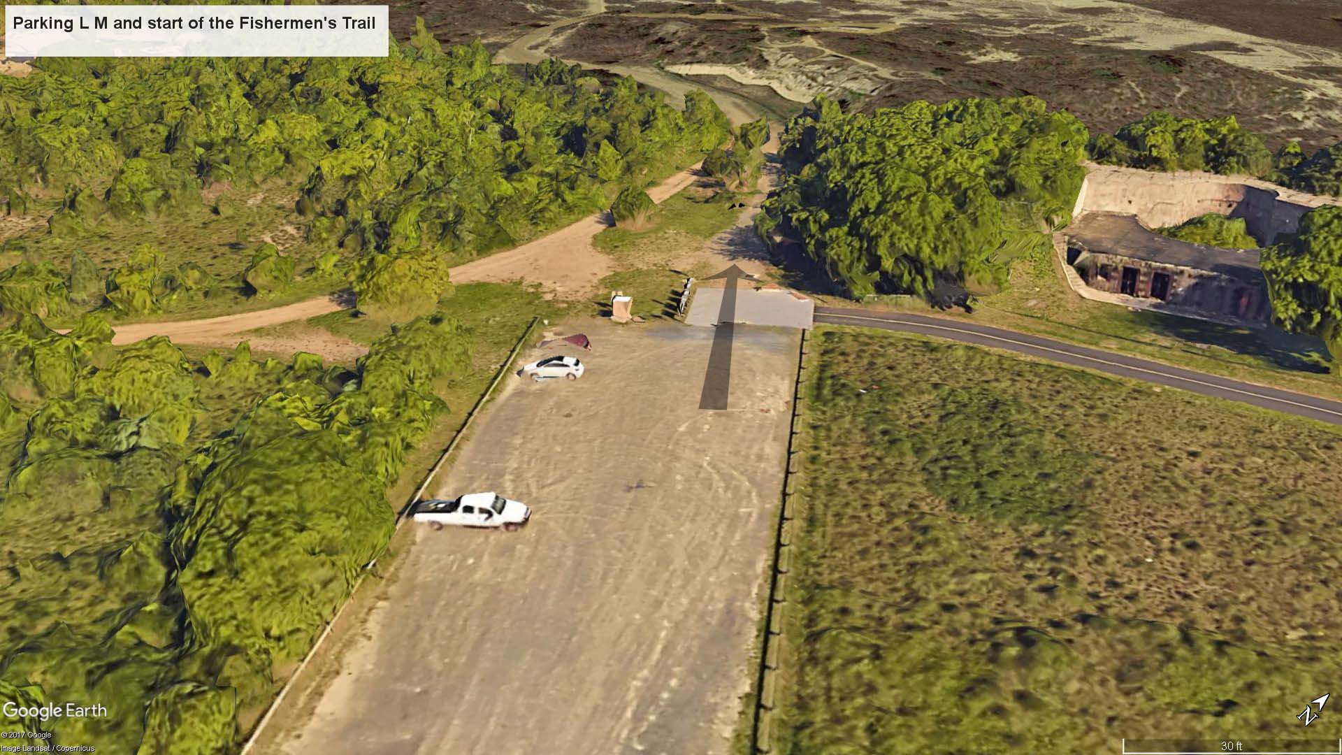
Satellite view of the start of the Fishermen’s Trail

Start of the Fisherman’s Trail at the Sandy Hook Parking Lot M, Gateway National Recreation Area
The trail starts off through a maritime forest on a hard-packed dirt trail, but in about a quarter mile the terrain opens up a little. You will pass Battery Peck shortly after departing, so if you don’t see it, you’ve gone the wrong way (the battery at the parking lot is the Nine-Gun Battery).

Fishermen’s Trail in the Sandy Hook unit of Gateway National Recreation Area passes Battery Peck
The trail forks soon after passing the battery. A right leads to an observation deck that was set up with bird watchers in mind. It’s just 75 yards down the trail, so it’s not a big detour if you want to check it out. Another military battery, Battery Engle, is completely buried in the vegetation below. Look to the left of where the trail comes in and you may catch a glimpse of concrete. There may be a better view of the battery in the fall and winter when the leaves are off the trees.

Turn off for the observation deck from the Fisherman’s Trail at Sandy Hook, Gateway National Recreation Area
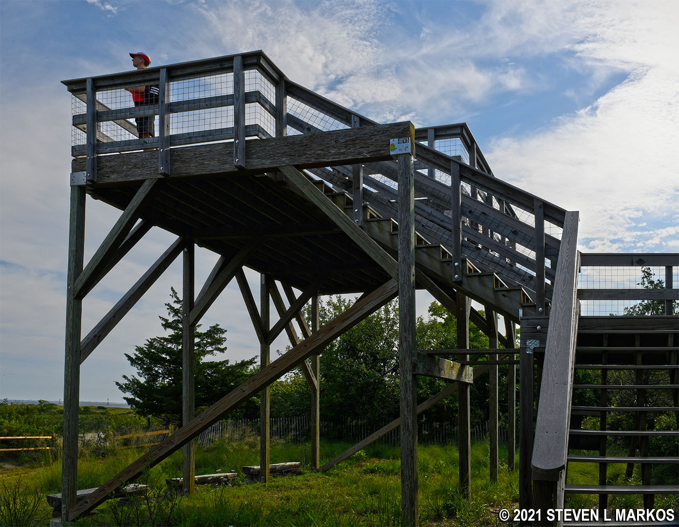
Observation deck at the north end of Sandy Hook at Fort Hancock, Gateway National Recreation Area

View from the observation deck on the north end of Sandy Hook, Gateway National Recreation Area
The Fisherman’s Trail continues straight ahead on deep beach sand and remains that way for the rest of the hike. When walking on beach sand you must take two steps just to move one step forward. While the terrain is as flat as a pancake, my legs got tired after a while.

Start of the sandy section of the Fishermen’s Trail in the Sandy Hook unit of Gateway National Recreation Area
It is .6 mile to the beach from the parking lot. For the first .4 mile you will be walking through a maritime forest, though this is not to say you will be in the shade. The trees in this forest aren’t very tall, and the trail itself is completely out in the open, so wear a hat and apply sunscreen if avoiding the sun is important to you. There are a few places where other trails branch off of it, but the Fishermen’s Trail is always the one that continues straight ahead.
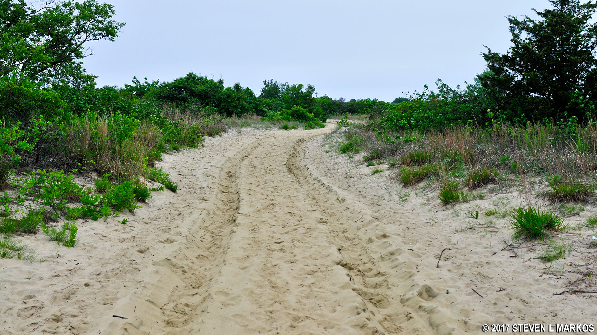
Typical terrain for the first .4 mile of the Fishermen’s Trail in the Sandy Hook unit of Gateway National Recreation Area
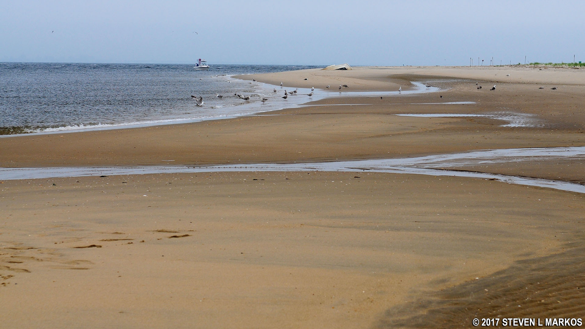
After .4 mile the trail emerges from the forest and is completely out in the open sand. The bay is another .2 mile ahead, but if you want to reach the actual point of Sandy Hook, take a right at the water and walk along the shore for another .4 mile. Without some sort of GPS and satellite map it’s hard to know where you are in the overall scheme of things, but the way to tell when you are at the point is that the waves change from calm, bay-side waves to rougher, ocean waves.
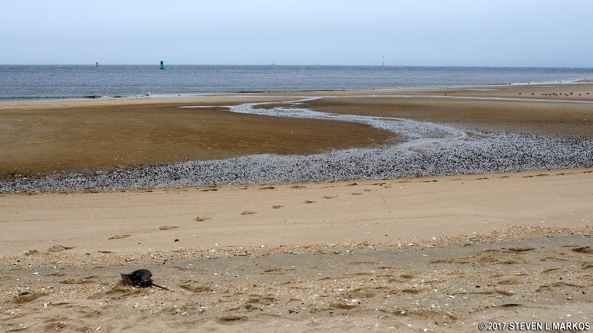
Sandy Hook Bay at the end of the Fishermen’s Trail in the Sandy Hook unit of Gateway National Recreation Area
It takes about an hour to walk out-and-back on the Fishermen’s Trail, though this does not count time spent on the beach relaxing or fishing. Seeing the tip of the peninsula is certainly a noteworthy experience. Of all the trails in the Sandy Hook Unit of Gateway National Recreation Area, this is the only one worth hiking.
With a few exceptions, use of any photograph on the National Park Planner website requires a paid Royalty Free Editorial Use License or Commercial Use License. See the Photo Usage page for details.
Last updated on December 10, 2024


