
Laurel Falls in the Elkmont Region of Great Smoky Mountains National Park
See the Elkmont Region web page for an interactive location map.

Length: 2.6 miles, round trip
Time: 1.5 hours
Difficulty: Between easy and moderate
Located near the Elkmont Campground and situated between the popular Gatlinburg and Cades Cove regions of Great Smoky Mountains National Park, it’s no surprise that the Laurel Falls Trail is one of the most hiked trails in the park. If you don’t get there early, on a nice day you may well be parking so far down the road that you will be hiking farther to and from your car than to the waterfall. When driving by at 1 PM on a Wednesday in October, just out of curiosity I checked my odometer and found that cars were parked one mile in either direction from the trailhead. The waterfall is only 1.3 miles away, though the trail itself runs 4 miles to the northern border of the park. Like nearly everyone else, my plan was to see Laurel Falls and then head back to the car.
The trail to the waterfall is a paved path, though beyond the falls it reverts to a typical earthen trail. From the start, the hike is uphill over hilly terrain, but the incline is gradual and not very strenuous. You will find people of all sizes and ages hiking here. However, though paved and relatively easy, the trail is a little too steep for those in a wheelchair, unless you are a Paralympian. A sign even warns against wheelchairs on the trail but does not prohibit them.

Laurel Falls Trail in the Elkmont Region of Great Smoky Mountains National Park
The trail weaves through a beautiful forest—not too thick, not too dark, just enough light coming through the canopy—and you get a clear view of the mountains at a few spots along the way.

Laurel Falls Trail in the Elkmont Region of Great Smoky Mountains National Park

View of the mountains from the Laurel Falls Trail in the Elkmont Region of Great Smoky Mountains National Park
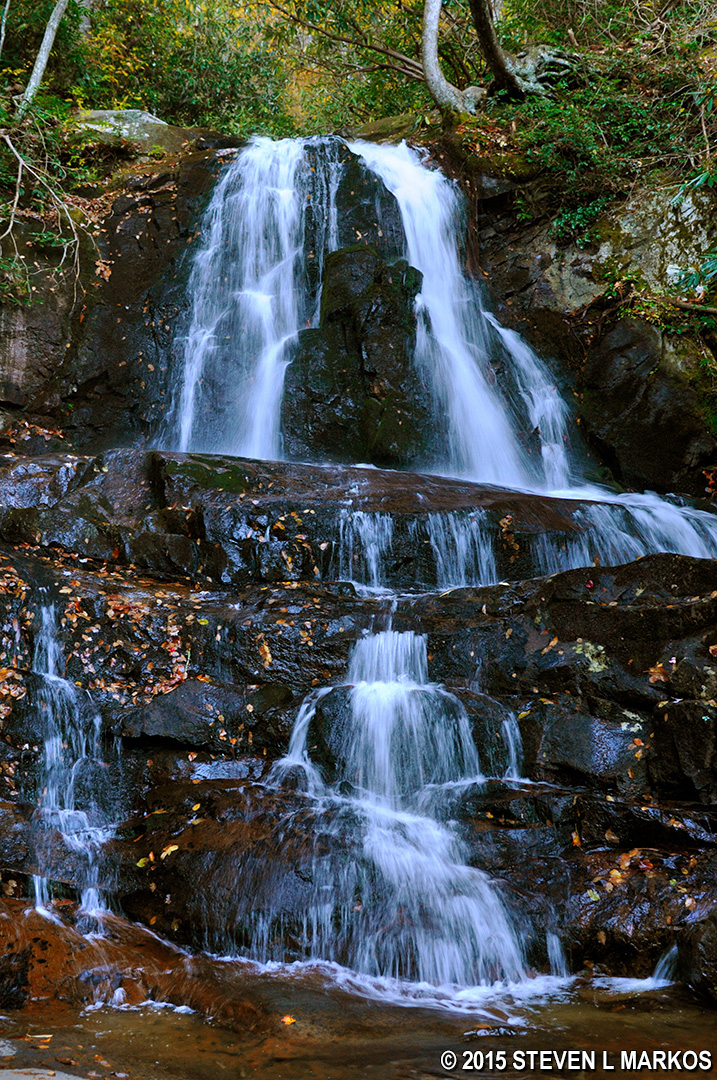
Laurel Falls is comprised of two tiers, and the trail puts you right in the middle, with the water flowing under the observation bridge before tumbling down to the lower level. You are not supposed to attempt to walk off-trail down to the bottom of the second tier, but not everybody follows the rules. As with most waterfalls in Great Smoky Mountains National Park, it is nothing spectacular. You won’t find awe-inspiring waterfalls in the Smokies as you do in Yosemite, the Grand Canyon, or Yellowstone. Most here are pleasant cascades that bring a smile to a hiker’s face, and that’s what you will find at Laurel Falls.
With a few exceptions, use of any photograph on the National Park Planner website requires a paid Royalty Free Editorial Use License or Commercial Use License. See the Photo Usage page for details.
Last updated on February 16, 2025


