

Battlefield Trail at Kings Mountain National Military Park
BATTLEFIELD TRAIL
Length: 1.5-mile loop
Time: 1 to 1.5 hours
Difficulty: Moderate
The only way to see the battlefield at Kings Mountain National Military Park is on foot. A 1.5-mile paved loop trail goes around the base of one side of the mountain and gradually works its way to the top, offering a battle perspective from both the American Patriot and British / Loyalist points of view. Most visitors walk the trail on their own, but Ranger-guided tours are usually held on weekends when staff is available. The tour covers the entire Battlefield Trail. There is no published schedule, so inquire about the tour at the Visitor Center.
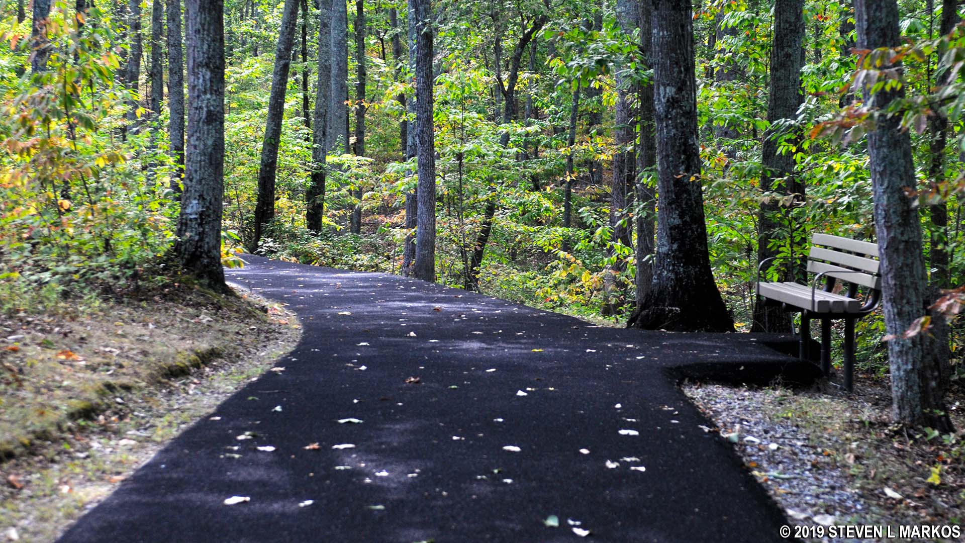
The word mountain is used very liberally here—Kings Mountain is more like a big hill—but the trail does climb 200 feet in altitude. The hike to the top is .7 mile long, and while the overall grade (angle of slope) is a moderate 7%, some short segments of the trail have grades as steep as 12% (most people consider 15% to be the start of strenuous hiking). Those in wheelchairs can make it to the top if someone pushes them or if they have a motorized wheelchair, but it is too steep for most wheelchair-bound people to make it on their own unless they are a Paralympic athlete. The National Park Service does provide wheelchairs for those who have trouble walking (available at the Visitor Center), but no other mobility services are offered on a daily basis. When the anniversary of the Battle of Kings Mountain is celebrated every October 7th, transportation to the top is provided for disabled visitors, but this is the only day such service is offered.

Hills of the Battlefield Trail at Kings Mountain National Military Park
The trail has always been paved, but it was formerly asphalt (as shown in older photos on this page). It was repaved in 2015 using a rubber material, so the walk now puts less stress on your knees, plus you get excellent traction even with a wet surface. Those who use hiking poles for aid in walking up hills will rejoice because the poles no longer slip and slide as they would on asphalt.

A paved trail made of a rubber material leads to the top of Kings Mountain, Kings Mountain National Military Park
Wayside exhibits that explain the events of the battle are located along the trail. In addition, Kings Mountain National Military Park has a free cell phone tour: dial a phone number, enter the stop number, and listen to information about events that occurred at that location. The phone and stop numbers are posted.

Wayside exhibit along the Battlefield Trail at Kings Mountain National Military Park
Benches are also available at various locations for those who need a break.
Benches are available along the Battlefield Trail at Kings Mountain National Military Park
In addition to the wayside exhibits, there are many monuments along the trail. The first that you come to is a memorial for Patriot officers William Chronicle, John Mattocks, William Rabb, and John Boyd. British officer Patrick Ferguson is also included. On the left is the original 1815 monument, and the larger monument is a 1914 replacement. The inscription on the original is no longer readable. These men were thought to be buried at this spot, but no bodies were found during a 1970s archaeological dig. (Note: Monuments at Kings Mountain refer to Ferguson as Colonel. He was a major at the time of the battle, but orders were underway promoting him to lieutenant colonel, a brevet rank. He died before knowing of his promotion.)

Memorial to Patriots William Chronicle, John Mattocks, William Rabb, and John Boyd, and British Major Patrick Ferguson along the Battlefield Trail at Kings Mountain National Military Park
Across from the Chronicle Memorial and up a short-but-extremely-steep path is a memorial marker on the spot where Major Chronicle was killed. This may be the steepest path in the park.

Marker for spot where Major William Chronicle was killed along the Battlefield Trail at Kings Mountain National Military Park
A marker on the spot where President Herbert Hoover gave a speech during the 150th anniversary of the battle on October, 7, 1930, is at the end of a short spur trail located about halfway around the Battlefield Trail.

Herbert Hoover Marker on the battlefield at Kings Mountain National Military Park
A new memorial was added to the battlefield in 2016 that commemorates black Patriots who participated in the Battle of Kings Mountain. Essius Bowman was a free man who fought in the battle with Captain Joel Lewis’s militia from Virginia. Andrew Ferguson was also a free man who fought in many battles during the war. John Broddy was a slave of the Campbell Family and servant to Colonel William Campbell during the war. It was believed that Broddy was the son of Charles Campbell, making he and William brothers, but recent DNA testing proved otherwise. He worked in a support role and did not fight in the battle, though he was shot at. Broddy was eventually given his freedom in 1793.
Two other men who are believed to have been at the battle, but not mentioned on the monument, are Primes (only known name) and Ishmael Titus. Primes was a free man who, like Ferguson, fought in many battles of the Revolution. Titus was a slave who was sent to fight in place of his master and promised his freedom for doing so. It was a common practice for rich slave owners to escape conscription by sending one or more of their slaves to fight instead.

Memorial to African-American Patriots who fought at Kings Mountain, Kings Mountain National Battlefield Park
Towards the top of the mountain is the Centennial Monument that was dedicated on October 7, 1880. Marble slabs on all four sides contain inscriptions. The monument was originally to have a bronze sculpture of an American Patriot soldier, but funds ran out. The monument marks where the most intense fighting took place.

Centennial Monument at Kings Mountain National Battlefield Park

Inscription of one side of the Centennial Monument at Kings Mountain National Battlefield Park
The Colonel Asbury Coward Memorial was placed to honor the president of the Kings Mountain Centennial Association. It was dedicated on October 7, 1931. Coward was a Confederate officer in the Civil War.

Colonel Asbury Coward Memorial at Kings Mountain National Battlefield Park
The U. S. Monument is the largest at Kings Mountain National Military Park. It sits at the top of the mountain and was dedicated on October 7, 1909.

U. S. Monument at the top of Kings Mountain, Kings Mountain National Battlefield Park
The Lieutenant Colonel James Hawthorn Memorial was dedicated in 1949. Hawthorn was wounded in the battle, but not killed. He died in 1807 in Kentucky.

Lt. Colonel James Hawthorn Memorial at Kings Mountain National Battlefield Park
A memorial marker is located on the spot where Major Patrick Ferguson was killed. This is also where the trail begins descending back down Kings Mountain.

Marker for spot where Major Patrick Ferguson was killed during the Battle of Kings Mountain, Kings Mountain National Military Park
The memorial marker for where Colonel Frederick Hambright was wounded is located down a short path that branches off the main trail. It is easy to miss if you aren’t paying attention.

Marker for spot where Colonel Frederick Hambright was wounded during the Battle of Kings Mountain, Kings Mountain National Military Park
The grave of Patrick Ferguson is located at the bottom of a very steep hill not far from the marker for where he was killed. One of his mistresses who was killed during the battle—one of two who traveled with him—is supposedly buried here a well. Obviously, he had to be buried soon after he died due to decomposition, but for whatever reason, his body was never exhumed and shipped back to Scotland where he was born. The actual body is underneath the pile of rocks behind the memorial.

Grave of British colonel Patrick Ferguson at Kings Mountain National Military Park
The Ferguson grave is the last monument on the trail. There is one more small hill to climb on the way back to the Visitor Center, which is just .1 mile from the grave.
Plan to spend 1 to 1.5 hours for the walk along the Battlefield Trail at Kings Mountain National Military Park, which gives you time to read the information on the wayside exhibits and listen to the cell phone audio tour. If you plan to walk the trail for exercise only, you can make it around in 30 to 45 minutes.
With a few exceptions, use of any photograph on the National Park Planner website requires a paid Royalty Free Editorial Use License or Commercial Use License. See the Photo Usage page for details.
Last updated on April 25, 2025


