

History Trail around Snee plantation
Length: .5 miles
Time: 20 minutes
Difficulty: Flat and easy
There are only 28 acres of the original Pinckney plantation remaining at Snee Farm. Most of the property was sold off over the years, and much of the land is now residential subdivisions. In fact, one subdivision adjacent to the back of the property is named the Snee Farm Subdivision. A short, half-mile trail that begins just outside the backdoor of the Charles Pinckney National Historic Site Visitor Center (a farmhouse built by subsequent owners of the property) encircles the field and woods and offers some wonderful photo opportunities. Wayside exhibits are placed along the trail to tell the history of the area.
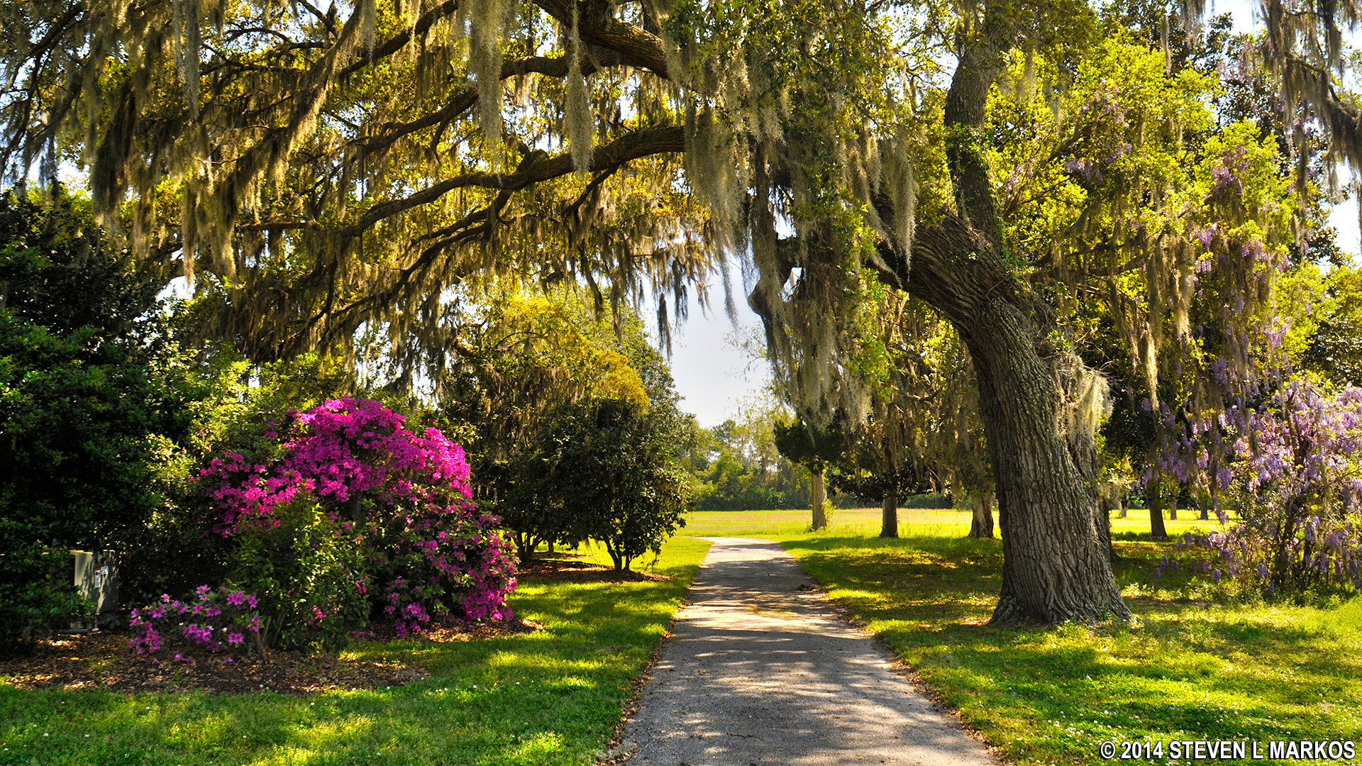
Walk along the paved path that begins behind the farmhouse until you come to a gravel road. This is the original road that ran from the plantation to the main road that led to Charleston. Today this road, known as a “trace,” ends a short distance from the farmhouse, cut off by the surrounding subdivisions. President George Washington walked along this road back in 1791.

Paved portion of the History Trail outside of the farmhouse at Charles Pinckney National Historic Site
Take a left onto the trace. After a few minutes’ walk be on the lookout for a trail that branches off to the right, a grass path cut through the field. This leads to the area thought to be where the slave quarters were located. The foundation posts of three buildings were discovered, and these building are now outlined with bricks set into the ground.

Grass path leads to the Slave Quarters on Charles Pinckney’s Snee Farm plantation, Charles Picnkney National Historic Site

Slave Community wayside exhibit and building foundation outline at Charles Picnkney National Historic Site
Once past the old slave quarters, the trail forks. The left fork leads through the woods and borders a tidal wetland. The other just follows the tree line along the open field and runs parallel to the wetland trail. The more interesting path is the wetland trail, and a boardwalk at the end overlooks Wampacheone Creek (this was closed during my visit).

Trail through the wetlands at Charles Pinckney National Historic Site
Once you exit the forest you will be heading back towards the farmhouse. On the way is a model of a rice trunk. Rice was the main crop grown at the plantation during Pinckney’s time, supplanted by cotton in later years. The rice trunk controlled the flow of water between rice paddies.

Model of a rice trunk at Charles Pinckney National Historic Site
The entire trail never leaves sight of the Visitor Center (though you can’t see the farmhouse when you are in the woods due to the trees blocking the view). If you came all the way out to Charles Pinckney National Historic Site, you might as well walk the trail. You can leisurely stroll through the grounds in no more than 20 minutes. There are many beautiful live oaks and magnolias on the property. You don’t have to stick to the trail. Feel free to walk anywhere you want to get a photo.
Beautiful grounds of the Charles Pinckney National Historic Site
With a few exceptions, use of any photograph on the National Park Planner website requires a paid Royalty Free Editorial Use License or Commercial Use License. See the Photo Usage page for details.
Last updated on April 29, 2024


