

Upper Delaware Scenic and Recreational River just south of Barryville, New York
Length: 12.5 miles
Water Level at Time of Trip: 2.9 to 3.9 feet
Average moving speed: 3.9 MPH with two paddlers
Time: 3.25 hours
This river review covers the Upper Delaware Scenic and Recreational River from the Barryville Canoe Launch in Barryville, New York, to the Monguap Canoe Launch in Sparrowbush, New York, a span of 12.5 miles. This is the longest section between public boat ramps within the boundary of the park. The National Park Service’s Planning Your River Trip brochure shows a ramp 10 miles downriver from Barryville in Buckhorn, Pennsylvania, but I scoured the shoreline for this and never saw anything that remotely looked like a launch point. There is a permit-only campground within the Buckhorn Natural Area, so if there is a ramp, it is most likely only for people camping there. For everyone else departing from Barryville, the Mongaup Canoe Launch is the first public exit point.

Upper Delaware Scenic and Recreational River between Barryville and Mongaup
Before starting a trip on the Upper Delaware Scenic and Recreational River, it is a good idea to check the water levels so that you have an idea of the river conditions. Levels of 2.5 to 4 feet are average and provide plenty of water for a trip down the river with conditions suitable for paddlers of all skill levels. The water level gauges relevant to the Barryville–Mongaup section of the river are at Barryville, New York, and Port Jarvis, New York. On the day of my trip in late October, the Barryville gauge was at 3.85 feet and the Port Jarvis gauge at 2.9 feet, and for the most part, there was plenty of water for an enjoyable trip. The observations made in this report are based on these water levels, so adjust your expectations according to the conditions on the day you do the trip. The lower the water, the more often you will hit rocks on the bottom of the riverbed and get stuck. The higher the water, the more paddling skills you need.
Upon departing from the Barryville Canoe Launch, you will pass under the Barryville-Shohola Bridge and quickly hit a quarter-mile stretch of minor rapids (a step up from riffles, but not much). This is followed by a short-and-calm section and then a 100-yard run of more sizeable rapids, though nothing dangerous even for younger kids (Class I / II).

Rapids on the Delaware River just south of Barryville, New York, Upper Delaware Scenic and Recreational River
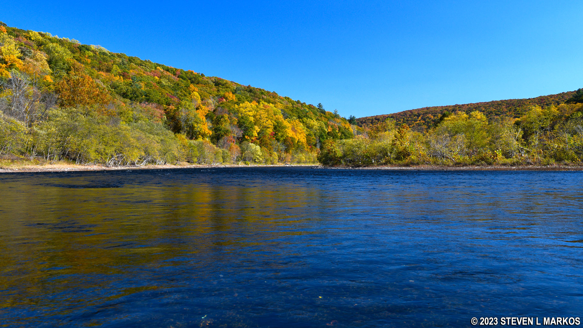
From Barryville, the Delaware River heads south for a little over a mile before coming to a large bend to the east. There are some small riffles just before making the turn, but after that the water is nearly still. I’ve noticed that these slow stretches often come at large bends in the river. This one lasts for another mile until the water finally picks up some speed at the next bend in the river to the south (that’s because, as any educated person knows, south is downhill).

Calm water a mile downriver from Barryville, Upper Delaware River Scenic and Recreational River
The aforementioned bend to the south is at the upper end of a backwards S-shaped curve in the river that starts at Camp Tel Yehudah (shown on Google Maps; you can’t see it from the river). There are multiple stretches of rapids over the next mile and a half, including some Class II rapids.

Rapid starting two miles downriver from Barryville, New York, on the Upper Delaware Scenic and Recreational River
At the lower end of the S-curve is an extreme bend in the river to the east where the water is again very still, very deep, and so clear that I could see the bottom.

Stretch of flat water 4 miles downriver from Barryville, Upper Delaware River Scenic and Recreational River
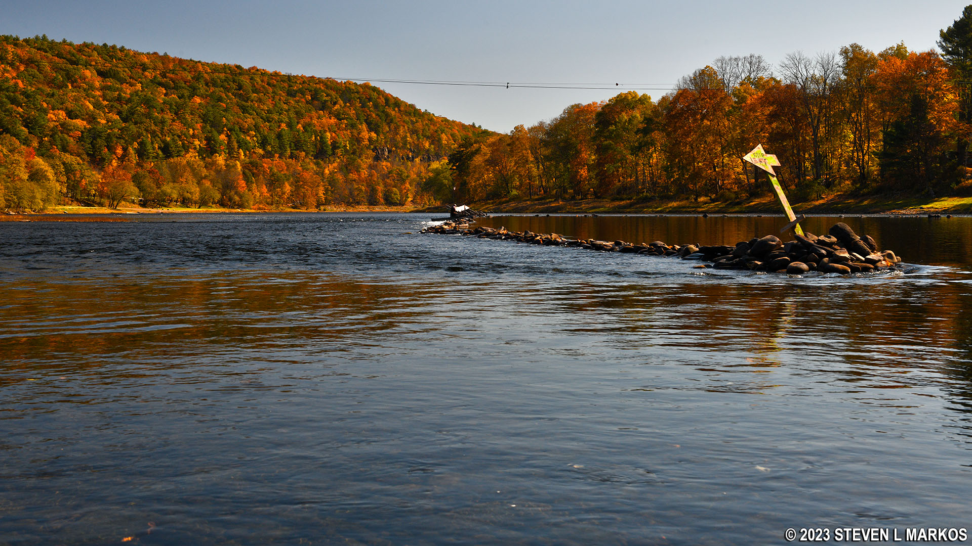
The next point of interest is just before Kittatinny Canoes’ boat ramp and Jerry’s Three River Campground, which is about 5 miles from Barryville: an eel weir. This is a V-shaped rock dam that funnels eels into a wooden trap at the nadir of the V on the downriver end. Permits are issued to build the trap and catch eels starting in late summer, and the trap remains in place up through the fall (the rocks are always there). When the trap is in place, boaters have to pass the eel weir either on the far left or the far right to get around it. There are signs in the river that point the way to go. I went to the left, and there wasn’t much water. In fact, I got stuck and had to drag my kayak off the rocks. I don’t know if going around the eel weir to the right will be any easier, but it can’t be much worse. I passed two other eel weirs prior to this one, and despite adequate water level readings for the area, there was shallow water at each one.

Warning sign for an eel weir on the Upper Delaware Scenic and Recreational River
Eel weir between Barryville and Sparrowbush, New York, on the Upper Delaware Scenic and Recreational River
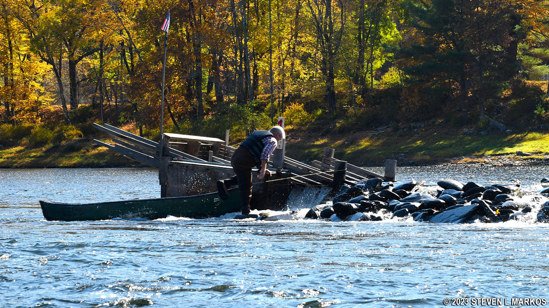
Man checking his eel trap on the Upper Delaware Scenic and Recreational River

Upstream view of an eel weir between Barryville and Sparrowbush, New York, on the Upper Delaware Scenic and Recreational River
Three quarters of a mile beyond the eel weir is a private canoe launch belonging to Jerry’s Three River Campground. While you can’t launch or take out here unless you are a customer, nothing stops you from pulling over and taking a break on the shore. There are portable toilets you can use as well. Just beyond the ramp is a fairly long run of small rapids.

Private canoe launch at Jerry’s Three River Campground, Upper Delaware Scenic and Recreational River
The Delaware River continues southeast for another mile before hitting a bend in the river to the northeast towards Pond Eddy, a small riverside town. From the curve until the Pond Eddy Bridge, the current is almost non-existent and the water is deep. This would be a good place to go swimming. For reference, the bridge is eight miles from Barryville.
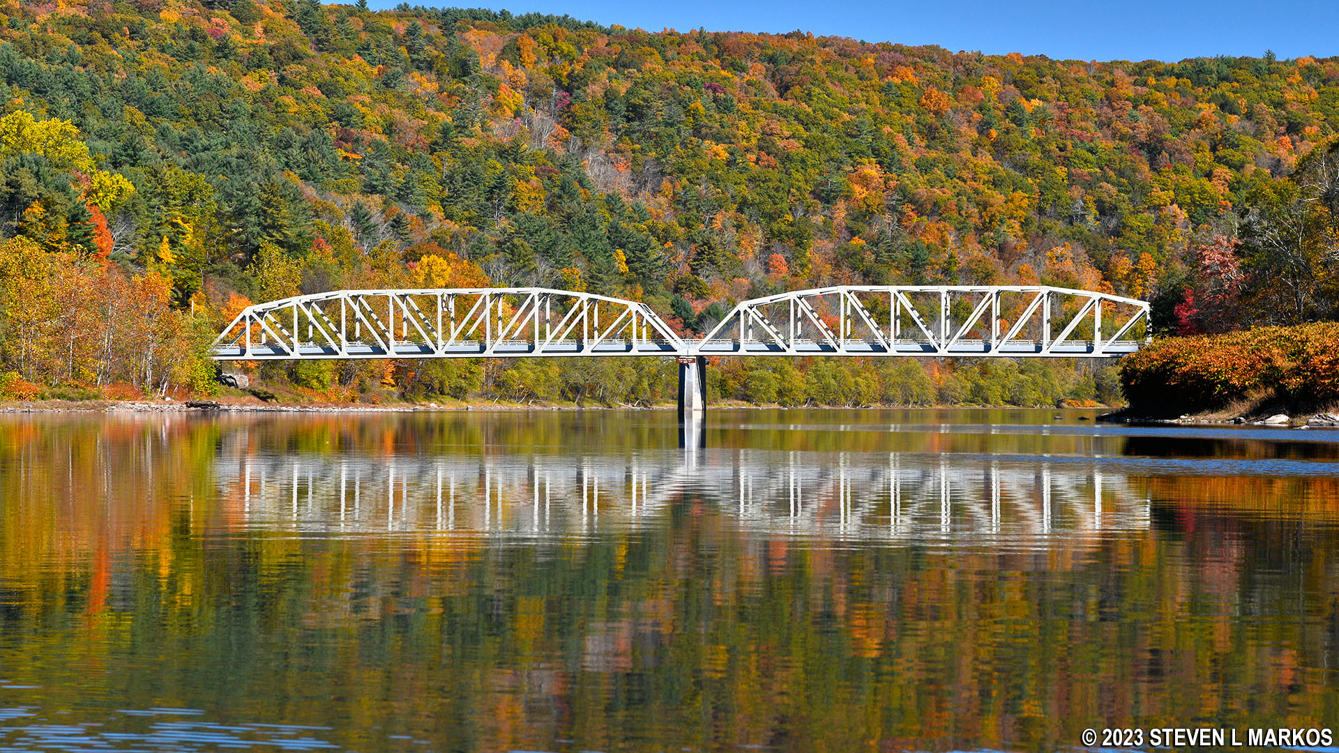
Pond Eddy Bridge on the Upper Delaware Scenic and Recreational River
Just past the Pond Eddy Bridge, the Delaware River makes another sharp curve to the southeast and passes around a couple of islands. This causes the river to split into narrower channels, which ultimately creates faster current and a few areas of riffles. The river is also much shallower here. Stay to the right and take the wider channel around the islands. This section of the river runs right along NY 97.

Delaware River just downstream from Pond Eddy, Upper Delaware Scenic and Recreational River
The map on the National Park Service brochure for the Upper Delaware Scenic and Recreational River names a run of rapids on this southeast stretch of river—the Stairway Rapids. Typically, named rapids indicate something beyond typical, but I didn’t find the Stairway Rapids to be any more difficult than anything that came before, at least not at the water levels when I did my trip. The rapids come at the end of the southeast stretch of river right before another bend to the east, ten miles from Barryville. This is the last major bend in the river before coming to Mongaup.

Upstream view of the Stairway Rapids near Mongaup, Upper Delaware Scenic and Recreational River

Stairway Rapids near Mongaup, Upper Delaware Scenic and Recreational River
Just before coming to the Mongaup Canoe Launch is an island. Not knowing exactly where the launch was, other than it was on the New York (left) side of the Delaware River, I stuck to the New York shoreline and went around the island on its left side. Be aware that just after passing the island is an eel weir—not in use when I did my trip—so regardless of which way you go around the island, stick to the shoreline to avoid the rock dam and expect to navigate through shallow water.
Delaware River flows around an island just upstream from Mongaup, Upper Delaware Scenic and Recreational River
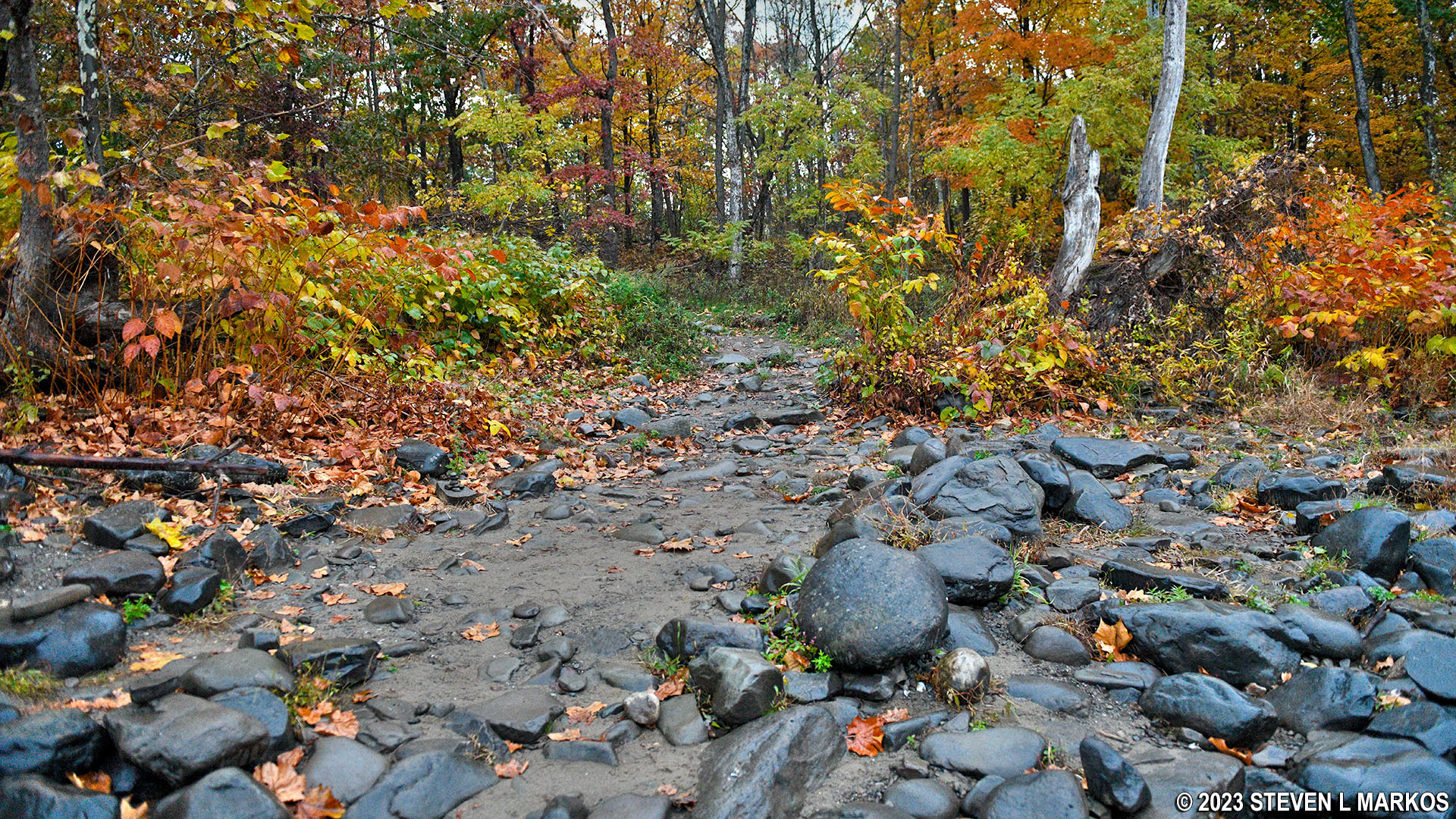
As I mentioned earlier, I never saw a Buckhorn Canoe Launch, and the Mongaup launch isn’t any easier to spot. If you aren’t looking for it, you will never find it. The launch comes just before the confluence of the Mongaup and Delaware rivers. If you plan to end a trip at Mongaup and you see the Mongaup River flowing into the Delaware, you went too far. In fact, the moment you see it, you better turn around and paddle as hard as you can back upriver because once you get to the Mongaup River you’ll be hitting the biggest rapids on the Upper Delaware Scenic and Recreational River, and there is no turning back. Thus, keep a keen eye out for what amounts to a gap in the vegetation. This is a trail that leads a tenth of a mile to a large parking lot on NY 97. There are two such trails, but skip the first one. It is the second trail that you want. If you have a GPS device, it is approximately .75 mile past the downstream end of the above-mentioned island.
View of the Mongaup Canoe Launch from the water, Upper Delaware Scenic and Recreational River
Next River Section | Previous River Section | River by Section Home Page
With a few exceptions, use of any photograph on the National Park Planner website requires a paid Royalty Free Editorial Use License or Commercial Use License. See the Photo Usage page for details.
Last updated on August 19, 2023


