Length: 3.8-mile loop
Time: 2-3 hours
Difficulty: Mainly easy, but there is one extremely steep hill and another that is moderately strenuous
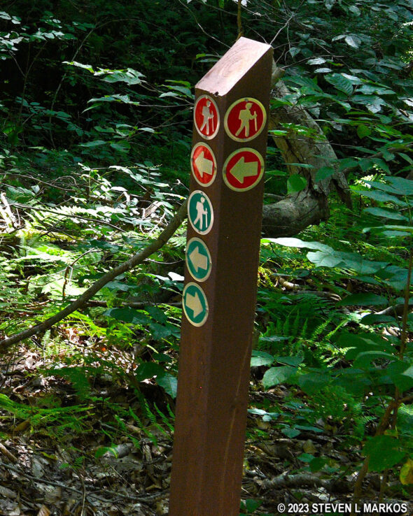
Before starting out on a hike around Friendship Hill National Historic Site, be sure to pick up a trail map at the Visitor Center. While the map is printed in black and white and lists trails by name, keep in mind that directional signage at the trailheads and intersections goes by colors, not trail names. Green is for the Main Loop Trail. Red is for the various meadow trails. Yellow tends to be for short connectors between the red and green trails.
The Main Loop Trail is the longest trail in the park. It begins at the gazebo located at the back of the Gallatin House. Walk through the archway of the Servant’s Quarters building and follow the paved path to the gazebo. The Servant’s Quarters is an addition to the house that was built in 1903 by Charles Speer, one of the many owners of Friendship Hill after Albert Gallatin sold the property in 1832.
The gazebo itself was built in the 1890s. It overlooks the Monongahela River, and due to erosion, it had to be moved back from the edge of the cliff. This was done by the National Park Service after it took over the property in 1980. There is an overlook of the river near the gazebo, but due to the trees that have grown up over the years, there is no longer a good view.
Take a left at the gazebo and follow the wooden fence out to an open field. There is a wayside exhibit about Sophia Allegre, the woman Gallatin married in 1789, the same year he built the original house at Friendship Hill. Sophia died five months after getting married and is now buried in an unmarked grave on the property. Her supposed gravesite is the first stop of interest on the Main Loop Trail.

Path from the Gallatin House gazebo to the Sophia Allegre wayside exhibit, Friendship Hill National Historic Site

Sophia Allegre wayside exhibit on the grounds of the Gallatin House at Friendship Hill National Historic Site
The Main Loop Trail has its share of hills, and Sofia’s grave lies at the bottom of the first notable one, though it is nowhere near as tough as the steepest hill on the trail.

Field at the bottom of the hill on the Main Loop Trail just north of Sophia Allegre’s grave, Friendship Hill National Historic Site
When you get to the field at the bottom of the hill, follow the mowed path along the tree line to the forest on the far side of the field. Sophia’s grave is just a hundred feet ahead, a quarter mile from the start of the Main Loop Trail. In fact, you can see it from the entrance into the forest.
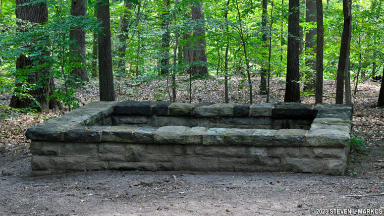
Albert and Sophia were married in May 1789, and Sophia died five months later in October. She is supposedly buried in an unmarked grave on the property. According to legend, subsequent owners of Friendship Hill removed her remains from the original grave and reinterred them within the current stone enclosure, though there has been no effort to excavate the site and verify the story. All that is known for sure is that she requested to be buried on a hill overlooking the Monongahela River. Nobody even knows how she died.
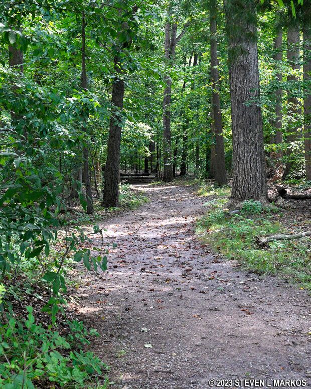
Wide path through the forest leads to Sophia Allegre’s grave at Friendship Hill National Historic Site
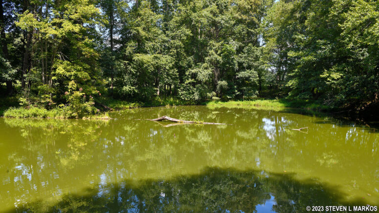
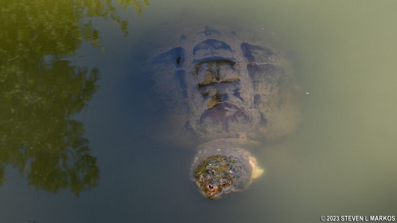
Beyond Sophia’s grave is a small pond. There is nothing picturesque about it, though I did see some huge turtles. I get the feeling that people feed them because they came swimming my way as soon as they saw me.
Once past the pond, the trail heads back into the forest. At .35 mile into the hike is an intersection with the South Meadow Loop Trail, a trail I hiked on a separate outing. The South Meadow Loop Trail is C-shaped, so it connects to the Main Loop Trail here and farther to the south. To continue on the Main Loop Trail, stay to the right and take the footbridge over a small stream. A sign marks the intersection.

Intersection of the Main Loop Trail and the South Meadow Loop Trail at Friendship Hill National Historic Site
From the northern to the southern intersections with the South Meadow Loop Trail, the Main Loop Trail often becomes quite narrow and at times is faint and hard to follow. The terrain is slightly hilly, but I mention this only to point out that it’s not completely flat.

Narrow section of the Main Loop Trail south of Sophia Allegre’s grave at Friendship Hill National Historic Site
The southern intersection with the South Meadow Loop Trail is about a half mile from the first. Just beyond the intersection, the Main Loop Trail reaches its most southern point and now curves to the west, dropping down to the Monongahela River on one of the steepest hills I have encountered at any National Park on the east coast. It looks like you are about to go over a cliff. The average grade of this hill is -27%, and it runs for 500 feet. Most hikers agree that a 15% (+ or -) grade is where strenuous starts, so this hill is way beyond that. Wooden stairs have been installed for much of the descent to make matters a little easier.
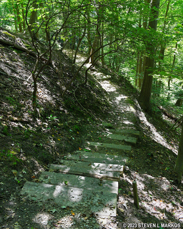
An extremely steep hill on the south end of the Main Loop Trail leads down to the Monongahela River, Friendship Hill National Historic Site
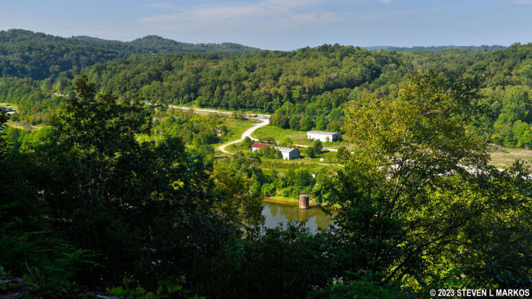
Once at the bottom, take a right to begin a .8 mile hike along the Monongahela River, though you rarely get a good look at it due to the trees blocking the view. The trail is still a good ways above the river, so there’s never a time when you can step right into the water. The terrain is now fairly flat with a few negligible dips here and there. The trail itself is an old dirt road, and it remains as such for most of its length from here on out.
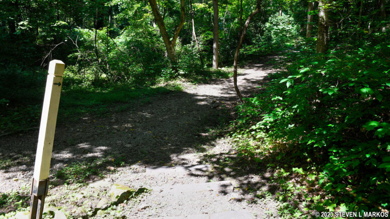
Southern end of the Main Loop Trail at the bottom of the hill near the Monongahela River, Friendship Hill National Historic Site
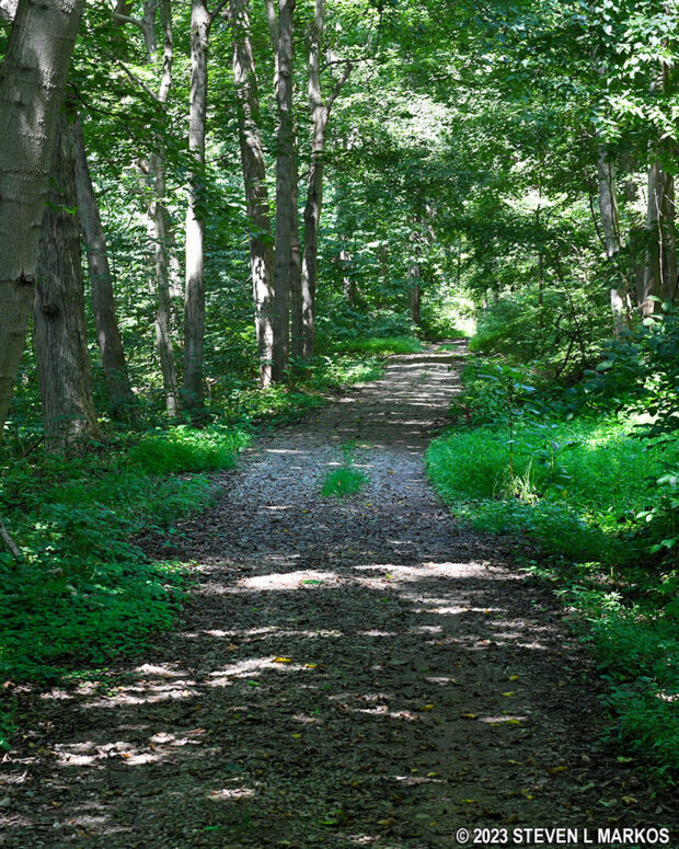
Typical terrain of the Main Loop Trail along the Monongahela River, Friendship Hill National Historic Site
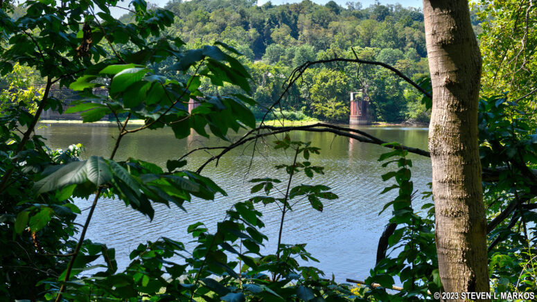
Halfway through the trip along the river is a manmade structure called a river gauge. From the trail, you are looking at the back of it, so it is hard to tell what it is. However, if you look through some of the periodic gaps in the vegetation, you can see two gauges on the other side of the river. These keep track of water flow and depth.
After hiking 1.75 mile, the Main Loop Trail veers from the Monongahela River for good, and the terrain becomes hilly once again. A quarter mile later is the intersection with the South Cutoff. This connects to the Main Cutoff, which you can take directly back to the Gallatin House parking lot for a shorter hike. Stay left at the fork to continue on the Main Loop Trail.

Intersection of the Main Loop Trail and South Cutoff Trail at Friendship Hill National Historic Site
A quarter mile later is the intersection with the Main Cutoff, a yellow-coded trail. Follow the green arrows on the directional signage to remain on the Main Loop Trail.
Just beyond the Main Cutoff is Ice Pond Run, a small creek. According to the trail map, if you “walk a short distance up Ice Pond Run, you’ll come to perhaps the prettiest of the park’s seven waterfalls.” I assume this means to walk off-trail, following the creek. I did not do this because, one, I had no idea how far “a short distance” is. Fifty feet? A quarter mile? A half mile? Who knows? And two, the creek is flanked on both sides by chest high weeds. You might as well just jump into a bed of ticks. You would literally have to “walk a short distance up” the creek, meaning wading in the water, to avoid the vegetation.
Just beyond Ice Pond Run is the intersection with the North Cutoff, a trail that connects to the North Meadow Loop Trail. Also, at this point the Main Loop Trail runs along the Monongahela Railroad. You can’t see the tracks, but you can see the railroad cut, the gully where the tracks are laid. Stay left at the fork to remain on the Main Loop Trail.

Intersection of the Main Loop Trail and North Cutoff Trail at Friendship Hill National Historic Site
The Main Loop Trail curves south at the intersection with the New Geneva Spur, a yellow trail that takes you to the town of New Geneva, which Albert Gallatin help found. At this point (2.8 miles into the hike) the level terrain comes to an end and the trail now begins climbing out of the river valley and back up to the plateau where the Gallatin House is located. The climb is not nearly as steep as the descent into the valley, never even reaching a 15% grade (12% tops). It is, however, moderately strenuous (4 out of 5 in difficulty) and stretches on for .35 mile.

Start of the hilly terrain on the Main Loop Trail south of the intersection with the New Geneva Spur, Friendship Hill National Historic Site
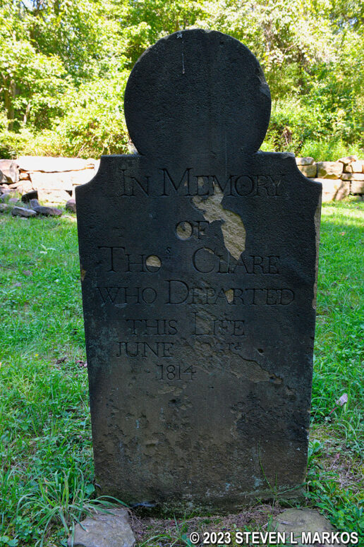
At the top of the hill is the Thomas Clare Cemetery. Clare was an early settler of the area from Ireland who was one of Gallatin’s neighbors and business associates. In addition to Clare’s grave, there are a few others within the stone enclosure that surrounds the cemetery, most of which are believed to be of Clare’s slaves and servants. Slavery was gradually phased out in Pennsylvania starting in 1780 via the Gradual Abolition Act. No more slaves were allowed into the state; those who were slaves prior to the bill were to remain slaves; and those born to enslaved parents after 1780 would remain in bondage until 28 years old, making them the last generation of slaves in the state. Clare himself died in 1814, and at that time all of his slaves were freed and given some land.
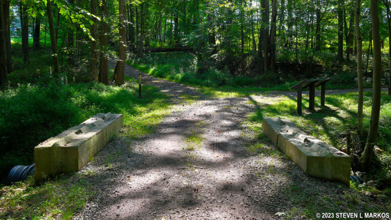
After passing the cemetery, the terrain is much flatter, and while there are some hills, most are negligible. The Main Loop Trail itself continues to be an old dirt road.

Typical terrain on the Main Loop Trail south of the Thomas Clare Cemetery at Friendship Hill National Historic Site
Two tenths of a mile past the Clare Cemetery is a four-way intersection with the School Spur. A right leads out to Highway 166. Across the street is Albert Gallatin South Middle School, so I assume this is where teachers might enter the park when taking school groups on park field trips. Left connects to the North Meadow Loop Trail, though just up ahead is the intersection with one of the trail’s official trailheads. The Main Loop Trail also crosses the Dublin Run at this intersection. Stay straight to continue the hike.
I could underhand throw a baseball from the School Spur to the next intersection (which is also 4-way). This time, a left puts you on the Hidden Meadow Loop Trail, and a right starts you off hiking around the North Meadow Loop Trail in the counterclockwise direction. This is a U-shaped trail that connects to the Main Loop Trail here and a little farther to the west. This report only covers the Main Loop Trail, but I actually broke off and hiked both the North Meadow and the Hidden Meadow loops. If you want to include them to your itinerary, the Hidden Meadow Loop adds .6 mile to the hike, and the North Meadow Loop adds 1.25 mile.

Intersection of the Main Loop Trail and the North Meadow and Hidden Meadow loop trails at Friendship Hill National Historic Site
If your plan is to stick with the Main Loop Trail, keep straight through the intersection. Another .2 mile ahead is the second intersection with the North Meadow Trail. Picking it up here sets you off hiking around in the clockwise direction.

Southwest intersection of the Main Loop Trail and the North Meadow Loop Trail at Friendship Hill National Historic Site
Another stone’s throw ahead is a fork where two wayside exhibits are located that detail how the land was being destroyed ever since Gallatin’s time and how it is now recovering ever since it became part of Friendship Hill National Historic Site in 1978. A left leads to the Trailhead Loop Trail parking lot on the main park road. Take a right to stay on the Main Loop Trail. On the printed map this is called the Ice Pond Run Loop (the loop is formed by using the park road), but it is called the Main Loop on the map panels posted along the trail (the map at the top of this page is a photo of one of those maps).
A quarter mile down the trail is another fork. The gravel road continues straight and leads to the park maintenance facilities, so you don’t want to go there. Thus, take the fork to the left onto the grass path.

Fork in the Main Loop Trail near the park maintenance buildings at Friendship Hill National Historic Site
The Main Loop Trail forks again right away, so stay straight on the mowed path that follows the tree line on the north end of a large field. This comes out on the park road in a tenth of a mile. Look to the right and you can see the main parking lot where the hike ends.
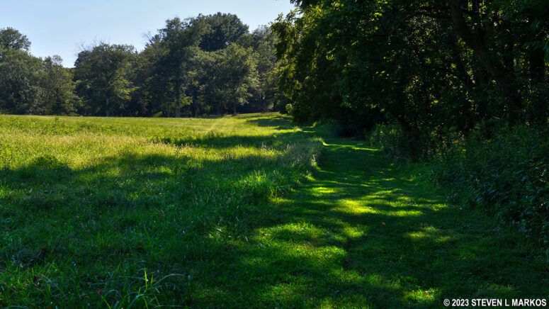
Final leg of the Main Loop Trail at Friendship Hill National Historic Site when hiking the loop in the clockwise direction

When hiking in the clockwise direction, the end of the Main Loop Trail is at the entrance road to Friendship Hill National Historic Site
With a few exceptions, use of any photograph on the National Park Planner website requires a paid Royalty Free Editorial Use License or Commercial Use License. See the Photo Usage page for details.
Last updated on November 29, 2024


