

North Meadow Loop Trail Map (click to enlarge)
Length: 1.25-mile loop
Time: 40 minutes
Difficulty: Easy
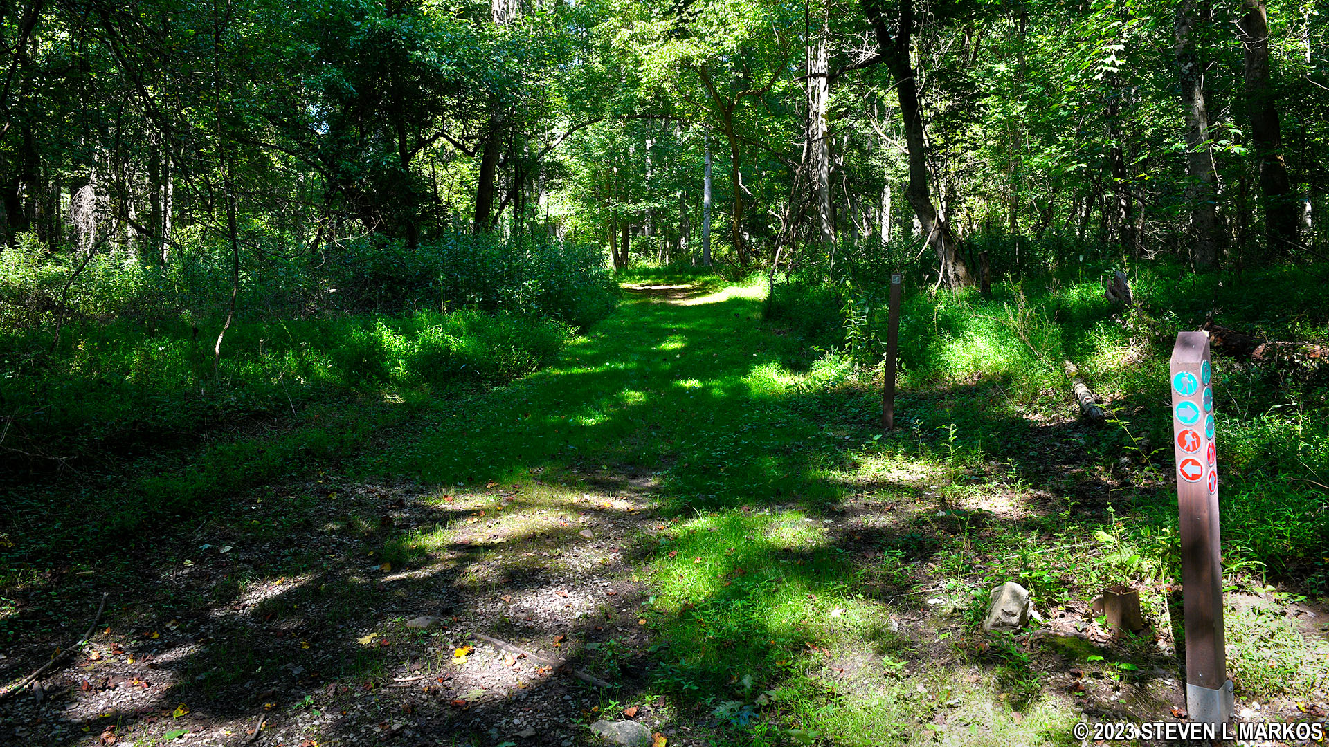
Before starting out on a hike around Friendship Hill National Historic Site, be sure to pick up a trail map at the Visitor Center. While the map is printed in black and white and lists trails by name, keep in mind that directional signage at the actual trailheads and intersections goes by colors, not trail names. Green is for the Main Loop Trail. Red is for the various meadow trails. Yellow tends to be for short connectors between the red and green trails.

Directional signage on the trails at Friendship Hill National Historic Site
You can’t get to the North Meadow Loop Trail without first hiking other trails. In fact, I can’t imagine anyone coming to the park specifically to hike it, so most likely a trip around the North Meadow will be part of a longer hike. I did it, along with the Hidden Meadow Loop Trail, while hiking the Main Loop Trail, a total distance of around six miles. The North Meadow Loop Trail itself is 1.25 mile long, not counting the distance you must hike just to get to it.
When hiking the Main Loop Trail, you can access the North Meadow Loop Trail either at its northern or southern end. The two trails do not physically intersect at the northern end, but you can take the North Cutoff, a quarter-mile Yellow Trail that connects the two together.
At its southern end, the North Meadow Loop Trail physically intersects with the Main Loop Trail in two places, .2 mile from each other. I was hiking around the Main Loop Trail in the clockwise direction and first came to the eastern intersection, but I skipped past it and began the hike at the western intersection (the one closest to the park road). This set me off hiking around the loop in the clockwise direction, and this trail report is written from that perspective.
Southwestern trailhead for the North Meadow Loop Trail at the intersection with the Main Loop Trail at Friendship Hill National Historic Site
Before deciding to hike the North Meadow Loop Trail, realize that there is no longer a meadow. What typically happens with a meadow is that it eventually gets filled in with trees. Thus, there may well have been a meadow many decades ago when the park opened in the early 1980s. There is a short segment that is out in the open and flanked on both sides by forest, but that’s about as meadowy as it gets.
The North Meadow Trail starts off through the forest on a mowed grass path. Where the trail isn’t grass, it’s an old dirt road (probably the entire trail is a dirt road, only grass has overgrown part of it). Thus, the surface remains rather smooth, free of rocks and roots that can trip you up.
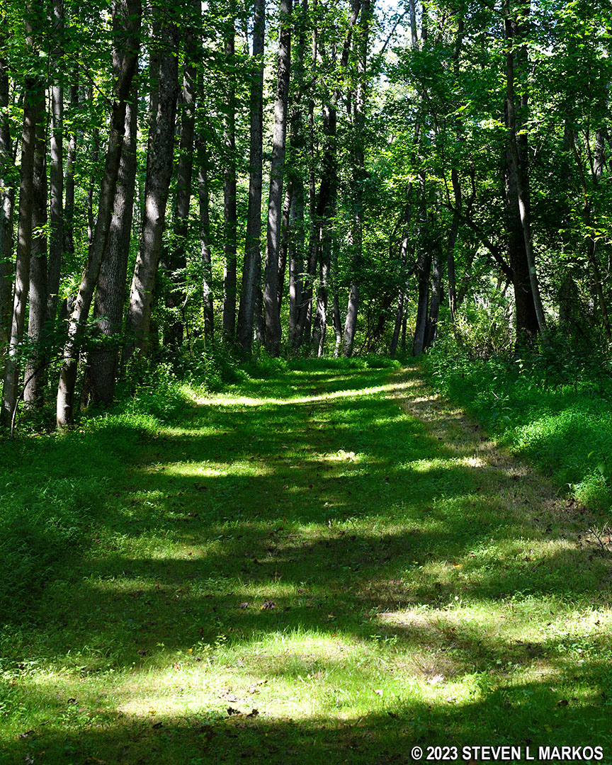
Typical terrain along the North Meadow Loop Trail at Friendship Hill National Historic Site
The open stretch of trail comes after a third of a mile and lasts for about 300 yards before heading back into the forest for good. That’s your meadow.
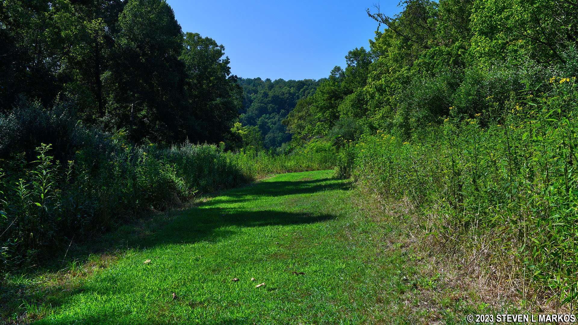
Open stretch of the North Meadow Loop Trail at Friendship Hill National Historic Site
On the northern end of the trail, roughly .6 mile from the start, is the intersection with the North Cutoff. The path actually dead ends at a T-intersection, so turn right to continue southeast around the loop. At this point the trail is visually an old gravel road.

Typical terrain on the east side of the North Meadow Trail south of the North Cutoff, Friendship Hill National Historic Site

Typical terrain on the east side of the North Meadow Trail south of the North Cutoff, Friendship Hill National Historic Site
A half mile from the North Cutoff is the intersection with the School Spur. Stay right at the fork and follow the directional signage for the Red Trail, which, as mentioned earlier, is the color coding for meadow trails at Friendship Hill National Historic Site.

Intersection of the North Meadow Loop Trail and the School Spur at Friendship Hill National Historic Site
The last leg of the hike before coming back to the Main Loop Trail is once again on a grass path. Part of it is out in the open, another remnant of the former meadow. When you get back to the Main Loop Trail, take a right and head towards the western intersection with the North Meadow Trail to complete the loop.

Segment of the North Meadow Loop Trail between the School Spur and the Main Loop Trail at Friendship Hill National Historic Site
In truth, the only reason to hike the North Meadow Loop Trail is just to get more exercise. There is no meadow or anything else of scenic value, unless you like looking at trees.
With a few exceptions, use of any photograph on the National Park Planner website requires a paid Royalty Free Editorial Use License or Commercial Use License. See the Photo Usage page for details.
Last updated on June 9, 2023


