
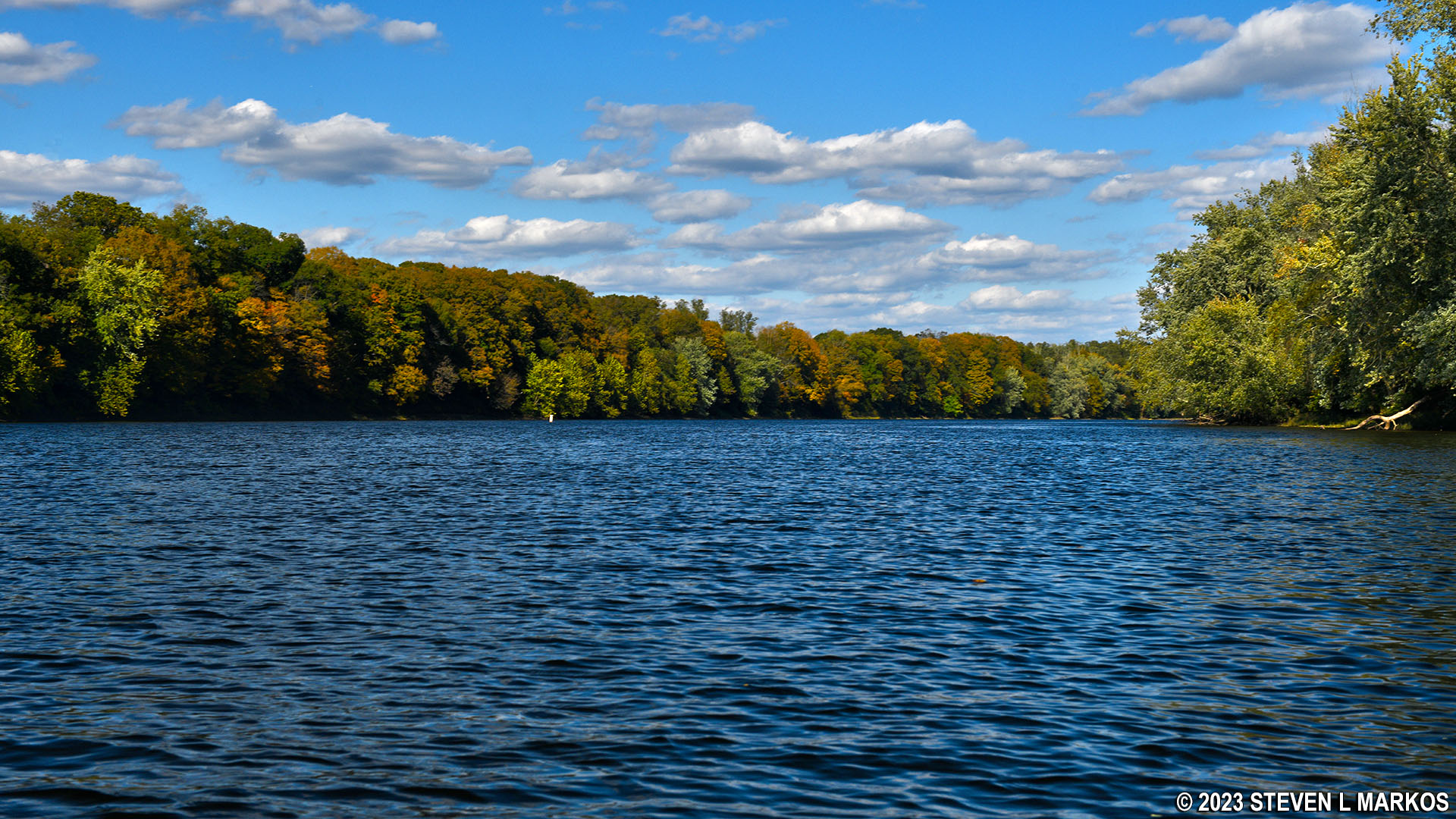
Delaware River between Poxono and Smithfield Beach in Delaware Water Gap National Recreation Area
POXONO TO SMITHFIELD BEACH RIVER TRIP
Length: 2 miles
Water Level at Time of Trip: 5.65 feet
Average moving speed: 4 MPH with two paddlers
Top Speed: 4.3 MPH
Time: 30 minutes
The Poxono Boat Ramp on the New Jersey side of the Delaware River is best suited for hand-launched watercraft due to the limited parking for vehicles with boat trailers, but motorboats can launch from here as well. There is no fee for parking.
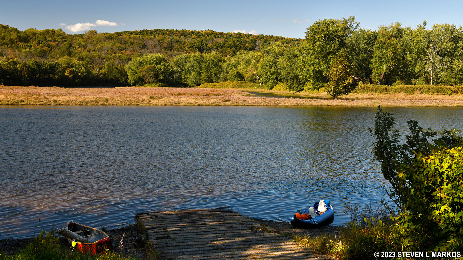
Poxono Boat Ramp in Delaware Water Gap National Recreation Area
Before starting a river trip through Delaware Water Gap National Recreation Area, it is a good idea to check the water levels so you are aware of the river conditions. At the northern end of the park, the USGS water level gauge at Montague (which is at Milford Beach) is the gauge used by the National Park Service to assess conditions. Levels between five and seven feet are typical and provide plenty of water for a trip down the river with conditions suitable for anyone with basic paddling skills. If the Montague gauge reads less than four feet, there may be spots on the river with very little water. Levels over seven feet require more paddling experience, and the river is closed due to extreme danger when water levels at Montague reach fifteen feet. Be aware that regardless of water levels, extreme winds can cause turbulent conditions that require advanced skills on water otherwise suited for all paddlers.
On the day of my trip, the gauge at Montague reported 5.65 feet of water, and the only other gauge within Delaware Water Gap National Recreation Area, the Water Gap gauge at the southern end of the park near Depue Island and the Worthington State Forest Campground, reported 6.12 feet. Regardless of which gauge is more pertinent to the Poxono-Smithfield Beach section of the river, there was plenty of water. Keep in mind that the observations in my report are based on these water levels. If you do the trip when the levels are lower, you may be dragging your boat to deeper water in some places and probably won’t experience the same degree of rapids as I report (historically, water levels at Montague rarely dip below five feet). If the water levels are significantly higher, you may experience more intense rapids, and more of them.
The trip between Poxono and Smithfield Beach is only two miles long, and there was no rough water on the day I did the trip, not even some chop to make things more interesting. It was the slowest section of the river within Delaware Water Gap National Recreation Area during my visit, and I have no reason to doubt it will be the slowest at any given time. This area of the Delaware River is called the Smithfield / Coppermine Pool, referring to a large pooled body of water with very little current. Sounds like a good place for beach, doesn’t it? Well, there are two on this stretch of river: Smithfield Beach and Turtle Beach. If there are beaches on a river where people are encouraged to swim, there isn’t going to be any fast current or rapids.

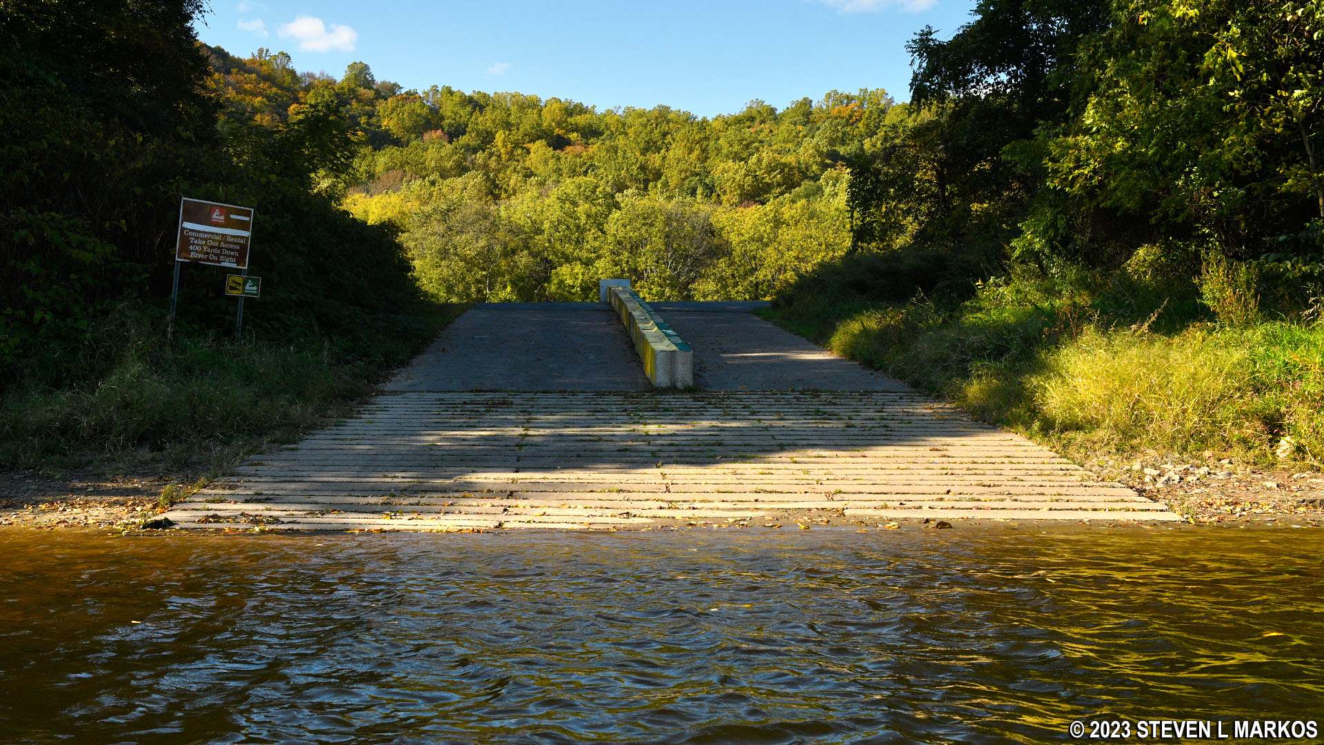
View downriver from the Poxono Boat Ramp in Delaware Water Gap National Recreation Area
Turtle Beach, one of three swimming beaches within Delaware Water Gap National Recreation Area, is just a mile downriver from the Poxono Boat Ramp, on the same side of the river (New Jersey). There is no boat ramp, and motorboats are not allowed to approach the area, but those is canoes, kayaks, rafts, and other hand-paddled watercraft can pull up on the shore—avoid the swimming area—and use the facilities, which include a large picnic area and restrooms. This is a good place to stop and take a lunch break. There is a fee to use the facilities from mid-April to early October, but since the entrance gate is far from the shore, I seriously doubt those in charge will even know, or care, that someone in a kayak just got in for free. Of course, I’m not suggesting that you break the rules.

View of Turtle Beach from the Delaware River, Delaware Water Gap National Recreation Area

Picnic area at Turtle Beach in Delaware Water Gap National Recreation Area
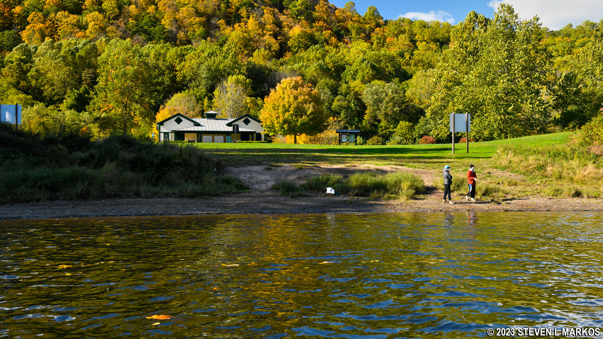
Smithfield Beach, the final destination for this river trip, is another mile downriver but on the Pennsylvania side. The concrete boat ramp that you first come to is for those with privately owned boats of any type. The right side is for hand-paddled watercraft and the left side for motorboats. A little farther down is a canoe launch set aside for commercial outfitters that run river trips within the park.
Smithfield Beach Boat ramp in Delaware Water Gap National Recreation Area
Like Turtle Beach, there is a swimming area, restrooms, and plenty of picnic tables. And like Turtle Beach, there is a charge to use the facilities from mid-April to early October. And also like Turtle Beach, I doubt anyone is going to care if you stop in for a break.
View of Smithfield Beach from the Delaware River, Delaware Water Gap National Recreation Area
Next River Section | Previous River Section | Paddling Home Page
With a few exceptions, use of any photograph on the National Park Planner website requires a paid Royalty Free Editorial Use License or Commercial Use License. See the Photo Usage page for details.
Last updated on January 29, 2024


