

Delaware River near Smithfield Beach in Delaware River Gap National Recreation Area
SMITHFIELD BEACH TO WORTHINGTON STATE FOREST RIVER TRIP
Length: 3.2 miles
Water Level at Time of Trip: 5.95 feet
Average moving speed: 3.2 MPH with two paddlers
Top Speed: 4.4 MPH
Time: 1 hour
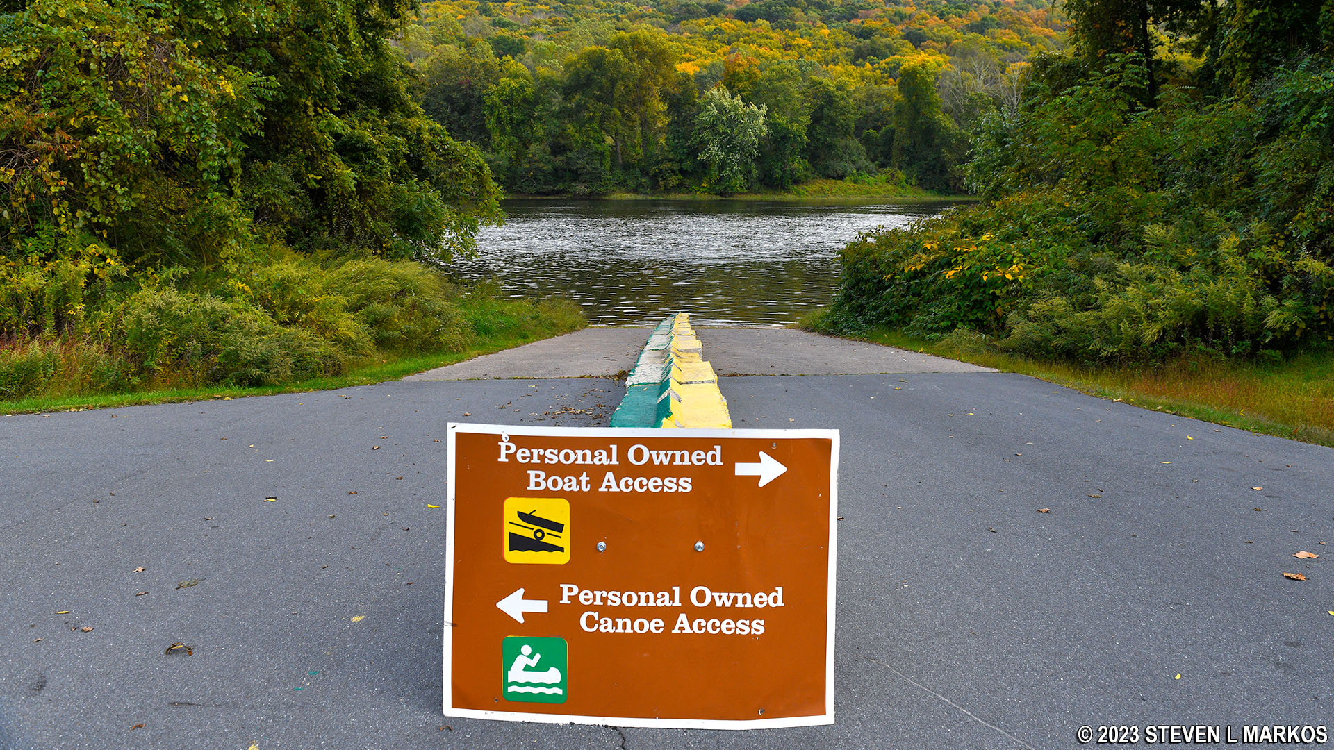
The Smithfield Beach Boat Ramp is a convenient place to launch a trip down the Delaware River from within Delaware Water Gap National Recreation Area. It has a concrete ramp for both trailer- and hand-launched watercraft, plenty of parking, and restroom facilities. There is a fee for parking from mid-April through early October but no specific fee to use the boat ramp, so you can get dropped off or picked up for free as long as the vehicle transporting you does not park at the facility.
Personal watercraft boat launch at Smithfield Beach, Delaware Water Gap National Recreation Area
Before starting a river trip through Delaware Water Gap National Recreation Area, it is a good idea to check the water levels so you are aware of the river conditions. At the northern end of the park, the USGS water level gauge at Montague (which is at Milford Beach) is the gauge used by the National Park Service to assess conditions. Levels between five and seven feet are typical and provide plenty of water for a trip down the river with conditions suitable for anyone with basic paddling skills. If the Montague gauge reads less than four feet, there may be spots on the river with very little water. Levels over seven feet require more paddling experience, and the river is closed due to extreme danger when water levels at Montague reach fifteen feet. Be aware that regardless of water levels, extreme winds can cause turbulent conditions that require advanced skills on water otherwise suited for all paddlers.
On the day of my trip, the gauge at Montague reported 5.9 feet of water, and the only other gauge within Delaware Water Gap National Recreation Area, the Water Gap gauge at the southern end of the park near Depue Island and the Worthington State Forest Campground, reported 5.95 feet. Keep in mind that the observations in my report are based on these water levels. If you do the trip when the levels are lower, you may be dragging your boat to deeper water in some places and probably won’t experience the same degree of rapids as I report (historically, water levels at Montague rarely dip below five feet). If the water levels are significantly higher, you may experience more intense rapids, and more of them.
Smithfield Beach is one of two beaches in a section of the Delaware River known as the Smithfield / Coppermine Pool. The other beach, Turtle Beach, is just a mile or so upriver. The water pools here, resulting in very little current that creates a relatively safe swimming area. As you can imagine, you won’t be traveling very fast on this section of the river without paddling vigorously. My speed through the pool was 1 MPH slower than farther upriver.

Calm water on the Delaware River between Smithfield Beach and Worthington State Forest, Delaware Water Gap National Recreation Area
The calm water was surprising because there are three islands between Smithfield Beach and Worthington State Forest, and when a river forks into two smaller channels to go around an island, it usually picks up speed and rapids form. Not here. The first island, the long and narrow Tocks Island, comes less than a half mile after launching from Smithfield Beach. I stuck to the Pennsylvania side of the Delaware River, passing the island on my left. Tocks Island, by the way, is the site of a controversial dam project proposed back in the 1950s. The projected was shelved in 1975 due to opposition from environmentalists and federal budgetary constraints as a result of the Vietnam War.

Tocks Island a half mile downriver from Smithfield Beach in Delaware Water Gap National Recreation Area
Labar Island is less than a half mile from the downriver end of Tocks Island. There’s actually a smaller, unnamed island closer to the shore, and I went through the middle of the two, with Labar Island on my left and the unnamed island on my right. Again, the water was calm despite the river splitting into smaller channels.

Delaware River near Worthington State Forest, Delaware Water Gap National Recreation Area
Once at the end of Labar Island, start heading over to the New Jersey side of the river (left) and stick to the shoreline. If it weren’t for the trees, you would see the Worthington State Forest Campground. The boat ramp, however, is another 1.25 mile downriver from Labar Island. It is a concrete ramp that is easy to spot. You’ll pass other islands on your right, with the biggest being Depue Island.

Boat Ramp at Worthington State Forest on the Delaware River
Next River Section | Previous River Section | Paddling Home Page
With a few exceptions, use of any photograph on the National Park Planner website requires a paid Royalty Free Editorial Use License or Commercial Use License. See the Photo Usage page for details.
Last updated on January 29, 2024


