

Jockey Hollow Trail Map (click to enlarge)
Be sure to pick up a trail map at either the Jockey Hollow Visitor Center or the Washington’s Headquarters Museum. There is a small fee for the map. You can also download a PDF version on the Park Map web page here on National Park Planner.
Length: 1.5-mile loop
Time: 1 hour
Difficulty: ★☆☆☆☆
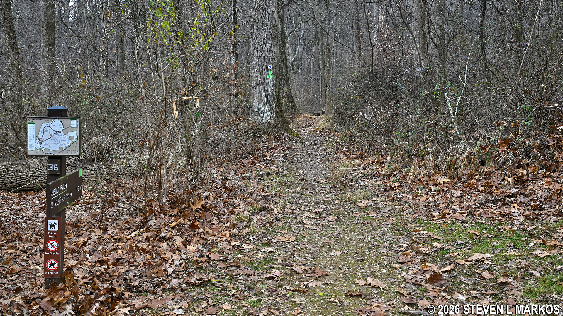
Clockwise-direction trailhead for the Aqueduct Trail in the Jockey Hollow unit of Morristown National Historical Park
The Aqueduct Trail at Morristown National Historical Park gets its name from an actual aqueduct system built in the late 1890s that carried water from the freshwater springs in the area to Morristown. Four miles of trenches were dug and many miles of pipe were laid by the Morris Aqueduct Company, New Jersey’s first water company. It remained in business until the early 1930s. Nothing much remains of the system, but there are a few remnants that can be seen along the trail. It is also called the Green Trail due to the green color coding on the trail map. Note that the directional signage along the route refers to it as the Aqueduct Trail, not the Green Trail.
The Aqueduct Trail is accessed at the Trail Center parking lot located on Jockey Hollow Road. This is the second parking lot on the right after entering the Jockey Hollow Encampment Area. It is not on the main park map, but it is shown on the park’s trail map. From this parking lot you can pick up any trail in the park except for the White Trail.
There is a trail guide that goes along with the hike, and you can get one from a brochure box attached to the Trail Center bulletin board. The guide gives information about plants, geological features, and historical sites found at eighteen stops along the trail that are marked by posts with letters engraved into them (stops range from A to R). Without this guide you will most likely walk right past these points of interest as I did—I didn’t notice the brochure box until after I hiked the trail.
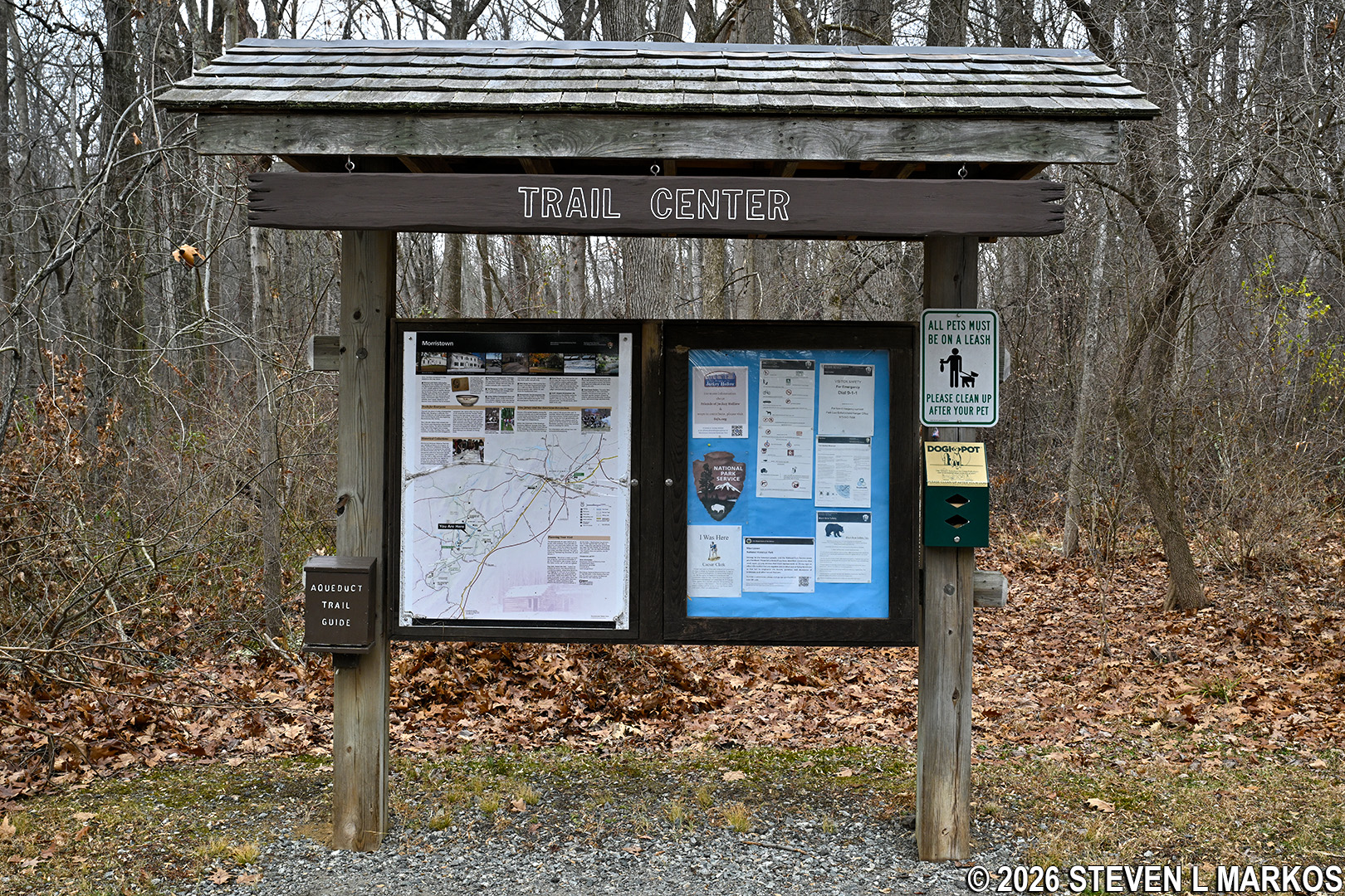
Trail Center Parking Lot bulletin board, Morristown National Historical Park
The Aqueduct Trail begins and ends at two different spots in the parking lot. I began at the eastern trailhead, which is located just to the right of the bulletin board, and this report is written from that perspective. This is a hikers-only section, and it sets you off in a counterclockwise direction around the loop. If you want to start on the western side of the trail, which allows horseback riding, take a left at the bulletin board and walk to the end of the parking lot. If you plan to use the trail guide, the Aqueduct Trail is actually meant to be hiked from here in the clockwise direction, for the stops progress in ascending order from A to R. However, it’s not like you have to read the information for Stop A in order to understand R, so regardless of which way you proceed, you’ll still learn something about the area.
When hiking in the counterclockwise direction, the Aqueduct Trails starts off by following a small creek named Primrose Brook. The trail crosses the creek twice right off the bat, both times over wooden footbridges. You can actually see one bridge from the other.

First bridge over Primrose Brook on the Aqueduct Trail in the Jockey Hollow unit of Morristown National Historical Park
Just before the second bridge, the Orange Trail comes in from the left and temporarily merges with the Aqueduct Trail. You will see both orange and green blazes painted on the trees. Blazes serve as Hansel and Gretel breadcrumbs for hikers to follow, with the colors corresponding to particular trails.
Second bridge over Primrose Brook on the Aqueduct Trail in the Jockey Hollow unit of Morristown National Historical Park
There are also Patriot’s Path logos on the trees. The Patriots’ Path is a collection of trails managed by the Morris County Park System. This particular segment runs from Speedwell Lake just north of Morristown to a little beyond the southern end of Morristown National Historical Park near the New Jersey Brigade Encampment Site. For a short stretch, the Aqueduct Trail, the Orange Trail, and the Patriots Path are all the same.

Patriots’ Path logo on a tree along the Aqueduct Trail in the Jockey Hollow unit of Morristown National Historical Park
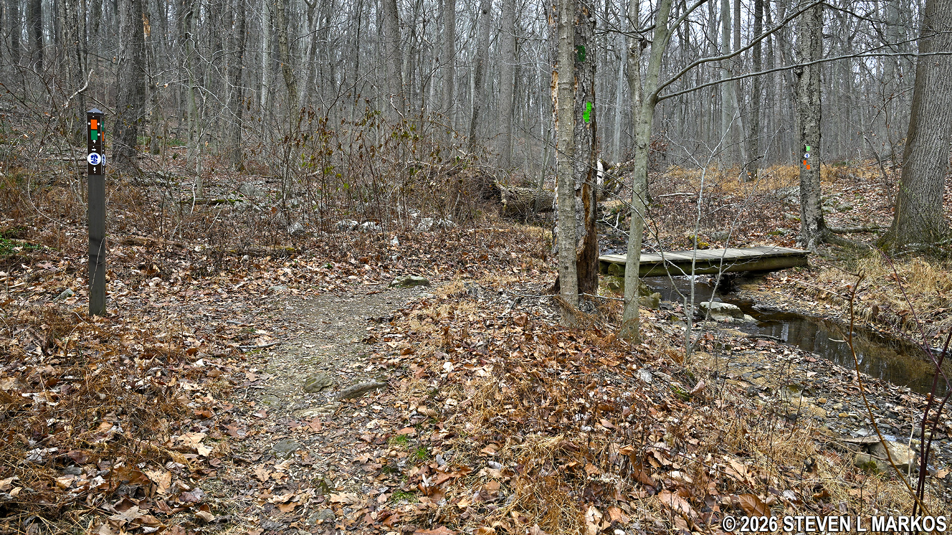
A few minutes after crossing the second footbridge is an intersection marked by a set of wooden steps. This is where the three trails split. You can clearly see an orange blaze and the Patriots’ Path logo on the trail that proceeds up the steps, but no green blaze. To find one, look on the tree next to the trail sign that is posted at the intersection. Two green blazes that stair-step to the left have been painted on it. A double blaze indicates a turn; a stair-step to the left indicates a left turn.

Intersection where the Aqueduct Trail splits from the Orange Trail / Patriot’s Path in the Jockey Hollow unit of Morristown National Historical Park
Once past the intersection, the trail quickly comes once again to Primrose Brook and another footbridge.

Third bridge over Primrose Brook on the Aqueduct Trail in the Jockey Hollow unit of Morristown National Historical Park
Not long after crossing the creek is another trail on the left. The Aqueduct Trail is a long and narrow finger-shaped loop trail, so when you get to the far end of the loop and begin the journey back to the starting point, you aren’t very far from where you were on the hike out. The trail you now see is the other side of the Aqueduct Trail loop. In fact, the two halves of the trail are so close together that there is an actual connector to the other side for people who want to cut the hike short and head back to the parking lot. Follow the sign that reads AQUEDUCT TRAIL TO STOP N to avoid the shortcut.

Shortcut to the other side of the Aqueduct Trail loop, Morristown National Historical Park
There are more creek crossings ahead, including one through an area so muddy that previous hikers have tossed sticks across the mud hole to have something stable to walk on.

Aqueduct Trail crosses a muddy section of Primrose Brook, Morristown National Historical Park
Since the start of the hike, the terrain has been hilly but not worth noting as far as difficulty goes. However, much of the trail surface is covered in rocks and roots, particularly anytime it runs close to Primrose Brook, so watch your step.

Typical terrain of the Aqueduct Trail when near Primrose Brook, Morristown National Historical Park
When you arrive at a three-way intersection, not only are you at the far end of the loop, but you are also at the start of the section of the Aqueduct Trail on which horses are allowed. If you continued straight, you’d end up on the Yellow Trail, which is for hikers only. A right leads over to Cemetery Road and eventually to the White Trail, which is for hikers and horseback riders. To stay on the Aqueduct Trail, take a sharp left. Directional signs point out the various destinations.

Three-way intersection at the far end of the Aqueduct Trail loop, Morristown National Historical Park
Being a horse trail, the path is now much wider and smoother.

Typical terrain on the western side of the Aqueduct Trail in the Jockey Hollow unit of Morristown National Historical Park
The hike eventually comes back to the shortcut connector near Stop N, though this time around you don’t want to head towards Stop N. Take a right to continue.

Intersection on the west side of the Aqueduct Trail with the shortcut connector to the east side of the loop, Morristown National Historical Park.
The terrain for the rest of the hike is fairly flat, just as it was on the way out at this point. In fact, you aren’t but fifty feet or so from where you were earlier.

Typical terrain along the western side of the Aqueduct Trail in the Jockey Hollow unit of Morristown National Historical Park
There is one last bridge to cross before arriving back at Trail Center. At this point the Green, Yellow, and Orange trails merge and remain that way all the way back to the parking lot just a short distance ahead.

Bridge at the merger of the Aqueduct, Yellow, and Orange trails in the Jockey Hollow unit of Morristown National Historical Park
When visiting history-themed parks such as Morristown National Historical Park, I usually prefer to hike trails that take me past historical sites so I can get a feel for the events that took place. Had I the trail guide, I would have seen the remnants of the aqueduct, but without it I was just taking a walk in the woods. However, I still enjoyed the Aqueduct Trail because of the scenery. I was essentially hiking out on one side of Primrose Brook and back on the other side, so I was nearly always within sight of water. If you do grab a trail guide and don’t need it, be sure to stick it back in the box.
With a few exceptions, use of any photograph on the National Park Planner website requires a paid Royalty Free Editorial Use License or Commercial Use License. See the Photo Usage page for details.
Last updated on July 15, 2026


