

Trailhead for the Life of the Dunes Trail at Assateague Island National Seashore
Maryland Hiking Trails main page
Length: .75 mile loop
Time: 45 minutes
Difficulty: Easy, but slow going
If you have ever hiked in sand, it is not much fun. It feels like you are taking two steps just to move one step forward. I did a 4-mile hike in the sand at Cape Hatteras National Seashore and it was miserable. Fortunately, the Life of the Dunes Trail at Assateague Island National Seashore is short and has one pretty neat, historic feature.
The Life of the Dunes Trail has stops along the way that are designated by numbered markers, and if you buy a trail guide at the Assateague Island Visitor Center or download a copy from Assateague Island National Seashore’s Hiking web page and carry it with you, you can read about the natural features at each stop. Most people won’t have this guide because nobody at the Visitor Center promotes it, and you only first learn about it from a sign at the trailhead. I can’t imagine anyone putting their day on pause to drive back to the Visitor Center to buy a guide. However, you, my dear reader, now know about the guide, so if you want one be sure to obtain it in some manner.

Numbered markers along Assateague Island National Seashore’s Life of the Dunes Trail correspond to information on a trail guide
Without the guide you will not find yourself wandering aimlessly on the trail, for there are information panels along the way.
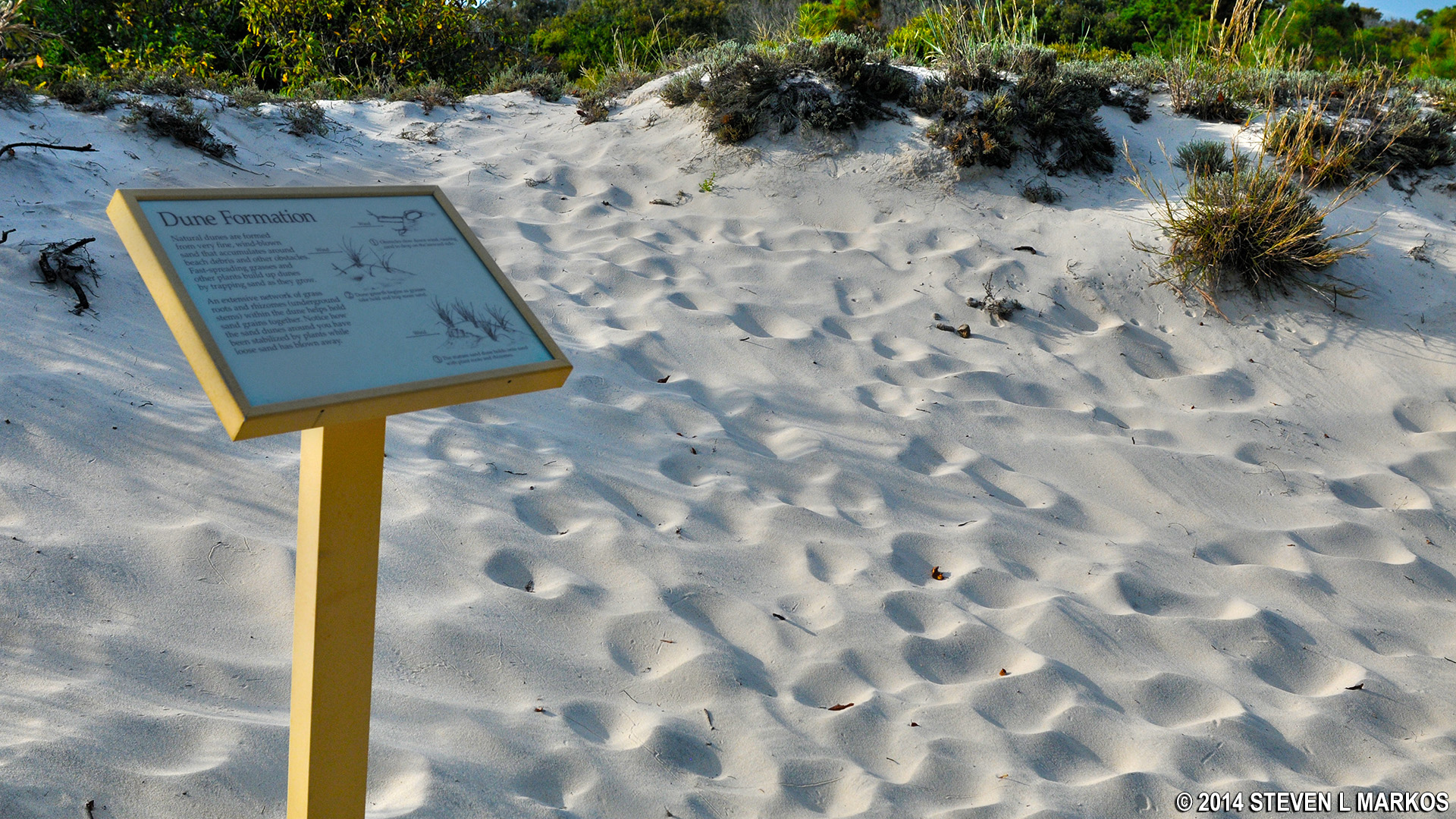
Information panels along Assateague Island National Seashore’s Life of the Dunes Trail tell of the natural aspects of the sand dunes
The trail is a loop, and the loop portion starts a short distance from the start. If you have the guide, be sure to go clockwise around the trail so you come to the numbered markers in the correct order.
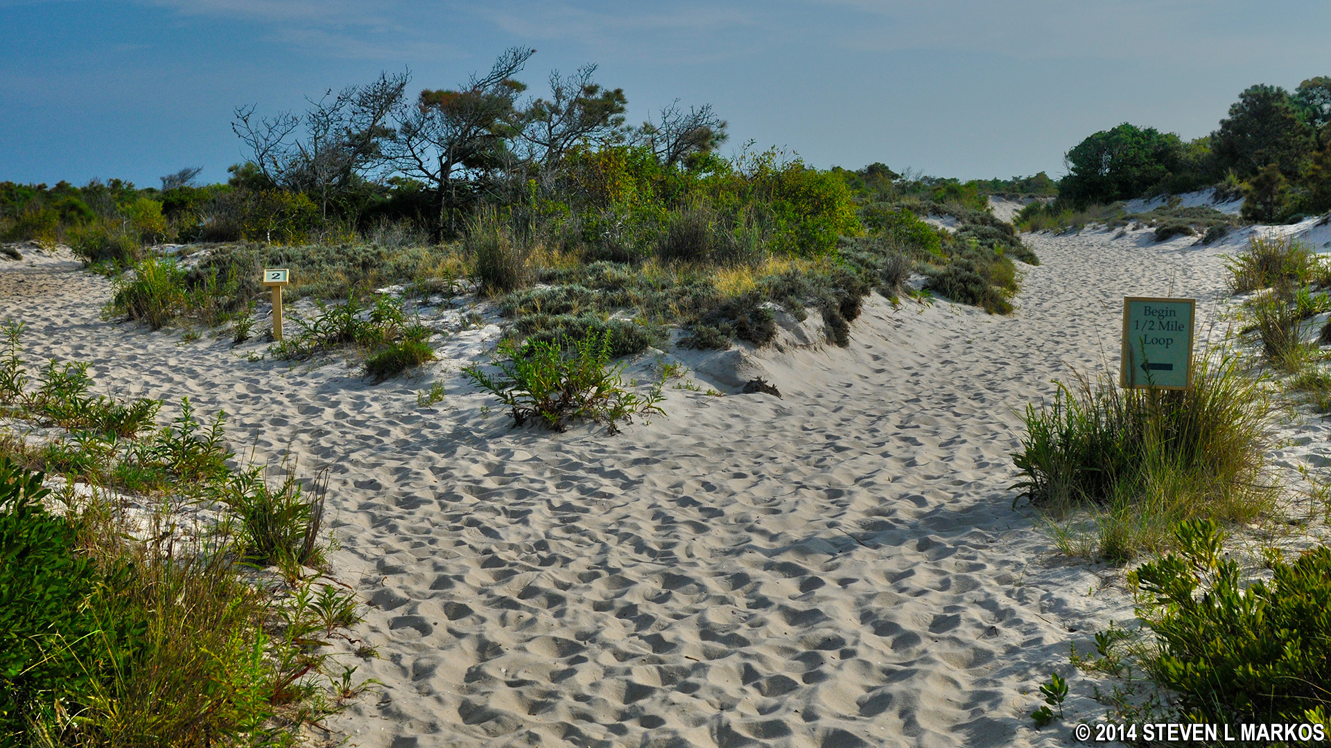
Start of the loop portion of the Life of the Dunes Trail at Assateague Island National Seashore
Unlike a dirt trail where the path has been etched into the earth by hundreds of other hikers before you, the Life of the Dunes Trail is made of sand, and sand can change. While there are no confusing intersections or unmarked side trails, there are points were the path becomes vague. If in doubt, follow the wooden fence that has been put up along portions of the trail or look for directional markers, which are either arrows or orange squares on posts.

A fence and direction markers (arrows or orange squares on posts) keep hikers going in the right direction on the Life of the Dunes Trail at Assateague Island National Seashore
As for the historic aspect of the trail, in the 1950s, real estate developers began to turn the island into a residential and business community. A road was built across the island that ran all the way to Baltimore; the road was aptly named the “Baltimore Highway.” In 1962 a storm swept across the island, taking with it just about everything that wasn’t nailed down and effectively ending the development project. What was “nailed” down were sections of the road, and you can still see the remains of the asphalt along the Life of the Dunes Trail. You can walk on the road or along the side of it. Had it not been for the storm, there might not be an Assateague Island National Seashore today.

Remnants of an asphalt road from a late 1950s /early 1960s planned community on Assateague Island
With a few exceptions, use of any photograph on the National Park Planner website requires a paid Royalty Free Editorial Use License or Commercial Use License. See the Photo Usage page for details.
Last updated on October 3, 2023


