
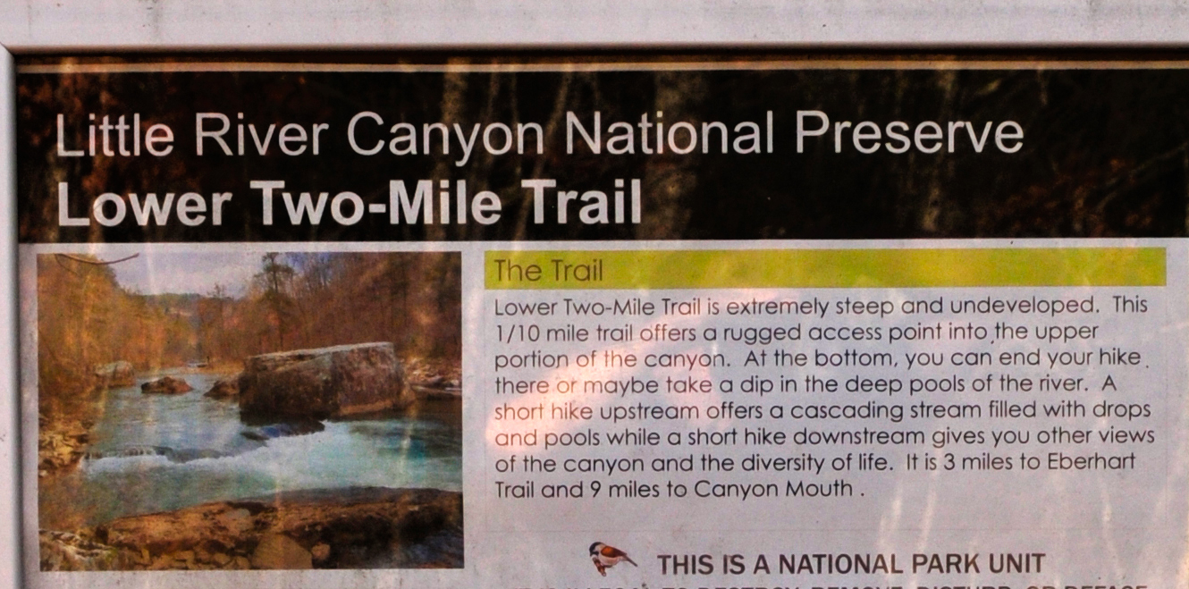
Information about the Lower Two-Mile Trail
I originally hiked the Lower Two-Mile Trail in 2014. During a 2025 visit to Little River Canyon National Preserve, I re-hiked every trail but the Lower Two-Mile Trail due to being 10 years older (60) and physically unable to tackle such a difficult trail. The report below is from my original 2014 hike. I am positive that nothing much has changed on the way down, but after hiking the Powell and Eberhart trails, which also lead to the Little River at the bottom of Little River Canyon, there is a chance that the riverbank might not be as accessible due to ten years’ worth of vegetation growth.
Length: .2 mile, round trip
Time: 30 minutes hiking plus time to explore the river
Difficulty: Strenuous and dangerous
There are three trails in Little River Canyon National Preserve that lead from the canyon rim to the Little River, which at certain points is 500 feet below. The Powell Trail and Eberhart Trail both get to the bottom of the canyon in .4 mile via switchbacks. The Lower Two-Mile Trail gets there in .1 mile. It is a testament to the fact that the shortest distance between two points is always a straight line, and the Lower Two-Mile Trail is just that: a straight line to the bottom of the canyon.
The National Park Service calls the trail arduous, not strenuous. Arduous is a word I had to look up in the dictionary. It means, makes strenuous look easy. You can get to the river with much less effort on the Powell and Eberhart trails, but if you want a fun and exciting challenge with a serious chance of being maimed, this is your trail—a true rock slide path down the canyon wall.
There are three ways to get to the river on the Lower Two-Mile Trail:
1) Use hiking poles.
2) Slide down on your butt.
3) Throw yourself down and hope you are still alive when you reach the bottom.
I used hiking poles, and while I can’t imagine anyone going down the Lower Two-Mile Trail without the help of poles, a Ranger told me that kayakers actually carry their boats down this trail. Oh, the wonders of youth! If you don’t want to kayak over Little River Falls, this is the trail that will get you the farthest up the river, but you will still miss out on the first three miles of rapids. That’s odd, because the trail’s name is supposedly based on the fact that it comes out at the two-mile point on the river below Little River Falls. Well, if that is actually the reasoning behind it, whoever did the distance measuring was a mile off (at least in river miles).
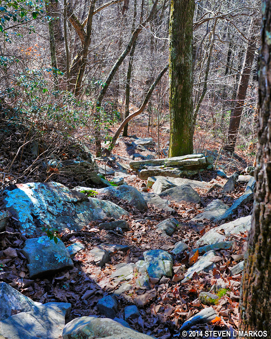
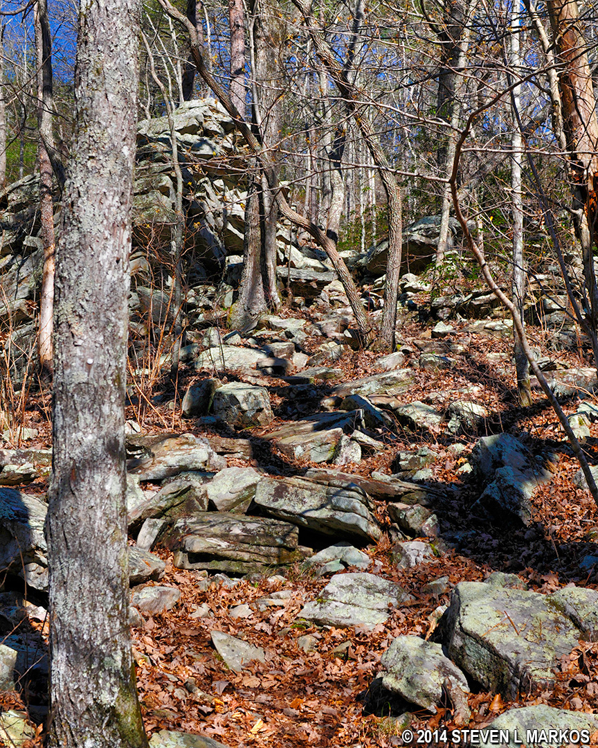
I am not sure what the angle of descent is, but it looks and feels like more than a 45 degree angle. It is without a doubt the steepest trail I have ever hiked, and I wouldn’t hesitate to state that it is the steepest trail in any National Park on the east coast of the United States. It is impossible to capture the steepness in a photograph, but the following photos at least give you an idea of what you are up against.
Steep descent down the Lower Two-Mile Trail to the Little River, Little River Canyon National Preserve

Typical terrain of the Lower Two-Mile Trail, Little River Canyon National Preserve
It only takes fifteen minutes to reach the bottom of the canyon, and once there, the Lower Two-Mile Trail spills out onto a small, sandy area along the riverbank.
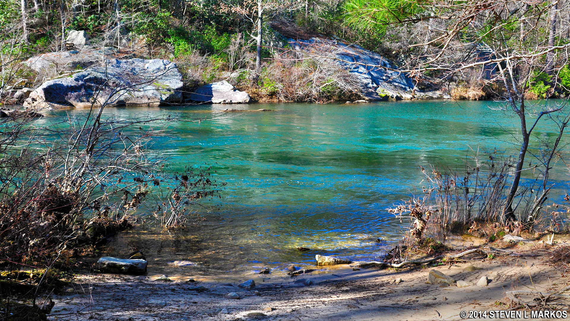
The end of the Lower Two-Mile Trail at the Little River, Little River Canyon National Preserve
The water before you is swift but calm enough to swim in, though in the summer there may not be much water at all. My visit was in December, the wettest month in Alabama.
View of the Little River at the end of the Lower Two-Mile Trail, Little River Canyon National Preserve
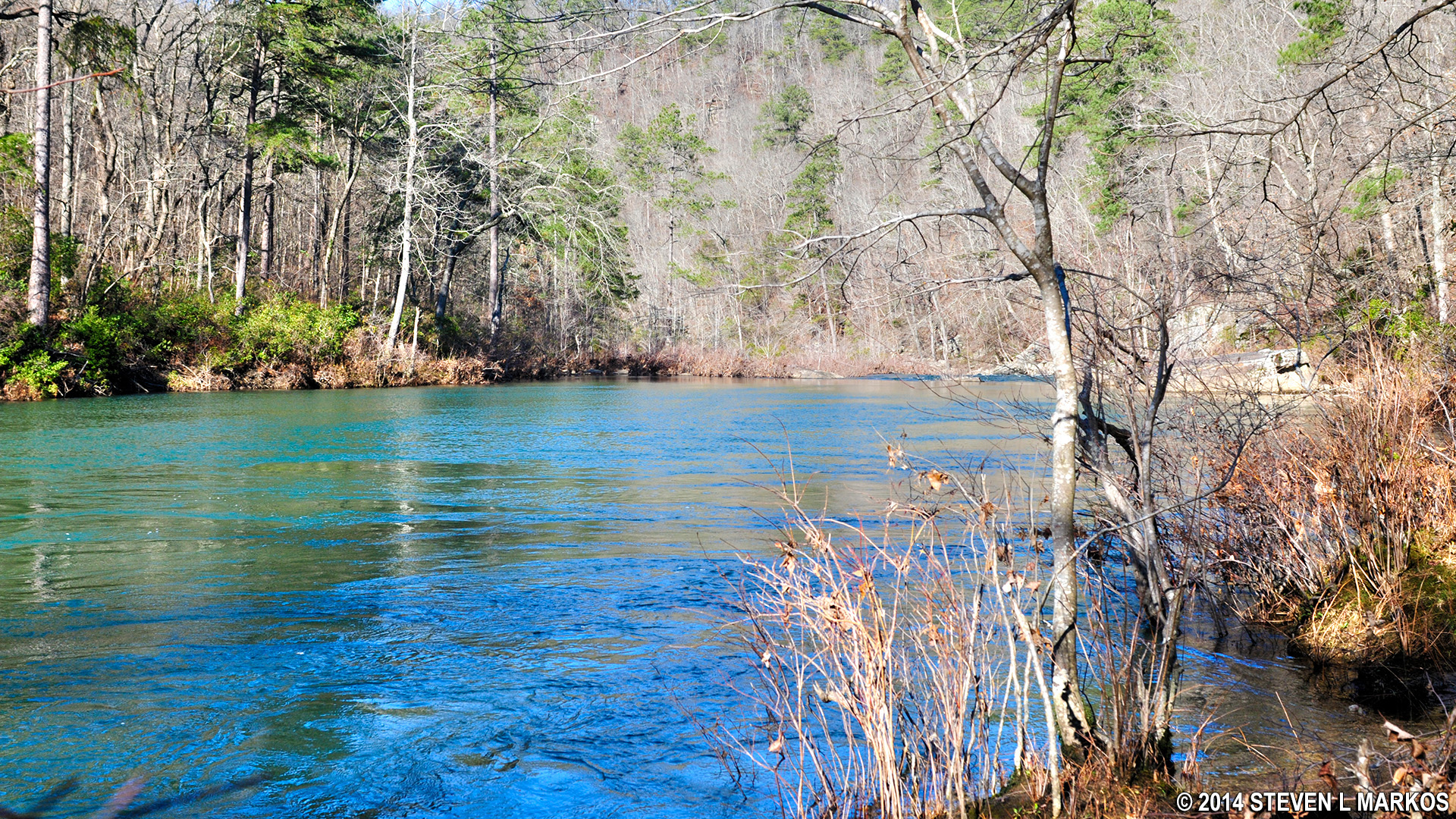
Rapids end a short ways upriver and begin again a little farther downriver; the in-between area has formed a deep pool. Swimming this section does not entail wading hip deep out into the water. Within ten feet from the bank you can’t see the bottom, so be sure you know how to swim.

Small rapids downstream from the swimming area at Lower Two-Mile Trail, Little River Canyon National Preserve
Supposedly you can hike upriver or downriver to see rapids and other river features. However, hiking in either direction is very limited, for any semblance of a trail quickly disappears, and to carry on farther would require you to Lewis and Clark It™. When hiking upstream you can’t get far before coming to a small creek that flows into the Little River. Had it been summer, and had I the proper footwear (or bare feet), I would have waded across it. But it was winter, so that’s as far as I went.

Small creek that empties into the Little River upstream from the swimming area at Lower Two-Mile Trail, Little River Canyon National Preserve
Hiking downstream leads to a large rock in the river that you can climb onto for an unobstructed view of the river in either direction.

View from the top of a large boulder in the Little River near the end of the Lower Two-Mile Trail, Little River Canyon National Preserve
I climbed back up to the rim of Little River Canyon in the same time that it took me to climb down—about fifteen minutes. Add thirty minutes to explore the river area (more if you plan to swim), and you have a 1-hour round-trip adventure ahead of you.
The climb back up Lower Two-Mile Trail at Little River Canyon National Preserve
With a few exceptions, use of any photograph on the National Park Planner website requires a paid Royalty Free Editorial Use License or Commercial Use License. See the Photo Usage page for details.
Last updated on June 5, 2025


