
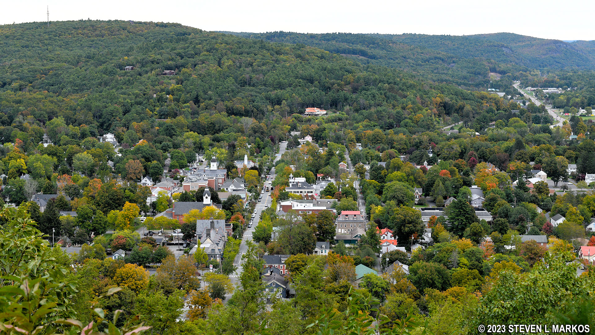
View of Milford, Pennsylvania, from the top of Milford Knob in Delaware Water Gap National Recreation Area
Length: 1.5 mile, one way
Time: 45 minutes (one way)
Difficulty: Mainly easy but with a very strenuous hike to the top of Milford Knob
The Milford Knob Trail is one of many trails in the Cliff Park section of Delaware Water Gap National Recreation Area. Located at the northern end of the park near Milford, Pennsylvania, this section takes its name from the Cliff Park Golf Course, the first golf course in America designed by a woman, Annie R. Buchanan. It became part of the park when the land was donated by the Buchanan Family in 2003. The Buchanans owned the property since 1803, and the golf course has been around since 1913.
If you are traveling south from Milford on Federal Road / U. S. 209, the Milford Knob Trailhead parking lot is on the right just before you come to the park’s entrance gate. The trail is a 1.5-mile out-and-back trail that leads to a view of Milford from the top of Milford Knob.
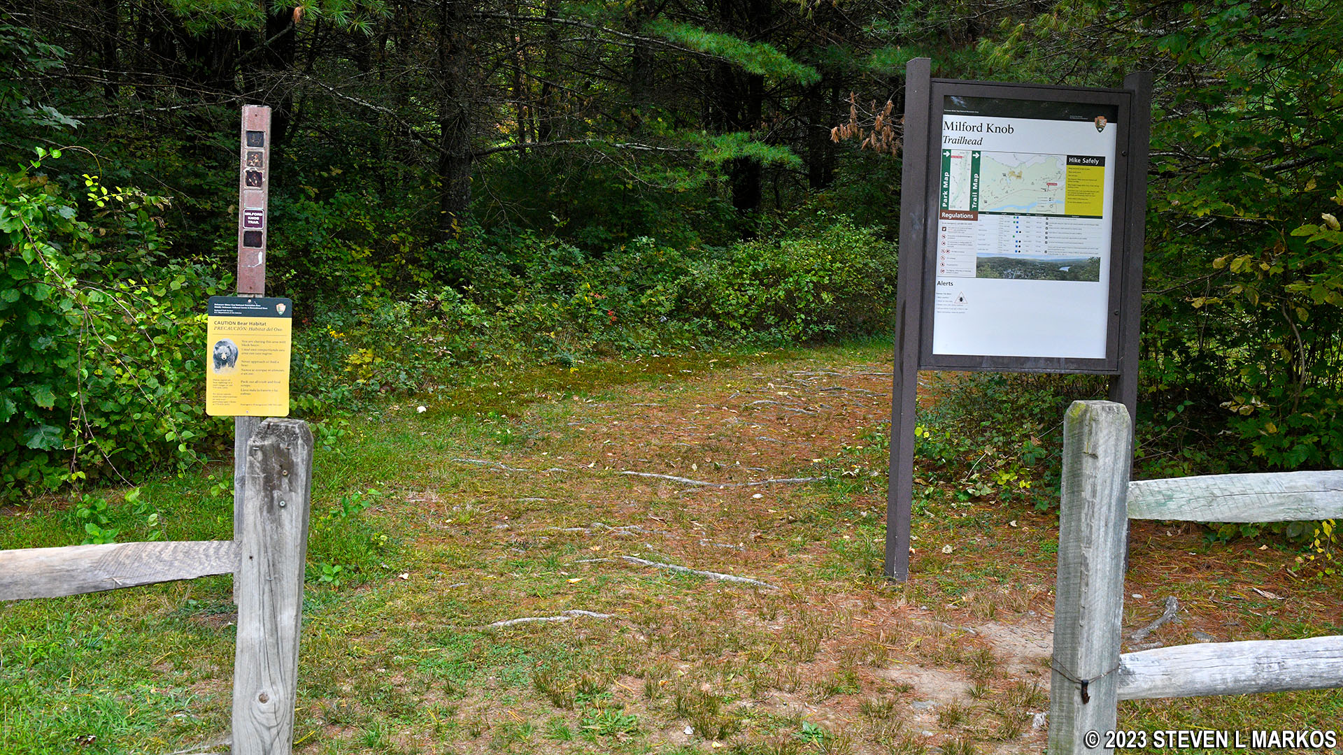
Trailhead on Federal Road for the Milford Knob Trail in the Cliff Park section of Delaware Water Gap National Recreation Area

Corrected trail map for the Cliff Park Area trails at Delaware Water Gap National Recreation Area (click to enlarge)
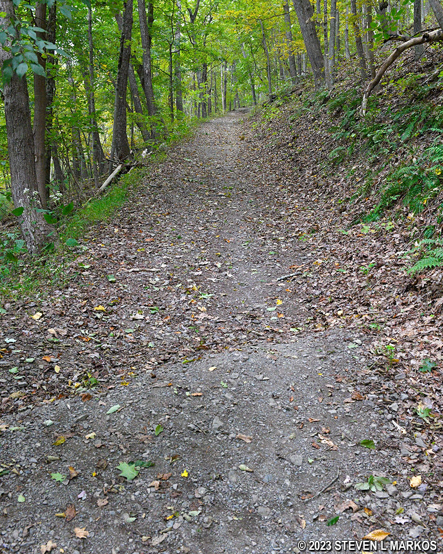
While the Milford Knob Trail starts out on flat ground, it eventually climbs 400 feet to the Milford Knob Overlook, so expect an uphill hike for most of the way. The first mile of the trail is a gravel path, and other than having a lot of tree roots on its surface at the very beginning, it is quite smooth and easy to hike. It heads uphill, but the ascent is very gradual and goes almost without notice.
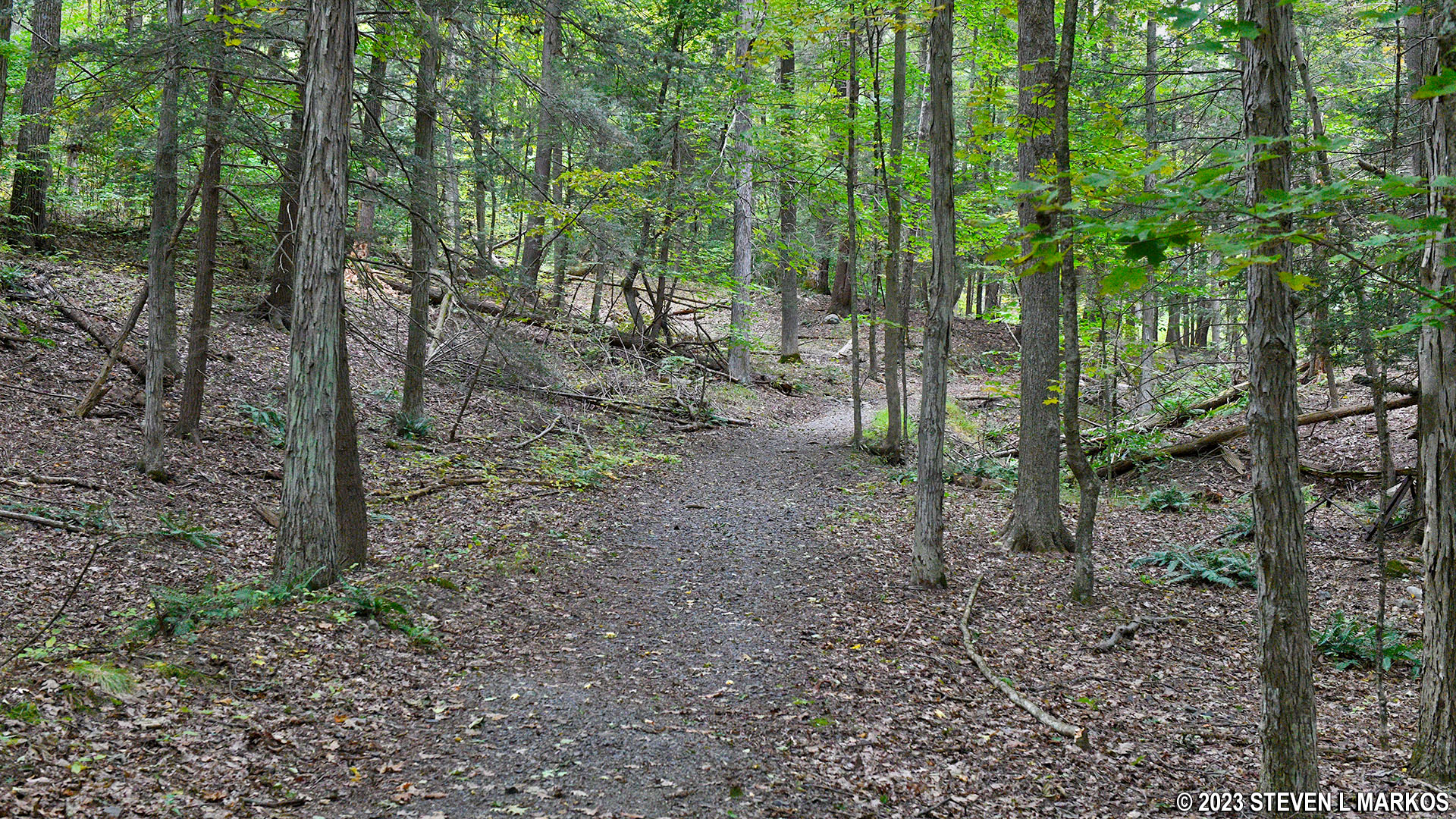
Typical terrain on the first mile of the Milford Knob Trail in Delaware Water Gap National Recreation Area
The Milford Knob Trail intersects with the Quarry Path Trail one mile into the hike. The trail map makes it look as if the intersection is a fork, but the Milford Knob Trail actually dead ends at a T-intersection. There is a sign post with directional arrows, but it does not provide trail names. That’s why it is good to know that the route of the Milford Knob Trail is marked with green blazes. These are paint splotches on trees or rocks that hikers follow like Hansel and Gretel breadcrumbs. A tree just prior to the intersection has a double green blaze on it that stairsteps to the right. A double blaze indicates a turn ahead, in this case one to the right.

Intersection of the Milford Knob and Quarry Path trails in the Cliff Park section of Delaware Water Gap National Recreation Area
A tenth of a mile farther ahead is another intersection, this time with a trail known as the Sawkill Glen Trail. Take a left to continue on to Milford Knob. A right leads down to the Milford Cemetery, which is private property, and then to a small pond on the park border. The Sawkill Glen Trail is closed from December 15th through July 15th for eagle nesting season. It no longer shows up on the National Park Service’s official Delaware Water Gap National Recreation Area website or map for the park. There are a lot of trails in Cliff Park that are not shown on the map, and I get the feeling that the National Park Service just wants these to go away. However, eliminating trails from the map does not mean they have disappeared from the landscape. I have made corrections that I know of to the map on this page (corrections are in RED).
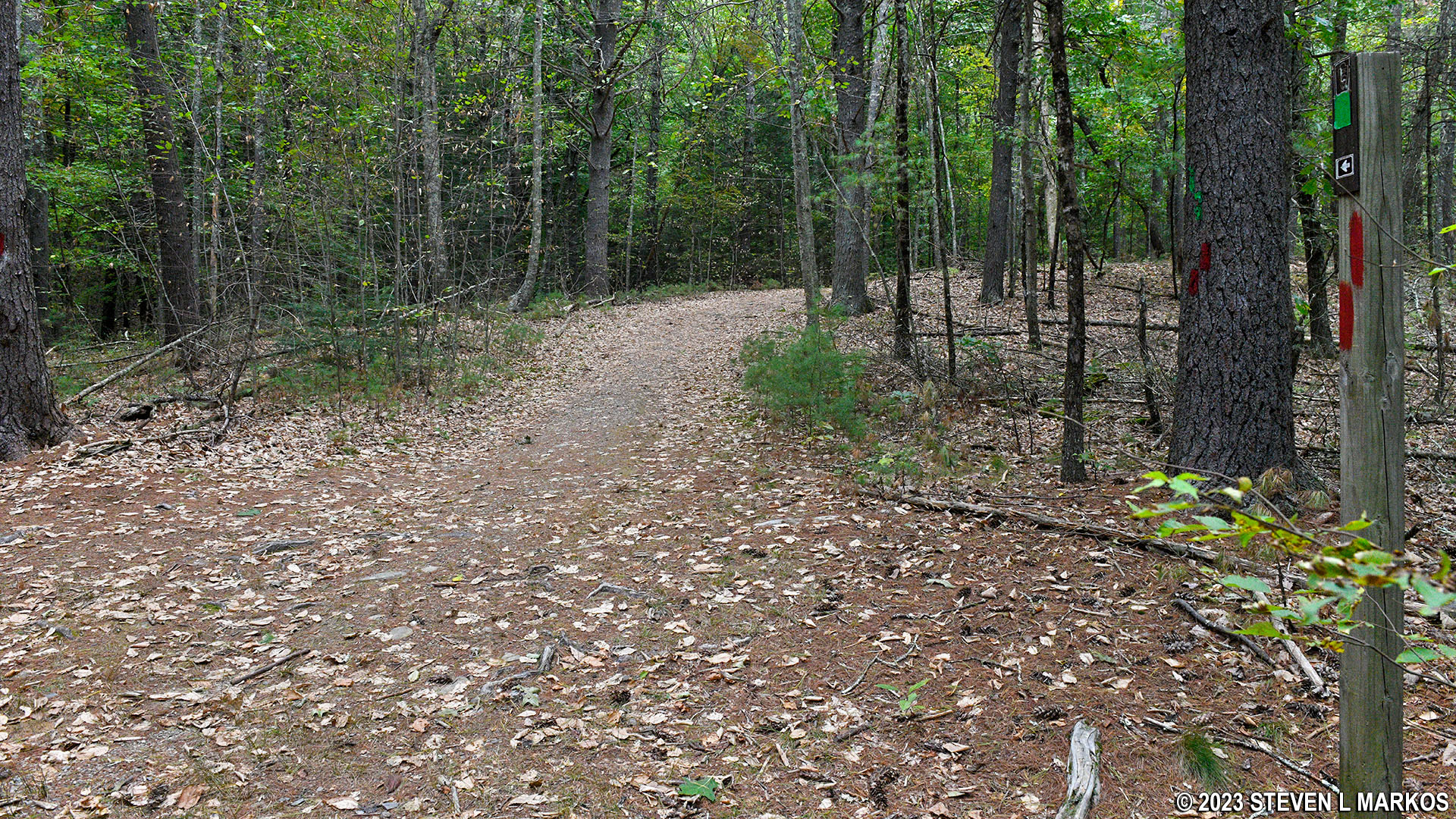
Milford Knob Trail at the intersection with the Sawkill Glen Trail, Delaware Water Gap National Recreation Area
The Guide to the Gap, a free tabloid-size publication that has maps to all trails within Delaware Water Gap National Recreation Area (except those that the government wants to disappear), has both a blue square (moderate) and a black diamond (strenuous) in the RATING column for the Milford Knob Trail. Up to this point I wouldn’t even consider it moderate. However, beyond the Sawkill Glen Trail intersection, the Milford Knob Trail gets a lot steeper. From here to the knob, it forms an S-curve. The first 400 feet isn’t too bad, but starting halfway through the first curve in the S, the trail heads straight uphill for a tenth of a mile. This section has an average grade of 23% (a 15% grade is the start of strenuous hiking). Prior to the intersection, the steepest grade rarely reaches 15%, and that’s only for very short segments (the average grade is just 5%). It is this final push to the top that qualifies the Milford Knob Trail for the black diamond rating. The climb is tippy-toe steep, which is where you have to push off on the balls of your feet to move forward, and your heels never touch the ground.
Steep terrain on the last tenth of a mile of the Milford Knob Trail in Delaware Water Gap National Recreation Area
The Milford Knob Trail levels out near the Cliff Trail intersection (stay right at the fork) and proceeds a short distance farther to the Milford Knob Overlook. Luckily there is still a view, so the strenuous climb is not in vain. Below the overlook is the town of Milford with the Delaware River flowing past it to the east.
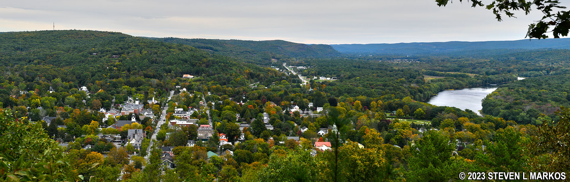
View of Milford, Pennsylvania, and the Delaware River from the top of Milford Knob in Delaware Water Gap National Recreation Area
When done, you can hike back to the parking lot the same way you came or, like me, form some sort of a loop hike by taking the Cliff Trail. I did a 12-mile hike that covered all trails in the Cliff Park Area except for the Sawkill Glen Trail, but shorter loops are also possible. A four-mile alternative is to hike the Cliff Trail for .8 mile to the Quarry Path Trail, then take the Quarry Path back to Federal Road via the Milford Knob Trail.
With a few exceptions, use of any photograph on the National Park Planner website requires a paid Royalty Free Editorial Use License or Commercial Use License. See the Photo Usage page for details.
Last updated on January 15, 2024


