

Henry Hill Loop Trail Map (click to enlarge)
Note: The trails at Manassas National Battlefield Park are poorly marked, so be sure to bring a trail map with you for navigation purposes. The best is the Trail Guide, a tri-fold map that is free at the Henry Hill Visitor Center. For planning purposes, you can download it here, but be sure to pick up a full-color version before you begin your hike.
Manassas Trail Map (PDF)
Length: 1.3-mile loop
Time: 1 hour
Difficulty: Easy, with a few hills
Since the attack on Fort Sumter on April 12, 1861, Union General Irvin McDowell had been tasked with capturing the Confederate capital of Richmond and ending the war early. One of his first objectives was Manassas Junction, a vital railroad hub. To defend against such an attack, 22,000 Confederate troops under the command of General Pierre G. T. Beauregard were stationed along the west bank of Bull Run (creek) guarding the crossing spots from the Stone Bridge south to Union Mills (located in the modern-day Hemlock Overlook Regional Park near Clifton). The Union had to cross Bull Run in order to reach Manassas Junction.
McDowell first confronted Confederate troops to the south of the Stone Bridge at Blackburn’s Ford, but had no luck. (Blackburn’s Ford is close to where Hwy 28 / Centreville Road crosses Bull Run). He then came up with a plan to mount a diversionary attack at the Stone Bridge while sending roughly 15,000 men marching north to cross Bull Run at Sudley Ford. They would then travel down the Sudley-Manassas Road (today’s Sudley Road) and attack the Confederates from behind.
At 5:30 AM on July 21, 1861, Union artillery opened fire on the men stationed at the Stone Bridge. However, after two hours of shelling and no formidable attack, Confederate Colonel Nathan Evans got suspicious and sent most of his men up to Matthews Hill. If anyone was going to sneak up behind him, they would be coming from that direction. Sure enough, at around 10 AM the two sides met, spoiling the Union’s surprise attack. Evans’s men were soon joined by reinforcements, but the Confederates were overrun after an hour and a half of fighting and retreated in disarray back towards Henry Hill to join newly arrived comrades who had marched from other locations on Bull Run. The Union army eventually positioned itself along the ridge stretching from today’s Henry Hill Visitor Center north towards the Warrenton Turnpike (today’s Highway 29), while the Confederates formed a battle line along the forest to the right of the Visitor Center.
The Henry Hill Loop Trail starts at the back of the Manassas National Battlefield Park Visitor Center (opposite side from the parking lot). While fighting took place on Henry Hill during the Second Battle of Manassas, it was the first battle in which the hill figured most prominently, and it is First Manassas exhibits that you will find along the trail.
Before setting off on the hike you may want to venture over to the Stonewall Jackson monument located to the right of the building in an open field. At no point does the trail come conveniently close to the monument, so if you want a photo, might as well get one now. At the start of the battle, Stonewall was just General Thomas Jackson. He got his nickname later that afternoon, supposedly for his cool demeanor in the face of certain defeat while waiting for the Union to attack.
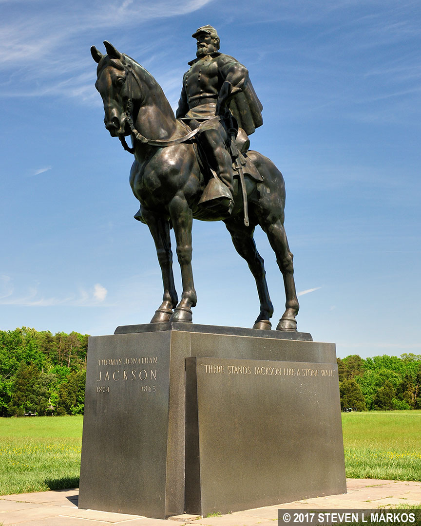
Stonewall Jackson Monument at Manassas National Battlefield Park
The entire Henry Hill Loop Trail is out in the open, so if avoiding the sun is important to you, be sure to wear a hat and apply sunscreen. Also, most of the trail follows a mowed swathe of grass, a favorite habitat for ticks. While I did not pick up any on this hike, I did on some of the other trails. I suggest wearing long pants treated with Permethrin when hiking anywhere in Manassas National Battlefield Park.
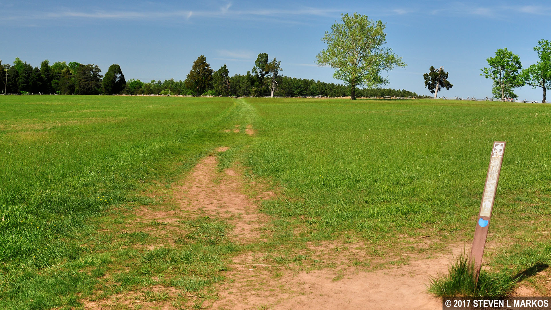
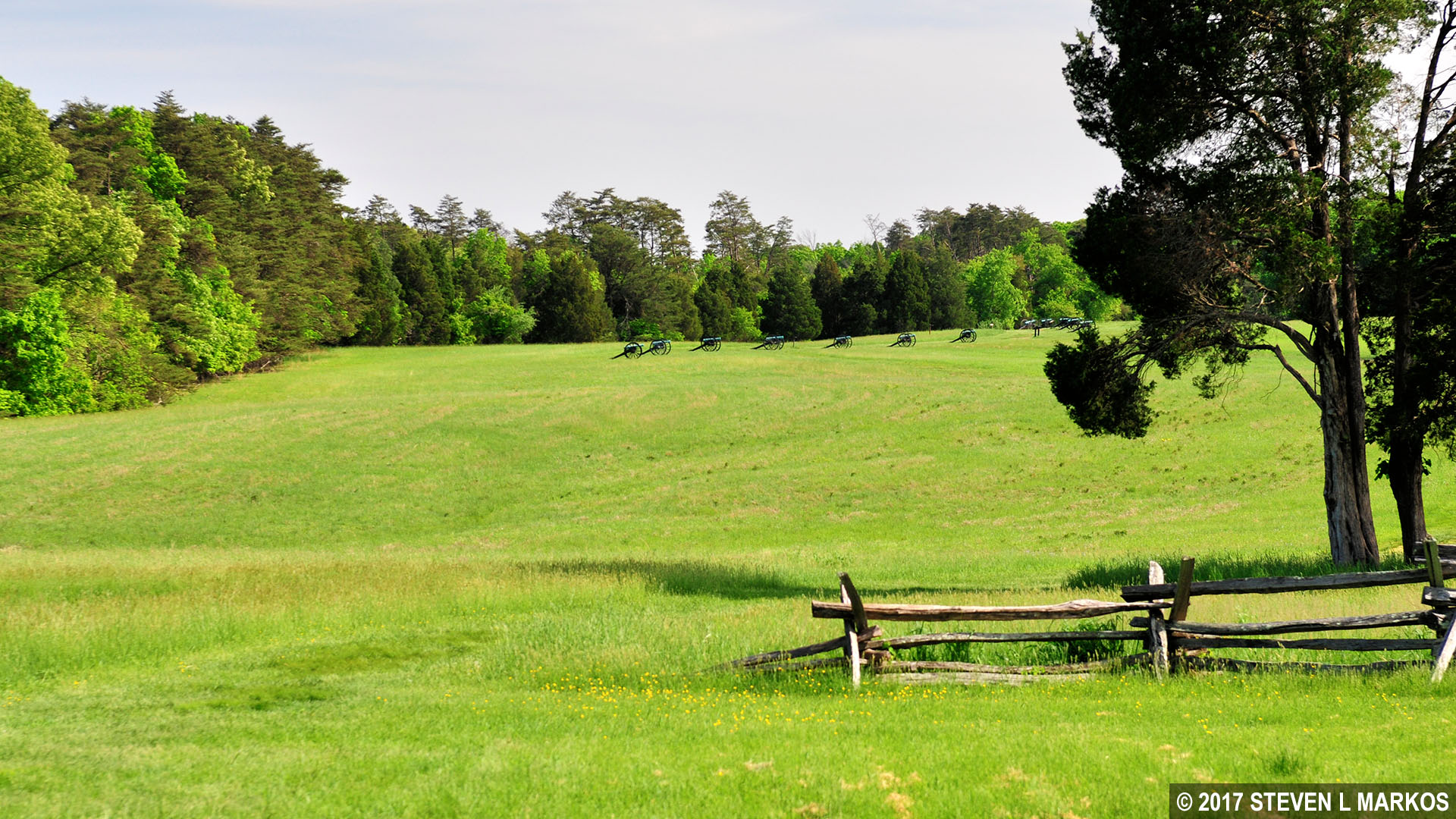
There is not much of a defined path at the start of the Henry Hill Loop Trail, so just walk towards the Henry House, the only house on the hill. Once you get there you will find a more obvious trail.

Path from the Henry Hill Visitor Center at Manassas National Battlefield Park towards the Henry House
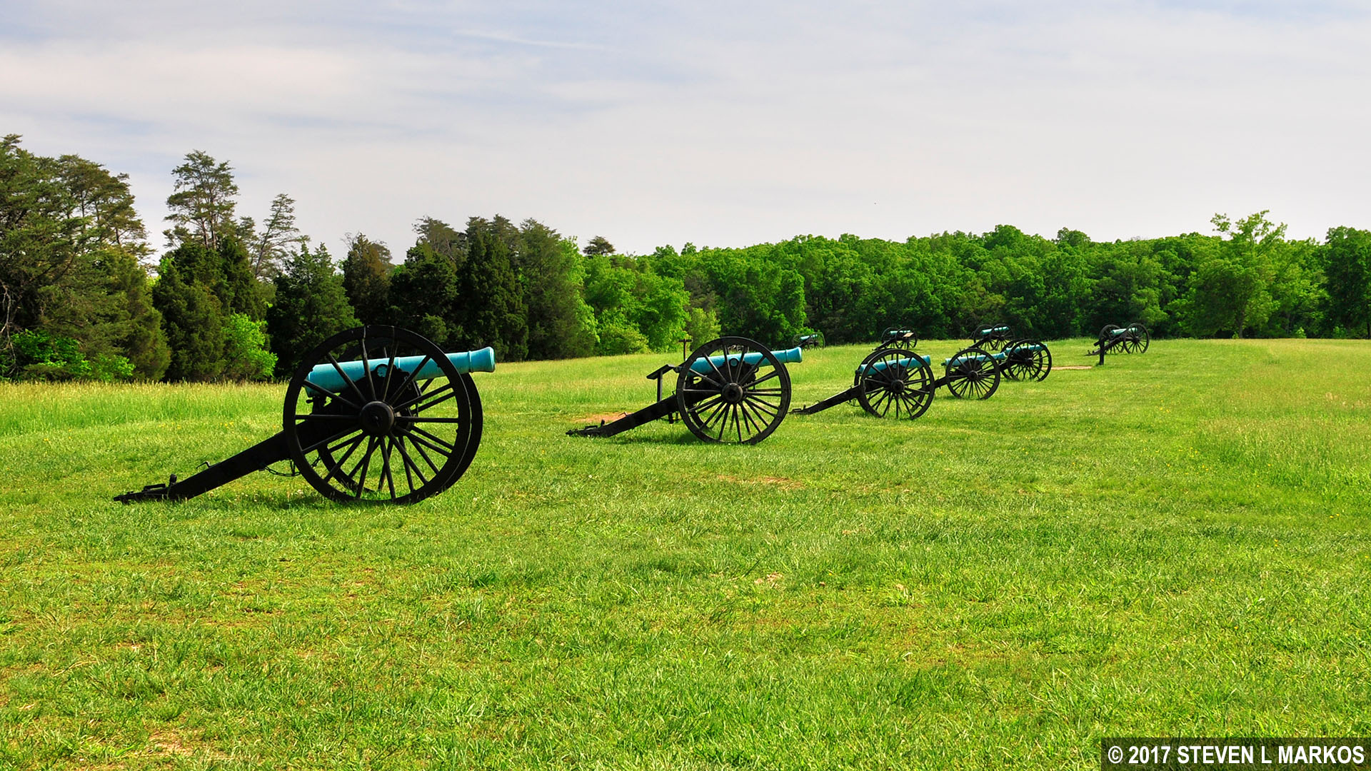
After driving the Confederates off of Matthews Hill, General McDowell decided to wait an hour for more troops to arrive, for they had started marching from near the Stone Bridge and the line was nearly six miles long. During this time he sent artillery commanders Captains James Ricketts and Charles Griffin to the top of Henry Hill to set up an artillery battery. This was a very risky move since they would be far ahead of the rest of the army. The cannon exhibits you pass on the way to the Henry House mark this location. They are aimed towards the forest, which is where the Confederates were positioned. All of the cannon on the battlefield are authentic Civil War-era cannon, though they were not necessarily used during the fighting at Manassas.
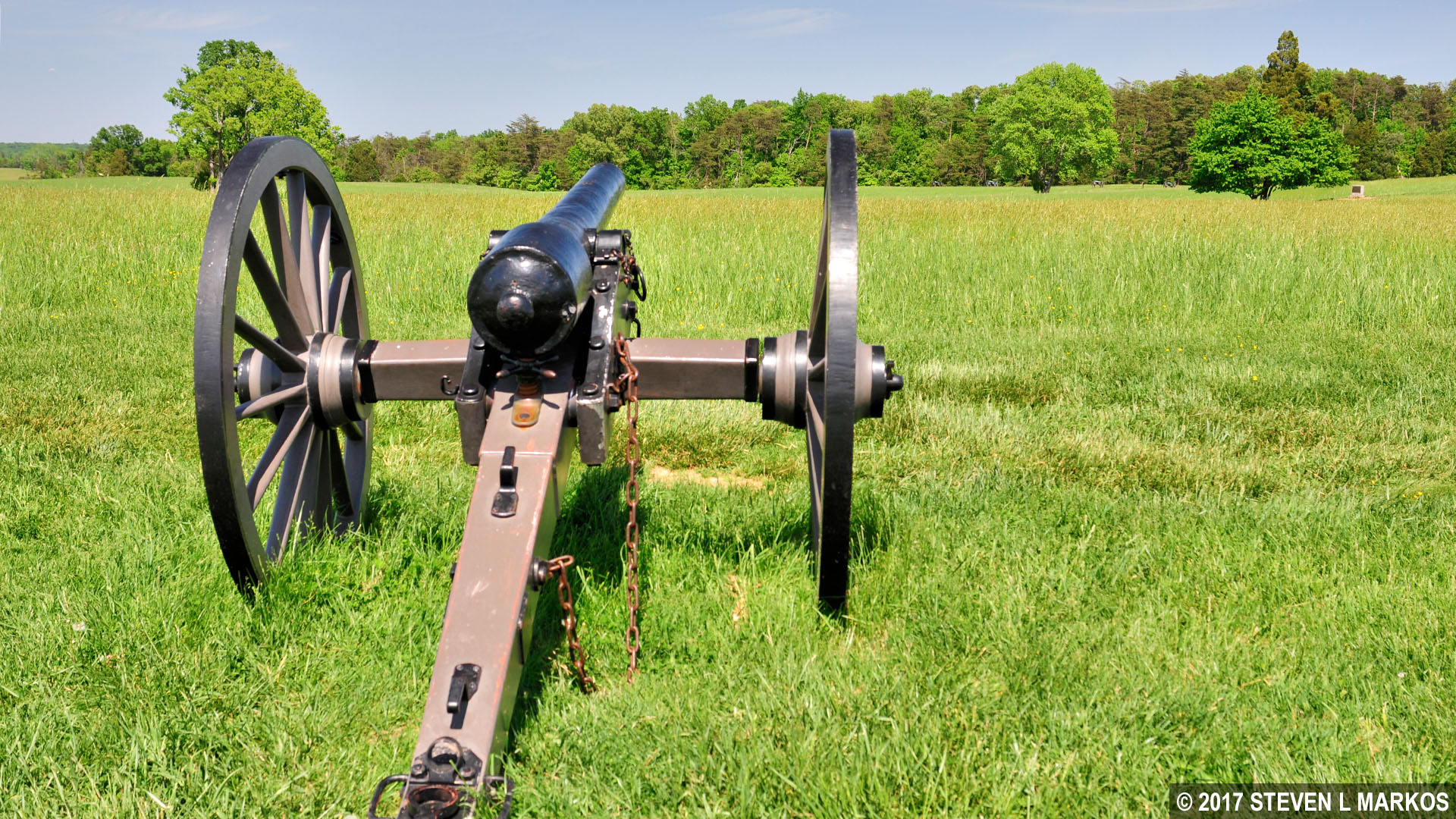
Union cannon on Henry Hill aims towards the Confederate line, Manassas National Battlefield Park
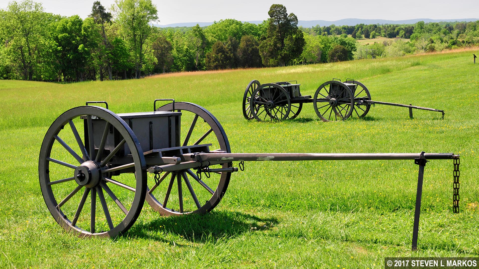
Union supply wagon for artillery on Henry Hill, Manassas National Battlefield Park
As you pass the cannon and supply wagons you may notice a marker that looks like a tombstone—it is not. In 1903 a group of men who fought in the war placed markers just like this one at various locations on the battlefield to indicate unit positions during the First Battle of Manassas. This one marks the spot where the 7th Georgia Regiment captured James Ricketts’ battery of cannon towards the end of the battle.
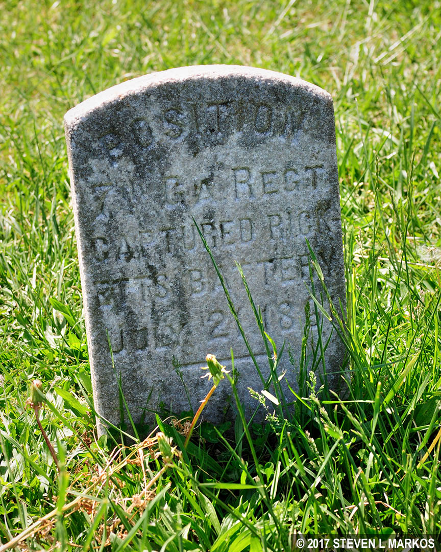
Marker on Henry Hill at the spot where Union cannon were captured by the Confederates, Manassas National Battlefield Park
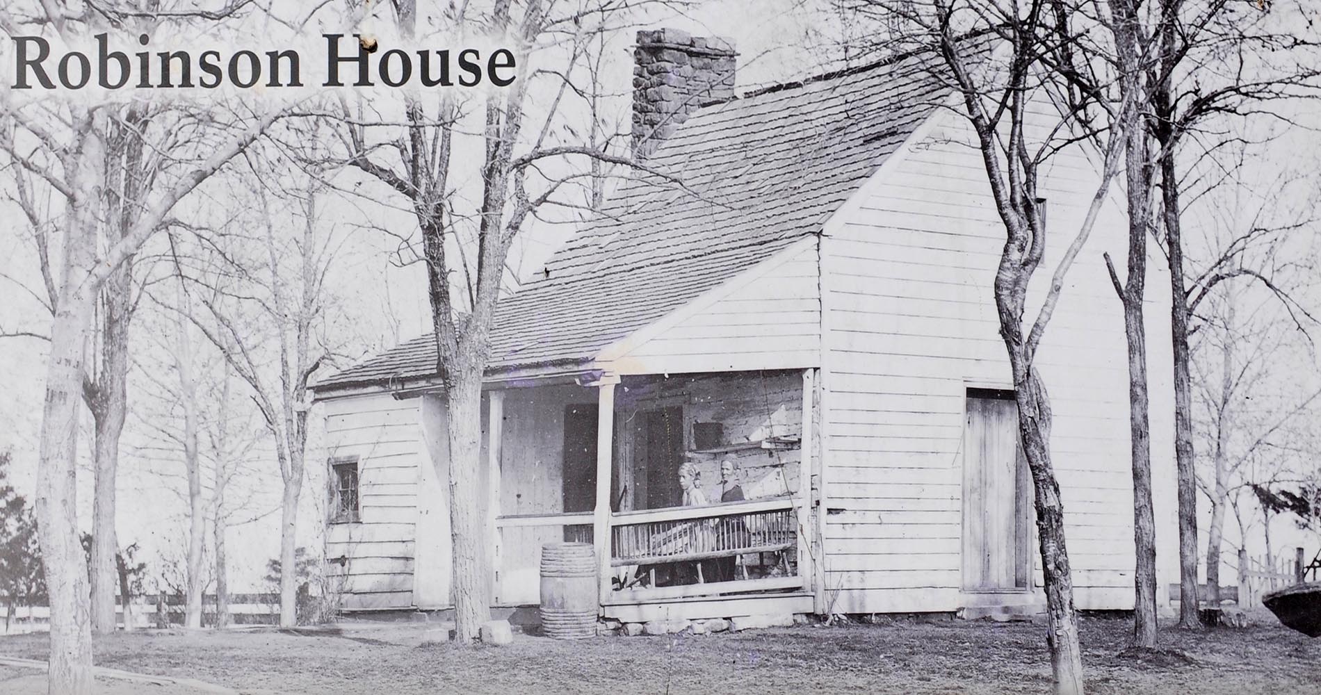
The first point of interest on the trail is the house of the Henry family, the family for which the hill gets its name (oddly enough, the Henrys called it Spring Hill). This is not the house that stood during the First Battle of Manassas. That house sustained extensive damage and was abandoned by the Henrys, and later that winter it was stripped clean for firewood by Confederate soldiers camping nearby. In 1870, two of the Henry children, Ellen and Hugh, decided to rebuild the house using part of the original foundation. Ellen and some of her cousins lived here, while Hugh moved in at a later time. In 1883 the house was enlarged to its current size.

Post-Civil War Henry House at Manassas National Battlefield Park
The Henry House is not open to the public. In lieu of stepping inside, information about the Civil War-era house has been placed in the windows for all to read. I found this to be a highly inventive solution to disseminate information without opening the house.
Information in a window at the Henry House, Manassas National Battlefield Park
Three people are buried in a cemetery located in the yard. The one who has become the most famous over the years is Judith Henry, a bed-ridden 84-year-old lady who refused to leave during the battle and was subsequently killed. Her daughter Ellen, her son John, and her slave Lucy Griffith were also in the house at the time. Confederate soldiers were using it for cover, and not realizing civilians were inside, James Ricketts decided to open fire on it. Everyone was injured to some extent, but only Judith was killed, the only civilian to die during the battle. Ellen and Hugh, who died much later of natural causes, are also buried here.
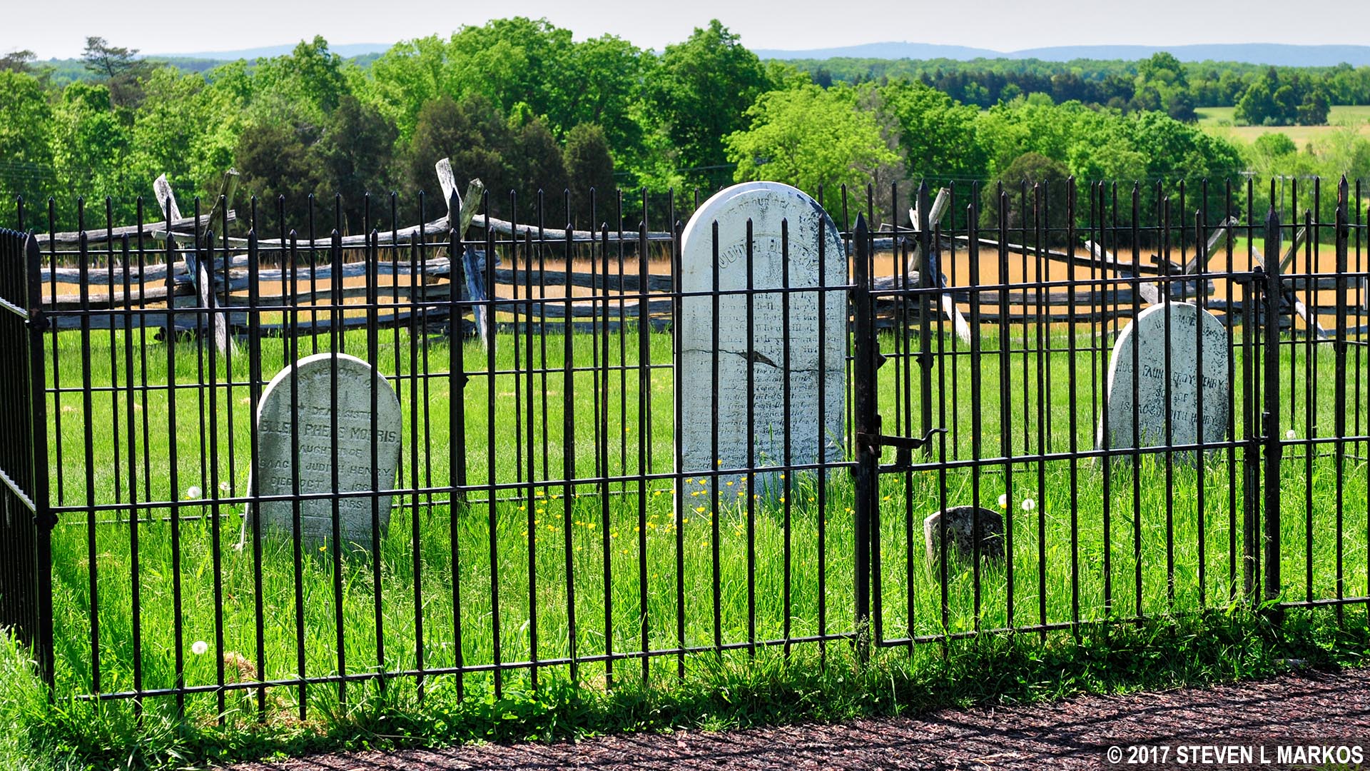
Henry Family cemetery, Manassas National Battlefield Park
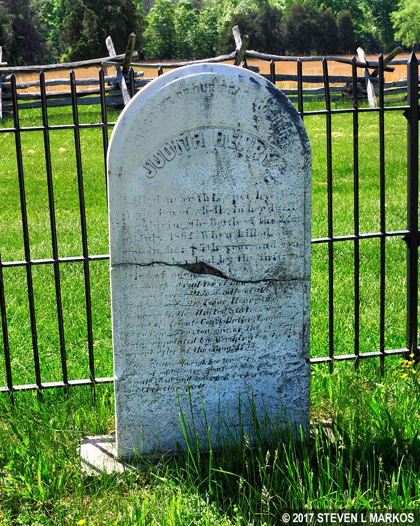
Grave of Judith Henry in the Henry Family cemetery, Manassas National Battlefield Park
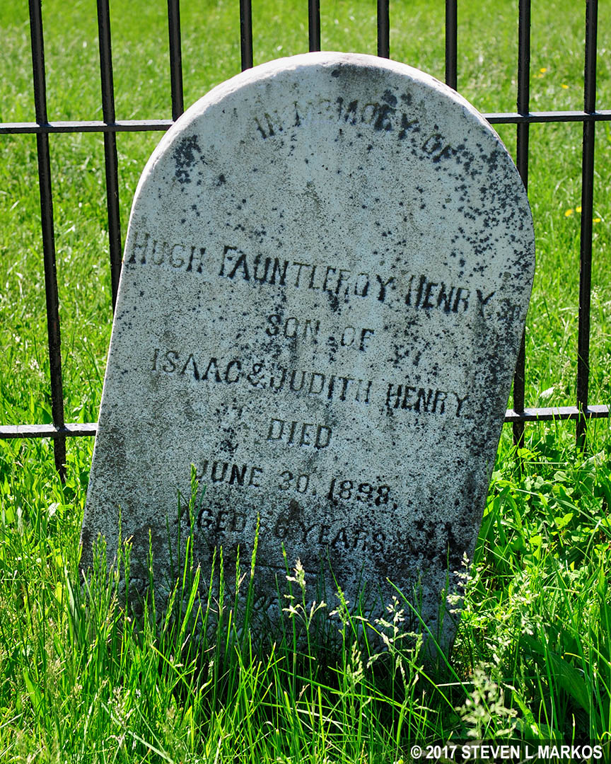
Grave of Hugh Henry in the Henry Family cemetery, Manassas National Battlefield Park

Grave of Ellen Henry (Morris by marriage) in the Henry Family cemetery, Manassas National Battlefield Park
Behind the house is the Henry Hill Monument, a memorial to the Union soldiers who died in the battle. Dedicated on June 13, 1865, it is one of the earlier Civil War memorials. The structure is made of sandstone blocks and has four 200-pounder shells placed around the base and one at the top.
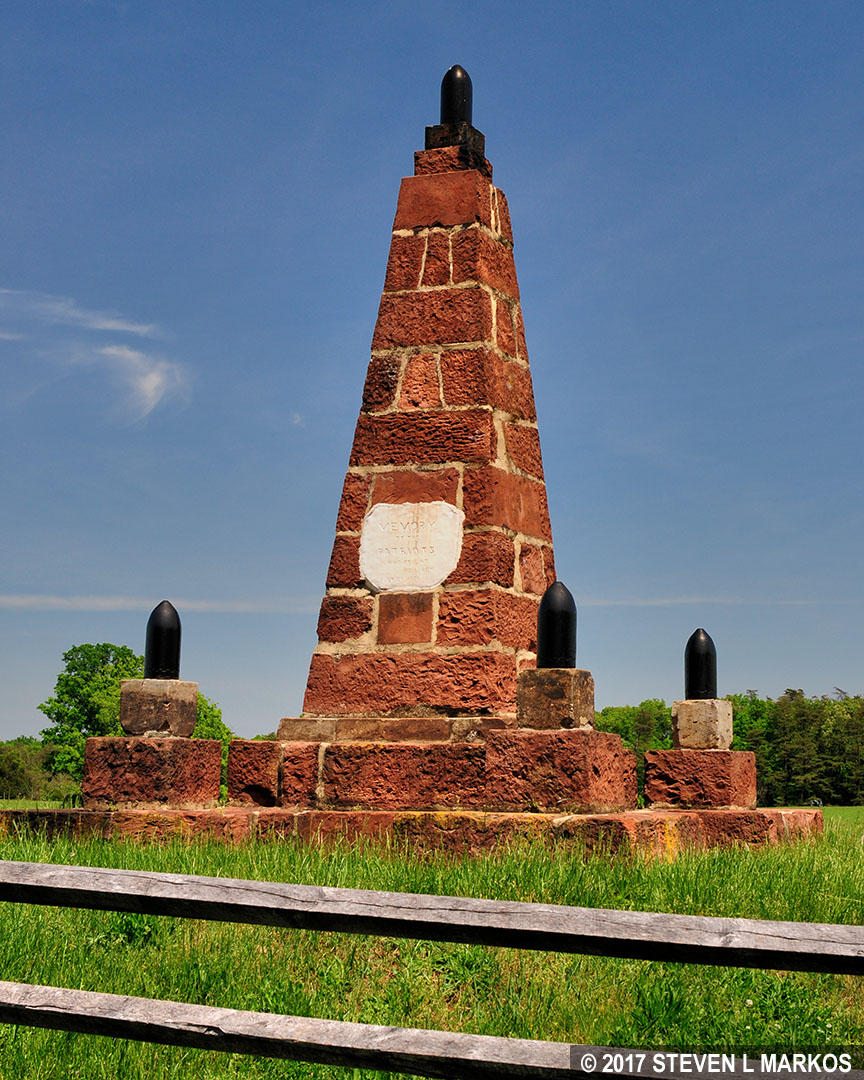
Henry Hill Memorial at Manassas National Battlefield Park
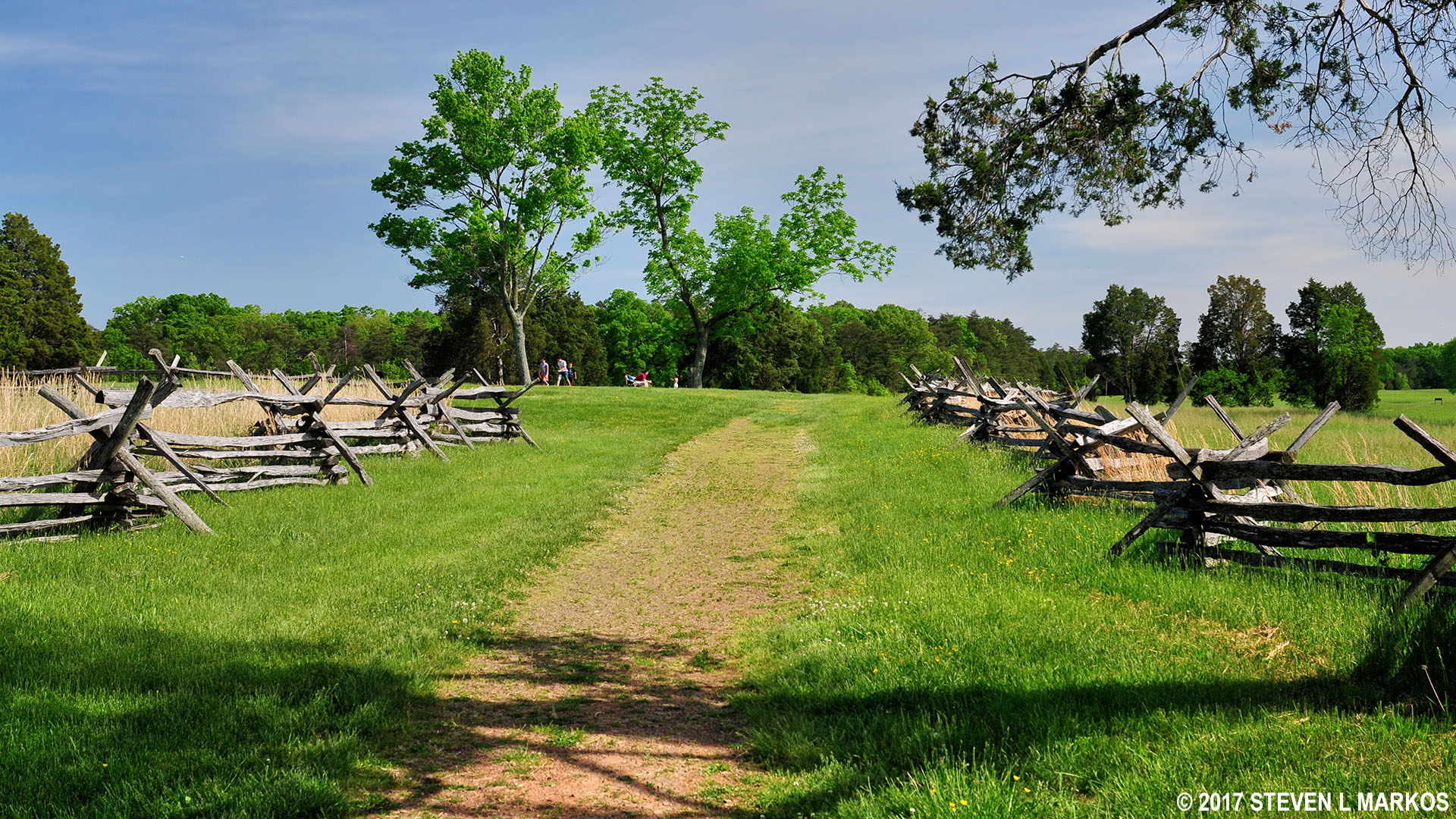
To continue the hike, walk through the opening in the rail fence and head north towards Highway 29.
Pass through the rail fence near the Henry House to stay on the Henry Hill Loop Trail, Manassas National Battlefield Park
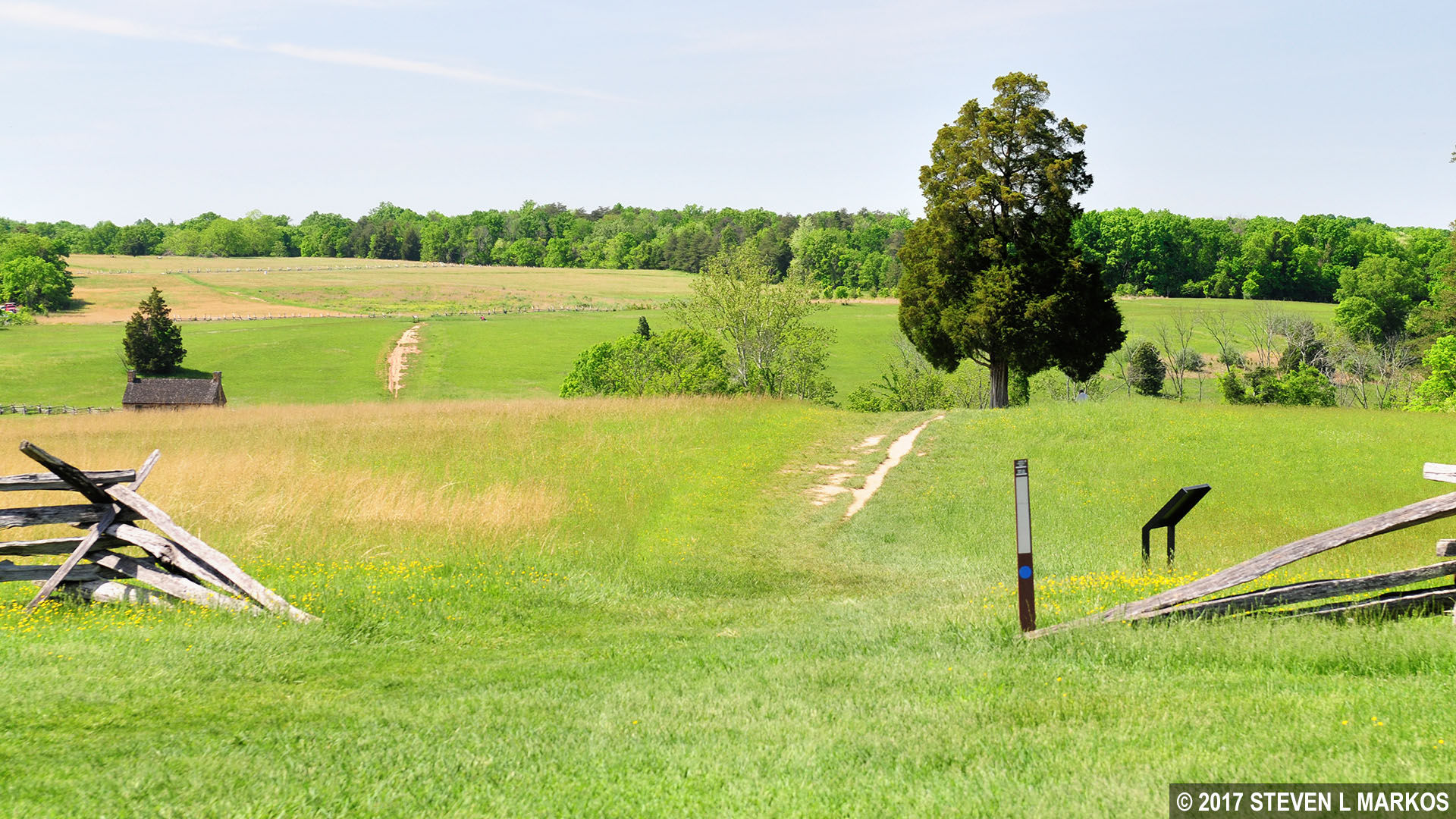
A tenth of a mile from the Henry House is an intersection marked by a lone tree and a wayside exhibit about the fighting on Matthews Hill, which you can see in the distance. As the Confederates on Matthews Hill were retreating towards Henry Hill, Confederate Captain John Imboden set up four cannon at this location to fire on the advancing Union soldiers in hopes of slowing them down so the Confederates had time to organize a defense to the east of this position.
Location of Confederate Captain John Imboden’s artillery battery on Henry Hill, Manassas National Battlefield Park

View towards Matthews Hill from Confederate Captain John Imboden’s artillery battery on Henry Hill, Manassas National Battlefield Park
Since you left the Visitor Center, the Henry Hill Loop Trail and the First Manassas Trail—a trail that loops around the entire battlefield—have been merged. It is here at the Imboden intersection that they split, with the First Manassas trail forking off to the left towards Highway 29 and the Henry Hill Loop Trail heading east towards the Robinson House, the next point of interest on the hike. This is the only common segment, so even if you have hiked or plan to hike the First Manassas Trail, it is still worth your time to hike the Henry Hill Loop Trail. I can’t say the same for the Matthews Hill Loop Trail or the Stone Bridge Loop Trail, the two other First Manassas-related trails in the park. These overlap extensively with the First Manassas Trail, so hike one or the other.
After taking a right at the Imboden intersection you will be hiking towards a small hill. The trail forks at the crest, and you need to stay to the left. Another sign with a blue dot marks the split and points the way.
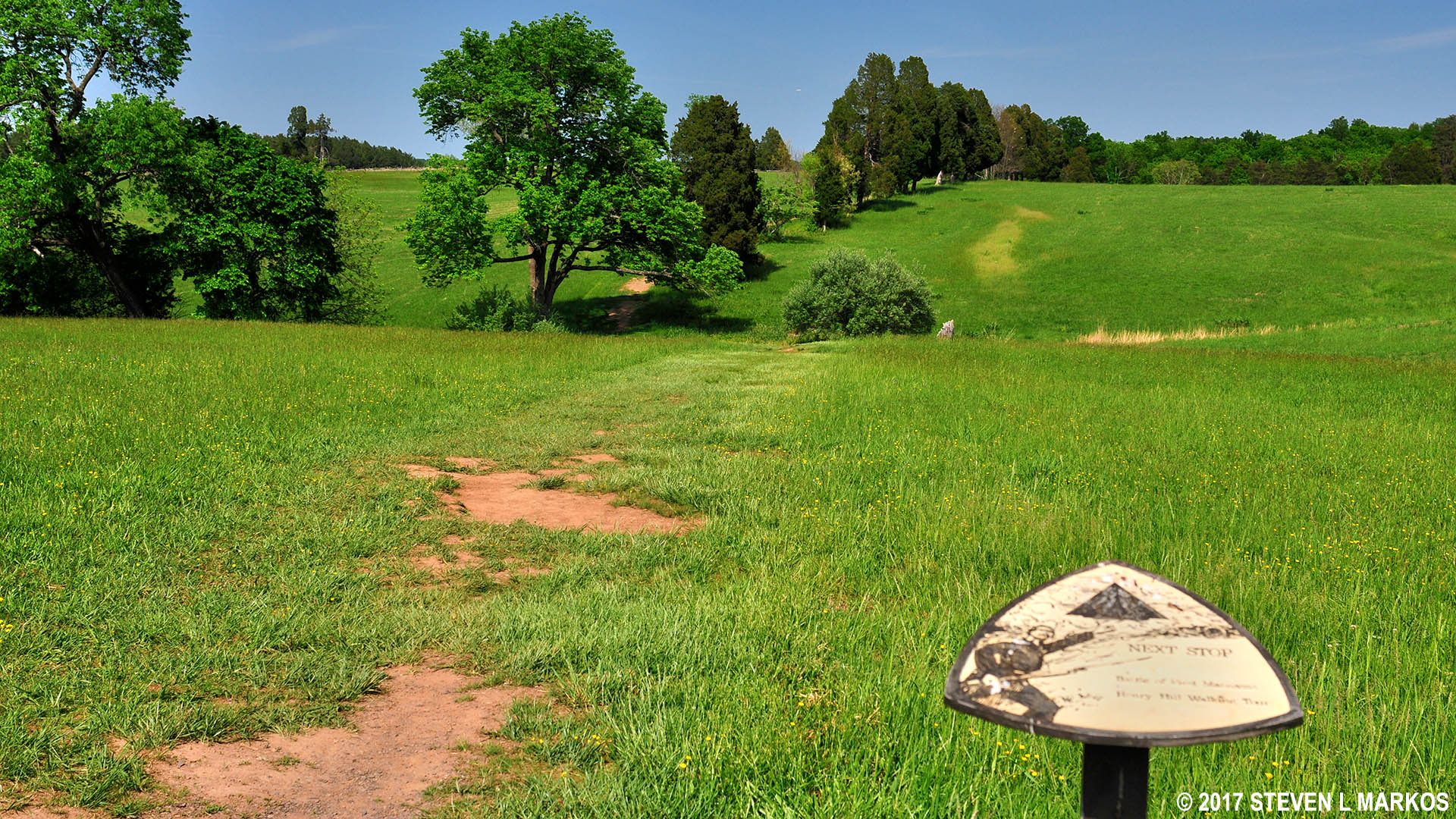
The Henry Hill Loop Trail forks at the crest of a hill east of Confederate Captain John Imboden’s artillery battery, Manassas National Battlefield Park
Trail marker points the way to the next stop on the Henry Hill Loop Trail in Manassas National Battlefield Park
You are now hiking through the area where Confederate Colonel Wade Hampton, a rich landowner who funded his own army, set up 600 of his men around noon in an attempt to hold off the advancing Union forces. Unfortunately, his stand didn’t last long, and he and what remained of his men eventually had to retreat as well.
The Henry Hill Loop Trail dead ends at a T-intersection not long after passing the aforementioned hill. The Robinson House site is just fifty yards or so to your right. The fences you now see, while new, have been placed where they would have been during the battle. There was more than one farm on the hill, and the fences marked off property lines. Soldiers used them to hide behind since the terrain was wide open.
Position of rail fencing during the First Battle of Manassas, Manassas National Battlefield Park
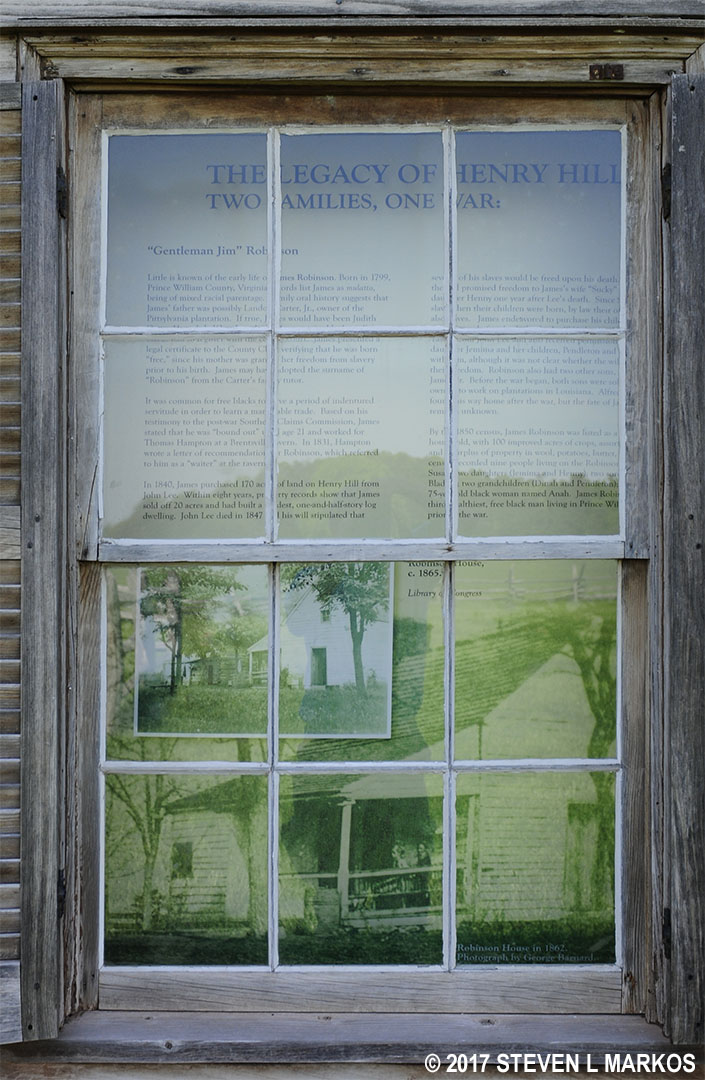
James Robinson was a black man who was born free (his mother had been freed). He purchased 170 acres on Henry Hill in 1840 and built a house. When the fighting broke out on Matthews Hill, Robinson moved his family out of danger, but he waited too long to escape himself and had to hide out under a bridge on the Warrenton Turnpike. His house miraculously survived with little damage, though other parts of his farm were not so lucky. During the Second Battle of Manassas no fighting took place here, but his property was used as a headquarters for Union General Franz Sigel. Members of the Robinson family lived in the house until it was sold to the National Park Service in 1936.
1862 photograph of the Robinson House by George Barnard
After the war, the Federal government created the Southern Claims Commission. If you were a Southerner and could prove you were loyal to the Union, you could file a claim for property damage sustained during the war. Robinson did so and received $1,250 for damage to crops, livestock, and other property.
While the house survived the war, it didn’t survive the vandals who burned it down in 1993. A few weeks prior, the house had been vandalized with racist graffiti, so most likely the fire was set by some cretins who were still living in 1865. Nobody was ever caught. All that remains of the house is the foundation.
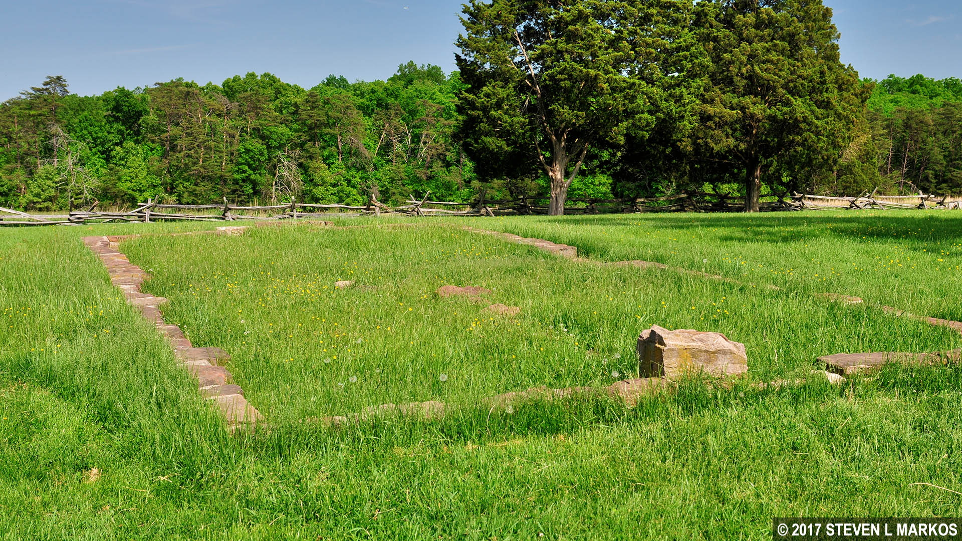
Foundation of the James Robinson House on Henry Hill, Manassas National Battlefield Park
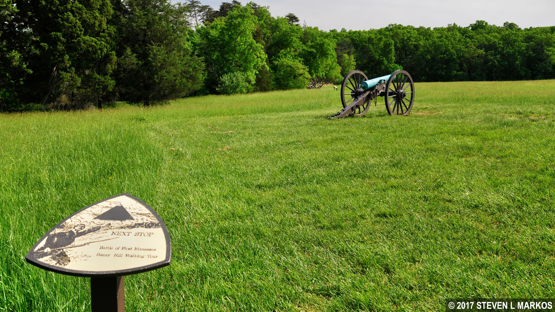
The next point of interest is a quarter mile down the trail: the Confederate battle line. You can see the artillery battery from the Robinson House. There isn’t much of a defined path, but all you need to do is hike towards the cannon.
View of the Confederate battle line on the east side of the Henry Hill Loop Trail, Manassas National Battlefield Park
By the time the fighting reached Henry Hill, the morale of the Confederates was at a low point and defeat seemed inevitable. Confederate generals Pierre Beauregard and Joseph Johnston showed up and were able to form an organized battle line from the disorganized troops. Around noon, reinforcements arrived under the command of Brigadier General Thomas Jackson, a man who had not yet earned his nickname Stonewall. His First Virginia Brigade had marched from the Portici plantation southeast of Henry Hill.
Cannon exhibit east of Henry Hill marks the location of the late afternoon Confederate battle line during the First Battle of Manassas, Manassas National Battlefield Park
At the artillery exhibit is a mowed path that leads directly to the Visitor Center. This is just a shortcut. If you want to complete the Henry Hill Loop Trail, follow the tree line and make your way towards the back of the Visitor Center parking lot.
Henry Hill Loop Trail continues along the tree line on its eastern side, Manassas National Battlefield Park
You are now following in the footsteps of Confederate soldiers who charged and captured two Union artillery pieces that were set up far to the right of the main battery—the cannon you saw at the beginning of the hike—and only 100-yards from their left flank. Union Captain Charles Griffin knew that artillery placed at this angle could fire perpendicularly into the Confederate line, a trajectory known as enfilading fire. When firing head on, shells may fall short or overshoot the target, but when firing from the side you can’t miss, plus it is possible to take out multiple men with one shot. A soldier who fought in the Second Battle of Manassas was eyewitness to a shell that came in at such an angle that it took off one man’s head, hit the next in the neck, the next in the chest, and a fourth in the gut, disemboweling him.

Enfilading Fire Diagram
Instead of just sitting there and waiting to get peppered at close range, Confederate Colonel A. C. Cummings ordered his 33rd Virginia Infantry to charge the guns. Four hundred men burst from the battle line, firing along the way. The cannon crews were wiped out and the Confederates captured the pieces. Union soldiers soon took them back but were driven off once again by Confederate reinforcements. As you approach the backside of the parking lot you will see two cannon that mark this spot. Be sure to make your way over to them and not back to the Visitor Center.
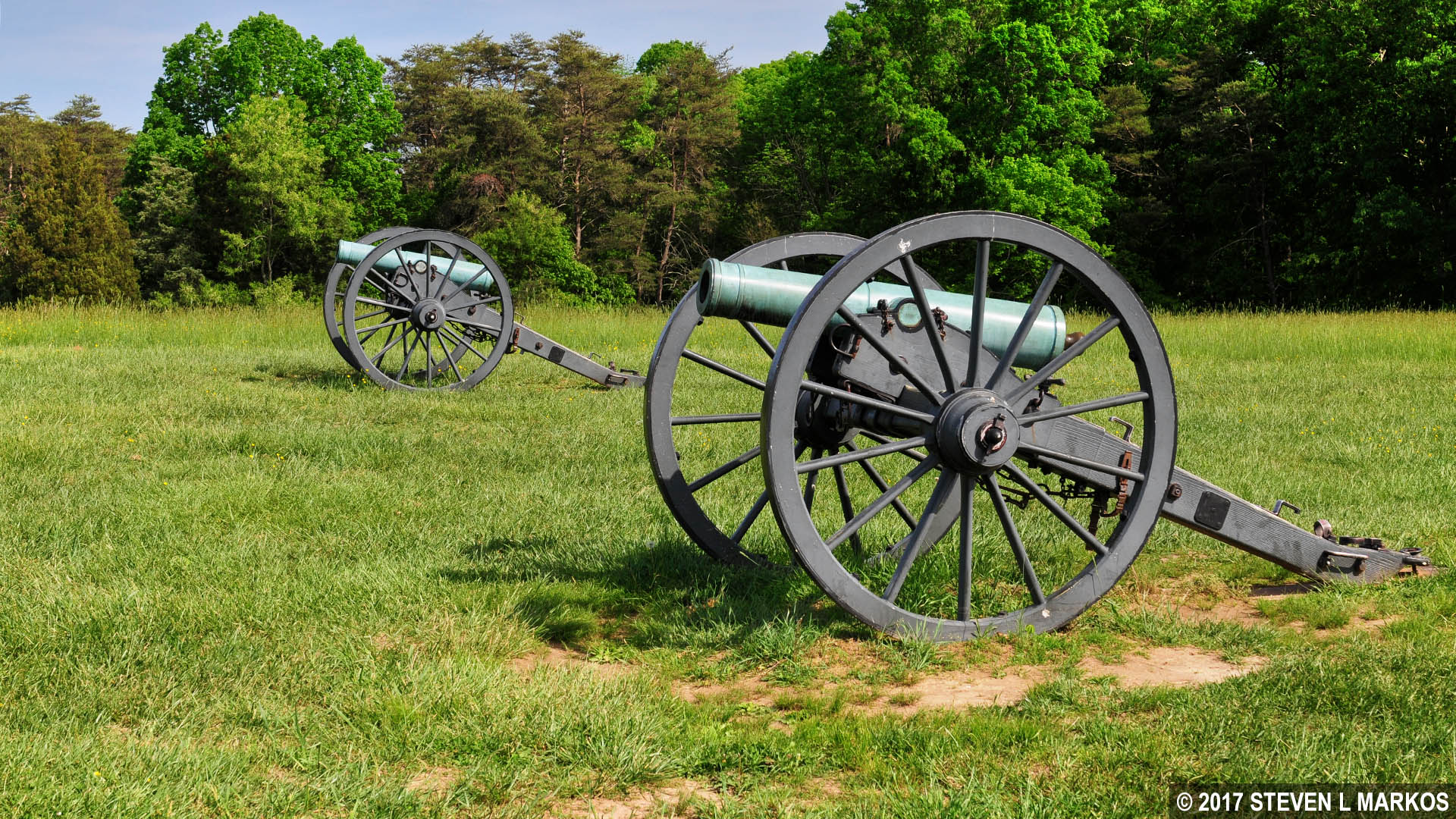
Two cannon mark the spot where Confederates captured Charles Griffin’s small artillery battery during the First Battle of Manassas, Manassas National Battlefield Park
Behind the two cannon is one last wayside exhibit that gives a quick synopsis of how the battle ended. The charge by the 33rd Virginia Infantry inspired other Confederates to do the same, and by the late afternoon the Union had been driven off of Henry Hill and pushed west all the way to Chinn Ridge, turning what looked to be a defeat into a possible victory. The battle ended on Chinn Ridge after fresh brigades of Confederate soldiers joined the fighting. Union troops retreated north along Sudley-Manassas Road, ending the first major battle of the Civil War.
When I am hiking on a battlefield, I don’t care much about scenery, but I do like the trails to enhance the battlefield experience. The Henry Hill Loop Trail certainly does that: the Union and Confederate artillery batteries, the Henry House, the Robinson House site, etc. You can read about the battle all you want, but until you see the terrain with your own eyes you can’t really understand it. I highly recommend this short hike, even if you have already done or plan to do the First Manassas Trail. For a better understanding of the fighting that took place on Matthews Hill, be sure to hike the Matthews Hill Loop Trail as well.
With a few exceptions, use of any photograph on the National Park Planner website requires a paid Royalty Free Editorial Use License or Commercial Use License. See the Photo Usage page for details.
Last updated on May 18, 2025


