
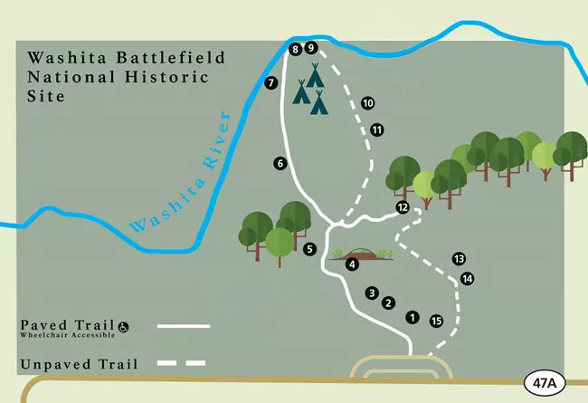
Washita Battlefield Trail Map, Washita Battlefield National Historic Site
Length: 1.5 miles
Time: 45 minutes to 1 hour
Difficulty: ★★☆☆☆
The Washita Battlefield Trail at Washita Battlefield National Historic Site is a 1.5-mile loop that leads to the site of the Battle of the Washita (aka Massacre on the Washita) that took place when Lieutenant Colonel George Armstrong Custer and his 7th Cavalry attacked the camp of Cheyenne chief Black Kettle on the morning of November 27, 1868. Hiking the trail is the only way for park visitors to see the battlefield up close. (Note that while Custer was a general during the Civil War, this was a brevet (temporary) appointment in the U. S. Volunteers, which was not part of the regular United States Army. After the war his rank reverted to captain in the regular army, and by 1868 he had been promoted to lieutenant colonel and given the command of the 7th Cavalry.)
The trail is figure-8 shaped, with the western half being paved and the eastern half being an unimproved, grassy path. For those in wheelchairs, this makes the Washita Battlefield Trail a 1.2-mile round trip out-and-back hike. Most of the trail is out in the open, so if avoiding the sun is important to you, be sure to wear a hat and apply sunscreen.
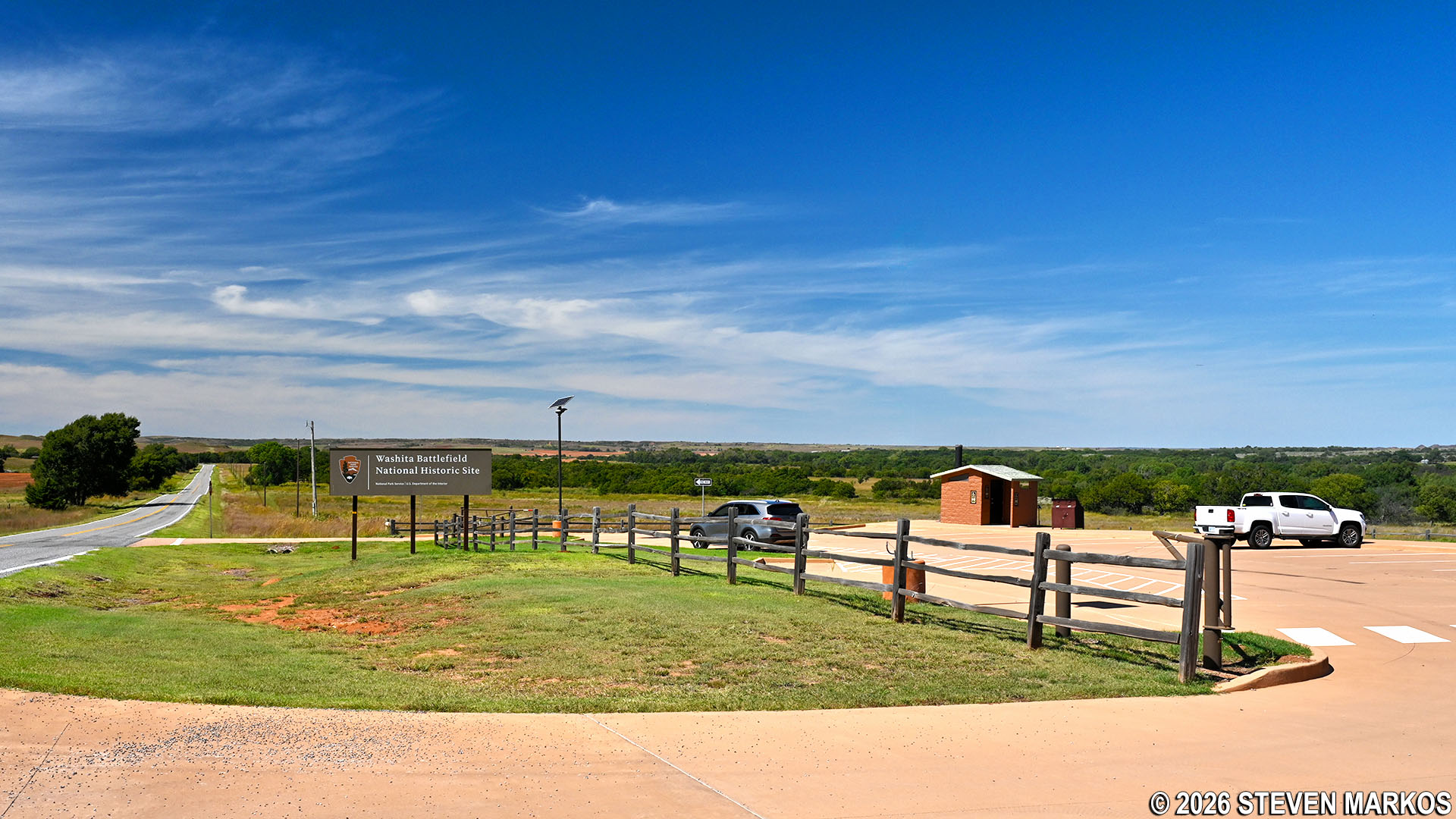
The trailhead is located at the Battlefield Overlook parking lot, which is a half mile past the Visitor Center. A restroom is available, but it’s just a fancy outhouse—what Jed Clampett would call a portable toilet in a permanent building.
Battlefield Overlook parking lot at Washita Battlefield National Historic Site
Three commemorative markers are situated around the parking lot. A red granite memorial known as Custer’s Battle was donated in 1932 by the Platonic Club of Cheyenne, a local women’s civic group. The granite used for the marker was formed over 500 million years ago and was mined from the Wichita Mountains less than a hundred miles away. This replaced the first memorial on the battlefield from the early 1890s, which is on display in the Visitor Center.
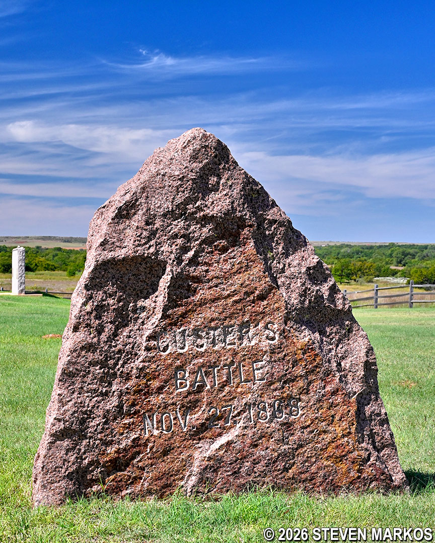
“Custer’s Battle” stone at the Battlefield Overlook parking lot, Washita Battlefield National Historic Site
Another historical marker placed in 1962 features etchings of Chief Black Kettle and Colonel Custer and includes text recounting the battle’s events. A third historical marker, made of pink granite, commemorates the site’s designation as a national historic landmark in 1965.
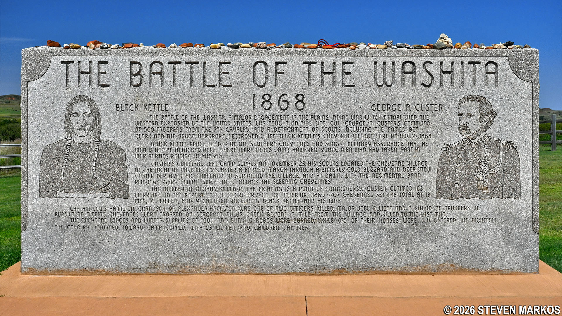
The Battle of the Washita historical marker at the Battlefield Overlook parking lot, Washita Battlefield National Historic Site
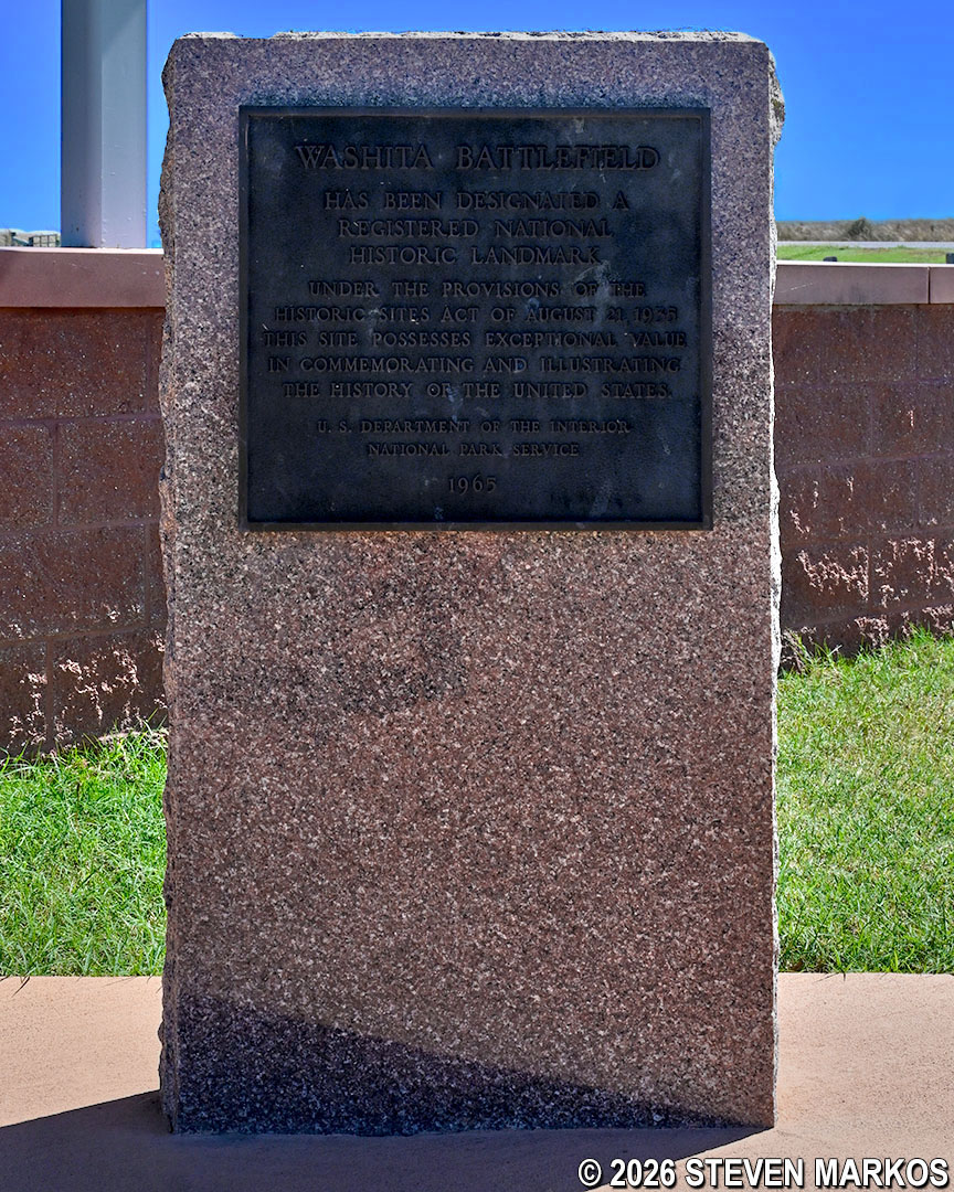
Washita Battlefield National Historic Landmark monument at the Battlefield Overlook parking lot, Washita Battlefield National Historic Site
A paved path on the east side of the parking lot leads to the Battlefield Overlook and the Washita Battlefield Trail. From the overlook shelter, visitors can get a good view of the Washita River Valley. A wayside exhibit describes the surprise dawn attack on Chief Black Kettle’s camp. There is also a granite panel engraved with the battlefield map and Custer’s plan of attack.
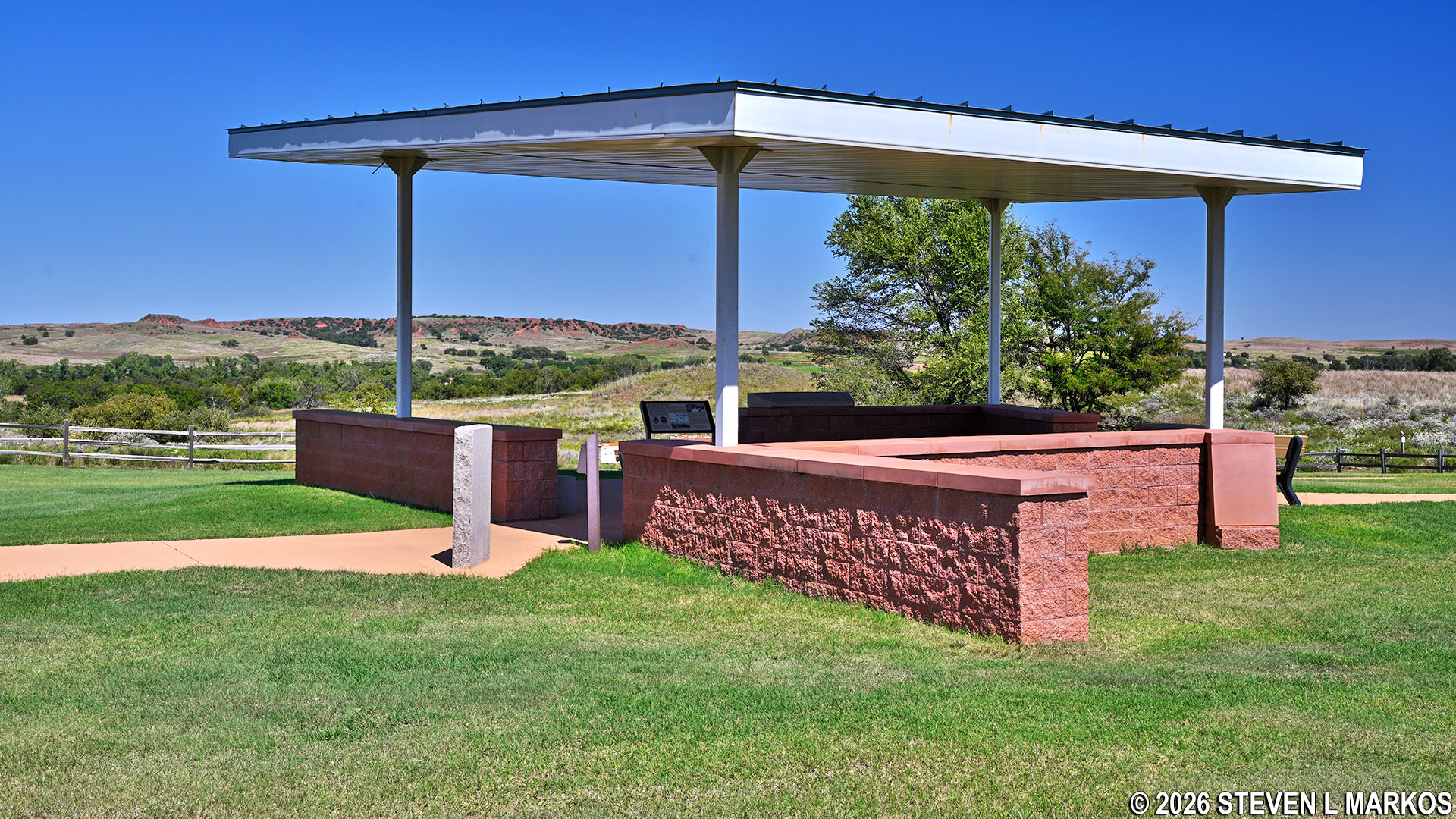
Battlefield Overlook at Washita Battlefield National Historic Site
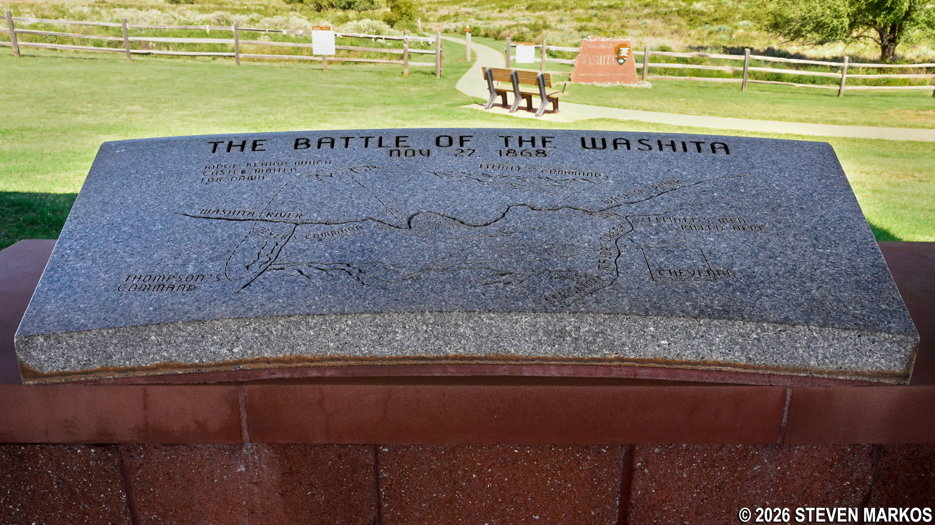
Granite engraved with Custer’s attack plan at the Battlefield Overlook, Washita Battlefield National Historic Park
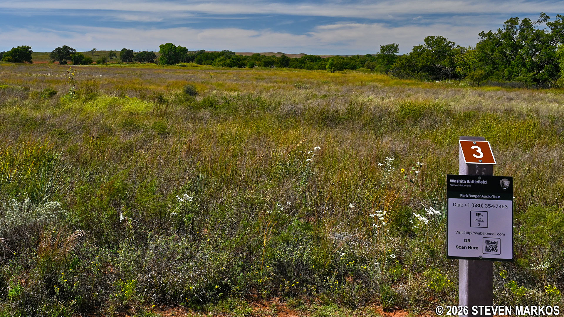
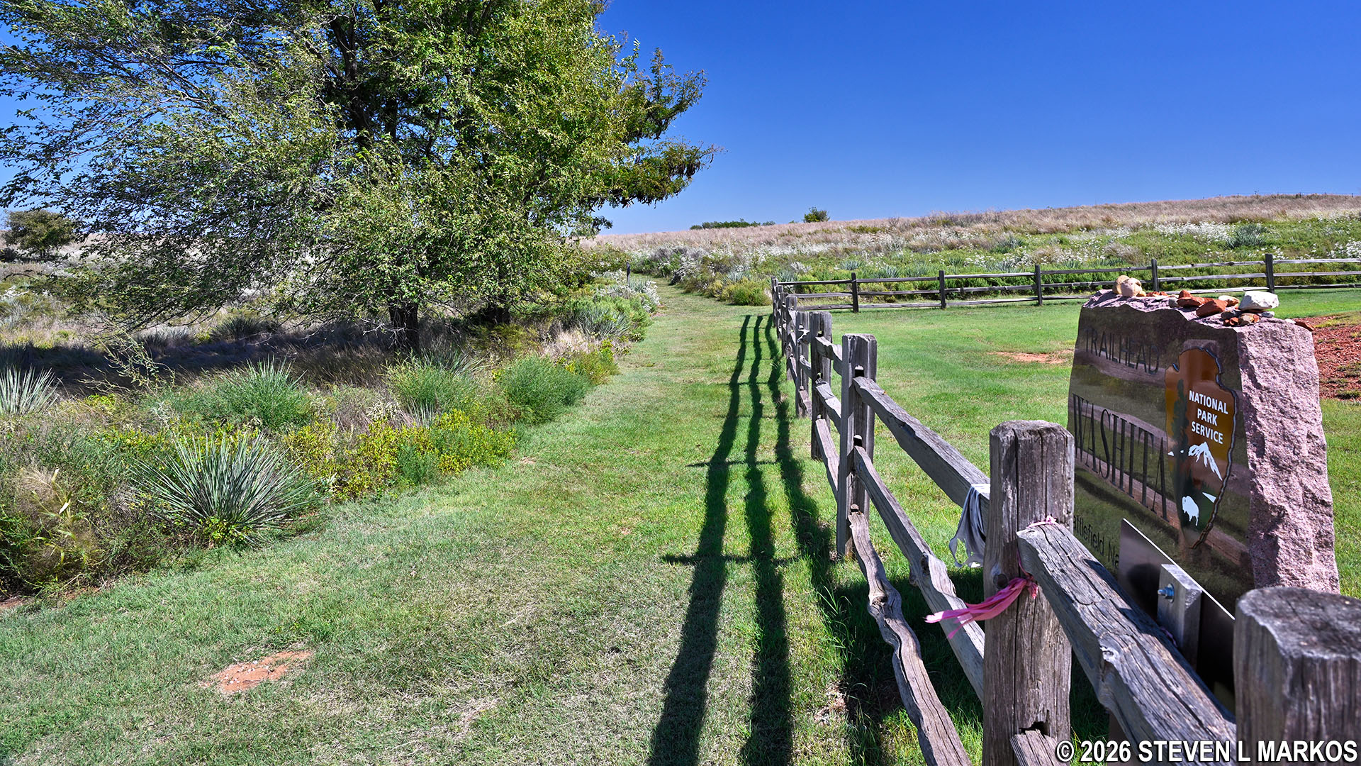
From the overlook, it is fifty yards down a slight hill to the start of the Washita Battlefield Trail at a wooden fence. Fifteen numbered stops along the trail mark key points on the battlefield. Information about each stop is provided in a brochure available at the Visitor Center. There is also a cell phone audio tour available. Dial the phone number (posted at each stop), enter the stop number, and listen to the narration. Note that when looking at the signs that you are looking in the direction of the events or geological features described on the brochure and in the audio program.

Start of the Washita Battlefield Trail at Washita Battlefield National Historic Site
Cell phone audio tour is available for the Washita Battlefield Trail at Washita Battlefield National Historic Site
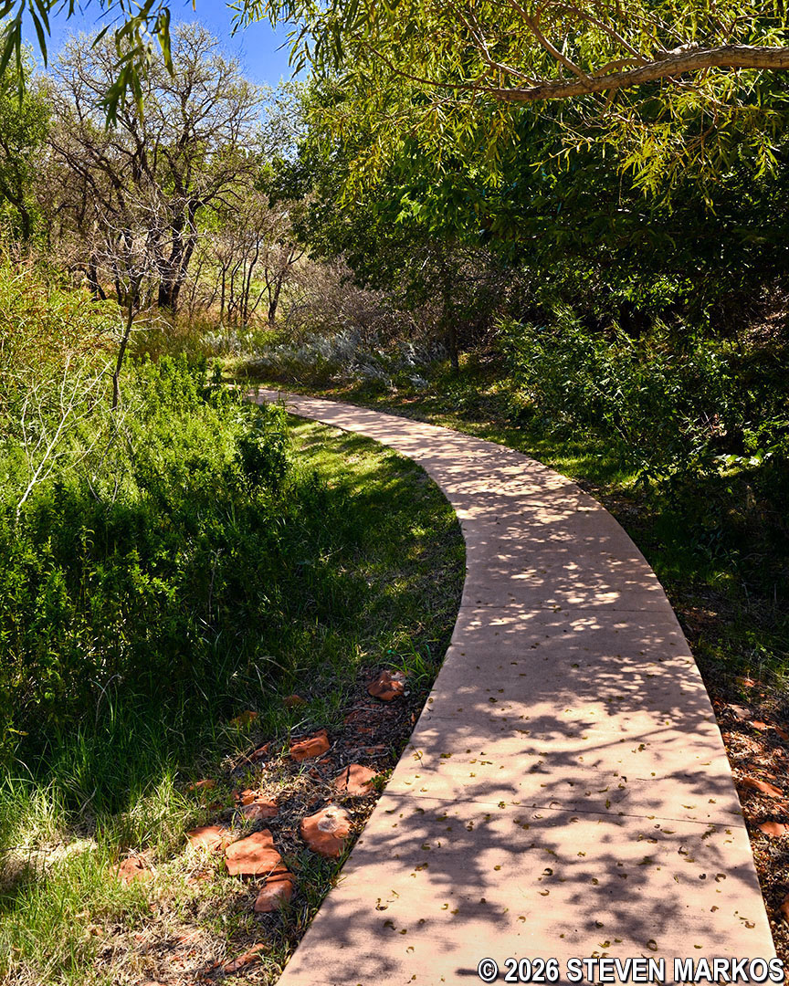
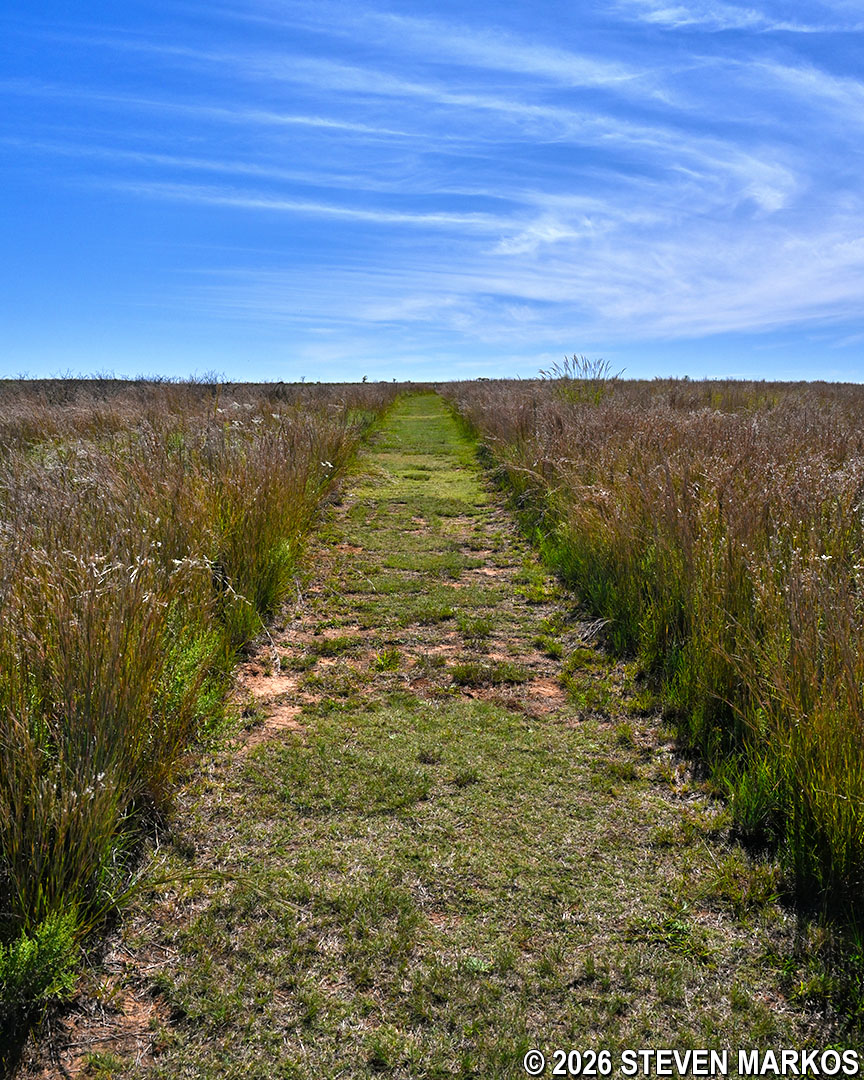
Being a loop, you can go around in either direction, but if you want to follow the stops along the trail in chronological order, keep straight on the paved section. Though not as obvious, the grass path on the right just inside the fence is also the Washita Battlefield Trail, and it is along this section that you will return at the end of the hike.
Grass path at the end of the Washita Battlefield Trail loop, Washita Battlefield National Historic Site
There were numerous crickets hopping about on the pavement when I did the hike in September. They often appear in large numbers during this time of year, especially if a dry spring is followed by a wet summer. Also be on the lookout for fire ants if you are hiking in the warmer months. While there are no ant hills on the paved path, fire ants may be scurrying back and forth across the pavement. Before stopping for any reason, make sure you aren’t standing on one of these ant paths because they will crawl on your feet and legs and bite the hell out of you for no reason.
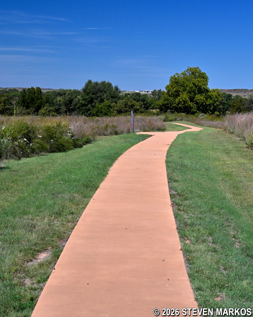
Typical terrain (crickets included) at the start of the Washita Battlefield Trail, Washita Battlefield National Historic Site
Two-tenths of a mile into the hike, the trail makes an S-curve as it passes Stops 4 and 5. There is a large tree right after Stop 5 if you need to take a quick break in the shade before moving on. This is one of the very few shady spots on the trail.
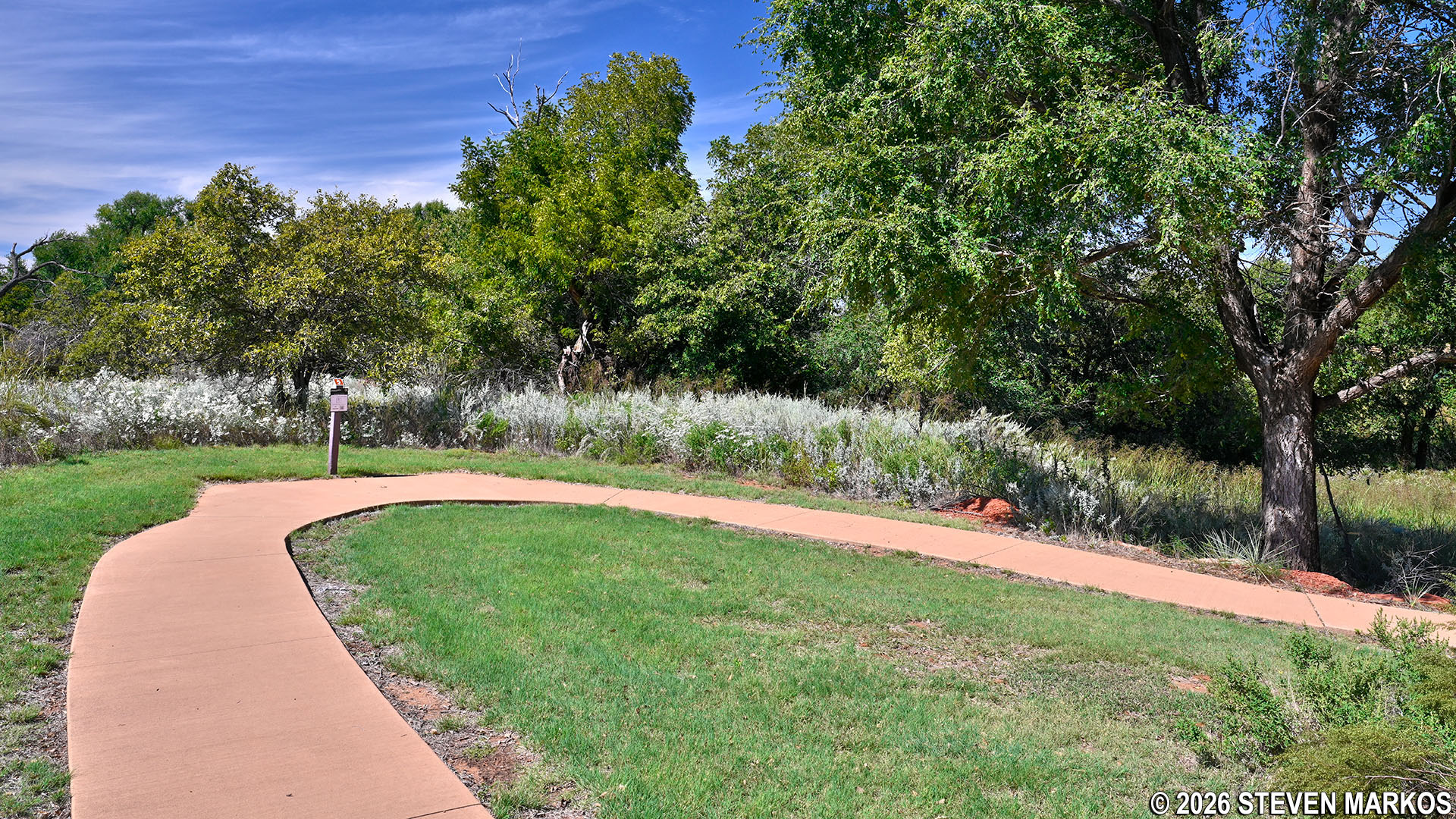
S-curve at Stop 5 on the Washita Battlefield Trail at Washita Battlefield National Historic Site
The trail continues downhill very gradually before coming to a split at the .3-mile mark. This is the mid-point of the Figure 8. Follow the sign for the LOWER TRAIL. If you want to shorten the hike by .6 miles and only do the lower loop, turn right for the UPPER TRAIL, which remains paved until Stop 12, the Pony Kill Site.
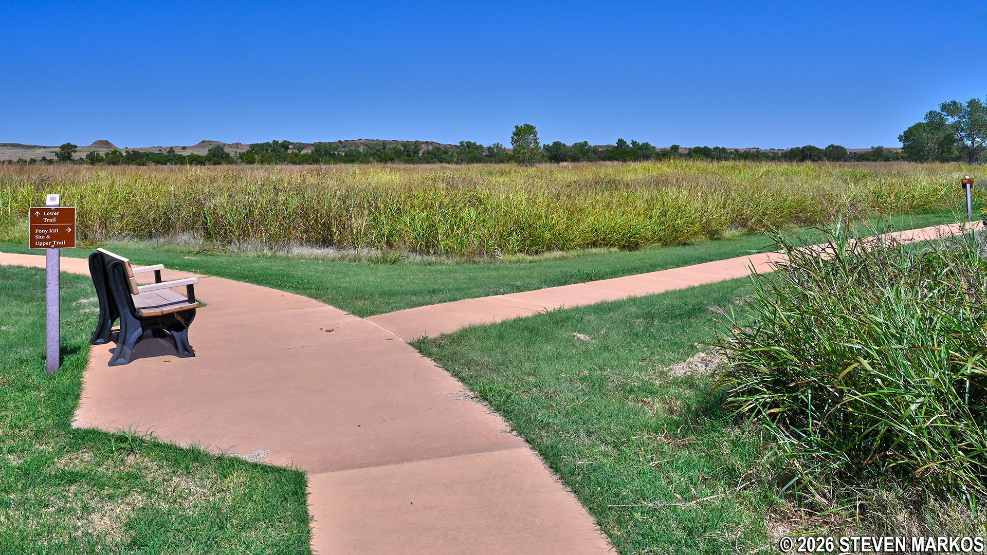
Split in the path at the midway point of the Washita Battlefield Trail at Washita Battlefield National Historic Site
A few hundred feet past the split is Stop 6, which faces west. It is believed that Black Kettle’s camp stretched from a quarter mile to the west to 75 yards to the east of this stop. At the time, the entire camp would have been situated along the Washita River. Today, since the river has changed course over time, the bulk of the camp would have been nowhere near the river.

Map of the Washita Battlefield showing the Washita River from 1873 (pink) and today (blue), Washita Battlefield National Historic Site
Black Kettle’s camp consisted of over 200 people living in 51 lodges. It was separated from the camps of many other tribes in the area. On the night before Custer’s attack, Black Kettle’s wife supposedly urged him to move the camp closer to the others for better protection. However, due to the cold temperatures, Black Kettle decided to move the next day, a move that never came.
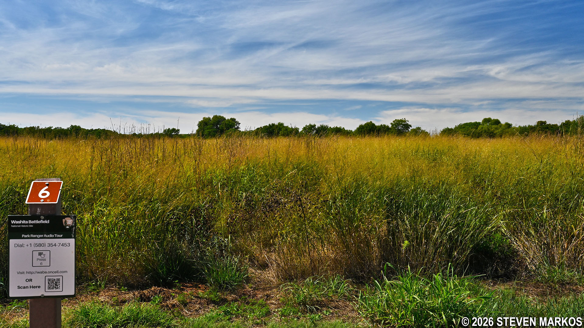
View at Stop 6 on the Washita Battlefield Trail of the terrain where Chief Black Kettle’s camp was located, Washita Battlefield National Historic Site
At Stop 7 there are two benches for visitors to rest. It is here that the Washita Battlefield Trail comes closest to the Washita River. However, it is not very wide and is impossible to see through the brush. Keep in mind that in 1868 when the Battle of the Washita took place, if you were standing here, you would not be anywhere near the river. As mentioned, it would have flowed through the area where Stop 6 is located.
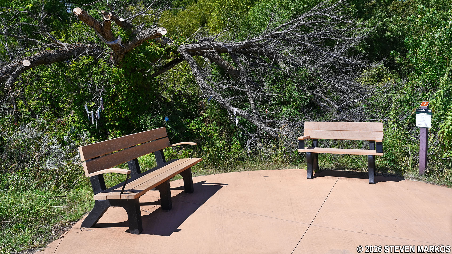
Stop 7 on the Washita Battlefield Trail, Washita Battlefield National Historic Site
Notice that there are pieces of cloth hanging in trees at this and other spots along the trail. Referred to as prayer cloths, these are physical and symbolic representations of prayers placed here by American Indians as part of their religious ceremonies.
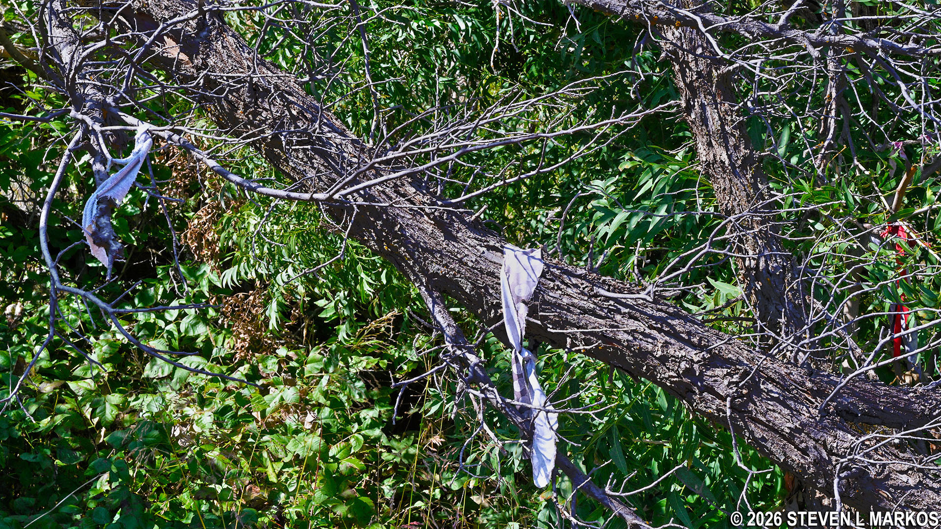
Prayer cloths hanging at Stop 7 on the Washita Battlefield Trail at Washita Battlefield National Historic Site
The paved section of the trail ends at Stop 8, .6 miles from the start. Depending on the season, there may be a bunch of fire ant hills at the start of the unpaved section, so make sure to watch where you are stepping if you decide to stand still for any reason. Luckily, the path becomes much grassier with hardly any ant hills just a little over fifty yards ahead.
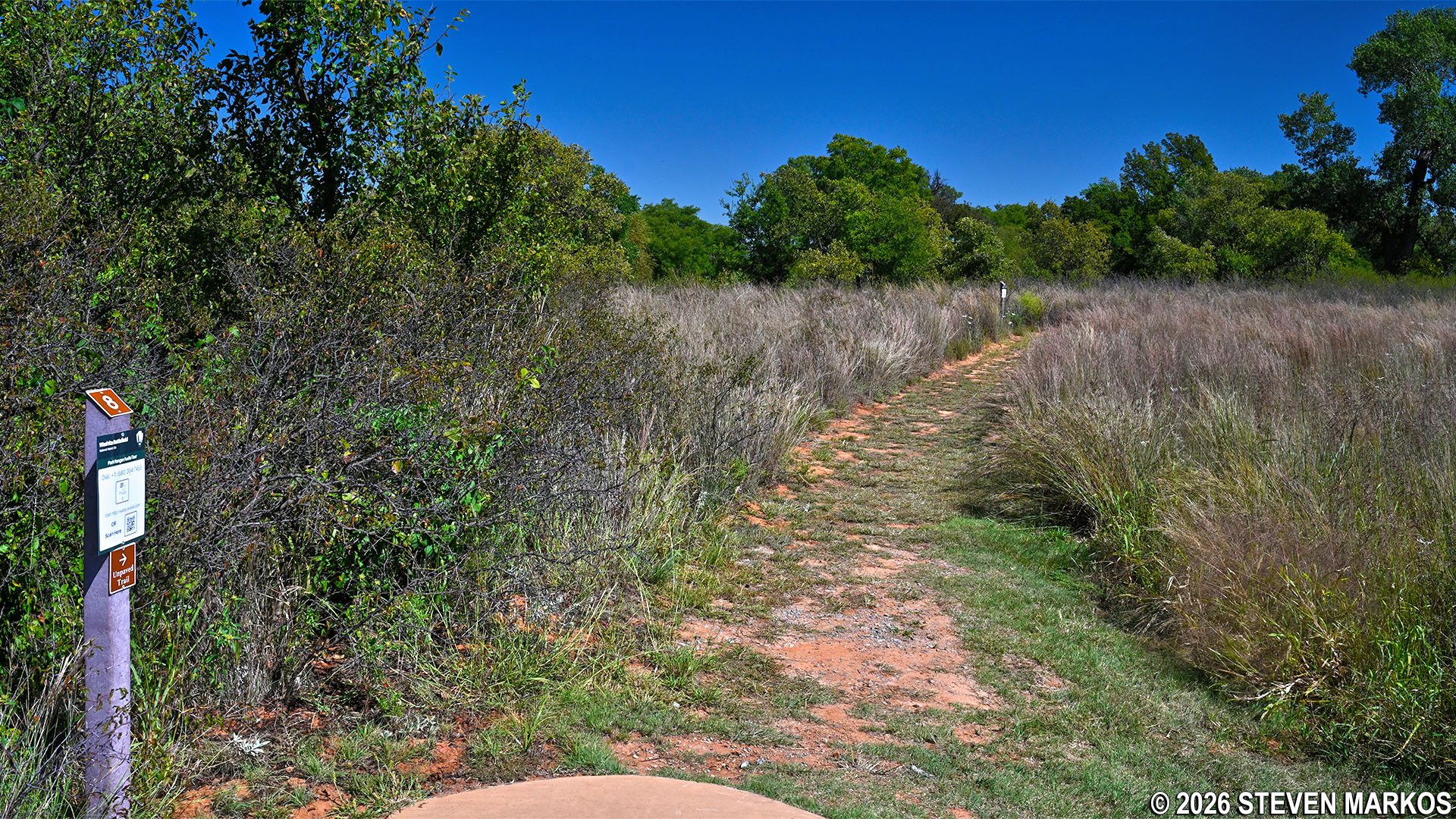
End of the paved path at Stop 8 on the Washita Battlefield Trail, Washita Battlefield National Historic Site
Earthen trail covered with ant hills at Stop 8 on the Washita Battlefield Trail, Washita Battlefield National Historic Site
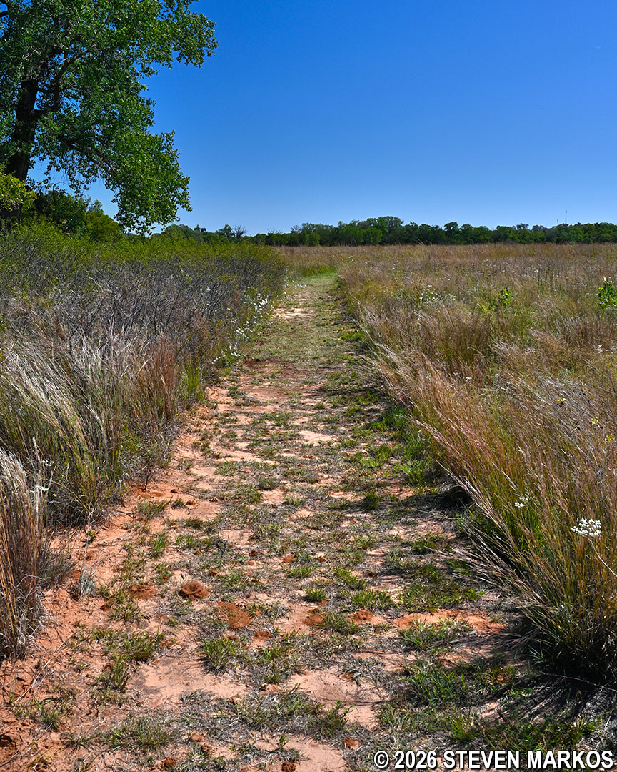
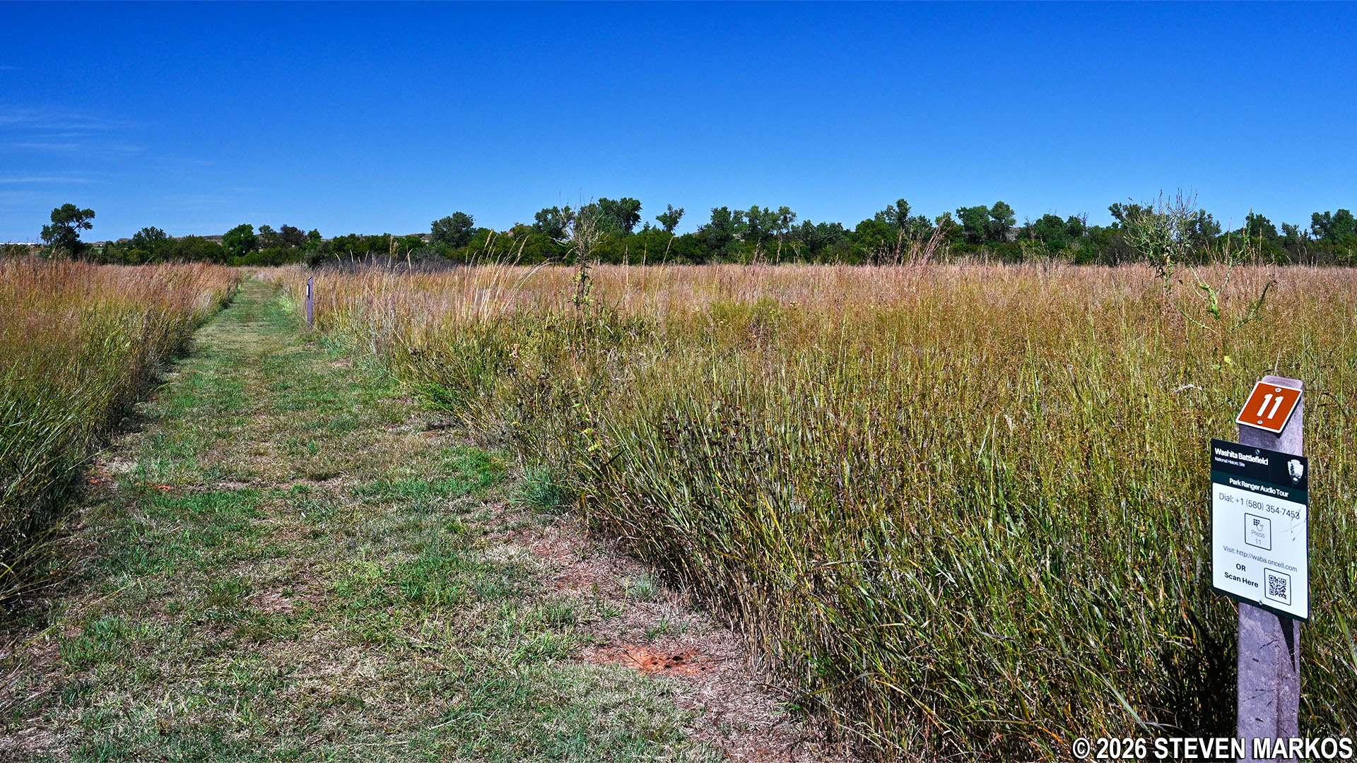
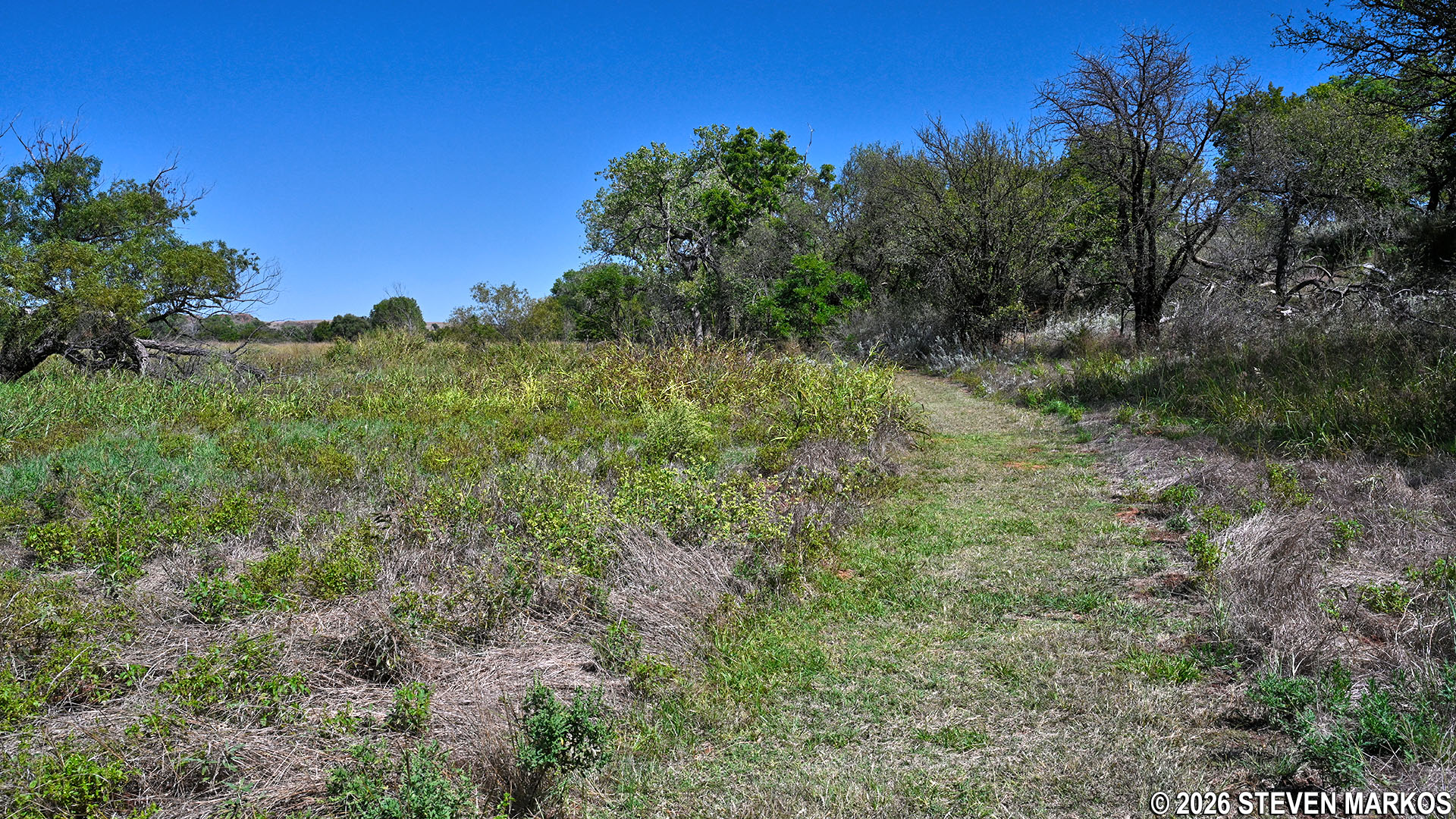
Just over three-quarters of a mile into the hike are Stops 10 and 11. These are located on the opposite side of the Washita Battlefield Trail from Stop 6, so back in 1868 the river would have flown through this area as well.
Typical terrain near Stops 10 and 11 on the Washita Battlefield Trail, Washita Battlefield National Historic Site
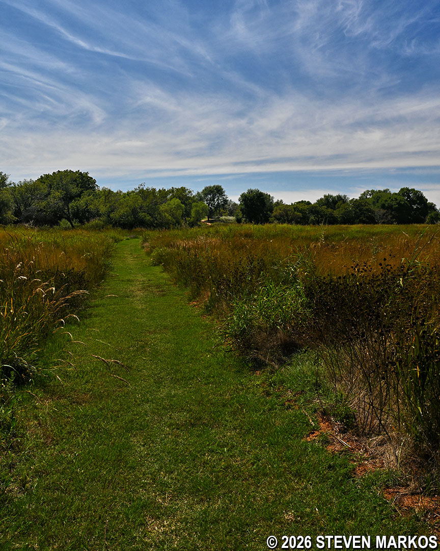
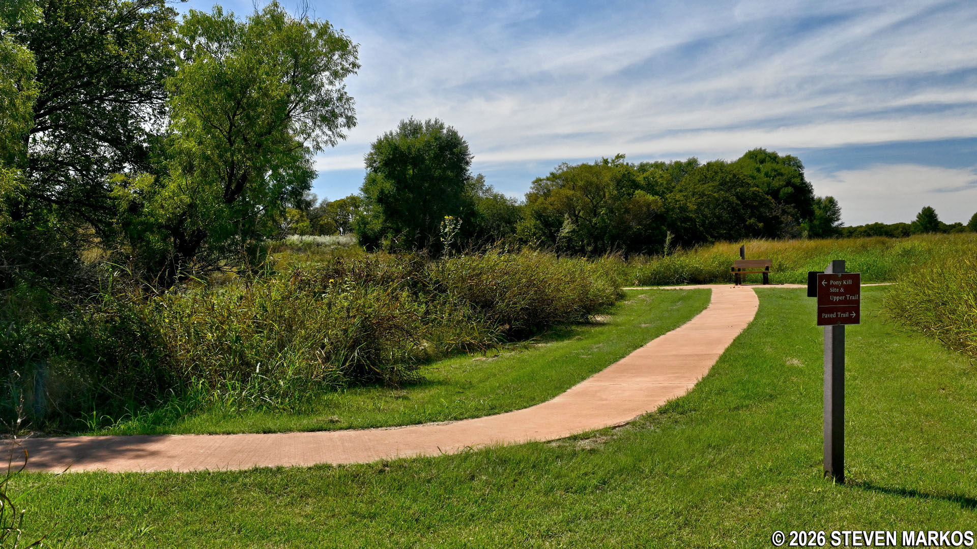
The Washita Battlefield Trail continues as a grass path before reconnecting to the paved section near the midway point. Follow the sign for the PONY KILL SITE & UPPER TRAIL to continue the hike.
Typical terrain on the east side of the Washita Battlefield Trail near Stop 11, Washita Battlefield National Historic Site
Grass path reconnects to the paved section of the Washita Battlefield Trail at its midway point, Washita Battlefield National Historic Site
Over the next two-tenths of a mile, there are a few shaded areas on the trail. Aside from the one large tree earlier, this and another short section just up ahead are the only other parts of the entire trail with any shade.
Shaded path on the east side on the Washita Battlefield Trail near Stop 12, Washita Battlefield National Historic Site
Stop 12 marks the end of the paved path in this direction. This stop, named the Pony Kill Site, is near to where over 600 horses from Chief Black Kettle’s camp were rounded up and shot to death after the battle. Custer wanted to deprive the Cheyenne of one of their most valuable assets, so he ordered all their ponies to be killed. To make matters worse, the soldiers forced the Cheyenne women who had been captured to lead the horses to this area because they feared the soldiers, who smelled differently than their owners. While the location of Black Kettle’s camp cannot be pinpointed to a tee, the site where the horses were killed is known for certain. The bones remained piled up in this area until 1935 when they were carted off to be ground into fertilizer.
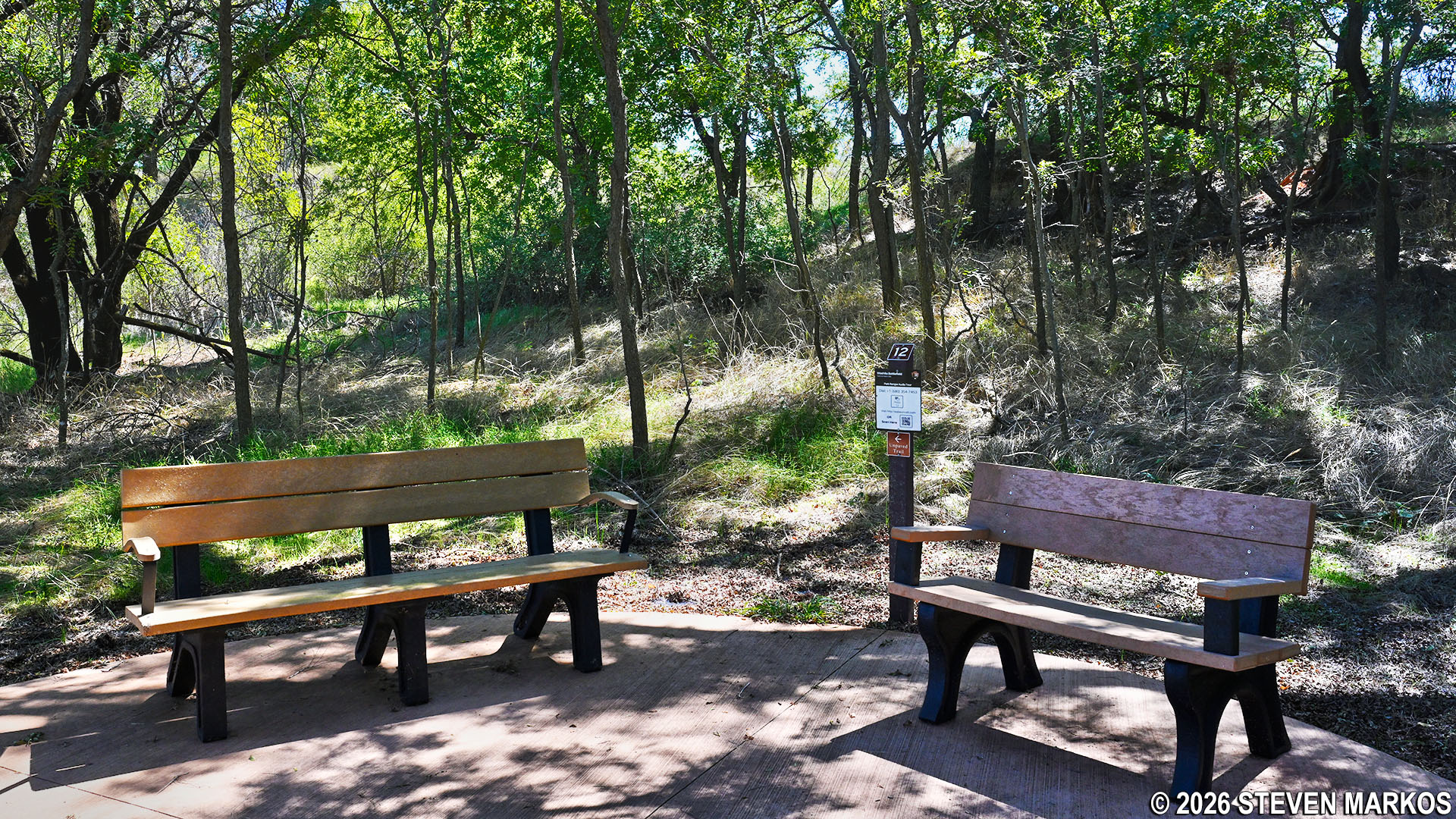
Benches at Stop 12 beside the Pony Kill Site on the Washita Battlefield Trail at Washita Battlefield National Historic Site
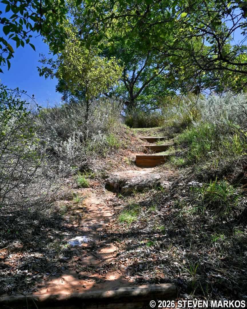
The grass path resumes at Stop 12. The hike continues up a small hill before entering another section of shade trees. At this point it quickly starts to feel more like an actual hike. Some erosion-control steps have been installed in this section as well.
Grass path after Stop 12 on the Washita Battlefield Trail at Washita Battlefield National Historic Site
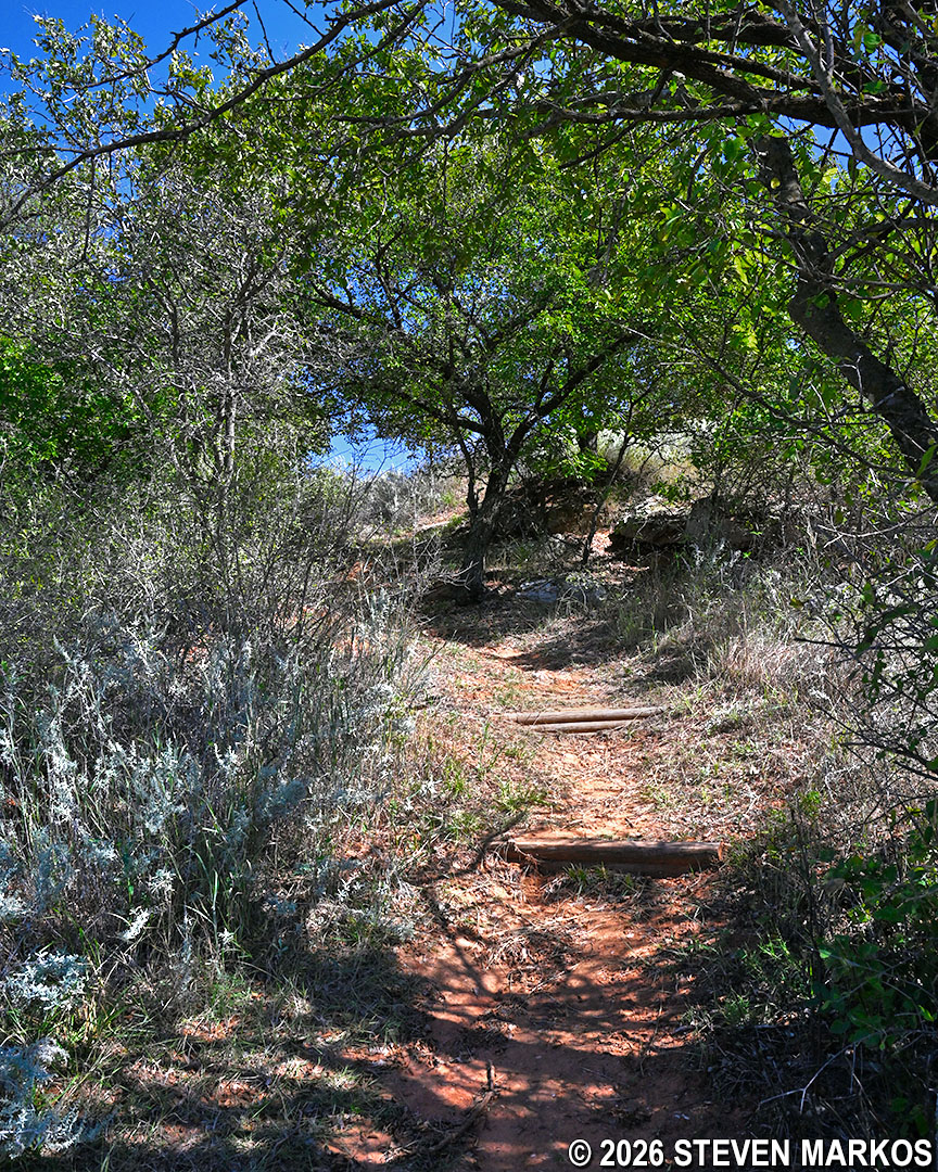
Erosion control steps on the Washita Battlefield Trail near Stop 12, Washita Battlefield National Historic Site
Across the next hundred feet, there are a couple of short-but-steep hills. The toughest has an average grade of 16.5% (strenuous hiking is considered to start at 15%). Luckily, this section doesn’t last very long, but it may be enough for those who have trouble walking up hills to decided to turn around at Stop 12 and take the paved path back to the parking lot.
Short-but-steep hill on the Washita Battlefield Trail east of Stop 12, Washita Battlefield National Historic Site
The Washita Battlefield Trail eventually emerges from the shade trees and once again becomes a grass path. At Stop 13 you will be surrounded by native bluestem grass. During the battle, some of the Cheyenne used this vegetation to hide themselves from Custer’s soldiers.
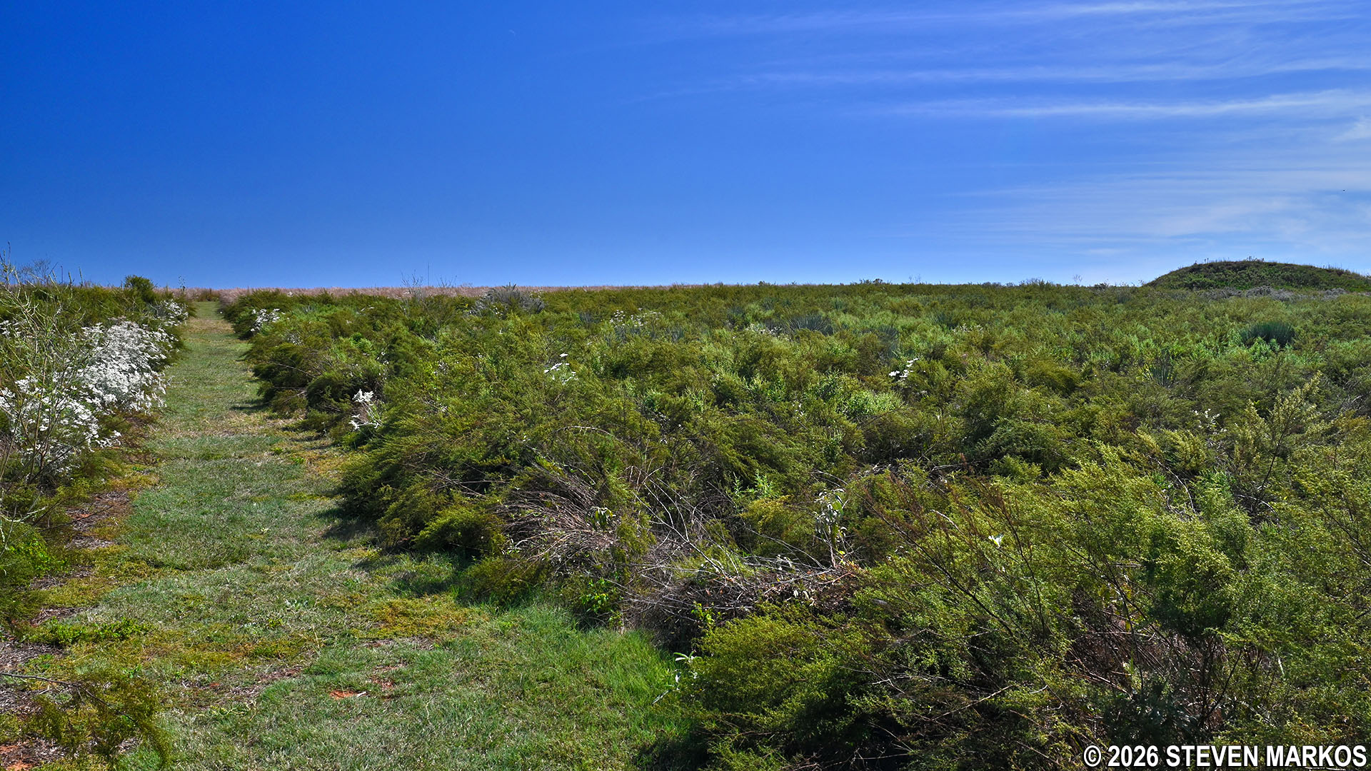
Typical terrain near Stop 13 on the Washita Battlefield Trail at Washita Battlefield National Historic Site
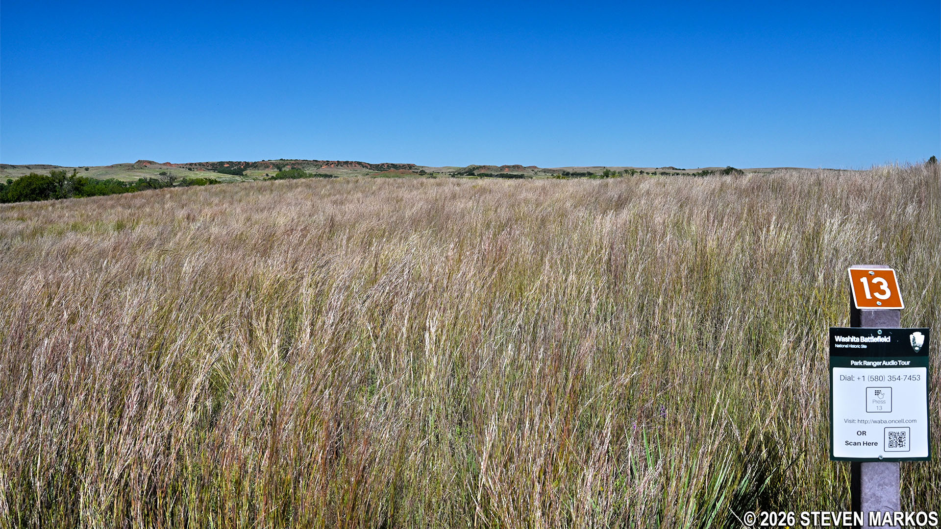
Prairie grass at Stop 13 on the Washita Battlefield Trail at Washita Battlefield National Historic Site
The rest of the trail remains out in the open and continues to gradually climb all the way to the end. Stop 15, which comes right before the wooden fence at the end of the hike, offers another view of the Washita River Valley.
Typical terrain near Stop 15 on the Washita Battlefield Trail at the Washita Battlefield National Historic Site
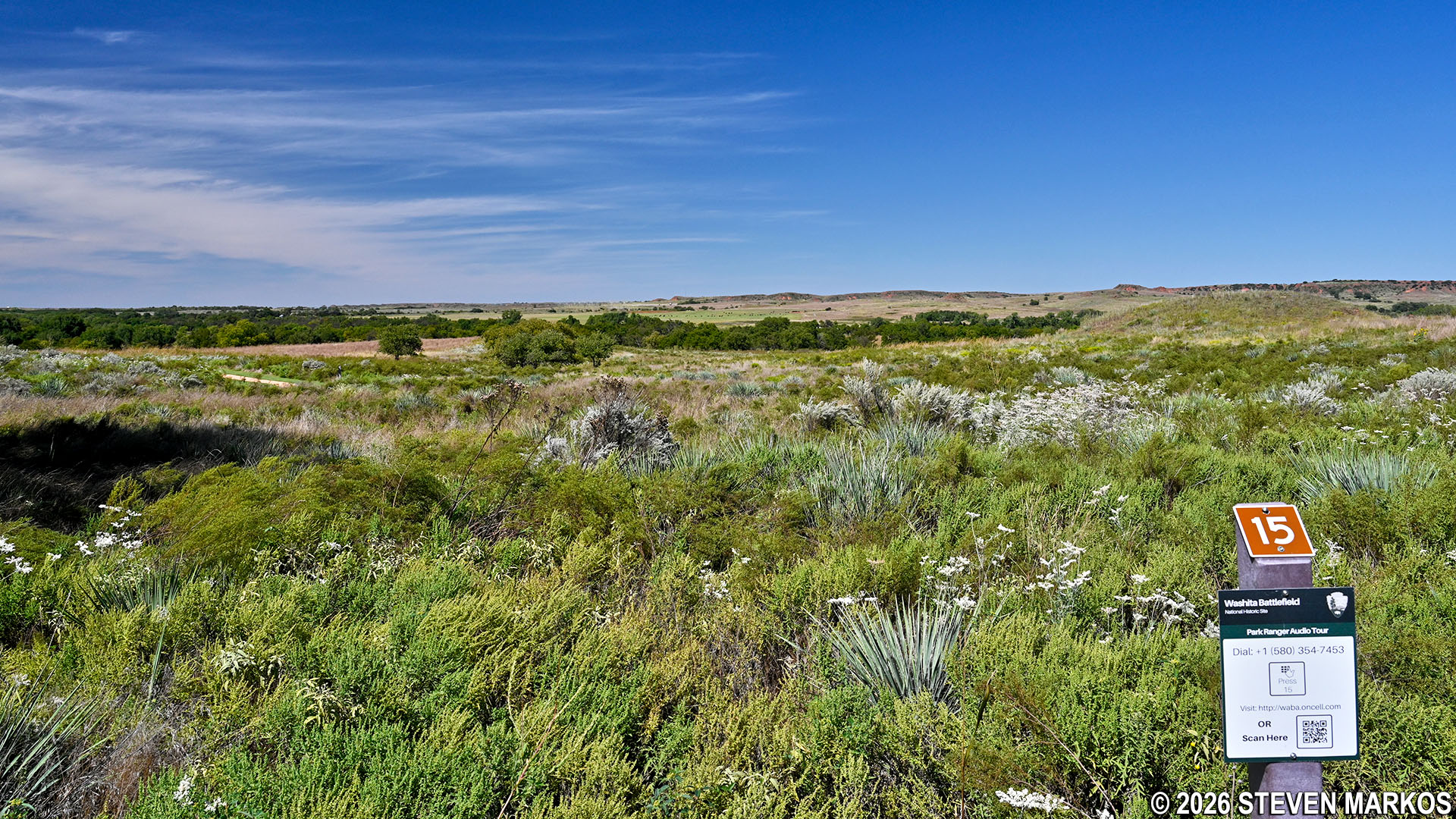
View of the Washita River valley from Stop 15 on the Washita Battlefield Trail, Washita Battlefield National Historic Site
As mentioned, the Washita Battlefield Trail is the only way to see the actual battlefield. If you are not willing to hike it, at least the wheelchair-accessible paved sections, then there is not much of a reason to visit Washita Battlefield National Historic Site. The battlefield is the park.
With a few exceptions, use of any photograph on the National Park Planner website requires a paid Royalty Free Editorial Use License or Commercial Use License. See the Photo Usage page for details.
Last updated on January 27, 2026


