
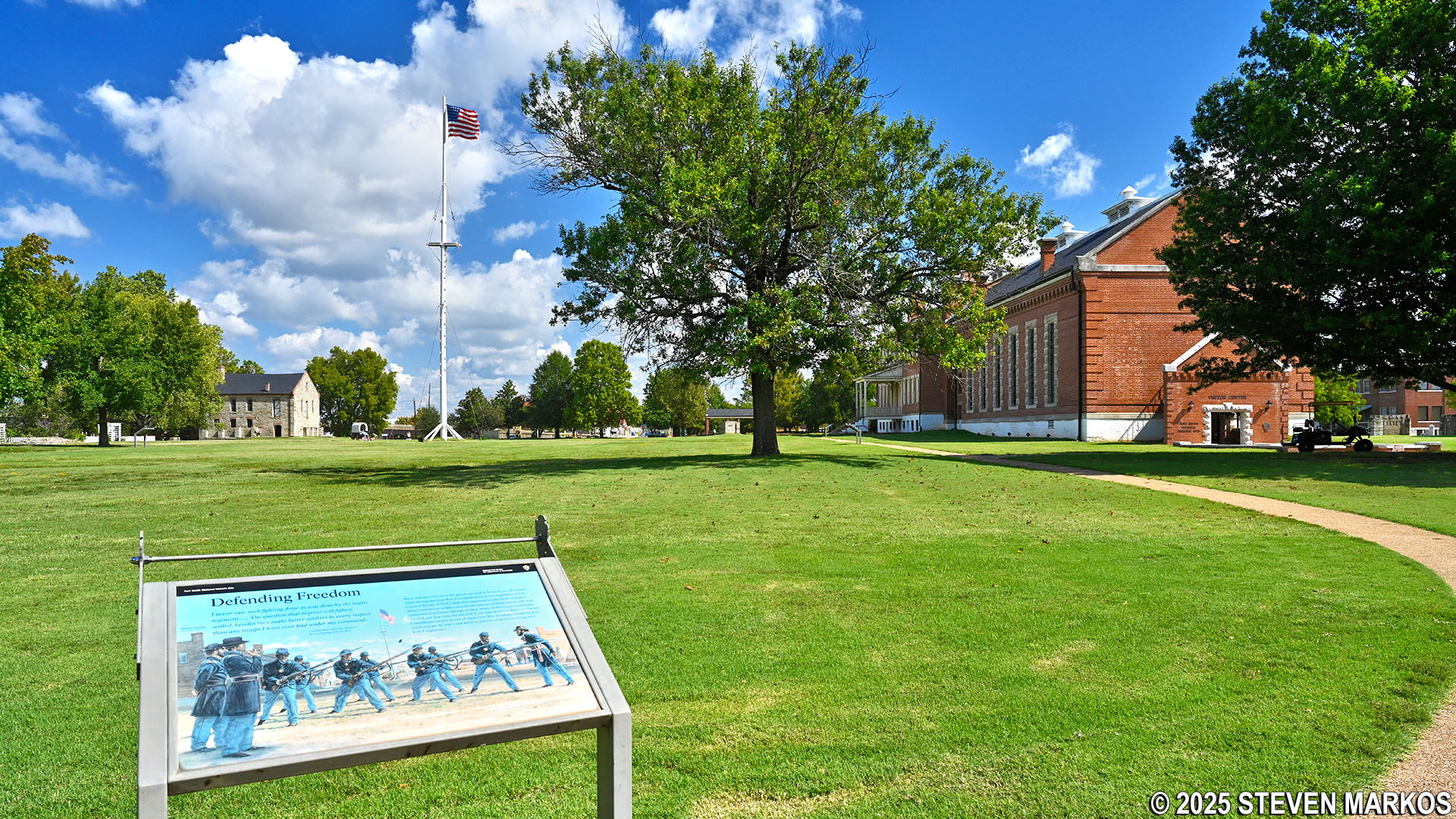
Parade ground at Fort Smith National Historic Site
The grounds of Fort Smith National Historic Site are open year-round from dawn to dusk. Visitors can walk the parade ground loop around the 1838 fort (the second fort built at Fort Smith), tour the remaining buildings on the grounds, and hike the River Loop Trail, which leads to the ruins of the first fort built in 1817 and runs alongside part of the Arkansas River. Some of the buildings, including the former military barracks, the commissary, and the gallows, are open to the public during set hours, so be sure to check the National Park Service’s official Operating Hours and Seasons web page for the latest schedule.
The main parking lot provides access to the second Fort Smith through its southern entrance. A quarter-mile paved-path circles the parade ground, which is the place where troops came to drill, exercise, and parade for inspection by high-ranking officers and visiting dignitaries. During the period of the second fort in the mid-1800s, the parade ground was regularly used by the soldiers. Surrounded by the military barracks and the officers’ quarters, it was the center of life at Fort Smith.
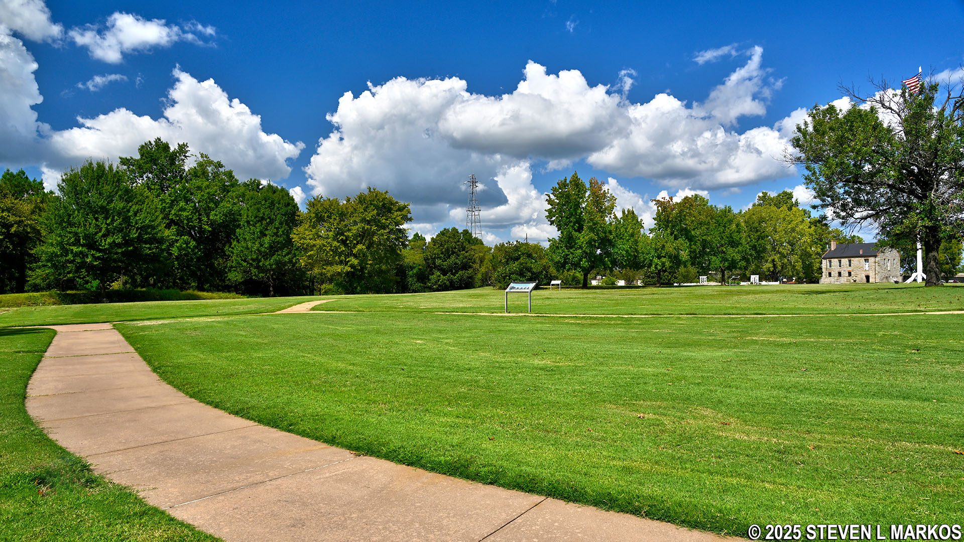
Section of the parade ground loop at Fort Smith National Historic Site
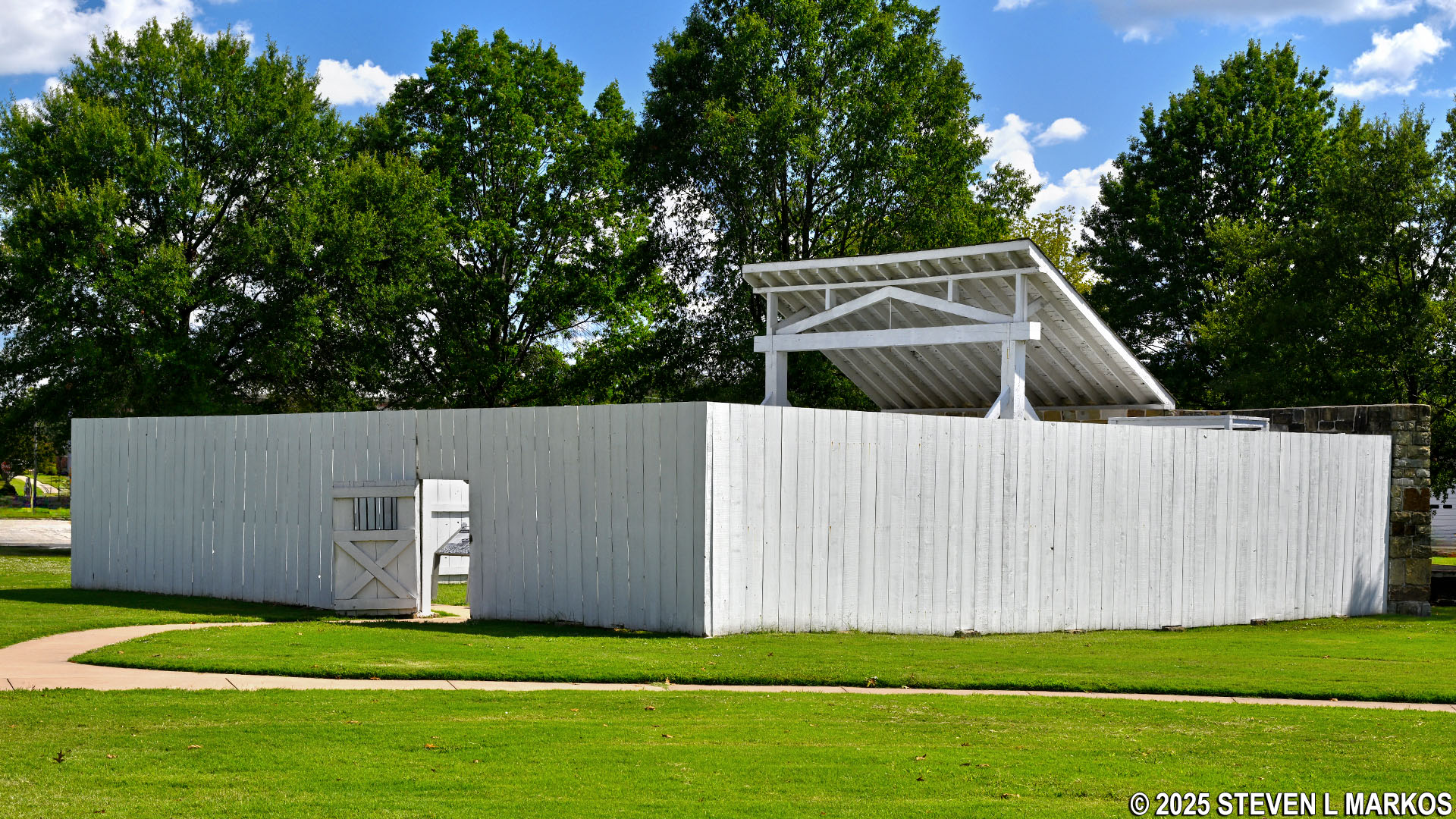
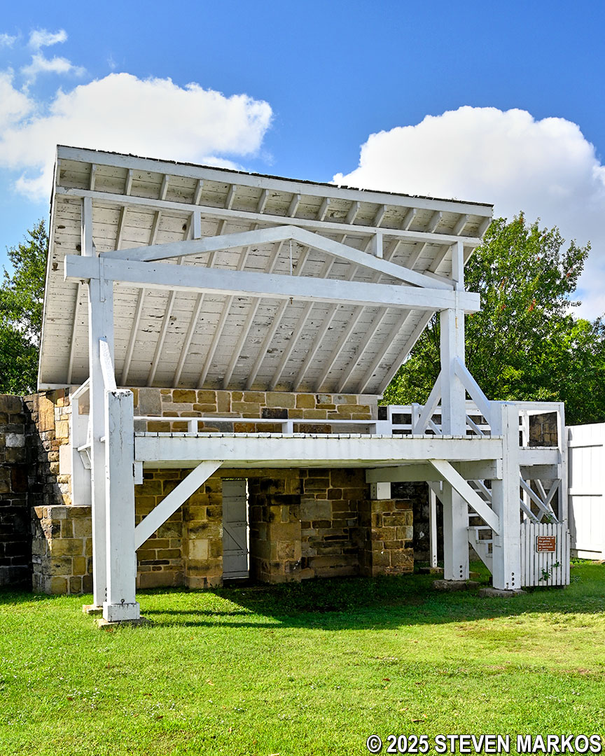
Being a loop, you can go around either way. I walked in the counterclockwise direction and first came to the reconstructed 1886 gallows from the federal court period of Fort Smith (1872-1896). Designed to hang as many as six criminals at a time, it was the largest of the gallows constructed at the fort. The federal court at Fort Smith had the most extensive criminal jurisdiction at that time and thus handled an extraordinary number of capital offense cases. When defendants were found guilty in these types of cases, federal law mandated the death penalty. A total of 86 men were executed at Fort Smith between 1873 and 1896. The following summer, after the federal court lost its jurisdiction over Indian Territory in 1896, the mayor of Fort Smith ordered the gallows to be taken apart and burned. The reconstruction standing today was built in the early 1980s. Two wayside exhibits provide a brief history of the court and a list of every man hanged at the gallows.
Reconstructed 1886 gallows at Fort Smith National Historic Site
Reconstructed 1886 gallows at Fort Smith National Historic Site
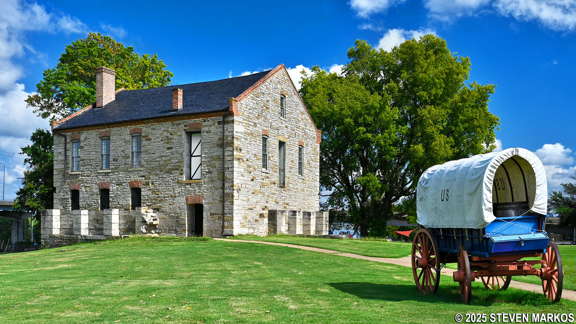
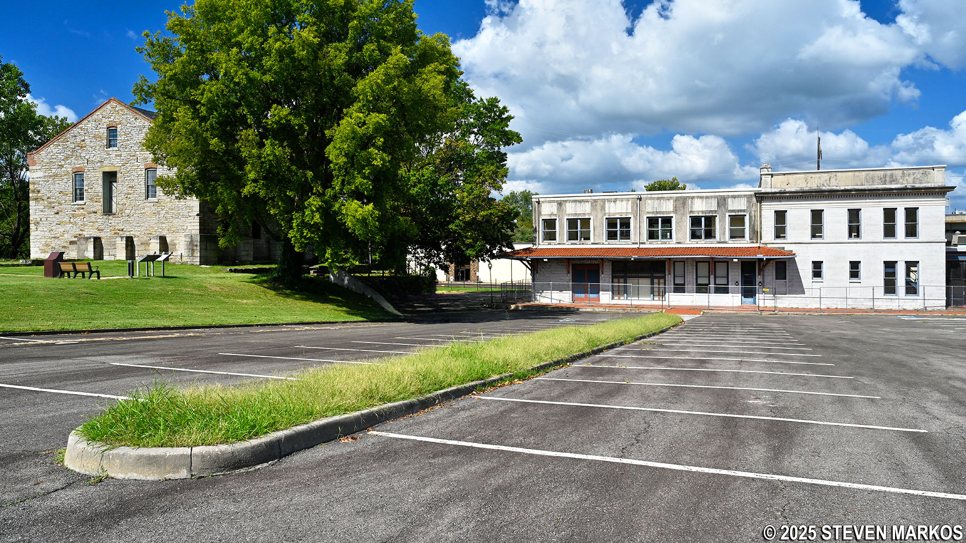
The largest building on the grounds of Fort Smith is the former military barracks, courthouse, and jail. When Fort Smith closed in 1871, only the barracks existed (right half of the building in the photo below). The next year, the Federal Court for the Western District of Arkansas relocated to the barracks, converting it into a courthouse and a jail. Due to the number of criminals in the territory, the jail was soon overcrowded.
After a news article was published in 1885 detailing the deplorable conditions of the Fort Smith jail, Congress authorized funding for a new one. The jail was constructed between 1886 and 1888 and was built adjacent to the barracks (left side of the building in the photo below). The Visitor Center for Fort Smith National Historic Site is now located on the bottom floor of the jail, and both buildings are full of exhibits about the fort’s history, the jails, and the courthouse.
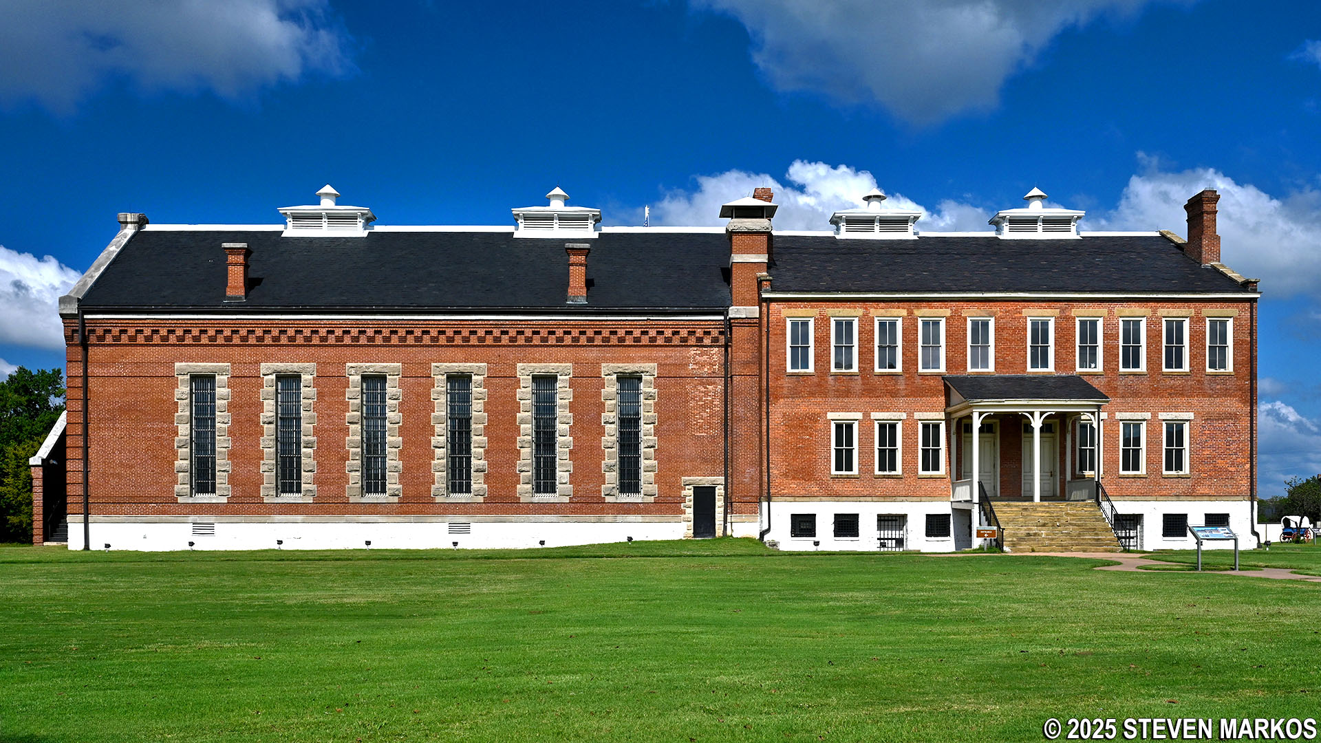
Former military barracks, courthouse, and jail at Fort Smith National Historic Site
The parade ground loop follows the east and west sides of the Visitor Center. The path to the east leads to a memorial gate that serves as the east entrance to Fort Smith. Erected in 1930 by the Daughters of the American Revolution, the memorial was built using original stones from the fort wall. The wall was twelve feet high and two feet thick and pentagonal in shape.
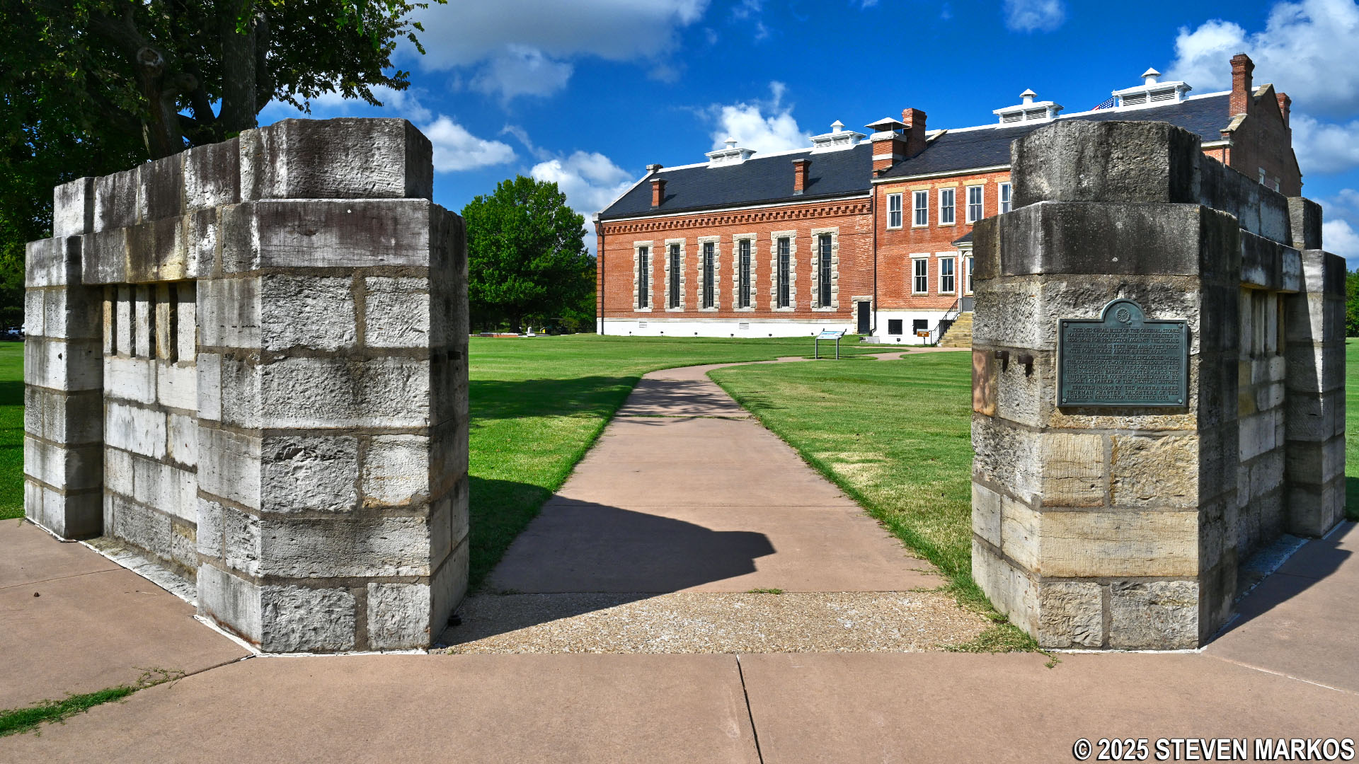
Memorial wall at the east entrance of the parade ground, Fort Smith National Historic Site
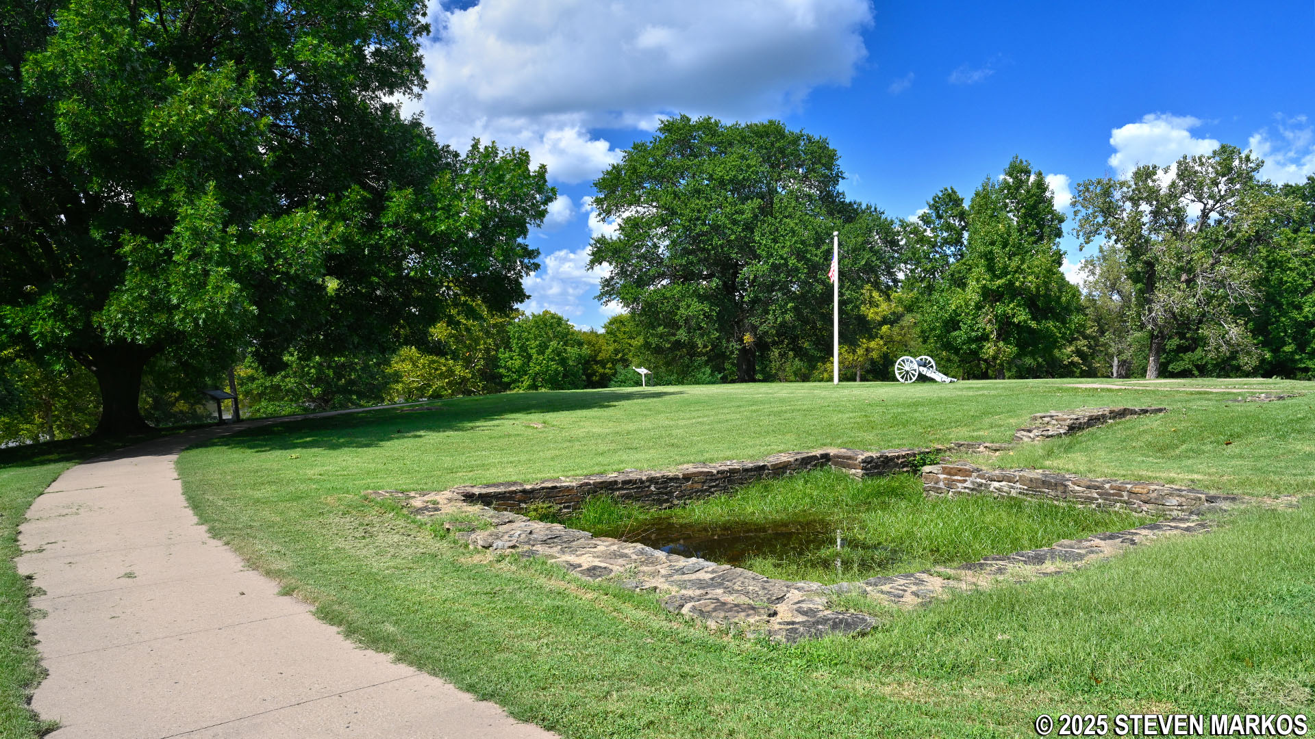
Bastions were located at the five corners of the fort wall. These are structures that protrude from the corners of a fort that allow men stationed within or on the structure to have a clear view of the fort walls and entrance. In addition to armed soldiers, short range artillery pieces were often mounted on the bastions, and any invader who approached the walls would be trapped in a crossfire between two bastions. If a fort were a perfect square, it would be hard to shoot at any enemy soldier who made it to the wall, for soldiers within the fort would practically have to hang over the wall to get a shot at him.

Bastion
When Fort Smith’s role was changed in 1845 from a frontier defense to a supply depot, Bastions 1, 2, and 3 were converted to a commissary, a quartermaster’s storehouse, and a powder magazine, respectively. Bastions 4 and 5 were left unfinished, and today, along with Bastion 3, a low stone wall outlines their locations.
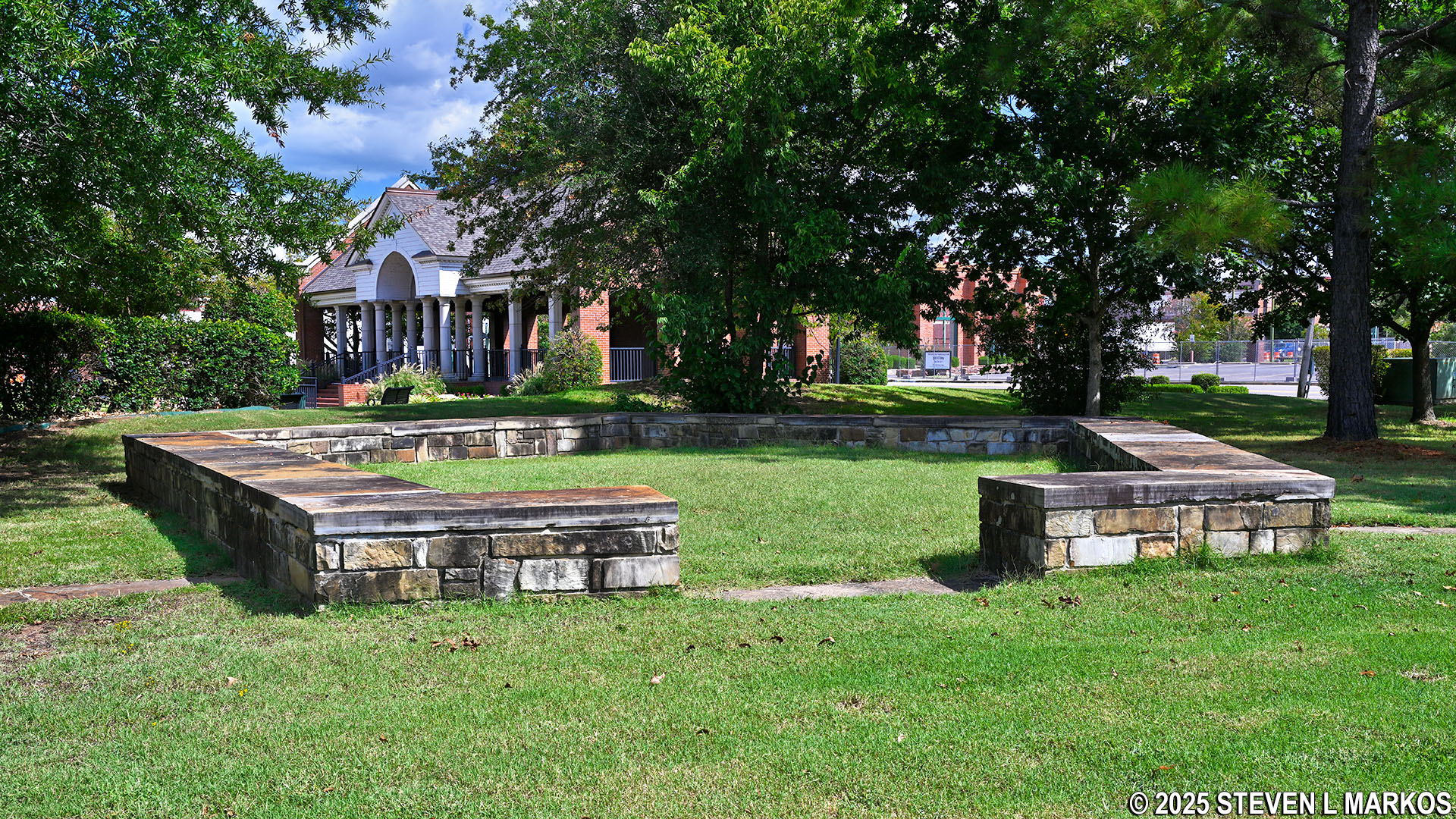
Stone wall outline of Bastion 5 at Fort Smith National Historic Site
Fort Smith was one of the last of its kind. Beginning in the 1840s, almost all of the frontier forts were built without walls. After the fort closed, portions of the wall were eventually either repurposed, removed, or deteriorated, and by the 1920s, hardly any remained. Today, the location of the wall is outlined by a continuous band of stone.
Section of the stone fort wall perimeter of the second fort at Fort Smith National Historic Site
Just north of the barracks and jail building is the location of the old guardhouse. Constructed in 1849, it was a focal point of daily activity at Fort Smith. It was used by the soldiers assigned to guard detail and the daily officer responsible for the post’s business. The guardhouse was also where soldiers who were arrested for minor offenses, such as drunkenness or fighting, were held. After Fort Smith was closed and the federal court relocated here, it continued to be used for confinement as a women’s jail. Although the original building no longer exists, in 2000 the National Park Service installed a concrete pad and constructed an open brick structure where the guardhouse once stood.
Modern structure marks the location of the former guardhouse and women’s jail at Fort Smith, Fort Smith National Historic Site
On the northern end of the parade ground loop is the commissary. Built in the late 1830s, it is the oldest building still standing in the city of Fort Smith. Throughout the years, the commissary served many uses. It was initially used to store food and supplies for the soldiers. When the fort was converted into a supply depot, it became one of the largest and busiest posts in the southwest. The commissary held supplies for approximately 17 forts in and around Indian Territory.
Commissary building at Fort Smith National Historic Site
After the Civil War ended, there was little need for Fort Smith, and it was closed in 1871. When the Federal Court for the Western District of Arkansas relocated to Fort Smith in 1872, the commissary building was repurposed once again. The first floor was used as a residence for some of the court officials. Judge Isaac C. Parker, who presided over the court for 21 years, had an office on the second floor.
After the federal court relocated to a new courthouse and lost its jurisdiction over Indian Territory, the commissary was sold to a private owner. In 1910, a local preservation group was formed to save the commissary and preserve the community’s heritage. It acquired the building and created The Old Commissary Museum, which remained open for nearly seventy years.
Today visitors to Fort Smith National Historic Site can tour the first floor or the commissary. Half of the floor is furnished as a typical commissary during the 1850s and the other half as a residence during the 1890s. The rest of the building is not open to the public.
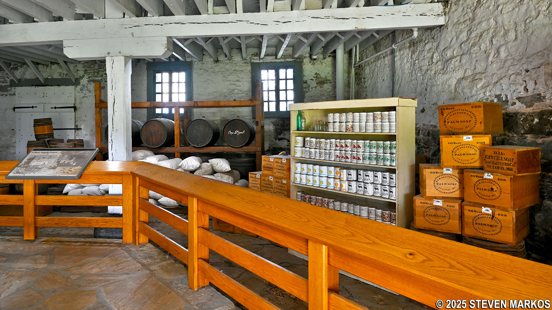
Reproduction of the 1850s commissary interior at Fort Smith National Historic Site
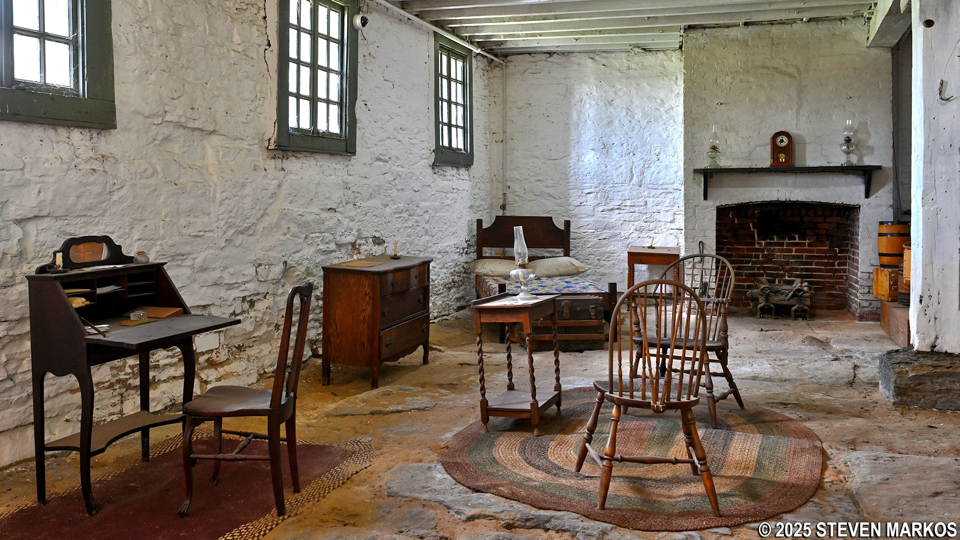
Reproduction of the 1890s residence inside the commissary at Fort Smith National Historic Site
Located behind the commissary is the historic Frisco Railroad Station, a unique reminder of railroad transportation history. A wayside exhibit provides information about the building. Although not directly related to Fort Smith’s military and federal court history, the depot—known as the Frisco—is within the park’s boundary. Its parking lot is available for visitors and provides access to the northern entrance of the grounds.
Built in 1903, the Frisco is the last remaining train depot in the city. After being abandoned as a passenger rail station in the 1970s, the Frisco served as a disco, a restaurant, and an office building. In 2003, the National Park Service acquired the train station property for the opportunity to establish the role of the railroad’s connection with Indian Territory, the impact of railroads on Fort Smith during its historic period, and the ongoing use of the modern railroad. However, at this point the Frisco is used for park storage. There are no immediate plans for restoration.
The Frisco train depot behind the commissary at Fort Smith National Historic Site
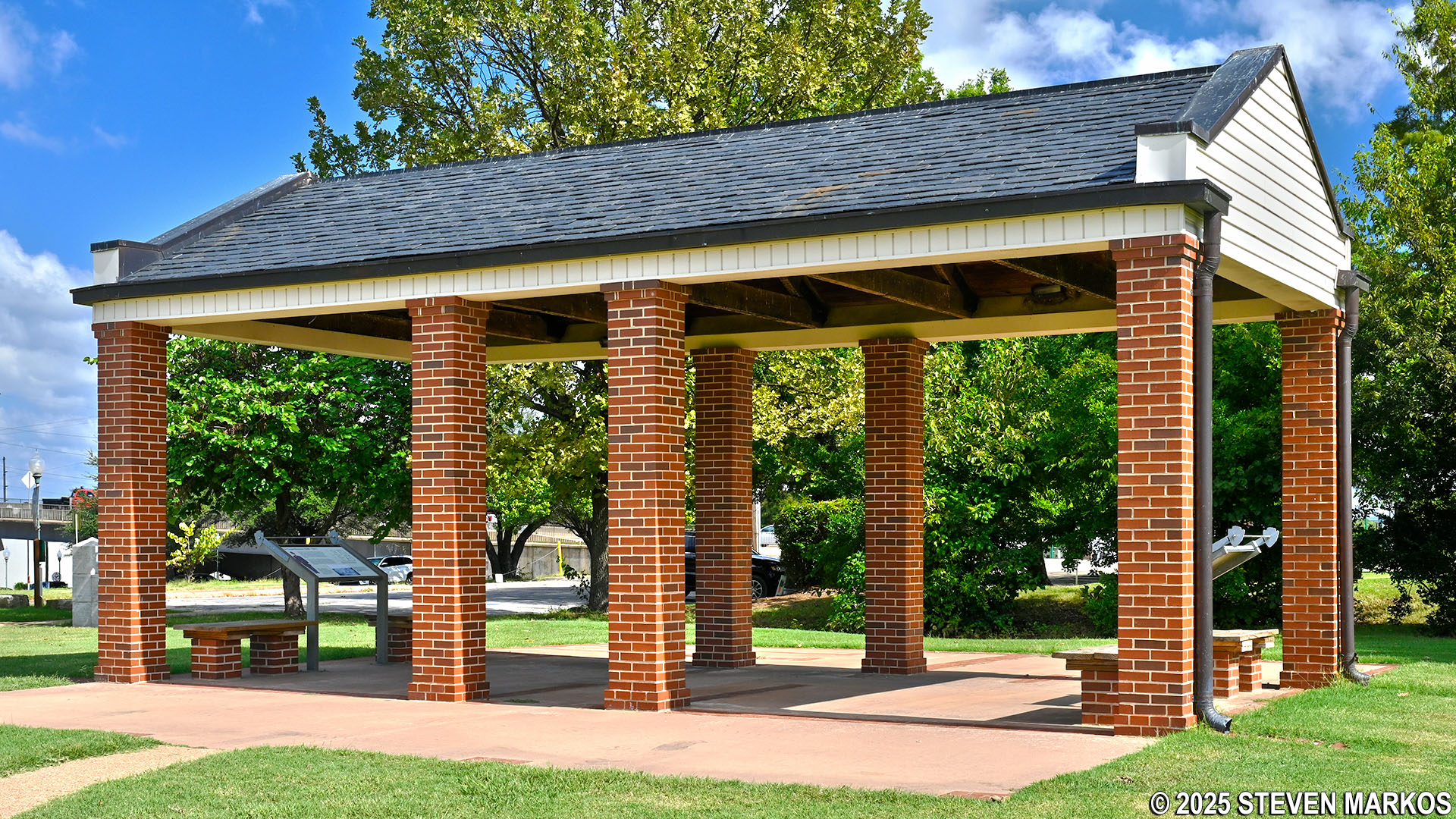
The parade ground loop path continues past the commissary to the Officers’ Garden. Wives and children of the officers tended the garden to supplement their diet, which mainly consisted of canned and preserved foods. They grew fresh vegetables and herbs for seasoning and medicinal purposes. Flowers were also grown to help brighten up the often-boring and repetitive life at the fort. Today, the Officers’ Garden is a recreation of a 1860s garden and is currently maintained by the Arkansas River Valley Master Gardeners.
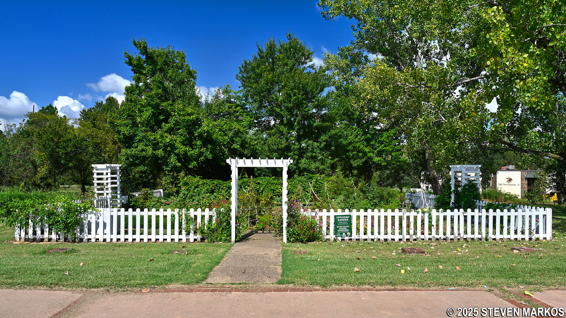
Officers’ Garden at Fort Smith National Historic Site
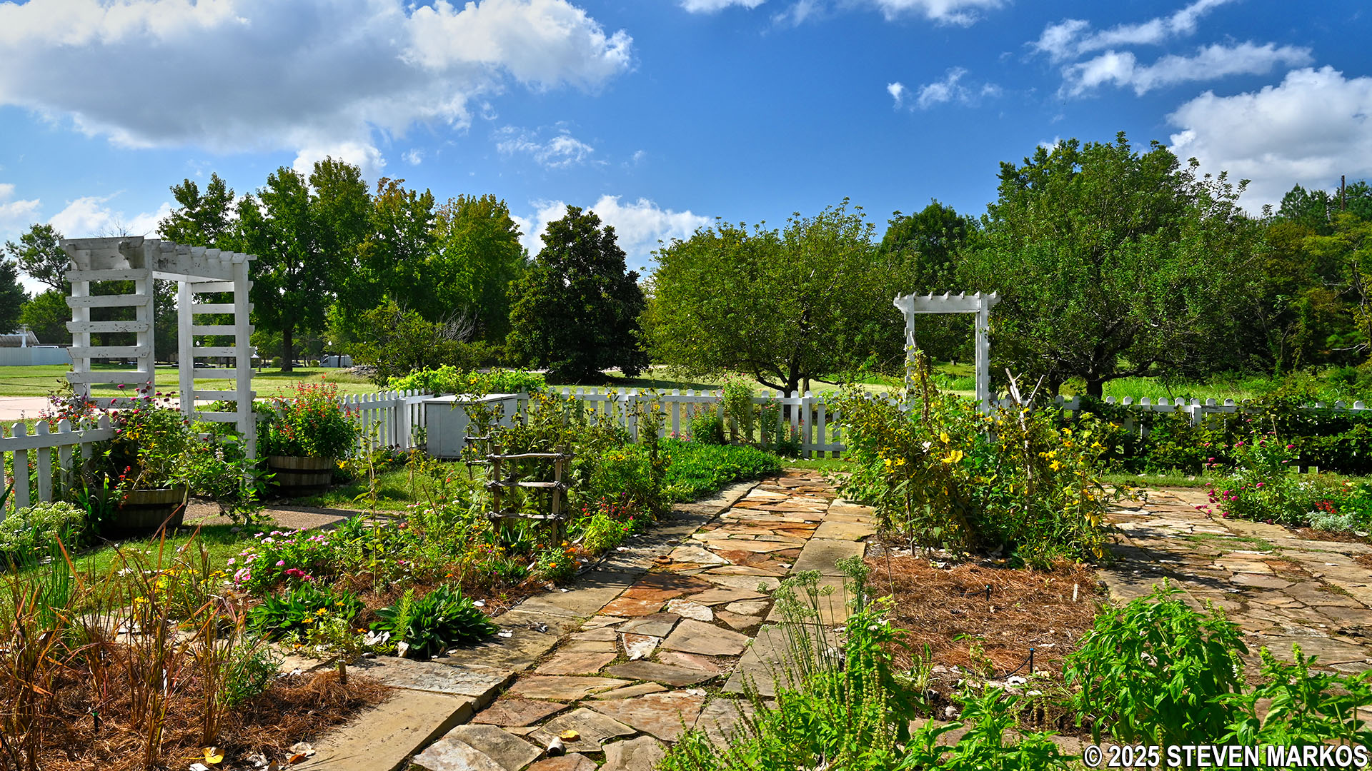
Officers’ Garden at Fort Smith National Historic Site
In front of the Officers’ Garden are two large concrete pads that mark the locations of the North End and South End Officers’ Quarters that were built in 1852. Unlike the cramped enlisted men’s barracks, there was a degree of privacy here. The buildings had four apartments, each with four rooms. Bricks laid within the concrete pads outline the floorplans of the buildings.
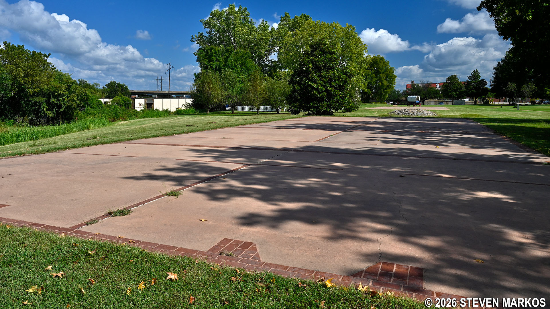
Location of the Officers’ Quarters at Fort Smith National Historic Site
Unfortunately, both Officers’ Quarters were destroyed by fires—the South End in 1867 and the North End in 1870. The lack of housing for officers was one of the reasons for the U.S. Army closing Fort Smith in 1871.
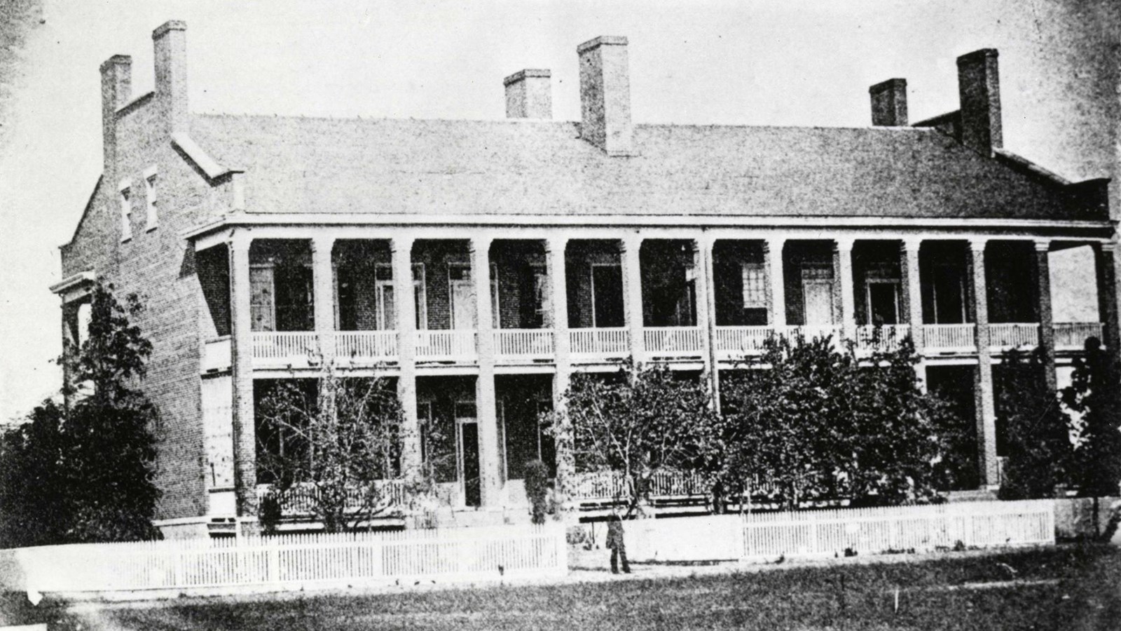
1867 photo of the South End Officers’ Quarters at Fort Smith
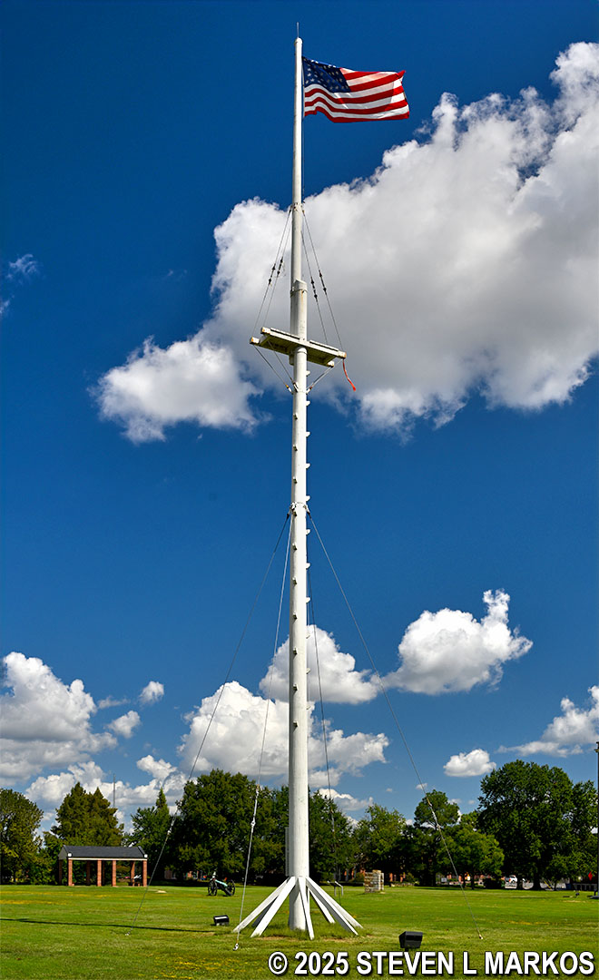
In the center of the parade ground stands a replica of the 100-foot-high flagstaff that was first built in 1846. Flying from the top of the pole is a replica of the 37-star flag that flew over Fort Smith when it closed. The 37-star flag was effective from 1867 to 1877. The current flagstaff was erected in 2021, replacing another replica built in 1984-85 by the Old Fort Militia, a local preservation group.
Replica of the flagstaff and 37-star flag flown in 1871 at Fort Smith National Historic Site
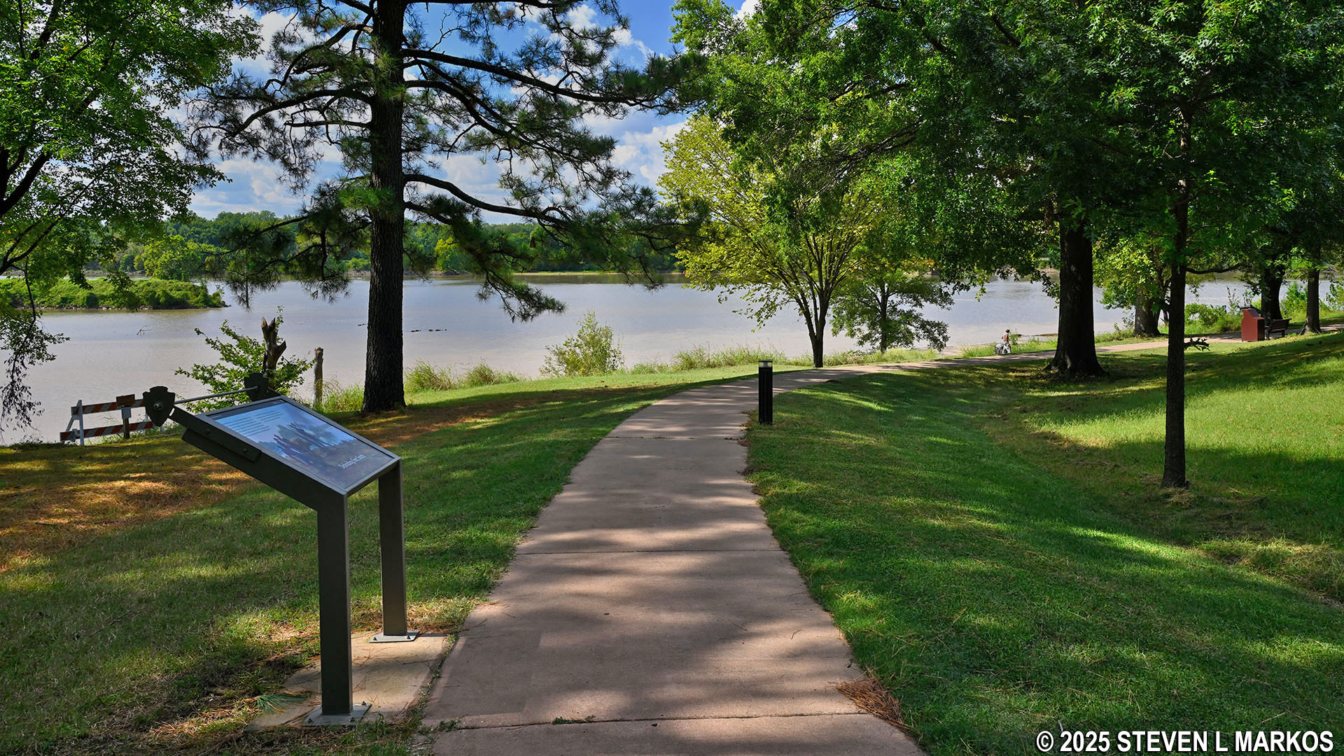
After touring the sites around the parade ground loop, visitors can check out the location of the first Fort Smith by walking the River Loop Trail. The paved, 1-mile loop leads to the fort ruins and provides scenic views of the Arkansas and Poteau rivers. The junction of these two rivers, known as Belle Point, became the site of the first Fort Smith.
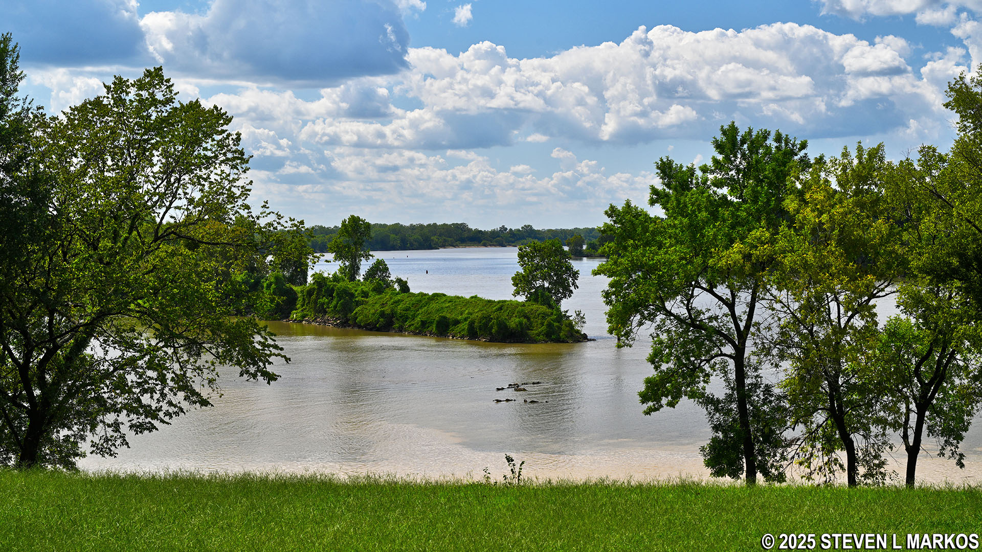
Junction of the Arkansas and Poteau rivers as seen from the River Loop Trail at Fort Smith National Historic Site
Along the way, the trail passes over a painted line that represents the 1834 boundary between the Arkansas and Indian territories (Arkansas was not a state until 1836). Just past the boundary line, a set of steps leads up to Bastion 2 of the second Fort Smith. A historical marker commemorating the first Fort Smith and a reproduction of the 1825 Initial Point Marker representing the boundary between the Arkansas Territory and the Choctaw Nation stand atop the bastion.
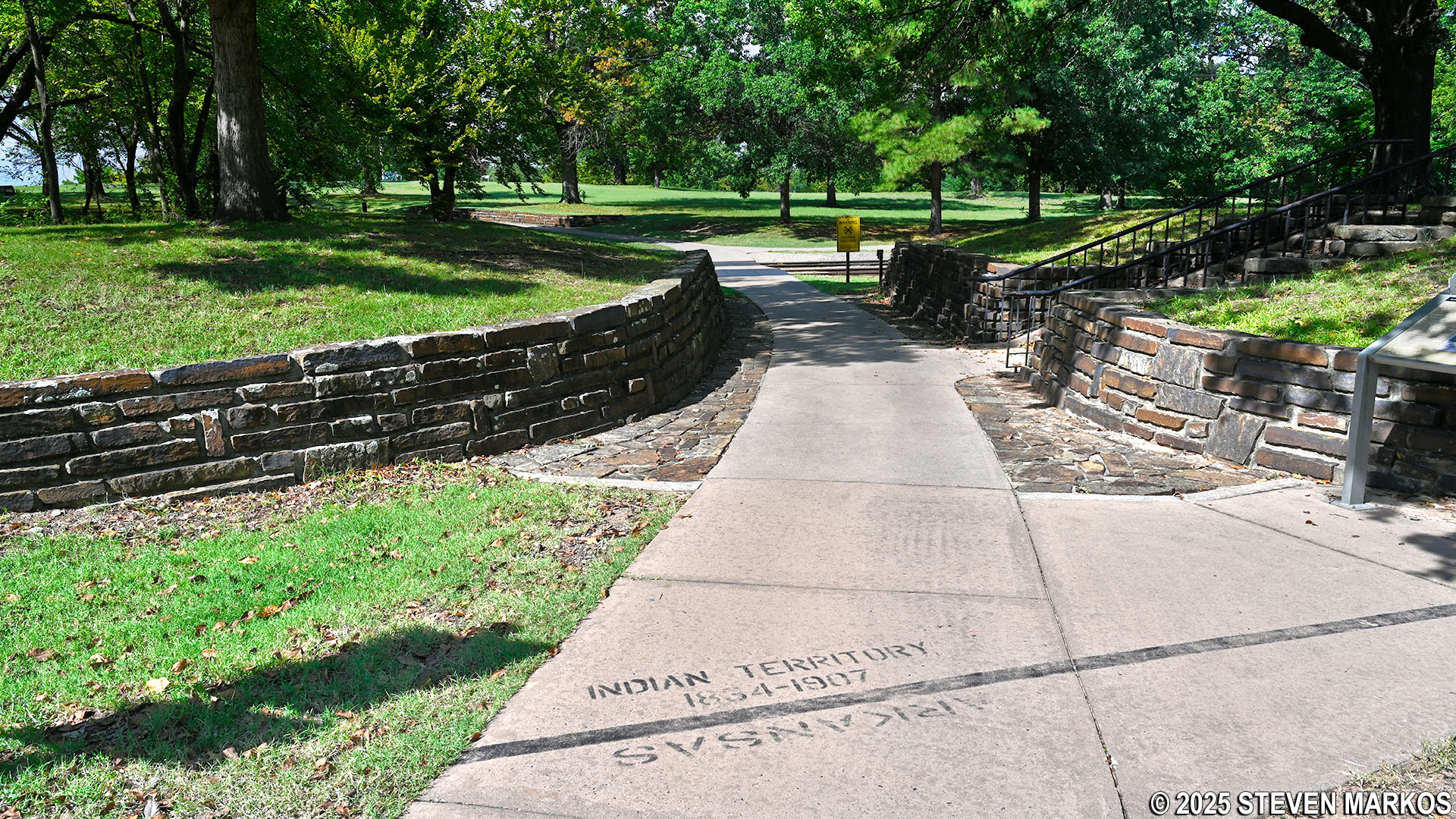
Indian Territory boundary line on the River Loop Trail at Fort Smith National Historic Site
Path leading to historical markers atop Bastion 2 at the second Fort Smith, Fort Smith National Historic Site
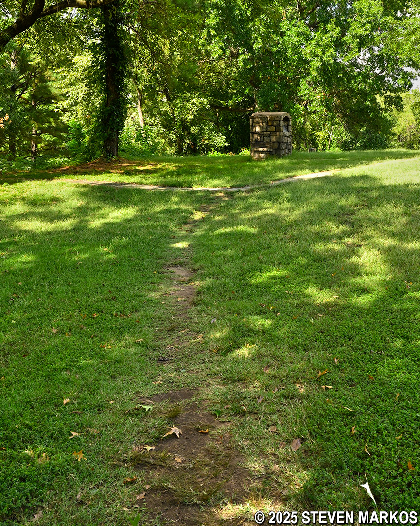
The River Loop Trail continues to the site of the first Fort Smith. The exact location was unknown until an archeological excavation in 1959 uncovered the stone foundations that are visible today. The rest of the trail leads down to the riverbank of the Arkansas River, passing by the river junction and the Trail of Tears Overlook before looping back around to the start.
Ruins of the first Fort Smith on the River Loop Trail at Fort Smith National Historic Site
Path leading to the Arkansas riverbank on the River Loop Trail at Fort Smith National Historic Site
With a few exceptions, use of any photograph on the National Park Planner website requires a paid Royalty Free Editorial Use License or Commercial Use License. See the Photo Usage page for details.
Last updated on January 7, 2026


