

Stone Bridge in Manassas National Battlefield Park
Note: The trails at Manassas National Battlefield Park are poorly marked, so be sure to bring a trail map with you for navigational purposes. The best is the Trail Guide, a tri-fold map that is free at the Henry Hill Visitor Center. For planning purposes, you can download it here, but be sure to pick up a full-color version before you begin your hike.
Manassas Trail Map (PDF)
Length: 1.6-mile loop (distance from the parking lot)
Time: 1 hour
Difficulty: Easy
At the time of the Civil War, Highway 29 was called the Warrenton Turnpike and the road crossed Bull Run via the Stone Bridge. Today thousands of tourists visit the bridge each year for its historic ties to the Civil War at Manassas National Battlefield Park. In the First Battle of Manassas (July 21, 1861), the bridge was the scene of a diversionary attack by the Union, one designed to hide the fact that 15,000 men were marching north to cross Bull Run at Sudley Ford before sneaking down from Matthews Hill and attacking the Confederates from the rear.
In March 1862, the Confederates left the Manassas area and blew up the Stone Bridge to prevent Union troops from having an easy time crossing the creek. A few months before the Second Battle of Manassas (August 1862), Union engineers built a wooden bridge at this spot using the abutments of the original Stone Bridge. This area did not see any fighting during the battle, but it was over the wooden bridge that the Union army retreated after suffering a second defeat at Manassas. They blew up the bridge once everyone was across. The bridge that stands today was built in 1884 and supposedly looks just like it did when originally built in 1825.

Photo of the destroyed Stone Bridge
Parking for the Stone Bridge Loop Trail is at Stop #12 on the Second Manassas Battlefield Tour. To begin the hike, take the path from the parking lot down to the bridge and cross over to the other side. The Stone Bridge Loop Trail starts here, and it was designed to be hiked in a counterclockwise direction to coincide with stops on a Cell Phone Audio Tour, so take a right at the intersection and begin walking along Bull Run. Being easy and rather scenic, the trail is popular, so expect crowds on a nice day.

Road across the Stone Bridge in Manassas National Battlefield Park

Hikers on the Stone Bridge Loop Trail in Manassas National Battlefield Park
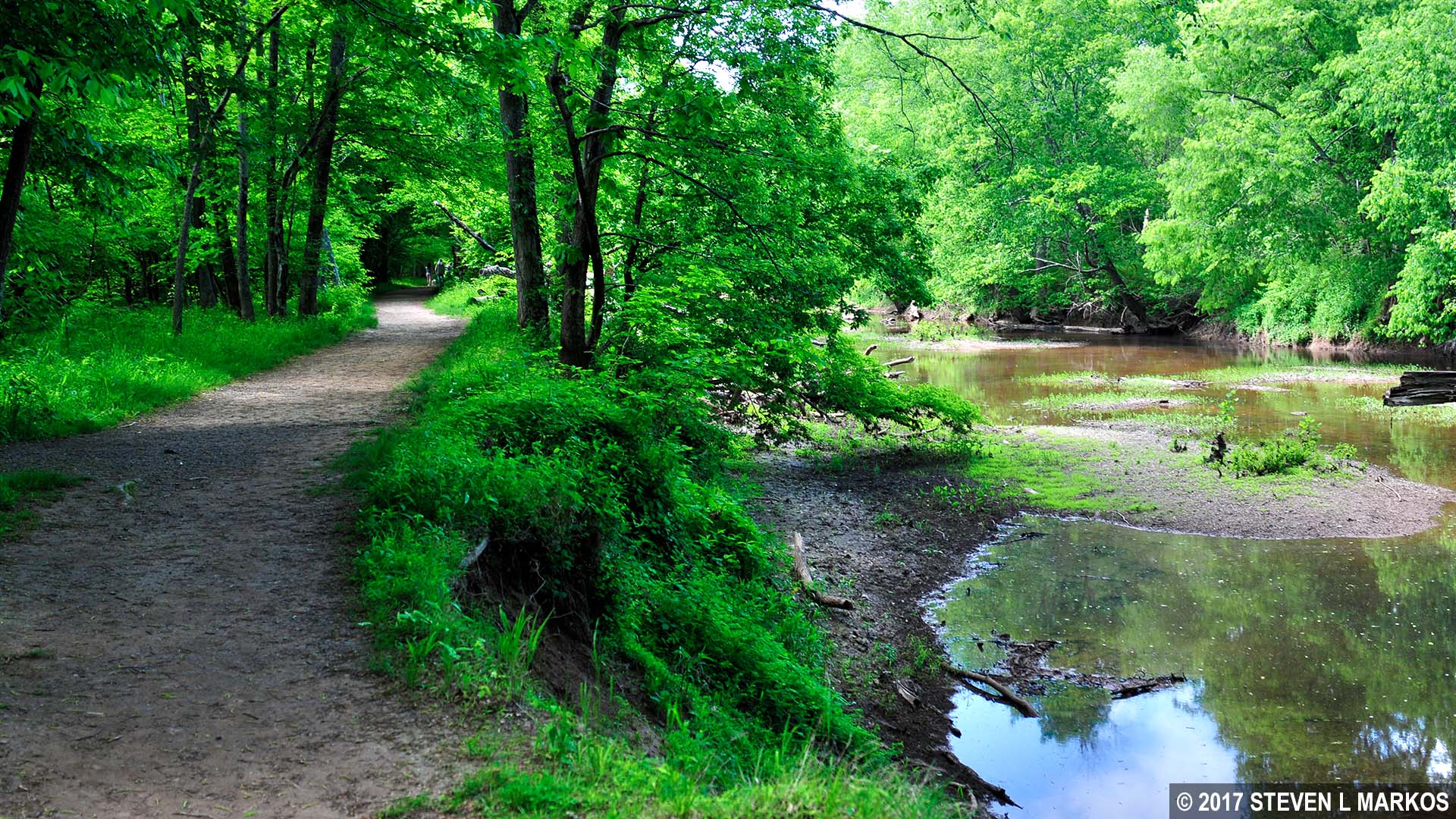
The Stone Bridge Loop Trail follows Bull Run, Manassas National Battlefield Park
At the half-mile point on the hike is an intersection marked by a footbridge that spans a small creek that feeds into Bull Run. The Stone Bridge Loop Trail continues straight over the bridge, but it hits an extremely steep hill just up ahead. For those who have trouble walking, you can turn left before the bridge and take a shortcut across easier terrain to the other side of the loop. This shortcut runs through the forest and comes out at a field. If you do this, be sure to take a left when reaching the field to continue the hike in the counterclockwise direction. For those who have no problem with a steep hill, stay straight and cross the bridge.

Stone Bridge Loop Trail crosses a small creek that feeds into Bull Run, Manassas National Battlefield Park

Steep hill past the footbridge on the Stone Bridge Loop Trail in Manassas National Battlefield Park
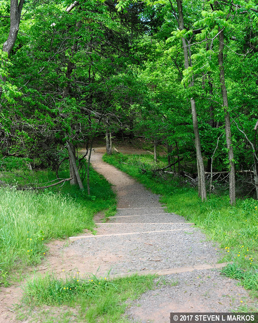
In a quarter mile from the bridge, the trail exits the forest and spills out onto an open field. Since the hike started, the Stone Bridge Loop Trail and the First Manassas Trail have been merged as one. It is at this field where the two finally separate. There is no trail sign indicating which way to go, but take a left to stay on the Stone Bridge Loop Trail.

Stone Bridge Loop Trail and the First Manassas Trail diverge at a field, Manassas National Battlefield Park
The Stone Bridge Loop Trail continues along a gravel road with the field on the right and the forest on the left. In a tenth of a mile is another intersection. This is where you would have come out had you taken the shortcut at the footbridge. By gazing down the trail, the shortcut doesn’t appear to be completely flat either, but I’m pretty sure that it doesn’t climb a hill as steep as the one I just climbed.
A glance down the shortcut on the Stone Bridge Loop Trail at Manassas National Battlefield Park
Continue down the road to the next intersection, which is marked by a wayside exhibit about the Van Pelt House. The house burned down in the 1930s, so there is nothing to see today. The field that you have been walking along was the Van Pelt Farm. The Confederates were positioned here during the First Battle of Manassas to guard the Stone Bridge. During the Second Battle of Manassas, Union soldiers used the house as a hospital.
To continue the hike, take a left at the Van Pelt intersection. At this point the Stone Bridge Loop Trail merges once again with the First Manassas Trail. There is another intersection just up ahead, but this will send you off hiking on the First Manassas Trail towards the Henry Hill Visitor Center, not back to the Stone Bridge.
As you walk south and get closer to Highway 29, you are walking along the ridge where the Confederates were positioned to guard the Stone Bridge. You can’t see anything today due to the trees, but during the Civil War all of this was farm land, and from this ridge the Confederates had a clear view of Bull Run. At 5:30 AM on July 21, 1862, Union artillery opened fire on them from a mile back on the other side of the creek. After two hours of shelling and no formidable attack by the Union, Confederate Colonel Nathan Evans got suspicious that perhaps this was a diversion, so he sent most of his men up to Matthews Hill. If anyone was going to sneak up behind him, they would be coming from that direction. Sure enough, at around 10 AM the two sides met, spoiling the Union’s surprise attack. A wayside exhibit on the ridge tells the story.
Just past the wayside exhibit, the trail curves north and begins down a hill as it comes off the ridge and heads towards Bull Run. It passes through a narrow strand of trees before coming out at a boardwalk. At this point the terrain levels out.

Boardwalk on the southern side of the Stone Bridge Loop Trail at Manassas National Battlefield Park
The boardwalk is the last leg of the journey, stretching nearly a quarter mile and ending just short of the Stone Bridge. Cross back over Bull Run to get to the parking lot and complete the hike.

The Stone Bridge in Manassas National Battlefield Park
When I am hiking on a battlefield I don’t care much about scenery, but I do like the trails to enhance the battlefield experience. Unfortunately, while there is some history along the Stone Bridge Loop Trail, there’s not enough to make it worthwhile if history is what you are looking to find. Let’s face it, what’s important is the bridge, and you can see that by taking a short walk from the parking lot. Furthermore, if you have hiked or plan to hike the First Manassas Trail, there is no reason to hike the Stone Bridge Loop Trail because at least 80% of the two overlap. The only segment that doesn’t overlap is the short stretch from where the trail first emerges onto the field down to the Van Pelt intersection, and there’s nothing worth seeing there anyway. Other than providing a chance to visit the Stone Bridge, this trail is for exercise purposes only.
With a few exceptions, use of any photograph on the National Park Planner website requires a paid Royalty Free Editorial Use License or Commercial Use License. See the Photo Usage page for details.
Last updated on June 17, 2025


